Three weeks after the autumnal equinox, it finally feels like fall.
Well, kind of.
This past weekend, Southern Californians breathed a collective sigh of relief as an oppressive heat wave broke. Temperatures in L.A. dropped 31 degrees, from 104 degrees on Oct. 4 to one week later, a high of 73 degrees, according to observed weather data.
I felt like a climatological grim reaper when, in the midst of my friends celebrating the drop in temperature, I told them it was temporary, as it was expected to get hot. Again. (I’m great at parties!)
But, even still, I want to help you get outdoors — safely. In this week’s edition of The Wild, our weekly outdoors newsletter, I will share three excellent L.A. hikes that each offer something different — great views or shade, for example — with caveats about the best time to go.
The first caveat is: The National Weather Service issued a red flag watch and warning, which signals an increased risk of fire danger, for much of L.A. and Ventura counties from Thursday morning through Saturday evening. It includes the San Gabriel and Santa Monica mountains. As a result, parks within Santa Monica Mountains National Recreation Area will be closed Thursday through Saturday. The closure applies to land managed by California State Parks, the National Park Service, the Santa Monica Mountains Conservancy and Mountains Recreation and Conservation Authority.
Daniel Swain, UC Agriculture and Natural Resources climate scientist, told my Times colleagues Terry Castleman and Rong-Gong Lin II in a recent story that the greater fire risk will be in communities and natural areas west of the 405 Freeway, as east of the 405 recently saw rain.

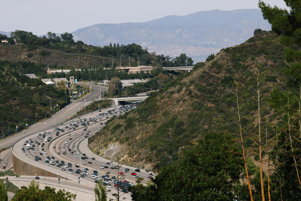
The 405 Freeway passes through several areas with hillsides covered in dense shrubs and trees.
(Dania Maxwell / Los Angeles Times)
“West of that point, almost no rain fell at all, and in early October we had a record-breaking heat wave,” Swain said. “East of the 405 in Southern California, the fire risk is lower because it recently rained.”
Bearing that in mind, two of the hikes below are east of the 405 and the third is an urban hike. All three avoid long drives far into the mountains. The two hikes closest to the foothills have large parking areas and clear exits. The urban hike usually offers clear views that should allow hikers to spot a fire near them and evacuate quickly.

Several children balance on rocks as they cross a segment of the Arroyo Seco near Pasadena.
(Jaclyn Cosgrove / Los Angeles Times)
1. A shady hike along a flowing river
Gould Mesa via Gabrielino Trail
Distance: About 4 miles out and back
Elevation gained: About 300 feet
Difficulty: Easier end of moderate
Dogs allowed: Yes
Nearest to: Pasadena, La Cañada Flintridge and Altadena
Accessible alternative: The first mile of this trail is paved. See notes below.
The Gabrielino National Recreation Trail is a 28.8-mile journey from Chantry Flat Recreation Area north of Sierra Madre all the way to the Ventura Street & Windsor Avenue trailhead near the Hahamongna Watershed Park in La Cañada Flintridge. It is a multi-use trail for hikers, mountain bikers and horse riders.
The trail has several beautiful sections, including from its western entrance in Hahamongna to the Gould Mesa Trail Camp. This segment is mostly shaded and great for a morning stroll, especially before 11 a.m. Saturday and Sunday.
To begin your hike, you’ll park at a large free dirt lot near the backside of NASA’s Jet Propulsion Lab. If hiking in a wheelchair or seeking an accessible paved path, I recommend parking at this smaller paved lot, as that’s where the paved portion of the trail begins. (Please leave this lot for folks seeking the accessibility alternative, as it’s smaller than the large dirt lot — and both are free!)
You can either take the paved trail or an unofficial dirt trail that follows the Arroyo Seco before leading you to the official trail. Either way, it’s primarily a mix of flat path and gentle inclines along the Arroyo Seco, shaded by coast live oaks, bay laurels and sycamore trees. After hiking about two miles, you’ll reach the Gould Mesa Trail Camp, where you can set up a picnic at one of the campground’s tables, or cool off along the creek.
And if you’d like to go a bit farther, you can continue onward to the Paul Little Picnic Site or the Brown Mountain Dam waterfall (see map). Regardless of where you stop, I promise you’ll be treated to a stunning landscape and likely hear the chirp and squawk of scrub jays, California quail and more.

The San Gabriel Mountains become blanketed in golden light in the early evening in Dunsmore Canyon in Deukmejian Wilderness Park, a Glendale park.
(Jaclyn Cosgrove / Los Angeles Times)
2. A canyon hike with incredible views
Dunsmore Canyon & Le Mesnager Loop Trail
Distance: 2.6 miles
Elevation gained: About 800 feet
Difficulty: Moderate
Dogs allowed? Yes
Accessible alternative: Stough Canyon Fire Trail with Action Trackchair AXIS 40
This 2.6-mile hike through the 709-acre Deukmejian Wilderness Park in Glendale will offer you not only great views of the surrounding cities but also an opportunity to spend time among healthy native trees and plants, including California buckwheat, black sage and California sagebrush (which you should smell).
You’ll park in a lot near the Stone Barn Nature Center. Several signs are usually posted around the lot warning visitors about when the park will close, and a staff member will lock the gate. I think that’s serious, so take note.
You’ll start your hike on Dunsmore Canyon Trail, headed northeast up a straight gravel path covered on both sides with thick ceanothus, yerba santa and more.

Although some hikes, like this path in Dunsmore Canyon in Glendale, may appear exposed during the day, you might find they’re shadier in the morning or evening, depending on their local topography.
(Jaclyn Cosgrove / Los Angeles Times)
Just 0.2 miles in, there’s a massive old coast live oak where kids could easily create an imaginary forest kingdom under its large branches.
As you continue to climb, you might hear Dunsmore Creek, which runs parallel to the trail. Remember to turn around as you gain elevation, as this trail rewards you with substantial views of Glendale and the Crescenta Valley soon after you start. All the while, you have the San Gabriel Mountains right in front of you, including Mt. Lukens, which you can hike to from the same park.
Half a mile in, you have the option to continue on the Dunsmore Canyon Trail or Le Mesnager Trail to make a shorter loop. Le Mesnager Trail includes a lookout point at about 2,750 feet, a great spot for sunset as long as you don’t get locked in! As you meander down the trail, you’ll find a nice shady canopy and continued views of the city below.
Given our weekend temperatures, this trail is best in the morning or evening. I personally prefer the latter, when golden hour paints the mountains a deep gold to red.
If you plan to hike it in the evening, though, keep the park hours in mind. It is open until 8 p.m. until Monday, when its hours shift to closing at 7 p.m., which remains until Daylight Saving Time ends Nov 1. This is relevant if you plan to park in the lot. Otherwise, you can walk out of the park and back to your car. Regardless, have fun!

Visitors reach the Baldwin Hills Scenic Overlook by climbing the Culver City Stairs.
(Myung J. Chun / Los Angeles Times)
3. An urban hike near a great picnic area
Culver City Stairs to Baldwin Hills Scenic Overlook
Distance: 1.4 miles
Elevation gained: About 350 feet
Difficulty: Moderate
Dogs allowed? Only on the paved road, not on trails
Accessible alternative: Discovery Park and Bluff Creek Trail
This 1.4-mile out-and-back jaunt up 282 concrete steps, known locally as the Culver City Stairs, takes hikers to the stunning Baldwin Hills Scenic Overlook. From here, you’ll have one of L.A.’s most breathtaking — kind of literally — city views.
To begin, you’ll take the Baldwin Hills Scenic Overlook entrance off Jefferson Boulevard. You’ll follow a dirt path briefly east, follow a switchback to the west and soon find stairs. Head straight up, pausing to breathe and appreciate the views. The stairs vary in height, from about 3 to 20 inches, so it’s good to take your time.
At the top, you’ll have panoramic views that, on a clear day, include the Pacific Ocean. To return, you can either head back down the steps or take the meandering dirt trail down.
Culver City is expected to be cooler on Sunday than Saturday, with an expected high of 85 degrees. Why not make it a morning trek followed by brunch?
Regardless of where you go, I hope you have a safe and meaningful time on our public lands!

3 things to do
1. Prance up to a giant pumpkin in Norco
The L.A. Fright Club will host a 1.6-mile moderate hike at 9 a.m. Sunday to Pumpkin Rock in Norco. Guests should wear comfortable hiking shoes and bring water. Costumes encouraged. Learn more, including how to register, at the club’s Instagram page.
2. Make marvelous marsh pics in Irvine
The California Native Plant Society’s Orange County chapter will host a beginner nature photography course at 5:30 p.m. Thursday at the Duck Club at the San Joaquin Marsh in Irvine. At 5:30 p.m., photographer Bob Allen will guide attendees on a short walk in the marsh, followed by a presentation and discussion of technique at 7 p.m. Learn more at the organization’s Instagram page.
3. Witness the cosmos near Palm Springs
The San Bernardino Valley Amateur Astronomers will host a star party from 8 to 10 p.m. Saturday at the Whitewater Preserve northwest of Palm Springs. Gates will open at 7:30 p.m. and close at 8:05 p.m. No late entry. Learn more at the preserve’s Instagram page.

The must-read

An Eastern box turtle at the Turtle Conservancy in Ojai.
(Julie Leopo / For The Times)
The 90-acre Turtle Conservancy in Ojai was founded in 2005 as a research center and advocate for turtle habitat. But over the past 10 years, its mission has shifted in response to illegal turtle poaching, prompting the small nonprofit to take in 810 turtles — more than 400 of which they received in the past six months. What should the conservancy do once it has the turtles? That question remains heavily debated (and underfunded), an issue covered in a recent Times story by writer Stuart Miller. “It’s so easy to pluck an animal out of the wild, but when you want to put one back there’s more roadblocks,” said conservancy founder Eric Goode. “Can we find a happy medium? Because the best thing for these turtles is not to keep them in holding areas for too long.”
Happy adventuring,

P.S.
Would you like to help scientists better understand where native species are thriving in L.A. County? Or how about researchers who are tracking where invasive species are taking up loads of space? The L.A. Nature Quest is a monthlong challenge that runs through Oct. 31. The L.A. Public Library helps host the challenge, which asks participants to download the citizen science app iNaturalist and then document the natural world in their neighborhood. This year, quest organizers are especially hoping people will pay attention to “cold spots,” where there is little to no data on habitat in an L.A. neighborhood. Check out the map at lapl.org to see how you can help.
For more insider tips on Southern California’s beaches, trails and parks, check out past editions of The Wild. And to view this newsletter in your browser, click here.