The achievement is breathtaking. Recognition is growing. The fastest known time is hers.
Ultrarunner Sophie Woods will have more to say after a few well-deserved full night’s sleep. For now, consider her unvarnished secret to traversing a mountainous 1,242-mile trail network through Italy, Slovenia, Austria, Germany, Liechtenstein, Switzerland, France and Monaco in 28 days, 17 hours and 59 minutes — nearly a week faster than anyone else has been known to do so.
“Just one step. That’s all you have to do. Just one step forward,” Woods said on Instagram.
Woods earlier reported the record time as 29 days, but corrected it in an email to The Times on Monday, saying she and her husband George “were all so exhausted they hadn’t calculated correctly.”
The Via Alpina course follows the length of the Alps with elevation equivalent to climbing Mount Everest a dozen times. The length is a nice round number in kilometers — 2,000. The total elevation climbed was roughly 110,000 meters, an average of 12,000 feet of daily vertical ascent per day.
Yet another number is equally impressive: Woods is 42 years old.
Woods, who competes using her maiden name Sophie Amy Grant, set off on July 4 in Trieste, Italy, and finished on the Mediterranean coast of Monaco. She endured heatwaves, storms, wildfires and a swarm of horseflies. She ran, climbed and hiked 14 to 18 hours a day, covering 40 to 50 miles before getting a few hours of sleep in a van, tent or occasionally a hotel room.
“I am ecstatic but knackered,” she told BBC Sport. “I’m really tired.”
She ate and drank what would be expected of someone exerting herself to the nth degree. Energy gels containing carbs, electrolytes and amino acids along with a sprinkle of caffeine were essential, but Woods also splurged on McDonalds and mounds of pasta when she met up with her husband, photographer Zoe Salt and dog Nila at day’s end. She estimated that she consumed close to 7,000 calories a day.
The first week was the toughest, with Woods describing her feeling “a thousand pulled muscles,” but by halfway through the journey she told Her Sports that “things still ache now, and by the end of the day my feet are definitely ready for a rest, but I currently only have one small blister on my heel, which I’m calling a huge win. All things considered, I’m feeling really good.”
Sophie Woods runs a route on Via Alpina at Klausenpass by Hotel Meiringen on July 20.
(Zoe Salt)
The previous fastest known time in the Via Alpina was 35 days, 21 hours by British runner Jake Catterall, 34, in 2024. Tessa Caspers, 33, set the fastest women’s time for the route at 38 days, 2 hours last year.
Catterall might need to update his website, which claims not only the Via Alpina record but others including an arduous mountain trek in North Africa and a 3,500-mile mad dash across the entire length of Europe, from Norway to Andalusia, Spain.
He knew all about Woods’ effort, however. On day 20 of her journey, Catterall met her in Switzerland after she had traversed “a particularly spicy descent on a sketchy section of via ferrata,” according to Woods’ Instagram.
“Safely back at base camp, she was met by a brilliant surprise,” the post read. “Waiting to cheer her on was @jakecatterall — the current Via Alpina FKT holder — who had gone out of his way on the journey to his own adventure just to support Sophie. It was such a thoughtful gesture, and one that gave everyone a real lift.”
FKT is short for the “fastest known time” that a person or small group achieves on a particular course, usually somewhere it would be difficult or impossible to host an actual race.
To submit an FKT, the route must be at least five miles long or have at least 500 feet of climbing. Some are very short — the Manitou Incline in Colorado is less than one mile long but climbs 1,900 feet and begins at 7,000 feet of elevation. Others such as the Via Alpina and the Appalachian Trail are thousands of miles long.
For verification, GPS information must be submitted to the FKT website. The route can be linked by uploading it to Strava, Garmin Connect or another online training platform. FKT has not verified Woods’ record yet.
Woods’ mark likely will be tested by another runner, although someone else her age and gender completing the Via Alpina in fewer than 29 days would be a challenging feat.
Woods is from New Zealand and she and her husband spent a decade in London before living in their camper van for years while traveling throughout Europe, finally settling in Andorra, a tiny principality situated in the Pyrenees mountains between France and Spain.
And it is there Woods will rest for a spell.
“I’m absolutely ecstatic,” she said on Instagram a day after she completed Via Alpina. “I still can’t believe that we did it.”
I am not someone who regularly goes out on a weekday.
But when I heard just how ideal the viewing conditions will be for the upcoming Perseid meteor shower, I texted multiple friends, inviting them on a late-night adventure into the woods. That’s exactly my kind of party.
The Perseid meteor shower, which can produce up to 100 meteors an hour in its most active period, is expected to peak from the evening of Aug. 12 into the early morning of Aug. 13. Last year during the shower’s peak, the moon was 84% full.
That’s part of what makes this year special. The night sky will be at its darkest during the Perseids peak because we’ll have the new moon, the lunar phase when our moon’s illuminated side faces the sun.
In this 30-second camera exposure, a meteor streaks across the sky during the annual Perseid meteor shower in West Virginia in 2021.
(Bill Ingalls / Associated Press)
In this edition of The Wild, our weekly outdoors newsletter, I will explain not only where near L.A. you can drive, hike or camp for the best viewing of this meteor shower, but also, thanks to a conversation with an astrophotography expert, how you can get better photos regardless of whether you’re using your cellphone or dedicated camera.
You are reading The Wild newsletter
Sign up to get expert tips on the best of Southern California’s beaches, trails, parks, deserts, forests and mountains in your inbox every Thursday
By continuing, you agree to our Terms of Service, which include arbitration and a class action waiver. You agree that we and our third-party vendors may collect and use your information, including through cookies, pixels and similar technologies, for the purposes set forth in our Privacy Policy such as personalizing your experience and ads.
First, though, let’s talk about what exactly a meteor shower is and why they occur.
🌑 Tips for viewing the Perseid meteor shower 🌃
I spoke to Bruce Betts, chief scientist at the Pasadena-based Planetary Society, a member-financed group focused on advancing space science.
Betts explained that Earth gets hit every night by an estimated 100 tons of material, equivalent to about 13 Randy’s Donuts signs blasting into the planet (which is a fun visual). This means there are meteors every night, around 10 an hour in a place with no light pollution.
A meteor shower occurs when Earth is moving through a debris field left by a comet. But nothing hitting Earth is thankfully as large as a 25-foot-high fiberglass doughnut.
“It’s mostly small-sized stuff — sand-sized, pebble-sized, dust-sized,” Betts said. “It’s going to burn up hundreds of thousands of feet up in the atmosphere. When you see it fizzle out, it’s way up there typically.”
I cannot be the only person who, learning this information, felt surprised that tiny specks of space dust can produce such dazzling experiences for us earthlings. But these particles are moving incredibly fast — tens of thousands of miles per hour — and as they move through our atmosphere, they’re heating up and vaporizing.
In the case of the Perseid meteor shower, you’re watching debris left behind by the comet Swift-Tuttle as it neared perihelion, its closest approach to the sun.
Earth orbits through that debris field every August. The Perseid meteor shower is named as such because as you’re watching, it appears as if the meteors are emanating from a point in the constellation of Perseus called the radiant point.
Meteors streak across the sky, seen above the Temple of Zeus during the Perseid meteor shower near Cavdarhisar, Turkey, in 2025.
(Emrah Gurel / Associated Press)
🌃 Getting the best Perseid-viewing experience 💫
To see the most meteors during the Perseids, you have to get to a point where you’re looking through less atmosphere, which around L.A. includes smog, smoke, clouds and, of course, light.
“The real problem is light pollution,” Betts said. “And that is, lights on the surface that are then reflecting off particles and stuff, a technical term, in the atmosphere. If you can get above that stuff, you start seeing better.”
Betts compared it to being in a bright room where there’s a dim light on. You won’t notice the dim light until you turn the rest of the lights off, and suddenly, that dim light is the brightest thing in the room.
During the Perseids peak, you don’t have to escape the light pollution of L.A. to see meteors. From outside your home, you will probably still see the largest blasts of light between 9 and 11 p.m. This is best for anyone who must be at their workplace at 8 a.m. for a meeting that could have been an email.
For the rest of us, let’s dive into where the best spots near L.A. are.
The 2023 Perseid meteor shower, as seen from Sequoia National Forest.
(Preston Dyches / NASA)
🏔️ Where to view the Perseids near L.A. 🌠
Below you’ll find my recommendations for spots that should provide good opportunities for viewing the Perseids. Please take good care when driving mountain or unfamiliar roads, and make sure someone outside your party knows where you’re headed and when you’ll be back. A meteor shower is still viewable when stranded with a flat tire, but far less fun!
Mt. Wilson Observatory: Located about an hour northeast of downtown L.A. in the San Gabriel Mountains, the observatory has a large paved parking lot at about 5,650 feet elevation that features nice views of the surrounding area. The only caveat is that the main gate usually closes at 5 p.m. in the summer, so you’ll need to park inside before then.
The Vetter Mountain Lookout: The lookout, at about 5,900 feet elevation, is reachable via a 5-mile round-trip hike and offers stunning panoramic views of the San Gabriel Mountains. The trailhead is about an hour drive northeast of downtown.
Chilao Campground: Also about an hour drive from downtown, this large first-come, first-served campground sits at 5,300 feet and offers great views of the night sky. Nearby Mt. Hillyer, which can be reached via a 6.4-mile round-trip hike from near the Chilao Visitor Center, could also be a nice spot to observe the meteor shower.
Crystal Lake Recreation Area and Campground: Crystal Lake is a 120-site first-come, first-served campground north of Azusa (about 1½- to two-hour drive northeast from downtown). At 5,539-feet elevation, it’s a great spot to camp and take in the shooting stars.
Mt. Pacifico Campground: This is a rustic 10-site campground that sits at 7,100-feet elevation and is deep in the San Gabriel Mountains. It’s about a 1½-hour drive from downtown L.A. and involves taking narrow mountain roads. High-clearance vehicles are required to make the final mile into the campground.
Musch Trail Camp: Musch Trail Camp is a small but charming campground in the Santa Monica Mountains. Located in Topanga State Park, it has picnic tables and a small restroom with flush toilets and sinks. It’s around a 45-minute drive mostly west from downtown.
Leo Carrillo State Park: Along with its hiking trails and campground, the park in Malibu features 1.5 miles of beach, where you can watch the sunset before the sky darkens enough to see the meteor shower.
Red Rock Canyon State Park: A two-hour drive from downtown L.A., this park has colorful desert cliffs and a 50-site campground with great views of the night sky.
McGill Campground/Chula Vista Walk-In Campground: A two-hour drive from L.A., either of these campgrounds in Los Padres National Forest will provide you with a memorable experience, as the area is known for its stargazing. McGill is mostly by reservation while Chula Vista is a walk-in spot with first-come, first-served sites. If not prepared to camp, you can also watch nearby from the Mt. Pinos parking lot, but it’ll likely be quite crowded during the Perseids, as it is the closest darkest spot to L.A.
Or, you could try a spot where you can safely and legally drive and/or hike into that you recall being fairly dark at night. There are online tools that can help you find your own spot, including light pollution maps.
Regardless of where you go, please remember to practice the Leave No Trace principles, including packing out any trash you bring, not taking anything from the forest that you didn’t bring and not playing loud music, as it not only bothers hikers but also the animals who live in our natural areas.
A Perseid meteor appears at the top left of the frame in this 25-second exposure, as seen from White Tank Campground in Joshua Tree National Park in 2024.
(Raul Roa / Los Angeles Times)
📸 How to photograph the Perseid meteor shower 🤩
Many of us have tried and failed to take photos of the night sky. I spoke to accomplished astrophotographer Jeremy Evans, a delegate for Dark Sky International who affirmed that it’s no easy task to capture the beauty of celestial bodies.
“Carl Sagan said astronomy can be a humbling and character-building experience because it is a little overwhelming to look up at that vastness of the sky and either explore it, photograph it [or] study it, [regardless of] whether through a telescope, camera or naked eye,” Evans said.
Here’s what Evans, who has photographed the Perseids for the past 20 years, recommends (after you’ve found the darkest area possible to view the shower).
1. Point your camera to the southwest
Perseus, the constellation that the upcoming meteor shower is named after, will rise in the northeast between 9 and 10 p.m., depending on your latitude.
Photographing a meteor shower can feel like a game of Whac-A-Mole, Evans said. Instead of trying to chase meteors across the sky all night, set your camera to face the southwest for the Perseids.
“Most of the [Perseids] meteors, based on my experience, fly from northeast to southwest, so I like to have my camera pointing toward the southwest, and catch those meteors flying overhead and into my frame,” Evans said. “The good thing about that is, when they start burning up and giving you that trail of ionized gases, they’re usually flying over the southwest at that point. You can point your camera to the northeast, but you might not get the fire balls and the tails.”
2. Adjust your camera’s settings
If using a dedicated camera (as opposed to a phone camera), turn off image stabilization. Otherwise, you might be plagued with blurry images all night.
Choose a wide lens. Evans generally recommends using a wide lens with a focal length between 14 and 24 mm. “You can use a fish eye,” Evans said. “However, a fish eye will show most of the night sky, but then the meteors are going to appear a lot smaller.”
Determine your shutter speed. Some astrophotographers use the “500 rule,” an equation that helps them figure out the ideal shutter speed. It’s essentially dividing your camera lens’ focal length into 500 to get your shutter speed. For Evans, that’s often 500 divided by 24, which he rounds down to equal a 20-second exposure. (If your shutter speed is too slow, the stars can come out blurry)
Turn off the flash.
Turn off your camera’s auto focus. You will need to manually adjust your lens, as your camera most likely won’t be able to automatically focus on the starry sky. (More on that below.)
Turn on shutter delay. If you don’t have an external remote, turn on the setting that allows for a multi-second delay after you press the button. This allows your camera to stabilize after you press the shutter. Wiggling camera = bad pics.
3. Set up your tripod.
Evans said a tripod is arguably your most important piece of equipment, and it’s worth investing in if you’re wanting to regularly practice astrophotography. Cheap tripods are often flimsy and can fall over and wiggle from a light breeze.
That said, I’ve taken good images of the stars by propping my DSLR up using soup cans on a metal bear box while out camping. I’ve also used boulders, including during a recent trip to capture the aurora. Really, whatever you’re using just needs to be as solid and unmoving as your least favorite relative’s political beliefs.
4. Use this trick to focus your camera.
Evans recommends pointing your camera at a bright object at least a quarter mile away, like a street light or other fixed object. You could also use a bright star or, if setting up early enough, Venus. Regardless, use this distant object to manually focus your lens.
If your DSLR has a “Live View” option, you can magnify the bright object using that feature, making it even easier to focus on the object. When you zoom back out, the object should be a fine point of light.
“And then be careful not to bump your lens,” Evans said.
5. Pack enough battery power.
Evans recommends bringing at least two batteries for your DSLR if you don’t own an external power source for your camera.
If your battery is more than 2 years old, it’s likely lost a significant amount of its capacity, Evans said. In that case, you’ll want to ideally pack a third battery, depending on how long you plan to stay out.
“When you’re taking a series of photographs in the day, you’re using a shutter speed of 1/500 of a second on average, and then when you go from 1/500 of a second to keeping that shutter open for 20 seconds, you’re using a lot more power,” Evans said, meaning a battery that usually lasts for several days might only provide enough battery to shoot night photography for, at most, a few hours.
🌠🌑🌃
Betts and Evans told me that they hope that people going out to view the Perseids results in more people not only enjoying the night sky but also wanting to protect it, namely from light pollution. I hope so too.
And I hope wherever you go, you witness the beauty of shooting stars burning in the night sky. It’ll be arguably the most fun you can have on a Wednesday night in August.
3 things to do
A great blue heron.
(Lois A. Sheppard)
1. Wander the wetlands in Seal Beach The Los Cerritos Wetlands Land Trust will host a guided nature walk from 8 to 10 a.m. Saturday in Seal Beach. Guests will learn about the Los Cerritos Wetlands, looking for herons and other birds who frequent the area. Close-toed shoes are required. Register at eventbrite.com.
2. Care for oaks near Calabasas The Resource Conservation District of the Santa Monica Mountains needs volunteers from 9 a.m. to noon Saturday in Topanga State Park to tend to fire-damaged oak trees. Participants will water, weed and mulch oak trees, and plant acorns to replace trees that have died. Attendees should wear durable shoes and bring drinking water. Register at eventbrite.com.
3. Cycle along Slauson in South L.A. T.R.U.S.T. South LA, People for Mobility Justice and Metro will host a community bike ride along the Slauson rail-to-rail bike path from 6 to 9 p.m. Tuesday. The group will meet in front of Augustus F. Hawkins Nature Park. At registration, guests can request a voucher for a Metro bike if unable to bring their own. Register at docs.google.com.
The must-read
Jackie, an internet-famous bald eagle, sits on an egg in her nest shared with partner Shadow in Big Bear.
(Friends of Big Bear Valley)
As of Monday, Jackie, the beloved Big Bear eagle, appears to be improving. In mid-July, Jackie was rescued by L.A. County’s San Dimas Raptor Rescue team and transported to Ojai Raptor Center for emergency care. Fans of Jackie, one half of the avian power couple whom thousands of people regularly view via live webcams near their nest, have since anxiously waited for news. “She is eating on her own, her energy and alertness have noticeably improved, and she has become much more feisty during feedings,” the Ojai Raptor Center posted on social media.
Happy adventuring,
P.S.
Cool new feature alert! Times digital subscribers can now save trails highlighted in our hiking guides directly to their profiles on latimes.com. This allows subscribers to create their own curated lists of not only hiking trails but also restaurants, music venues and more. For example, you could save whale-watching sites, trails and beaches you wanted to check out, and then use the map function to see which spots are close to each other. And if you’re feeling especially spunky, you could throw some restaurants into the mix. I am personally excited to play around with this new feature because the No. 1 thing I like to do after a hike is eat, and our food writers are always finding great spots. Have fun out there!
For more insider tips on Southern California’s beaches, trails and parks, check out past editions of The Wild. And to view this newsletter in your browser, click here.
After an 18-month closure prompted by the Palisades fire and subsequent damaging floods, Temescal Gateway Park reopened Friday, restoring access to beloved trails in the Santa Monica Mountains.
Hikers can walk along Temescal Creek, crossing a few charming wooden bridges, or take one of the steep ridge line trails to gape at the ocean as they gasp for air. But the popular Temescal Canyon Trail, which takes hikers to Temescal Falls, remains closed.
In this edition of The Wild, our weekly outdoors newsletter, I will quickly outline what you need to know about returning to Temescal Canyon. My visit Friday was actually my first, but given the serenity I found in this coastal alcove, I will absolutely return. (Note: As of this morning, Google Maps still showed the park was closed; that is inaccurate.)
The Michael J. B. Allen memorial bench sits on a nice overlook in Temescal Canyon.
From the park, you can hike into Topanga and Will Rogers state parks, although some state park trails remain closed. Those include:
People who frequented Temescal Canyon before the Palisades fire will notice the inevitable changes that come after a fire. Trail crews removed several fire-damaged trees, including multiple mature oaks, as dead trees can and do fall unexpectedly, according to the Mountains Recreation and Conservation Authority. The agency plans to continue reforestation projects in the park as money becomes available.
You can easily enter the park through its entrance off Sunset Boulevard. Upon entry, you’ll need to pay the $12 day-use fee at one of the machines stationed around the parking lot if you’re parking on the property. (And it’s not something to roll the dice on — I saw at least one couple get ticketed.)
A burned wayfinding sign on the Temescal Ridge Trail, which was left from the Palisades fire.
(Jaclyn Cosgrove / Los Angeles Times)
I parked under a large coast live oak and headed northwest onto the Temescal Ridge Trail, which is exposed and has minimal shade but offers multiple options for day hikes, including:
A quick out-and-back up Temescal Ridge Trail to one of the route’s popular lookout points.
A 3.1-mile lollipop loop, taking Temescal Ridge Trail about 1.4 miles north to Bienveneda Trail, which loops you back around to the Temescal Ridge Trail at 2.3 miles into your journey.
Or even farther up, as Temescal Ridge Trail leads to other longer trails in the Santa Monica Mountains.
A hiker heads up Tesmescal Ridge Trail in the Santa Monica Mountains.
(Jaclyn Cosgrove / Los Angeles Times)
I huffed up the trail and was pleased with how quickly I could see the ocean. Several burned trees and shrubs remain, but they’re surrounded by an abundance of plant life coming back, including cliff aster and laurel sumac.
Along the route, I was pleasantly surprised by the exuberance of my fellow hikers. Multiple people stopped me — a fun experience for a reporter — to just share how wonderful they felt being back in the park. “Isn’t this great?” one hiker shouted to me as she headed up the ridge line. A couple from Minnesota told me they’d flown in the day before and were eager to get back to Temescal Canyon, their favorite spot to hike in L.A.
A burned tree with native plants growing up and around it.
(Jaclyn Cosgrove / Los Angeles Times)
My next stop was along the Sunset Trail, a 0.4-mile trail that runs along Temescal Creek. While I marveled at the gnarled and twisted old oak trees along the trail, I met a 14-year-old Parson Russell terrier named Finnegan. She seemed just as happy to be back as the people I encountered, especially on this shady trail next to running water.
Workers have installed three wooden bridges that cross over the creek, giving this short jaunt a whimsical feel. It ends near the road, and I turned back north, taking the sidewalk past picnic tables and rock shelters in a sycamore grove.
The Sunset Trail along Temescal Creek.
(Jaclyn Cosgrove / Los Angeles Times)
I would have loved to visit the Temescal Canyon Trail to see Temescal Falls, but as I mentioned, that trail remains closed.
You are reading The Wild newsletter
Sign up to get expert tips on the best of Southern California’s beaches, trails, parks, deserts, forests and mountains in your inbox every Thursday
By continuing, you agree to our Terms of Service, which include arbitration and a class action waiver. You agree that we and our third-party vendors may collect and use your information, including through cookies, pixels and similar technologies, for the purposes set forth in our Privacy Policy such as personalizing your experience and ads.
Isabela Noriega, a project manager at the Mountains Recreation and Conservation Agency, said the agency will work with California State Parks officials to begin restoring the route, as only a portion of the trail is within the boundaries of Temescal Gateway Park and the rest is on state land.
“You’ll remember the fires happened Jan. 7, and then we got storms in February,” Noriega said. “So there was a lot of erosion [and] dirt debris that washed out the trails. [It’s] two disasters piling up on top of each other that we’re working to deal with.”
Instead, the third trail option you’ll have is the Rivas Canyon Trail, a fun jaunt up the hillside that features several sets of wooden stairs. You can access the trail at either of its trailheads (see map).
I started at its southern trailhead, which is behind a few buildings and near some machinery and felled trees. From there, I walked north along a wide path shaded by oak trees before taking the first set of stairs up.
One of multiple sets of stairs along the Rivas Canyon Trail.
(Jaclyn Cosgrove / Los Angeles Times)
You’ll continue up the stairs, the views of the ocean growing better as you gain elevation. I was able to spot four sailboats as I hiked.
Although the trail is well maintained, there was a short stretch that was thick enough with cliff asters to make me grateful I wore pants. There were also a few spots where I paused to lightly stomp because low-lying branches of native shrubs covered the trail. These shady sites are great nap spots for rattlesnakes, which are common to the area.
Burned trees surrounded by native plants growing back after the Palisades fire scorched the hillside.
(Jaclyn Cosgrove / Los Angeles Times)
About half a mile in, you’ll reach the Michael J. B. Allen memorial bench, built in honor of a UCLA professor and avid hiker. This is a nice spot to take a break and have a snack.
Right after this first bench, the trail is speckled with rocks that reminded me of dinosaur eggs or little bits of the moon. These moments always make me wish I’d paid far more attention in geology class, as I can generally only provide such riveting commentary as “Look at that pretty rock” or “Hey, is that a geode?” (It’s never a geode.)
Stairs lead to the overlook point where there’s a memorial bridge for local trail legends Rob and Mary Ann Webster.
(Jaclyn Cosgrove / Los Angeles Times)
I continued east to the second memorial bench, built in honor of Ron and Mary Ann Webster, two beloved advocates of the Santa Monica Mountains. It’s often said that, if you’ve hiked in the Santa Monicas, you’ve likely stepped foot on a trail Ron designed.
The view from Rivas Canyon Trail in Temescal Canyon.
(Jaclyn Cosgrove / Los Angeles Times)
I decided to end my day on the Websters’ bench. The self-care app I use had recommended I spend 15 minutes outside that day reading, and this felt like a fine spot to finish a fascinating piece about how to properly measure a mountain.
I paused, though, first to take in the view.
All around me, there were reminders of both the fire and its aftermath — burned-out trees and plants. But past the hillsides dotted with native plants returning in force, I saw the wooden frames of several houses being rebuilt. It was a reminder that this park’s reopening is another signal that nature, ourselves included, will continue onward.
3 things to do
A stargazer calibrates a telescope to look at the Orion Nebula during a star party hosted by the Los Angeles Astronomical Society in L.A.
(Carlin Stiehl / For The Times)
1. Savor s’mores and the stars in Chinatown Los Angeles State Historic Park, a 32-acre expanse of public land in Chinatown, will host a “Park After Dark” event with the L.A. Astronomical Society from 7 to 9 p.m. Friday. Telescopes will be set up, and park workers will help guests make s’mores around a community campfire at the park’s roundhouse bridge. Learn more at the park’s Instagram page.
2. Doddle along the dunes in Santa Monica The Santa Monica Helping Hub and the Coastal Alliance will co-host a dune walk from 9 to 11 a.m. Sunday in Santa Monica. Conservation biologist Ashley Oelsen, the alliance’s founder, will lead guests through the dunes and share why the stretch of beach is ecologically significant, serving as important habitat for threatened shorebirds and native coastal plants. Register at eventbrite.com.
3. Bend under the Buck Moon in L.A. We Explore Earth, a local outdoors nonprofit, will host a full-moon hiking experience from 6 to 8:30 p.m. Wednesday in Elysian Park. Attendees will start meeting at 5:45 p.m. before heading on the hike at 6:25 p.m. After taking the Elysian Park west trail, participants can continue the evening with yoga, live music and stargazing with telescopes. Free, but donations of $5 to $10 are appreciated. Register at eventbrite.com.
The must-read
Crowds hike their way up the Mist Trail, one of the more popular trails in Yosemite National Park.
(William Hale Irwin/For The Times)
I am seemingly always planning my next adventure, including frequently pondering how soon I can return to Yosemite National Park. I last went in August and swam in the Merced River, hiked to Taft Point, saw Tunnel View at sunset and even went skydiving. But this past summer, that itch has felt more like a siren’s call as, like many outdoors lovers, I’ve been saddened by reports of serious overcrowding at one of America’s crown jewels. Over the past few weeks, I spoke to park-goers who’ve been to Yosemite this season, and I asked them: “Is it possible to still have fun there?” The answer, as I wrote in this story, was essentially, “Yes, but only if you plan accordingly.” Thankfully, they shared some tips on how to do that.
Happy adventuring,
P.S.
A bald eagle believed to be Jackie, one half of the celebrity raptor couple in Big Bear, was taken to a wildlife rehabilitation center in Ojai after being rescued this past weekend. Times staff writer Lila Seidman reported that a team with the San Dimas Raptor Rescue arrived around 1:30 a.m. Saturday in Big Bear Lake and found a weak and tired eagle on the lake’s shoreline. The eagle was then transported to the Ojai Raptor Center, where the reason for her deterioration remains unknown. “Queen Jackie is in the best of care! And will be able to return soon!” one YouTube user wrote Tuesday evening in the livestream’s chat. “Sending all our love & prayers to her and the kiddos and her amazing hubby super Shadow holding it down!”
For more insider tips on Southern California’s beaches, trails and parks, check out past editions of The Wild. And to view this newsletter in your browser, click here.
If Oxnard to you is just a freeway sign on the way to Santa Barbara or Ojai, you’re missing out on a few things. Like an extensive harbor with none of the traffic or showy affluence of its southern cousins. Miles and miles of white sand where you won’t find another family right next to you as soon as you lay down a towel. A diverse, chilled city with an energetic subculture (Nardcore, anyone?) and some pretty decent tacos.
There are a bunch of ways to spend your time here. Take an architecture tour around Heritage Square, perhaps, or taste your way around September’s Chowderfest at the Maritime Museum. On the water, you can paddleboard ‘til you drop, commune with whales on a boat excursion or skip off to the Channel Islands on a whim.
It’s the only California Cultural District in Ventura County, an honor bestowed by the California Arts Council, which says that “from Guelaguetza and Fiestas Patrias to Juneteenth celebrations, Nardcore punk shows, lowrider cruises, fandangos, and Ballet Folklorico, the district’s cultural life is exuberant and deeply rooted in community.” Rapper/producer and Oxnard native Anderson .Paak named his third album after the city and has hosted the .Paak House music festival in the region.
And Oxnard is a summer home to Netflix darlings the Dallas Cowboys Cheerleaders. For two decades, the Cowboys have held their training camp in the city, and this time around, the cheerleaders will join the scene for Oxnard Fan Night on July 31, the opening ceremony Aug. 1 and toa dance clinic Aug. 2.
Oxnard may not be overly polished, which of course adds to its charm. To get to know the community, you’ll have to veer a few miles off the 101 — but the detour makes for a vibrant SoCal weekend.
LONDON — British runner Josh Kerr ran the mile in 3 minutes and 42.66 seconds to break the longstanding men’s world record at a Diamond League meet in London on Saturday.
Kerr broke Moroccan Hicham El Guerrouj’s mark of 3 minutes and 43.13 seconds, set in Rome in 1999, and the Edinburgh native then set off on a lap of honor at London Stadium.
Kerr was so dominant on Saturday that he finished more than three seconds clear of American Yared Nuguse in 3:45.69.
The crowd support as he closed in on the record was “just incredible,” Kerr told the BBC.
“It was just me, my shoes and the track,” he said. “I was absolutely deaf in that last 110 meters.
“I didn’t take my foot off the gas,” he continued, “but … I started to glide and I was like ‘oh wow this feels incredible.’ It’s incredible because I’m slowing down. So, I was like ‘I better get to the line.’ So, crossing the finish line, seeing 42-something — anything — was my goal, so it was great.”
The 28-year-old Kerr’s previous best time was 3:45.34 in 2024.
He had targeted the mile race at the Diamond League meet as a main goal in a track season with neither Olympics nor world championships.
The mile is not a championships event yet has iconic status in track history, with the four-minute barrier broken in 1954 by another British runner, Roger Bannister.
Kerr was a silver medalist in the 1,500 meters at the 2024 Paris Olympics.
Josh Kerr says breaking the men’s mile world record is an “an awesome achievement” but hints he could attempt to set a new mark.
Kerr, 28, beat Moroccan Hicham El Guerrouj’s 1999 time, crossing the line in three minutes 42.66 seconds.
The Scot became the seventh British athlete to claim the mile record and first since Steve Cram in 1985. Kerr’s previous best personal best over the mile was a British record of 3:45.34.
“The biggest goal that I had [this year] was going after the world record in the mile,” Kerr told BBC Breakfast. “It was a perfect year for it.
“With the history that the UK have in the mile distance, obviously with Sir Roger Bannister breaking the four-minute mile back in 1954 and then the slew of incredible British athletes that we had for a long time – [Sebastian] Coe, Cram, [Steve] Ovett – it was just time for me to bring that distance and that record back home to the UK.
“To be able to break that record by nearly half a second was an awesome achievement.
“On another day, with maybe a little bit more favourable wind, I could maybe take another little chunk off it. It’s with us now and if we’re in the fitness for it again, we’ll maybe go after it and take a good more chunk off it.”
Great Britain’s Josh Kerr breaks the world record for the fastest mile, held by Moroccan Hicham El Guerrouj since 1999, by half a second in the Diamond League London event at the London Stadium.
Weekly insights and analysis on the latest developments in military technology, strategy, and foreign policy.
The U.S. Navy is envisioning a future force of carrier-based uncrewed aircraft capable of attacking enemy forces at least 1,000 nautical miles away from the ship. They would also have to be able to do this without needing to refuel in mid-air, though tankers could further extend their reach. This, along with other details, offers the first real sense of the combat drone capabilities the Navy wants to add to its future carrier air wings.
The range target was included in a very broad request for information (RFI) contracting notice regarding a future Air Wing of the Future (AWOTF) “family of systems,” which Naval Air Systems Command (NAVAIR) put out this week. NAVAIR is looking for prospective drone designs that could perform any combination of eight distinct missions. These are surface warfare; strike warfare; anti-submarine warfare; air warfare; electronic warfare; intelligence, surveillance, reconnaissance, and targeting (ISR&T); mobility; and logistics. A breakdown of how these missions are defined, in general terms, in the RFI is provided below.
The mission sets as defined in the RFI. The acronyms JFC and CVW here refer to the joint force commander and the carrier air wing, respectively. USN
It should be noted here that the Navy says the family of AWOTF platforms already includes the MQ-25A Stingray tanker drone, which will have a secondary surveillance and reconnaissance role, as well as future Collaborative Combat Aircraft (CCA). The Navy is still very early on in the process of defining what it wants its CCA drones to be able to do, even just initially. As TWZ has noted in the past, the MQ-25’s core design and baseline performance, specifically its extreme endurance and low-signature design, also leave open the possibility that it could be adapted to strike, advanced ISR, and other missions in the future.
A demonstrator used in the development of the MQ-25 Stingray tanker drone, seen on the deck of the supercarrier USS George H.W. Bush during testing. USN
“For missions involving attacking the enemy, the system must be capable of delivering effects a minimum of 1,000 NM [nautical miles; approximately 1,151 miles statute miles or 1,900 kilometers] from the CVN without refueling,” the RFI NAVAIR issued yesterday says.
The drones must be “fully compatible with both Nimitz class and Ford class CVN launch and recovery systems,” per the RFI. “The system must demonstrate increased combat effectiveness over current 4th generation platforms at a given spot factor.”
Spot factor here is the amount of physical space the platform occupies, which is a very important consideration for carrier-based aircraft, where room on the flight deck and below is at a premium. Though the focus is on prospective carrier-based designs, the RFI also highlights the Navy’s interest in vertical takeoff and landing capable drones that could operate from destroyers or other vessels. This is something the service has openly discussed in the past and that we will come back to later on.
The Navy also wants any potential designs to be “capable of integration into existing U.S. Navy Unmanned Carrier Aviation (UCA) control systems.” Furthermore, the service is asking prospective vendors to explain how their concepts “address flight autonomy (e.g., carrier pattern, taxiing) and mission autonomy (e.g., dynamic tasking / retasking, threat evasion, automated aerial refueling) maturity,” and whether “their solution is single-role, multi-role, or a modular/variant-based approach.”
The video below from Collins Aerospace offers a notional look at what crewed-uncrewed teaming involving carrier and land-based CCA-type drones might look like in the future.
Collaborative Mission Autonomy
The range requirement is particularly interesting. As adversary anti-access/area denial (A2/AD) bubbles continue to expand in scale and scope, carriers and their air wings will be pushed further and further away from target areas. Having aircraft, crewed and uncrewed, that can cover those extended distances will be vital. Having CCA-type drones, in particular, with ranges similar to or greater than that of the crewed fighters they are expected to be paired with, is also key to enabling that particular concept of operations.
Not necessarily needing tanker support to complete those missions will also be a boon. Aerial refueling capacity is always in high demand during sustained conflicts, as underscored by the recent fighting with Iran, and that need will be further magnified in a future high-end fight against a near-peer opponent like China. Those same tankers would, by extension, also be top targets for enemy forces.
The new uncrewed carrier-based aircraft RFI from NAVAIR outlines exactly this reality:
“Aligned with the 2025 National Security Strategy (NSS), the 2026 National Defense Strategy (NDS) issued by the Department of War, and the Chief of Naval Operations’ (CNO) Fighting Instructions, the Navy is seeking capability improvements to expedite transition from a 4th-generation-centric Carrier Air Wing (CVW) to a 5th/6th-generation manned-unmanned AWoTF. This transition supports the Golden Fleet initiative and the Navy Warfighting Concept, which is a proactive approach leveraging global maritime maneuver to gain sea control, impose sea denial, and project power independently. Unmanned systems are critical to increasing Carrier Strike Group (CSG) strike capacity, extending CVW operational reach, and introducing advanced methods for executing Naval Aviation missions in a Highly Contested Environment (HCE). The objective is to evaluate the feasibility of fielding platforms with extended range and payload capacity, while minimizing deck footprint and integrating with established CVN infrastructure.”
F/A-18E/F Super Hornets and F-35C Joint Strike Fighters seen on the deck of the supercarrier USS Theodore Roosevelt on July 10, 2026. Seaman Apprentice Tyler Harstad/USN
A 1,000 nautical mile range target is in line, at least in broad strokes, with what the Navy is looking for in terms of combat radius for F/A-XX. The service has said in the past that the sixth-generation jets will offer a 25 percent increase in range over the existing tactical combat jets. This would be roughly 837.5 nautical miles (just over 1,551 kilometers) based on the stated combat radius of the F-35C (670 nautical miles, or close to 1,241 kilometers). The F-35C has the longest reach, with a relevant payload, of any tactical jet in the Navy’s current inventory. The service has also previously expressed interest in finding new ways to extend the unrefueled range of its F/A-18E/Fs and EA-18Gs.
The US Air Force released this infographic in May, which includes the combat radius figures and other specifications for the F-47, as well as for the YFQ-42A and YFQ-44A CCA drones, along with other existing tactical platforms. USAF
As an aside, it is interesting to remember that the Navy’s abortive Unmanned Carrier-Launched Airborne Surveillance and Strike (UCLASS) program had been aiming for a platform with a combat radius of up to 2,000 nautical miles when operating in the strike role. There was also a requirement to be able to fly surveillance and reconnaissance orbits in areas 1,200 nautical miles from the deck of a carrier. UCLASS payload requirements fluctuated, but a pair of X-47B stealthy demonstrator drones tested during the program were designed to carry two 2,000-pound-class munitions internally.
One of the X-47B demonstrators. US Military
UCLASS showed much promise, and the X-47Bs achieved many firsts for carrier-based drones. Despite this, UCLASS was transformed into the radically different Carrier-Based Aerial-Refueling System (CBARS) program in the mid-2010s, which then led to the MQ-25. This was a shift that seemed abrupt to many and was done for reasons that are still not entirely clear, as TWZ has previously explored in detail in a seminal feature readers can find here.
Northrop Grumman X-47B | First to Complete Autonomous Aerial Refueling
As mentioned, the Navy is still refining the requirements for its planned carrier-based CCA drones. Anduril, Boeing, General Atomics, and Northrop Grumman are all on contract now to develop conceptual designs. So far, what we have seen are designs intended to operate from carriers in a broadly traditional manner using existing catapults and/or arresting gear. General Atomics has publicly put forward a carrier-based member of its highly modular Gambit family of drones, which are based around the common chassis concept that you can read more about here. Boeing has also previously shown a rendering of a carrier-based version of its MQ-28 Ghost Bat, a drone developed by the company’s Australian subsidiary. The Navy has also expressed specific interest in Ghost Bat.
A rendering depicting General Atomics carrier-based Gambit 5 drones operating from a British Queen Elizabeth class carrier. General Atomics
It is also worth pointing out that the NAVAIR RFI uses the term “combat radius” but also frames the requirement around “delivering effects” out to the desired range without the need for refueling. This might leave the door open to concepts that use stand-off munitions and/or other capabilities to extend the functional reach of the drone, even if its actual combat radius is under 1,000 nautical miles.
As mentioned earlier, the RFI also discusses VTOL drone operations for vessels other than carriers. Concepts of operations that involve launches from carriers (or other ships) and recovery at tertiary points at sea (or on land) could also have impacts on the range equation. Depending on their design and performance, drones could be launched from forward locations and then recover aboard carriers further to the rear, too.
Shield AI has notably talked about exactly this kind of flexibility as being a key benefit of its still-in-development X-BAT stealthy jet-powered combat drone. X-BAT is designed to take off and land vertically using nothing more than a trailer-based launch and recovery system. Shield AI is aiming for a maximum range of 2,000 nautical miles for the drone, which you can learn about in far more detail here
X-BAT: Earth Is Our Runway
A screen capture from the video above highlighting different potential concepts of operations for the X-BAT. Shield AI
A rendering of a forthcoming variant of Kratos’ Valkyrie drone with tricycle landing gear. This version will also be capable of rocket-assisted takeoffs from static launchers. KratosAn XQ-58 seen during a rocket-assisted launch. USAF/2nd Lt. Rebecca Abordo
Beyond exploring specific design concepts and capability mixes, NAVAIR’s RFI makes clear that the Navy is very much still refining its overall vision for what the uncrewed complement of future carrier air wings will look like. Senior service officials have said in the past that the goal is for the total makeup of carrier air wings to eventually be 60 percent or more uncrewed.
At the same time, the Navy has acknowledged that it has been moving more slowly than the Air Force and Marines with its plans to develop and field a carrier-based CCA fleet. The NAVAIR RFI also points to efforts now to expand that work, but it remains unclear when operational CCAs, or any other future uncrewed members of the AWOTF, will appear on the decks of U.S. carriers. The Navy has consistently said that it is focused first on fielding the much-delayed MQ-25, which will then help serve as a ‘pathfinder’ for other drones. The service is now targeting next year to finally reach initial operational capability with the Stingray, something that was originally scheduled to happen in 2024.
What we do know now is that the Navy also sees a combat radius of at least 1,000 nautical miles as a key threshold requirement for uncrewed tactical elements of its future carrier air wings.
It’s a rare day when you cannot hike somewhere in Los Angeles.
But as I write this, L.A. County is under an extreme heat warning through Thursday evening. California recently saw its first storms of monsoon season, which I learned is the reason I found myself earlier this week whining about the humidity. We’ve now entered the period of summer when you need to plan your trips with heat in mind.
In this week’s edition of The Wild, our weekly outdoors newsletter, I will highlight three hikes around L.A. where, if you go early, you can enjoy a quick, shady jaunt in nature. But first, let’s talk summer trail safety.
You are reading The Wild newsletter
Sign up to get expert tips on the best of Southern California’s beaches, trails, parks, deserts, forests and mountains in your inbox every Thursday
By continuing, you agree to our Terms of Service, which include arbitration and a class action waiver. You agree that we and our third-party vendors may collect and use your information, including through cookies, pixels and similar technologies, for the purposes set forth in our Privacy Policy such as personalizing your experience and ads.
How to hike safely in L.A. in summer
⌚Avoid hiking in the hottest part of the day. This will vary by day and region, but I typically plan to leave the trail by 11 a.m. in summer, or hike in the evenings, around 6 p.m.
🫗Pack more water than you normally need. Dehydration is a major reason that adventurers out on a day hike need to be rescued. It’s generally recommended to drink at least 1 quart every two hours (the amount in your typical Nalgene bottle). In summer, you will need to increase that. During summer, I also like to carry electrolyte powder and gummies.
🌤️Check the weather forecast of where you’re heading. If headed to Angeles National Forest, which includes the San Gabriel Mountains, take a look at the “Current Conditions” tab to find relevant weather information. The Santa Monica Mountains National Recreation Area has a similar page here. If hiking in an L.A. park, remember that, because the region has several microclimates, temperatures can vary widely across the county.
😎 Wear sun protection. This includes a sun hoodie, wide-brimmed hat and sunglasses. I also recently started regularly carrying the hiking umbrella that I reviewed in last year’s Times Gift Guide.
🥵 Know the signs of heat illness. Heat cramps can be the first signal from your body that something is amiss, usually presenting as painful spasms in your legs and/or abdomen. Next comes heat exhaustion. Symptoms include clammy skin, nausea, cramps, vomiting and headache. “Don’t ignore a headache when hiking in hot weather!” the American Hiking Society cautions. “This is serious stuff. Stop. Drink. Rest.”
📲 Tell someone where you’re going. Complete this form (or something similar) and share it with a friend or family member. Place an additional copy on your vehicle’s dash if driving to the trailhead. The last thing you want is to be injured without anyone knowing where you are.
3 shady hikes around L.A.
As I’ve said many times, the best hike is where you are. The three hikes below all feature early-morning shade, but if they’re farther than you can drive or reach by transit, check out this guide I wrote about how to find shady hikes near you. I returned to it when writing this piece to remind myself of my own tips!
OK, let’s imagine the air blowing from your office fan or air conditioner is actually a light mountain breeze as we explore these three great hikes. Adventure awaits!
Sycamore trees cast shade over a trickling creek in Sullivan Canyon near Brentwood.
(Jaclyn Cosgrove / Los Angeles Times)
1. Sullivan Canyon Trail
Distance: 8.8 miles out and back Elevation gained: 1,200 feet Difficulty: Moderate Dogs allowed: Yes Nearest to: Brentwood and the Pacific Palisades Accessible alternative:Inspiration Loop Trail at Will Rogers State Historic Park
The Sullivan Canyon Trail is an 8.8-mile out-and-back trek along a seasonal creek, shaded by tall sycamores (easy to identify because of their mottled bark) and thick old coast live oaks. There are a few options to explore the canyon, including a loop, but that will include a more exposed route.
To start the most shaded option, you’ll walk past a green gate on Queensferry Road and head down a short, steep paved road. (The walk back up will be the hardest part of the entire hike.)
After about a fifth of a mile, you’ll head northwesterly onto the trail, a wide dirt and gravel road. I immediately felt like I’d been transported into a fairy-tale scene where someone in a carriage would come heading down the trail toward me. Instead, it was a mountain biker, which was less enchanting, but fine nonetheless.
Quickly, I noticed there’s a tree swing builder who loves this canyon. I spotted two swings, one of which I stopped and enjoyed because, why not?
I was surprised to see that the Sullivan Canyon creek, which is about 6.2 miles and starts (per this map) near San Vicente Mountain Park, was still flowing. You will cross the creek and its offshoots a few times, an easy enough task in the summer months when the water is lower.
As you navigate the creek, you’ll notice tadpoles swimming about. I was charmed when I noticed one of these larval amphibians use a leaf to camouflage its movements as it darted to and fro in a shallow pool. That’s one way to trick a bird looking for a snack!
A gopher snake lounges on the trail in Sullivan Canyon.
(Jaclyn Cosgrove / Los Angeles Times)
I was admiring the chaparral growing up the canyon walls and the late-blooming wildflowers when I gasped. A few feet ahead, a snake sunned itself on the trail. I used iNaturalist, a citizen science app, to photograph the reptile. The app AI identification system informed me it was 82% sure this was a gopher snake. I laughed to myself, thinking about telling the rescuers after I was struck, “I was 18% sure it wasn’t a rattlesnake!” I passed without issue, but will note that both species are common sights in the canyon.
You do not have to hike the entire length of the trail to enjoy Sullivan Canyon. Because the first 2 miles in are fairly flat, this is a great hike for when you’d like to walk and talk with a friend. Or you could bring a child who needs to frolic, as there are multiple large old trees with thick branches low to the ground, tempting even an older millennial outdoors journalist to try to climb them.
The only downside to this hike is the parking situation. When I arrived, I quickly realized my first task would be to solve a bureaucratic riddle. There were signs noting parking was prohibited from 7 a.m. to 7 p.m. and then other signs with just arrows pointing in various directions.
Puzzled, I asked a driver in an REI shirt who was standing nearby, as I figured they were probably outdoorsy. They confirmed that amid the arrows, there were gaps where people are allowed to park. As I packed up my bag to head on the hike, feeling semi-confident that my car wouldn’t be towed, a mountain biker pulled up next to my car and asked where he could park. I laughed to myself, suddenly a newfound expert on where to park on Queensferry Road! (And if you want the history of how and when these parking restrictions went into place, you can read this 1998 Times story.)
But even with the parking headaches, Sullivan Canyon remains a treasure worth exploring for the shade, light breeze and beauty it offers to early-morning hikers.
Left, Millard Creek runs alongside this hike to the Dawn Mine; and right, a view of the San Gabriel Valley and beyond from the Millard Canyon area.
(Jaclyn Cosgrove / Los Angeles Times)
2. Dawn Mine Trail
Distance: About 6 miles out and back Elevation gained: About 1,550 feet Difficulty: Moderate Dogs allowed: Yes Nearest to: Altadena Accessible alternative: Gabrielino Trail near NASA’s JPL
This 6-mile jaunt to the Dawn Mine offers hikers a shade-lined path along Millard Creek where it’s common to spot California tree frogs and newts, along with a host of native shrubs and trees.
To begin your hike, you can either parallel park nearNuccio’s Nurseries, taking care to obey all parking signage, or if those spots are all taken, park nearby and order a rideshare to drop you at the trailhead. I had cell reception with Verizon here, so it should be possible to order a ride back to your vehicle.
Millard Creek in Angeles National Forest.
(Jaclyn Cosgrove / Los Angeles Times)
From here, you have two options to reach the Dawn Mine trailhead.
1. Follow Chaney Trail road for a mile until you reach Mt. Lowe Motorway (called Mt. Lowe Road on some maps), where you’ll turn east. Chaney Trail road offers limited shade, so start early.
2. Walk about half a third of a mile north from Nuccio’s, and then near a bend in the road you’ll take the Chaney Trail, a winding dirt path north, for about half a mile where it’ll meet up with Mt. Lowe Motorway. (This option is also about a mile, although distance will depend on where you park.)
Headed northeast-ish on Mt. Lowe Motorway, you will walk just over a third of a mile before heading off the pavement and onto a trail. You’ll reach Millard Creek in about two-thirds of a mile.
You’ll head east and northeast until reaching Dawn Mine, which former Times outdoors writer John McKinney noted was a literal gold mine from 1895 through the 1950s. These days, it’s a figurative gold mine for local history buffs or those who want to take a cool selfie.
Millard Creek in the San Gabriel Mountains near Altadena, as seen in January.
(Jaclyn Cosgrove / Los Angeles Times)
It is not safe to enter the mine, but you can enjoy the frigid breeze coming out of its mouth. Mountain air-conditioning!
I’d advise turning around from here. You might notice on your map that it’s possible to make a loop, and although that route offers great views, it’s exposed and not ideal on the hotter days of summer.
Franklin Canyon Reservoir north of Beverly Hills.
(Jaclyn Cosgrove / Los Angeles Times)
3. Franklin Canyon Park loop
Distance: 1.2-mile loop with options to extend (see map) Elevation gained: About 200 feet Difficulty: Easier end of moderate Dogs allowed? Yes Nearest: The hillsides between Beverly Hills and Studio City Accessible alternative: Franklin Canyon Drive loop
Franklin Canyon Park is 605 acres of public land north of Beverly Hills that features chaparral and oak woodlands. The park has three bodies of water: the 3-acre Franklin Canyon Lake, Heavenly Pond and Wild Pond.
To reach the park, you’ll enter through either the northern or southern gate. (The northern gate was closed for months while the L.A. Department of Water and Power completed a project.)
Take good care as you drive into the park, as there are a few tight corners with low visibility.
Upon arrival, I’d recommend taking a 1.2-mile loop, which I’ve mapped out here, that will take you past the lake and ponds and up into the park’s hillsides. Whenever I’ve visited the park, I’ve found it to be cooler than the nearby neighborhoods, thanks to its water and abundant shade provided by oaks, sumac and other trees.
To begin your hike, you’ll park in the large dirt main parking lot. Head south on Franklin Canyon Drive, where you’ll quickly find a trail entrance with wooden steps that lead down near Franklin Canyon Reservoir. I hope you’re greeted by the sound of quacking waterfowl like I was!
Continue in the southerly direction, appreciating the gnarled coast live oaks and sound of shy red-eared sliders plopping off their logs into the water. This short trail will lead you back up to the road where you’ll walk south for just a bit before turning onto the gentle path that loops around Heavenly Pond. This is an especially good spot to find turtles and ducks.
A turtle rests on a hunk of wood in the Heavenly Pond in Franklin Canyon Park.
(Jaclyn Cosgrove / Los Angeles Times)
From Heavenly Pond, continue south on the paved road, following it past the private residence to the wooden steps at the reservoir’s southern end. Take these stairs down onto Chernoff Trail. You’ll quickly spot toyon and pine trees, among other natural delights. Soon, you’ll bear right (or northeast) to take stairs onto the road. Cross the road and continue northeast onto the trail. Take the next set of steps up past thick bunches of black sage.
Continue north on Blinderman Trail, following as it bears east before it loops back around west. Along the way, you’ll pass well-maintained benches and bridges. If it’s already sunny out, please consider shortening your jaunt up these steeper trails in Franklin Canyon and consider repeating your excursion around the ponds.
At any point you need to refill your water bottle, there are water fountains near the Eugene and Michael Rosenfeld Auditorium, which is just southeast of the main lot.
***
Wild writer Jaclyn Cosgrove takes a turn on a tree swing attached to a sturdy coast live oak branch in Sullivan Canyon.
(Jaclyn Cosgrove / Los Angeles Times)
We are so lucky to have an abundance of public land tucked throughout L.A. I hope you find blissful shade, trickling streams and the experience you need out there!
3 things to do
Hikers talking and connecting on a previous Better Future Club hike.
(Amanda Sayeg)
1. Make new friends on a hike in L.A. The Better Future Club will host a short hike at 9:30 a.m. Saturday in Griffith Park. Participants will gather at the Trails, a cafe in the park, before heading out. Register at luma.com.
2. Chill out with the mountain chickadees near L.A. The Antelope Valley Audubon Society will host a birding field trip from 8 a.m. to noon Saturday at Chilao Visitor Center in Angeles National Forest. All experience levels welcome. Society members will bring extra binoculars, but guests are encouraged to bring their own if they have a pair. Register at eventbrite.com.
3. Saunter down Santiago Creek in Orange The Santiago Creek Greenway Alliance will host a five-mile community bike ride from 1 to 3 p.m. Sunday in Orange. Riders will meet at the Sports Center at Grijalva Park parking lot (368 N. Prospect in Orange). The group will take the Santiago Creek Bike Trail to the Santiago Park ECO Center in Santa Ana. Register at eventbrite.com.
The must-read
The Hansen Dam Aquatic Center in Lake View Terrace is said to be the largest pool in America. The center features public swimming, its own beach, pedal boats, a large water slide and fishing.
(Kayla Bartkowski / Los Angeles Times)
I personally love “Gray May” and “June Gloom,” the times when Los Angeles is overcast for several days in late spring and early summer. It makes choosing a hike easy, as I don’t need to exclude every single exposed path or fire road from the possibilities of where I will go on a particular day. We are now entering what I’ve laughingly dubbed, mostly in my head, “You Fry July!” Although the L.A. temperatures are nothing like what my friends and family back in Oklahoma are experiencing, our dry heat is getting hotter as we move more fully into summer. That’s why, instead of hiking, consider taking a dip at one of these 24 affordable L.A. pools. Or take a dip after a morning hike. Either way, stay cool, stay hydrated and stay safe, friends!
Happy adventuring,
P.S.
Two weeks ago, I wrote about great first-come, first-served campgrounds near L.A. where you can often find a spot, even when arriving last minute. A reader later commented on my story that Google Maps had taken them on a harrowing back road to reach Horse Flat Campground. My heart dropped, as I worried I had sent a Wild reader into danger. I quickly checked which route Google Maps was recommending — and I got big mad. Google Maps was showing that Angeles Crest Highway was closed just east of Red Box Picnic Area, which was inaccurate. I contacted Google (crickets from them) and the California Department of Transportation, who quickly corrected the route to accurately portray where the highway is actually closed. The best way to know about closures along Angeles Crest Highway is to check the California Department of Transportation’s QuickMap tool. Please be safe out there!
For more insider tips on Southern California’s beaches, trails and parks, check out past editions of The Wild. And to view this newsletter in your browser, click here.
The Trump administration has signed off on a company’s plan to convert an oil and gas pipeline to pump groundwater from the Mojave Desert to thirsty California cities for the first time, a lucrative venture that critics say threatens natural springs and wildlife.
The federal Bureau of Land Management released documents Thursday saying that Cadiz Inc.’s plan to repurpose 162 miles of the pipeline to transport water “will not significantly affect” the environment.
“We’re excited to achieve this pivotal milestone. After many years of planning and environmental review, the project has now reached the construction stage,” said Susan Kennedy, chair and chief executive of Cadiz.
Environmental advocates and leaders of Native tribes, who have been fighting the project, criticized the decision.
“This groundwater mining proposal would drain the desert and rob the Mojave of its rare springs and wildlife habitat,” said Chance Wilcox, California desert associate director of the National Parks Conservation Assn. “It’s indefensible that the Trump administration would once again try to revive the pointless Cadiz project, by defying decades of scientific warnings and refusing to conduct an environmental review of the groundwater mining.”
The application for the federal authorization was filed by the Fenner Gap Mutual Water Co. The documents say the company plans to build seven pump stations, three of them located on federal land managed by the agency.
The 30-inch steel pipeline runs underground from Cadiz’s desert property, near the town of Amboy, northward to the town of Mojave.
The BLM said in its authorization that repurposing the pipeline for water “would comply with all applicable statutes and regulations.” The agency said it has “reasonably determined that the impacts of groundwater withdrawal associated with Cadiz’s groundwater extraction project are outside the scope of analysis.”
Cadiz’s attempts to export water from its property 200 miles east of Los Angeles have drawn controversy for decades.
In 2019, Gov. Gavin Newsom signed legislation that requires the project to undergo scientific study and gain approval from the State Lands Commission before it can take water from the Mojave and sell it to California cities.
Activists opposing the company’s plans include civil rights leader Dolores Huerta.
“Cadiz spells destruction for water, sacred lands, and the desert economy,” Huerta said in a statement. “It is exactly this type of greed and injustice that I have dedicated my life to oppose.”
Leaders of nearby tribes have also objected to Cadiz’s plans to pump from the desert aquifer near the Mojave Trails National Monument and Mojave National Preserve.
“It is the living heart of the desert,” said Daniel Leivas, chairman of the Chemehuevi Indian Tribe. “To drain it would be to drain the life out of the entire desert. No profit is worth such desecration.”
Chairman Timothy Williams of the Fort Mojave Indian Tribe said the company’s plan “to pump and sell 25 times more groundwater each year than the aquifer can replenish would desecrate our traditional territories.”
“Pumping more groundwater than is sustainably replenished is not only negligent, but dangerous to the American Desert Southwest,” he said in the joint statement with other opponents of the project.
For years, while pursuing its plan to sell water far away, the company has been using wells on its property to irrigate nearly 2,000 acres of farmland growing lemons, grapes and other crops. It has drilled more wells in anticipation of being able to export water once the government approved its pipeline.
The company intends to pipe water to communities in San Bernardino County and says it’s “expected to provide one of the lowest-cost sources of new water in the drought-plagued Southwest.” It says the federal permit “marks a key milestone as we finalize project financing with prospective investors.”
Cadiz bought the 220-mile pipeline from El Paso Natural Gas in 2020. Once construction is completed, the company says the pipeline will be able to transport up to 25,000 acre-feet of water per year — about 5% of what Los Angeles uses each year.
The Los Angeles-based corporation is also seeking to build a new pipeline along a railroad right-of-way to transport water to the south.
Environmental groups have repeatedly filed lawsuits challenging the project.
Ileene Anderson, a senior scientist at the Center for Biological Diversity, called the Trump administration’s decision “a green light for environmental destruction.”
She said six of the proposed pumping stations slated to be built are in the habitat of desert tortoises, a species in decline.
“We’ve successfully fended off this project before and we’ll continue to fight to stop this zombie from coming back,” Anderson said.
In 2021, the Biden administration reversed a Trump administration decision that had cleared the way for Cadiz to pipe water across public land. In 2022, a federal judge scrapped the pipeline permit that the Trump administration had issued.
But during President Trump’s second term, the company has again made headway on its plans. In February, Cadiz announced that the federal Environmental Protection Agency had invited it to submit an application for a $194-million low-interest loan for the northern pipeline project.
The company said in May that it reached an agreement with the federal Bureau of Reclamation to provide funding for a review of its potential role in “augmenting water supplies” along the shrinking Colorado River.
The company has also been lobbying the Trump administration. The group Public Citizen said in a recent report that Cadiz, through its nonprofit Fenner Gap Mutual Water Co., enlisted former Interior Secretary David Bernhardt’s new lobbying firm, the Bernhardt Group, and has spent at least $330,000 on lobbying in 2025 and 2026.
Records show lobbyist Luke Johnson has repeatedly accompanied Kennedy at meetings with Interior Department officials.
“The extensive influence of David Bernhardt’s boutique lobbying firm on the agency he formerly led highlights how insider firms staffed with former Trump officials have grown in recent years,” said Alan Zibel, a research director with Public Citizen. He said Bernhardt and his lobbyists “have learned how to master influence-peddling in the anything-goes era of Trump 2.0.”
Earlier this month, an Arizona water agency announced it signed an initial “memorandum of understanding” agreement to buy up to 10,000 acre-feet of water per year from Cadiz’s Mojave Groundwater Bank. The Central Arizona Irrigation and Drainage District provides water to farmlands in Pinal County, where growers are dealing with water cutbacks.
The company said that for this to happen, it would need to build pipelines and reach deals to exchange water across state lines.
Members of California’s congressional delegation have raised concerns. In a recent letter to Interior Secretary Doug Burgum, California Sens. Adam Schiff and Alex Padilla called for a thorough environmental review, saying that federal agencies and peer-reviewed scientific analyses have “warned of the significant and irreversible impacts that Cadiz’s project could have on federal lands and surrounding communities.”
Rep. Raul Ruiz (D-Indio) said in a letter to Burgum that he is concerned about the company’s long-standing effort to extract and export groundwater.
“The area I represent cannot afford to absorb the long-term costs of a commercially driven groundwater export scheme,” Ruiz said.
It’s a Tuesday evening, just before sunset, and I am in a meadow thrashing an air guitar with a dozen strangers in Griffith Park.
We take the lyrics to Prince’s “Let’s Go Crazy” literally as we gyrate and bend to the song’s iconic guitar solo, which lasts almost 45 seconds. Huffing and puffing, we leave the meadow, laughing together at the beautiful end of the hourlong “silent disco” hike we completed along one of the park’s dirt trails.
I stay for an extra 45 minutes, talking to two other dancers whom I hope become future friends — and that we all dance together again soon.
You are reading The Wild newsletter
Sign up to get expert tips on the best of Southern California’s beaches, trails, parks, deserts, forests and mountains in your inbox every Thursday
By continuing, you agree to our Terms of Service, which include arbitration and a class action waiver. You agree that we and our third-party vendors may collect and use your information, including through cookies, pixels and similar technologies, for the purposes set forth in our Privacy Policy such as personalizing your experience and ads.
That night, I participated in Dance Quest’s silent disco hike, a new way to experience Griffith Park where participants shimmy and shake on a trail alongside L.A. improviser and comedian Kristen Smith.
For a suggested donation of up to $25 — Smith emphasizes that no one will be turned away for lack of funds — participants don headphones and hike as they listen to a playlist that Smith has curated. That Tuesday night’s playlist included Donna Summer, Madonna and Carly Rae Jepsen (whom Smith unapologetically stans).
Smith plans to host at least two night hikes a month, but will schedule more if those events sell out. She’s taking a brief pause, though, because her wife gave birth to their second child last Thursday.
Dance Quest leader Kristen Smith pumps her fists in the air on an overlook along a trail in Griffith Park.
(Jaclyn Cosgrove / Los Angeles Times)
I’m kind of an experiential purist when it comes to hiking — never headphones, never music. I love putting my phone away and just being there with the trees and bees. I couldn’t help but wonder: Would this silent disco ruin or enhance the outdoors experience?
I was pleasantly surprised by the answer, but I think it largely depends on who leads the dancing.
Smith, a tribal member of the Chickasaw Nation who identifies as two spirit and uses she/they pronouns, said they were inspired to start Dance Quest while on a trip to Scotland in 2024 to celebrate their mother’s 70th birthday.
Kristen Smith of Dance Quest leads hikers on a silent disco trek through Griffith Park.
(Jaclyn Cosgrove / Los Angeles Times)
While out and about, Smith and her mom spotted Guru Dudu, a character created by Melbourne-based performer David Naylor, leading a silent disco through the streets of Edinburgh.
“That looks fun,” Smith’s mom said.
They both signed up for a tour, led by Dudu, who wore a purple sequin jumpsuit.
“We danced through the very crowded streets of Edinburgh, and it was the most fun I’d had in such a long time,” Smith said.
L.A. artist Heidi Neilson, center, dances alongside other silent disco hikers in Griffith Park.
(Jaclyn Cosgrove / Los Angeles Times)
Smith, who’d spent years performing on stages throughout L.A., had been stuck inside and away from people for much of the COVID-19 pandemic.
In summer 2021, just as vaccines were becoming available and it was becoming safer to gather with groups indoors, Smith was diagnosed with follicular lymphoma, a type of non-Hodgkin lymphoma.
Smith’s summer was soon full of surgeries and tests until they started chemotherapy that September, receiving a dose every three weeks until early 2022, when their doctors switched Smith to chemotherapy every three months.
Smith’s treatment was going well, but that didn’t mean an immediate return to normalcy was on the horizon. Her doctors said Smith and her family needed to assume Smith’s COVID-19 vaccine didn’t give her immunity to the virus.
As Smith watched her friends return to a semblance of their pre-pandemic lives, she worked inside at her Nickelodeon job, grateful for health insurance and employment in the entertainment industry, but missed the joy and connection that comes with performing.
Kristen Smith of Dance Quest is surrounded by silent disco dancers in Griffith Park.
(Jaclyn Cosgrove / Los Angeles Times)
Smith kept wondering how they could find a way to remain active and connect with others. Plus, being outside remains the safest option for Smith to be around people, as the type of cancer they have is not considered curable and is managed like a chronic illness.
“I know that one of the things that I offer to the world is joy and sparkly effervescence,” Smith said. “I was like, ‘What can I do to be my own boss, is something that’s of service to people in this time of darkness and is also good for me as well?’”
During the silent disco in Edinburgh, Smith realized as they danced alongside others that they felt like they were performing and letting go in a way they hadn’t been able to do in a long time. “When we finished, I was like, ‘I can do this,’” Smith said.
Smith told their mentor at Nickelodeon about their idea to start Dance Quest and they immediately encouraged them to give it a shot. Smith bought the equipment the next week and launched Dance Quest, her company that hosts the silent disco hikes, earlier this year. After doing a test run with friends and family, they started hosting events in the park.
When I arrived to the silent disco, I quickly met my fellow dancers, a welcoming group of people ages 5 and older. I liked that I could adjust the volume on my headphones rather than listen to music all at the same volume.
Holly Gray, an L.A. event planner, throws her arms in the air alongside other dancers in Griffith Park.
(Jaclyn Cosgrove / Los Angeles Times)
We took a wide dirt path in the park that’s not as popular as other routes, which allowed us to spread out and really do whatever we wanted. I quickly realized this was primarily going to be a lot of frolicking to a good beat, which was exactly what I wanted.
Along the way, Smith pointed out invasive plants like black mustard and native plants and animals that live in the park. Whenever a hiker headed our way, we made a tunnel of “spirit fingers” for them to pass through, which I detected 95% of people actually enjoyed. In today’s fast-paced and often negatively focused world, it’s kind of nice to turn a corner and find strangers cheering for you.
Smith, who taught improv to children, teenagers and business professionals, will not force participants to dance. That isn’t the purpose of Dance Quest.
Kristen Smith of Dance Quest, center, leads two children along a dirt path in Griffith Park.
(Jaclyn Cosgrove / Los Angeles Times)
Rather, it’s to find joy with others and escape the harsh political environment that queer and BIPOC people face on a daily basis.
“When you put on the headphones, you forget how you look, and hopefully I provide a no-pressure environment where, however your body tells you to move, you move that way,” Smith said. “And there’s strength in numbers with the silent disco.”
3 things to do
Families play volleyball at an L.A. County overnight camping event at a local park.
(Los Angeles County Department of Parks and Recreation)
1. Camp with family and friends around L.A. Los Angeles County Parks and Recreation will host family campouts on weekends in July and August at five of its parks. That includes campouts at Castaic Lake Recreation Area at 6 p.m. Friday; Frank G. Bonelli Regional Park in San Dimas at 6 p.m. Friday; Kenneth Hahn State Recreation Area at 6 p.m. July 17; and 6 p.m. July 24 at Santa Fe Dam Recreation Area. Those parks, along with Whittier Narrows Recreation Area, will host additional family campouts in August. General admission is $15. Children age 13 and younger are free. To register, visit anc.apm.activecommunities.com.
2. Clear out streambeds in L.A. Friends of Griffith Park needs volunteers from 8:30 to 11 a.m. Saturday in the park’s Fern Dell hiking area. Participants will clean streambeds and trails, yanking weeds and restoring habitat. Learn more at friendsofgriffithpark.org.
3. Kayak the L.A. River near Van Nuys L.A. River Expeditions will host a two-hour kayak tour at multiple times Saturday through the Sepulveda Basin, a lush area of the Los Angeles River. Paddlers will move through the tree-lined, mud-packed riverbanks, observing local fish and birds. Trips are at 9 a.m., 12:30 p.m. and 3:30 p.m. Tickets are $53.74. Register at eventbrite.com.
The must-read
Mary Saba Tehran takes part in a Mindful Archery class at the Woodley Park Archery Range in Van Nuys.
(Eric Thayer / Los Angeles Times)
Times staff writer Deborah Vankin recently learned via a bow and arrow the importance and freedom that can come with literally letting go. Vankin wrote about her experiencing at Mindful Archery, a course led by spiritual counselor and archer Angie Fadel at Woodley Park Archery Range in Van Nuys. Fadel said her goal is to help female and BIPOC participants release something holding them back or take aim at a goal. “An archery range can be a very white, male-dominated space,” she said. “And the stance, with a bow and arrow in your hand, shooting — it’s very male. And [men] don’t have any problem, most of the time, taking up space. So it is a practice to remind ourselves, as a queer woman, a trans person, nonbinary person, anybody that’s kind of othered in our society, to be able to take up space. To adopt a power stance and be, like, ‘I’m allowed to be here.’”
Happy adventuring,
P.S.
Great news! State lawmakers have selected the California State Library park pass to receive ongoing funding in future budget cycles. Previously, lawmakers had to approve funding every year for the program to be added into the state’s budget, according to the California State Parks Foundation. This development means Californians will be able to check out a state parks pass for free at their local library for the foreseeable future, unless a governor or the Legislature announces otherwise. In L.A. County, participating parks include the Antelope Valley California Poppy Reserve, Leo Carrillo State Park, L.A. State Historic Park and Malibu Creek State Park. You can find out which library near you offers the pass by visiting this interactive map. Have fun out there!
For more insider tips on Southern California’s beaches, trails and parks, check out past editions of The Wild. And to view this newsletter in your browser, click here.
OLYMPIC VALLEY, Calif. — In the pre-dawn chill of the Sierra Nevada, Christina Klayko bounced on the balls of her feet, trying to keep warm and calm before one of the planet’s most punishing competitions.
Surrounding her at the starting line for the Western States Endurance Run — a lung-busting 100-mile race over towering mountain ridges and through deep, sun-scorched canyons — were some of the most elite athletes in the world, including former champions, record holders and an Olympic marathon medalist.
Share via
Klayko, a 48-year-old mother of three, had no illusions about winning — she was just relieved to be there. She is a two-time cancer survivor, and a year earlier, she was lying on an operating table enduring a full hysterectomy, followed by months of radiation treatment. She was terrified she might die.
Spectators trekked to Emigrant Pass before dawn to cheer at the first significant milestone the Western States Endurance Run.
“I was in a very dark place,” she said. “I would have given anything just to be able to walk my dog around the block.”
But Klayko, a former software engineer from Los Altos, has never been a quitter. In her twenties, following a breast cancer diagnosis and a full mastectomy, she finished an Ironman triathlon. Last Saturday, she was hoping to complete an even more miraculous comeback.
To do so, she would have to run almost half the width of California, from the shores of Lake Tahoe to Auburn, a former mining town in the foothills above Sacramento, along remote, rock-strewn paths that rise and fall like a roller coaster.
In all, she would have to propel herself up more than 18,000 vertical feet, or three times the elevation hikers climb to the summit of Mt. Whitney, the tallest peak in the contiguous U.S. And she’d have to endure relentless jack-hammering from nearly 23,000 feet of descent.
Hard things are nothing new to her, Klayko said. And unlike cancer, running is a choice. You can walk away when you’ve had enough.
There’s no prize money for doing well in the Western States 100, but finishers get a commemorative belt buckle and, more importantly, membership in one of the most exclusive clubs in all of sports. More than 11,000 runners entered a lottery for fewer than 400 spots this year. Many had waited for more than a decade for their chance.
But there’s a cruel twist — not everyone who crosses the finish line wins the bragging rights.
There’s a strict 30-hour time limit. Which means, most years, dozens of competitors struggle over snow-capped mountains, push themselves to the brink of heat stroke in the sweltering canyons and endure a long, dark night in the wilderness, only to show up at the finish line a few minutes late.
Eric Strand, 65, of Wildwood, MO, center, runs in front of the Granite Chief Wilderness at the start of the Western States Endurance Run.
They’re not acknowledged as finishers. As far as the official record is concerned, they didn’t make it.
So as Klayko waited for the ceremonial shotgun blast that signals the start, she wasn’t worrying about cancer, or mortality, or even the hours of torture that lay ahead — she was dreading the cutoff.
“I knew I could just push and push as long as I had to,” Klayko said. But she couldn’t escape the looming fear of “running out of time.”
The first major obstacle was Emigrant Pass, a high ridge that is four miles, almost straight uphill, from the start at the Palisades Tahoe ski resort.
Half an hour after the start, the sun peeked over distant summits, turning the horizon orange, and the first runners approached the top.
In the lead pack was Jim Walmsley, a four-time Western States champion and holder of the course record — an astonishing 14 hours, 9 minutes and 28 seconds. Spaniard Kilian Jornet, arguably the greatest ultra runner of all time, was right there with him. That was no surprise. In addition to having won Western States and almost every other notable ultramarathon, Jornet famously summited Mt. Everest twice in one week — without supplemental oxygen.
Among the women was Molly Seidel, perhaps the most recognizable name after Jornet. Seidel had been a 27-year-old barista and babysitter before the COVID-delayed Olympics in 2021, when she shocked the running world by winning the bronze medal in the marathon. It was only the third marathon she had ever run.
These battle-hardened pros barely flinched when they crested the ridge and ran headfirst into bitter, gale-force winds gusting to 65 mph. Their bare, muscled legs kept pumping steadily and carried them down the other side, where the gusts quickly subsided.
The rest of the pack didn’t make it look so easy.
Spectators watch the sunrise before the start of the Western States Endurance Run.
Many were hunched and gasping as they struggled toward the crest. One woman bent over and started retching violently. Locking eyes with a reporter, she shouted, “I’M OK!” — apparently unaware that she was screaming over the wind and whatever was playing in her headphones. “I JUST SWALLOWED TOO MUCH SPIT!”
Then she straightened and staggered into the howling gale: only 96 more miles to go.
Seven hours later, at mile 56, the lead runners climbed out of the course’s deepest and hottest canyon, onto a dusty promontory called Michigan Bluff.
The first few looked almost as fresh and fast as they had at the ridge. But the punishment was starting to show on everyone else.
Jornet, who had been nursing a knee injury before the race, was concerned about the canyons. He didn’t make it through them, dropping out at mile 38.
Walmsley, who had been among the leaders for the first 30 miles, was fading by Michigan Bluff. Persistent hip pain would force him from the race at the next aid station. At this point, most of the other runners, including Klayko, were hours behind.
Justin Grunewald, a 40-year-old Colorado doctor, who some picked as a dark horse contender to finish in the top ten, looked exasperated as he emerged from the canyon. He went straight to his support team, who started dumping water down the back of his shirt and tying an ice bag around his neck.
“I’m totally fine,” he told them, “but my knee is killing me because I keep eating s—.” That’s runner shorthand for falling.
His knee was bleeding, but the real problem was his vision. He pulled off his sunglasses, and his eyes were a scary shade of red. He leaned his head back while a friend squeezed drops into them and reminded him to keep wearing his glasses. Obvious advice — but what else do you say to someone hellbent on running another 44 miles?
“Ultra runners are a strange breed,” said Amanda Basham, Grunewald’s wife. She was on his support team this year, but she has twice finished the race in fourth place.
Jacob Banta, of Mill Valley, pushes up the trail near Michigan Bluff during the Western States Endurance Run.
As Grunewald composed himself and trotted off into the distance, it seemed like a good time to ask the obvious: why does anyone put themselves through such an ordeal?
Basham laughed and said most people would probably brush the question aside with something safe and trite, like, “I just love running!” But the truth, she said, is that “almost everyone here has an intense story.”
Grunewald’s first wife and running partner, Gabe, died after fighting a rare cancer for 10 years, Basham said. Other competitors have lost a child, struggled with mental health or battled addiction. Running long distances on secluded trails can be a coping mechanism. For some, showing up at big races to commune with their tribe is like group therapy.
“We all come together for this common thing, and it doesn’t really matter if you went to rehab 10 times,” Basham said. “You’re here trying to get better, and it’s cool.”
Minutes later, Seidel hobbled out of the canyon clutching her thighs. When her crew offered her a chair, she tried to settle but started panting in pain, apologizing that she was in too much agony to sit.
This was her first attempt at 100 miles. She would explain later that she hadn’t eaten enough during the race and had developed excruciating skin lesions from chafing. It looked like her day was done, but she refused to quit.
The women’s winner, Jennifer Lichter, might have the most intense story of them all. Born in Bogota, Colombia, she was a nine-year old orphaned by cartel violence when a couple from Wisconsin adopted her.
In her first 100-mile race, she shaved a minute off the women’s course record, finishing in 15 hours, 28 minutes and five seconds.
The men’s winner, Vincent Bouillard, smashed the overall course record by more than 20 minutes, sprinting across the line in 13 hours, 46 minutes and 15 seconds.
Klayko, who never imagined herself involved in the chase for records, emerged from the canyon eight hours behind the leaders.
For most of the race, she hovered between hiking fast and running slow. She subsisted mostly on energy chews and gels, indulging in a baked potato sprinkled with salt at one point, and luxuriating in a cup of broth with rice at another.
Was attempting the race wise, given her health? Had she told her doctors she was planning to do this?
“That’s, um, a good question,” she said with a chuckle. “They know I’m a serious runner but … I don’t think I actually told them I was running the Western States.”
Probably for the best.
Like a lot of the runners, Klayko said she got a jolt of much needed energy at mile 78, on the bank of the American River, where the run suddenly turns into an obstacle course.
Racers grab a thin nylon rope and gingerly wade into the freezing water. Volunteers offer life vests and stay close to prevent drownings, but offer no assistance.
A racer crosses the American River during the Western States Endurance Run.
Near the middle of the crossing, the water got so deep that many runners submerged completely, pulling on the rope to haul themselves to the far bank.
“It definitely woke me up,” Klayko said of her crossing in the dark at 3 a.m. “It was a lot colder than I expected.”
On the other side — soaked to the bone, with wet clothes and shoes — she crawled back onto the dusty trail and started running again. Soon after, the trouble set in.
It began with a burning sensation on the bottom of her left foot. As the pain intensified, she started hobbling, leaning on the trekking pole in her right hand to take pressure off the blister that was growing bigger than a golf ball.
With just miles to go, her husband, Chris, who ran beside her — after the halfway point, competitors are allowed to have a companion for safety — kept checking the time. They were falling behind.
What do you say to someone you love in such a situation? You don’t want them to suffer, but you don’t want them to fail.
“We need to hustle,” he told her.
In the last few hundred yards, the race enters the football stadium at Placer High School. Seidel had finished hours earlier, at 5:29 a.m., when the stadium was relatively empty.
But the last 60 minutes before the notorious cutoff — known as Golden Hour — attracts a huge crowd.
Cameras film from every angle as one battered body after another circles the track. Some jog, some hobble, some openly sob. Whatever they do, it’s fully public and likely to go viral on social media.
Christina Klayko pushes for the finish at Placer High School with just minutes to spare in the Western States Endurance Run..
Klayko said she was coached to visualize her finish during training. In her head, it looked nothing like this.
When she came around the final bend with the clock ticking down, gasps arose from the media gaggle behind the finish line.
Desperate to compensate for the enormous blisters on both feet now, she leaned forward and to the right at almost 90 degrees — wobbling and weaving on her heels, relying on trekking poles to stay upright and claw forward.
It was hard to watch but impossible to look away.
When she was finally in stumbling distance of the line, Chris bounced up and down and thrust his arms in the air. The crowd roared.
She finished with 18 minutes to spare.
Christina Klayko nearly collapsed after crossing the finish with minutes to spare in Western States Endurance Run.
Like many outdoors lovers, I love a last-minute camping trip.
There’s a special kind of magic when the stars align, you snag a reservation and realize you’ll soon be sleeping under the stars in a place you’ve never been.
But given the popularity of California’s campgrounds, is it really possible to book a campsite on short notice? In this edition of The Wild, our weekly outdoors newsletter, I will explain not only how you can but also where you will be more likely to find open spots (even, if lucky, on a holiday weekend).
You are reading The Wild newsletter
Sign up to get expert tips on the best of Southern California’s beaches, trails, parks, deserts, forests and mountains in your inbox every Thursday
By continuing, you agree to our Terms of Service, which include arbitration and a class action waiver. You agree that we and our third-party vendors may collect and use your information, including through cookies, pixels and similar technologies, for the purposes set forth in our Privacy Policy such as personalizing your experience and ads.
L.A. sits within a quick drive to both the San Gabriel and Santa Monica mountains, two expansive ranges that offer multipleopportunities.
But first, I want to share what I learned in my conversation with Mike Lee, owner of Campsite Tonight, a website and app that monitors campgrounds throughout California for cancellations so its users can book sites.
One of the expansive views of the San Gabriel Mountains that can be found at Chilao Campground.
(Jaclyn Cosgrove / Los Angeles Times)
I’ve long been a skeptic of using private websites to book a campsite on public lands. But given Lee is an avid camper, dad and Californian running the site on his own, I wanted to hear him out.
Lee was motivated to take over Campsite Tonight a few years ago after finding himself frequently frustrated with how challenging it was to book campsites at state and national parks in California at times when his busy family could take a vacation.
Campsite Tonight frequently scans several websites throughout California and several other states (including Utah for those dreaming of a trip to Zion National Park). His site checks the popular campgrounds every 12 seconds for cancellations while less popular campgrounds are scanned often but less frequently.
He also offers data for popular campsites too, so users can learn more about when to look. For example, at Yosemite’s Upper Pines Campground, Lee includes that 11 a.m. Pacific is the peak hour when cancellations appear (and about 31% of reservations there are booked within seven days of arrival).
A tent in the evening light at Upper Pines Campground in Yosemite National Park.
(William Hale Irwin / For The Times)
Lee’s app offers limited-but-still-useful features to free users, including some ability to search for open sites, and is $29.99 a month or $59.99 a year for advanced features, including the option to more rapidly book a campsite at a national park by essentially linking your Campsite account with your Recreation.gov account.
Running the website has “taught me, as I’ve looked at the data more and more, that last-minute camping is actually pretty achievable,” Lee said while sitting inside a tent in a campground near Yosemite. “The biggest thing is being flexible. Before, if I didn’t book it in advance or if I didn’t get [a site when I wanted], I would never look again. Now I look more.”
Lee said he’s noticed fewer cancellations on long weekends, although there will still be families that can’t make their trips. After we initially spoke, Lee built a page specifically to scan for campsites available over Fourth of July weekend. I was surprised by just how much remained open.
Leo Carrillo State Beach.
(Mike Cilantro / For The Times)
Scanning the page on Tuesday, I noticed a spot at Leo Carrillo State Park. Although it was for Wednesday night, I was tempted. Multiple campsites remained open in Los Padres National Forest, even over the weekend. A random campground in Sequoia National Forest made me look at just how far of a drive it would be from my apartment. And I noticed there was even a spot free at a Big Sur campground on Sunday evening. “No, you can’t, er, you shouldn’t drive that far for one night of camping,” I told myself. (Should I, though?)
That said, there are several first-come, first-served campgrounds near L.A., especially in Angeles National Forest, for those who’d like to stay closer to home or can’t find something online.
Here is a quick guide to what I recommend trying to snag. Given it’s a holiday weekend, it will still be more challenging, but if you can leave early Friday, I don’t think it’ll be impossible to camp at one of these spots.
For those looking for simple car camping (beginner)
A campsite at Chilao Campground with a large campfire ring.
(Jaclyn Cosgrove / Los Angeles Times)
Each of these campgrounds are in Angeles National Forest, offer piped water and vault toilets, and have sites with picnic tables, parking spots and campfire rings.
Chilao Campground: A large campground with 84 sites spread over two loops, Little Pines and Manzanita. Its landscape features large boulders, sweeping views and pine trees (especially the eponymous loop). Piped water is available, although it is at times turned off, so please check the campground website before heading out. The Chilao Visitor Center, open on the weekends, is nearby.
A campsite in Chilao Campground shaded by several pine trees.
(Jaclyn Cosgrove / Los Angeles Times)
Crystal Lake: A 120-site campground north of Azusa. It sits at 5,539-feet elevation and features great views of nearby peaks, including Mt. Islip and Windy Gap. Visitors can fish in Crystal Lake when it’s deep enough and find a hot meal at Crystal Lake Cafe and General Store.
Monte Cristo: A campground with 19 individual drive-in sites, including some with large shady sycamore trees. A small seasonal creek runs through the middle of the campground and has small pools in spring and early summer. (Note: Because of its proximity to L.A., this one can fill up quickly.)
For adventurers willing to plan just a bit, even last minute (intermediate)
Oak Flat Campground.
(Jaclyn Cosgrove / Los Angeles Times)
These sites offer their own escape, but because they lack potable water (unless otherwise noted) and are farther away from L.A., they require more planning than those on the “beginner” list. Each site has picnic tables and campfire rings. The campgrounds below are in Angeles National Forest unless otherwise noted.
Horse Flats: A shaded 26-site campground that offers easy access to nearby trails, including Mt. Hillyer and the Silver Moccasin Trail.
Oak Flat: A campground north of Castaic just off the 5 Freeway with 20 sites situated around a nice small meadow shaded by several oak trees.
Musch Trail Camp: This small-but-charming backpacking campground in Topanga State Park features flush toilets and sinks and requires only a one-mile hike in, a trek that’s on the easier end of moderate.
Sawmill: A rustic eight-site campground whose main challenge, outside of its lack of water, is just reaching it, as campers must take a steep gravel road off Pine Canyon Road (see website for information on road closure).
For experienced trekkers looking for quick escapes (expert)
One of a handful of sites at the Valley Forge Trail Camp in Angeles National Forest.
(Jaclyn Cosgrove / Los Angeles Times)
These backpacking sites offer backcountry adventures for those with the time and the right gear.
Glenn Camp: A 10-site forested haven next to the West Fork of the San Gabriel River that’s reached via a seven-mile paved road that can be hiked or biked; no restrooms available, so campers will need to follow Leave No Trace principles.
Valley Forge: Reachable via 2.4-mile hike along the Gabrielino Trail from Red Box Picnic Area, this six(ish)-site campground has picnic tables, campfire rings, vault toilets and is a sylvan refuge of mighty pines next to the pristine West Fork of the San Gabriel River.
Cooper Canyon: A backcountry campground shaded by towering old pine trees with about five sites, offering vault toilets, campfire rings, klamath stoves, large picnic tables and bear-proof boxes. Because of the Angeles Crest Highway closure, you will need to reach the site either by walking the closed road or Pacific Crest Trail.
Regardless of where and when you go, I hope you have a wonderful time enjoying our public lands. Please remember to practice the Leave No Trace principles and, in short, leave it cleaner than you found it!
3 things to do
A volunteer waters plants in the nursery at North East Trees in Ascot Hills Park in El Sereno.
(William Hallstrom)
1. Restore native plants in Ascot Hills North East Trees, a climate resiliency nonprofit, needs volunteers from 9 a.m. to noon Saturday at its native plant nursery in Ascot Hills Park (4371 Multnomah St.). Participants will get hands-on experience working with native plants as they help water and restore habitat. Learn more at the group’s Instagram page.
2. Sketch plankton in Playa del Rey Nature Nexus Institute, an environmental equity nonprofit, will host two beach ecology sketching events: an online option Tuesday from 6:30 to 8 p.m. and then an in-person event on July 12 in Playa del Rey. Learn more at the group’s Instagram page.
3. Check out the birds in Calabasas Two National Park Service volunteers will host an easy bird walk from 8:30 to 10 a.m. Saturday at King Gillette Ranch in Calabasas. Participants will walk less than a mile at an easy pace, stopping often to observe the birds. Children are welcome. Register at eventbrite.com.
The must-read
A visitor walks on the Redwood Canopy Trail at Trees of Mystery in Klamath.
(Andrew Cullen / For The Times)
If you’re sitting there, daydreaming over your next adventure, consider this California wildlife factoid: Our state is home to 139,000 acres of protected public lands where nearly half of the world’s remaining old-growth redwood forests live. The allure of walking beneath these giants is what drew writer Edwin Goei to head to Humboldt County. Goei maps out a guide for The Times of how an Angeleno can make the long-but-worthy trip there (including how to snag an $80 round-trip flight). “I learned that Humboldt County — including the cities of Eureka, Arcata and Ferndale — is full of treasures beyond its abundance of the Earth’s tallest trees,” Goei wrote.
Excuse me while I go research flights there.
Happy adventuring,
P.S.
You have until Monday to snag a free California State Parks Historian Passport. In honor of both Juneteenth and the 250th anniversary of the signing of the Declaration of Independence, the state is offering the pass — which typically costs $50 — to anyone who registers for it through ReserveCalifornia.com, but just for a few more days. The pass will be good through the rest of 2026 and will allow unlimited entry for up to four people to state historic parks and museums that charge a per-person admission fee or a vehicle day-use fee. I was amazed that it took less than 10 seconds once I was logged into my ReserveCalifornia account to secure my pass. Enjoy!
For more insider tips on Southern California’s beaches, trails and parks, check out past editions of The Wild. And to view this newsletter in your browser, click here.
PHOENIX — For decades, all that separated the U.S. from Mexico was barbed wire.
Now, after a massive infusion of cash from Congress, President Trump’s administration is swiftly building what it has dubbed a “smart wall,” a combination of 30-foot-tall steel fencing and an array of sophisticated technology like sensors, cameras and towers allowing Border Patrol to surveil the territory.
The wall is under heavy scrutiny for the billions of dollars being dedicated to it when border crossings are at their lowest in decades. Critics say the U.S. is militarizing the border as it increasingly deploys sophisticated surveillance technology to the area, impacting local communities.
“We are seeing a massive expansion of surveillance and surveillance technology across the borderlands,” said Ricky Garza, border policy counsel at the Southern Border Communities Coalition, an advocacy group. “The wall in all its forms is harmful to communities.”
Officials say the technology is complementary to the physical wall and frees up agents for other tasks.
“It’s a smart wall. It’s not just a barrier,” Customs and Border Protection Commissioner Rodney Scott said during recent congressional testimony. “It maximizes the use of our most valuable resource, which is our agents.”
Contracts for hundreds of miles of wall already inked
The wall has been a top priority for Trump, a Republican, since he first ran for president.
During the administration of President Joe Biden, a Democrat, the border emerged as a flashpoint, with thousands of people seeking to cross into the country each day. Those numbers started to taper off shortly before Trump returned to office last year and then slowed to a trickle, with his broader immigration crackdown serving as a deterrent for would-be migrants.
Flush with $46 billion to finish the wall after an infusion by Congress for immigration enforcement, CBP is inking tens of billions of dollars in contracts to build the wall and push along the president’s signature project.
Homeland Security Secretary Markwayne Mullin said recently that a preliminary part of the wall will be finished by “this time next year.” Scott said his agency is putting up 6 miles of wall a week.
Hundreds of miles had already been built before Trump returned to office. As of mid-June 2026, CBP has erected another 74 miles and aims to build hundreds more. There is no wall planned for roughly 535 miles of the roughly 2,000-mile-long border, because rugged terrain already serves as a barrier. Ground sensors and towers will be used instead.
CBP is also going back to hundreds of miles of already built wall and adding more technology, lights and roads. Along the long stretches of river in Texas that mark the border with Mexico, they’re deploying 12- to 15-foot-long cylinder-shaped buoys meant to keep migrants or smugglers from crossing the border.
More technology being deployed on the border
Technology is playing a greater role in the Trump administration’s effort to make illegal crossings along the border more difficult, part of a broader transformation of CBP in the years since Sept. 11, 2001, into an intelligence operation with a mass surveillance network whose reach extends far beyond the nation’s frontiers, according to reporting by The Associated Press.
And critics say the border technology poses a threat.
The Southern Border Communities Coalition says surveillance technologies can push migrants into more dangerous routes to avoid being detected.
Garza, the group’s policy counsel, warned that surveillance technology infringes on the privacy rights of border residents and that locals have found ground sensors used to detect smuggler or migrant traffic placed on their property without their consent.
Nayda Alvarez and her relatives own land along the Rio Grande roughly 125 miles inland from the Gulf of Mexico. She has found cameras placed on her family’s land, and just last week she spotted a surveillance tower about a quarter of a mile down the river from her house.
“Are we expecting a war or something?” she said. “It doesn’t make me feel safer.”
Dave Maass, director of investigations for the Electronic Frontier Foundation, a nonprofit that focuses on civil liberties related to digital technology, said the technology has made the border area “a hostile environment” for locals and would-be migrants.
The foundation has published a guide on the various types of surveillance towers in use along the southern border designed to help local residents.
These can range from fixed towers with video, infrared and radar technologies that have a range of roughly 8 miles to remote video surveillance systems that have cameras and a spotlight fixed on top. Some are mounted on the backs of trucks so agents can drive them to different parts of the border.
Increasingly, these towers are autonomous. They can scan an area, analyze what they’re seeing using artificial intelligence and alert Border Patrol agents to something suspicious. Proponents say this helps keep Border Patrol agents out in the field instead of sitting in front of computer screens watching for activity. But it also increases AI decision-making along the border when experts have warned about the technology’s potential for bias or other problems.
The big GOP tax cuts and spending bill passed by Congress last summer requires that CBP buys only the autonomous towers, and the department is deploying an additional 95.
Underground, buried fiberoptic cables can sense movement, capturing data that is also then analyzed by AI.
“We follow the contour of the land. We go through trees. We go down into the river banks. We can go absolutely everywhere,” said Magnus McEwen-King, CEO of Sintela, which has a contract with CBP to install the cables. He spoke at a recent border security expo in Phoenix, where some of the technology was on display.
CBP also uses ground sensors and trail cameras to detect smuggling routes.
Concerns over cost and future plans
The nonpartisan watchdog group Taxpayers for Common Sense has questioned both the huge amounts of money for the wall-building and whether taxpayers are getting their money’s worth.
In 2011, under Democratic President Obama, Homeland Security Secretary Janet Napolitano pulled the plug on a project to build a “virtual wall” of integrated technology like radars, sensors and cameras across the entire border after it ran over budget, faced technological glitches and was behind schedule.
Josh Sewell, director of research and policy at Taxpayers for Common Sense, said the organization would like to see more “robust evaluation” of the technologies being used to avoid similar scenarios. And he criticized the Trump administration for lack of oversight on how the money is being spent, a charge CBP has denied, citing “oversight mechanism.”
In the Big Bend area of southern Texas, opposition to the department’s wall-building plans gathered strong bipartisan support especially in the most sensitive areas that run through a state and national park and a wildlife area.
CBP now says it is not planning to build a 30-foot-high bollard wall in those areas. Its recently announced plans include installing patrol roads and some barriers designed to stop cars and using detection technologies.
Clara Benson, who is one of the founders of the No Big Bend Wall coalition, says bright lights in the area designed to illuminate the border could pollute the skies in an area renowned for having some of the best views of the stars. Even without a 30-foot-tall steel wall running through the land, there is concern about CBP’s plans.
“There’s still a lot of fear and dread that the plan is still going to be quite damaging,” she said.
Just 16 miles north of the California border, enchanting Ashland, Ore., has drawn theater fans for more than 90 years. The city owes its modern tourism economy in large part to William Shakespeare.
The Oregon Shakespeare Festival runs from spring to fall annually, attracting many of the 350,000 annual visitors to the city of 21,000 residents. Locals and travelers gather to watch live productions in venues like the Allen Elizabethan Theatre — modeled after a 1599 London playhouse, with a three-story Tudor facade — where for one magical evening, they’re transported to Shakespeare’s heyday.
While it’s hard to escape the Bard’s reach in the downtown core, Ashland and environs offer much more than theater. Its outdoor wonderland especially is well worth exploring. Or as Shakespeare once put it: “One touch of nature makes the whole world kin.”
Within a short drive await wineries, hiking, cycling and white-water rafting on the magnificent Rogue River. Crater Lake National Park is about a two-hour drive, and the destruction of dams on the Klamath River reopened scenic rafting there last year for the first time in more than a century. As a designated Tree City USA community, Ashland is steeped in greenery. Parks abound. Lovely Ashland Creek meanders through the town.
Founded as a farm town in the 1850s, Ashland incorporated as a city in 1885 after rapid growth fueled by the railroad’s arrival. Many buildings in the downtown historic district date to the turn of the 20th century. Today, Ashland is home to a variety of shops — a couple of favorites include Bloomsbury Books with its ecology rack right out front and Mountain Provisions for high-quality outdoor gear. And with more than 100 restaurants, Ashland’s food and beverage scene runs the gamut from casual (try the porkstrami at Sammich) to inventive (check out the unique Alsatian menu at Nous).
These days, a cautious optimism prevails throughout Ashland, which had been hit hard by the pandemic and simultaneous wildfires. At downtown’s Village Baker, the scent of baking bread hints at the 1,400 loaves produced daily. They start at 4 a.m. and deliver for miles around. That broad reach, co-owner Gerardo Gutierrez says, has helped them weather challenging times.
I was explaining the location of my broken-down car in Angeles National Forest to the tow truck dispatcher when I suddenly found myself shouting.
“Bear!” I yelled.
A black bear ambled across the road and into Red Box Picnic Area. I hollered at the bear, as did another person in the lot.
The bear ignored us both, focused on where it would find its dinner that night: a bear-proof trash can.
You are reading The Wild newsletter
Sign up to get expert tips on the best of Southern California’s beaches, trails, parks, deserts, forests and mountains in your inbox every Thursday
By continuing, you agree to our Terms of Service, which include arbitration and a class action waiver. You agree that we and our third-party vendors may collect and use your information, including through cookies, pixels and similar technologies, for the purposes set forth in our Privacy Policy such as personalizing your experience and ads.
In this edition of The Wild, our weekly outdoors newsletter, I will share the three bear encounters I had last week with black bears in Angeles National Forest. They were my first, second and third times to experience bruins in the San Gabriels. The third time, when a bear slapped my backpacking tent, was the most memorable moment. We’ll get to that later.
For anyone feeling rusty on the best course of action when you see a black bear in our local mountains, here’s a quick refresher on the tips I got previously from a conservation biologist.
🙅🏃Don’t run. You will look like prey.
🗣️ Let bears know you’re there. Say something loudly and calmly — don’t shriek! — like “Hey, bear!” in a deep voice.
💪 Make yourself big. Put your hands up and out — don’t shake them around — and try to get the bear’s attention without indicating that you’re scared or that you’re a threat to that bear.
👀👀👀 Keep your eye on the bear. But don’t look it in the eye. That can be perceived as threatening or like you’re trying to be dominant.
🤔 Observe its behavior and react accordingly. To learn more about this portion of my tips, check out No. 4 on my list.
🏔️ Carry bear spray. Bear spray is legal to carry in Angeles National Forest and generally on national forest land unless otherwise posted. It is prohibited in Yosemite National Park and other California national parks.
A black bear wanders along Canyon Road in March 2020 in Arcadia.
(Irfan Khan / Los Angeles Times)
Anyone who hikes in Angeles National Forest is likely familiar with Red Box Picnic Area. It’s where adventurers park to hike up to Strawberry Peak or other nearby trails, like the Gabrielino Trail, which I wrote about last week. That’s how I found myself briefly stranded in the forest.
I had spent the day hiking past gorgeous wildflowers and splashing around in the Arroyo Seco. I got back to my car around 7:30 p.m., discovered my car’s battery was dead and, after realizing I had cellphone reception, called for help.
As I waited, I chatted with a good Samaritan, an outdoors woman reading a book in her car who decided she’d wait with me until a service technician arrived.
The bear arrived in the lot around 8:30 p.m. As the sun dipped lower into the horizon, we watched the hungry fluffball knock over the brown metal trash can that was specifically designed to keep its species out.
A bear with its head inside a bear-proof trash can.
(Jaclyn Cosgrove / Los Angeles Times)
After knocking the trash can down, the bear easily shoved its arms inside. Over the next several minutes, it repeatedly shook the can toward its (adorable) face. It was kind of like watching a human shake a potato chip bag toward their mouth to get the very last bits of delicious fried starch.
My new friend and I agreed, in all our travels throughout California, we hadn’t seen anything like this. I contacted the California Department of Fish and Wildlife to ask them: How normal is it for a bear to deftly navigate the mechanisms of a trash can built to resist it?
“It’s pretty uncommon that the bears actually break in,” agency spokesman Cort Klopping said. “When I was talking to our biologist about it yesterday and a couple people in the office, the reactions were all kind of like, ‘Wow.’ Either somebody didn’t secure that thing or that bear was an absolute hulk of a bear to get into a bear-proof or bear-resistant trash can. … I was joking with the biologist that I think I’ve actually had trouble opening those.
“You were witness to what I would refer to as a pretty rare sight,” Klopping added.
I’d known there was a bear in the area when I started my hike earlier that day. At Switzer Picnic Area, I read signs posted around the picnic tables warning visitors, “Active Bear Area: Do not feed bears or leave food unattended.” The flier featured an image of a bear standing on a picnic table, eating through some family’s meal.
A sign posted at the Switzer Picnic Area in Angeles National Forest.
(Jaclyn Cosgrove / Los Angeles Times)
Angeles National Forest spokesperson Keila Vizcarra said in an email that since last August, forest officials have received at least four reports from the public and staff about two bears active in the Switzer area.
Earlier this month, recreation staff spotted two bears at the Switzer Picnic Area eating food left unattended at a picnic table. They notified state wildlife officials.
“The animals may be the same bears seen last year, but it is difficult to confirm because tag numbers are not always visible or provided; in this case, one of the bears did not appear to be tagged,” Vizcarra said.
Forest staff use various hazing methods to discourage bears and other wildlife from eating human food, like making loud noises, securing or repairing trash cans and educating visitors about how to keep their food safe from animals, she said.
“A major contributing factor continues to be unsecured or unattended food, which attracts bears from long distances,” Vizcarra said.
The bear at Red Box finished its trash-inspired tasting menu and then walked past our cars. We both honked, but it was so unfazed, I wondered aloud whether it was deaf. (It wasn’t.)
It then headed south from the parking lot, and we didn’t see it again. I had already planned to write this week’s newsletter about that experience.
Then I went backpacking as a little treat to myself.
On Friday afternoon, my dog, Maggie May, and I headed out from near Pasadena down the Gabrielino Trail with a plan to camp overnight at the Gould Mesa Trail Camp. Despite loving the outdoors, I’d never been backpacking, but after my parents bought me a tent and sleep pad for my birthday in late May, I was itching to go. Gould Mesa is close to a city. It’s next to the Arroyo Seco with water to filter and reachable by a short two-mile mostly flat hike. It felt like the perfect first trip.
About a mile in, a mountain biker warned us of a “big bear, really big bear” at the campground before he sped off. A female hiker told me the bear was average, probably 5 feet on its haunches. Others hadn’t seen it.
I was talking to another mountain biker, who was telling me the bear had been active in the area for about a month, when a man came racing down the trail, shouting about how the bear was aggressive and dangerous. The man said he’d lunged at the bear, trying to protect his food, and proceeded to make several choices that would likely be found on a “What not to do when you encounter a bear” list. Maggie and I continued onward.
We arrived at the campground around 4:30 p.m. and didn’t see anything. I asked a mother and son set up at the site next to mine about the bear, and they pointed to a large coast live oak where a small, young bear laid over a thick branch, its small feet dangling down, right above the trail. One reason hikers hadn’t seen the bear was that they’d walked right under it.
A young bear lies on the branch of a large coast live oak above the Gabrielino Trail near Pasadena.
(Jaclyn Cosgrove / Los Angeles Times)
The bear had entered the campground from near the river, and without the mother-son duo realizing that the bear was approaching them, it grabbed their food right off their picnic table. The mom told me that she considered trying to pull the food back, but the bear made noises suggesting that it preferred she didn’t. It then left the campground, and presumably after eating the meal that her son told me had “a lot of protein” in it, the bear climbed into the tree and took a nap.
I’d camped in areas with bears before, including in Kings Canyon National Park where bears came into the campground every night. This bear wasn’t being aggressive. Instead, it seemed young and like it was testing out how easy it was to get food from these weird animals — we humans — in its backyard.
I decided to stay, especially after the bear left around 7:30 p.m., and none of us saw it again. The campground was full, and two of us, myself included, had bear spray.
Maggie and I got into the tent around 9 p.m. and soon fell asleep to the sweet serenade of frogs and toads singing their nightly songs.
Then, at 2:39 a.m., I woke up to the sound of something slapping the corner of my tent next to my head.
“What the f—?” I screamed.
I lay there, heart racing, listening.
I had put my tent’s rain fly on, so I couldn’t see outside, but I could hear the bear as it left. A large whoosh-whoosh sound headed away from my tent.
For the next 20 minutes, I listened intently to every single sound the forest made. Then, after checking that my bear spray and satellite communicator were close by, I fell back asleep. In the morning, I found a small cut in my rain fly that the bear’s paw had left. My dad later suggested that I date the hole with a marker.
A small cut left after a bear swiped the rain fly of Wild writer Jaclyn Cosgrove’s backpacking tent.
(Jaclyn Cosgrove / Los Angeles Times)
Maggie and I left around 10:30 a.m. to beat the day’s heat. Once at my car and with strong cellphone reception, I must admit that I opened ChatGPT. I don’t have a bear biologist on speed dial — yet! — and I wanted to talk to someone about why the bear hit my tent.
I explained that there wasn’t any food or toiletries in my tent. I had packed everything inside a bear canister that I then placed inside the bear vault in the campground. The chatbot and I soon agreed: This bear was likely making its rounds for a late-night snack, hoping someone had dropped a marshmallow or hot dog, when it encountered my tent. Maybe my tent was in its way. Maybe it looked weird.
Later, I called Klopping with the California Department of Fish and Wildlife again.
When we’d spoke earlier in the week about the trash-can bear, I’d asked him whether that bruin was at risk of euthanasia.
I told him that Goldie, a mama bear euthanized by the state earlier this year after swiping at and injuring two people, was top of mind for me, along with Victor, a beloved bear in Mammoth who was euthanized in 2024.
Goldie was the first California black bear to be euthanized in 2026, Times staff writer Clara Harter reported. “There were two bears euthanized in 2025, three bears in 2024 and five bears in 2023, according to Fish and Wildlife,” Harter wrote.
Klopping said the trash-can bear was just out for an easy meal and would be classified as a “no harm, no foul bear,” defined by the agency as “a bear that has strayed into an area where an incident could occur, has not engaged in nuisance activity or caused property damage, and may require assistance to return to nearby suitable habitat.”
He said it was unlikely, based on what I reported, that the bear would be moved since it was already in a forest far from any neighborhood. Instead, the only action would probably be that someone secure the bear-proof trash can so it actually functions properly. (Sorry, bear.)
“As much as I don’t want to say it, this bear is doing bear things,” Klopping said. “This is a natural thing for a bear to do. It’s searching out calories to sustain itself — they’re there, readily available. This bear knows how to get to them.”
When I called Klopping back to talk about the bear (or bears) at the campground, I was more worried. I reported the incident through the agency’s website because I know its biologists use the data for several reasons, including discerning when to implement bear-resistant measures in an area or relocate a bear. But again, I worried about what would happen to the bear or bears.
A black bear peeks its head around the vault toilets in the Red Box Picnic Area in Angeles National Forest.
(Jaclyn Cosgrove / Los Angeles Times)
Klopping had told me it was rare for the agency to euthanize a bear: California Department of Fish and Wildlife received 2,735 calls and reports regarding black bears in 2025, including some duplicates where multiple people were reporting the same incident, compared with the two bear euthanizations that same year.
During our second call, he told me that a biologist would review the report I made and might call me to get additional information, but again, this wasn’t “aggressive” behavior, he said.
When bear yearlings separate from their mothers at around 18 months old — which often happens in June — Klopping said the agency will get reports of these adolescent bears wandering closer to populated areas.
“You would use the term ‘testing boundaries’ — that may have been exactly what happened here,” he said. “Odds are pretty good you probably scared it just as much as it scared you.”
I hope the bears I encountered soon return to foraging for forest delicacies that don’t come in fast-food wrappers.
As interesting as last week was, I really hope the only bears I see the rest of the summer are at the pride festivals I attend. They’re absolutely welcome to go camping with me!
3 things to do
Cyclists ride down an open street at a previous CicLAvia event.
(CicLAvia Los Angeles)
1. Frolic through the streets in South L.A. CicLAvia will host a free car-free open streets event from 9 a.m. to 4 p.m. Sunday through the Leimert and Exposition Park neighborhoods. The 3.6-mile pop-up park includes a short segment of Crenshaw Boulevard and mostly stretches along Martin Luther King Jr. Boulevard from Crenshaw to Figueroa Street. Visitors are welcome to walk, skate, bike, play and explore along the route. For more details, visit ciclavia.org.
2. Celebrate Pride along the river in Long Beach Friends of the L.A. River will co-host an LGBTQ Pride nature walk from 10 a.m. to noon Saturday through the Dominguez Gap Wetlands with the California Native Plant Society South Coast Chapter. Plant enthusiast Tory Jaimez will guide the walk, teaching participants about local ecology. Register at support.folar.org.
3. Listen to the birds in Huntington Beach We Explore Earth, a local outdoors community group, will co-host with Save Orange Hills and Friends of Shipley Nature Center a peaceful bird walk from 8:30 a.m. to 11:30 a.m. Saturday at Shipley Nature Center in Huntington Beach. Guides will help participants learn about local bird species and ecosystems. Register at eventbrite.com.
The must-read
Perched atop a tall pine tree, resident bald eagles Jackie, left, and Shadow protect their latest offspring in their 5-foot-wide nest. The nest is viewable via a live feed from the nest cam.
(Gina Ferazzi / Los Angeles Times)
Friends of Big Bear Valley, the nonprofit behind a popular eagle nest camera, is rushing to raise $10 million by July 31 to buy land that could become a lakeside gated community, leading to the destruction of crucial habitat that celebrity birds Jackie and Shadow use for foraging, along with other wildlife who call it home. Times staff writer Lila Seidman wrote that if the nonprofit can raise the money, then the San Bernardino Mountains Land Trust would conserve the roughly 63 acres and might transfer it to the U.S. Forest Service (a common practice of land conservancies). That’s if they meet the July deadline. “Failure is not an option,” said Jenny Voisard, media and website manager for Friends of Big Bear Valley. “We’re not going to let them build on it.”
Happy adventuring,
P.S.
After Goldie the bear was euthanized, lawmakers listened to the public’s demand for a more transparent process of when the California Department of Fish and Wildlife plans to kill a bear that the agency has deemed a threat to public safety. That includes Senate Bill 1135 by state Sen. Catherine Blakespear (D-Encinitas) that would “create the Wildlife Coexistence Program, which would provide public education, offer technical assistance and maintain a statewide incident reporting system. It would help communities deploy nonlethal devices to deter predators, like barriers or noise and light machines,” former Times staff writer Katie King wrote. The bill is set to have a hearing before the state Assembly’s Committee on Water, Parks and Wildlife on Tuesday at the state Capitol. Although the deadline to submit a letter to the committee has passed, residents can still attend the hearing, where they’re allowed to give their name, organization (if with one) and their position on the bill. You can still also contact your Assembly member or the committee.
For more insider tips on Southern California’s beaches, trails and parks, check out past editions of The Wild. And to view this newsletter in your browser, click here.
I was only about 30 minutes from my home, but there I was in the solitude of the San Gabriel Mountains without another soul on the trail.
Dozens of butterflies, likely variable checkerspots with hints of yellow and red on their wings, fluttered all around. A territorial hummingbird repeatedly buzzed past my head, resembling the sound of either the world’s largest bumblebee or a tiny angry drone zipping past my face. Western whiptails flitted across the trail and onto rocks. A cacophony of birdsong and calls filled my ears, including, per my birding app, spotted towhee, Western wood-pewee, wrentit, bushtit and a purple finch I looked long and hard to try to identify in the treetops. Later, a gray squirrel expressed its displeasure at an interloper disrupting its peace.
These are special and common experiences that I frequently find hiking along the Gabrielino Trail, a 28(ish)-mile route through the San Gabriel Mountains that runs from Chantry Flat north of Arcadia to a lush riparian area along the Arroyo Seco east of NASA’s Jet Propulsion Lab near Pasadena. Although it offers hikers an epic close-to-home backpacking experience, you do not need to complete the entire trail to enjoy it.
Because of its length and proximity to other trails, it is replete with epic day-hike opportunities and, because of that, it’s a great place to spend the summer solstice, both the mark of the beginning of summer and the longest day of the year.
You are reading The Wild newsletter
Sign up to get expert tips on the best of Southern California’s beaches, trails, parks, deserts, forests and mountains in your inbox every Thursday
By continuing, you agree to our Terms of Service, which include arbitration and a class action waiver. You agree that we and our third-party vendors may collect and use your information, including through cookies, pixels and similar technologies, for the purposes set forth in our Privacy Policy such as personalizing your experience and ads.
This weekend, we will see just over 14 hours of sunlight on Friday, Saturday and Sunday. The sun will rise around 5:40 a.m. and set just after 8 p.m. It offers hikers the opportunity to not only travel longer distances, but also take rests along the way to really savor their surroundings.
In this edition of The Wild, our weekly outdoors newsletter, I will suggest a few routes along the Gabrielino Trail. I encourage you, though, to take a look at a paper map of Angeles National Forest (available at most local outdoors gear stores) or use a mapping service such as CalTopo or onX Backcountry to discern what would be the most fun for you and your hiking party.
Before we discuss the hikes, a few safety reminders:
🙅 Don’t drink water straight from the creek (unless in a serious emergency). Always use a filter or pack your own water.
🫗 Pack more water in summer than you would in other seasons. Dehydration can evolve into a serious and life-threatening situation.
🤮 Never relieve yourself in or next to a river, as it’s a major contributor to pollution; never leave toilet paper in the woods.
🥾 Wear water-resistant or waterproof footwear with good traction, and pack extra wool socks to better ensure you won’t get blisters.
📡 Bring a cellphone with satellite messaging capabilities or a satellite communicator to ensure you can call for help; you likely won’t have cellphone reception in the San Gabriel Mountains.
🤔 Freshen up on Leave No Trace principles and how to best pack your bag for the safest best day.
Additionally, please note that the segment of the Gabrielino Trail in and around the West Fork and Devore Trail camps was damaged in recent storms. The Lowelifes Respectable Citizens’ Club, a trail maintenance crew, is repairing it and hopes to have it online soon.
OK, here’s what I recommend along the Gabrielino Trail. Have fun out there!
A hiker meditates near the Brown Mountain Dam just off the Gabrielino Trail in Angeles National Forest.
(Jaclyn Cosgrove / Los Angeles Times)
1. Gabrielino Trail near JPL to Brown Mountain Dam (or beyond)
Distance: 7.6 miles Elevation gained: About 650 feet Difficulty: On the easier end of moderate Dogs allowed? Yes Accessible alternative: Paved segment of Gabrielino Trail from Windsor Avenue
This 7.6-mile out-and-back trek takes hikers along the Arroyo Seco, under the canopy of massive coast live oaks and past aromatic native plants such as California bay laurel.
You will park in the large dirt parking lot and take the steep paved road a very short jaunt to join the trail. If hiking with a wheelchair or if you’re a hiker who prefers pavement, it’s better to park in the lot south of the dirt lot.
Once on the Gabrielino Trail, you can hike as far as you’d like. Short on time? Hike two miles to Gould Mesa campground, have a little snack (and maybe a swim) and head back.
To reach the dam, follow the trail in the northwesterly direction for about 3.4 miles from the starting point. You’ll come to an intersection where the Gabrielino Trail continues northwest, leading you away from the river. Instead, you’ll want to follow the footpath along the river to reach the man-made-but-still-lovely waterfall.
1a. Want a longer day?
If you want a longer day, you could continue on the Gabrielino Trail after your side quest to the Brown Mountain Dam waterfall and ask a friend to pick you up at this gate off Angeles Crest Highway at a specific time. This point-to-point journey will be about 7.6 miles. The extension is also much more challenging than the first 3.7 miles, as it gains about 1,500 feet over 3.9 miles. This trail through Dark Canyon can be overgrown, so please plan accordingly, including downloading a map and bringing a paper map with you. (See map)
Switzer Falls in Angeles National Forest.
(Raul Roa / Los Angeles Times)
1b. Big adventure day
For an even longer point-to-point journey, leave the Brown Mountain Dam waterfall and take the Gabrielino Trail all the way to Switzer Falls, asking a friend to pick you up at the Switzer Picnic Area at a specific time. This point-to-point route will be about 11 miles, and you will gain about 2,350 feet in elevation. This is the most rugged option, and this trail can be overgrown in places. Plan accordingly! (See map)
The Gabrielino Trail, a 28-mile trek through Angeles National Forest, passes through various plant communities and canyons, providing pockets of shade along the way.
(Jaclyn Cosgrove / Los Angeles Times)
2. Red Box to Valley Forge Trail Camp via Gabrielino Trail
Distance: 4.8 to 6.6 miles, depending on your route Elevation gained: About 1,200 feet Difficulty: Moderate Dogs allowed? Yes Accessible alternative:Mt. Wilson Observatory paved walking path
This 4.8- to 6.6-mile out-and-back trek will take you along a delightful path that always feels a little bit like a fairy wonderland to me. You’ll pass under shady oak canopies and past moss-covered rock walls. You end at the Valley Forge Trail Camp, which has lovely tall conifers and a vault toilet (that’s usually clean).
To begin, you’ll park in the Red Box Picnic Area parking lot, which can fill up on the weekends and does require you to display an Adventure Pass or other federal public lands pass. You’ll find the trail’s start down some rock steps in the southern area of the lot.
Valley Forge Trail Camp, left, and mossy rocks.
(Jaclyn Cosgrove / Los Angeles Times)
Just over two miles in, you’ll near the trail camp. Take good care to ensure you’re on the right trail. Instead of following the Gabrielino Trail, keep your eyes peeled for the trail that descends toward the riverbed. After a nice rest at the trail camp, you can take the trail or fire road back. (See map)
As of mid-June, the Red Box Picnic Area is experiencing active bear activity, so be mindful if returning to your car around dusk.
2a. For those feeling hardcore
From near Valley Forge Trail Camp, you could consider taking the very steep Valley Forge Trail, a 2.6-mile trek that gains about 1,550 feet, to the Eaton Saddle. From here, you could take the Mt. Lowe Motorway to the San Gabriel Peak Trail, head north briefly using the Mt. Disappointment Road to take the Bill Riley Trail down to Mt. Wilson Red Box Road. The downside is that you’ll have to then take the road about a third of a mile down to Red Box, and drivers zoom through here like they suddenly learned burgers at In-N-Out are free for only the next hour. That’s to say: Proceed with caution.
City lights glow after sunset in a view along the road to Mt. Disappointment in Angeles National Forest.
(Brian van der Brug / Los Angeles Times)
Additionally, parts of this trip extension might be overgrown. It is about 5.5 miles and gains 2,300 feet in elevation. It will be through a beautiful area of the forest though! (See map)
Regardless of which route you take, please make sure to check the weather, pack smart and be OK with turning around if the conditions on the trail aren’t passable. Additionally, please be mindful of trails that remain closed under the Eaton fire area closure order.
The stretch of the Gabrielino Trail between Red Box and Switzer picnic areas offers great views of nearby peaks in the San Gabriel Mountains.
(Jaclyn Cosgrove / Los Angeles Times)
3. Red Box Picnic Area to Switzer Picnic Area
Distance: About 8.6 miles Elevation gained: About 1,450 feet Difficulty: Moderate Dogs allowed? Yes Accessible alternative: West Fork National Scenic Bikeway
Earlier this week, I took this 8.6-mile moderate route, parking at the Red Box Picnic Area before heading down into the canyon on the segment of the Gabrielino Trail that runs parallel to Angeles Crest Highway. (See map)
This trail is both beautiful — lush with native plants and the last blooms of wildflower season with great views of nearby peaks — and exposed. There will be shady patches as you hike under healthy oak and maple tree canopy, but wear ample sun protection.
One of many deep pools along the rivers that run next to the Gabrielino Trail.
(Jaclyn Cosgrove / Los Angeles Times)
Although the trail runs parallel to the Arroyo Seco for a stretch, you cannot easily access the river because of a steep drop-off from the trail to the river. I didn’t cross the river until 3 miles in, and by then, I was feeling hot and ready for a quick dip.
That said, when I arrived at the Switzer Picnic Area, I felt like I’d won the lottery. I had skipped the nightmare that it has become to park here, but I still got to swim around in one of the river’s deep pools. It was 1.8 miles farther to Switzer Falls, one of the best cascades in Angeles National Forest.
Great views from the Gabrielino Trail.
(Jaclyn Cosgrove / Los Angeles Times)
***
If you have any questions or feedback about the suggested routes, you can simply reply to this email if you’re a Wild subscriber. It will go directly to me. I love hearing from you. Have fun out there and happy summer!
3 things to do
Volunteers work at a Channel Islands Restoration event.
(Channel Islands Restoration)
1. Serve the river in Santa Paula Channel Islands Restoration, a Santa Barbara-based habitat restoration nonprofit, needs volunteers from 9 a.m. to noon Sunday at Santa Clara River Preserve (1368 Mission Rock Road in Santa Paula). The preserve spans almost two miles and is about 1,000 acres. All ages and skill sets welcome. The site is ADA-friendly, and restrooms are on-site. Register at cirweb.networkforgood.com.
2. Eradicate invasive plants in Irwindale The California Native Plant Society San Gabriel Mountains Chapter needs volunteers from 8 to 10:30 a.m. Saturday to yank weeds from the Santa Fe Dam natural area. Volunteers will also learn from plant society members about the local flora and fauna. Learn more at chapters.cnps.org.
3. Investigate the invertebrates in Rowland Heights The Invertebrate Club of Southern California will host a 1.5- to 3-mile hike from 6:30 p.m. to 9 p.m. June 26 through Big Dalton Canyon. Participants will learn about scorpions, beetles and other interesting creatures. Learn more at the group’s Instagram page.
The must-read
The Malibu coastline just south of Point Dume.
(Jackie Snow)
Freelance writer Jackie Snow was feeling inspired to get outdoors. After reading my 2024 piece about walking the entire 27.4 miles of Washington Boulevard, she came up with an idea: Walking the entire L.A. County shoreline. Snow took 10 trips from November through mid-January to accomplish her goal, walking 70(ish) miles in total. She maps out in her piece how you can do that too! “I have seen whale-watch perches, burned-out Malibu lots, crowded boardwalks and magnificent waves. The coastline is both fragile and welcoming — and walkable — if you’re willing to chase the tides,” Snow wrote in her article for The Times.
Happy adventuring,
P.S.
It’s ladybug season in Los Padres National Forest. Volunteers with the Los Padres Forest Assn. recently discovered thousands of the insects while they were working on the Piedra Blanca Trail. “If you know where to look, you can find them hibernating on rocks, leaf litter, and trees in masses called ‘lovelinesses,’” the association wrote on Instagram. “But, have you ever seen the next generation hatch and fly away in the springtime?” No, but I hope to someday.
For more insider tips on Southern California’s beaches, trails and parks, check out past editions of The Wild. And to view this newsletter in your browser, click here.
We took Atlantic all the way to the Pacific, traveling from the San Gabriel Valley to Long Beach on foot. On the last morning of May, a group of us set out at 7:45 a.m. from a barren In-N-Out parking lot in Alhambra, where Atlantic Boulevard begins. We kept walking until we reached the water, 12 hours and more than 55,000 steps later.
In all, our group passed eight freeways, two highways, and one river, twice. We walked through a dozen cities: Alhambra, Monterey Park, Commerce, Vernon, Maywood, Bell, Cudahy, South Gate, Lynwood, Compton, Long Beach and, of course, Los Angeles.
We spent only about 1.5 miles, a half-hour, in the city of Los Angeles itself, all in East L.A. We spent more time in Lynwood than Los Angeles. We spent far more time — more than a third of our day — in Long Beach.
Share via
To walk Atlantic was to connect the dots about how our region functions economically, from the port to the factories to the suburbs. It was also to realize just how expansive and multifaceted Long Beach is.
This is the sixth such walk of one lengthy street that, ending at the ocean, we’ve completed across Los Angeles. Our pursuit began in 2022 with Wilshire’s 16 miles, continued in 2023 withSunset’s 25, maxed out in 2024 withWestern’s 28-plus miles, and stepped back in 2025 withPico’s 15.5 miles. Earlier this year, roughly 30 of us strolled all of Santa Monica’s14.5 miles.
This time, we started with a group of 16, ranging in age from 20-something to sexagenarian, and finished with 12. Some walkers left and joined us along the way. Ten, including one Long Beach local, completed the street.
1
2
3
4
1.Pedro Moura, center, gives a pep talk before leading a group on a 25-mile walk the length of Atlantic Boulevard.(Scott Strazzante/For The Times)2.In so-L.A. fashion, a Tesla Cybertruck rolls past a pile of possessions flooding the sidewalk in front of an apartment building.3.Josiah Fields, 15, earns money by cleaning car windshields at the intersection of Atlantic and Alondra Boulevards.4.During the final mile of the their 25 mile walk, Chloe Stepney and Trevor O’Brien lead the way past Louis Burgers III on Atlantic Avenue.(Scott Strazzante/For The Times)
We’ve been playfully calling our annual jaunts the Big Walk. This one, we called the Bigger Walk. I suppose that makes Western the Biggest. We’ve come to believe the ideal distance for an all-day effort is about 20 miles. That seems long enough for it to feel like a real feat and short enough to include more interested folks and ample break time.
After a tranquil time on Santa Monica, I wrote that we expected Atlantic to be the opposite experience — “unwieldy, at times unwelcoming, and excessively industrial.” That was an overstatement at best and factually wrong at worst.
We did visit Vernon, the city that proudly promotes itself as “exclusively industrial.” But by one measure, Atlantic was literally the most welcoming street we’ve done yet. Many more people greeted us. The actual street was at least as pedestrian-friendly as Western or Sunset. At no point did we have to walk on the road or in a minuscule median.
We did, though, have to cross five crosswalks just to continue on Atlantic at one point, at an absurd intersection with Ferguson Drive, Goodrich Boulevard, Telegraph Road and Triggs Street. Railroad tracks and the famed old East L.A. Union Pacific Station stood to our left, and the 5 freeway to our right. Clearly, pedestrian convenience had not been front of mind during the area’s planning.
Oil might be the simplest way to illustrate how Atlantic differs from more famous L.A. streets. On Pico Boulevard, there are oil derricks hidden behind elaborate, towering facades. Along Atlantic, the derricks are just everywhere in plain sight for a while. We did walk atop both the Long Beach Oil Field, a mega giant field, and the Wilmington Oil Field,the third-largest oil field in the contiguous United States.
That’s Atlantic, lacking in pretense, not hiding anything, but exceeding our expectations. We saw more plants native to our region, including Cleveland sage and Sacred datura, than along Santa Monica. And we kept encountering vibrant pockets where we did not know they would be. Monterey Park was the first to impress us, with gorgeous Cascades Park tucked into a lush little valley.
A rose peeks through a fence at St. Rose of Lima Church on Atlantic Boulevard.
Lykayla Melendez poses in her quinceañera dress at Cascades Park along Atlantic Boulevard.
In East L.A., chilaquiles, tamales, tejuino and ribs were all available street-side, and one of our members noticed the newer location of the famed La Azteca Tortilleria in a strip mall near the Metro station. Azteca has been the No. 1 seed in Times columnist Gustavo Arellano’s tortilla tasting tournaments with KCRW; we picked up a couple dozen to go.
Farther south, Bell is best known locally as thehome of brazenly corrupt city officials earlier this century. When we passed through, the shade provided by a pocket park in the city center became a crucial respite for our lunch break. Across the street, a community market was just starting up for the afternoon. We caught a couple songs from a talented mariachi band.
Once we crossed the 105 overpass, we quickly encountered four sizable parks, each no more than two miles from the last. We saw one pump track, two tennis courts and skate parks, several sports fields, and an impressive number of food trucks, including Instagram-famous Kitchen’s Corner BBQ. At least another dozen food vendors seemed to be setting up for evening service as we marched by in the late afternoon.
By the third park we passed, we were in Long Beach, specifically North Long Beach. The fourth, Scherer Park, is a sprawling, 26-acre gem. Soon enough we were in Bixby Knolls, where, for more than a decade now, Long Beach officials have beeninvesting in improving bicycle and pedestrian access. It shows. We had a delightful happy hour on Ambitious Ales’ front patio overlooking Atlantic.
August Fagerstrom and Pedro Moura fist bump a well-wisher on Atlantic Avenue.
Official lists of the longest L.A.-area streets are almost impossible to find. Often, such lists are kept by cities. The longer the street, the less likely that all of it is within one city’s limits.
We can say this: There are not many stretches of a single street with the same name longer than Atlantic in the L.A. Basin. Western Avenue, definitely. Imperial Highway, depending on your perspective on what constitutes a street. Sunset is about the same length. And that’s about it.
Unless you want to be particularly persnickety and disqualify Atlantic on the grounds that it technically has two names. For its northern 10 miles, Atlantic is a boulevard. For its southern 15, it’s an avenue. Where Maywood becomes Bell, it switches. But it’s Atlantic all the same, and that was good enough for us.
At the end of their 25-mile walk, Chris Kirkham celebrates with fellow walkers at Atlantic Avenue and Ocean Boulevard.
Speaking of names: Our Alhambra is named after a Washington Irving book inspired by his visit to the 13th-century Islamic fortress of the same name in what is now Spain. You can walk to the actual Atlantic from that Alhambra in about 150 miles.
This was easier than that, at least. If you’re eager to explore the backbone of Los Angeles, curious for a challenge, you could do worse than attacking Atlantic. I promise you’ll see something new. We saw a street juggler. We saw a live chicken and a dead turkey. We saw a discarded box of Pacifico beer that had been cooking in the sun so long it turned from yellow to white.
Pedro Moura points out Chloe Stepney’s sock tan line as they celebrate the end of their 25-mile walk down Atlantic with a dip in the Pacific Ocean at Alamitos Beach.
After we rinsed our weary feet in the Pacific, some of us waddled back up to Downtown Long Beach and scarfed down Sonoratown burritos and chivichangas before heading home. It was a Sunday well spent.
I wanted to know more the moment I read “Sister Elsie Peak” on an old map.
I discovered the name while researching trails around Mt. Lukens, the highest peak in Los Angeles proper. Looking at the peak’s location on a historical map of L.A. County’s mountains, I noticed that it was previously named for a woman I’d never heard of.
Few of Southern California’s mountain peaks are named after women, so Sister Elsie Peak stuck with me. Who was she? And why was her mountain renamed to instead honor local leader Theodore Lukens?
In this edition of The Wild, our weekly outdoors newsletter, I will take you with me on my arduous journey to find the origins of the first known name for Mt. Lukens. Over the past week, I enlisted help from multiple librarians, map experts and one gracious historian (who you’ll meet later). We all scoured newspaper archives and history books, catching the fever of curiosity that seems to consume anyone who tries to find out who Sister Elsie was.
You are reading The Wild newsletter
Sign up to get expert tips on the best of Southern California’s beaches, trails, parks, deserts, forests and mountains in your inbox every Thursday
By continuing, you agree to our Terms of Service, which include arbitration and a class action waiver. You agree that we and our third-party vendors may collect and use your information, including through cookies, pixels and similar technologies, for the purposes set forth in our Privacy Policy such as personalizing your experience and ads.
What we collectively found was this: Sister Elsie was most likely not a real person, and her legend was most widely shared in the early 20th century by a local landowner who was known to embellish, including claiming that Josephine Peak near Mt. Lukens was named after his daughter. (It wasn’t.)
There appears to be no record anywhere — in newspapers, in history books, in Catholic Church records — as to the existence of a Sister Elsie or, as you’ll learn more about below, an alleged orphanage, ranch or school that she ran in the Tujunga area for Indigenous children or the broader Indigenous community.
In that same vein, I want to call something out before we begin: Stories about the relationships between colonizers and Indigenous peoples often get romanticized (see: Thanksgiving), with storytellers and early historians intentionally leaving out any details of forced assimilation or the American genocide. I cannot report anything concrete about how Sister Elsie actually treated Indigenous people in large part because I don’t believe she was real.
The sunset as viewed from a trail near Mt. Lukens in the San Gabriel Mountains.
(Jaclyn Cosgrove / Los Angeles Times)
OK, I’ve held you in suspense long enough. Let’s jump into everything under the actual sun that I could find about Sister Elsie Peak.
To begin my reporting, I contacted Times editorial library director Cary Schneider, who is always eager to help me with prospective stories (i.e. highly specific internet rabbit holes I’ve fallen down).
Cary found what might be the earliest mention in a local newspaper: A story in the Monrovia Daily News on April 23, 1910, in which a writer mentions a new trail leading to Sister Elsie Peak, but tragically gives no details of its namesake.
Next, we jump 20 years into the future when The Times and the Pasadena Star-News covered the dedication of Sister Elsie’s Well in Tujunga. Both publications described the well in their stories on April 28, 1930, as named after “the Catholic nun” who ran a school for Indigenous children “in the days of the Spanish missions.” The Times called her a “pioneer nun and teacher.”
Multiple radio towers and other infrastructure sit at the top of Mt. Lukens, as seen on a 2022 hike there.
(Jaclyn Cosgrove / Los Angeles Times)
The dedication occurred on the land of Philip Begue, a crucial character to understand in the Sister Elsie legend, as he’s believed to have either spread or made up the story, according to a local historian. Begue’s family bought land around Tujunga and La Crescenta in 1882, and later, Begue was an early pioneer and one of the first forest rangers in what would later become Angeles National Forest.
Throughout the late 1920s and 1930s, Begue seemed set on sharing the story of Sister Elsie. In 1934, he told the Pasadena Star-News that the sister “ministered to the sick and needy” Indigenous people.
A Times story on Sept. 29, 1935, announced a barbecue fundraiser for a local Catholic institution at the “old Basque rancho” owned by Begue. “The ranch on Honolulu avenue was famous in early days when Los Angeles was a pueblo and Sister Elsie had a children’s home where the ranch now stands.” The Begue family planned to cook “hundreds of pounds of meat for the affair.”
Times columnist Harry Carr offered in his column, the Lancer, a completely different take. Carr wrote on April 3, 1935, that Sister Elsie Peak was named “for a nun who lost her life trying to walk from San Fernando to San Gabriel.” No, he doesn’t provide a source for where he learned that information. Trust me: I too shook my fist at the sky.
The last rays of sun blanket across Mt. Lukens, as seen from Dunsmore Canyon in Deukmejian Wilderness Park near Glendale.
(Jaclyn Cosgrove / Los Angeles Times)
I would be remiss to mention that the oldest reference to a “Sister Elsie” in The Times’ archives appears to be an 1889 story about — buckle up — a psychic medium in Azusa. For a brief and beautiful moment, Cary and I hoped Sister Elsie Peak would turn out to be named after Elsie Wheeler, a spiritualist medium whose own story relates to an astrological tool. Alas, the peak was named before she was born (which doesn’t work unless she was a really good psychic). That said, a peak named after a mythical nun and a clairvoyant feels arguably appropriate for the highest point in L.A.
Cary also discovered one of my favorite facts about the Sister Elsie legend — that it was turned into a play titled “Sister Elsie in Tujunga.” It was written by Frances Muir Pomeroy, superintendent of summer school at Our Lady of Lourdes Catholic Church. It was said to be about “the experiences of Sister Elsie when she conducted an orphanage here many years ago,” according to a 1938 Times story.
There are other references to Sister Elsie in The Times’ archives over the next several decades, but nothing that gives concrete evidence that she actually existed.
Cary advised me to contact the Los Angeles Public Library. Librarian Kelly C. Wallace, who specializes in California history, quickly got back to me.
Knowing that Cary had already scoured The Times’ archives, Wallace sifted through the agency’s Los Angeles Area Historical Newspapers database, which contains the Los Angeles Daily Star (1870-1879), the Los Angeles Evening Post-Record (1896-1936) and the Los Angeles Star (1851-1871), along with community newspapers such as the Eagle Rock Sentinel and the Highland Park Herald. She found little there.
The trail through Stone Canyon to reach Mt. Lukens.
(Mary Forgione / Los Angeles Times)
This is especially puzzling if Sister Elsie did exist because, before the advent of television, newspapers reported seemingly everything that we now post on social media — detailed trip reports, the attendees of parties, birth announcements, and even basic road repairs.
Wallace did discover a few interesting tidbits in books, but curiously nothing before 1930.
The earliest reference that Wallace found was in the 1938 book “History of La Crescenta-La Canada Valleys” by Grace J. Oberbeck. She spoke to Begue, who spun quite the yarn:
“On El Rancho de las Hermanas, the ranch of the sisters, a group of nuns who had an orphanage not far distant, kept a herd of cows which was looked after by” local Indigenous people “who supplied milk to the school whenever needed. Sister Elsie was the much loved nun in charge of” the Indigenous dairy workers, “and her name was given to the well. Almost directly north from here towers a high peak of the Sierra Madre range and this bears the name of Sister Elsie Peak.”
Legendary outdoors writer and historian John W. Robinson, Wallace found, told the Sister Elsie story in his 1977 book “The San Gabriels,” but followed it up with a correction in his 1983 tome, “The San Gabriels II”: “The derivation of Mt. Lukens’ original name, Sister Elsie Peak, is clouded in uncertainty. Exhaustive research into Catholic Church records fails to find any evidence of a nun named Sister Elsie nor an orphanage named El Rancho de Dos Hermanas.”
You’re telling me, John!
Wallace also found an entirely different story about Sister Elsie on page 47 of “The San Fernando Valley” by Jackson Mayers, published in 1976.
“Sister Elsie, a Sister of Charity, came to Tujunga from Los Angeles between 1850 and 1875 to work with” Indigenous people “at a school and orphanage. Near Haines Canyon was Sister Elsie’s well; Sister Elsie’s Peak was named, it is said, because when troubled she would gain strength by raising her eyes to that eminence, one whose top she was to be buried. Others held that two nuns on their way from Mission San Fernando to Mission San Gabriel lost their way in Tujunga and died atop the peak.”
There is tragically no footnote on the page, so I have no idea who Mayers’ source was.
I hoped that finding out when Sister Elsie Peak was named would help, but that also proved to be a dead end.
Local historian Mike Lawler, former president of the Historical Society of the Crescenta Valley, told Realtor Sharon Hales in a 2016 interview that cartographer George M. Wheeler and his team named the mountaintop Sister Elsie Peak during their survey of California in the late 1800s.
“We don’t know why he named it Sister Elsie Peak,” Lawler said. “The reasons why he named everything are lost to history. They were destroyed in the 1906 San Francisco earthquake.”
This led me to contact the staff at the David Rumsey Map Center at Stanford University Library, as its collections are vast, and I hoped maybe they’d somehow find half a charred page of notes with Sister Elsie’s biography scrawled in quill pen.
Instead, Kristina Larsen, the center’s associate curator, came up short, finding only that a misspelling, “Sister Else Pk” was on the 1881 land classification map from Wheeler.
Evan Thornberry, the center’s head and curator, unearthed “Vignettes of California Catholicism,” a 1988 book by Monsignor Francis J. Weber, longtime archivist for the Archdiocese of Los Angeles at the San Fernando Mission.
Weber conducted an exhaustive search for the existence of Sister Elsie and found no proof of any existence of Sister Elsie or a Catholic orphanage in the Tujunga area at the time.
Weber offered my favorite suggestion for why no one can find any hint of Sister Elsie’s existence: “Maybe the good Sister was kidnapped by Martians!”
If so, I hope someone there takes better care to protect knowledge regarding the names of that planet’s mountains.
You’d think I’d give up here, right?
Instead, I contacted historian Kristine Gunnell, who wrote “Daughters of Charity: Women, Religious Mission and Hospital Care in Los Angeles, 1856-1927” (Vincentian Studies Institute).
I hoped Gunnell would have an answer, as Sister Elsie was said to be in the Sisters of Charity, an American version of the Daughters of Charity, a group that was founded in France in the 1600s with an aim of serving low-income and sick people.
The Daughters group eventually inspired American Catholic women to serve in a similar way, first forming the Sisters of Charity until the groups essentially merged. In the 1850s, as more people moved to the American West, a bishop in the L.A. area requested that Daughters of Charity come to L.A., Gunnell said.
But, there’s no Sister Elsie referenced in Gunnell’s book.
Gunnell said after hearing from me, she contacted a history professor from DePaul University who is compiling a database about all the Daughters of Charity who served in California. He found no one referred to as “Sister Elsie” between 1850 and 1900.
A 1931 news story references that Sister Elsie treated Indigenous children diagnosed with typhoid fever.
Tujunga “was only a day’s wagon ride from Los Angeles, and if these Tongva were Catholic or had Catholic connections, the sisters may have considered their request,” Gunnell wrote to me. “I was hoping that I’d be able to find a record of the typhoid outbreak in Tujunga in the 1860s or 1870s and cross reference it with the Daughters’ records. It’s a good story, and the sisters likely would’ve reported it if it’s true. However, I can’t isolate a specific outbreak.”
Later, Gunnell and I hopped on a Zoom call to commiserate.
With all of our research before us, we reached the same conclusion: A Catholic sister could have feasibly traveled to Tujunga at the request of a bishop to help Indigenous people, but currently there is no record of a woman known as Sister Elsie who did so. There’s no record of much of anything told in the Sister Elsie story. It seems, instead, to have been an urban legend of its time.
At least for now.
Hikers in Elysian Park.
(Dania Maxwell / Los Angeles Times)
3 things to do
1. Reach for the rainbow in L.A. One Down Dog, an L.A. yoga and fitness studio, will host a Pride hike from 10:30 a.m. to noon Saturday in Elysian Park. Guests will hike a loop trail through the park. For more details, register at eventbrite.com.
2. Marvel at mollusks in Malibu The Wishtoyo Chumash Foundation will host a tidepooling event from 8 a.m. to 1 p.m. June 19 near the Wishtoyo Chumash Village (33904 Pacific Coast Highway) in Malibu. Guests will learn about Wishtoyo Village, which is typically not open to the public. All experience levels welcome. Learn more at the foundation’s Instagram page.
3. Learn along the L.A. River in Downey The California Native Plant Society and Friends of the L.A. River will host a guided bike ride along the L.A. River. Naturalist Cris Sarabia will teach participants about local ecology during the ride. Binoculars will be provided. Guests should bring safety gear and water. Learn more at the group’s Instagram page. Register at folar.org.
The must-read
Burn damage to the Torrey pine grove at Santa Rosa Island.
(Kayla Bartkowski / Los Angeles Times)
The length of time that it will take for Santa Rosa Island to recover after a blaze scorched about one-third of the island remains unclear, Times staff writer Grace Toohey wrote after a recent visit to the island. The fire, which grew to 18,379 acres, is now fully contained. Firefighters faced vicious winds and, at times, 30-foot flames. “They held the line, and we have them to thank for saving housing, saving the island, saving the history of the Santa Rosa Island,” said Ethan McKinley, superintendent of Channel Islands National Park. The island has long been a respite for hikers and backpackers, including Times staff writer Lila Seidman, who shared her experiences on the island and her grief that came in the wake of the blaze. “Now fear clouds the memories: Does the rugged, magical place of my mind’s eye still exist?” Seidman wrote.
Happy adventuring,
P.S.
I have a flurry of good California animal news to share. First, three mule deer were the first animals to walk over California’s first wildlife crossing over State Route 97 in Siskiyou County. Second, scientists have feared that the population of endangered steelhead trout in the Santa Monica Mountains were killed in massive debris flows after the Palisades fire. However, researchers recently spotted the fish — and their babies — in Topanga Creek. And finally, the California Department of Fish and Wildlife shared earlier this week that five orphaned black bear cubs that were rehabilitated and released into northern California in November successfully hibernated through the winter and returned to the landscape this spring healthy and active, according to recent data reviewed by the agency’s scientists.
For more insider tips on Southern California’s beaches, trails and parks, check out past editions of The Wild. And to view this newsletter in your browser, click here.
WARNER, N.H. — For Rahm Emanuel, the road to the White House runs through the uphill climbs of rural New Hampshire.
The onetime Democratic congressman, White House chief of staff, Chicago mayor and U.S. ambassador to Japan hasn’t formally announced his ambition to return to power in Washington. But his weekend trip through the state that typically holds the first presidential primary was hardly subtle.
There were the union hall visits and intimate house parties, staples of New Hampshire political rituals. At one event in the backyard of a handsome home in Concord, Emanuel greeted voters and practiced a stump speech that highlighted strains on the middle class and the excesses of the tax system.
And then there was the bike tour.
Over the course of three days, Emanuel pedaled more than 117 miles across New Hampshire from Portsmouth on the coast to Hanover on the Vermont border in what he dubbed the “Spin-Free Tour,” a nod to his blunt demeanor that he sees as an asset for a Democratic Party trying to move beyond its devastating losses in 2024.
“Tough times require a tough leader,” Emanuel told the Associated Press during a break at a coffee shop in Warner. “I don’t think this is just about learning the words to ‘Kumbaya.’”
For someone who has spent the better part of three decades in the highest orbits of political power, the 66-year-old Emanuel is in the unusual position of lacking a natural platform. His likely rivals in a Democratic presidential contest are mostly younger and, as governors, senators or a recently departed vice president, can more easily attract attention.
And despite his thick resume, Emanuel isn’t especially well known outside political circles, as demonstrated by a woman who asked who he was after he left the coffee shop. When informed that it was Emanuel and that he was considering a campaign, she responded, “A campaign for what?”
How Emanuel taps into tenacity to overcome hurdles
Emanuel is tapping into his hard-wired tenacity in hopes of overcoming such challenges.
As many prominent Democrats focus on castigating President Trump, Emanuel has released a flurry of policy proposals addressing everything from social media bans for children to prediction markets and a mandatory retirement age of 75 for those in public office. That would prevent him from seeking a second term if he were elected.
Emanuel is often on the road, talking education in Mississippi and Michigan. He’ll travel to Israel next month to address the U.S.-Israeli relationship as the war in Gaza has spurred new divisions in both political parties, especially among younger voters.
He is a regular guest on podcasts ranging from those hosted by Katie Couric and Kara Swisher to shows focused on fly fishing. He often uses the appearances to knock his own party for overreaching in cultural debates, particularly those involving the rights of transgender people. It’s a message of centrism that has echoes of that of the first president he served, Bill Clinton.
“We did things that were really ridiculous,” he said of Democrats on an episode of Couric’s podcast that posted last week. “Rather than worry about classroom excellence, we were worried about bathroom and locker room access.”
And he hops on the bike.
The tour gives him a chance to both demonstrate his physical fitness at a time of heightened awareness of the nation’s aging political leaders and to introduce himself to the state’s notoriously picky voters before the rest of the field swoops in after the November midterms.
“It is early,” said Rep. Maggie Goodlander, D-N.H., who appeared alongside Emanuel at the Concord house party. “But what I’d say is the people in New Hampshire know how to vet candidates and they’re the most engaged electorate in the country.”
Martha Kruse, a 76-year-old retired special education teacher from Laconia, New Hampshire, is just that type of voter. Active in her local Democratic Party, she traveled to the Concord event to see Emanuel after hearing him in interviews.
“I’m going away really enthused about him,” she said, adding that he was “right on” to prepare a campaign so early.
Riding through the hills of rural New Hampshire
The future of the presidency seemed a world away during a hilly 20-mile stretch of the ride on Saturday, which included an elevation gain of more than 1,300 feet. Along with a cadre of friends and aides, Emanuel cycled past homes where residents were tending to their yards or celebrating a recent graduation on their front patio. He was chatty at times as he rode with the pack and cycled alone at other points, showing little strain in navigating the steep hills.
With summer finally creeping into New England, the humidity was high and the rain was occasionally intense. The group stopped for water and snacks every 10 to 15 miles, huddling under a barn during one rainy stretch. A small group of local activists met up with Emanuel at the coffee shop in Warner, where he held court from a rocking chair.
But the realities of modern politics occasionally asserted themselves. The group cycled past signs praising Trump and denigrating his predecessor, Joe Biden. As the miles dragged on, a chase vehicle crept by periodically with cameras poking out the window to capture scenes that could later be shared on social media, where Emanuel now has an almost daily presence.
And the whir of the midterms wasn’t far away. In neighboring Maine, Graham Platner was contending with a drumbeat of reports about his history with women that has left some Democrats worried that the party’s path to a Senate majority is suddenly imperiled. Emanuel, who helped power Democrats to their sweeping 2006 victories in the U.S. House, said the “jury is still out” on whether Platner can win the Senate race.
“Everybody is holding their breath whether this is the start of something or the end of something,” he said.
Emanuel hopes voices of moderation are prevailing
But as the broader debate over the Democratic Party’s ideological future unfolds, Emanuel said he thought voices of moderation were prevailing. He noted recent wins by Rebecca Bennett, who emerged from a crowded Democratic primary in New Jersey with the nomination for a competitive House seat, along with Josh Turek, the new Democratic Senate nominee in Iowa.
“There’s a bigger character piece to this than ideological,” Emanuel said. “There’s radical moderates and their profile and character speak to kind of fighting a system, which is what’s needed right now.”
The bike tour was certainly not John McCain’s “Straight Talk Express,” the 2000 campaign bus from which the Arizona Republican senator opined on any question that came his way to seize attention and mount a surprise New Hampshire win over front-runner George W. Bush. But some voters said they were open to Emanuel.
Don Daley, a 60-year-old state employee from Concord, watched Emanuel talk from a bench in the backyard of the house party. He said that Emanuel probably “steps on a few toes.”
“But I think that’s what we need right now,” he said. “Some of our Democratic leaders haven’t been strong enough.”
You can’t own the beach in California. Our shoreline is public — thanks to the Coastal Act and the Coastal Commission — even when everything around it gets expensive and complicated. You can live next to it, monetize it and build a personality around proximity to it, but the wet sand itself belongs to everyone.
Jackie Snow takes a selfie by the new public stairs at Escondido Beach, also known as Hidden Beach.
(Jackie Snow)
In 2024, my colleague Jaclyn Cosgrove walked 27.4 miles of Washington Boulevard in a single day, from Whittier to the ocean. I read it in awe of the shape of it. One street. One day. A city revealed in a straight line.
And then a thought occurred to me, I could do something like that. What if I walked the entire L.A. shoreline? What would happen if I went to the beach and just kept walking along the crest of its waves? Except the shore does not reward this approach. It closes. It opens. Erosion pushes you onto the road and lets you back when it feels like it.
I set out to walk the 75 miles along the Los Angeles coastline anyway. I started at the mouth of the San Gabriel River and worked north toward the Ventura County line, taking 10 trips from the end of November to the second week of January, mostly waiting on tides and weather to cooperate.
Being a surfer helped. I already knew that wet sand means public access in California, that satellite view tells you things the default map doesn’t, and that tides can make or break an outing. For someone wanting to do a similar journey, the California Coastal Trail website is a valuable resource. You can walk long stretches and return back, but I went point to point, which means figuring out how to get back to your car. I usually Ubered, although public transit exists on some stretches. The slickest option is going with a friend who has a car: leave their car at the end, drive yours to the start, and walk. Their car is waiting at the finish to bring you both back to yours. Beyond that, bring more water than you think you need to especially as most stretches have no fountains, no services and no shade. Pack snacks that will sustain you throughout the journey, wear a hat and put on sunscreen, then reapply it. Even on gray, marine-layer days, you’re exposed for hours with nothing overhead.
If you’re inspired by this mega-trek but want to instead do a micro version, I suggest the 5.7 miles from Malibu Pier to Escondido Beach. You can park at one end and take a picturesque bus back where a tasty lunch at the pier’s Malibu Farm awaits at the finish. One last tip I picked up: be nice. People sometimes will give you water, or offer help, wanting to see you get to your destination too.
1
2
3
1.A red-tailed hawk perched on a coastal access sign along the boardwalk in Long Beach.2.A bench off the Long Beach boardwalk, near the start of the 75-mile walk.3.Birdhouses located near the Long Beach boardwalk.(Jackie Snow)
Alamitos Beach to Port of Long Beach: 4.9 miles
I start at the mouth of the San Gabriel River at Alamitos Park at about 10 a.m. on a busy Sunday at the end of November, walking with a friend. The first stretch is a flat, easy boardwalk. We stop at the Long Beach Museum of Art, which sits on the bluffs overlooking the water, and grab lunch at Claire’s, the museum’s outdoor cafe. From there, we walk toward the mouth of the Los Angeles River, passing through the marina, where boats sit quietly and a pirate ship is inexplicably for sale. We don’t make it up the man-made pier to the Queen Mary. Instead, we turn around just short of it, one river book-ending the other.
Looking back toward the marina near the mouth of the Los Angeles River, one river bookending the other.
(Jackie Snow)
Cabrillo Beach to Portuguese Bend Beach Club: 8.7 miles
I park at Cabrillo Beach, along the Port of Los Angeles, around 6:30 a.m. People are already playing ping-pong. Someone is dancing alone on the sand.
I start along the Cabrillo Beach Walking Path, which you enter at the south end of the beach where the sand ends and the bluffs start. In what feels like two seconds, I’m up on the cliffs, which quits partway and dumps me onto the residential streets of Coastal San Pedro, a neighborhood that looks quintessentially California. The houses are probably a few million dollars each, but they’re tidy bungalows, not the kind of aggressive beachfront wealth that makes you feel like you’ve wandered somewhere you’re not supposed to be.
I pass through Point Fermin Park, home to a lighthouse perched above the water. Down below, the beaches are rocky and loud. The waves are being sucked forcefully back out between the rocks, a sound that feels more industrial than oceanic. There’s more neighborhood walking on West Paseo Del Mar, interrupted by a Little Free Library stop where I add a few books to my bag. I hit the San Pedro hike trails, and the coastline turns dramatic, and suddenly I can’t step two feet off the path without risking a fall, but it’s breathtaking in its beauty.
Cabrillo Beach at the Port of Los Angeles, where the second walk began.
(Jackie Snow)
I hit another closed section, this one bordering Trump National Golf Club in Rancho Palos Verdes. Not wanting to end up on a Secret Service list that bars me from flying, I find another way around, on a surprising trail that curves between holes that’s part of the Ocean Trails Reserve. I climb down to the beach and start picking my way along the rocks toward the Portuguese Bend Beach Club, moving slowly and trying not to break my neck. You can definitely skip this part.
A security guard named Gilbert Blair waves me over and explains to me what I already know: I’m allowed to walk on the wet sand, but everything else is private. When I tell him what I’m doing, he starts offering advice, pointing out places on my Google map he thinks are closed because of last year’s heavy rains. This area is some of the shiftiest parts of all of California, with landslides going back all through the geographical record. In 2024, areas were moving 9 to 12 inches a week, although it has slowed down to 1 to 2 inches a week. He tells me the unstable land actually created a new beach, which the coast almost never does. People came from all over to see it, he says, gesturing toward a new form of sand that locals have called “unreal.”
Blair is nice, but not nice enough to wave me off the wet sand and through Portuguese Bend’s private roads so I can call an Uber. I have to backtrack, spending more time than I’d like carefully navigating the rocks. I briefly consider stopping at the nearby Trump National Golf Club to eat and use the bathroom, but I’m hot, sweaty and not in the mood to test my welcome.
The trail descending toward the rocky beaches below Point Fermin, where waves get sucked back out between the rocks with a sound more industrial than oceanic.
(Jackie Snow)
Terranea Beach to Palos Verdes Estates Shoreline Preserve: 5.4 miles
Based on Blair’s advice, I skip a section that isn’t open to the public and probably not safe. I drive Palos Verdes Drive South, a rutted, uneven road that skirts the area and feels vaguely off-roading. I park at Terranea Resort, which charges a fee, but there is also nearby free public parking. I pick the walk back up at the charming tucked-away Terranea Beach. As I head north, the trail climbs. I can see stretches of shoreline closed off, tantalizingly visible with no way to reach them.
I stop at the Point Vicente Interpretive Center, a modest but free museum perched above the water. Several people are gathered outside with binoculars, scanning the horizon. They tell me humpbacks were spotted farther out earlier, feeding. It’s easier to see them on the far side of Catalina, they explain, but they still watch from here, every day, sunrise to sunset, December through May. This is the Gray Whale Census and Behavior Project, run by the American Cetacean Society. Volunteers have been coming here for 43 years, counting whales as they migrate past the point.
The Point Vicente lighthouse, perched above the water where Gray Whale Census volunteers keep watch.
(Jackie Snow)
Volunteers with the Gray Whale Census and Behavior Project scanning the horizon. They’ve been counting whales here for 43 years.
(Jackie Snow)
After I peel myself away from looking for whales, the tides won’t allow me to climb down to Honeymoon Cove. I stay on the cliffs and admire the impressive houses around me. I continue until I round the Palos Verdes Estates cliffs, on Paseo del Mar, and see the long, flat stretch of built-up beaches unfurling ahead, South Bay-style, Malibu faint in the distance.
I’ve only done about 15 miles of my walk and suddenly I see how much more there is to go. I’m hot. I’m tired. I packed bad snacks. The sheer expanse of it, frankly, stresses me out. I had planned to make it to Rat Beach in Palos Verdes Estates, but I call it early.
The small coves that punctuate the Palos Verdes coastline, visible from the cliffs above.
(Jackie Snow)
Palos Verdes Estates Shoreline Preserve to El Porto Beach: 7.9 miles
I start back at Palos Verdes Estates cliffs. A couple of turns in, I come across my first real surf spot of the walk. I don’t think I’ve ever seen a surf break from this high up. The waves look less like waves and more like pulses of energy moving under the skin of the ocean.
When I finally hit Rat Beach and see how flat the coastline stretches ahead, I feel like dropping to my knees and kissing the ground. After days of cliffs and detours, the openness feels generous.
Hermosa Beach is busy with volleyball nets in use at a level that suggests Olympic aspirations. Forty minutes later, I stop atErcole’s in Manhattan Beach two blocks off the boardwalk and demolish one of its famed burgers. Instead of stopping where I planned, I keep going and end at my familiar surf spot El Porto.
Surfers walking out to the break at El Porto.
(Jackie Snow)
El Porto Beach to Ballona Creek Jetty: 4.8 miles
I’m back at El Porto Beach, this time walking a paved boardwalk through a thick, foggy marine layer with my husband and a friend who’s in town visiting.
Suddenly, my friend realizes he’s dropped his wallet somewhere north of El Segundo. Cue a round of retraced steps and mild panic. An angel named Dr. Gaz finds it, looks up my friend, and bikes it over so we don’t have to retrace any further. The wallet is returned. Our trio survives. We keep walking, stopping at Ballona Creek Jetty.
A dog and his man relaxing on the beach in Marina Del Rey.
(Jackie Snow)
Marina Del Rey to Will Rogers Beach: 7.4 miles
In this classic boardwalk stretch, we eye the muscle men of Muscle Beach, pause for a quiet break atSmall World Books in Venice and walk next to skateboarders (including one dressed as a Santa) in Santa Monica, before ending at Will Rogers State Beach.
The rocks and tide pools just past Malibu Lagoon, where the king tide pulled the water back farther than usual.
(Jackie Snow)
Will Rogers Beach to Malibu Pier: 7.7 miles
I do this stretch with my husband on New Year’s Day, parking at Will Rogers Beach Lot Three and timing it to a king tide. The highs are higher, but the lows are lower too, which is the part we’re interested in.
Even with the king tide low, the beach opens up and pinches closed without warning, and we move between wet sand, rocks we feel like traversing, and the shoulder of the Pacific Coast Highway when we don’t.
Soon enough, we hit the section of burned-out houses that still haunt the beach nearly a year later. I think I can still smell the smoke. It’s the quietest stretch of the whole walk, and the only place the emptiness feels like loss instead of calm.
The Malibu coastline near Escondido Beach.
(Jackie Snow)
When we finally reach the Malibu Pier, it feels like stepping back into civilization. People are on the beach. Nobu is packed. We eat at Malibu Farm and sit indoors, grateful for chairs, shade and food that isn’t trail mix.
Afterward, we take the bus back to the car from a stop near the Pier on the PCH, which turns out to be one of the most beautiful bus rides in existence, with the coastline framed perfectly by wide windows.
Malibu Pier to Escondido Beach: 5.7 miles
We come back the next day for another king tide, despite rain in the forecast. I start on the other side of Malibu Lagoon State Beach, which looks like nothing else on this walk. It’s swampy and green and quietly buzzing, reminding me of Florida, my home turf. Birders are out, rain jackets zipped, binoculars already up.
There are still rocks and little rivers to navigate, but the tide is so low it’s exposing tide pools I didn’t know existed up here. The sand is packed and forgiving, and we cover distance quickly until the rain really starts coming down.
We exit using the new stairs at Escondido Beach, also known as Hidden Beach, which were installed in 2023 after a multidecade battle over access. I take them slowly as I celebrate a mostly triumphant walk.
The Malibu coastline just south of Point Dume.
(Jackie Snow)
Escondido Beach to Zuma Beach: 6.7 miles
I head back to Escondido Beach, a few days later at low tide, though the tide is already coming in. That turns out to be a mistake. My second mistake is coming alone. As I scramble over rocks helpfully labeled with a sign warning not to climb on them, it’s dangerous, I notice my phone has no service. I decide the safest option is to soak my hiking boots instead along the incoming tide.
With my shoes sloshing and Google Maps satellite view looking deeply uncommitted to the stretch just south of Point Dume, I try to exit. Nope. Gated community. Not ready to give up, I keep going.
The surfer south of Point Dume whose companions offered to unlock the gate.
(Jackie Snow)
I spot a woman surfing and stop to take a photo. Her non-surfing companions start chatting with me. When they hear what I’m doing and where I’m trying to go, they offer to unlock the gate. It’s a genuinely kind gesture. But since I’m doing this for you, reader, I ask if there’s an exit farther along. They say there are stairs up ahead, probably reachable. I tell them, in the nicest way possible, that I hope I don’t see them again, and keep going.
My shoes are now collecting water on every step, the bottoms of my pants are wet, and everything underfoot is baseball-sized rocks, which I think is the worst possible rock size for walking. I round the curve. I spot the stairs.
If I had turned off satellite view, the stairs would have been obvious. So much for trying to read the coastline.
I climb out and walk to the tip of Point Dume and look south. I can see the South Bay, where I called it early weeks ago, hot and tired and hating my snacks. I’m still hot. I’m still tired. My snacks are still crummy. But standing here, salty and damp, I realize I don’t want this to walk to end.
The view from the cliffs near Point Dume.
(Jackie Snow)
Zuma Beach to county line: 5.3 miles
Today I timed the hike with a tide going out and my husband joins me so I don’t have a repeat from last time. We park along the PCH at Zuma. The first stretch we go by “Hannah Montana’s View,” a very persistent Google map label. It’s calm until a curve, where a gaggle of adolescent boys, shirtless and shoeless, are trying but failing to climb over the mussel-covered rocks ahead of us. For the second time on this walk, I have to turn around and back-track to the last exit, maybe a quarter mile back.
Luckily, the sighting of a Little Free Library makes the detour feel less like a failure and more like a reward. We cut through a small gated community that turns out to have a door for exactly this purpose, a quiet acknowledgment that people do, in fact, want to walk through here. There is so much rock walking. So much. Eventually we reach Leo Carrillo State Beach, where Los Angeles actually ends and Ventura County begins. Despite the name, County Line Beach is another mile or so away.
Gated Lechuza Point neighborhood has a beach access road that lets walkers get to the shore.

(Jackie Snow)
I watch people walk across the county border without noticing it at all, no fanfare, no announcement, no sense that anything has changed. They keep going. I stop. They are not done walking, but I am.
I haven’t seen every inch of the Los Angeles County coastline. I double-checked my walking distance and I’m still not at 75 miles, more like 65. The number I found online is probably not entirely accurate (the coastline is constantly changing). Maybe it’s closer to 70. But I have seen whale-watch perches, burned-out Malibu lots, crowded boardwalks and magnificent waves. The coastline is both fragile and welcoming — and walkable — if you’re willing to chase the tides.
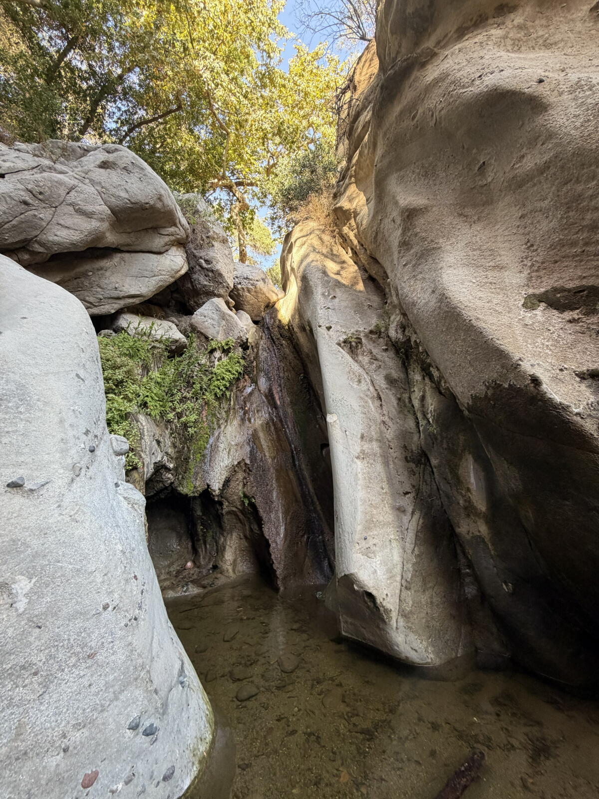
SARATOGA SPRINGS, N.Y. — Golden Tempo closed out the Triple Crown season Saturday the same way he began it: In the winner’s circle.
The circumstances were different from the Kentucky Derby, when the late-running son of Curlin was helped by a hot pace that tired out the front-runners.
There was no such setup in Saturday’s Belmont Stakes, but Golden Tempo showed he didn’t need it.
Ridden again by Jose Ortiz, the Derby champion stormed into the stretch and outfinished Commandment to win a thrilling stretch duel by 1¼ lengths at Saratoga Race Course.
“Golden Tempo is amazing. Jose is amazing,” said trainer Cherie DeVaux, who added to her historic win as the first woman to capture the Derby by becoming the first woman to win two Triple Crown races.
“Amazing feeling,” she said on Fox Sports.
Golden Tempo was sent off as the co-fourth choice with Commandment at 6-1 and returned $14 for a $2 win ticket. Renegade, the Derby runner-up, finished third as the 17-10 favorite and Chief Wallabee, the second choice at 5-1, was fourth. The rest of the finishing order: Emerging Market, Growth Equity, Vitruvian Man, Ottinho and Powershift.
This marked the second straight year the Derby winner also captured the Belmont after skipping the Preakness, with Golden Tempo following Sovereignty. It’s the fifth time in the past six years that a horse used that formula to win this race.
Could Golden Tempo have won the Triple Crown?
“It’s not something I want to think about,” DeVaux said. “We made our decision and he won today and we’re going to be happy about that.”
Trainer Cherie DeVaux lifts the August Belmont Trophy as she stands next to winning jockey Jose Ortiz, left, after Golden Tempo’s victory in the Belmont Stakes on Saturday.
(Al Bello / Getty Images)
Golden Tempo, a homebred of owners Phipps Stable and St. Elias Stables, won for the fourth time in six starts. He earned $1.2 million from the $2-million purse to push his career total past $4.6 million.
Despite his victory five weeks ago in Kentucky, the general feeling about Golden Tempo entering the Belmont was pessimism. Not one of the 19 experts surveyed in Saturday’s Daily Racing Form selected him to win, with just two picking him second. The consensus was he would not finish in the top four.
The lack of pace was one reason, and sure enough, the race played out pretty much as expected, with Renegade’s stablemate, Powershift, dawdling through the first six furlongs in 1 minute, 12.38 seconds, about a second and a half slower than the same distance for the Derby (1:10.90).
Golden Tempo, ridden by jockey Jose Ortiz, crosses the finish line to win the Belmont Stakes on Saturday.
(Yuki Iwamura / Associated Press)
As he was in the Derby, Golden Tempo was last for more than half the race, but Saturday he trailed eight horses instead of 17 and never was more than about eight lengths behind the leader.
Growth Equity, who had been stalking Powershift, took the lead as the field turned into the stretch, but he soon was passed by Chief Wallabee. Before the field had run another furlong, though, Golden Tempo had moved around Renegade to the front. Commandment was on Golden Tempo’s outside but was unable to get past in the final furlong. In fact, the winner was pulling away as they reached the finish.
The final time wasn’t fast, 2:03.49 for 1¼ miles at Saratoga, which was hosting the Belmont for the third and final year while Belmont Park is rebuilt. The race started about five minutes after rain began falling in upstate New York.
Baffert’s Nysos dominates Met Mile
Nysos crosses the finish line to win the 133rd running of the Met Mile at Saratoga on Saturday.
(Yuki Iwamura / Associated Press)
The afternoon did not begin well for trainer Bob Baffert, who saw his top 3-year-old, Crude Velocity, routed by DeVaux’s Englishman in the Woody Stephens and his leading sprinter, Imagination, come up empty in the True North. But Nysos, the best horse in Baffert’s barn, salvaged the day — and then some — with a dominant win over Journalism and five others in the Grade 1 Met Mile.
“I’ve always thought he was one of the best horses in training and today he showed it,” Baffert said of the 7-5 favorite, who returned $4.94 after clocking 1:34.85, just 0.13 off the track record.
The victory was not without an anxious moment or two. Jockey Flavien Prat rushed Nysos to the lead out of the gate, but when he was joined on the pace by Antiquarian, Saudi Crown and Knightsbridge, the jockey dropped Nysos back to fourth place at the midway point.
“When he took him back I just thought, ‘I hope he knows what he’s doing,’” Baffert said.
Not surprisingly, Prat did. After Knightsbridge passed Antiquarian on the far turn, Prat took Nysos around those two as they moved into the stretch and pulled away. Knightsbridge was four lengths back in second with Journalism another three-quarters of a length behind in third.
“It felt like down the backside, the pressure from the outside never really stopped,” Prat said. “I figured I had to give him a chance, knowing he was carrying 126 [pounds] and he hasn’t run for [four] months, and it just played out good. When I tipped him out, he gave me a great run.”
It was the eighth win in 10 lifetime starts for Nysos, a 5-year-old son of Nyquist. He was second in the two defeats.
“He’s one of the best horses I’ve ever trained,” Baffert said.
The victory earned Nysos a berth in the Breeders’ Cup Dirt Mile in October at Keeneland, but the horse won that race last year and Baffert has a bigger prize in mind.
“We’re going for the Classic,” he said, mentioning the Aug. 22 Pacific Classic at Del Mar as a possible race to bridge the gap between now and Oct. 31.