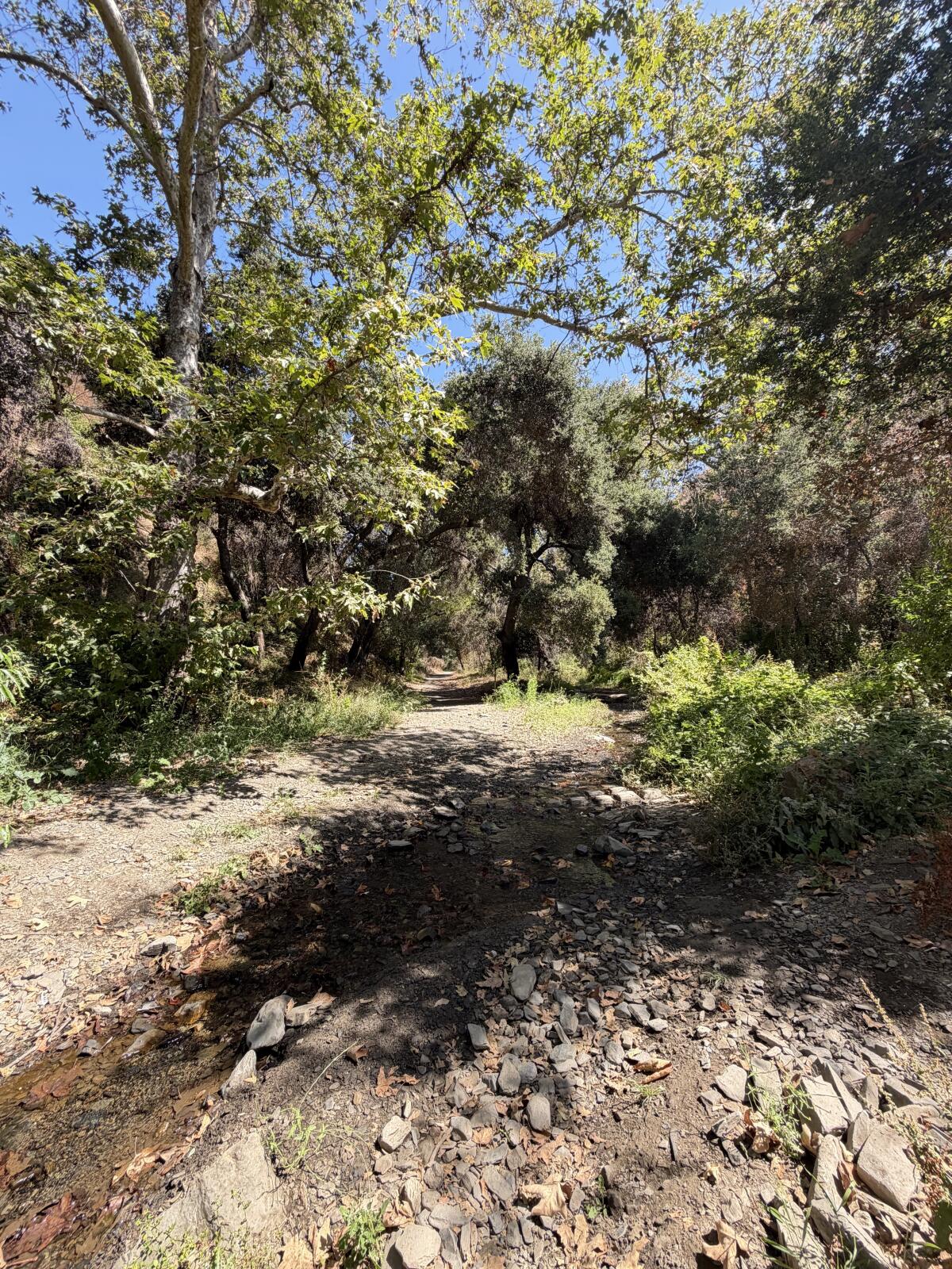
It’s a rare day when you cannot hike somewhere in Los Angeles.
But as I write this, L.A. County is under an extreme heat warning through Thursday evening. California recently saw its first storms of monsoon season, which I learned is the reason I found myself earlier this week whining about the humidity. We’ve now entered the period of summer when you need to plan your trips with heat in mind.
In this week’s edition of The Wild, our weekly outdoors newsletter, I will highlight three hikes around L.A. where, if you go early, you can enjoy a quick, shady jaunt in nature. But first, let’s talk summer trail safety.
How to hike safely in L.A. in summer
- ⌚Avoid hiking in the hottest part of the day. This will vary by day and region, but I typically plan to leave the trail by 11 a.m. in summer, or hike in the evenings, around 6 p.m.
- 🫗Pack more water than you normally need. Dehydration is a major reason that adventurers out on a day hike need to be rescued. It’s generally recommended to drink at least 1 quart every two hours (the amount in your typical Nalgene bottle). In summer, you will need to increase that. During summer, I also like to carry electrolyte powder and gummies.
- 🌤️ Check the weather forecast of where you’re heading. If headed to Angeles National Forest, which includes the San Gabriel Mountains, take a look at the “Current Conditions” tab to find relevant weather information. The Santa Monica Mountains National Recreation Area has a similar page here. If hiking in an L.A. park, remember that, because the region has several microclimates, temperatures can vary widely across the county.
- 😎 Wear sun protection. This includes a sun hoodie, wide-brimmed hat and sunglasses. I also recently started regularly carrying the hiking umbrella that I reviewed in last year’s Times Gift Guide.
- 🥵 Know the signs of heat illness. Heat cramps can be the first signal from your body that something is amiss, usually presenting as painful spasms in your legs and/or abdomen. Next comes heat exhaustion. Symptoms include clammy skin, nausea, cramps, vomiting and headache. “Don’t ignore a headache when hiking in hot weather!” the American Hiking Society cautions. “This is serious stuff. Stop. Drink. Rest.”
- 📲 Tell someone where you’re going. Complete this form (or something similar) and share it with a friend or family member. Place an additional copy on your vehicle’s dash if driving to the trailhead. The last thing you want is to be injured without anyone knowing where you are.
3 shady hikes around L.A.
As I’ve said many times, the best hike is where you are. The three hikes below all feature early-morning shade, but if they’re farther than you can drive or reach by transit, check out this guide I wrote about how to find shady hikes near you. I returned to it when writing this piece to remind myself of my own tips!
OK, let’s imagine the air blowing from your office fan or air conditioner is actually a light mountain breeze as we explore these three great hikes. Adventure awaits!

Sycamore trees cast shade over a trickling creek in Sullivan Canyon near Brentwood.
(Jaclyn Cosgrove / Los Angeles Times)
1. Sullivan Canyon Trail
Distance: 8.8 miles out and back
Elevation gained: 1,200 feet
Difficulty: Moderate
Dogs allowed: Yes
Nearest to: Brentwood and the Pacific Palisades
Accessible alternative: Inspiration Loop Trail at Will Rogers State Historic Park
The Sullivan Canyon Trail is an 8.8-mile out-and-back trek along a seasonal creek, shaded by tall sycamores (easy to identify because of their mottled bark) and thick old coast live oaks. There are a few options to explore the canyon, including a loop, but that will include a more exposed route.
To start the most shaded option, you’ll walk past a green gate on Queensferry Road and head down a short, steep paved road. (The walk back up will be the hardest part of the entire hike.)
After about a fifth of a mile, you’ll head northwesterly onto the trail, a wide dirt and gravel road. I immediately felt like I’d been transported into a fairy-tale scene where someone in a carriage would come heading down the trail toward me. Instead, it was a mountain biker, which was less enchanting, but fine nonetheless.
Quickly, I noticed there’s a tree swing builder who loves this canyon. I spotted two swings, one of which I stopped and enjoyed because, why not?
I was surprised to see that the Sullivan Canyon creek, which is about 6.2 miles and starts (per this map) near San Vicente Mountain Park, was still flowing. You will cross the creek and its offshoots a few times, an easy enough task in the summer months when the water is lower.
As you navigate the creek, you’ll notice tadpoles swimming about. I was charmed when I noticed one of these larval amphibians use a leaf to camouflage its movements as it darted to and fro in a shallow pool. That’s one way to trick a bird looking for a snack!

A gopher snake lounges on the trail in Sullivan Canyon.
(Jaclyn Cosgrove / Los Angeles Times)
I was admiring the chaparral growing up the canyon walls and the late-blooming wildflowers when I gasped. A few feet ahead, a snake sunned itself on the trail. I used iNaturalist, a citizen science app, to photograph the reptile. The app AI identification system informed me it was 82% sure this was a gopher snake. I laughed to myself, thinking about telling the rescuers after I was struck, “I was 18% sure it wasn’t a rattlesnake!” I passed without issue, but will note that both species are common sights in the canyon.
You do not have to hike the entire length of the trail to enjoy Sullivan Canyon. Because the first 2 miles in are fairly flat, this is a great hike for when you’d like to walk and talk with a friend. Or you could bring a child who needs to frolic, as there are multiple large old trees with thick branches low to the ground, tempting even an older millennial outdoors journalist to try to climb them.
The only downside to this hike is the parking situation. When I arrived, I quickly realized my first task would be to solve a bureaucratic riddle. There were signs noting parking was prohibited from 7 a.m. to 7 p.m. and then other signs with just arrows pointing in various directions.
Puzzled, I asked a driver in an REI shirt who was standing nearby, as I figured they were probably outdoorsy. They confirmed that amid the arrows, there were gaps where people are allowed to park. As I packed up my bag to head on the hike, feeling semi-confident that my car wouldn’t be towed, a mountain biker pulled up next to my car and asked where he could park. I laughed to myself, suddenly a newfound expert on where to park on Queensferry Road! (And if you want the history of how and when these parking restrictions went into place, you can read this 1998 Times story.)
But even with the parking headaches, Sullivan Canyon remains a treasure worth exploring for the shade, light breeze and beauty it offers to early-morning hikers.

Left, Millard Creek runs alongside this hike to the Dawn Mine; and right, a view of the San Gabriel Valley and beyond from the Millard Canyon area.
(Jaclyn Cosgrove / Los Angeles Times)
2. Dawn Mine Trail
Distance: About 6 miles out and back
Elevation gained: About 1,550 feet
Difficulty: Moderate
Dogs allowed: Yes
Nearest to: Altadena
Accessible alternative: Gabrielino Trail near NASA’s JPL
This 6-mile jaunt to the Dawn Mine offers hikers a shade-lined path along Millard Creek where it’s common to spot California tree frogs and newts, along with a host of native shrubs and trees.
To begin your hike, you can either parallel park near Nuccio’s Nurseries, taking care to obey all parking signage, or if those spots are all taken, park nearby and order a rideshare to drop you at the trailhead. I had cell reception with Verizon here, so it should be possible to order a ride back to your vehicle.

Millard Creek in Angeles National Forest.
(Jaclyn Cosgrove / Los Angeles Times)
From here, you have two options to reach the Dawn Mine trailhead.
1. Follow Chaney Trail road for a mile until you reach Mt. Lowe Motorway (called Mt. Lowe Road on some maps), where you’ll turn east. Chaney Trail road offers limited shade, so start early.
2. Walk about half a third of a mile north from Nuccio’s, and then near a bend in the road you’ll take the Chaney Trail, a winding dirt path north, for about half a mile where it’ll meet up with Mt. Lowe Motorway. (This option is also about a mile, although distance will depend on where you park.)
Headed northeast-ish on Mt. Lowe Motorway, you will walk just over a third of a mile before heading off the pavement and onto a trail. You’ll reach Millard Creek in about two-thirds of a mile.
You’ll head east and northeast until reaching Dawn Mine, which former Times outdoors writer John McKinney noted was a literal gold mine from 1895 through the 1950s. These days, it’s a figurative gold mine for local history buffs or those who want to take a cool selfie.

Millard Creek in the San Gabriel Mountains near Altadena, as seen in January.
(Jaclyn Cosgrove / Los Angeles Times)
It is not safe to enter the mine, but you can enjoy the frigid breeze coming out of its mouth. Mountain air-conditioning!
I’d advise turning around from here. You might notice on your map that it’s possible to make a loop, and although that route offers great views, it’s exposed and not ideal on the hotter days of summer.

Franklin Canyon Reservoir north of Beverly Hills.
(Jaclyn Cosgrove / Los Angeles Times)
3. Franklin Canyon Park loop
Distance: 1.2-mile loop with options to extend (see map)
Elevation gained: About 200 feet
Difficulty: Easier end of moderate
Dogs allowed? Yes
Nearest: The hillsides between Beverly Hills and Studio City
Accessible alternative: Franklin Canyon Drive loop
Franklin Canyon Park is 605 acres of public land north of Beverly Hills that features chaparral and oak woodlands. The park has three bodies of water: the 3-acre Franklin Canyon Lake, Heavenly Pond and Wild Pond.
To reach the park, you’ll enter through either the northern or southern gate. (The northern gate was closed for months while the L.A. Department of Water and Power completed a project.)
Take good care as you drive into the park, as there are a few tight corners with low visibility.
Upon arrival, I’d recommend taking a 1.2-mile loop, which I’ve mapped out here, that will take you past the lake and ponds and up into the park’s hillsides. Whenever I’ve visited the park, I’ve found it to be cooler than the nearby neighborhoods, thanks to its water and abundant shade provided by oaks, sumac and other trees.
To begin your hike, you’ll park in the large dirt main parking lot. Head south on Franklin Canyon Drive, where you’ll quickly find a trail entrance with wooden steps that lead down near Franklin Canyon Reservoir. I hope you’re greeted by the sound of quacking waterfowl like I was!
Continue in the southerly direction, appreciating the gnarled coast live oaks and sound of shy red-eared sliders plopping off their logs into the water. This short trail will lead you back up to the road where you’ll walk south for just a bit before turning onto the gentle path that loops around Heavenly Pond. This is an especially good spot to find turtles and ducks.

A turtle rests on a hunk of wood in the Heavenly Pond in Franklin Canyon Park.
(Jaclyn Cosgrove / Los Angeles Times)
From Heavenly Pond, continue south on the paved road, following it past the private residence to the wooden steps at the reservoir’s southern end. Take these stairs down onto Chernoff Trail. You’ll quickly spot toyon and pine trees, among other natural delights. Soon, you’ll bear right (or northeast) to take stairs onto the road. Cross the road and continue northeast onto the trail. Take the next set of steps up past thick bunches of black sage.
Continue north on Blinderman Trail, following as it bears east before it loops back around west. Along the way, you’ll pass well-maintained benches and bridges. If it’s already sunny out, please consider shortening your jaunt up these steeper trails in Franklin Canyon and consider repeating your excursion around the ponds.
At any point you need to refill your water bottle, there are water fountains near the Eugene and Michael Rosenfeld Auditorium, which is just southeast of the main lot.
***

Wild writer Jaclyn Cosgrove takes a turn on a tree swing attached to a sturdy coast live oak branch in Sullivan Canyon.
(Jaclyn Cosgrove / Los Angeles Times)
We are so lucky to have an abundance of public land tucked throughout L.A. I hope you find blissful shade, trickling streams and the experience you need out there!

3 things to do

Hikers talking and connecting on a previous Better Future Club hike.
(Amanda Sayeg)
1. Make new friends on a hike in L.A.
The Better Future Club will host a short hike at 9:30 a.m. Saturday in Griffith Park. Participants will gather at the Trails, a cafe in the park, before heading out. Register at luma.com.
2. Chill out with the mountain chickadees near L.A.
The Antelope Valley Audubon Society will host a birding field trip from 8 a.m. to noon Saturday at Chilao Visitor Center in Angeles National Forest. All experience levels welcome. Society members will bring extra binoculars, but guests are encouraged to bring their own if they have a pair. Register at eventbrite.com.
3. Saunter down Santiago Creek in Orange
The Santiago Creek Greenway Alliance will host a five-mile community bike ride from 1 to 3 p.m. Sunday in Orange. Riders will meet at the Sports Center at Grijalva Park parking lot (368 N. Prospect in Orange). The group will take the Santiago Creek Bike Trail to the Santiago Park ECO Center in Santa Ana. Register at eventbrite.com.

The must-read

The Hansen Dam Aquatic Center in Lake View Terrace is said to be the largest pool in America. The center features public swimming, its own beach, pedal boats, a large water slide and fishing.
(Kayla Bartkowski / Los Angeles Times)
I personally love “Gray May” and “June Gloom,” the times when Los Angeles is overcast for several days in late spring and early summer. It makes choosing a hike easy, as I don’t need to exclude every single exposed path or fire road from the possibilities of where I will go on a particular day. We are now entering what I’ve laughingly dubbed, mostly in my head, “You Fry July!” Although the L.A. temperatures are nothing like what my friends and family back in Oklahoma are experiencing, our dry heat is getting hotter as we move more fully into summer. That’s why, instead of hiking, consider taking a dip at one of these 24 affordable L.A. pools. Or take a dip after a morning hike. Either way, stay cool, stay hydrated and stay safe, friends!
Happy adventuring,

P.S.
Two weeks ago, I wrote about great first-come, first-served campgrounds near L.A. where you can often find a spot, even when arriving last minute. A reader later commented on my story that Google Maps had taken them on a harrowing back road to reach Horse Flat Campground. My heart dropped, as I worried I had sent a Wild reader into danger. I quickly checked which route Google Maps was recommending — and I got big mad. Google Maps was showing that Angeles Crest Highway was closed just east of Red Box Picnic Area, which was inaccurate. I contacted Google (crickets from them) and the California Department of Transportation, who quickly corrected the route to accurately portray where the highway is actually closed. The best way to know about closures along Angeles Crest Highway is to check the California Department of Transportation’s QuickMap tool. Please be safe out there!
For more insider tips on Southern California’s beaches, trails and parks, check out past editions of The Wild. And to view this newsletter in your browser, click here.