The air was cool and crisp, and yellow-orange mushrooms were bursting out of the soil near mossy hillsides. Deep in the canyon, I could see bright yellow leaves of Western sycamores. It was what I’ve come to learn as the quintessential Southern California autumnal experience.
And somehow, I had it all to myself.
In this week’s edition of The Wild, I will explain how you can replicate my hike through Devil’s Canyon, a moderate 5.9-mile out-and-back trek through a pristine gulch in the San Gabriel Mountains that features a creek with short cascades that flow down into deep pools. It ends at a trail camp where I hope to one day backpack and spend the night, as it offers a gorgeous open view of the night sky and is next to a creek with a steady flow.

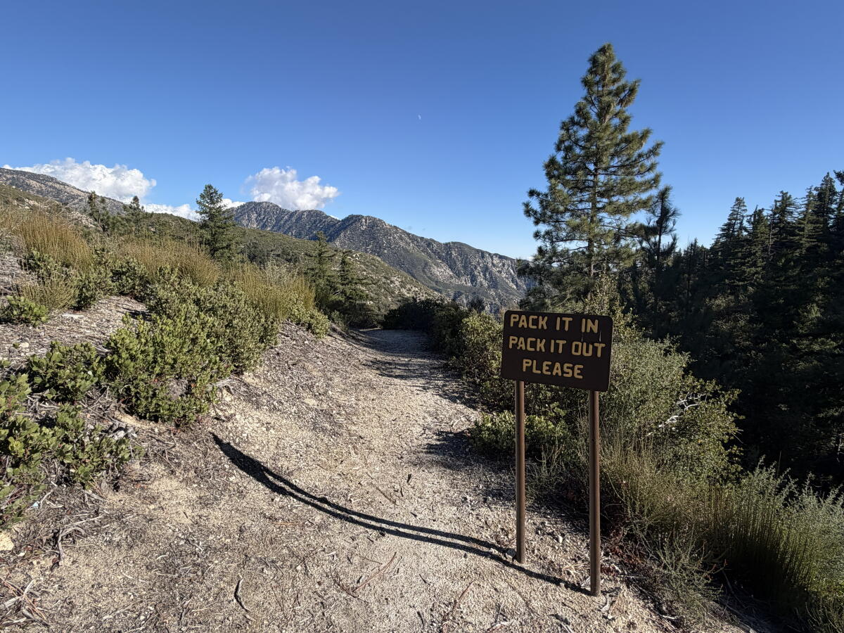
A sign at the start of Devil’s Canyon trail reminds you to leave no trace.
(Jaclyn Cosgrove / Los Angeles times)
Before we dive in, though, I wanted to let you know: There won’t be an edition of The Wild next week, as it falls on Thanksgiving. In the interim, if you’d like to go on a leaf-peeping adventure with your family, check out the article I wrote last year where I outline how to best identify trails that will feature fall foliage. I hope you and yours have a wonderful Thanksgiving!
A few quick safety notes before we dive in:
- You will almost certainly not have cellphone reception at the trailhead or during this hike. Make sure to tell someone where you’re going and consider leaving a completed copy of this form on your vehicle’s dash.
- The trail below has several narrow spots. As such, I recommend hiking down with trekking poles and then using them on the hike back up when the trail narrows. Tired legs = less balance.
- Download a map and consider bringing a paper one. Most of the trail is easy to follow, but once you make it to the canyon bottom, it becomes more challenging to notice the route. A previous forest goer left orange flagging tape, which I understand is controversial as it’s arguably litter, but regardless, those markings may help you find your way.
- The elevation at the start of this hike is around 5,300 feet. Read: Cold in fall and colder in winter. Around 2:15 p.m., my car’s thermometer read 46 degrees. At night, it can easily dip into the 30s. This time of year, I pack a dry bag with an extra long-sleeve shirt, my puffer jacket, thermal underwear, a beanie and insulated gloves. I recommend you do similar. This is the time of year when packing your bag like you’re spending the night can save your life.
- With a strong El Niño increasing the odds of a wet winter, make sure to check the forecast before leaving for the forest.

Hikers are treated to stunning views of the mountains and hillsides around Devil’s Canyon.
(Jaclyn Cosgrove / Los Angeles Times)
OK, let’s talk about this stunning sylvan sanctuary!
To begin, you will park at the Devil’s Canyon lot and remember to display your Adventure or America the Beautiful pass. Note: The Angeles National Forest website cites this trailhead as closed because of damage to Angeles Crest Highway. This is dated information and no longer accurate. The highway closure, prompted after serious storm damage, begins just under 4 miles northeast.
You’ll head east and cross over Angeles Crest Highway to the trailhead. Be careful as you cross, as there’s a tight corner near the crossing and undoubtedly someone in a sports car is doing 90 mph not too far off.
You’ll find a trail register at the trailhead where you should leave your name, the time you enter and the time you leave. This helps trail managers collect trail usage data and can help search-and-rescue teams know when you entered an area, should an emergency occur.

The narrow trail near the top of the Devil’s Canyon.
(Jaclyn Cosgrove / Los Angeles Times)
The only downside of this trail, really, is that it starts downhill, meaning you will have to climb back up the 1,400 feet you descend. I personally took my ascent as an opportunity to appreciate the views!
As you trudge over pea gravel and crunchy leaves, make sure to look down. I have never seen as many mushrooms as I did on this hike. I used iNaturalist to try to identify them, and the app suggested I documented common milkcaps, brittlegills and maybe Western painted suillus. I also loved how much moss and lichens were living along the hillsides and boulders. I am from a hilly forested area of Oklahoma, and for a moment, I felt like I was walking along a childhood route.
You will soon find a tree that’s fallen across the path where it appears safest to crawl under rather than over. Quickly thereafter, you’ll start seeing incredible views of the surrounding peaks, including West Twin near Twin Peaks.

One of several mushroom species growing in Devil’s Canyon in the San Gabriel Mountains.
(Jaclyn Cosgrove / Los Angeles Times)
This was about the time I started noticing bear scat and possibly some fresh bear tracks. I carry bear spray when in the backcountry, as it is legal to carry in Angeles National Forest. I’d advise similar. I kept my eyes peeled for a furry blob in the distance, but only saw “bear trees,” as I call them: Burned-out logs that resemble our ursine neighbors (and still can give you quite a fright!).
I thought I also spotted poodle-dog bush, which can give you a serious rash if you brush against it, but again, I used iNaturalist. The app suggested the plant was instead hairy yerba santa. I also quickly spotted sage plants and buckwheat turning a deep red.
About 1.2 miles in, I started to spot the yellow leaves of the sycamore trees and grew excited over what was to come. Once down in the canyon, I passed dozens of sycamores sporting picturesque fall foliage and heaps of yellow and light orange leaves covering the path.
Here at the canyon bottom, the trail will start to become less clear, especially around 2.5 miles in, where you need to maneuver around a short tree and splash through the creek bed to continue onward. I really lost the trail, though, when I was closest to the camp, and although I enjoyed looking at the pinkish rock lining the creek, I was ready to eat my lunch. At one point, I fell, briefly lost my phone and laughed at myself, the professional adventurer. This all underscores why it’s important to have a map and a compass, as I checked mine after I took that tumble.

Sycamore leaves line the trail across Devil’s Canyon.
(Jaclyn Cosgrove / Los Angeles Times)
Soon, I arrived at the trail camp, and I sat down at the makeshift fire pit where I enjoyed the day’s lunch (which included a slightly squished hummus wrap from Trader Joe’s).
I couldn’t find how Devil’s Canyon got its name. I saw no hornlike rocks shooting out of the mountain or a creepy cave that whispered my name. Maybe I’ve been watching too much “Widow’s Bay”?
Regardless, this area has been called Devil’s Canyon for more than 100 years. The earliest Times reference I found was in a 1911 story about hunting. Then I dug deeper and found this 1903 U.S. Geological Survey map that includes Devil’s Canyon. If you happen to know anything further, please let me know!

A short waterfall with a pool of clear water and orange leaves.
(Jaclyn Cosgrove / Los Angeles Times)
I was alone the entire hike, which delighted and confused me. I’d driven past the Switzer Falls upper parking lot, which had at least a dozen cars. This magnificent hike — with its sweeping views, diverse flora and fauna and a crystal clear creek — is far and away worth the extra 30 minutes to drive to the Devil’s Canyon trailhead instead.
But maybe it’s the name keeping people away. Admittedly, I have driven past the trailhead several times on my way to hikes deeper in the backcountry. I imagined a place called Devil’s Canyon to be dry, rocky and exposed to the heat. That’s far from what I found.

The Devil’s Canyon Trail Camp, a backcountry destination in Angeles National Forest.
(Jaclyn Cosgrove / Los Angeles Times)
That did get me to thinking: Maybe we should rename some of the overcrowded trails after the most notorious biblical villain. Would people still flock to Switzer Falls if we renamed it Satan’s Sanctuary? What about Beelzebub’s Brook for Trail Canyon Falls?
Regardless, the only thing devilish I found about this hike was my longing to stay in the canyon, full of fall foliage, orange-yellow fungi and a healthy creek that reflected back a most heavenly view of the forest.
Editor’s note: In last week’s newsletter, we forgot to include the full name of Norma Edith García-González, director of L.A. County Department of Parks and Recreation.

3 things to do

Alex Keller, Mount Wilson Bicycling Assn. president, during a trail work day along the Gabrielino National Recreation Trail.
(Mount Wilson Bicycling Assn.)
1. Patch up a path near L.A.
The Mount Wilson Bicycling Assn. needs volunteers from 8 a.m. to 3 p.m. Saturday in the San Gabriel Mountains. Participants will hike or bike up a segment of Strawberry Peak Trail before making repairs. Carpooling is encouraged. No prior trail work experience required. Register at eventbrite.com.
2. Take a liking to lichens in Calabasas
The UCLA Stunt Ranch Reserve will host a free two-hour workshop about lichen biology and ecology from 10 a.m. to noon Saturday at its Santa Monica Mountains Reserve in Calabasas. Botanist Hank Dingman will teach participants about local lichens and then lead a hike in the reserve to observe members of the taxonomic group. Register at eventbrite.com.
3. Meditate among mule deer in Coto de Caza
The Orange County California Native Plant Society will host a two-mile, slow-paced meditation hike at 2:30 p.m. Saturday in Thomas F. Riley Wilderness Park in Coto de Caza. After a grounding practice, participants will mosey past coastal sage scrub, grassland and woodland habitat. For the final 30 minutes, guests will participate in a seated, guided meditation. Parking is $3. Register at eventbrite.com.

The must-read

Mendocino Grove Campsgiving.
(Mendocino Grove)
As I read Times staff writer Christopher Reynolds’ story about camping on Thanksgiving, I asked myself: “Why have I never done this?” Campsgiving, as it has become known, is a growing tradition among friends and families who are ditching the dinner table for the Dutch oven. Campsgiving “is by far my favorite time for guests to gather at the campground during our seven-month season,” said Teresa Raffo, owner and co-founder of Mendocino Grove, in an email. “… Campers who didn’t come together end up together and usually back together the following year.”
Pardon me while I search the internet for the best way to make a pecan pie over a campfire.
Happy adventuring,

P.S.
I bought my satellite communicator — the discontinued (but still awesome) Garmin inReach Explorer+ — in the summer of 2021 after signing up for my first SoCal Six Pack of Peaks Challenge. My Garmin has not only brought me amazing peace of mind but also allowed me to communicate with my friends and family, including when I’m running late. If you’ve been considering whether to buy your own satellite communicator, now is the time. Through REI’s annual holiday sale, you can buy a satellite communicator starting at 20% off. I carry my Garmin device along with an iPhone that can send satellite messages. I prefer the Garmin for its consistency and ease of sending messages. I hope you are able to score a great deal that empowers you to take more adventures!
For more insider tips on Southern California’s beaches, trails and parks, check out past editions of The Wild. And to view this newsletter in your browser, click here.