My friend Andrea and I had hiked about 3½ miles before we perched ourselves atop boulders near the Brown Mountain Dam waterfall. We eagerly pulled out our sandwiches, jalapeño pimento cheese, and chips and queso we’d carried in our backpacks.
Nearby, a small group of hikers glowered at us, eating jerky and protein bars, commenting on the resplendent meal before us (which we’d purchased from local deli Maciel’s). It seemed they were rethinking their food choices. 💅
I love spending time in nature, regardless of whether I’m lounging on a blanket with a friend at a park or hauling my body up a steep fire road to summit a local peak. But the uniting factor of many of the best experiences I’ve had outdoors is great food.
Below you’ll find three hikes that will lead you to great picnic spots around L.A. You’ll see that I’m defining “picnic spots” as a place that offers enough open space to take a seat, including on park benches, picnic tables and flat ground.
Before we dive in, I’d like to remind you of something I frequently scream on trails: Orange peels are trash! Please don’t leave any food out in nature that you bring with you.
“There is a common misconception that ‘natural trash’ such as orange peels, banana peels, apple cores, and shells from nuts and seeds are OK to leave behind on the trail, in campgrounds, or in other outdoor spaces,” Leave No Trace’s Erin Collier and Brice Esplin wrote in this article. “While these things are natural, they are not natural to the places they are being left. These types of trash attract wildlife to areas with human activity, affecting their health and habits.”
Now that you’ve vowed to pack out what you pack in, let’s dive into this week’s hikes.

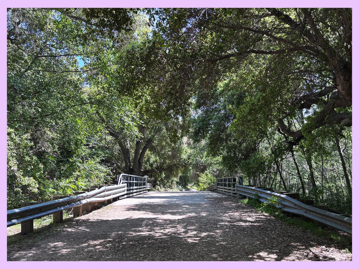
Oak woodlands and riparian habitats are among several plant communities in the mountains around L.A., including along the Gabrielino Trail near Pasadena.
(Jaclyn Cosgrove / Los Angeles Times)
1. Gabrielino Trail to Gould Mesa campground
Distance: 3.6 miles out and back
Elevation gained: About 300 feet
Difficulty: Moderate
Dogs allowed? Yes
Accessible alternative: The first mile of this trail is paved!
The Gabrielino National Recreation Trail is a 28.8-mile long journey from Chantry Flat Recreation Area north of Sierra Madre all the way to Ventura Street & Windsor Avenue trailhead near the Hahamongna Watershed Park in La Cañada Flintridge. It is a multi-use trail for hikers, mountain bikers and horse riders.
The trail has several beautiful sections, including from its western entrance in Hahamongna to the Gould Mesa Trail Camp.
To begin your hike, you’ll park at a large free dirt lot near the backside of NASA’s Jet Propulsion Lab. If hiking in a wheelchair or seeking a paved path, I recommend parking at this smaller paved lot.
You can either take the paved trail or an unofficial dirt trail that follows the Arroyo Seco before leading you to the official trail. Either way, it’s a fairly easy stroll along the Arroyo Seco, shaded by coast live oaks, bay laurels and sycamore trees. After hiking about two miles, you’ll reach the Gould Mesa Trail Camp, where you can set up your picnic at one of the campground’s tables, or nearby along the creek.
And if you’d like to go a bit farther, you can continue onward to the Paul Little Picnic Site or the Brown Mountain Dam waterfall that I mentioned above. Regardless of where you stop, I promise you’ll be treated to a stunning landscape and likely hear the chirp and squawk of scrub jays, California quail and more.

Hikers make their way up a trail to the Griffith Observatory.
(Carlin Stiehl / For The Times)
2. Griffith Observatory via Fern Dell/Four Loops (Griffith Park Explorer Segment 6)
Distance: 4.1 miles
Elevation gained: 750 feet
Difficulty: Moderate
Dogs allowed? Yes
Accessible alternative: Griffith Park Explorer Segment 4 — Anza, Autry and Main
How often do you act like a tourist in your own city? Well, now’s the time!
The Fern Dell/Four Loops trail is a 4.1-mile figure-eight-shaped looping path through Griffith Park’s southern end. Although it doesn’t officially include a stop at the Griffith Observatory, that’s what I’d recommend, as it is such a serene place to share a meal with family and friends.
To begin, you’ll park in an O-shaped lot north of the Trails Cafe, where you could grab a meal to-go before heading out. You’ll head north from the lot, following the West Trail in a loop back south to the aptly named Loop Trail. After completing the Loop Trail’s loop, you’ll head south before taking the Observatory Trail on your next loop. If following the Griffith Park Explorer map, you’ll want to take note of when to turn to head to the Griffith Observatory.
If the Observatory area is busy, consider going just a little farther north to the Berlin Forest to have your picnic. Just make sure to link back up with the Fern Dell/Four Loops trail so you can not only enjoy the lush greenery in the Fern Dell area, but also make it back to where you parked.

One of many benches on the way to Mt. Thom and Tongva Peak in Verdugo Mountains.
(Jaclyn Cosgrove / Los Angeles Times)
3. Mt. Thom and Tongva Peak via Brand Park
Distance: About 3 miles
Elevation gained: 1,950 feet
Difficulty: Hard
Dogs allowed? Yes
Accessible alternative: Crescenta Valley Community Regional Park loop
If you’ve ever looked out your plane’s window as you flew out of Hollywood Burbank Airport, and thought, “My, that trail looks hard,” you would have been correct.
The trail from Brand Park in Glendale to Mt. Thom is a grueling dirt trail, but its payoff includes stunning views of the San Fernando and San Gabriel valleys and San Gabriel Mountains. And along the way, you’ll find benches and other lookout spots that would make for epic picnic spots. (Plus, if you do it, you could brag from your plane window, “I hiked up there and had these great tacos from that very peak!”)
To begin your hike, you’ll park near the Miss American Green Cross statue before heading northeast up the trail. Please note that there isn’t any water access on the trail, and it has limited shade outside of its lookout points with benches, which you’ll reach just under a mile in.
You’ll reach Mt. Thom about half a mile farther, but it will be a steep half mile. Keep going for about three-quarters of a mile, and you will find a quick offshoot that’ll take you to Tongva Peak. This is a fabulous place to relax, take in the views and, most importantly, eat.
If you’d like to skip the steep section, I’d recommend parking near the Sunshine Preserve, a critical wildlife passageway managed by the Arroyos & Foothills Conservancy. From here, you’ll take Sunshine Drive up to Las Flores Motorway, which offers an easier incline to reach Mt. Thom and Tongva Peak.
Either way, you should spot some benches and flat areas to take a seat or lay out a blanket and enjoy the expansive views of Glendale, Burbank and the cities beyond there. I promise: Your meal will taste even better after the climb to Mt. Thom — especially since it won’t be just jerky or a protein bar!

3 things to do

Runners participate in a previous 4 Mile Hill Challenge run.
(Aztlan Athletics LLC)
1. Frolic for feathered friends in L.A.
Athletes from beginner to elite have until Friday to sign up for Saturday’s 4 Mile Hill Challenge, a trail run and walk in Ernest E. Debs Regional Park. Proceeds from the race benefit the Audubon Center at Debs Park. Race onlookers can partake in bird-themed activities as they cheer on their athletes. Register at 4milehillchallenge.com.
2. Get moving in Montebello
Montebello Outdoor Adventures will host a hiking trip from 9 a.m. to 3 p.m. Saturday in the Puente Hills Preserve. Guests will meet at the Cathy Hensel Youth Center (236 S. Taylor Ave. in Montebello) before being taken by free transportation on the day trip. Registration is required. Register at montebellorecreation.com via the Trips and Tours page.
3. Foster the forest in Sunland-Tujunga
The Sierra Club Angeles Chapter will host a volunteer workday from 8 to 10 a.m. Saturday in Sunland-Tujunga. Volunteers will water and mulch four or more trees, helping them stave off disease or death, especially in hotter months. Participants should bring gloves and sun protection. Tools provided. Location released upon registration. Register at act.sierraclub.org.

The must-read

A motion-sensor camera captures an adult female mountain lion in the Verdugo Mountains in 2016.
(U.S. National Park Service via Associated Press)
I continue to be amazed by the ongoing legacy of P-22, L.A.’s dearly departed lion king. On Thursday, the California Fish and Game Commission unanimously voted to list six specific mountain lion populations — more than 1,400 pumas — in Southern California and the Central Coast as threatened under state law. “Hemmed in by freeways and housing, cougar clans in the Santa Monica and Santa Ana mountains — both included in the listing — have a 16% to 28% chance of extinction in 50 years if they aren’t able to reach lions to mate with in other areas, providing genetic diversity,” wrote Times staff writer Lila Seidman. It’s hard to imagine this happening without the advocacy for mountain lions stimulated by P-22, whose memorial in 2023 lasted more than three hours and drew thousands of guests.
Happy adventuring,

P.S.
Do you have a story of love on the hiking trail? Did someone break up with you atop a mountain? Or perhaps it was a marriage proposal on a peak! On April 3, The Times will host L.A. Affairs Live, a competition show featuring real dating stories from people living in the Greater Los Angeles area. The event is a spin-off of our popular dating and romance column of the same name. Seven to 10 storytellers will be selected to perform 5- to 7-minute relationship stories related to the theme of “Starting Fresh.” A live audience will choose the winner. The winner will get a written version of their story published as an L.A. Affairs column and receive a $400 payment. So, do any of our Wild readers have a lowercase-wild story to tell? Learn more about how to audition here. The deadline to submit is midnight Sunday!
For more insider tips on Southern California’s beaches, trails and parks, check out past editions of The Wild. And to view this newsletter in your browser, click here.