Everyone switched off their headlamps and there we stood together in total darkness, inside the San Gabriel Mountains. Yes, inside.
I had joined a local caving group in an attempt to understand more about what lies beneath the plants, trees and dirt we hike around.
I was in awe of the cavern’s striations and white globs of minerals dripping from its ceiling. The experience stuck with me, enough that in this week’s Wild, we’re exploring more about the geology of our local mountains.
And we’re in luck! This week, the Natural History Museum in Exposition Park debuted “Unearthed: Raw Beauty,” an exhibit of rare earth minerals, including several from Southern California.
Visitors will see blue cap tourmaline, crystals named after their blue tops, and other tourmaline crystals mined in San Diego. They’re estimated to be 100 million years old!
Tourmaline grows in Southern California inside rocks called pegmatites, which are “basically granite that had time to grow large crystals. These rocks form when hot magma cools and hardens into solid rock inside Earth’s crust,” according to the museum. (We’ll talk more about pegmatites in a minute.)
While at the opening night event for the exhibit, I spoke to two experts to better understand all that rocks and rolls around us: Aaron Celestian, the curator of mineral sciences at Natural History Museum of Los Angeles County and Kriss Leftwich, collections manager of mineral sciences at the Natural History Museum.
My main question for them was: How can hikers better understand what they’re seeing and hiking over and around?
Let’s dive into what I learned, which I’ve compiled for you into a brief beginner’s guide. It rocks!

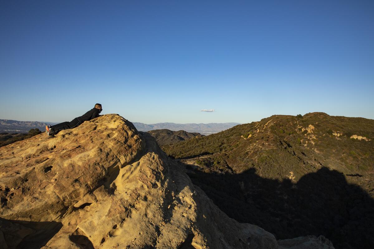
A lone hiker takes in sweeping views of the Santa Monica Mountains at Eagle Rock along the Backbone Trail in Topanga State Park.
(Brian van der Brug / Los Angeles Times)
What minerals can be observed in the Santa Monica Mountains?
The sediment and minerals of the Santa Monica Mountains were formed over millions of years, including through a process of ocean transgression and regression, Celestian said.
As Earth went through its natural periods of warming and cooling, ice sheets would melt and grow, causing sea levels to rise and fall. When sea levels rose, water moved further inland, covering ancient beaches and sandstone in layers of marine sediment, including shells and skeletons of sea animals. When the sea levels would fall, the water would recess, causing more beach material and sediments close to the shore to layer over the marine layers, he said.
Parts of the Santa Monicas were previously a beach-type environment that eventually developed into sandstone that we see while out hiking, Celestian said.
As this geologic report on the Santa Monica Mountains points out, “Sediments that were deposited in marine settings millions of year (sic) ago now sit high in ridges and peaks of the park as a result of tectonic forces and the uplift.”

The sunset seen from the Ray Miller Backbone Trail in Point Mugu State Park.
(Jaclyn Cosgrove / Los Angeles Times)
The Santa Monica Mountains were formed over millions of years through a process called “compression,” where tectonic plates force land upward, and tectonic folding, where the rock bends instead of breaking.
Celestian said the Santa Monica Mountains originally ran along the coastline, but “they started to rotate horizontally … [because] there’s a fault that actually rotated the Santa Monicas perpendicular.”
“They call them the Transverse Ranges because they got twisted,” he added.
Because of the diversity of our mountains and how they were formed, geologists (or lucky hikers) might find surprising micro-environments with unexpected minerals.
One way these can be formed is through the cooling process of a magma chamber. “It’s releasing lots of water, and that water is like a convection cell, and it circulates through it, and it concentrates metals in various areas. So you can get these little pockets of random crystals that you’ve never seen before because of how the water cooled,” deep underground, Celestian said.
While out hiking recently in the Santa Monica Mountains, he found lots of invertebrate fossils at the top of a mountain. And then he found a “huge pocket of quartz underneath a tree” with nothing else around it, likely due to a geological process that developed a micro-environment.

A close look at a tourmaline on feldspar on display at the “Unearthed: Raw Beauty” exhibit at the Natural History Museum.
(Ronaldo Bolaños / Los Angeles Times)
What types of minerals might we notice while hiking in the San Gabriels?
As you hike in the San Gabriels, you may notice striations in rock walls, like large white rock with little black veins. That was likely a quartz-rich rock with mica, a flaky, “very glittery” mineral that will resemble the texture of eye shadow, Leftwich said.
“When it’s black, it’s biotite, and when it’s purple, it’s lepidolite,” Leftwich said, adding there are several other types of mica.
If lucky, hikers might observe pegmatite, which is essentially a rock with large crystals forming within it, she said.
Leftwich said the pegmatite on display at the museum could have been in a cooling magma chamber or a similar environment. The large hunk of rock — visitors are encouraged to touch it — features large plates called albite or cleavelandite, which are types of feldspar, a group of minerals “distinguished by the presence of alumina and silica in their chemistry,” according to Minerals Education Coalition.
Celestian said the reason that hikers might observe a lot of quartz, feldspar and mica in the San Gabriel Mountains is because the range is “mostly like old basement volcano rocks.”
“It was like magma chambers that cooled down deep in the earth, and over time, that got pushed up to the surface, and that’s what we have in the San Gabriels and surrounding mountains,” he said.

A tourmaline on quartz on display at the “Unearthed: Raw Beauty” exhibit. The piece is from the tourmaline King Mine in San Diego County and is estimated to be 100 million years old.
(Ronaldo Bolaños / Los Angeles Times)
Are there any tools I can carry as a hiker to help me identify rocks?
Celestian has tested apps that claim to be able to identify rocks and has found they’re correct only about 10% to 15% of the time.
“A lizard is going to have the same morphology every single time. A bird is going to have the same morphology every single time. A mineral is not,” Celestian said.
Hence why it’s so hard to develop an app. Calcite, he said, can grow in hundreds of different forms, making it near impossible for an app to recognize it just by using a phone’s camera.
Still, the best tool for beginners is your phone’s camera because you can take photos of the rock in question for later research.
Taking pictures and “just trying to figure out your environment is really exciting,” Celestian said. “It matters a lot because all of the resources that we have available to us today came from the earth, and knowing more about how that came about, how much time it takes to create these things, adds a different perspective of Earth’s resources and how we appreciate them.”

A pegmatite rock on display at “Unearthed: Raw Beauty.” Attendees are allowed to touch and interact with the rock as part of the exhibit.
(Ronaldo Bolaños / Los Angeles Times)
To take the most useful images for mineral identification, I’d recommend reading the rock key from the Mineralogical Society of America before heading out. It will help you understand the types of pictures you need to take (especially since on our public lands, you’ll be leaving the rock where you found it).
For example, the first question on the rock key is, “Is the rock made of crystal grains? (Does it have a lot of flat, shiny faces — maybe tiny to small — that reflect light like little mirrors? You may need to use a magnifier.)” To answer that question, you’d want to ensure you captured those characteristics in your photographs.

A piece of gold stands on on display at “Unearthed: Raw Beauty.” The piece is from the Mother Lode District in El Dorado County.
(Ronaldo Bolaños / Los Angeles Times)
How can a hiker learn more about our local geology?
One of my biggest takeaways from my conversations with Celestian and Leftwich was our local geology varies widely, and thus, there’s a lot to learn. But that complexity opens up a great opportunity to find community.
You can join one of several local geology groups where hopefully you’ll find not only knowledge but also new friends. And for anyone wanting to dive a little deeper, there are local caving groups like the SoCal Grotto, which teaches its members how to explore safely and responsibly, along with hosting experts at its meetings where members learn about a range of earth science topics.
A final thought
“Look under the rock before you pick it up — because of spiders and snakes,” Celestian said.

3 things to do

(Jaclyn Cosgrove / Los Angeles Times)
1. Celebrate New Year’s Day hiking around L.A.
California State Parks will host its annual First Day Hikes on Jan. 1 at more than 60 of its parks, including across L.A. At the Santa Susana Pass State Historic Park near Simi Valley, hikers can arrive by 11 a.m. for a stroll past its narrow canyons and hulking rocks. Mount San Jacinto State Park will host a snowshoeing hike at 11 a.m. for hikers willing to take the tram up. Or if you’re perhaps feeling like a later start, Malibu Creek State Park will host a guided night hike at 5 p.m., where hikers will trek under an almost full moon. Learn more, including how to register, at parks.ca.gov.
2. Nurture native plants in Agoura
National Park Service and Santa Monica Mountains Fund need volunteers from 9 a.m. to noon Saturday to restore native plants around Cheeseboro Canyon. Participants will plant hundreds of live plants grown from locally collected seed. Register at eventbrite.com.
3. Capture the sunset in Borrego Springs
The Anza-Borrego Foundation will host photographer Paulette Donnellon to teach a sunset photography class from 1:30 to 6:30 p.m. Jan. 3 at the park. Donnellon will share tips on how to shoot wildlife and landscapes before leading students into the desert for both golden hour and “blue hour” just after sunset. The class is $100. Register at theabf.org.

The must-read

Joseph Brambila vanished on Mt. Whitney in early November. This image is from a previous climb in the summer of 2025.
(Joseph Brambila)
Like many Southern California hikers, 21-year-old southeast L.A. County resident Joseph Brambila had fallen in love with Mt. Whitney. Only a four-hour drive north of L.A. to its trailhead, Mt. Whitney is the nation’s tallest mountain outside of Alaska. In early November, Brambila was reported missing, his last known location being Mt. Whitney. Times staff writer Jack Dolan spoke to Brambila’s family about the budding alpinist, highlighting what kept Brambila coming back to the mountain. “He always said he loves to disconnect from the real world,” his girlfriend, Darlene Molina, said. “He just wanted to be out there and enjoy life. … It was just him, nature, and God.” On Monday, the Inyo County Sheriff’s Office announced it had recovered the body of a young male hiker that fit the description of Brambila. He is the second person believed to have died near a steep, icy section of trail known as the 99 Switchbacks.
In reading Dolan’s story, I felt like I got a brief glimpse into the excitement and love that Brambila carried with him into the mountains. It’s an energy we can all relate to, one that keeps us returning for more.
Happy, safe adventuring,

P.S.
This is the final Wild for 2025. If you’d like to catch up on all we’ve covered, head over to our archives or my author page. The most-read Wild of the year was this piece about Austin Nicassio, founder of Accessible Off-Road, a nonprofit aimed at bringing off-road mobility devices to parks and trails around L.A. If you’re reading this as an email, consider replying and letting me know what you’d like to see more of. Yes, I read your last emails and I do plan to write more in 2026 about hikes in Orange and Ventura County. I love hearing from you and I cannot thank you enough for your support of The Wild. Happy holidays, friends!
For more insider tips on Southern California’s beaches, trails and parks, check out past editions of The Wild. And to view this newsletter in your browser, click here.