blm land

A cheap alternative to Hawaii: Beginner’s guide to snorkeling in L.A.

As a kid growing up in rural Oklahoma, I feared what lurked beneath the lake water.

I’d listen as my family spun yarns about the massive catfish they’d discovered while noodling. I was terrified that, despite their docile nature that not a single adult told me about, an alligator gar would eat me while I bobbed in the lake. Old timers would recount finding a water moccasin in their boat. And I’ve still never recovered from the concept of a “breeding ball,” which a friend’s cousin’s cousin claimed to have run into while water skiing.

Despite the fact that nothing bad ever happened to me in a lake, my fear stayed with me into adulthood. I’ve met several Californians who hold fears similar to mine, but rather than lakes, their outsized anxieties lie within the ocean. It not only keeps them from swimming at our local beaches but also from venturing beyond the shallow shoreline.

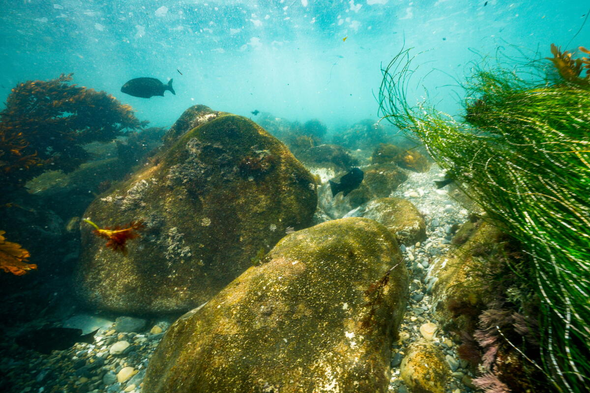
An underwater scene of bright green sea grass, a few fish milling about and large brown rocks amid a rocky sandy bottom.

An underwater view near Terranea Resort on the Palos Verdes Peninsula.

(Allen J. Schaben / Los Angeles Times)

In this week’s edition of The Wild, our weekly outdoors newsletter, I will discuss how to safely tackle those fears and start exploring with a snorkeling kit. Get ready to learn about the incredibly diverse and colorful world that lives beneath our local waters — you’re about to feel like Ariel exploring a whole new world! Let’s dive in.

You are reading The Wild newsletter

Sign up to get expert tips on the best of Southern California’s beaches, trails, parks, deserts, forests and mountains in your inbox every Thursday.

I spoke to Ralph Buck, who founded Barnacle Busters, an L.A.-based LGBTQ scuba club, with two others almost 40 years ago. Buck’s passion for helping others learn how to safely explore the ocean was so infectious that by the time we ended our call, I was seriously considering whether I should get my scuba certification (which is a story for another day).

Here’s what Buck advised regarding snorkeling.

A snorkeler in a black wetsuit hovers in turquoise water near a small school of silver blue fish.

The Wild writer Jaclyn Cosgrove snorkels among what appear to be grunion or topsmelt near the coastline of the Palos Verdes Peninsula.

(Allen J. Schaben / Los Angeles Times)

1. Get the right gear

Generally you will need the following gear to get started:

  • A correctly sized mask and snorkel.
  • A wetsuit (with booties, as a bonus, to protect your feet): Generally, 7 mm is a great thickness for Southern California, although our water is warmer because of our El Niño season (and climate change).
  • A life jacket or flotation device: This is considered optional, as the wetsuit will help you float, but there’s absolutely no shame in being extra safe! (And if you don’t have a wetsuit, please do wear a life jacket.)
  • Fins: It might be too strong to suggest they’re “optional,” but they can be awkward for those new to snorkeling and not necessary if you’re in calm enough waters or an overall strong swimmer.
  • Camera: Very, very optional. While out at Santa Cruz Island two weeks ago, I took some terrible underwater photos with my iPhone and wished I’d just left it on the shore.
  • Weight belt: If you want to dive, you might need a weight belt to help you go under. That said, this is a more advanced tool, and it’s good to just focus on the basics as you get more comfortable in the water.

One thing new snorkelers might not realize is the level of buoyancy that a wetsuit gives you. Both times I’ve been in the past month, I wore a 7-mm suit and loved how easy it was to float above the eel grass at Santa Cruz Island and the kelp on the coast of Palos Verdes. I love a sport that includes just lying around.

Bright yellow kelp and orange marine plant life in turquoise water.

Kelp, sea grass and various algae grow beneath the water at Terranea Beach Cove in Rancho Palos Verdes.

(Allen J. Schaben / Los Angeles Times)

2. Plan for getting your wetsuit on

For anyone on the shore of Prisoners Harbor two weeks ago, they got the pleasure of watching me groan (and curse) as I maneuvered into a thick wetsuit without anything but my swimsuit on. I told my friend I knew what sausage felt like as it’s shoved into its casing.

Zach Cantrell, owner of Ventura Dive and Sport, gave me a tip I will be eternally grateful for: Bring a plastic bag or something else that will help you slide into your wetsuit, as it helps reduce the friction between your body and the wetsuit. I brought one with me when my colleague, Allen J. Schaben, and I went out last week, and getting my wetsuit on was a breeze. No human sausage vibes (or cursing).

Buck suggested other options might be pantyhose or a long-sleeved unitard. Anything to help you slide into your wetsuit!

3. Before going out, practice in a pool

“I would suggest before hitting the open water, go hop in a pool and maybe find an experienced snorkeler to go with you simply because there are some subtle little pieces to the puzzle, which are” easy to miss for a new snorkeler, Buck said.

That includes the direction to point your snorkel. If it’s pointing too far forward, you will likely find yourself breathing straight saltwater as the waves hit you. But if you point it straight up or tilt it a bit backward, it’ll help your breathing apparatus stay clear.

A mix of kelp, clumps of sea grass and a rocky bottom under bright blue water.

A variety of marine life living around the rocky bottom of Terranea Beach Cove in Rancho Palos Verdes.

(Allen J. Schaben / Los Angeles Times)

4. Never snorkel alone

You look out at the ocean and see calm waters. You hear the siren’s call. You are alone. Resist.

Despite looking like a fairly chill activity, snorkeling still comes with significant risks that will be exacerbated if swimming alone. While out with my colleague off the coast of Rancho Palos Verdes, he pointed out a massive rock that I thought I could maneuver around. I timed my movements wrong and whacked right into it. I was fine, but also glad someone had my back if I wasn’t.

5. Assess the day’s conditions

  • Check the weather. If it is a particularly windy day, it’s likely not a good day for snorkeling, not only for safety reasons but also visibility.
  • Check the surf. There are several websites that pull data about the height of the surf, including the L.A. County Department of Beaches & Harbors.
  • Before entering, scan the shore to assess the movement of the water.
  • Learn how to spot rip currents. Rip currents “most commonly form at low spots or breaks in sandbars and near structures such as groins, jetties, and piers,” according to the National Oceanic and Atmospheric Administration.

“If you’re a beginner, and the waves are higher than knee high, I would just go to brunch,” Buck said. “If the surf’s too big, your visibility is going to suck anyway.”

I do love any excuse to have waffles.

A person in a black full-body wetsuit and snorkeling kit shuffles over rocks into the ocean.

The Wild writer Jaclyn Cosgrove carefully enters the water at Terranea Cove Beach in Rancho Palos Verdes.

(Allen J. Schaben / Los Angeles Times)

6. Choose an area that’s easy to enter and exit

This includes sandy beaches, where you can easily wade into the water without losing your balance. At Prisoners Harbor, I fell over several times because the shore is covered in various fist-sized rocks. (I need to work on my balance.) Snorkeling off the Palos Verdes Peninsula, I took my time, watched the waves and slowly moved into the water as the waves allowed. I found that, when there are rocks around, walking into the water like I’m navigating a balance beam is a good approach.

Also, in terms of looking for the best spots to snorkel, look for kelp forests and rock reefs. And because you’re newer, I would stick to spots known for snorkeling.

7. Plan for fog

Buck said before the COVID-19 pandemic, the Barnacle Busters, like most diver clubs, would recommend a simple solution to fog in your goggles: Spit. They still recommend using your spit in bodies of water where your germs won’t immediately affect other swimmers like in the ocean.

You can also buy an anti-fogging agent for your goggles. If you take your goggles off at any point as you snorkel, you’ll need to reapply either spit or anti-fog spray.

While I was out snorkeling, I was amazed at how well spit worked. (And if you want to understand the science behind why this works, check out this blog post from Scuba.com.)

A bright orange fish swims among yellow kelp as sun beams through the clear water

A garibaldi, California’s state fish, at Casino Point Dive Park on Catalina Island in 2016.

(Allen J. Schaben / Los Angeles Times)

8. Check in with yourself and your partner

You should check in with your partner every 30 seconds. That might feel like it’s way too frequent, but you’ll be amazed at how far apart you can float from your friend in that time frame. It can be as simple as making sure you see them and they see you.

9. Keep an eye out for hazards

When entering the water, you’ll want to do the “stingray shuffle” to ensure you alert any nearby rays of your presence. Around L.A. County, you’ll also want to watch out for sea urchins because their spines can prick your skin, which will require treatment if you bump into them.

As our county lifeguards point out, L.A. beaches aren’t typically places you’ll find the most dangerous jellyfish. “Jellyfish in Southern California are usually smaller in scale and have a more mild sting than other species found around the world,” according to the agency’s website.

(And don’t worry. Electric eels don’t live in the ocean.)

I asked Buck how often he and his fellow divers check for hazards like sharks.

He told me that outside of rocks, high surf and going out too deep for one’s skill level, he and his diving partners don’t think too much about hazards in our local waters.

Pointy purple creates on a large brown rock underwater.

Purple sea urchins grow on a rock near the shore of Prisoners Harbor on Santa Cruz Island in the Channel Islands National Park.

(Jaclyn Cosgrove / Los Angeles Times)

“Well, we don’t consider sharks to be a hazard at all. My husband and I blame Steven Spielberg for the irrational fear of sharks,” Buck said, referencing Spielberg’s 1975 film “Jaws” and the adverse effects the film had on white sharks.

Buck said he and his husband rarely see sharks. He does give some weight to the argument that divers in wetsuits can resemble seals and sea lions when floating on the surface.

“But in areas where you’ll probably be snorkeling, you’ll probably be snorkeling on shallow rocky reefs or shallow kelp. It’s not even a consideration for us,” he said.

Lastly, if you or your partner start to shiver, get out.

A snorkeler in a black wet suit hovers over plant life in the turquoise blue ocean.

The Wild writer Jaclyn Cosgrove snorkels at Terranea Cove Beach in Rancho Palos Verdes.

(Allen J. Schaben / Los Angeles Times)

10. Don’t touch anything

Practice Leave No Trace in the ocean too. “That’s our philosophy for diving too,” Buck said. “Look, but don’t touch.”

And never feed the marine life.

11. Have fun!

Since learning to snorkel, I’ve already found two friends who also enjoy it, and I plan to ping them to go out soon. If you don’t have anyone in your circle who snorkels yet, consider joining a local club.

In a world that feels hard right now, I felt like I had a two-hour vacation as I floated above the bright green sea grass and golden yellow kelp, watching garibaldi and what appeared to be grunion or topsmelt bob and dive around me. I came out refreshed and grateful to live here.

A wiggly line break

3 things to do

Two hikers cross a crystal clear creek dotted with gray white boulders of various sizes.

The hike to Eaton Canyon Falls in the San Gabriel Mountains before the 2025 Eaton fire.

(Myung J. Chun / Los Angeles Times)

1. Learn about Eaton Canyon’s future in Arcadia
L.A. County Parks and Recreation will host From Ashes to Action: Reimagining Eaton Canyon from 5 to 7 p.m. Wednesday at the L.A. County Arboretum’s Ayres Hall (301 N. Baldwin Ave. in Arcadia). Attendees will learn about design concepts for the next Eaton Canyon nature center along with the latest work completed in the natural area. The event is free, but registration is required. Register at arboretum.org.

2. Service sage in San Pedro
Cabrillo Marine Aquarium (3720 Stephen M. White Drive) needs volunteers from 9 to 10:30 a.m. Saturday to work on its native plant garden. Participants will learn about plants as they work. All ages welcome. Learn more at cma.recreation.parks.lacity.gov.

3. Launch into Latino Conservation Week in L.A.
The Audubon Center at Debs Park will kick off Latino Conservation Week from noon to 6 p.m. Sunday at Metabolic Studio (1745 N. Spring St.). Activities include a bachata class, panel discussion and guided nature hike. Learn more at act.aubudon.org.

A wiggly line break

The must-read

A scorched landscape next to deep blue water.

Burn damage to the Torrey pine grove at Santa Rosa Island, as seen from a ferry on June 8.

(Kayla Bartkowski / Los Angeles Times)

Last week, the National Park Service announced that up to 80% of the rare Torrey pines on Santa Rosa Island in the Channel Islands National Park could die after being harmed by a wildfire in May. Times staff writer Corinne Purtill wrote that initially park officials were hopeful that because the fire, which charred through 40% of the 18,000-acre island, burned at low intensity through the grove, the trees could recover. Research found the fire hurt the mature trees’ exposed root systems. However, I am holding onto hope — for a few reasons. “Park staff have also collected more than 14,000 seeds released from the pine cones. Viable seeds will be planted and raised in a nursery until the seedlings can be planted in the grove,” Purtill wrote.

Another reason is that volunteers are already actively working to save these trees. You can help with that. The California Institute of Environmental Studies needs volunteers to help with recovery as well as with Channel Islands Restoration. You can also donate to the Channel Islands Park Foundation’s Santa Rosa fire resilience fund.

Now more than ever, it’s on us to protect our public lands.

Happy adventuring,

Jaclyn Cosgrove's signature

P.S.

While out kayaking off the coast of Santa Cruz Island last month, I yanked a plastic wrapper out of the ocean. I frequently pick up plastic snack wrappers and corners of wrappers that people have accidentally dropped on the trail. And not infrequently have I found thick plastic bags — those said to be reusable — floating in shallow water near the beach. In recent years, California lawmakers have passed laws to address our state’s plastic consumption, including the Plastic Pollution Prevention and Packaging Producer Responsibility Act, or Senate Bill 54. Starting in 2027, the state will receive $500 million every year for 10 years to address plastic pollution, and state leaders want to hear from you how to best spend that money. You can submit your thoughts through Sept. 30 using this form or send your message using the email listed on the form’s webpage. Times staff writer Susanne Rust recently wrote about how there’s a secretive multimillion-dollar campaign to crush California’s landmark plastics law. If the battle over single-use plastic in California is something you’re passionate about, consider subscribing to Boiling Point, where my Times colleagues explore what’s happening to our climate-changed world. They’ll definitely keep you posted!

For more insider tips on Southern California’s beaches, trails and parks, check out past editions of The Wild. And to view this newsletter in your browser, click here.


Source link

A guide to camping at Channel Islands’ Prisoners Harbor Campground

It was a Thursday evening, and I was performing Gloria Gaynor’s 1978 hit “I Will Survive” for my audience of three on an ocean pier as we waited for the partial lunar eclipse.

As we shimmied to ‘70s hits via a Bluetooth speaker, I boasted about winning a talent competition in my tiny town thanks to my rendition of the disco classic. “We need to see these dance moves!” a fellow camper proclaimed.

Somehow, we had this island all to ourselves.

This was one of several memories I made last week when I traveled to Santa Cruz Island in Channel Islands National Park to stay at Prisoners Harbor Campground on its opening night. When the National Park Service announced that reservations would open Aug. 18, I spent 11 hours that day refreshing the page, waiting for my chance. At last, site No. 1 was mine.

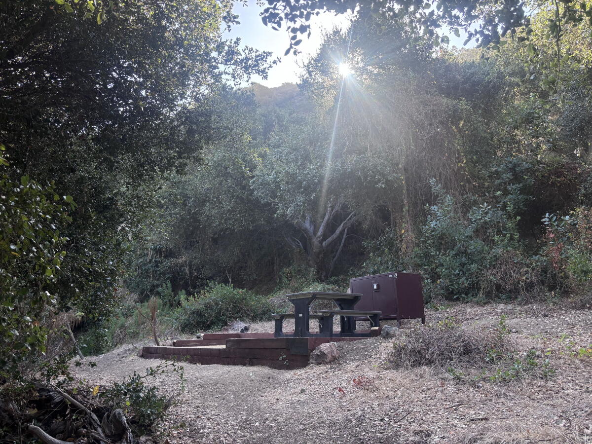
A small dirt tent pad surrounded by wood beams with a small picnic table and brown metal box surrounded by trees

Campsite No. 2 at the Prisoners Harbor Campground on Santa Cruz Island.

(Jaclyn Cosgrove / Los Angeles Times)

In this edition of The Wild, I lay out how you can create your own memories at this quiet campground on a lesser traveled side of Santa Cruz Island. I will explain how to book your site and ferry, what to pack and what you can do while on the island.

You are reading The Wild newsletter

Sign up to get expert tips on the best of Southern California’s beaches, trails, parks, deserts, forests and mountains in your inbox every Thursday.

Step 1: Book your campsite ⛺

Prisoners Harbor Campground is a small, rustic campground open year-round on Santa Cruz Island, the largest island in California. Although the National Park Service lists the campground as having six sites, it technically has seven. Reservations can be made for $15 a night through Recreation.gov.

Prisoners Harbor Campground is about a 13-mile hike southwest from Scorpion Canyon Campground, the popular 31-site spot where most folks visiting the island camp. Unlike Scorpion Canyon, Prisoners Harbor does not have any water on site and is a more DIY experience. There are also fewer tours and experiences led by outfitters on this side of the island.

A green map with dots and icons identifying the locations of campsites and other amenities and landmarks

The map of Prisoners Harbor Campground.

(Jaclyn Cosgrove / Los Angeles Times)

Each campsite at Prisoners Harbor has a dirt-packed tent pad, a picnic table and metal food storage containers that everyone called “fox boxes,” as the island fox is the largest land predator on the island (and will absolutely steal your food, and maybe your shoes).

From the pier, you’ll walk about one-fifth of a mile on a mostly flat dirt road, passing the brick Prisoners Harbor warehouse and two pit toilets. You will cross the Cañada del Puerto, which was dry during our visit but can swell to 3 feet and become impassable, according to the park service.

I was pleased to find that site No. 1 is tucked away in the campground’s northern corner. It is shaded by oak trees and surrounded by thick brush, offering privacy and the feeling like you exist only in this one little corner of the world.

Site No. 2 is on the path to site No. 1 and isn’t presently bookable on Recreation.gov. (I’m guessing the park service will remedy that soon, as the site exists and is ready for campers!)

A campsite with a dirt tent pad with wooded beams on its sides and a brown metal storage box and black-brown picnic table

The shaded campsite No. 6 at Prisoners Harbor Campground.

(Jaclyn Cosgrove / Los Angeles Times)

Sites No. 3, 4, 5 and 6 are all positioned in a row on the southwestern corner of the campground. Similar to site No. 1, site No. 6 is tucked under thick tree canopy. I think it’s probably shaded for most, if not all, of the day. Sites No. 3, 4 and 5 also have some shade.

Site No. 7 is the accessible campsite and has a ramp leading up to it. It is fairly exposed, appearing to have the least amount of shade and privacy. It is closest to the pit toilet, though, which also has a ramp leading up to it.

As I was getting ready for bed, I noticed the soothing sound of ocean waves. My friend Christine was already cozy inside the tent, and I asked her if she’d turned on an ambient soundtrack on her phone to fall asleep. “No, that’s just the ocean!” she said.

Step 2: Book your ferry ⛴️

There are only two ways to get to Santa Cruz Island: Take a private boat or, the more popular route, book a ferry through Island Packers, leaving out of Ventura Harbor.

A roundtrip ferry to Prisoners Harbor costs $72 for children ages 3 to 12, $96 for campers ages 13 to 54, $91 for those 55 and older. It is also $91 for members of the U.S. military.

Upon booking your ferry, you must read the rules that Island Packers emails to you. I cannot stress that enough. There are weight limits (i.e. no single item may weigh more than 45 pounds) and limitations about what you’re allowed to bring. That said, it’s all fairly easy to follow — like not packing your water or fuel inside your bag, as those both are packed in specific places on the boat.

A person in a large hat sits aboard a yellow kayak in the ocean with a paddle in her hands near a rocky jagged coastline

Christine, a friend of The Wild, paddles along the coastline of Santa Cruz Island near Prisoners Harbor.

(Jaclyn Cosgrove / Los Angeles Times)

Step 3: Plan out what you’d like to do on the island 🚣😎

With Prisoners Harbor being more of a DIY experience than Scorpion Canyon, one of the most important things you can do is plan ahead and book your activities at least a full day — ideally a few days — before your trip.

I knew I wanted to try snorkeling, but I don’t own gear — yet. Thanks to a recommendation from Island Packers, whose staff graciously answered all my questions, I contacted Ventura Dive and Sport to see what was doable. Owner Zach Cantrell was helpful and accommodating, setting me up with everything I needed, including a 7-mm wetsuit that made me feel like an actual marine mammal thanks to my ability to float while wearing it. Cantrell also made it easy to return my gear since the ferry was returning after his shop was closed.

Outside of snorkeling, you can also rent a kayak through Channel Islands Kayak Center. Or you can bring your own kayak, keeping in mind that Island Packers has specific rules around which kayaks you’re allowed to bring. You should also take a look at the National Park Service’s safety guidance regarding the risks of ocean kayaking.

A steep wide dirt road with views opening to blue ocean water and mountains in the distance

The hike along Navy Road offers nice views of ocean and mountain ranges on the mainland.

(Jaclyn Cosgrove / Los Angeles Times)

You can also swim near the Prisoners Harbor pier, but you should keep in mind:

  • The beach here is not sandy, but rather covered with rocks of varying sizes; pack swim shoes to protect your feet
  • The waves can get choppy, so make sure not to swim alone
  • There are stingrays in the area, so enter the water doing the stingray shuffle
  • There are sea urchins on some rocks in the area, so watch out for those as well, as their sting also hurts

On the island, there’s, of course, hiking. There are two trailheads at Prisoners Harbor:

  • The 4-mile out-and-back Pelican Bay hike, a challenging trek that traverses along the coastline, offering seemingly endless views of the area, before ending at the bay and Tinkers Harbor, another spot where you can swim and snorkel; The hike is on Nature Conservancy land, an environmental nonprofit that owns 76% of the island, and the conservancy requires that you sign a waiver and only traverse the hike when an Island Packers staffer is present on the trail.
  • A hike along Navy Road that you can take to the backcountry Del Norte campground, or to a variety of other spots on the island, should you pack a paper map or download a map before your trip.

Christine and I had originally planned to check out the Pelican Bay hike on Friday morning, but then a kind island visitor said we could borrow their kayaks for free. That was an irresistible offer.

I’ve kayaked several times on rivers and in lakes but never on the ocean, so I wanted to be fairly cautious. We paddled northwest along the island’s coast, taking in the island’s jagged rocky cliffs. We spotted what appeared to be a small sea cave but agreed it wasn’t a good idea to explore without a guide who knows the island. You should always be ready on any adventure to check in with yourself and your travel companions about your skill and comfort levels. If the reason you’re wanting to do something is really just “FOMO,” ask yourself if it should instead be a “NO-GO.” (Yes, I just made that up.)

Three paddlers in brightly colored kayaks head toward a rocky coastline on the blue ocean water

Kayakers leave out of Scorpion Anchorage on Santa Cruz Island.

(Jaclyn Cosgrove / Los Angeles Times)

I saw repeatedly on the National Park Service website that the island’s weather conditions can change rapidly, including while out on the kayak. Christine was out front and noted the wind was picking up. We swiftly paddled back, carried in part by the waves, which pushed our kayaks along in a similar sensation to surfing. I quickly fell in love with that feeling!

Despite the campground being fully booked, there were only two other campers during our trip — retired educators and travel besties Kim Eaton and Annemarie Lee, both of Riverside. They’d visited the Channel Islands multiple times, including Anacapa, Santa Rosa, San Miguel and had made previous trips to Santa Cruz, and they’d always wanted to do the Pelican Bay hike.

We were all on the island when it was particularly hot and humid, so the duo chose to go halfway and turn around.

A cloudy night sky with white-golden light and a deep blue sky with twinkling white stars above the dark ocean

The cloudy night sky, as seen from the Prisoners Harbor pier.

(Jaclyn Cosgrove / Los Angeles Times)

“The views were beautiful,” Eaton said, noting how clearly they could see the rugged coastline and waves. “We saw you guys kayaking!”

“The color of that ocean is beautiful,” Lee added.

Rocky outcroppings near Scorpion Anchorage.

Rocky outcroppings near Scorpion Anchorage.

(Jaclyn Cosgrove / Los Angeles Times)

Step 4: Plan what you’ll pack, including all your water

Everything you pack in, including your trash, you must pack out. There is no food for purchase, and there is no water at Prisoners Harbor, so you must bring whatever you plan to use for drinking and other purposes. I brought 4 gallons, and Christine packed 2. As I said, it was pretty hot, and we left the island with about a gallon and a half left.

I didn’t realize coolers were allowed. Nearby in campsite No. 4, Kim and Annemarie not only had a cooler but large ice cubes they’d frozen specifically for the trip, which last longer thanks to their size. “So if you like your cocktails, you’ll have ice” for multiple days, Kim said.

Step 5: Don’t miss the boat!

Island Packers requires campers to check in an hour before the boat leaves.

I left my home just before 6 a.m., picked up Christine and boogied to Island Packers, parking just before 8 a.m. Parking at Ventura Harbor is free Monday through Thursday, and $10 for a full-day pass Friday through Sunday and on major holidays.

After checking in, we worked with Island Packers staffers to load our gear onto the boat. I also thankfully had time to buy a four-shot latte next door at Freedom Coffee. Island Packers has several items for sale in their gift shop, including waterproof phone cases and other items you might have forgotten at home.

As you board the boat, make sure you remember wherever you tuck your return ticket. Our departure time from the island was 4:15 p.m. Friday, which gave us the better part of the day to explore.

An island fence lizard rests on a log at campsite No. 1, scoping out the new visitors to its island.

An island fence lizard rests on a log at campsite No. 1, scoping out the new visitors to its island.

(Jaclyn Cosgrove / Los Angeles Times)

Step 6: Have fun!

Full of motion-sickness drugs and glee, we boarded the boat. I tried to keep my expectations low for what we’d see on the trip to the island. I’ve been on three whale watching excursions out of Long Beach, including once when we didn’t see any whales.

A bottlenose dolphin swims alongside the Island Packer boat on its journey to Santa Cruz Island.

A bottlenose dolphin swims alongside the Island Packer boat on its journey to Santa Cruz Island.

(Jaclyn Cosgrove / Los Angeles Times)

However, shortly into our trip, our boat was visited by bottlenose dolphins that swam next to us. As we neared Scorpion Anchorage to drop off the passengers day-tripping and camping there, we saw so many common dolphins, it felt like an organized and official welcoming celebration.

A humpback whale near the coastline of Santa Cruz Island.

A humpback whale near the coastline of Santa Cruz Island.

(Jaclyn Cosgrove / Los Angeles Times)

But the real magic happened shortly before we docked at the Prisoners Harbor pier when our captain Pancho spotted at least one (maybe two) humpback whale. We paused for a bit to take in the majestic animal’s movements. Christine and I agreed it was easy to see how sailors believed in sea monsters, given how otherworldly the humpback’s body appears as it slithers in and out of the water.

Before leaving for the island, I’d read about how the island foxes will approach you while you’re eating, and that they’ll come into your campsite to try to snag your food. We didn’t have that experience, thankfully, as the campground is so new, and the animals aren’t used to people being there yet.

These tiny canines remained rather elusive — until just before we left. We were headed to the restroom when I gasped. An island fox, about the size of a large house cat, was busy foraging for food in the leaves. It made me happy to see it act naturally, rather than begging us for human food.

An island fox roots through leaves in pursuit of a meal.

An island fox roots through leaves in pursuit of a meal.

(Jaclyn Cosgrove / Los Angeles Times)

The fox cautiously walked a few feet past us on its journey for bugs and other snacks. It was a last bit of island magic before we left.

Although the beauty and biodiversity of the island is a major reason to visit, I carried something else with me back to the mainland, though. To a person, everyone was kind to each other. Prisoners Harbor, through its simple design, offers you the opportunity to move slower, notice more and just enjoy life in a way that’s harder to do when you have cellphone service.

For those looking for a simple escape near L.A., Prisoners Harbor Campground is that and so much more. Late-night karaoke is not required — but highly recommended.

A wiggly line break

3 things to do

Declan Beck, left, his brother Colson and friend Dayna Monbello visit Malibu Creek State Park near Calabasas.

Declan Beck, left, his brother Colson and friend Dayna Monbello visit Malibu Creek State Park near Calabasas.

(Mel Melcon / Los Angeles Times)

1. Celebrate biodiversity around L.A. and beyond
California Biodiversity Day, which actually runs for a week from Saturday through Sept. 13, will include several opportunities to get outside and learn in L.A. County. Malibu Creek State Park and UCLA Stunt Ranch are both hosting one-day data collection events, called bioblitzes. Friends of Ballona Wetlands will offer a freshwater marsh tour on Sept. 12 in Playa Vista. And Arroyos & Foothills Conservancy will host a native plant walk. Find events near you at californianature.ca.gov.

2. Celebrate the black walnut in Ascot Hills
Coyotl wan Macehualli and several other local groups will host a “Black Walnut Day” from 10 a.m. to 4 p.m. Saturday at Ascot Hills Park. The annual gathering will include plant adoptions, a bird walk, a community bike ride, hiking and more. Learn more at the organization’s Instagram page.

3. Plant seedlings near Agoura Hills
The Santa Monica Mountains Fund, a local nonprofit, needs volunteers from 9 a.m. to noon Saturday to work at Cheeseboro Canyon. Volunteers will plant hundreds of live plants grown from locally collected seed. Register at eventbrite.com.

A wiggly line break

The must-read

Illustration of a female figure balancing on one leg with arms outstretched below a blue cloudy sky. A gray cat looks on.

(Ryan Gillett / For The Times)

Falling during a hike can lead to a serious injury, or even worse. This is why it’s crucial that hikers not only wear appropriate footwear but also ensure their ability to balance isn’t being hampered by underlying health issues. Times staff writer Deborah Vankin recently wrote “Get A Leg Up,” a multipart series on improving our balance. First, you read about how to test your balance IQ to discern any issues you might have. Then, you can use exercises that Deborah explains to improve your balance. “Knowing your balance ability is a critical component of self-care,” says Mike Teater, director of balance for Fyzical, a national network of clinics specializing in balance and dizziness, “so you can age gracefully and do the things you want to do — and enjoy the life you built for yourself.”

Happy adventuring,

Jaclyn Cosgrove's signature

P.S.

The L.A. River community is mourning the loss of Steven Appleton, founder of the LA River Kayak Safari. A longtime L.A. River supporter, Appleton died July 25 at his Elysian Valley home following an 18-month battle with a rare and aggressive form of esophageal cancer, according to a GoFundMe page launched to help his family. Times staff writer Doug Smith wrote of Appleton in 2019, “For more than a decade, he has been launching kayak expeditions just upstream from his newly acquired parcel. He has literally blazed water trails by moving broken chunks of concrete to eliminate obstacles to wading and kayaking.” Money from the GoFundMe fundraiser will help Appleton’s family cover his memorial and final expenses. Thank you, Steven, for doing your part to help our local river.

For more insider tips on Southern California’s beaches, trails and parks, check out past editions of The Wild. And to view this newsletter in your browser, click here.


Source link

3 Los Angeles night hikes where you can watch the ‘blood moon’ eclipse

I didn’t want to feel disappointed, so I suggested we leave.

My friend Mejin countered that we should give the moon a little more time to show itself.

We’d hiked up to Five Points, where five trails meet in Griffith Park, with the goal of watching the moon rise over the nearby Los Angeles River and Elysian Valley.

You are reading The Wild newsletter

Sign up to get expert tips on the best of Southern California’s beaches, trails, parks, deserts, forests and mountains in your inbox every Thursday.

But the smog was thick, and the view was obscured. I already felt beat down by life. Now, the moon was a no-show? But as Mejin and I chatted with passersby about why we were standing around — no one seemed as hyped about the moon as we were — we spotted a flicker of golden light, low in the sky.

In this edition of The Wild, our weekly outdoors newsletter, I will recommend three night hikes around L.A. where you should have great views to watch the moon rise. Each trail offers an opportunity to still get outside despite this oppressive heat wave L.A. is experiencing this week. And this week’s full moon is extra special. On Thursday night, we’ll be able to witness a partial “blood moon” eclipse. Sounds spooky, and it isn’t even Halloween yet!

First, let’s talk through the time of sunset and the moon’s rise so you can plan your hike accordingly:

  • Thursday: Sunset at 7:25 p.m., moon rise at 7:16 p.m.
  • Friday: Sunset at 7:24 p.m., moon rise at 7:43 p.m.
  • Saturday: Sunset at 7:22 p.m., moon rise at 8:09 p.m.
  • Sunday: Sunset at 7:21 p.m., moon rise at 8:37 p.m.
The golden orange moon in a deep blue sky with a city skyline below.

A view of the super blue moon as seen from the Hollywood Hills on August 2023.

(Jason Armond / Los Angeles Times)

In terms of the partial “blood moon” eclipse, here’s what you need to know, thanks to a story by Times staff writer Fedor Zarkhin:

  • “The main stage of the eclipse will begin at 7:34 p.m., when the moon will fall under the core, or umbra, of Earth’s shadow. It will gradually turn a reddish, copper color as sunlight bends and filters through the atmosphere to fall on the otherwise-obscured part of the moon.”
  • “The eclipse will peak at 9:13 p.m. — when 96% of the moon’s surface will fall under the Earth’s shadow.”
  • “The most visible phase of the eclipse will end at 10:52 p.m.”
  • “The eclipse will end entirely just after midnight.”

If you’d like to look for your own full moon hike, rather than using the list below, your hiking spot will ideally include:

  • Clear views to the east. The moon generally rises in the northern hemisphere in the eastern sky (at around 102 degrees on Thursday in L.A., coordinates you can find using your cellphone’s compass).
  • Open after hours. Several of our local parks are only open from sunrise to sunset (outside of special events). Make sure to check the hours (if there are any) if you’re planning to take a night hike not listed below.
  • A wide dirt or paved path. None of the hikes below are terribly technical. That’s intentional, as the best night hikes are those along a wide fire road or paved path.
A gorgeous yellow white natural satellite, also known as the moon, shines over jagged brown mountains and houses below.

The moon rising in Thousand Oaks over Simi Peak to the east in October 2021 in the phase known as waxing gibbous.

(Al Seib / Los Angeles Times)

  • Friends. It’s best to hike in a group at night, in part because your chatter and laughter will alert any animals that you’re nearby.
  • Hiking poles. Although none of these trails are terribly technical, there’s still an inherent risk that comes with hiking. Consider bringing poles for the trip down, just to give yourself a bit more purchase on the sandy soil.
  • Extra water. We’re all slowly melting in this heat wave. Pack more water than you’d normally bring because we’re probably all a bit more dehydrated than usual this week!
The moon rises above the snow capped San Gabriel mountains and the Los Angeles skyline.

The moon rises above the snow-capped San Gabriel Mountains and the Los Angeles skyline as rain clouds begin to envelope the sky. The view is from Kenneth Hahn State Recreation Area in January 2021.

(Genaro Molina / Los Angeles Times)

As always, please remember to practice the seven Leave No Trace principles out on the trail, which include picking up after yourself (including orange peels) and not playing loud music. This better ensures we leave it better than we found it so everyone, including our local wildlife, can continue to enjoy our public lands.

OK, toss an extra water bottle in your pack and let’s take a look at these hikes!

Seven people sit on a concrete square covered in graffiti with expansive views of cities and mountains below and all around.

Hikers sit on the ledge of the Topanga Lookout, a concrete base of a fire lookout that is believed to have been torn down in the 1970s after smog made the lookout tower irrelevant.

(Jaclyn Cosgrove / Los Angeles Times)

1. Topanga Lookout

Distance: 2.1 miles
Elevation gained: About 350 feet
Difficulty: Easy end of moderate
Dogs allowed: Yes
Nearest to: Topanga
Accessible alternative: An L.A. County beach with accessible offerings

The 2.1-mile trek out and back to the Topanga Lookout takes hikers along the Topanga Ridge Motorway (called Topanga Tower Motorway on some maps) to an iconic spot in the Santa Monica Mountains where, on a clear day, you can see dozens of miles away.

Along the way, you’ll spot massive rock slabs that look like the forgotten frisbees of Zeus and his pals. And you’ll be treated to a lush habitat of native plants, including prickly phlox, chaparral yucca, black sage, hollyleaf cherry and Coulter’s Matilija poppy.

Three lights are seen along a dirt path through thick green plants and large crunchy boulders

Hikers light the path to the Topanga Lookout in the Santa Monica Mountains.

(Jaclyn Cosgrove / Los Angeles Times)

To begin, you’ll park near the trailhead at Stunt and Saddle Peak roads. Be careful if crossing the road, as that large bumblebee you hear nearby is actually a sports car ripping along the road. From the trailhead, you’ll take Topanga Ridge Motorway for just over a mile northeast. You will pass an entry point for the Backbone Trail and a private road.

The trail starts as a wide paved path before transitioning after about a third of a mile to a dirt path of varying widths. Although it’s not overly technical — I chatted with a hiker walking it in slides — the trail has some uneven surfaces, so a headlamp or good flashlight is necessary when hiking it at night.

You will pass at least one spur trail — unofficial, user-generated — including one that’s steep and unstable. I overheard one youthful hiker tell their friends, “Dude, I almost died three times.” Not a ringing endorsement for that route. Plus, it didn’t sound like it offered any better views than you’ll get at the lookout spot.

As you approach the lookout, you’ll notice a steep path up to the concrete base. If you, instead, take the foot path to the right of the lookout, you’ll find stairs that allow you a much easier time getting to the top. You likely won’t find solitude — I interacted with a dozen hikers on a Wednesday night — but you will find incredible views of the Santa Monica Mountains and L.A. County. I was blown away.

A brightly lit dirt path with several plants, including sage and yucca, along the way with a deep blue sky above.

A headlamp lights the path ahead as the stars twinkle above near the Topanga Lookout in the Santa Monica Mountains.

(Jaclyn Cosgrove / Los Angeles Times)

I kept calling this spot the Topanga Overlook in my head, knowing that was wrong. It hadn’t clicked for me that this used to be the site of a fire lookout tower, hence the reason there’s a concrete structure here.

Believed to be built in 1934, the Topanga site was one of three fire lookout towers that the L.A. County Fire Department maintained in the Santa Monica Mountains with the other two located at Castro Peak and Triunfo Peak near the Ventura County line, according to a 1958 Times article. (For more history on fire lookouts in L.A. County, including how to hike to an existing one, you can read this article I wrote about Vetter Mountain.)

A bright moon in the night blue sky over a dark ridgeline and thousands of city lights.

An almost full moon rises over the Santa Monica Mountains and nearby cities.

(Jaclyn Cosgrove / Los Angeles Times)

The Forest Fire Lookout Assn. lists the reason for the Topanga Lookout’s demolition to be “unknown.” However, I think I figured out what happened.

Author Milt McAuley wrote in one of his Santa Monica Mountains hiking guidebooks that the lookout tower was removed in the 1970s but provided no further details. This was around the time that air quality was worsening in L.A. County.

The sunset as seen from the Topanga Lookout trail in the Santa Monica Mountains.

The sunset as seen from the Topanga Lookout trail in the Santa Monica Mountains.

(Jaclyn Cosgrove / Los Angeles Times)

“The County Fire Department has seen the day coming when the lookout tower would be outmoded,” Deputy Fire Chief George Brunton said in a 1969 Times article. “Too much smog cuts the effectiveness of the lookout operators and as the area becomes populated we no longer feel the need for these fixed fire spotters.”

Brunton told The Times that the county was launching a pilot program (somewhat literally) to use helicopters as fire lookouts. Officials had already closed the Triunfo tower and another at Parker Mountain near Saugus. “If the pilot program proves successful, other towers will be shuttered, according to Brunton,” the story reads.

Today, the Topanga Lookout and the surrounding area is mostly public land. Please respect any “No Trespassing” signs you see, as there remains some private land nearby, and if able, bring a trash bag with you. Unfortunately, not all visitors practice Leave No Trace!

The view from the Seco View Trail in Debs Park.

The view from the Seco View Trail in Debs Park.

(Jaclyn Cosgrove / Los Angeles Times)

2. Seco View and Oak Grove trails to overlooks

Distance: 1.4 to 1.86 miles
Elevation gained: 600 feet
Difficulty: Moderate
Dogs allowed: Yes
Nearest to: Northeast L.A.
Accessible alternative: L.A. River trail near the Taylor Yard bridge

This short jaunt through Ernest E. Debs Regional Park in the Montecito Hills offers great views at any time of day, with a bonus of great spots to sit at the top.

To begin, park at Hermon Park, or walk from the Highland Park Metro stop, as it is about a 0.7-mile walk to the trailhead from there.

From Hermon Park, head south, crossing Via Marisol from the crosswalk. From the crosswalk, you’ll walk west to the trailhead.

You will take the Seco View Trail southwest-ish for just over a quarter of a mile before turning left (or south) on Oak Grove Trail. You will follow Oak Grove Trail for about a quarter of a mile and then continue on Oak Grove Trail as it jags to the right (or west). You’ll quickly come to a wider dirt path. Turn left (or west).

A bench in golden light surrounded by dry grasses.

A green park bench at Debs Park.

(Gina Ferazzi / Los Angeles Times)

In just 300 feet, you’ll come to a paved path where you can turn left or right and reach benches either way. From here, the choice is yours to sit, rest and enjoy the moon rise.

On your way back, you have the option of following a wide-but-steep path down rather than returning on Oak Grove Trail.

A deep orange moon rises over hillsides dotted with lights from building.

The moon rises over Elysian Valley in late July.

(Jaclyn Cosgrove / Los Angeles Times)

3. Five Points via Fern Canyon Trail

Distance: About 2.4 miles
Elevation gained: About 475 feet
Difficulty: Moderate
Dogs allowed: Yes
Nearest to: Atwater Village
Accessible alternative: Griffith Park Observatory paved paths

This 2.4-mile journey will take you to Five Points (5-Points on some maps), where five trails meet and offer you the opportunity to extend your adventure (as long as you packed a map).

To begin, park at the Merry-Go-Round Lot 1 or nearby, keeping in mind that sometimes parking lots in the area close for setup and equipment for Shakespeare in the Park.

Exit the parking lot in the southeast corner and head to the Lower Beacon Trail, a wide flat dirt path parallel to the road. You’ll only be on this for about 200 feet.

Two hikers on a dirt path pass an opening in the greenery. A highway stretches out in the distance.

At Five Points in Griffith Park, where, on a clear day, you can see Santiago Peak, the highest peak in Orange County.

(Jaclyn Cosgrove / Los Angeles Times)

Soon, you will turn left (or southwest) onto the Fern Canyon Nature Trail.

You stay on this lush shady path for just under one-fifth of a mile, continuing southwest until you reach the Fern Canyon Trail, a wide dirt path.

You will follow Fern Canyon Trail as it takes you first west, then southeast before taking you eastward to Five Points.

If anyone in your party is thirsty, the Joe Klass Water Stop is nearby.

From Five Points, you can hang out until you spot the sturgeon moon, the name for this month’s full moon. And if it doesn’t come quickly, consider waiting.

A wiggly line break

3 things to do

A tribute will honor the life and music of Swamini Alice Coltrane Turiyasangitananda.

A tribute will honor the life and music of Swamini Alice Coltrane Turiyasangitananda.

(Adam Corey Thomas / TreePeople)

1. Celebrate Alice Coltrane’s birthday in Beverly Hills
TreePeople and Living Earth will host a tribute to Alice Coltrane from 7 to 10 p.m. Thursday at TreePeople’s outdoor venue in Beverly Hills. Proceeds from ticket sales will go toward the musicians, money needed to restore the ashram Coltrane established that burned in the 2018 Woolsey fire and to TreePeople, a local nonprofit that has planted more than 3 million trees in our region. Tickets range from $33 to $66 plus a $3.21 processing fee. Purchase at livingearth.la.

2. Bird-watch in a cemetery in Altadena
Pasadena Humane will host a wildlife walk from 6:30 to 8 p.m. Friday through Mountain View Cemetery in Altadena. Guests will learn about local birds, squirrels and coyotes, and also the history of the graveyard. Tickets are $7.18. Register at eventbrite.com.

3. Locate lizards in Culver City
Herpetologist Earyn McGee will host a lizard art walk from 10 a.m. to 1 p.m. Saturday at the Stoneview Nature Center (5950 Stoneview Drive) in Culver City. After taking a hike to observe lizards in their natural habitats, McGee will lead the group in an art activity at the nature center. Register at docs.google.com.

A wiggly line break

The must-read

A large elk tromps through grasses near a cliff with the blue Pacific Ocean in the background.

A male tule elk frolics near the Tomales Point Trail, part of the Point Reyes National Seashore in Inverness.

(Josh Edelson / For The Times)

Point Reyes National Seashore is a stunningly beautiful 110-square-mile expanse about an hour north of San Francisco. It’s at the heart of a debate between environmentalists and ranchers over the best way to manage the landscape. Times staff writer Susanne Rust wrote that after a lawsuit brought by environmentalists over the future of ranching there, in 2025 “a settlement was announced with the National Park Service laying out how the park would function going forward. Natural landscapes and wildlife would take priority over agriculture. Eleven of 13 historic ranching families would leave and be made whole for their losses.” But the remaining two families want to continue the fight. And they’re apparently finding the ear of the high-ranking officials of the Trump administration.

Happy adventuring,

Jaclyn Cosgrove's signature

P.S.

I’ve had a handful of moments on the trail when I felt like I was in real danger. The time I accidentally went off trail and ended up on an unstable hillside, dropping my pack in a river below. The time a bear slapped my tent. And because I’m a wimp, the moment when two entangled snakes emerged from the bushes and looked at me — before returning to their tryst. If you hike often enough, you will undoubtedly run into some kind of trouble. I’d love to hear from you. I write Between a Rock, an outdoors survival series that I hope helps educate other outdoors folks about how to respond in the face of emergencies. I’ve interviewed folks who’ve faced down mountain lions and bears, and underprepared strangers. You can submit your story via this form, and I will reach out if I’d like to hear more. I love these interviews because I always learn something too.

For more insider tips on Southern California’s beaches, trails and parks, check out past editions of The Wild. And to view this newsletter in your browser, click here.

Source link

3 kid-friendly L.A. hikes to decompress after going back to school

I spent my 10-year-old niece’s last week of summer freedom with her, jumping into and swimming in our family’s lake and overall being feral in nature.

She told me after our trip that she was dreading her return to school, communicating her Gen Alpha feelings via a simple broken heart emoji. It felt too soon for me too.

That energy is what inspired this week’s edition of The Wild, our weekly outdoors newsletter. Below I outline three great hikes around Los Angeles that are kid-friendly and great options to decompress after your family’s first week back to school (including if you’re a kid-free household with a tired educator). I hope you find these trails as rejuvenating as I did!

You are reading The Wild newsletter

Sign up to get expert tips on the best of Southern California’s beaches, trails, parks, deserts, forests and mountains in your inbox every Thursday

Before we dive in, a few quick reminders:

  • You will not have cellphone reception for at least two of these hikes. Download trail maps ahead of time on your hiking navigation app, and also download an offline map of your driving route on your phone’s GPS navigation app.
  • Pack extra water, especially if traveling to the San Gabriel Mountains, as mountain weather can be hard to predict, and it can be hotter than you anticipate.
  • Take your time on twisting mountain roads; use paved vehicle turnouts to let faster traffic pass you, and watch out for cyclists; turn on your headlights when entering Angeles National Forest, regardless of the time of day.
  • Let someone know where you’re going, including what time you’ll be back. Place a completed version of this form (or something like it) on your vehicle’s dashboard — just in case!
  • And practice Leave No Trace principles, including not feeding any wildlife, picking up after yourself (including toilet paper) and not playing any loud music, as it bothers grumpy hikers like me and also the wildlife (the latter being more important than the former).

OK, now that you’re prepared to be safe and good to nature, let’s talk about those hikes!

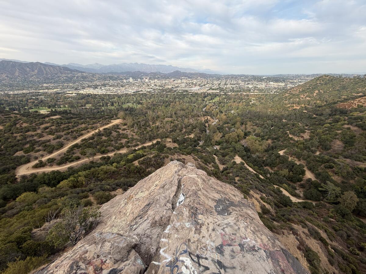
A rock juts out above a park with a winding dirt trail and beyond the trees, a dense city and then jagged mountains.

The view of the L.A. area and our local mountains from Bee Rock in Griffith Park.

(Jaclyn Cosgrove / Los Angeles Times)

1. Old Zoo — Bee Rock Loop (Griffith Park Explorer Segment 7)

Distance: 5 miles
Elevation gained: 930 feet
Difficulty: Moderate
Dogs allowed: Yes
Nearest to: Atwater Village
Accessible alternative: Rio de Los Angeles Park loop

The Old Zoo — Bee Rock Loop is a 5-mile hike that takes you up to Bee Rock, an epic lookout point in Griffith Park. The route is part of Friends of Griffith Park’s Griffith Park Explorer, which organizes official trails into 15 hikeable segments (rather than you getting lost or ending your hike far from where you parked — not that I’ve ever experienced that).

I have passed Bee Rock at least a dozen times and each time told my hiking companion, “I really need to hike up there sometime!” I finally did last week, and I am already itching to return.

After leaving, I wanted to know how this local monolith got its name. I went to The Times’ archives, where I couldn’t find a precise answer.

A jagged rocky outcropping amid tree-covered hillsides.

Bee Rock as seen from the Bill Eckert Trail in Griffith Park.

(Jaclyn Cosgrove / Los Angeles Times)

“Bee Rock acquired its name from the millions of bees which store their honey in its tiny caves which honeycomb it,” a March 1940 Times story read. Seems reasonable.

Retired ranger Bill Eckert told hikers per a 1985 story that Bee Rock got its name “because bees were attracted to the sweets at the old zoo’s refreshment stands and made their homes in the rock’s crevices.”

Eckert has a trail named after him, so I did feel inclined to believe his story.

As I searched for a clear answer, I felt better when I discovered that even experts like Gerry Hans, president of nonprofit Friends of Griffith Park, aren’t sure.

“There are theories and legends,” Hans wrote in a blog post in 2022. “The first is that the outcrop simply looks like a beehive. Another tale describes maintenance workers at the Old Zoo dumping spoiled soda syrup off the cliff, which lured swarms of bees. A third theory suggests that bees naturally take up residence in the holes and pocks on the cliff side overlooking Spring Canyon.”

Hans wrote that he had seen bees in the rock’s small caverns, but to do so, you must have good binoculars.

Armed with those facts and maybe some binocs, you can head out on the trail.

To begin your hike, you’ll park at Merry Go Round Lot One and head to the Lower Beacon Trail just past the southeast corner of the parking lot. Take good care in selecting where to start, as there are about five different paths you could take here.

You will head west on the Lower Beacon Trail, briefly walk southwest along the Fern Canyon Trail before taking the Upper Zoo Trail for much of the way. You’ll reach the Bee Rock Trail at 1 mile into your hike.

A dirt trail cuts through a tree and shrub-lined landscape with city buildings in the distance and farther away, mountains

Views from the Bee Rock Trail around golden hour in Griffith Park.

(Jaclyn Cosgrove / Los Angeles Times)

You will follow the Bee Rock trail northwest for a short jag before you come to what might feel like a dead end.

The Bee Rock Trail narrows and heads south. You will take a few switchbacks up, wondering how you suddenly became surrounded in tree canopy. Hopefully the sky is helicopter-free and you can hear the local chatter of acorn woodpeckers and California scrub jays.

You’ll arrive at a chain-link fence where you can take a narrow dirt path to the rocky outcropping atop Bee Rock. If hiking with children, it’d be good for the adults to go first, as there are a few spots where the fence has been cut, and the allure of venturing farther than one should out onto boulders is high.

The view is stunning, and on a Thursday evening, I had it all to myself as the sun lowered near the horizon. It was a clear day, and I could see a large swath of Glendale and nearby Mt. Thom and Tongva Peak in the Verdugos and farther away Josephine Peak, Strawberry Peak and several other summits in the San Gabriel Mountains.

From here, you can turn around and head back to your car, especially if the smaller hikers among you are tired, or continue onward to complete the loop. The rest of the trail is not challenging, as you’re either walking on a flat trail or headed downhill. And it’s generally not crowded. If you’re hiking with a teenager, the rest of the trail offers a quiet few miles to talk together about the school day.

A deep pool of cool clear water in a shady forest.

One of the pools along Soldier Creek.

(Jaclyn Cosgrove / Los Angeles Times)

2. Lewis Falls

Distance: About a mile out and back
Elevation gained: About 300 feet
Difficulty: Easy, but requires proper footwear
Dogs allowed: Yes
Nearest to: North of Azusa
Accessible alternative: West Fork National Scenic Bikeway

The 1-mile out-and-back trek to Lewis Falls offers hikers a gorgeous journey along Soldier Creek, lined with California bay laurels, oak trees and hulking old conifers. The trail runs mostly parallel to the creek until you reach its end, where you must cross the creek, rocks and logs to reach Lewis Falls.

You will start by finding parking, its own adventure, as there is no lot. Rather, you will need to find a spot along Highway 39 near the trailhead. I didn’t have any trouble on a weekday, but on a weekend, it might be more challenging. That is essentially the only real downside of this trail.

A hulking tree, perhaps a type of pine, grows near smaller oaks and other trees as the sun peeks through their branches.

A large old conifer provides shade along Soldier Creek.

(Jaclyn Cosgrove / Los Angeles Times)

You will hike slightly northeast for about half a mile before reaching the falls. Along the way, you’ll have ample opportunity to take a dip in Soldier Creek, as multiple pools remain, even this late in our summer.

If you find yourself saying, “Wow, this trail is really steep,” you are likely on the wrong path. You will spot multiple spur trails, likely created by either an impatient human or dexterous deer. You can identify them mostly by looking them over and realizing they offer a quicker, more dangerous option than the trail before you.

Two short waterfalls, one cascading down the creek and another running down the hillside.

Soldier Creek features several shorter waterfalls as well as nearby Lewis Falls.

(Jaclyn Cosgrove / Los Angeles Times)

Although it is generally called Lewis Falls by hikers, the cascade historically had a different name.

“Longtime San Gabriel Mountains visitors and old maps refer to Soldier Creek Falls as ‘Lewis Falls,’ in honor of forest ranger Anselmo Lewis, who once patrolled these parts,” former Times outdoors writer John McKinney wrote in a 1998 article.

Although this trail is short, it does require a bit of technical expertise but nothing too tricky. You will find yourself navigating boulders and, at one point, using a root to step down onto the rest of the trail. It requires just a little patience and looking ahead of yourself to determine the safest route.

I was greeted by small blue dragonflies as I hiked along the creek. Instead of racing back to my car, I lay down on a log and listened to the sounds of rushing water and chirping birds. Soldier Creek provides any hiker willing to slow down with an opportunity to reset, regardless of whether you have homework waiting for you at home.

And if you aren’t ready to go home, consider heading five miles north on Highway 39 to the Crystal Lake Recreation Area, where further adventure — and a snack at the Crystal Lake Cafe — awaits.

Large rocks can be seen at the top of a mountain.

Once you reach Mt. Hillyer, you’ll be greeted by large rocks that are fun to scramble along.

(Jaclyn Cosgrove / Los Angeles Times)

3. Mt. Hillyer via Silver Moccasin Trail

Distance: 5.8-mile lollipop loop
Elevation gained: About 1,100 feet
Difficulty: Moderate
Dogs allowed: Yes
Nearest to: About 45 minutes northeast of La Cañada Flintridge
Accessible alternative: Paved paths through Chilao Campground

This 6-mile jaunt along the Silver Moccasin Trail, which is just over 50 miles when fully open, takes you through high desert and pine trees.

Shaped like a lollipop, the trailhead sits about half a mile northwest of the Chilao Visitor Center, which is typically open on the weekend. You will head north for a mile before turning left (or west) off the Silver Moccasin Trail.

You will follow Horse Flats Road to the Rosenita Saddle trailhead, where you’ll take the trail southwest to Mt. Hillyer.

A hillside covered in dense conifers intersecting with another mountain speckled with large boulders.

Views of the San Gabriel Mountains from the trail to Mt. Hillyer.

(Jaclyn Cosgrove / Los Angeles Times)

Keep an eye out for Jeffrey pines, which will have deeply furrowed bark and round prickly cones. Their bark smells like butterscotch or vanilla, which I always love pausing to sniff.

The trail also features Coulter pines that produce massive cones nicknamed widowmakers because of their size. The Coulter pine cones can weigh up to 11 pounds. If you’re in the area when it’s windy, please watch your head.

To reach Mt. Hillyer, you’ll follow a short spur trail about half a mile southwest from the Rosenita Saddle trailhead. Mt. Hillyer features several large boulders, perfect for kids to scramble and play on. It’ll also offer you sweeping views of the San Gabriel Mountains.

A person in a puffy hat and coat walks among tall pine trees and yellow-brown grasses.

A hiker takes the path to Mt. Hillyer in the winter in Angeles National Forest.

(Jaclyn Cosgrove / Los Angeles Times)

You can make the trail a loop by continuing south until it jags back east, meeting back up with the paved road you previously took.

And for the ultimate weekend adventure, grab a first-come, first-served campsite at Chilao Campground, and then you can hike and check out the Chilao Visitor Center, which is open from 9 a.m. to 3 p.m. on Saturday and Sunday through November. As a bonus, there’s a short, flat nature trail at the east end of the nature center parking lot where you can typically find massive Coulter pine cones to inspect. A seasonal creek flows through this area too.

Regardless of which option you choose, I hope you make great memories in our local public lands.

A wiggly line break

3 things to do

A sky full of stars and bands of light from the Milky Way.

The Milky Way is seen in the western night sky near Mt. Pinos in the Los Padres National Forest.

(Raul Roa / Los Angeles Times)

1. Ponder astrophysics in Pasadena
Caltech will host a stargazing lecture from 8 to 10 p.m. Friday at the Cahill Center for Astronomy and Astrophysics (1216 E. California Blvd. in Pasadena). Philosophy professor Charles “Chip” T. Sebens will lecture about basic questions that remain regarding atoms. A Q&A and then guided stargazing will follow. The event is free, and no registration is required. Learn more at events.caltech.edu.

2. Improve insect habitat near Altadena
The Invertebrate Club of Southern California needs volunteers from 8 to 11:30 a.m. Saturday at Eaton Canyon. Participants will yank invasive plants to help restore the canyon. Volunteers must be 14 years or older. Registration is required. Sign up at signupgenius.com.

3. Peek at sandpipers in Pacoima
The San Fernando Valley Audubon Society will host a bird walk from 8 to 10 a.m. Saturday. Guests will meet at the ranger station (10965 Dronfield Ave. in Pacoima) before heading out on a 1- to 3-mile walk through riparian areas, grassy lawns and unique rock formations. Birders can expect to see 30 to 50 species. Learn more at the group’s Instagram page.

A wiggly line break

The must-read

Several people in a wide flat river using tubes and also just swimming as white umbrellas line the short.

Johnson’s Beach, along the Russian River, is one of the most popular spots along the lower Russian River.

(Christopher Reynolds / Los Angeles Times)

The lower Russian River and the small communities along the watercourse in Sonoma County offer visitors every kind of adventure, whether you want to stay in a tent and simply float or you want a high-end outdoors experience. That’s what I gleaned from reading Times staff writer Christopher Reynolds’ article about how to get the most out of a visit to the Northern California sylvan paradise. “On summer weekends, thousands show up in Guerneville with kayaks, canoes, inner tubes — just about anything that will float, preferably with a cooler attached,” Reynolds writes. “Then they spend hours gliding downstream past scenery that might as well be a Northern California highlight reel: vineyards, redwood forests and eventually a beach scene full of driftwood and sea stacks.”

After finishing the piece, I immediately searched online for how far away L.A. is from Guerneville. It’s a long drive, but my colleague makes it sure feel worth it.

Happy adventuring,

Jaclyn Cosgrove's signature

P.S.

Everyone should feel safe to recreate and work in outdoor spaces. To better ensure Deaf and Hard of Hearing folks feel supported wherever you recreate or volunteer, consider taking CorpsTHAT‘s upcoming “ASL for the Outdoors” virtual classes. Classes run from September to November and range from beginner to advanced. The fee is $250 per student. You can learn more, including how to register, at the organization’s website.

For more insider tips on Southern California’s beaches, trails and parks, check out past editions of The Wild. And to view this newsletter in your browser, click here.


Source link

How L.A. hikers can protect themselves from mosquitoes this summer

Given the resilience and diversity of our local mosquito population and our warming climate, Los Angeles doesn’t really have an easily defined mosquito season.

That was one of my biggest takeaways — and bummers — from my conversation with Chris Barker, an epidemiology professor at UC Davis who has studied mosquitoes for almost 30 years, including at his lab.

“I hate to say it, but there are mosquitoes year-round,” Barker said, “and in Southern California in particular, many of your mosquitoes are active year-round, and they don’t go through a reproductive pause, so they’re really just waiting on conditions to be right for biting and for development. In that sense, the warmer [weather], the better for the mosquitoes, and the worse it is for us.”

For this week’s edition of The Wild, our weekly outdoors newsletter, I spoke to Barker about how hikers can best avoid nature’s rudest insect this summer. I wanted to understand what common misconceptions hikers have about mosquitoes, any behavioral changes we can make and what types of trails are most likely to have active mosquito populations. (Spoiler alert: It’s a lot of them.)

First, let’s quickly discuss the mosquitoes that you will find in Southern California, as Barker emphasized to me that we shouldn’t just imagine mosquitoes as one bloodthirsty monolith.

“There are many species of mosquitoes that exhibit a wide range of behaviors, and some species never bite people,” Barker said. “Knowing just a little bit of mosquito biology can help a hiker know when and” where to hike.

Types of mosquitoes found around L.A. hiking trails

In California, there are more than 50 species of mosquitoes, living from below sea level in the desert to above 10,000 feet in our mountains, according to the UC Agriculture and Natural Resources.

Thankfully, our local population is smaller than that and includes:

  • Three mosquitoes in the Aedes genus: Often dubbed “ankle biters,” the black-and-white-striped female aedes mosquitoes bite during the day, often around the legs, often multiple times; the most prevalent in Southern California, Aedes aegypti, generally lives where people are, as it depends heavily on manmade water sources to lay its eggs; different species are vectors for different diseases, including Aedes aegypti, which can carry dengue fever.
  • Six mosquitoes in the Culex genus: Adults are most active from dusk to dawn; they prefer to bite birds but will bite humans; otherwise, they will rest in cool, shaded dense vegetation; the Southern house mosquito in this genus can transmit West Nile.
A mosquito on a green leaf

Culex mosquitoes bite at dawn and dusk and tend to feed off birds. The Southern house mosquito in this genus can transmit West Nile.

(Orange County Mosquito and Vector Control District)

  • Anopheles franciscanus: Living in warm sunny pools with algae; not known to carry disease in California; peak biting during dusk and dawn; included in this list to make us all feel a little better, just in case you worry as much as your local outdoors journalist about mosquito-borne diseases.
  • Ochlerotatus sierrensis: Also known as “western treehole mosquitoes,” these little jerks lay their eggs in tree holes, especially oaks, laurels and eucalyptus, and emerge in spring, ready to unapologetically ruin your backpacking trip; these mosquitoes will bite in the day and evening, but are especially active at dusk.
  • Ochlerotatus washinoi: Also known as “woodland pond mosquitoes,” which makes them sound more charming than they are, these aggressive daytime biters are typically found in floodwater habitats in early spring; not known to carry disease in California.

A quick 101 on West Nile virus

Outside of an itchy bite or, in rare cases, a severe allergic reaction, the most significant health threat that mosquitoes pose to hikers around L.A. is West Nile virus.

West Nile virus is typically contracted by humans through the bite of an infected mosquito. Most people infected with the virus, an estimated 80%, never know it, because they don’t get sick. About 20% of those infected experience flu-like symptoms, according to the Centers for Disease Control and Prevention.

Less than 1% develop serious illnesses that affect the central nervous system and usually require hospitalization.

Similar to the lack of clarity around who develops long COVID, scientists have yet to identify why certain people develop serious neurological conditions from West Nile. Advanced age, especially in people 65 and older, is thought to play a role, given that with age, the body’s immune system is slower to respond to threats, according to the National Library of Medicine. Other risk factors are thought to include being male; having diabetes, heart disease or chronic kidney disease; or being immunocompromised, according to research.

In recent years, reported West Nile human cases have typically peaked in early September, according to data analyzed by the L.A. County Department of Public Health. This year, West Nile has been detected in traps and in dead birds across L.A., but especially in Cerritos and Long Beach, according to the Greater Los Angeles County Vector Control District.

Given all that we know now about our local mosquito population and risks, let’s discuss Barker’s tips and tricks for how hikers can best avoid getting bit.

How L.A. hikers can best avoid getting bitten by mosquitoes

two people, one walking with a small dog and the other crossing a shallow rocky creek.

People walk in and around the Arroyo Seco.

(Carolyn Cole / Los Angeles Times)

1. Consider what water source is near.

I personally love hiking along the Arroyo Seco or San Gabriel River, where it’s often shady and cooler than other parts of Angeles National Forest. Unfortunately, mosquitoes love those areas too.

Mosquitoes prefer standing water, but not permanent water, Barker said. For certain species, this could be a segment of the river where the water has stopped flowing, leaving a nice warm pool for mama mosquitoes to lay their eggs, or even a small puddle.

“When I go hiking … especially in the mountains, I always look in the rock homes next to the streams that have captured snow melt water as it recedes,” Barker said. “Those rock holes keep water through much of the summer, and if you look in those rock holes, you often see hundreds or thousands of mosquitoes in individual rock holes. They’re the immatures that are still developing and will come out and eventually bite people and other animals in the area.”

I was honestly happier before I knew that.

2. Consider the day’s forecast and its effect on mosquito behavior.

“Often these mosquitoes are biting from late afternoon into early evening — so all the times we love to be outdoors,” Barker said.

Like us, mosquitoes are most active when temperatures are warm but not extremely hot. “On our hot days in the summer, mosquitoes will wait until the late afternoon, evening or even morning periods to bite instead of the hottest part of the day,” Barker said.

That said, if there’s a light breeze or it is windy, you’re far less likely to get bitten, as mosquitoes are thought to only fly up to 1 to 1.5 mph.

Shaded path lined with shrubs headed toward a glowing hillside.

Dunsmore Canyon in Glendale.

(Jaclyn Cosgrove / Los Angeles Times)

3. Take extra precautions on morning and evening hikes.

Mosquitoes are often most active during these time periods — the ideal summer hiking time. As such, Barker advised hikers to wear baggy light-colored pants and hiking shirts, so that you will remain cool enough under the sun but your skin will be more protected.

You can also pre-spray your clothing with Permethrin, an insecticide that kills and repels mosquitoes.

A black and white mosquito on human skin.

An Aedes mosquito, commonly called an ankle biter, prefers humans over animals. While Aedes can carry dengue, they do not transmit West Nile virus.

(Orange County Mosquito and Vector Control District)

4. Reapply mosquito repellent.

I generally set a timer for around 50 minutes when out hiking to remind myself to reapply sunscreen, but I rarely remember to reapply bug repellent.

“Most people do kind of a one-and-done application and happily go off and hike, and if you hike for hours, especially if you’re using repellent with either a lower DEET concentration or some other alternatives, you often have to reapply those at more frequent intervals,” Barker said.

Several mosquitoes hanging on a white net.

Mosquitoes inside a storage container are tested after capture by public health workers for West Nile virus. This particular station is in Pacoima.

(Ronaldo Bolanos / Los Angeles Times)

DEET has long been found to be a highly effective mosquito repellent, but as I reported back in 2024, DEET has a perception problem. Unlike some repellents, it isn’t naturally occurring, which has caused some members of the public to take pause.

“They want something that’s natural. They forget that strychnine [and] ricin are all natural products,” said Walter S. Leal, a UC Davis distinguished professor in molecular and cellular biology, in a 2024 interview, referencing poisons derived from plants. “Being natural does not necessarily mean it is good, and being synthetic doesn’t necessarily mean it is bad.”

Additionally, people often incorrectly associate DEET with the banned insecticide DDT. “This is a big mistake,” Leal said. “There is no chemical similarity between the two.”

Small boulders amid small white flowers and green foliage with a view of the blue ocean and horizon in the distance.

The view from a bench at a lookout point near the Saddle Peak Trail in the Santa Monica Mountains.

(Jaclyn Cosgrove / Los Angeles Times)

5. Try coastal hikes to avoid mosquitoes.

“Coastal environments sometimes have fewer mosquitoes,” Barker said. “In L.A., you have that strong temperature gradient as you move away from the ocean, and things get warmer in the inland areas. Cooler areas slow mosquito development, and you tend to have fewer mosquitoes right along the coast.”

This excludes areas near tidal marshes, like the Ballona and Los Cerritos wetlands, where certain mosquitoes can become “quite numerous” if not controlled by local vector agencies.

Yellow flowers grow near a creek surrounded in green plants.

The Ballona Wetlands Ecological Reserve in Marina del Rey in 2023.

(Genaro Molina / Los Angeles Times)

The coastal breeze also helps hikes along the ocean — like several routes you’ll find in the Santa Monica Mountains or Palos Verdes Peninsula — have fewer mosquitoes.

“And some of the coastal mosquitoes fly inland to find their blood meal hosts before they come back and lay eggs,” Barker said. “So right along the coast is not a bad place to be from a mosquito-biting perspective.”

Did somebody say Type-O Tuesday?

a large tan boulder and nearby Joshua tree with green prickly leaves

A Joshua Tree and rocks are lit up by the sunrise at Jumbo Rocks Campground in Joshua Tree National Park.

(Allen J. Schaben / Los Angeles Times)

6. If weather allows, hike in the desert to avoid mosquitoes.

“There is no real escape from mosquitoes, I would say, except possibly in the deserts in areas with less water,” Barker said. “That’s your best escape in California.”

If you head out to Joshua Tree, this generally means hiking before 10 a.m. and after 5 p.m., as you will otherwise almost certainly get overheated.

7. Be mindful when taking breaks.

It’s harder for mosquitoes to bite you when you’re moving or when there’s a breeze. Keep an eye out when taking breaks, as this will more likely be the time you get bitten. And often where we like to take breaks is where mosquitoes also like to rest.

Several mosquitoes.

A field sample of mosquitoes that could carry West Nile virus is seen at offices of the Riverside County Department of Environmental Health in Hemet.

(David McNew / Getty Images)

“Mosquitoes do tend to rest in areas with vegetation or other vertical structures that protect them from harsh conditions like direct sunlight or strong winds,” Barker said. “The female mosquitoes also search for their blood meal hosts in those areas, which include us.

“Unfortunately for us,” Barker added, “they like a lot of the same areas we do.”

A wiggly line break

3 things to do

About 25 people stand on a cliff near the ocean holding a white flag with "Just Trek" in black lettering.

A group of hikers at a Just Trek event.

(Victor Martinez)

1. Celebrate community in Malibu
Just Trek, a local hiking community, will host its seven-year anniversary party at 9:30 a.m. Sunday in Malibu. The group will take a two-mile hike and then hang out at a local beach near a seafood restaurant. Donations appreciated. Register at partiful.com.

2. Behold native botany in L.A.
The L.A. Parks Foundation will host From Trail to Seed, a botany-focused nature walk, from 8 to 10 a.m. Saturday at the Fern Canyon Trail in Griffith Park. Botanist Terry Huang and park ecologist Ryan Kinzel will lead the group as they take a moderately challenging route through the park. $20 donation requested. Register at los-angeles-parks-foundation.givecloud.co.

3. Use your nature skills in Baldwin Hills
The Nature Nexus Institute needs volunteers from 8 to 11 a.m. Saturday for a habitat restoration event in the Baldwin Hills. Volunteers must wear long pants and closed-toe shoes. The work site will include traversing uneven terrain. Learn more at the institute’s Instagram page.

A wiggly line break

The must-read

A stunning bald eagle with a bright white head and yellow beak looks into the camera from her twig-filled nest

Jackie the eagle.

(Friends of Big Bear Valley)

Jackie, arguably the world’s most famous bald eagle mama, died Monday morning after a mysterious illness that veterinarians at the Ojai Raptor Center worked hard to combat. She was 14. Jackie and her mate Shadow transformed into avian all-stars after Friends of Big Bear Valley installed live cameras of their nest. Millions of people across the world tuned in to witness the two eagles raise their young and live their lives in our local mountains. That included Anny Liu of Altadena, who started watching Jackie and Shadow and their little eaglets after losing her community to the Eaton fire in 2025. “Jackie and her family gave me hope and gave me giggles and smiles that I thought were lost with the fires,” Liu wrote to The Times via a reader callout. “My heart felt lighter when I watched her even to this day as we try to rebuild. Never in my life did I expect an eagle would help me so much emotionally and mentally.”

May we continue to allow ourselves to feel these deep connections with our animal neighbors, as it leads to us wanting to protect their homes and, in turn, protect our world.

Happy adventuring,

Jaclyn Cosgrove's signature

P.S.

Do you want to help repair damage from the devastating fire that burned across Santa Rosa Island? The California Institute of Environmental Studies needs volunteers to help implement emergency fire recovery work on the island, including rolling erosion control wattles on steep slopes to better protect the Torrey Pine forest from erosion caused by winter rains. To learn more, you can email Destinee Rabelo, the center’s restoration ecologist field lead, by using the email linked in the organization’s Instagram post. Have fun out there!

For more insider tips on Southern California’s beaches, trails and parks, check out past editions of The Wild. And to view this newsletter in your browser, click here.


Source link