TECATE, Mexico — White sage burning, Norma Meza Calles gathers guests at a Mexican wellness resort into a semicircle facing Kuuchamaa Mountain and asks everyone to close their eyes and feel its presence.
“This is sacred to us like a church for you all. The mountain is our healer, our psychologist,” said Meza Calles, a Kumeyaay Nation tribal leader who explains that in its creation story a shaman transformed into the mountain. “Here is where we gather strength to live in this difficult world.”
Then she calls for a moment of reflection. But the silence is pierced by the crushing of rock. U.S. federal contractors have been blasting and bulldozing Kuuchamaa, which straddles the U.S.-Mexico frontier, to make way for new sections of border wall.
Indigenous leaders say that in the Trump administration’s rush to build border wall segments, contractors are desecrating Native American sacred places and cultural sites at an unprecedented pace, more than 170 years after the international boundary split the territories of dozens of tribes.
Blasts on sacred mountain
Wall construction has ramped up along the 1,954-mile border even as illegal crossings have plummeted to historic lows. Much of it began this year after the U.S. Department of Homeland Security waived cultural and environmental laws.
In California, explosions on Kuuchamaa, also known as Tecate Peak, send rocks hurtling down its Mexico side.
“We feel that in our DNA,” said Emily Burgueno, a California member of the Kumeyaay Nation, noting that “body” and “land” are the same word in the Kumeyaay language. Some tribal leaders met with Homeland Security officials to urge them to protect Kuuchamaa and are looking into legal action.
“No one ever consented or supported the use of dynamite on the mountain,” Burgueno said.
In Arizona, Homeland Security contractors last month carved through a massive, 1,000-year-old fish-shaped geoglyph called Las Playas Intaglio. The rare drawing, etched into the desert floor much like Peru’s Nazca Lines, was created on a lava field in what is now the Cabeza Prieta National Wildlife Refuge.
Construction crews work April 24 on a new border wall segment near the end of a previously built section on Kuuchamaa Mountain, seen from Tecate, Mexico.
(Gregory Bull / Associated Press)
The Tohono O’odham Nation said it had pointed out the site on its ancestral land for contractors to avoid.
“This was a devastating and entirely avoidable loss,” Tohono O’odham Chairman Verlon Jose said in an April 30 statement. “There is nothing more important than our history, which is what makes us who we are as O’odham. The site was also an irreplaceable piece of the United States’ history, one none of us can ever get back.”
U.S. Customs and Border Protection said in a statement that a contractor “inadvertently disturbed” the site west of Ajo, Ariz., on April 23, but it vowed to protect the remaining portion. CBP Commissioner Rodney Scott is talking to tribal leaders to determine next steps.
Members of the Inter-Tribal Assn. of Arizona, which represents 21 tribes, traveled to Washington last month to lobby against a 20-foot secondary wall being built along that section of the border, as well as a primary 30-foot bollard wall planned on Tohono O’odham tribal lands.
They met with Homeland Security Secretary Markwayne Mullin, a Cherokee Nation member, who listened but made clear his intent is to build more border wall as fast as possible, the Tohono O’odham Nation said in a statement.
Hundreds of miles under contract
The Trump administration says the barriers are necessary to keep people and drugs from entering the U.S. illegally. It wants walls to cover at least 1,400 miles of the border.
Trump’s One Big Beautiful Bill Act last year devoted more than $46 billion to the effort.
CBP has awarded contracts or begun construction on over 600 miles of new border wall, with companion surveillance technology. A double wall is planned or under construction along an additional 370 miles.
In Arizona, where the Patagonia Mountains descend to the border, heavy machinery crawls along freshly graded roads to extend a double wall that could block a wildlife corridor for endangered ocelots and jaguars. Jaguars have long coexisted with the Tohono O’odham, who consider the species “spiritual guardians,” Austin Nunez, a tribal leader, said in a 2025 lawsuit that unsuccessfully challenged the Homeland Security waivers.
In Sunland Park, on New Mexico’s border with Mexico, crews this year set off blasts on Mt. Cristo Rey, a pilgrimage site topped with a limestone crucifix.
CBP is seeking to seize a strip of the mountain owned by the Roman Catholic Church for wall construction. The Diocese of Las Cruces asked a judge this month to deny the land transfer as an affront to religious liberties and the “faithful who seek to commune with God on Mount Cristo Rey.”
In western Texas, the federal government in February notified ranchers on the Rio Grande east of Big Bend National Park of its interest in their land that contains canyonland pictographs and petroglyphs, said Raymond Skiles, a retired Big Bend National Park ranger.
“There are pictographs, paintings of shaman figures and various things that we don’t know how to interpret,” said Skiles, describing the drawings on his family’s ranchlands.
After community backlash, CBP’s online planning map showed the 30-foot-wall plans were scrapped for surveillance technology, patrols and some vehicle barriers. A segment in the national park and neighboring Big Bend Ranch State Park would rely on technology alone.
CBP says it recognizes the importance of natural and cultural resources and is working to minimize the construction’s impact, including leaving drainage gates open in wildlife corridors for animal passage. Illegal border crossings have littered, polluted and trampled sensitive habitat, the agency says.
CBP also says 535 miles of remote, rugged border terrain will solely rely on detection technology.
Many tribes would prefer that to walls.
Norma Meza Calles, a Kumeyaay Nation leader, leads a guided tour of traditional Kumeyaay uses for local plants at a wellness center in Tecate, Mexico.
(Gregory Bull / Associated Press)
Desecrating Native American sites is a felony
Tribes along the border “are all experiencing the same tragic desecration of our cultural and sacred sites,” said Burgueno, chair of the Kumeyaay Diegueño Land Conservancy, a nonprofit organization in California that works to protect Kumeyaay lands. “This is a great example of the federal government not following federal laws.”
Desecrating a sacred Native American site on U.S. federal or tribal land is a felony, punishable by imprisonment and fines. In 1992, the National Park Service listed Kuuchamaa Mountain in the National Register of Historic Places, giving it limited protection. It noted that “discarding or disturbing the mountain’s natural state would be sacrilegious.”
Rising 3,885 feet above sea level, Kuuchamaa has also captivated non-Native people.
Sarah Livia Brightwood Szekely said her father, Edmond Szekely, felt the mountain’s healing energy when he arrived in Tecate, Mexico, as a Hungarian Jewish refugee during World War II, and started the renowned wellness resort, Rancho La Puerta, which she now runs.
“There are all of these people that have a deep relationship with the mountain,” she said.
Meza Calles leads walks at Rancho La Puerta to teach guests about Kuuchamaa.
Traditionally, young men would spend 40 days at its base in a coming-of-age ceremony before becoming warriors or shamans, she said. Today’s rituals are shorter. People suffering from a death, debt, divorce or other difficulty seek Kuuchamaa’s healing, she said.
“It’s sad they are ruining the mountain,” she said. “We’ll see how far they go. Destiny is destiny. But the fight is not over.”
Watson and Lee write for the Associated Press and reported from Tecate and Santa Fe, N.M., respectively.
It seemed inevitable that the Chargers’ social media team would poke fun at the NFL’s biggest offseason story, and they did just that Thursday in their 2026 schedule release video.
In the Halo-themed video, the Chargers made a couple references to the ongoing drama when revealing their Thanksgiving weekend game against the New England Patriots. A sign with the words “Next Photo Dump 1 Mile” was in the video as was a pop-up notification from the New York Post, which broke the story about the Patriots coach and the former Athletic reporter. You can watch the video here:
should we REALLY make our schedule release video in halo?
This isn’t surprising. The Chargers’ last game was a playoff loss to Vrabel’s Patriots, so nothing short of an edict from the NFL probably would have stopped the franchise’s social media team from referencing the Vrabel-Russini controversy.
And when “Inside the NBA” put Vrabel and Russini in a “Gone Fishing” mock photo earlier this month, it probably sent some NFL social media teams into a frenzy. If ESPN, which is 10% owned by the NFL, can get away with that, why couldn’t they?
It’s good the NFL isn’t as buttoned up as it used to be regarding its public image, although it’s probably wishing this story would go away.
The 67-mile Backbone Trail through the Santa Monica Mountains is a bucket-list trip for many Southern California hikers.
Often, though, it’s hard to carve out time to tackle the whole thing at once. There are limited backcountry camping options, and water can be sparse on the trail. That’s why hikers, myself included, often complete it in sections, similarly to how people will hike the Pacific Crest Trail or Appalachian Trail in segments.
Last week, I ticked off a segment that runs through Latigo, Solstice and Corral canyons that my friends who frequently hike the Santa Monica Mountains have told me is a “must” to try out. I can now see why!
I am eager to share my experience with you and how this hike offers essentially everything there is to love about hiking in the Santa Monicas: incredible ocean views, massive rock formations, native wildflowers and diverse wildlife experiences — all within a short drive from L.A. How lucky are we?
You are reading The Wild newsletter
Sign up to get expert tips on the best of Southern California’s beaches, trails, parks, deserts, forests and mountains in your inbox every Thursday
By continuing, you agree to our Terms of Service, which include arbitration and a class action waiver. You agree that we and our third-party vendors may collect and use your information, including through cookies, pixels and similar technologies, for the purposes set forth in our Privacy Policy such as personalizing your experience and ads.
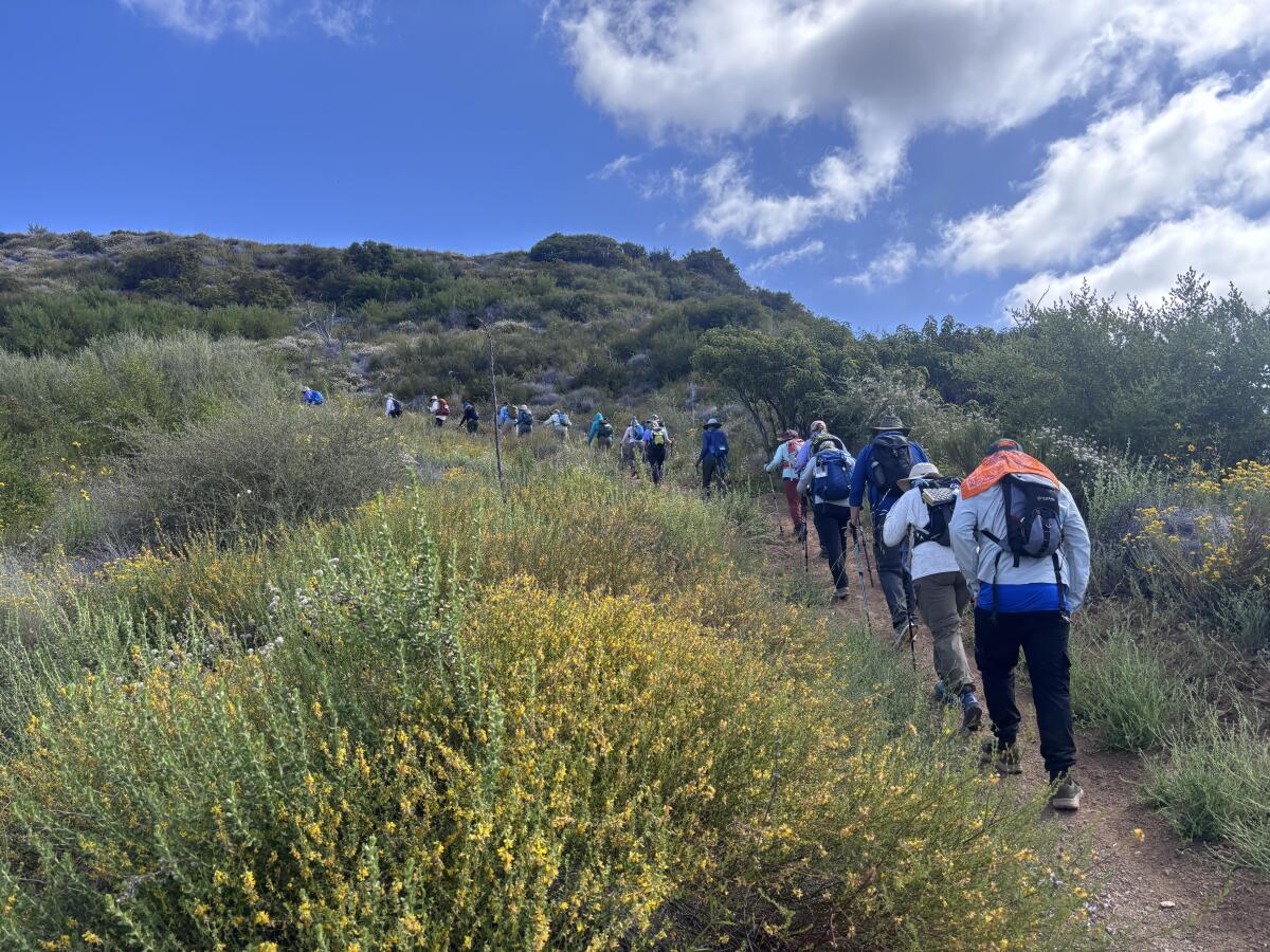
I often hike alone on the weekdays, and I have come to enjoy the solitude. But last week, I hiked a 9.8-mile segment of the Backbone Trail alongside almost 30 other hikers.
Hikers from the Santa Monica Mountains Trails Council’s annual Backbone Trek trudge along the trail.
(Jaclyn Cosgrove / Los Angeles Times)
It is an annual trip organized by the Santa Monica Mountains Trails Council, a volunteer-run group that maintains trails throughout the Santa Monica Mountains and nearby public lands. (The council has regular volunteer opportunities, including three trail workdays this month; RSVP required.)
This was its 21st year to offer the trip at a cost of $625 per person. Trail council volunteers set the route, provide daily hike leaders, set up camp for the group and lug most of the equipment — outside of daypacks, water and snacks — to the group’s next campsite.
The trip usually ends at the eastern terminus of the Backbone Trail in Will Rogers State Park. That area remains closed after the Palisades fire damaged the trail, destroying the Chicken Ridge Bridge. The bridge “is an important link on the [Backbone Trail] and will be the biggest single reconstruction effort for State Parks,” Rachel Glegg of the Sierra Club’s Santa Monica Mountains Task Force wrote last year.
A view from the Backbone Trail around the Newton Canyon area of the Santa Monica Mountains.
(Jaclyn Cosgrove / Los Angeles Times)
I joined the trail council‘s Backbone Trek last Wednesday as an enthusiastic interloper. I showed up late because of horrendous traffic on the 101 Freeway, earning me the trail nickname “Late Edition,” in honor of my punctuality and newspaper job. I felt immediately welcome (and forgiven).
We took a bus from Malibu Creek State Park’s lush group campsite over to the Latigo Canyon trailhead. There is a dirt parking lot there, making it an easy starting point for a day hike.
Our goal was to trek four miles east to the Corral Canyon area, where we’d have lunch among giant rock formations. Shaded by laurel sumac, oak trees and other native plants, we began our journey through the canyons. We were immediately greeted by a resplendence of wildflowers, including purple-pink woolly bluecurls, bright orange southern bush monkey flower, red bursts of cardinal catchfly and at least one Catalina Mariposa lily.
Clockwise from top left: Southern bush monkey flower, Catalina Mariposa lily, keckiella corymbosa and San Bernardino larkspur. Center: Variable checkerspot.
(Jaclyn Cosgrove / Los Angeles Times)
Because I love to dillydally, photographing flowers and taking in the views, I became fast friends with Denise Pomonik, a trail council leader who served as the day’s sweeper, making sure no one got left behind.
Pomonik, who lives in the San Fernando Valley north of the mountains, started volunteering with the council in early 2019 after seeing the 2018 Woolsey fire rip through the Santa Monica Mountains. “The more you hike an area or mountain-bike it, the more personal it gets,” Pomonik said. “I couldn’t control the fire, but I could control what I could do afterward.”
Denise Pomonik of the Santa Monica Mountains Trails Council waves from a large rock formation where the Backbone Trek group had lunch.
(Jaclyn Cosgrove / Los Angeles Times)
The council organizes the annual Backbone Trek not as a fundraiser but instead as a means of creating new land stewards who they hope will fall in love enough with the landscape to want to help protect it, either by donations, volunteerism or activism.
“The more people who fall in love with this mountain range, the more it will be protected,” said Pomonik, who works in the entertainment industry and had no prior trail work experience.
I did not anticipate how expansive the views would be, both of the Pacific Ocean to the south and the nearby peaks, hillsides and valleys to our north. I felt grateful and small.
Chatting with several of the hikers on the trip, I found they had signed up for two main reasons: adventure and healing.
A hiker on the Backbone Trek takes a photo of another as they trek along large boulders and ancient rock formations.
(Jaclyn Cosgrove / Los Angeles Times)
Vidya Oftedal, of Soldotna, Alaska, heard about the trip from a friend who serves on the trails council. Having someone else set up and haul all the gear was the biggest draw for her, she said, because then she could just simply focus on the hiking.
Oftedal, 71, said she loved pushing herself every day on the trip, finding a balance between knowing her limits and learning more about what her body can do.
“I’ve always loved the outdoors,” Oftedal said. “It speaks to me. I feel oneness with nature. Everybody is such an inspiration here. A lot of the women have done solo [trips] … and they’re all seniors like me. It’s like, ‘Wow, maybe I can pick up some courage and do things like that.’”
The camaraderie among the group was easy to see. Although many of them had been strangers just a few days prior, the hikers checked on each other and cheered one another on. After especially steep stretches, we’d pause to catch our breath, and someone would undoubtedly offer snacks to their fellow group members, including roasted fox nuts, or makhana, which the group had become especially taken with.
A raven flies over the rock formation that hikers along the Backbone Trail often say resembles an elephant’s eye.
(Jaclyn Cosgrove / Los Angeles Times)
At lunch, we sat in an area full of large, dramatic rock formations, including one that resembled an elephant’s eye. A few group members perched into small shady alcoves within the boulders. I commented that people had probably been sharing meals together in this area for thousands of years.
I was surprised by how many hikers on the trip were from Southern California but had never visited the Backbone Trail.
I spoke to Bill Edmonds, who told me he’d wanted to tackle the Backbone Trail for years. He grew up in Culver City and around the San Fernando Valley.
Edmonds said he led an active lifestyle, regularly running and skiing, and hiking with his wife, Kathy, who died last June after 51 years of marriage together.
“This has been special,” Edmonds said. “It helped me think about how much she would have enjoyed this.”
A view of the Pacific Ocean from a high point along the Backbone Trail.
I headed out as the group grabbed showers and prepared their taco dinner. I got into my car with a deeper appreciation for what the Santa Monica Mountains can provide us all, along with a few new friends — and a new trail nickname.
3 things to do
Cyclists on a previous Glow Ride hosted by People for Mobility Justice.
(People for Mobility Justice)
1. Illuminate the streets of Florence-Firestone People for Mobility Justice, an L.A.-based transportation equity collective, will host a bike ride from 6:30 to 8:30 p.m. Wednesday starting at Ted Watkins Memorial Park. Riders are encouraged to decorate their bikes with colorful and creative lights for this free Glow Ride through the streets of the Florence-Firestone neighborhood. Register at eventbrite.com.
2. Ascend to new heights in L.A. The Saturday Hike Crew will host a trek at 8:30 a.m. Saturday through Ascot Hills Park. Hikers will ascend steep hillsides to lookout points with sweeping views of L.A. Sturdy shoes are recommended. Register at eventbrite.com.
3. Pack out trash in Fullerton Friends of Coyote Hills needs volunteers at 9 a.m. Saturday to clean up a trail in Fullerton. Participants are encouraged to bring their own gloves and water. You can also bring a trash grabber if you own one. Volunteers should wear sun protection and comfortable sneakers or boots. Register at eventbrite.com.
The must-read
A sign is posted on a eucalyptus tree stating, “Stop killing our trees,” on Glenrose Avenue, where the trees were previously cut down.
(Carlin Stiehl / Los Angeles Times)
Trees in and around the Palisades and Eaton fire burn scars are dying — or being inappropriately removed — at an alarming rate, Times staff writer Noah Haggerty wrote. After a fire, surviving trees in a burn scar often need support, including watering, to survive. Neither city nor county officials prioritized such efforts in the Palisades or Eaton fire scars. Additionally, contractors have removed trees that they were authorized to take down. Builders have also pressured homeowners to cut down trees that they claimed would die anyway, although advocates say native oaks incorrectly identified as dead could have recovered.
It makes me wonder about the fates of trees along hiking trails in the burn scars.
Happy adventuring,
P.S.
Angeles National Forest is home to at least three new ursine residents. Wildlife photographer Robert Martinez documented three cubs following their mom through the forest in late April. Interestingly, the Chaney Trail Corridor Project documented a mama bear and three cubs walking through the foothills of the San Gabriel Mountains near Altadena in early May. I asked them: Could it be the same family? “In theory possible, but unlikely as the locations are more than 20 miles apart,” a volunteer from the Chaney Trail Corridor Project told me via Instagram. “Black bears with young cubs usually keep a smaller home range of just a few square miles. Both families are equally adorable though and about the same size and age!” If this news gives you a bit of the heebie-jeebies, then head over to my article where I explain how to best protect yourself if you encounter a bear while hiking. Be safe out there!
For more insider tips on Southern California’s beaches, trails and parks, check out past editions of The Wild. And to view this newsletter in your browser, click here.
Acoma makes 100 years of history look like small change. To get there, you veer south from old 66 for 14 miles at the tiny town of Paraje, about an hour west of Albuquerque.
Also known as Sky City, Acoma is a Native community of earthen homes perched atop a 357-foot-high mesa. It has been occupied for roughly 1,000 years by the Acoma Pueblo tribe, which is independent of the nearby Navajo, Zuni and Laguna, with its own language and about 5,000 enrolled members.
Thanks to revenues from their Sky City Casino and hotel along Interstate 40, the Acoma also have a large, handsome Haa’ku Museum and Sky City Cultural Center next to the historic mesa. There, outsiders can gather for escorted tours of 60 to 90 minutes, mostly walking. It’s $30 per adult. Photography, binoculars and note-taking are closely restricted, and outsiders are generally forbidden from the mesa except on tours.
My group of 18 travelers was led by guide Gail Toribio, 27. After a quick bus ride up a steep road built in the 1950s, we found ourselves on top of the mesa, facing one massive church, about 500 homes and several pottery stalls that materialize during tours. The views were spectacular, the pottery was full of painstaking detail, and it was fascinating to see the ancient and modern elements together in the hilltop homes. But the biggest thing and most astonishing story on the mesa is the San Estévan del Rey Mission.
When Spanish troops and missionaries showed up in the 16th century, they forced labor and Christianity upon Native groups, often slaughtering and maiming those who resisted, including many Acoma. By the 1640s, forced labor had produced the church on the mesa, its 40-foot-long ponderosa pine beams dragged from Mt. Taylor, more than 30 miles away. Somehow, when the area’s tribes rose up in the Pueblo Indian revolt of 1680 and killed most of the Catholic priests in New Mexico, the church endured. And over time, Toribio told us, most Acoma families settled into a sort of dual faith, combining their traditional beliefs with Catholic rituals, including Christmas.
After the church, we walked among two-story homes that were here long before the first Europeans showed up. (Only a handful of the homes are still occupied full time.)
“I was actually raised up there,” potter Gwen Patricio, 52, told me back at the visitor center. “No electricity, no running water. They asked the elders if they wanted electricity, but they said no.”
The undefeated and untested son of Nyquist was made the co-second choice on the morning line when post positions were drawn Monday afternoon at Laurel Park, the temporary home of the Preakness while Pimlico — about 30 miles north — is being rebuilt. Laurel Park, located halfway between Baltimore and Washington, D.C., has never hosted the Preakness, which will start just after 4 p.m. PDT on NBC.
With Golden Tempo becoming the second straight Kentucky Derby winner and third in the last five years to race in the Preakness, there will be just three runners from the Derby — Ocelli (third), Incredibolt (sixth) and Robusta (14th).
Among the full field of 14 starters, though, only Taj Mahal can complete the “Triple Crown” for women trainers, with Russell seeking to follow DeVaux and Jena Antonucci, who captured the Belmont three years ago with Arcangelo.
“It would sort of feel like probably a fairy tale,” Russell said. “ … It would mean an awful lot.”
Taj Mahal was one of three horses listed at 5-1 on the morning line behind lukewarm 9-2 favorite Iron Honor. He is the only Preakness starter who has raced at Laurel; in fact, he has never run anywhere else, going three for three there, including an 8¼-length triumph last month in the Federico Tesio.
His Beyer Speed Figure that day was 92, just two points (equal to about a length) behind Ocelli’s number in the Kentucky Derby. Chip Honcho, with a 92 for his runner-up effort in the Risen Star in February, is the only other Preakness horse with a Beyer number above 90 in a route race.
Taj Mahal was in the same yearling sale as Iron Honor (also a son of Nyquist) in September 2024 at Keeneland and sold for $50,000 more than his rival this week ($525,000 to $475,000). The colt originally was trained by Bob Baffert but was sent to Russell last fall when he wasn’t progressing.
“When he first showed up, it took some time for him to come around,” Russell said. “And, honestly, that’s why he was sent my way. If horses aren’t progressing or need a change of scenery, luckily for me it’s kind of become their place [for the owners] to send them.
“… The first time I worked him, did I think he would become a star? No, it took some time, but he developed and he progressed.”
Taj Mahal won a maiden race Feb. 6, then came back 15 days later to win a minor stakes race. He had almost two months between that race and the Tesio on April 18.
Russell’s husband, Sheldon, will ride Taj Mahal, who will break from the rail.
“To be fair, he’s a good gate horse,” Sheldon Russell said. “He broke so sharp last time. If he were to do the same thing again, he’d put me in a great spot. We’ve just got to hold that spot until we get to the bend, but we’ve got a longer run this time. He’s going to have to overcome a few things, but good horses overcome things.”
Iron Honor, who joins Taj Mahal as the most inexperienced horses in the field with three starts each, won his first two races, including the Gotham at Aqueduct. But he finished seventh last month in the Wood Memorial, his only try around two turns. He will be ridden for the first time by Flavien Prat.
“[He] got bothered in the first turn from a bad post and … just never really relaxed,” said his trainer, Chad Brown, who won the Preakness in 2017 (Cloud Computing) and 2022 (Early Voting). “We took the blinkers off the horse, gave him a chance to get over that experience and he seems to be in a good place right now, training just the way we want.”
The other horses listed at 5-1 were Incredibolt, who wasn’t even mentioned as a possibility for the race until Monday, and Chip Honcho, who finished ahead of Golden Tempo in the Risen Star but skipped the Derby after a poor showing in the Louisiana Derby. Ocelli is 6-1, and Napoleon Solo, the only Grade 1 winner in the field (last year’s Champagne Stakes), is 8-1.
Incredibolt, trained by Riley Mott, at least spares the Preakness from not having a single graded-stakes winner in a two-turn race. The son of Bolt d’Oro captured the Grade 3 Street Sense last fall over 1 1/16 miles at Churchill Downs. (He also won the ungraded Virginia Derby this year at 1⅛ miles at Colonial Downs.)
Chip Honcho will break from the No. 6 post under Jose Ortiz, who won the Derby. Ortiz’s brother, Irad Ortiz Jr., who was second in the Derby with Renegade, will be next to him in the No. 5 post aboard Talkin.
Ocelli is the most experienced horse in the race, with seven starts. He’s also the only starter not to have won a race. No maiden has won the Preakness in the modern era, with the last victory coming in 1888. Bodexpress was the last to try, in 2019, but he reared leaving the starting gate and dumped his jockey.
I excitedly followed my uncle down the narrow dirt path along Wildhorse Creek, a canopy of oaks, maples and other deciduous trees above us.
“What’s this?” I asked, picking up a stick that looked like it’d gotten into a fight with a wood chipper.
“That’s a beaver stick,” my Uncle Dale told me, explaining that one of the cute rodents had chewed on it, probably in the midst of making a dam along the river.
“Can I keep it?” I asked, a little in awe that I could hold such a magical thing.
We were trekking along a trail that my uncle had created on my family’s land in Oklahoma. For years, the stick was in my childhood bedroom, a memento from my earliest hiking memory.
You are reading The Wild newsletter
Sign up to get expert tips on the best of Southern California’s beaches, trails, parks, deserts, forests and mountains in your inbox every Thursday
By continuing, you agree to our Terms of Service, which include arbitration and a class action waiver. You agree that we and our third-party vendors may collect and use your information, including through cookies, pixels and similar technologies, for the purposes set forth in our Privacy Policy such as personalizing your experience and ads.
Spending time hiking with my uncle helped me fall in love with the outdoors, and I hope this week’s edition of The Wild, The Times’ weekly outdoors newsletter, helps you make memorable moments with the kids in your life too.
I chose three hikes for children of all ages, including for us kids at heart. The trails are all either easy or some level of moderate. They don’t require technical skills, but curiosity, sunscreen and a reusable water bottle are all encouraged. They each feature a mix of native plants and trees and offer opportunities to see a range of wildlife.
I chose trailheads where parking isn’t too challenging (at least, I hope it isn’t). There are restrooms at two out of the three trails. You’ll want to pack snacks and water, as two of the three hikes don’t have water refill stations available.
Logistics done, let’s dive into the hikes!
The Park to Playa Trail offers panoramic views of L.A. County, including views of the Pacific Ocean and San Gabriel Mountains.
(Jaclyn Cosgrove / Los Angeles Times)
1. Park to Playa Trail to Baldwin Hills Scenic Overlook
Distance: 2.6 miles Elevation gain: 304 feet Difficulty: Easy Dogs allowed? Limited (see below) Accessible alternative: Gwen Moore Lake path at Kenneth Hahn State Recreation Area
The Park to Playa Trail is a 13-mile regional trek that starts near Leimert Park and takes hikers all the way to the Pacific Ocean. It’s also fun to break into small adventures, like the one I outline below.
You can take Park to Playa from Culver City up to the Baldwin Hills Scenic Overlook, a fun day for adults and kids (and teenagers who enjoy taking selfies with great views). If visiting Friday through Sunday, you and your kids can pop into the Baldwin Hills Scenic Overlook Visitor Center, which offers educational exhibits, maps and more.
Although Culver City Park allows dogs, canines aren’t allowed on trails in Baldwin Hills Scenic Overlook, so you and Fluffy would need to use roads or sidewalks once you enter state parkland.
To begin your hike, park in or near this Culver City Park lot. The lot offers two-hour parking. If you’d like to stay longer, you can pay to park in the 10-hour parking along the street. Either way, you’ll follow the Park to Playa Trail signs northeast out of the lot.
A wood bridge trail leads hikers to great views of L.A.
(Jaclyn Cosgrove / Los Angeles Times)
You’ll take a well-built wood bridge trail that’s shaded by several large oak and other trees. At the top of the bridge, you’ll arrive at a small picnic area with a public art piece that’s also an equatorial sundial. You’ll get your first glimpse here at the views you can expect the higher you climb.
Head north, either taking the short stairs or ramp, to then hike east past green sports fields. You’ll follow the Park to Playa Trail around a field before entering Baldwin Hills Scenic Overlook via a charming metal archway.
From here, the dirt path widens, and you’ll start to notice more native plants such as California brittlebush and a variety of sages (which offer a fun sensory experience when you pause to give them a sniff).
The Park to Playa Trail passes through the Baldwin Hills Scenic Overlook area.
(Jaclyn Cosgrove / Los Angeles Times)
Just under a mile in, you’ll reach your first large overlook. Look east toward the Hollywood Hills, and you can likely spot the Hollywood sign and Griffith Observatory. I paused here to watch a red-tailed hawk dip and fly above the city below.
Follow Park to Playa as it winds around, turning left (east) onto a separate trail that will take you up to the main overlook. You’ll soon pass the famous Culver City Stairs, which you could take the rest of the way up to the overlook, or follow the gentler dirt path before you. The path will head southeast before leading you to the overlook where it’s mandatory to pause and take it all in: the ocean, the mountains, the views of why we live here.
From the overlook, you can take the path south to the visitor center, where you’ll also find flush toilets and water fountains. You have the option to turn back around and head down with your crew to where you parked — or continue onward on Park to Playa, which if you feel adventurous, you could take to Kenneth Hahn State Recreation Area.
The Antonovich Trail runs alongside Walnut Creek in San Dimas.
(Jaclyn Cosgrove / Los Angeles Times)
2. Antonovich Trail
Distance: 7.8 miles out and back Elevation gained: 385 feet Difficulty: On the easier end of moderate Dogs allowed? Yes Accessible alternative: The Antonovich Trail, but instead of entering the trail off San Dimas Avenue, where you must navigate a steep hill, start the trail from this parking area; the trail is not paved, but it is mostly flat if you head in the westerly direction from the parking lot.
The Antonovich Trail is a 7.8-mile out-and-back trail that follows gently flowing Walnut Creek, shaded by canopies of coast live oak, fig and Southern California black walnut. Besides a steep descent from the parking lot into the canyon, the route is mostly flat.
Unfortunately, there’s no easy restroom access along the trail. If that’s a deal-breaker, then I’d recommend the Placerita Canyon and Waterfall Trail, which I wrote about here, if you’d like to hike in a similarly shaded canyon vibes. You’ll park near the Placerita Canyon Nature Center, which I’d highly recommend visiting for its educational exhibits and animal ambassadors. It has flush toilets and water fountains.
As shown on this map, there are multiple places to start the Antonovich Trail. If starting it from the lot off San Dimas Avenue, you will navigate an exposed, steep dirt path down into the canyon. As you descend, take in the views of the San Gabriel Mountains.
The trail is popular with horse riders and locals who enjoy bringing their dogs to frolic in the cool creek waters. Keep a keen eye out for birds commonly spotted here, including black phoebe, acorn woodpeckers and hawks. Also watch out for poison oak.
The path splits off into multiple unofficial trails, so keep an eye on your hiking app or map as you scurry along. The first time I hiked this trail, I was diverted from the main route a few times, including once when, to my delight, my detour brought me to a tire swing (which I tested out, flying over a nearby sparkling pool of water).
The trail appears to just abruptly end, but it actually connects to a larger local trail network.
The Devil’s Chair Trail in Devil’s Punchbowl Natural Area leads to an incredible overlook point on a small boulder.
(Jaclyn Cosgrove / Los Angeles Times)
3. The Devil’s Chair Trail
Distance: 7.4 miles Elevation gain: About 1,500 feet Difficulty: Moderate Dogs allowed? Yes Accessible alternative: Prime Desert Woodland Preserve walking trail in Lancaster
The Devil’s Chair Trail is a 7.4-mile out-and-back hike that takes visitors through ancient sandstone formations of every imaginable shape and size. It’s a great all-day adventure for adults, teenagers and older kids.
About an hour-and-a-half drive from L.A. near Pearblossom, the hike starts in the Devil’s Punchbowl Natural Area, a 1,310-acre L.A. County park with massive sandstone rock formations and a healthy desert landscape of juniper and Joshua trees, along with native wildlife, including bighorn sheep.
Upon arriving in the large parking lot, you’ll find vault toilets and a visitor check-in area. The nature center is a great stop with live snakes, bugs and other crawly creepers inside. The rosy boa and tarantula are among my favorites to view.
The Devil’s Chair Trail was previously closed because of storm damage, but reopened about two weeks ago, thanks to the diligent work of county staff.
Its trailhead is in the southeast corner of the parking lot. The first mile of this hike is arguably the hardest part because you gain 500 feet in just under a mile.
After catching your breath, you’ll turn left (or east), cross a seasonal creek and hike for just over 2½ miles on a gentle path.
As you hike along the trail, you’ll likely spot chipmunks and gray squirrels. I frequently hear a variety of birds when I hike in the park, including hawks, ravens, white-crowned sparrows and dark-eyed juncos (which are very cute).
You also get incredible views of the desert below and mountains in the distance, including nearby Table Mountain in Angeles National Forest and the Tehachapi Mountains in Kern County.
To reach the trail’s namesake, you will walk down a narrow fenced path to a small boulder, surrounded by a short fence, that overlooks the valley below. This is the aforementioned devil’s chair. It’s a great spot to take a family selfie, share snacks and reminisce. And if you’re lucky, you might spot bighorn sheep in the valley below.
***
Regardless of how you spend time in the outdoors, with your immediate or chosen family, I hope you make great memories on our public lands.
3 things to do
A guest at Clockshop’s Kite Festival flies a large octopus kite at L.A. State Historic Park.
(Gina Clyne / Gina Clyne Photography)
1. Fly a kite with friends in Chinatown Clockshop’s Kite Festival, an annual free celebration, is scheduled from 2 to 6 p.m. Saturday at L.A. State Historic Park. Visitors can attend free art and kite-making workshops, compete in a kite competition and dance to local music. This year, The Times collaborated with Clockshop to publish a newspaper kite design. We will have a booth where you can get a copy of our newspaper kite design while supplies last. RSVP and donate at clockshop.org.
2. Yank weeds in Northeast L.A. The Ascot Hills Green Team and local hiking group We Explore Earth will host a volunteer day from 8 to 10:30 a.m. Saturday at Ascot Hills Park. Participants will yank out castor bean and black mustard, two invasive species that turn into serious fire hazards when they dry out. Closed-toe shoes, long pants and a reusable water bottle are recommended. Register at eventbrite.com.
3. Restore the land in Santa Clarita TreePeople, an L.A. climate resilience nonprofit, will co-host a volunteer restoration day with CalFire from 8 a.m. to noon Saturday in San Francisquito Canyon in Santa Clarita. Volunteers will remove invasive weeds and water native plants over uneven ground. Register at treepeople.org.
The must-read
(Photo illustration by Jim Cooke / Los Angeles Times; source photo / Getty Images)
Cute animal videos are a huge part of what makes the online world go round, including a recent viral video where Big Bear’s bald eagle Shadow appears to give his famous mate Jackie a nice massage. Too bad it was fake. Times staff writer Lila Seidman wrote that deepfake wildlife videos are taking over social media, prompting much concern from animal experts. “Far from benign, some experts say the videos can skew how people view and even interact with wildlife — potentially leading to perilous encounters,” Seidman wrote. “They may also undermine viewers’ growing desire to tune into nature to escape the frenetic rhythms of daily life.”
Happy adventuring,
P.S.
Any hiker who has driven into Angeles National Forest has undoubtedly forgotten to buy a $5 day pass or mistakenly left their annual pass at home. Good news, forgetful ones! Angeles National Forest installed an automated day pass dispenser at the pull-off at the intersection of Angeles Crest Highway and Angeles Forest Highway. The lot previously housed the Clear Creek information center and sits just west of the entrance to Switzer Picnic Area. The machine only takes cards. Better to stop and grab a pass than risk a ticket!
For more insider tips on Southern California’s beaches, trails and parks, check out past editions of The Wild. And to view this newsletter in your browser, click here.
Correction: A previous version of the April 30 edition of The Wild instructed readers to take Griffith Avenue outside the Audubon Center at Debs Park. The street’s name is Griffin Avenue.
As the spines of the invasive thistle bit into my legs, I worried I had failed.
I had spent hours at my computer staring at maps of northeast Los Angeles in hopes I could develop an urban hike that used existing trails to connect at least four of the area’s parks.
But there I was, standing in a narrow footpath on a hilltop, realizing I’d essentially hit a dead end, because to get into Ascot Hills Park, I would need to trespass (not allowed) or do something dangerous (also not allowed).
I headed down the steep hillside and told myself, “It’s OK. It’s your job to fail a little.” It was time to try again!
You are reading The Wild newsletter
Sign up to get expert tips on the best of Southern California’s beaches, trails, parks, deserts, forests and mountains in your inbox every Thursday
By continuing, you agree to our Terms of Service, which include arbitration and a class action waiver. You agree that we and our third-party vendors may collect and use your information, including through cookies, pixels and similar technologies, for the purposes set forth in our Privacy Policy such as personalizing your experience and ads.
In today’s edition of The Wild, I will introduce you to a 13.5-mile urban hike that I developed and fact-checked myself from the ground. I have admittedly been a mountain hiking snob since arriving in L.A., running off to the San Gabriels or Santa Monicas any chance I get. This experience opened my eyes to the joy and potential of urban hiking. I’m so excited to share what I learned with you.
I was inspired to develop this route for a few reasons. For one, I love going to Ernest E. Debs Park and Elephant Hill Open Space, and because I could see one park from a hilltop in the other, I’d wondered: “Could these be connected?”
A view of downtown L.A. and the surrounding city, as seen from the City View Trail in Ernest E. Debs Park.
(Jaclyn Cosgrove / Los Angeles Times)
Secondly, I attended the California Trails & Greenways conference earlier this month where I learned in sessions about hikers connecting existing trails, including San Francisco’s Crosstown Trail and the American Discovery Trail, which I wrote about in last week’s Wild.
Each time I visit one of L.A.’s open spaces, I am in awe of how hard local residents fought to protect the space and how each space has a dedicated fleet of volunteers lovingly restoring it to its glory by ripping out invasive plants (like thistles) and bringing back oaks, sumac and gorgeous wildflowers.
Some quick logistics before I dive into the route:
I developed the route using CalTopo, an online mapping software with a desktop site and mobile app. You can download the trail from CalTopo to use on your Garmin or other device. I also uploaded it to my AllTrails profile.
I called the trail “River to the Hilltops” in CalTopo. I kept it simple. If you have a clever name, feel free to suggest it.
I haven’t marked everywhere you can find a restroom or water, but will try to add those as time allows. Please plan accordingly, as some stretches run through neighborhoods or open spaces where there isn’t much nearby.
There is no single place to start this route. You can start and stop this route in several spots.
Trail access and conditions can change. Please follow all posted signage (and contact me if you encounter major issues).
This route travels through several neighborhoods. Please refrain from using Bluetooth speakers and anything else that would be disruptive to residents.
At several junctures along the suggested route, you will have an option to take a different path that will essentially get you the same place. Do what’s best for you, and most important: Have fun, be safe and don’t trespass!
Elephant Hill Open Space and the San Gabriel Mountains, as seen from near Ascot Hills Park.
(Jaclyn Cosgrove / Los Angeles Times)
Now let’s talk more about the route.
To begin my “River to the Hilltops” hiking adventure, my friend Patrick and I met last week at the entrance of Flat Top Park, parking on the shoulder of the north side of Montecito Drive. Our plan was to check the route I’d mapped out from Flat Top to Rose Hill Park, Ernest E. Debs Regional Park and the Arroyo Seco. I planned to walk the rest of the route a few days later.
Neither of us had been to Flat Top, an open space of more than 120 acres with several private owners. Local residents have advocatedfor years for Flat Top to be turned into a public park. North East Trees, a local environmental justice group, manages about 37 acres of the site that feature trails and native plant installations.
A snake skin hangs atop buckwheat in Flat Top Park.
(Jaclyn Cosgrove / Los Angeles Times)
From the gate, we trekked southwest along its wide dirt path. Patrick soon spotted a buckwheat plant with a snake skin draped over it, a gift from a previous visitor for all to appreciate.
We headed onward and were greeted by the park’s panoramic views of L.A. County and the San Gabriel Mountains. It’s a quiet respite in the middle of the city.
As we left Flat Top, we spotted a large gopher snake that we both mistook for a rattler. Our day was already off to a cool start!
We traveled northeast on Montecito Drive, watching for cars while observing interesting stilt houses and one home that reminded us of Storybook architecture. Just over half a mile from Flat Top, we found the trail I’d noticed in my research. Its entrance has two barriers in the middle that I interpreted as an attempt to keep out motorized vehicles.
The narrow dirt footpath, called Rose Hill Link Trail on some maps, featured multiple Southern California black walnut trees and at least two healthy Canary Island palms. I paused Patrick mid-sentence because I really wanted to know who was providing us with such loud birdsong. It was a mix of house finch and red-whiskered bulbul.
Weeds crowd the Rose Hill Link Trail, but it remains passable.
(Jaclyn Cosgrove / Los Angeles Times)
Portions of the trail were overgrown with castor bean and other invasives, but some park workers or kind volunteers are doing their best to keep it clear enough to pass.
We took a quick detour to Rose Hill Park in search of a restroom. Both facilities with flush toilets were closed as of Saturday, but there are portable toilets with a hand-washing station.
We headed north from Rose Hill Park onto a steep, direct route to Peanut Lake, a small pond with benches, shade and turtles. We walked around the pond clockwise and took a route on the north end of the pond to continue northward.
After just a tenth of a mile from the pond, we turned left (or west) onto the aptly named City View Trail. The route started to descend steeply after just a third of a mile. I criss-crossed the path to create my own switchbacks, which helps with gaining traction and makes traveling downhill easier on your joints.
We did not take the first left turn off the City View Trail because a hiker carrying a toddler on their back told us it was kind of steep — and they seemed more hardcore than we were. Instead, you’ll find my route suggests you take the Scrub Jay Trail, the second left turn from the City View Trail.
Wild writer Jaclyn Cosgrove and friend Patrick crab-walk down the river embankment.
(Jaclyn Cosgrove / Los Angeles Times)
Patrick and I actually took a different path because I thought the map had suggested there was an entrance to the Arroyo Seco Bike Path from near South Avenue 52. I can’t recommend that option, as it involves an unofficial trail and crab-walking down the side of the concrete river bank.
Instead, you’ll essentially follow the Scrub Jay Trail to a road that leads hikers past the Audubon Center at Debs Park and onto Griffith Avenue. There’s a crosswalk you can take across to an actual entrance to the river bike path.
We ended our day here, taking a rideshare car back to our vehicles. Our driver was curious enough about our day to want to subscribe to The Wild to learn more. I felt that was a good sign!
A few days later, I walked about 9.2 miles to check the rest of the route. I walked up steep hills through South Pasadena before passing through a green space (with a significant history) and into El Sereno. Soon, after chatting with a resident feeding her beloved speckled hens some fresh fruit and complimenting a man’s classic restored truck, I arrived at Elephant Hill Open Space.
The view of downtown L.A. from a high point at the Elephant Hill Open Space in El Sereno.
The agency has worked with community activists to develop the open space’s first official hiking trail, which I had the pleasure of hiking before the grand opening this Saturday. I trekked past the L.A. Conservation Corps workers and contractors busily working to complete the new path. Boulders and oak trees along gates to tamp down illegal off-roading have been added to the space.
After saying hello to a friend who lives nearby, I took Collis Avenue for two blocks and turned onto Yoakum Street, a dirt path, up to Harriman Avenue.
I followed the path labeled “Elephant Hill/Ascot Hills Connector” on my map, where I foraged for a Diet Coke and pretzels at a convenience store and grabbed a poetry book from a free book rack outside Son of a Vet thrift shop. There are many perks to urban hiking!
Soon, I faced my next surprise.
A metal stool sits along a trail in Debs Park where hikers can see great views of L.A.
(Jaclyn Cosgrove / Los Angeles Times)
For reasons unclear to me, someone labeled a spot north of Ascot Hills as the “Ascot Hills Northern Trailhead.” Maybe they were manifesting what could someday be a great walk, because what I found was not a trail I’d repeat.
As I mentioned up top, I hoofed up through thistle and dried-out mustard, thinking I’d find a connection to the well-maintained trails I knew were in Ascot Hills Park. I got to about here, and although I could see the park’s actual trails, I could not safely or legally reach them. Cursing, whining, bemoaning, I made it back down the path that was about a 20% grade.
I stood in the neighborhood, looking like a sad weirdo with a backpack. I decided to try one last thing. It looked like, from the map, there was a northern entrance.
I headed west on Bedilion Street and then turned south onto Bowman Boulevard. After two-tenths of a mile, I turned west onto Lynnfield Street. On the fence, I noticed a wooden sign with green, white and red letters. “Victor’s Walk starts here,” it read.
A memorial for a neighbor near Ascot Hills.
(Jaclyn Cosgrove / Los Angeles Times)
“Who was Victor?” I asked a resident cleaning the street.
He told me that Victor had died recently. He’d helped Victor, who walked daily, keep the street tidy by tending to the plants and picking up trash, and he was doing his best to make his late neighbor proud. We chatted more, and he confirmed that there was a nearby way to reach Ascot Hills. (He’d helped other hikers who’d taken the thistle-filled route.)
I soon found a locked gate with access for hikers, and farther down a paved road and a razor-wire-lined fence, an opening to the park.
Ascot Hills Park in Northeast L.A.
(Jaclyn Cosgrove / Los Angeles Times)
Reaching a vista point, I took in the views of downtown L.A. and the rest of the city, grateful for my first visit to the park and the people I met along the way to get there.
Before finishing the final 2.6 miles, I stopped at the Village Mart & Deli near Ascot Hills for a sandwich.
The rest of my day included more life-affirming surprises.
Lincoln Park in Los Angeles.
(Jaclyn Cosgrove / Los Angeles Times)
I reached Lincoln Park as a Union Pacific train rumbled past. A Muslim man performed his late afternoon prayer with his mat under a shade tree. Kids played baseball in an adjacent field. I followed the concrete path to the lake, where I navigated around ducks and geese and watched a fisherman catch a bass.
Continuing north, I stopped at the Wall Las Memorias AIDS Monument and ran my fingers over the names etched into one of the panels honoring the dead. I felt chills as I took in the reverence for human life communicated in the memorial’s art and design. I hope you’ll stop by as a part of your walk too.
The entrance to the Wall Las Memorias AIDS Monument in Lincoln Park.
(Jaclyn Cosgrove / Los Angeles Times)
I had fooled myself into believing the end of my walk would be easy — like somehow I’d gently ride off into the sunset.
Instead, after taking Gates Street to North Broadway, I looked up to discover what I told a friend in a text message was my “final boss”: North Thomas Street. In just under a third of a mile, the street gains about 260 feet, similar in steepness to the start of a challenging mountain trek.
North Thomas Street, a steep road along the 13.5-mile path.
(Jaclyn Cosgrove / Los Angeles Times)
I rallied, reminding myself of the time I walked all 27.4 miles of Washington Boulevard in one day, and headed up. Just under half a mile in, I reached the top. I thrust my arms into the air and cheered like I’d won a race.
Ever since moving to L.A., I’ve been blown away by just how many people truly care about our public lands and open spaces. It has taken decades for the parks on this route to be as protected as they are, although much of the space remains threatened by development.
My route is a kind of thank-you to those of you who’ve been doing this work. I hope more people see it, appreciate it and want to show their gratitude too.
3 things to do
Stargazers observe the celestial bodies at the Star Party, hosted by the Los Angeles Astronomy Society, last year.
(Carlin Stiehl / For The Times)
1. Jump for Jupiter in Silver Lake The Los Angeles Astronomical Society will host a free star party from 8 to 10:30 p.m. Thursday at the Sunset Triangle Plaza in Silver Lake. Guests will listen to local musicians while hopping among telescopes. Learn more at the group’s Instagram page.
2. Notice the nighttime critters in Orange County We Explore Earth will host a 3-mile nocturnal wildlife hike from 7 to 9 p.m. Saturday through Black Star Canyon about 15 miles east of Santa Ana. Hikers will look for evidence like burrows, nests and tracks of tarantulas, toads, scorpions, glowworms and other nighttime creatures. The trek is along a wide dirt trail with minimum elevation gain. Register at eventbrite.com.
3. Hike in solidarity and support in Claremont Hiking With Bill, a sober hiking group, will host a hike at 7 a.m. Saturday at Claremont Hills Wilderness Park. The group aims to provide a safe, sober and supportive community outdoors experience. To learn more about the group’s exact meeting location, either email hikingwithbill935@gmail.com or visit the group’s Instagram page.
The must-read
An opening date for later this year was announced at the Wallis Annenberg Wildlife Crossing in Agoura Hills on April 22.
(Christina House / Los Angeles Times)
Apparently, social media still has the power to create sudden outrage over seemingly the most random of targets: the Wallis Annenberg Wildlife Crossing. Times staff writer Lila Seidman wrote that after a conservative think tank dubbed the bridge a $114-million “bridge to nowhere,” conservative media and politicians jumped on the opportunity to criticize the effort (and Gov. Gavin Newsom, a Democrat considering a presidential run). Curiously, the bridge is a fourth of the cost of President Trump’s White House ballroom — as the bridge’s original price has increased in part due to worsening inflation and tariff-driven price increases. The bridge is set to open Dec. 2.
Happy adventuring,
P.S.
Although I find most trails around L.A. County are largely free of litter, I have seen metallic balloons deep within the San Gabriel Mountains, far beyond wherever they were released. I wasn’t surprised when I saw, via a post from Steampunk Farms Rescue Barn, a Ranchita-based farmed animal sanctuary, that the balloons can make it far into the Mojave too. The image of a desert tortoise considering a lunch of a “Congrats, Grad!” balloon still made my stomach lurch. The organization asked readers to consider: “Don’t release balloons. Any of them — mylar, latex, ‘biodegradable,’ sky lanterns. Weight them, pop them, recycle them indoors,” among other helpful ideas.
For more insider tips on Southern California’s beaches, trails and parks, check out past editions of The Wild. And to view this newsletter in your browser, click here.
A NEW Ferris wheel has popped up along a famous seafront – and it’s set to open just in time for summer.
The new feature marks the second wheel in four years to be positioned on Great Yarmouth’s skyline.
Sign up for the Travel newsletter
Thank you!
Great Yarmouth Borough Council have officially installed the giant wheel on the seaside town’s beachfront, with visitors set to ride the attraction this summer.
The council wrote in a Facebook post: “We’ve secured a brand new Big Wheel for the seafront, opening just in time for the summer season.
“Get ready to experience stunning new views across the coastline and town from above – a fresh perspective you won’t want to miss.”
Locals have reacted to the news positively, with one commenting: “Lovely, I will have to take the grandchildren on it. Looks great.”
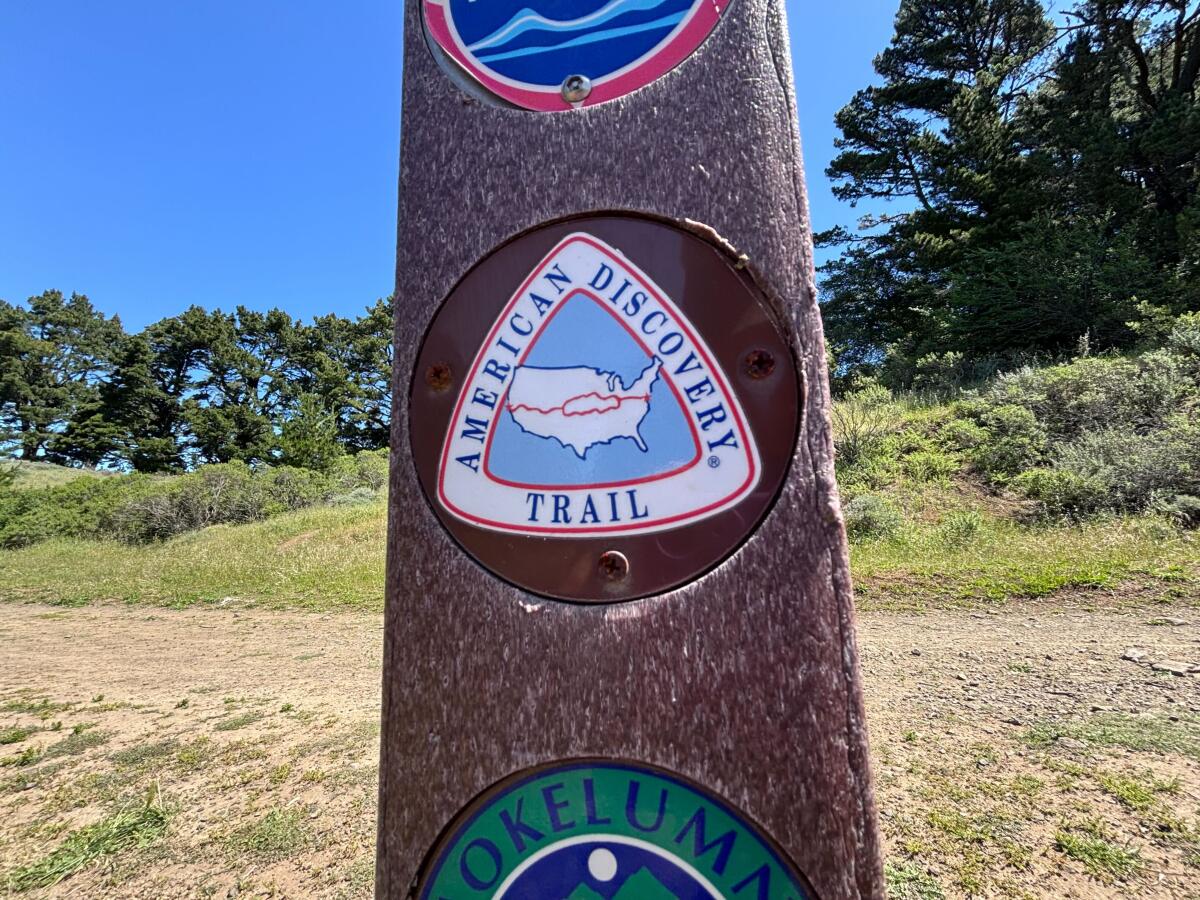
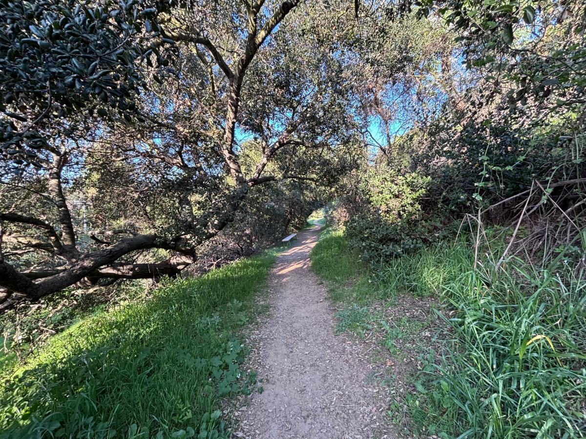
It was my first time hiking through Tilden Regional Park, a 2,079-acre wooded hilly expanse near Berkeley, and I was looking for one very specific thing: a small red, white and blue rounded triangular trail marker with a tiny map of the United States.
I’d already struck out twice, parking at the wrong trailheads, and I was really hoping the third time would be the charm. I trudged up the Upper Big Springs Trail, a wide dirt path lined with fragrant eucalyptus, pine trees and California bay laurels and, peeking out of the invasive grasses, California poppies and orange bush monkey flower.
I crested a hill after about two-thirds of a mile, and there I saw a sign, both literal and metaphorical, on a small brown post letting me know I was exactly where I needed to be. I was officially hiking along the American Discovery Trail, a contiguous 6,800-mile coast-to-coast nonmotorized route of multiuse trails that runs from Point Reyes National Seashore in Marin County to Cape Henlopen State Park in Delaware.
The American Discovery Trail sign in Tilden Regional Park near Berkeley.
(Jaclyn Cosgrove / Los Angeles Times)
“The ADT is all about connections — people to people, community to community, urban areas to wilderness,” according to a website outlining its history. “… The ADT connects five National Scenic, 12 National Historic, and 34 National Recreational Trails; passes through urban centers like Cincinnati and San Francisco; leads to 14 National Parks and 16 National Forests” and visits thousands of historic, cultural and natural sites.
I’m excited to share not only about the joy that can be found along this route, but also how you can join a relay in July across America along the trail. I certainly plan to!
You are reading The Wild newsletter
Sign up to get expert tips on the best of Southern California’s beaches, trails, parks, deserts, forests and mountains in your inbox every Thursday
By continuing, you agree to our Terms of Service, which include arbitration and a class action waiver. You agree that we and our third-party vendors may collect and use your information, including through cookies, pixels and similar technologies, for the purposes set forth in our Privacy Policy such as personalizing your experience and ads.
I’d never heard of the American Discovery Trail until last week when I attended the California Trails & Greenways conference in San Ramon. There, I met with American Discovery Trail co-founder John Fazel and John Mercurio, the trail’s California coordinator, to learn more.
The idea to create a coast-to-coast trail was born out of a 1980-81 hike across America called “HikaNation,” where several members of the American Hiking Society trekked more than 4,000 miles across the country. That adventure inspired Backpacker magazine and the American Hiking Society in 1989 to start developing the American Discovery Trail.
A view of the San Francisco Bay from the Seaview Trail in Tilden Regional Park near Berkeley. The route is a part of the American Discovery Trail.
Then, in 1991, the American Hiking Society hired a national coordinator to work with volunteer state coordinators to develop the route, and in 1996, trail advocates formed the American Discovery Trail Society to ensure their dreams became a reality.
“It’s an opportunity to get to know America up close and personal and not as a flyover,” said Fazel, who grew up in Iowa.
The San Pablo Reservior as seen from Tilden Regional Park near Berkeley.
(Jaclyn Cosgrove / Los Angeles Times)
Most people don’t complete the trail in one trip, Fazel said, as it takes months to finish and requires participants to leave the East Coast around February to ensure that enough snow has melted by the time they reach the mountains in Colorado and California.
Although the trail has existed for several years, Fazel and Mercurio admit that they don’t know exactly how much of the route is a recreational trail, sidewalk or roadway. That’s in part because it’s a technically complicated task to complete, especially for a mostly volunteer group. But it’s also because the route is ever-evolving (which is actually exciting).
“Since we got involved, small towns, counties, even states are funding millions of dollars to build trails in their area, and when they see a national trail goes across the country, they want to connect to it, and when they do, where it is on back roads, we can move it off,” Fazel said. “And it happens.”
A labyrinth in Tilden Regional Park along the American Discovery Trail.
(Jaclyn Cosgrove / Los Angeles Times )
In California, the only place hikers are on pavement for a significant amount of time is from the Antioch Bridge north to Sacramento as they travel through the Sacramento-San Joaquin Delta, Fazel said.
Mercurio said he is working with local officials to try to move the trail from this narrow roadway onto an old railroad track that’s owned by the state.
“It’s been sitting there vacant for many, many years,” Mercurio said. “Now, they should know that there’s this national trail, this coast-to-coast trail, [that] is interested in utilizing that to provide a safe way for us to make our way across the delta.”
Unlike the Pacific Crest Trail, Appalachian Trail and other multistate routes, the American Discovery Trail is not federally designated under existing law.
The National Park Service studied the American Discovery Trail in the mid-’90s and acknowledged that the American Discovery Trail doesn’t fit neatly into any of the existing categories outlined in the National Trails System Act, Mercurio said. The agency mapped out three options for Congress to consider, including creating a new category for discovery trails, he said.
A lush tree canopy along the Seaview Trail, part of the American Discovery Trail, in Tilden Regional Park.
(Jaclyn Cosgrove / Los Angeles Times)
Trail advocates have been pushing Congress for more than 25 years to create such a category. They came close in 2021 when U.S. Rep. Mark DeSaulnier (D-Concord) introduced such legislation that garnered 63 co-sponsors.
“We had people on the House resources committee who were far right and killed it,” Fazel said, adding the trail has otherwise garnered bipartisan support for decades in states it passes through.
There was a mix of suspicion and concern that the recognition of the trail would lead to eminent domain and requests for federal money, neither of which the trail’s organizers want, Fazel and Mercurio said.
“The thing is, we don’t build any trail at all,” Mercurio said. “All we do is route onto stuff that’s already there, and our presence influences local jurisdictions to create trail that would be good for our route. But they’re in this anti-federal feeling, so they just knee-jerk don’t want to support it.”
The Golden Gate Bridge as seen from Tilden Regional Park.
(Jaclyn Cosgrove / Los Angeles Times)
The duo remains optimistic that their trail will get national recognition. In the interim, they’ve got other big plans.
On July 1, as long as everything goes according to plan, the American Discovery Trail Society will launch its “America 250 Relay,” aiming to cross the Golden Gate Bridge by July 4 and ending in Delaware at the Atlantic Ocean on Thanksgiving Day.
Anyone can join to traverse the trail in a people- or horse-powered way. Participants will carry a copy of the Declaration of Independence in a celebration of America and the outdoors. (I’ve already texted two best friends to entice them to do part of the relay with me!)
A flax-leaved blue pimpernel in Tilden Regional Park.
(Jaclyn Cosgrove / Los Angeles Times)
In a time of rising authoritarianismacross the globe, it’s important we seek both joy and connection, focusing less on what we’re fed by algorithms and more on our shared humanity. I know that sounds fairly Pollyanna, but especially as a transgender American who constantly worries about whether I can safely visit my family in the Midwest, where lawmakers are seemingly seeking to outlaw my existence, I do actually mean it.
As I neared the end of the trail, a golden Labrador retriever greeted me, and after lots of head scratches, I met the dog’s owner. He and I started chatting, and soon realized that, although we belonged to different generations, we had both grown up as farm kids.
He started to tell me the story of when his dad ran himself over with a tractor.
“My dad ran himself over with a tractor too!” I said. “Did your dad start the tractor from the ground even though he’d told you a million times as a kid not to?”
“No, but he did try to get off and get back on a moving tractor,” he said, which my new friend’s father had repeatedly told him not to do.
I didn’t expect to discuss tractors and hay bales with a stranger in the East Bay, but I found that these experiences are a part of what the American Discovery Trail provides.
3 things to do
A human and canine guest travel along a previous CicLAvia event route.
(CicLAvia Los Angeles)
1. Wander the car-free streets of West L.A. CicLAvia, an L.A. nonprofit, will host a free three-mile, car-free open streets event from 9 a.m. to 4 p.m. Sunday through West L.A. The event marks the 65th open streets event the organization has held around L.A., but it’s the first time that one has been held in West L.A. The route includes portions of Santa Monica and Westwood boulevards. Attendees are invited to traverse the route in any people-powered device, although there are certain restrictions on e-bikes. Learn more at ciclavia.org.
2. Prop up the pollinators in Castaic TreePeople will host Pollinator Palooza from 9 a.m. to 1:30 p.m. Saturday at Castaic Lake. Volunteers will plant milkweed and restore habitat. The event will also feature plant giveaways, an environmental resource fair and a pollinator-themed fashion show. Learn more at treepeople.org.
3. Orient yourself in Irvine Save Orange Hills and Naturalist For You will host a hike, yoga and meditation event from 8 to 10 a.m. Sunday at Irvine Regional Park. After a short warm-up hike, guests will take part in an all-levels yoga session. Tickets are $17.85, but no one will be turned away due to lack of funds. Register at eventbrite.com.
The must-read
San Joaquin River Parkway, currently operated by the San Joaquin River Conservancy, would join various properties into an 874-acre state park, expanding recreation opportunities and greater access along the river. The park would complement nearby Millerton Lake State Recreation Area.
(California State Parks)
California could soon see the development of three new state parks in the Central Valley. State officials announced the proposed parks on Wednesday, which are Feather River Park in Yuba County, San Joaquin River Parkway near Fresno and Dust Bowl Camp in Bakersfield, Times staff writer Hayley Smith wrote. State officials also aim to expand three existing parks in Mendocino County, Nevada County and San Mateo County. “California’s state parks are nothing short of iconic — with locations like Big Sur, Southern California beaches, and the world’s tallest trees — but our state has even more to offer,” said Wade Crowfoot, California’s natural resources secretary.
Happy adventuring,
P.S.
Hikers and trail builders have until April 30 to complete the California Trails Survey, which state officials will use to help shape how nonmotorized recreational trails are developed in the state — and how officials use millions from Prop 4, often called the “climate bond” because its money is supposed to be spent to combat climate change. The survey includes two portions, one for trail users and another for trail builders and advocates. If you fit both categories, you are invited to complete both portions. Early data, released at a trails conference I attended last week, suggested that white hikers were overrepresented in the results, so please spread the word, especially to BIPOC hiking organizations in your area!
For more insider tips on Southern California’s beaches, trails and parks, check out past editions of The Wild. And to view this newsletter in your browser, click here.
I’ve come to resent the frenzy around superblooms.
You are reading The Wild newsletter
Sign up to get expert tips on the best of Southern California’s beaches, trails, parks, deserts, forests and mountains in your inbox every Thursday
By continuing, you agree to our Terms of Service, which include arbitration and a class action waiver. You agree that we and our third-party vendors may collect and use your information, including through cookies, pixels and similar technologies, for the purposes set forth in our Privacy Policy such as personalizing your experience and ads.
Not because I don’t love seeing our hillsides blanketed with nature’s bounty, but because it misses the point that every wildflower that bursts out of the ground is its own sort of miracle. Have you ever slowed down on the trail just to stare at an individual California poppy and considered how in the world a seed that’s a fraction of an inch (1/20 to be exact-ish) became this bright orange delicate thing before you?
For me, each wildflower I spot on the trail is an opportunity to practice gratitude. I hope I can persuade you to consider the same.
With that same energy, I’d like to teach you how I find wildflowers and other plants I love, both as a hiker and outdoors journalist. Here is what I consider as I’m searching for the best spring hikes.
A large oak tree provides shade over a trail in Franklin Canyon Park.
(Jaclyn Cosgrove / Los Angeles Times)
1. Learn the landscapes
L.A. County is home to a multitude of diverse plant habitats, with each offering its own range of wildflowers, shrubs, trees and more. And often, these landscapes can be interspersed among each other.
Hikers around L.A. commonly encounter plant habitats and ecosystems that include:
Coastal sage scrub: Found at lower elevations (generally below 3,000 feet), this fire-adapted plant community often includes bright yellow bush sunflower, sticky monkey flower (orange blooms), deerweed (orange and yellow blooms) and fragrant California sagebrush and black sage, which features white and bluish blooms; this is a great plant habitat to hike when you want to really stop and smell things.
Chaparral: Often said to be the most extensive vegetation type in California, chaparral is found throughout Southern California’s mountain ranges up to about 5,000 feet, although it does grow higher; chaparral is a “continuous cover of low-growing shrubs creating a mosaic in shades of green,” according to research by the U.S. Forest Service; common flowering plants found in chaparral include woolly bluecurls, chamise (white flowers), ceanothus (shrubs with fragrant purple, white and sometimes pink blooms) and manzanitas.
Oak woodlands: A plant habitat often found in low- to mid-elevations (generally below 5,000 feet) in foothills and valleys, this ecosystem is “officially defined as an oak stand in which at least 10% of the land is covered by oaks and other species, mostly hardwoods,” writes author Kate Marianchild in “Secrets of the Oak Woodlands”; wildflowers that often grow here include California buttercup (yellow blooms), Collinsia heterophylla (purple and white blooms), hummingbird sage (super cool plant with magenta flowers) and more.
Several coast live oaks, including this one with a swing, live along the Gabrielino Trail, left. Top right, there are several native plants and wildflowers along the Gabrielino Trail, including golden yarrow. Bottom right, Bush monkey flower, sometimes called sticky monkey flower, is a native shrub found along the Gabrielino Trail.
(Jaclyn Cosgrove / Los Angeles Times)
Riparian habitats: This is the term used to describe the lush landscape found around rivers, creeks and in moisture-rich canyons and includes riparian woodlands; it is less defined by elevation and more so is used to describe the life found around water. Wildflowers and plants that bloom include western columbine, scarlet monkey flower and miner’s lettuce (white and pale pink blooms). You can often also find California bay laurels, which have a zesty pungent smell (that not everyone loves).
Where to see it: Essentially anywhere along the 28.8-mile Gabrielino Trail, which runs parallel in several sections to the San Gabriel River and Arroyo Seco.
The snow plant (sarcodes sanguinea Torr.) is starting to come up around pine trees at the Chilao Picnic Area in the Angeles National Forest. It grows in the spring, after snow has melted, has no chlorophyll and gets its nutrition from fungi growing on conifer roots in the soil.
(Raul Roa / Los Angeles Times)
2. Go higher for late-season blooms
Thanks to our proximity to the San Gabriel Mountains, the wildflower season often extends into late spring and early summer.
In Angeles National Forest, you can easily hike above 5,000 feet and even farther into the sub-alpine regions where you’ll find mixed conifer forests and a range of wildflowers and other interesting plants. One of my favorites to spot is the snow plant, a funky red parasitic plant that “derives sustenance and nutrients from mycorrhizal fungi that attach to roots of trees,” according to the California Native Plant Society. Other blooms you might spot include various types of lupine, pumice alpine gold and some types of paintbrushes.
Grape soda lupine grows in Angeles National Forest, including here along the Cooper Canyon trail.
(Jaclyn Cosgrove / Los Angeles Times)
3. Determine whether an area has burned in recent years
Many of the most beloved areas of the Santa Monica and San Gabriel mountains have burned in recent years. The immediate aftermath is devastating to witness: blackened hillsides with shrubs and trees burned down to nubs and stumps.
But, as the ecosystem starts to heal, several wildflowers known as “fire followers” will start popping up.
“Often boasting beautiful blooms, some germinate only when their seeds are exposed to heat, while others take advantage of the charred, mineral-rich soil left behind, helping to secure the land and reduce erosion,” according to TreePeople.
I’ve found this to be true in areas that burned in the 2020 Bobcat fire, where trails burst with blooms from several types of lupine (including grape-soda lupine, my personal favorite), phacelias, including large flowered phacelia and caterpillar phacelia, and withered snapdragon.
California poppies bloom next to the California State Route 138 near the Antelope Valley California Poppy Reserve State Natural Reserve on March 12. The state’s wildflowers typically bloom from mid-March through April.
(Kayla Bartkowski / Los Angeles Times)
4. Check the data and help others do the same
Before heading out, I often head to iNaturalist, a citizen science app where users submit photos of animals, plants and other living organisms they observe. I will usually look at what other users have submitted in recent weeks. And on every hike, I typically submit at least 20 observations of wildflowers, lizards and trees I noticed. (As of today, I’ve submitted 675 observations of 341 species, including eight California poppy observations and seven black bear observations, which are really just photos of scat.)
To use iNaturalist, you can either visit its desktop site or use the app, which is available for iPhone and Android. You can easily search specific plants — although rare and endangered specimens will have their locations hidden — to discern whether any have been spotted along the trail you’re headed to. This is one of the ways I discovered an abundant showing of wildflowers in Towsley Canyon and in the Santa Monica Mountains, which hopefully is still there thanks to the recent rainfall.
As you can tell, there is much to learn about the diverse landscapes covering Southern California. I hope this newsletter prompts you to learn even more as you venture out there.
May your adventures lead you to a day full of springtime color and a deep sense of gratitude for whatever you find!
3 things to do
Violet Tiul, 12, removes invasive mustard weed at Friends of the Los Angeles River’s Habitat Restoration & Earth Month Celebration at the Sepulveda Basin Wildlife Preserve in Los Angeles on May 24, 2025.
(Carlin Stiehl / Los Angeles Times)
1. Celebrate Earth Month at the L.A. River Friends of the L.A. River needs volunteers from 8 to 11 a.m. Saturday at the Sepulveda Basin for its Earth Month habitat restoration day. Other local groups at the event will include the California Native Plant Society and the L.A. and San Fernando Valley chapters of the Audubon Society. Volunteers will yank weeds and install native plants and be rewarded with guided nature walks around the native reserve. Binoculars will be provided. Learn more at support.folar.org.
2. Explore the night sky in Joshua Tree The Mojave Desert Land Trust will host an interactive evening exploring the night skies from 7 to 10 p.m. Friday at its headquarters in Joshua Tree. Interns from the trust’s Women In Science Discovering Our Mojave (or WISDOM) will share their research findings, and afterward, guests will be treated to s’mores and a night sky viewing with a National Park Service ranger. Learn more and register at mdlt.org.
3. Hike with bats and more in Calabasas Malibu Creek State Park will host a guided night hike from 7:30 to 9 p.m. in Calabasas. Guests will learn about nocturnal animals as they hike about three miles round trip. Register at eventbrite.com.
The must-read
Carrizo Plain National Monument in San Luis Obispo County.
(Christopher Reynolds / Los Angeles Times)
If you’re feeling up for a road trip, may I suggest heading to the Carrizo Plain National Monument? Times staff writer Christopher Reynolds outlined how, even though we are past its peak wildflower season, the monument is still a gorgeous display of springtime blooms. “By the time my wife and I arrived in the first days of April, the flowers were past their peak, but the hills were still green and many meadows popped with yellow, purple and blue,” Reynolds wrote. “If I’m reading my wildflowers handbook right, these were tidy tips, Goldfields, Owl’s Clover, thistle sage, Valley Larkspur, coreopsis, phacelia and hillside daisies.”
We are so lucky to live among such rich biodiversity!
Happy adventuring,
P.S.
Would you like to meet me IRL? I am hosting “L.A. Hiking 101” at 1:45 p.m. Sunday at Mudd Hall 203 during the L.A. Times’ Festival of Books at USC. The festival is free to attend, as are several of the panels, mine included. I will share how to find some of the best hikes around L.A., what I’ve learned writing about our local wildlands and, as a fun show-and-tell, what I carry in my pack when I’m out on a day hike. Space is limited, so grab your ticket now for my talk. I am eager to hear what questions you have. See you there!
For more insider tips on Southern California’s beaches, trails and parks, check out past editions of The Wild. And to view this newsletter in your browser, click here.