water

‘Extremely drunk’ British tourists drenched in buckets of water by ‘fed up’ Italian local

Locals in Rome’s Trastevere district complain that tourists have been making noise in the early hours, leading one frustrated 74-year-old to resort to extreme measures

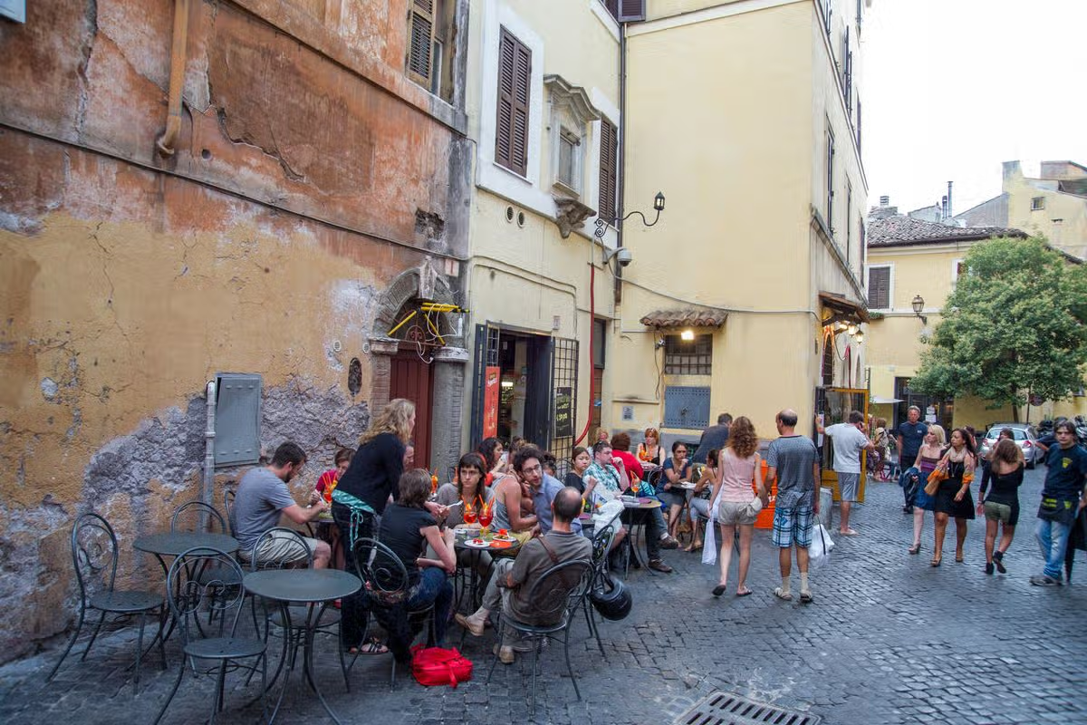
A frustrated Italian local has admitted to dousing rowdy, “drunk” British tourists with buckets of water after they disturbed her in the night. Locals in Rome’s Trastevere district complain that UK and US tourists have been making noise beneath apartments in the early hours, leading one 74-year-old to resort to extreme measures.

Rome has long been a popular holiday destination, drawing in millions of visitors each year. Tourists flock to the Italian capital to soak up the city’s Roman history and art, and enjoy its nightlife and world-famous cuisine.

With the swathes of tourists comes a downside, though: some allegedly get “extremely drunk” and cause a nuisance in the middle of the night. Local Simonetta Marcellini told The i Paper that she keeps buckets of water by her window.

She said: “At first I’m polite, and I point out to them that it is the early hours of the morning and that people will be sleeping. The moment they start arguing back and insulting me, I pour water on them.”

Simonetta, a former radiographer born in the area, has grown frustrated with the changes she’s witnessed. She claims there has been a marked decline in the quality of restaurants, and businesses have been replaced by bars and sandwich shops.

Meanwhile, Rome was inundated with 22.9 million visitors last year, a figure said to be more than seven times the local population. Simonetta decided she’d had enough when she spotted tourists urinating against her building.

She claims that life has “gotten much worse” in relation to tourism since the Covid pandemic. “Regulations are fewer and our complaints from years ago were underestimated.

“So a phenomenon that could have been controlled was practically left unchecked and we’ve arrived today with all the reckless partying.”

It comes after British holidaymakers were warned they could face a 500 euro fine in “some Italian towns”. The Foreign, Commonwealth and Development Office (FCDO) plays a crucial role in keeping Brits informed when travelling.

In its travel advice section for Italy, the FCDO warns that “some Italian towns and cities have specific laws, and you could be fined for breaking them”.

Some of the acts include eating and drinking near certain churches, historic monuments and public buildings. It’s also important to remember that entering or bathing in many public fountains is prohibited – including in Rome.

On the sun-kissed island of Capri (situated off Italy’s Amalfi Coast), a rule is in place regarding disposable plastic. Visitors are banned from bringing items such as plastic bags, cutlery, cups, trays, or straws onto the island.

Further FCDO guidance reads: “Illegal traders operate on the streets of all major Italian cities. It is illegal to buy items from unlicensed street traders. If you do, you could be stopped by the local police and fined.

“It’s illegal to remove sand, shells or pebbles from coastal areas in Italy. You could face a large fine for doing so. It’s also illegal to collect various species of flowers, plants and herbs from mountain and wooded areas.

“For more information, check with the regional authorities of the area you’re visiting.”

Source link

A California desert icon, the Bagdad Cafe on Route 66, is in limbo

Four decades ago, the cult hit “Bagdad Cafe” was filmed at a ramshackle diner in the Mojave Desert.

The tale of two women in the lonely landscape — a hardworking, rifle-wielding cafe owner and a stranded German tourist with a suitcase full of lederhosen — captivated viewers, particularly in Europe and Japan.

Busloads of international tourists rolled up to the actual Bagdad Cafe on a cracked, sunbaked stretch of Route 66.

Real-life proprietor Andrea Pruett, a sweet but steely Southerner who kept her own gun behind the counter, greeted them in French and German, then fed them buffalo burgers and omelets.

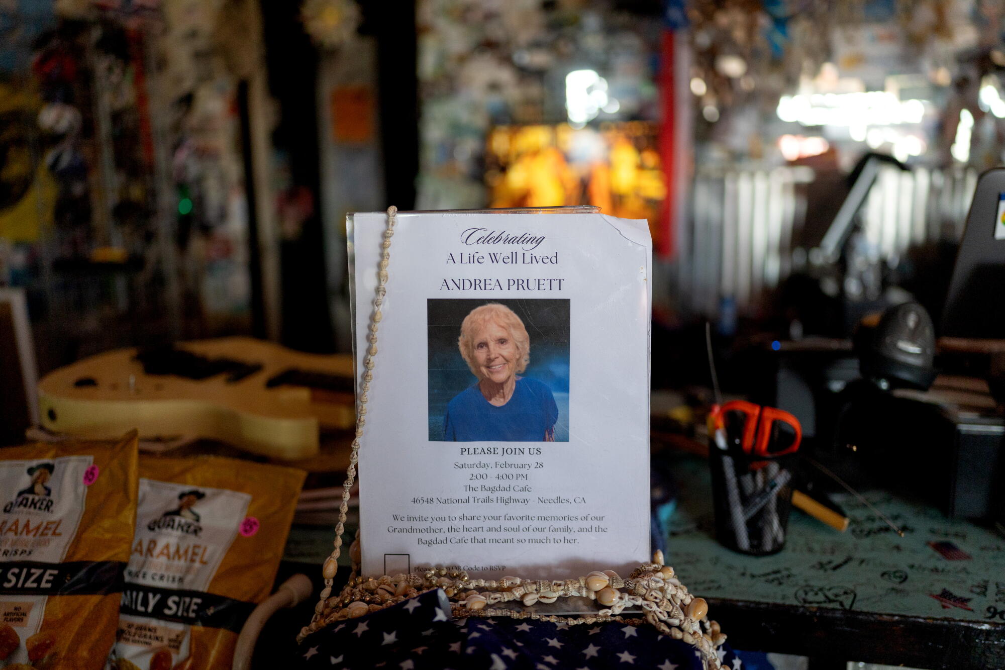
A memorial announcement for owner Andrea Pruett is seen at the Bagdad Cafe on Route 66 in the Mojave Desert.

A memorial announcement for owner Andrea Pruett is seen at the Bagdad Cafe on Route 66 in the Mojave Desert.

As Pruett aged, her grip on reality loosened. But she refused to leave.

Now, the Bagdad Cafe is in limbo. Though T-shirts and tchotchkes are still for sale, the kitchen is closed. And Pruett’s family is figuring out what comes next.

Buses full of Europeans still come. So, too, do the roadtrippers celebrating Route 66, which turns 100 this year.

“We don’t get any locals, and we don’t cook any food right now,” said Mark Bradley, the cafe’s gruff but genial manager. “But we’re definitely on the map to see … it’s magic that takes place here.”

The cafe is a cacophony of color in an expanse of desert brown. Flags from all over — France, Brazil, Japan, New Zealand, Canada — hang from low ceilings. The walls are covered floor to ceiling by visitors’ passport photos and dollar bills with Sharpie signatures. “We’ve been here three times!” an Italian visitor raved in a guest book.

Pruett is still there, too. An urn holding her ashes sits by the front door.

A drone image shows the remote Bagdad Cafe on Route 66 in Newberry Springs.

A drone image shows the remote Bagdad Cafe on Route 66 in Newberry Springs.

In 1995, eight years after the movie’s European premiere, Pruett and her husband, Harold, stopped for burgers at what was then called the Sidewinder Cafe in Newberry Springs, 20 miles east of Barstow. They had just bought 640 acres for an ostrich ranch, which ultimately didn’t work out, though they kept some of the birds as pets.

The owner told them the A-frame, wood-shingled diner was for sale. “My husband looked at me and I said, ‘Don’t even think about it,’ ” Pruett told The Times in 2003.

But their son, actor Harold P. Pruett II — who was 26 and starring that year in a campy erotic horror flick called “Embrace of the Vampire” — declared the cafe “cool,” and that was that.

The Pruetts promptly rechristened it Bagdad Cafe, following German filmmaker Percy Adlon’s lead.

The exterior of the Bagdad Cafe.

The exterior of the Bagdad Cafe.

Nearby Bagdad was a railroad town named in the 1880s by Southern Pacific Railroad officials after the Middle Eastern metropolis — without the H — because of the desert terrain.

Bagdad became a stop for steam-powered trains whose engines needed more water every eight miles or so in the desert climate, said Scott Piotrowski, past president of the California Historic Route 66 Assn.

The bustling little town was also a hub for gold, silver and copper mining camps.

Mining eventually faded, but cars on Route 66 overheated easily and often limped into town for water. A restaurant named, naturally, Bagdad Cafe, owned by a woman named Alice Lawrence, was the only place for miles with a dance floor and jukebox.

When Interstate 40 opened in 1972 about 10 miles north — taking most traffic and tourists away from Route 66 — it was the death knell for Bagdad, where all that remains today is a single scruffy cedar tree.

Two men look at the interior of the Bagdad Cafe on Route 66.

Thierry Farion, left, from France, and Aziz Khechine, right, from Tunisia, look at memorabilia inside the Bagdad Cafe.

At Pruett’s Bagdad Cafe, she embraced the movie. The two female characters, initially wary of each other, are both on a hiatus from their husbands, and the German tourist eventually draws big crowds by performing magic tricks.

“When people came in, it was like a director saying, ‘Action!’ ” said Pruett’s grandson, Greg Landers, 47, of Glassell Park. “She would just go right into welcoming people and telling them to sit down, answering their questions.”

A petite bottle-blonde who spoke with the laid-back drawl of her native Arkansas, Pruett showed off memorabilia signed by the “Bagdad Cafe” director. She got a yellow thermos like the one in the film, which, miraculously, never seems to run out of java, even when the coffee pot is busted.

A guest book displays messages at the Bagdad Cafe.

A guest book displays messages at the Bagdad Cafe.

She kept the jukebox on the movie’s Academy Award-nominated theme song, “Calling You,” recorded by R&B singer Jevetta Steele and covered by Celine Dion, Barbra Streisand, George Michael and others.

The lyrics immortalized the Bagdad:

A desert road from Vegas to nowhere
Some place better than where you’ve been
A coffee machine that needs some fixing
In a little café just around the bend

Pruett’s place drew desert eccentrics, including a gravelly-voiced man dubbed General Bob who sniped at customers who doubted his claims that he designed the Pentagon, built the Golden Gate Bridge, was a brain surgeon and was 109. (“Actually, he’s 83 years old, and if he wants to be older, I let him,” Pruett told NPR in 2003.)

Monaco’s Prince Albert II stopped in once. So did actress Renée Zellweger, who told Jay Leno on “The Tonight Show” that there was a “little old guy, he’s been sitting there for, I think, maybe 45 years on the same barstool. We had chicken fried steak together.”

When Huell Howser popped in unannounced for a 2001 episode of his California road trip show, General Bob, perched at the bar with a fedora atop his long silver hair, proclaimed he was 98 years old and “a real general, not a f—up.”

Marian Box, left, works the counter and talks to visitor Jaelene Kleckner.

Marian Box, left, works the counter and talks to visitor Jaelene Kleckner.

For all the joy, desert life brought plenty of hardship.

One night in the 1990s, not long after Pruett bought the place, she was closing out the cash register when a man walked in, slammed a wooden 2-by-4 on the counter and ordered her to put all the money in a bag.

“She actually had a shotgun under the counter, and she pulled it out and said, ‘Stop,’ and cocked it,” said Landers, her grandson.

The man threw his hands up and said his family was in the car. They had been traveling and ran out of money. Pruett ushered them inside, fed them and sent them away with some cash — after making them wash their own dishes.

Pruett, who gave birth to Landers’ father, Corky, at 15, had a tough and impoverished youth. But she was “kind almost to a fault,” said Landers, a contractor who lived with her for a spell in his 20s and worked in the cafe. People who just about everyone else had given up on — she’d give them a place to stay and work to do.

In February 2002, the younger of Pruett’s two sons, Harold the actor, died of an accidental drug overdose. Her husband died two months later.

Pruett’s love for her customers kept her going, said Bradley, who has been around the cafe for 26 years as a frequent visitor and employee.

“She would have them crying as they left, but happy crying,” he said. “She could do that to people by giving them a hug and in just the few minutes that they were here. She had a magic to her.”

In 2016, Sarah Jane Woodall — a former nude model who posts popular desert travelogues on YouTube under the moniker Wonderhussy — stopped for breakfast and shot a video.

The cafe was quiet and grimy. She loved it.

“It was just, like, a lovable hot mess,” said Woodall, an Army kid who lived for a time in Germany, where people were obsessed with the movie.

The COVID-19 pandemic lockdowns devastated the Bagdad Cafe — and Pruett, who turned 80 in the summer of 2020.

The Europeans disappeared. Vandals busted the windows. Pruett let go of her waiters. Her kitchen closed and never reopened.

A sign for a former motel next to the Bagdad Cafe on Route 66 in Newberry Springs.

A sign for a former motel next to the Bagdad Cafe on Route 66 in Newberry Springs.

In 2021, her house burned down. She slept in the cafe, her thin frame curled up in a red vinyl booth.

That summer, Léa De Carmo, an aspiring actress, was driving back to Los Angeles from Las Vegas with a friend and, after a night of partying, craved a cup of coffee. They pulled into the Bagdad Cafe, where — as in the movie — the coffee pot was broken.

De Carmo, a native of Paris who had never seen the film, was stunned when she opened the door and “saw French flags and soccer team stuff everywhere.”

“It seems like all the French are led there for one reason or another,” said De Carmo, 29, who talked to Pruett that day for over two hours.

“She had essentially lost everything — her business, her house — but she just had this incredible energy and warmth and humor,” De Carmo said. “There was also this very deep loneliness.”

For the next four years, De Carmo drove from L.A. to Newberry Springs dozens of times, filming Pruett for a just-finished documentary called “The Keeper of Bagdad Cafe,” about her final years in the crumbling diner.

In the film, friends help Pruett move into an RV in the parking lot. As a woman gently washes her white hair with bottled water behind the cafe counter, Pruett says she can’t remember where she’s from.

“One thing she never forgot was the cafe,” De Carmo said. “She always knew where she was and that it was the place she wanted to be.”

Landers said his father, who died in 2022, asked her to move in with him in L.A., but she didn’t want to leave the Bagdad.

“It was just hard,” said Landers, who added that she might have fared better, physically, at least, in a dementia care facility. But she repeatedly said, “No, this is my place. This is where I want to be.”

Pruett’s friends in the desert stepped up. Bradley took care of her and the cafe, opening it each day for tourists to come in and take photos.

In 2023, Tropical Storm Hilary pummeled the diner’s old roof. Water poured in.

Woodall returned at the cafe’s request, filming the stained, decaying ceiling and the water-catching buckets and coffee pots on the floor. The YouTuber’s fans raised more than $25,000 — enough for a new roof.

In the video, Pruett stood by, smiling, quiet, a little confused.

For the next three years, she stayed at the Bagdad, even as her memory continued to fade. She died this January at 85.

On a Friday morning this summer, with the outside temperature already 115 degrees, Matt Parker stood behind the worn green Formica counter, setting a smart TV to the movie and preparing to make Nescafé instant coffee — a favorite of Europeans.

On a good day, they get three tour buses, he said.

Parker, 53, moved from L.A. County to Newberry Springs — where he used to camp with his dad and ride dirt bikes as a kid — a few years ago and fell in love with the cafe.

“You can’t recreate this,” he said. “We’re just caretakers of it. It’s a museum and church, in a sense, with all this stuff. Mrs. Pruett really focused on protecting it, protecting these people’s stuff — their mark.”

An urn is seen near the entrance of the Bagdad Cafe on Route 66.

Andrea Pruett’s urn near the entrance of the Bagdad Cafe, which she ran for three decades.She died in January.

Landers said that, while the family figures out what to do with the cafe, he asked Bradley to keep it open like his grandma did.

Though her urn remains in the place she loved most, Landers hopes, someday, to bury her ashes in the Hollywood Forever Cemetery next to her youngest son.

Since her death, he can’t help but think of a scene from the movie. The German woman — forced to leave after her tourist visa expires — is gone and the bustling restaurant quiet again. A customer walks in and asks where the magic shows went.

A snoozing employee sits up and says: “The magic? It’s gone.”

In the end, the German returns to the Bagdad Cafe. And so do the crowds.

Source link

Popular San Diego hiking spot begins months-long closure

Torrey Pines State Natural Reserve, which includes some of the most dramatic sandstone sea cliffs and oceanfront trails in Southern California, closed Monday for utility upgrades. Reopening is scheduled for March 2027.

The closure covers cars, cyclists and walkers. The 1,750-acre Torrey Pines reserve, located north of La Jolla and south of Del Mar in San Diego County, attracts an estimated 4 million visitors yearly. Its population of Torrey pine trees is one of just two spots in the U. S. where that species is found. (The other is Channel Islands National Park’s Santa Rosa Island, where a fire in May killed much of the Torrey pine population.)

Meanwhile, next door to the natural reserve, Torrey Pines State Beach remains open. Visitors can still park at the North Beach and South Beach parking lots and walk to that 4.5-mile stretch of sand, much of it at the foot of 300-feet cliffs.

State parks officials said in a release that the improvement project includes installation of new gas, water, wastewater and communication lines, along with accessibility upgrades.

Source link

The massive European camping resort named the best by mums with Tiki water complex and 40-ride theme park

EUROCAMP has hundreds of resorts across Europe – but there is one that has been backed by mums as being the best.

Found in Holland, Duinrell has a lot to shout about including a theme park as well as a huge indoor and outdoor waterpark.

Eurocamp Duinrell in the Netherlands has a huge theme park that’s free for guests Credit: Eurocamp
It also has an indoor and outdoor waterpark Credit: Eurocamp

With all this, it’s no surprise that it’s one of the top-rated Eurocamp resorts for families – and it was voted as such on Mumsnet.

Its main draw is the enormous theme park which is completely free for guests with over 40 rides and attractions.

It has high thrill rollercoasters like The Falcon which is 72 feet tall with vertical drops, loop the loops and a top speed of 43mph.

There are other more family-friendly rides like log flumes, bumper cars, slides and climbing towers.

TOP STAYS

Best-rated UK hotels as voted for by guests – with rooms from just £31 a night


ISLE BE GOING

Sun Travel’s favourite islands from Europe’s Caribbean to a £2 wine paradise

Something else that makes it so popular is the enormous waterpark which has a total of 21 waterslides and huge swimming pools which are both indoor and outdoors.

The complex has a lazy river, a wave pool and an outdoor Tiki pool with tipping buckets and fountains which is open in the summer months.

Inside is where families will find the Playa waterpark which is especially designed for little kids up to 12 years old, with four waterslides for children.

Guests will need to pre-book time slots and pay up to €15 (£12.88) per person for the waterparks.

Activities don’t stop there either, as families can spend hours in its arcade which has over 80 games.

There’s mini golf, air hockey, classic arcade games, including eight immersive racing simulators.

The outdoor pools and slides are open during the summer months Credit: Eurocamp

In the comments, one previous visitor wrote: “We love Duinrell…I would do at least a week as loads to do.”

Another added: “This is an absolutely brilliant place!! Everything about it is spot on! Between the accommodation and the theme park, it’s all fantastic.”

A third said the waterpark was the “best we’ve been to!”

The park has eating options too from a creperie to an Italian restaurant and at the bars there’s entertainment like discos, karaoke and talent shows.

As for a place to stay the Eurocamp has a selection of ultimate holiday homes which can sleep up to eight across three bedrooms.

They have fully kitted out kitchens with open living areas and spacious bedrooms.

All of its attractions mean Duinrell has been declared the best for families Credit: Eurocamp
You can stay in Duinrell Eurocamp from £23.70pppn Credit: Unknown

When the sun shines there’s an outdoor decking and a barbecue too.

For eight people to stay in an Ultimate 3-bedroom cabin next May for seven-night works out to £1,327.48 or £23.70pppn.

The Eurocamp is just outside The Hague, meaning that luckily for Brits it’s very easy to get to as it sits in between Amsterdam and Rotterdam.

Flights to Rotterdam can be as quick as 50-minutes and heading to Amsterdam can take just one hour.

The cities can also be reached by the Eurostar in three hours and 15 minutes.

For more Eurocamp resorts, here are 10 with pools, waterparks and beaches.

And this Eurocamp in France has a huge kids club and laid back vibes.


Source link

The Nepal floods question: When the Himalayas collapse, who gets warned? | Climate Crisis News

New Delhi, India – On the morning of August 26, the Himalayan landscape above Nepal’s Rasuwa district changed in minutes.

A mass of ice and rock broke loose high in the mountains and sent a violent surge of water, mud and debris down the Lhende Khola River. The torrent travelled through valleys, swept away settlements and infrastructure and eventually reached the Nepal-China border.

What followed was not simply a flood.

It was a chain reaction.

By mid-September, more than 1,400 people had been reported dead and at least 6,000 remained missing in Nepal and across the border in Tibet. Twelve hydropower plants were destroyed, while roads, bridges and homes were buried or washed away.

The scale of the destruction has left scientists and disaster managers confronting a difficult question: How do you warn communities about a disaster whose trigger may occur high above them, in terrain that is difficult to monitor and where there may be only minutes to react?

Basanta Raj Adhikari, director of the Centre for Disaster Studies at Tribhuvan University in Kathmandu, described the event to Al Jazeera as unprecedented in size, affected area and mechanism. His estimate suggested that the energy involved was greater than that released by the Hiroshima atomic bomb, a comparison intended to illustrate the scale of the physical forces involved rather than suggest that the event was equivalent to a nuclear explosion.

For scientists who study the Himalayas, the disaster demonstrated how quickly an event originating in a remote, high-altitude environment can become a regional catastrophe.

And Nepal is not alone.

The warning problem

A warming climate is altering glaciers, snow cover, permafrost and high-altitude lakes. At the same time, roads, hydropower projects, tourist facilities and settlements have pushed deeper into mountain valleys.

That combination is creating a new risk landscape in which one hazard can trigger another.

An avalanche can block a river. A blocked river can form a temporary lake. A sudden release can become a debris flow. That debris can destroy a road or bridge, block another river and create another flood downstream.

The August disaster in Nepal showed how quickly such a sequence can unfold. It also exposed a weakness in the way early-warning systems are often designed.

Many systems are built around a particular hazard: rainfall, river level or glacial lake outburst flood. But the Himalayas do not always respect those categories.

In July, the International Centre for Integrated Mountain Development, or ICIMOD, warned that a below-normal monsoon should not be interpreted as a safer one.

“The biggest misunderstanding is that less seasonal rainfall means lower flood risk,” said Saswata Sanyal, a disaster risk reduction specialist at ICIMOD.

“A drier monsoon can still be a dangerous monsoon,” he added, warning that seasonal averages cannot capture the cloudbursts capable of producing catastrophic flooding in mountain valleys.

The Nepal disaster went a step further.

The immediate trigger was not simply heavy rainfall.

Scientists have been examining an ice-rock avalanche and other possible processes that temporarily obstructed the river system before releasing a destructive surge. ICIMOD has described the event as an ice avalanche rather than a conventional glacial lake outburst flood, while other scientists have examined the role of local seismic activity and other high-altitude processes.

That distinction matters.

A warning system waiting for rainfall or a rising river may not provide enough time when the real trigger happens several kilometres upstream and above the line of sight of the communities below.

Indian National Disaster Response Force (NDRF) personnel conduct a search and rescue operation at the site of a flash flood at a village in the Kishtwar district of Indian-administered Kashmir on August 16, 2025 [AFP]

Kashmir’s warning signs

Thousands of kilometres away, scientists studying Kashmir’s Himalayas are seeing another part of the same problem.

A study published in the Journal of Glaciology this year mapped 155 glacial lakes above 2,500 metres (8,200ft) across the Himalayas in Indian-administered Kashmir.

The researchers found that the area of ice-contact proglacial lakes – bodies of water that form directly against the margin of a melting glacier, trapped by moraine ridges, bedrock basins, or ice dams – had increased by 26 percent between 1992 and 2024.

Five lakes were classified as having very high susceptibility to glacial lake outburst floods.

An outburst from those lakes, the researchers found, could threaten several thousand buildings, 15 major bridges, roads and a hydropower project.

More significantly, the study warned that hazards could occur in chains, with an upstream lake outburst potentially triggering secondary events downstream.

For Irfan Rashid, a glaciologist and associate professor at the University of Kashmir who co-authored the study, the implications extend beyond individual lakes.

Rashid recently told Al Jazeera that without action, the melting, thinning, and destabilisation of glaciers, seasonal snow cover, and permafrost along the Hindu Kush-Himalayas system would increase, and water shortages could become a major problem across the Upper Indus, Ganga and Brahmaputra basins by the end of the century.

That is why the Nepal disaster resonates in Kashmir.

The landscapes are different, the rivers are different and the individual hazards may differ. But the underlying problem is increasingly similar: Communities living downstream of a rapidly changing high-altitude environment may have little time to respond when something breaks loose above them.

The challenge is particularly acute in places where roads, bridges and hydropower projects occupy narrow valleys.

Once a mountain river begins carrying enormous quantities of rock, ice and mud, infrastructure designed for conventional floods can quickly become irrelevant.

Volunteers rescue flood-affected victims along with their livestock using a boat following heavy rains and overflowing of the Sutlej river, on the outskirts of Multan in Punjab province, Pakistan on September 4, 2025.
Volunteers rescue flood-affected victims along with their livestock using a boat following heavy rains and overflowing of the Sutlej River, on the outskirts of Multan in Punjab province, Pakistan, on September 4, 2025 [Shahid Saeed Mirza/AFP]

Pakistan has already begun building a warning network

The same concern runs across the western Himalayas and Karakoram ranges.

The Gilgit-Baltistan region in Pakistan-administered Kashmir contains hundreds of glaciers and glacial lakes, while communities and infrastructure sit along valleys exposed to sudden floods and landslides.

Pakistan has responded by expanding early-warning infrastructure.

Under a United Nations-supported programme, early-warning systems, evacuation shelters, disaster-management centres and other protective measures have been established in vulnerable valleys.

But technology alone cannot solve the problem. A sensor can detect a change. Someone still has to receive the message. Someone has to understand what it means. And people downstream have to have a route to safety.

That last part is often the weakest link. A siren is useful only if the people hearing it know where to go. An automatic warning is useful only if it arrives before the flood. A satellite image is useful only if the information can be converted into a decision quickly enough to save lives.

This is why disaster scientists increasingly talk about anticipatory action rather than simply disaster response.

“The era of preparing for a single, predictable hazard is over,” Sanyal said earlier this year. “Anticipatory action and early warning must now be the foundation.”

Nepal army soldiers work during a search and rescue operation outside a tunnel near the Hydropower Project sites, following deadly flash floods and mudslides, in Rasuwa district, Nepal, in this handout obtained by Reuters on September 1, 2026. Nepal Army/Handout via REUTERS THIS IMAGE HAS BEEN SUPPLIED BY A THIRD PARTY. MANDATORY CREDIT. NO RESALES. NO ARCHIVES.
Nepal army soldiers work during a search and rescue operation outside a tunnel near a hydropower project site, following deadly flash floods and mudslides, in Rasuwa district, Nepal, on September 1, 2026 [Reuters]

The infrastructure trap

The Himalayas are also becoming more heavily engineered.

Hydropower is central to Nepal’s economy. Roads are being expanded. Border crossings are growing in importance. Tourism is pushing deeper into remote valleys.

The benefits are obvious. So are the risks.

The August disaster struck an area where hydropower infrastructure was concentrated along the river corridor. At least 900 workers were believed to have been inside tunnels and other facilities in the aftermath, making rescue operations extraordinarily difficult. Two workers were eventually pulled alive from a hydropower tunnel nine days after the disaster.

The question is no longer simply whether infrastructure can withstand a flood. It is whether planners have adequately considered what happens when a flood is carrying an enormous mass of rock and ice, when a river changes course, or when one mountain hazard triggers another.

For decades, engineering risk assessments have often relied on historical records. But history becomes a less reliable guide when the physical conditions producing disasters are changing.

A river that flooded once every several decades may no longer behave according to the same pattern. A glacier that appeared stable from satellite imagery may sit beneath an increasingly unstable slope. A lake that was considered remote may suddenly become a threat to a road, village or power plant hundreds of metres below.

Relatives of victims and missing people react outside the morgue of the Tribhuvan University Teaching Hospital (TUTH), in Kathmandu, Nepal, August 29, 2026
Relatives of victims and missing people react outside the morgue of the Tribhuvan University Teaching Hospital (TUTH), in Kathmandu, Nepal, August 29, 2026 [Narendra Shreshtha/EPA]

The border problem

There is another complication that no satellite can solve on its own.

Borders.

The Himalayas are divided among countries with different political systems, security concerns and approaches to sharing information. But rivers do not stop at international boundaries. Neither do floods.

The August disaster reached the Nepal-China border and damaged the Gyirong crossing, an important trade and pilgrimage route. The disaster also raised questions about how quickly information about hazards in high mountain areas can move between countries.

This is where regional cooperation becomes more than a diplomatic slogan, experts say. A sensor positioned in one country can provide warning to people in another. A satellite image collected over one mountain range can reveal a developing hazard that threatens a valley downstream. A river gauge can provide critical information before floodwaters reach a settlement.

The technical capability already exists in many cases. The missing piece is often the architecture connecting it.

A 2026 assessment of Himalayan disaster risks has argued for stronger monitoring, early-warning systems and regional coordination because hazards are increasingly interconnected.

The idea is simple: Information about a mountain hazard should not stop at the same line where a political boundary begins.

Buildings are inundated after flash floods triggered by sudden heavy rainfall swamped Rangpo town in Sikkim, India, Friday, October 6, 2023
Buildings are inundated after flash floods triggered by sudden heavy rainfall swamped Rangpo town in Sikkim, India, Friday, October 6, 2023 [Prakash Adhikari/AP Photo]

From Nepal to Sikkim to Kashmir

The August disaster in Nepal isn’t a tragedy belonging to one country, point out experts.

The Kashmir Himalayas study has already identified lakes capable of producing destructive outburst floods and has warned of cascading processes.

Northeast India’s Sikkim provides another example.

After the 2023 South Lhonak glacial lake outburst flood killed dozens and damaged major infrastructure, India expanded monitoring and mitigation efforts.

Today, 40 high-risk glacial lakes have been identified in Sikkim, including 16 placed in the highest-risk category, with authorities working on drainage, flood-retention and other protective measures.

But the lesson from each disaster is broadly the same: Waiting for a disaster to prove the risk is the most expensive form of preparedness.

The world's second largest mountain, the 8,611 meter high K2 (seen in the distance), and the 8,051 meter high Broad Peak (R), are illuminated by the moon at Concordia, the confluence of the Baltoro and Godwin-Austen glaciers, in the Karakoram mountain range in Pakistan September 7, 2014. While other parts of Pakistan and northern India were flooded, Concordia in the Karakoram mountain range was covered with a seasonally unusual amount of snow. Geographically, Pakistan is a climbers paradise. It rivals Nepal for the number of peaks over 7,000 meters and is home to the world's second tallest mountain, K2, as well as four of the world's 14 summits higher than 8,000 meters. In more peaceful times, northern Pakistan's unspoilt beauty was a major tourist draw but the potentially lucrative industry has been blighted by years of violence. The number of expeditions has dwindled, wrecking communities dependant on climbing for income and starving Pakistan's suffering economy of much-needed dollars. Picture taken September 7, 2014. REUTERS/Wolfgang Rattay (PAKISTAN - Tags: SOCIETY ENVIRONMENT TRAVEL TPX IMAGES OF THE DAY)
The world’s second largest mountain, the 8,611-metre- (28,251ft-) high K2 (seen in the distance), and the 8,051-meter- (26.414ft-) high Broad Peak (R), are illuminated by the moon at Concordia, the confluence of the Baltoro and Godwin-Austen glaciers, in the Karakoram mountain range in Pakistan, September 7, 2014 [Wolfgang Rattay/Reuters]

The Third Pole test

The Himalayas are sometimes called the Third Pole because they contain one of the world’s largest concentrations of snow and ice outside the Arctic and Antarctic.

Major Asian rivers depend on water originating in these mountains. Hundreds of millions of people live downstream.

That makes the changing Himalayas not only an environmental issue but a security, infrastructure and humanitarian one.

The August disaster demonstrated the most frightening version of that future. A mountain can collapse without warning. A river can become a weapon of debris. A hydropower tunnel can become a trap. A border crossing can disappear in minutes. And by the time people downstream understand what is happening, the water may already be there.

It’s a future that a region stretching from northeast India, spanning Tibet, Nepal, Kashmir and Pakistan, can no longer ignore. Yet disaster management remains largely divided by national boundaries. That contradiction is becoming harder to navigate.

The next glacial collapse could begin in Kashmir. It could begin in Pakistan’s high mountains. It could begin in Sikkim, Nepal or Tibet.

Wherever it starts, the same question will follow the mountain downstream: Who knew, how early did they know, and did the warning reach the people in time?

For a region entering an era of increasingly complex mountain hazards, that may be the real measure of whether the Third Pole is prepared.

Source link

3 Los Angeles area hikes with water after the September rains

Hikers trekking along trails around Los Angeles know that, by late summer, most creeks and rivers have dried up for the season.

However, recent rainfall across Southern California has replenished our waterways just enough to bring back a little of their spring and early summer glamour.

In this week’s edition of The Wild, our weekly outdoors newsletter, I will highlight three L.A. trails where you can still find water flowing, offering a cool relief in a year when L.A. residents are sick of humidity, heat and high electric bills.

You are reading The Wild newsletter

Sign up to get expert tips on the best of Southern California’s beaches, trails, parks, deserts, forests and mountains in your inbox every Thursday.

Before heading out, here are a few things to remember:

  • Familiarize yourself with what poison oak looks like, as it will be prominent on all of these trails. Its leaves this time of year range from glossy green to red, orange and yellow.
  • Practice seven Leave No Trace principles, including never leaving anything behind such as toilet paper or orange peels.
  • Rocks and boulders in and along creeks will often be slippery from years of erosion. Take good care when climbing them or using them for leverage as you traverse an area.
  • Wear insect repellent. Mosquitoes and ticks are both found along the routes below.
  • Riparian habitats, like creeks flowing through canyons, are home to sensitive creatures including California newts, frogs and toads. Take good care to watch where you’re stepping, ensuring you aren’t crushing one of these little sweeties as you tromp along.

Now that we’ve all agreed to recreate responsibly, let’s talk about those hikes!

Within a canyon of smooth light orange-ish tan rocks, there's a trickling waterfall and small cave with green ferns.

The Santa Ynez waterfall is an 18-foot cascade through a canyon carved by water for thousands of years.

(Jaclyn Cosgrove / Los Angeles Times)

1. Santa Ynez Waterfall Trail

Distance: 2.2 miles out and back
Elevation gained: About 200 feet
Difficulty: Easy in the beginning with technical aspects near the falls
Dogs allowed: No
Nearest to: Pacific Palisades
Accessible alternative: Inspiration Loop Trail at Will Rogers State Historic Park

The Santa Ynez waterfall trail is a 2.2-mile journey along Santa Ynez Creek in Topanga State Park, shaded by large sycamores, oak trees and the canyon’s walls. You’ll notice a small cave-like structure in the canyon wall shortly upon starting the hike. Unfortunately, other visitors have carved into its sides. Don’t be one of them.

To begin your hike, you will park along Vereda de la Montura. Note that parking isn’t allowed daily between 8 p.m. and 6 a.m.

A small cave-like structure in Santa Ynez Canyon in Topanga State Park.

A small cave-like structure in Santa Ynez Canyon in Topanga State Park.

(Jaclyn Cosgrove / Los Angeles Times)

I thought I was in the wrong place when I first pulled up, given the trailhead sits in the middle of a neighborhood. I walked northwest along the street and found an open gate with stairs leading down. This is where you’ll start the trail.

I was immediately reminded of Sullivan Canyon (which is about 3 miles away, as the crow flies), as the two canyons feature rocky canyon walls and tall old trees. There are a few times when the trail splits off and returns to itself. Just over half a mile in, though, the trail splits in two, with Santa Ynez Canyon Trail to the west (or left) and the waterfall trail, which you will take to the north or northwest-ish.

A dirt path surrounded by green grasses and shrubs meanders past oak trees that grow straight and at angles.

A lush tree canopy provides shade in Santa Ynez Canyon as hikers head to the waterfall.

(Jaclyn Cosgrove / Los Angeles Times)

The first mile of this trail is primarily a nice stroll northward along a creek, the ground covered in green and brown leaves. However, just over a mile in, if you want to see the waterfall and small cave next to it, you will need to scramble up a large boulder and then rock hop through the creek. As of last week, there was a rope to aid hikers upward. (On my way down, I unintentionally slid quickly down the rock, feeling every peddle in the tuchus until I landed feet first in the creek — so take your time here.)

The waterfall isn’t roaring at the moment, but I found the trickling sound of water soothing. It’s also a geologically interesting area to look around, as the water has carved out the canyon walls into interesting shapes (and created a small cave near the waterfall).

A shallow creek runs through a narrow canyon with high smooth curved walls

The walls of Santa Ynez Canyon were carved by water, wind and time over centuries.

(Jaclyn Cosgrove / Los Angeles Times)

As I was heading back from the falls, I noticed several bees circling an area high in the canyon wall where it appeared they’d built a nest. Pack accordingly if you are allergic to bee stings.

The top of a canyon with large rock formations and green leafy trees.

Slow down and look up as you hike through Santa Ynez Canyon, taking the opportunity to observe rock formations, plants and reptiles.

(Jaclyn Cosgrove / Los Angeles Times)

I only saw three other people along the trail while there on a weekday. I was mostly alone, though, listening to the wrentits and spotted towhees as blue dragonflies darted to and fro.

A wide shallow creek with clear water and several small rocks submerged with lush forest around the creek.

Cold Creek in the Cold Creek Valley Preserve near Calabasas.

(Jaclyn Cosgrove / Los Angeles Times)

2. Cold Creek Trail

Distance: 2.2 miles out and back (with option to extend)
Elevation gained: About 300 feet
Difficulty: Easier end of moderate
Dogs allowed: Yes
Nearest to: South of Calabasas
Accessible alternative: Nicholas Flat ADA Trail

The Cold Creek Valley Preserve, cared for by the TreePeople Land Trust, is a shady riparian habitat near Calabasas with a gently flowing creek that features multiple short cascades. The land was saved from development by several local residents and nonprofits, including Timothy B. Schmit, bass player for the Eagles.
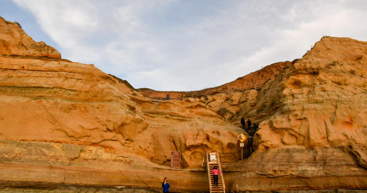
The preserve features multiple public hiking routes, including the Cold Creek Trail.

“Located on an ancient trade route, the [I]ndigenous people of Southern California have used the area for hunting and settlement for generations, leaving a lasting influence visible on the land,” according to TreePeople. “The perennial Cold Creek is the keystone feature of the area, one of the cleanest free-flowing streams in the Santa Monica Mountains.”

Tree branches covered in short creek leaves hang over a dirt trail through the forest.

The tree canopy along the Cold Creek Trail in the Cold Creek Valley Preserve provides a shady cool environment for hikers.

(Jaclyn Cosgrove / Los Angeles Times)

To begin your hike, you’ll park in a bumpy dirt lot just off Stunt Road. Be mindful as you near the trailhead, as there will likely be construction crew members in the area. They’re working to install rumble strips and other infrastructure to slow down drivers and hopefully improve traffic safety.

At the start of the trail, you’ll find a portable toilet near the gate. You’ll walk southeast for a short bit before rounding the curve of the trail. You’ll officially be transported into this sylvan sanctuary (although I could admittedly still hear the construction workers communicating on their walkie-talkies).

The trail mostly runs parallel to Cold Creek, which you will hear flowing and have the opportunity to sit near at multiple points along the route, including on a few wooden benches. The trail crosses the creek about four times, but it isn’t overly technical to maneuver.

Golden rays of sun cast over a tall green tree above a shady path.

The Cold Creek Valley Preserve is open from sunrise to sunset.

(Jaclyn Cosgrove / Los Angeles Times)

About half a mile in, the trail intersects with Lower Stunt High Trail. You can continue northwest along the creek. You will find another option, the Yucca Trail, just under a mile into your hike, a nice .68-mile loop through the preserve.

The park, open from sunrise to sunset, offers a sweet reprieve from the sun and is a great spot to take a deep breath and meditate in the woods.

The Gabrielino Trail is a multi-use trail frequented by hikers, bikers and horseback riders.

The Gabrielino Trail is a multi-use trail frequented by hikers, bikers and horseback riders.

(Jaclyn Cosgrove / Los Angeles Times)

3. The Gabrielino National Recreation Trail (multiple segments)

Distance: 28.8 miles
Elevation gained: About 6,000 feet
Difficulty: Challenging when done in its entirety
Dogs allowed: Yes
Nearest to: Arcadia and Pasadena, depending on the trailhead
Accessible alternative: Gabrielino Trail starting near North Windsor Avenue near Altadena

The Gabrielino National Recreation Trail is a 28.8-mile journey through the San Gabriel Mountains. Most thru-hikers start the trail at Chantry Flat and take the trail on a squiggly N-shaped journey all the way to its western trailhead near NASA’s Jet Propulsion Laboratory near Pasadena.

However, it isn’t necessary to take the entire Gabrielino Trail to enjoy its beauty. The trail has several entry points, offering short day trips, including the following, which run parallel to at least one local creek or river:

Regardless of where you go, I hope you enjoy our last weekend of summer. That’s right: Summer ends Tuesday! Hopefully that means it soon feels like autumn in L.A.

A wiggly line break

3 things to do

Three people with tote bags walk along the sand near a pier with colorful buildings.

Volunteers walk down the beach at a Heal the Bay coastal cleanup event in 2024 with Water for L.A.

(Heal the Bay)

1. Clean up public lands around L.A.
Heal the Bay will host L.A. County’s annual coastal cleanup day from 9 a.m. to noon Saturday in more than 60 sites. Participants should consider wearing closed-toe shoes and sun protection. Cleanup supplies will be available at sites but will run out at popular sites. Volunteers can pick a beach, river, park or trail near them by visiting support.healthebay.org.

2. Portray a bird of prey in San Dimas
The San Dimas Canyon Nature Center will host a guided sketch experience from 6 to 7 p.m. Friday at 1628 Sycamore Canyon Road in San Dimas. Participants will learn how to draw a red-tailed hawk. Learn more at the center’s Instagram page.

3. Learn dangers from rangers in Newbury Park
Hikers can bring their four-legged besties to Rancho Sierra Vista/Satwiwa from 9 a.m. to noon Saturday for a B.A.R.K. Rangers event where rangers will educate dog owners on how to safely and responsibly enjoy public lands. Rangers will also conduct a special swearing-in ceremony, complete with a Santa Monica Mountains National Recreation Area B.A.R.K. Ranger badge, for pups who complete certain challenges. Learn more at eventbrite.com.

A wiggly line break

The must-read

A silver gray-colored great white shark swims through shimmering turquoise waters.

A juvenile great white shark in Hermosa Beach in April, seen via drone.

(CSULB Shark Lab)

Yes, El Niño morphed our city’s usually pleasant Mediterranean climate into the largest hot yoga class in L.A. But did you know it has also resulted in our ocean water being warm enough to attract animals not usually seen along our coastline? Those fishing off the Malibu Pier were surprised in mid-August by a hammerhead shark swimming nearby. A giant whale shark was recently documented by a fish spotter between Malibu and one of the Channel Islands, a species that prefers warmer waters (and is the largest known fish on the planet). And in line with our predicted “sharky summer,” a juvenile great white shark was spotted a bit close to a swimmer off the coast of Santa Barbara. The best news is: Nothing bad has happened to any humans or animals during these visits, underscoring how well we can co-exist with these beings, despite our fears of them.

Happy adventuring,

Jaclyn Cosgrove's signature

P.S.

More and more wildlife lovers are heading into public lands for “recreational herping,” the practice of looking for amphibians and reptiles. Conservation photographer Mario Ramos recently raised concerns via his Instagram page about how the increase is leading some folks to unintentionally harm the animals they seek to observe. “A harsh truth about field herping is that our interactions with wild herps are often stressful and potentially detrimental to the animals, no matter how you frame it,” Ramos wrote. Ramos then outlined how to ethically look for animals that slither and slide in the wild. Always respect the locals, folks!

For more insider tips on Southern California’s beaches, trails and parks, check out past editions of The Wild. And to view this newsletter in your browser, click here.


Source link

Former U.S. Sen. Jon Kyl of Arizona, a ‘workhorse’ who shaped water policy, dies at 84

Former U.S. Sen. Jon Kyl, a longtime Republican lawmaker from Arizona who shaped landmark water policies in the U.S. West and guided the confirmation of Supreme Court Justice Brett Kavanaugh, has died. He was 84.

Kyl died Wednesday night from a neurological disorder, said Gordon James, a communications professional who is a longtime friend of the Kyl family. Kyl had withdrawn from public life in December 2025 after announcing he had been diagnosed with dementia.

Kyl spent almost three decades in Congress, serving in both chambers, and watched his party undergo a drastic transformation, with his career spanning Ronald Reagan’s presidency to President Trump’s first term.

Former Republican Arizona Gov. Doug Ducey, who considered Kyl a mentor, described the former senator in a February 2025 interview with the Associated Press as a true statesman and a “workhorse” among Washington, D.C.’s “showhorses.”

“If you saw him on the plane, he was sitting in the aisle, in coach, and he was reading,” Ducey said. “And he was reading potential bills or Senate business.”

Kyl returns briefly to Senate to fill McCain seat

Kyl rose to a leadership position during his last full term in the Senate, when his Republican colleagues selected him as minority whip. After retiring from politics in 2013 and becoming a lobbyist, Kyl returned to Congress briefly in 2018, when Ducey appointed him to fill the vacancy left by the late U.S. Sen. John McCain.

His appointment drew high praise from Trump, who said he was looking forward to working with “the extraordinary senator.” Kyl stayed for less than four months before rejoining lobbying firm Covington and Burling.

“At the federal level, and I regret to say that this is the case, but probably a lot of my better achievements were in preventing bad things from happening (rather) than forcing good things to happen,” Kyl said in a 2012 conversation with former U.S. Supreme Court Justice Sandra Day O’Connor.

Lawyer with expertise in water gets elected

Kyl was born in Oakland, Nebraska, on April 25, 1942, and grew up in a rural farming district in Iowa that his father represented in the U.S. House. At 18, he headed southwest to attend the University of Arizona, where he met his wife, Caryll, and earned a law degree.

Before being elected for the first of his four terms in the House in 1987, Kyl was a key participant in shaping Arizona’s 1980 groundwater code as a lawyer representing a large water utility. The first-of-its-kind code created a regulatory framework for managing groundwater in the drought-stricken state, largely centering on the state’s population centers, including Phoenix and Tucson.

In 2004, Kyl authored legislation that provided one of the largest tribal water rights settlements, which, after a decades-long battle, gave the Gila River Indian Community enough water to fill nearly 313,500 Olympic-sized swimming pools annually. Republican U.S. Sen. Mitch McConnell of Kentucky, who later served as majority leader, called Kyl’s work ethic “legendary” in a 2012 floor speech and said Kyl had labored mostly behind the scenes for 15 years to advance the settlement.

“It was one of the hardest things I’ve ever done, but I was in a position to be the catalyst,” Kyl told the Phoenix New Times in a 2006 interview. “There wasn’t anybody else who could do that water deal. And it had to be done.”

Arizona State University’s Kyl Center for Water Policy takes its name from him. Its director, Sarah Porter, said Kyl was generous with his time and an effective member of the state’s congressional delegation who took a practical approach to water policy. “He’s always sort of cared about the public good and been able to think about, ‘What will this mean for the generations to come?’” Porter said, adding that Kyl remained “quite a dynamo” until recent years, as his wife battled health problems.

‘Giant’ in the Senate kept Republican caucus together

Ducey said Kyl was a “giant” in the Senate, further describing him as serious, engaging, forthright and thoughtful. His biggest impacts, Ducey said, came from the way he kept the Republican caucus together in opposition to Obamacare and his staunch support of Israel.

Kyl also backed legislation to authorize construction of a fence stretching hundreds of miles along the U.S.-Mexico border. He later joined with Democrats to support a bill that would provide a path to citizenship and temporary guest-worker status for those in the U.S. without authorization. The proposal ultimately failed.

As a lobbyist, Kyl helped guide the confirmation of Trump-picked U.S. Supreme Court Justice Brett Kavanaugh. When Kyl returned to the halls of Congress in 2018, he was known as Kavanaugh’s chief Sherpa — an informal but widely known term for a nominee’s guide to the political tundra in the Senate.

In a statement disclosing his dementia diagnosis, Kyl harkened back to the words of Reagan, when the former president revealed his own Alzheimer’s diagnosis and said he was starting a journey that would lead him to the end of his life.

Kyl said he shared Reagan’s confidence for Arizona and the nation’s future, and that despite his diagnosis, he was a “very fortunate man.”

Billeaud writes for the Associated Press. Former Associated Press writer Sejal Govindarao contributed to this report.

Source link

‘Water for Elephants’ at the Pantages is a circus in a play

It’s never too late to run away and join the circus.

That’s a major theme of the Tony-nominated musical “Water for Elephants,” and living proof is on stage at the Hollywood Pantages Theatre an hour before the curtain rises on opening night. The show — about a traveling circus — boasts an ensemble with as many acrobats as actors, all of whom must warm up prior to performing. This nightly routine is a show in and of itself, with acrobats stretching, tumbling and throwing one another in the air. Another ensemble member is juggling nearby as someone spins in a giant hoop at an unnatural speed.

The night includes a special treat: The company is breaking in a new piece of equipment known as the Chinese pole, a nearly 20-foot-high cylinder the performers climb up, slide down and generally defy laws of gravity on. This pole won’t be used just yet — it arrives with a texture that can be slick or uneven, so the troupe must spend a couple weeks prepping it for better gripping and friction.

An acrobat rolls in a hoop onstage.

Adam Fullick, of the touring production of Broadway’s “Water for Elephants,” practices using a Cyr wheel on stage at the Hollywood Pantages Theatre.

(Ariana Drehsler / For The Times)

There’s an almost comically blasé way in which the performers — who are used to such spectacles — go about their work an hour before thousands of audience members will gasp and clap at the same tricks. That’s not to mention the gorgeous puppetry work done by another set of performers as the play reveals a series of detailed circus animals.

“It’s really fun to hear the audience react to this show,” says Serafina Walker, an actor and acrobat in the ensemble who also serves as circus captain. “There’s a lot of moments that come as a surprise, you can definitely hear the audience reaction, and that is what fuels us on stage as performers.”

Walker got into competitive gymnastics at the age of 3, and at 13 she began working with a Vermont-based traveling youth circus called Circus Smirkus. She graduated from École Nationale de Cirque in Montreal a year ago and is now on her first musical tour. She is one of several performers who play the roles known collectively as “Kinker & Roust,” slang terms for acrobats/aerialists and “roustabouts,” a.k.a. circus laborers. It’s a deceptively simple title for a role that will soon have her spinning from hoops and being thrown high into the air — not to mention singing, dancing and acting alongside the ensemble.

An acrobat poses for a head shot.

Actor and acrobat Serafina Walker backstage at the Pantages.

(Ariana Drehsler / For The Times)

Walker is one of many performers who has to blend specialty skills with traditional acting to form one flawless company. Co-choreographer Jesse Robb comes from a concert and theater background while his co-choreographer/circus designer Shana Carroll emerged from the circus world, having directed and choreographed for Cirque du Soleil. Carroll is also a co-founding artistic director of the acclaimed circus collective the 7 Fingers

“What makes the collaboration so special is that we don’t simply bring our separate perspectives to the table—we truly meld into each other in the work,” Robb says. “The boundaries between circus, Broadway, and concert language become fluid, and something new emerges from that intersection.”

Based on Sara Gruen’s 2006 novel, “Water for Elephants” tells the story of Jacob Jankowski, a 93-year-old man who reflects on his time in the 1930s with a traveling circus. As a young veterinarian student, Jacob loses his parents in a tragic accident and jumps a moving train that just happens to belong to the Benzini Bros. Circus. He is hired by the owner and ringmaster August Rosenbluth, but complications ensue when Jacob falls for August’s wife, Marlena, as they work together to train a stubborn elephant named Rosie for their star act.

Two acrobats perform.

Helen Krushinski and Zachary Keller perform in the touring production of “Water for Elephants” at the Pantages, which has as many acrobats as it does actors in its ensemble.

(Matthew Murphy)

The story was previously adapted into a 2011 film before being reworked as a musical with music and lyrics by PigPen Theatre Company, a book by Rick Elice and directed by Jessica Stone. After an Atlanta run in 2023, “Water for Elephants” hit Broadway in March 2024, where it earned seven Tony nominations, including best musical. The first national tour is in Los Angeles through Sept. 27 before playing the Segerstrom Center for the Arts in Costa Mesa Nov. 10-22.

Also displaying massive versatility is Summer Severin, who, in addition to being an ensemble swing member, serves as dance captain and understudies the role of Marlena. While Severin had an extensive background in acting, singing and dancing, she has found herself learning skills she never imagined, from standing on people’s shoulders to aerial work.

A woman poses by her dressing room mirror.

Dance captain and ensemble swing member Summer Severin in her Pantages dressing room.

(Ariana Drehsler / For The Times)

“I’ve never trained in acrobatics or circus or anything,” says Severin, who had to learn a trapeze act for her part as Marlena. Severin says she came in “completely raw” and took four weeks to learn the routine. And while one might think her background in movement helped, she says it actually provided a challenge. “That was the most difficult thing to learn because, as a dancer, you have such a relationship to the floor and you have to dance with an apparatus that doesn’t quite move with you.”

Fortunately, Severin says everyone has been more than generous with their time and knowledge. “Circus performers are not gatekeepers in any way,” she notes. “They want to share what they love with everyone else, and it’s completely mutual. All of the different worlds [this show] bridges, it’s infectious.”

Co-choreographer Robb gives much of the credit for cast synchronicity and camaraderie to the director. “Our fearless leader, Jessica Stone, always believed that ‘Water for Elephants’ should feel like one company,” he says. “Everyone needed to feel like they were part of the same circus troupe traveling across the country. There weren’t separate camps of actors, circus artists, dancers, musicians, puppeteers or singers. ”

A man juggles onstage.

Tyler West juggles on stage ahead of the production.

(Ariana Drehsler / For The Times)

This philosophy also extended to his collaboration with Carroll. Though they had both worked with Cirque du Soleil, the two had never met when they entered into what he jokingly calls “an arranged marriage.” Fortunately, it worked. “We were constantly looking for the place where our disciplines could overlap and strengthen one another. The whole production became an exercise in that same idea: Take what you know, learn what you don’t, and trust the people around you enough to try something new.”

It’s one of the reasons the performers say they always feel safe, despite some of the death-defying acts seen on stage. While Walker admits two-show days can be tiring and she spends a lot of time concentrating on “energy conservation,” the performance itself is a joy.

Severin agrees, “There’s never really scary moments,” she says. “You know somebody’s going to catch you. I trust all of these people with my life, every day. It’s built into the choreography. It’s built into the nature of the show.”

Water for Elephants

Where: Hollywood Pantages Theatre, 6233 Hollywood Blvd., L.A.

When: 7:30 p.m. Tuesdays-Thursdays; 8 p.m. Fridays; 2 and 8 p.m. Saturdays; 1 and 6:30 p.m. Sundays. (Check schedule for exceptions.) Ends Sept 27

Tickets: Start at $49 (subject to change)

Contact: BroadwayInHollywood.com or Ticketmaster.com

Running time: 2 hours, 20 minutes (including one intermission)

The production also runs Nov. 10-Nov. 22, Segerstrom Center for the Arts, 300 Town Center Drive, Costa Mesa. scfta.org

Source link

How to have the best Sunday in L.A., according to Jimmy Smits

Throughout his 40 years in Los Angeles, one piece of advice on where to live still rings true for Jimmy Smits, known for starring in “L.A. Law,” “NYPD Blue” and “Sons of Anarchy.” Long ago, producer Steven Bochco, who helped launch Smits’ TV career, encouraged the native New Yorker to stick around.

“He said, ‘I think you’re going to be working at Fox or around here for a while,’” Smits recalls. “‘Don’t be a schmuck. Stay near, so you can get to work on time. Get the s— house in the best ZIP Code you can.’”

In Sunday Funday, L.A. people give us a play-by-play of their ideal Sunday around town. Find ideas and inspiration on where to go, what to eat and how to enjoy life on the weekends.

And so, from West Los Angeles to Santa Monica to Brentwood, Smits and his wife, actor Wanda De Jesus, have made the Westside their home base.

“Even when I lived in Brooklyn, we were near water,” Smits says. “It’s not Coney Island, but it’s the Santa Monica Pier. We have this New York-L.A. thing.”

When he’s not working, Smits prioritizes relaxation and his spiritual life. Most Saturday evenings, there’s a Mass to attend. All physical activities are done near water.

Beyond acting, the Emmy and Golden Globe winner is an advocate for education and the arts. This year is the 30th anniversary of the National Hispanic Foundation for the Arts, which he co-founded to support emerging talent in the performing arts.

Here’s a look at his ideal Sunday, with a bit of a New York-L.A. state of mind.

This interview was edited for length and clarity.

6:30 a.m.: First, the news

I still love reading the newspaper, tactile-wise. I keep the entertainment sections for weeks at a time for both the L.A. Times and New York Times. I recently had to go digital with the New York Times because my wife was like, “we can’t have all these newspapers around here!”

8 a.m.: People watching over breakfast

We’re not real foodies. Food is more like fuel for me. I love to experiment with different types of cuisines, but going to restaurants is more about the atmosphere. For breakfast, we’ll go to the Brentwood Farmers Market off San Vicente or the Coast Beach Café at Shutters on the Beach. You can people watch there. Or, they have an enclosure in the back that’s more chill. You can feel the ocean breeze on the water. If I’m really hungry, I’ll have the brioche French toast with some scrambled eggs and turkey bacon. But most of the time, it’s a pressed juice, English breakfast tea with warm milk and honey and a blueberry muffin.

9:30 a.m.: Beachside workouts

Part of the day will always have some kind of physical thing, and it’ll always relate to the water. Biking, brisk walking or wogging on the beach is ideal. If we’re biking, we’ll go up to where Will Rogers State Park is. It’s much quieter around there. We’ll start there and go towards the Santa Monica Pier and do laps back and forth. We’ll make stops along the way, at the Annenberg Community Beach House in Santa Monica or the bluffs at Palisades Park in Santa Monica, where they have a rose garden, [the California Incline roadway] and a lot of ways to get physical activity.

11:30 a.m.: What’s for lunch? Pasta

For lunch, it’s Divino, which is an Italian place in Brentwood. I’d order a light pasta and salad.

1 p.m.: Head to the playhouse for a matinee

My main go-to theaters are the Geffen Playhouse, which is close to us on the Westside; the Center Theatre Group, with the Ahmanson Theatre or the Mark Taper Forum, the Pasadena Playhouse or the Latino Theater Company Center at the Los Angeles Theatre Center, which specializes in Latino and multicultural productions. I get my New York theater fix by going to see plays at one of those places.

4 p.m.: Family time

At some point in the day, there would always be an East Coast call that winds up lasting way too long. With FaceTime, wherever we’re at, we can talk with the family, who are mostly in New York.

6 p.m.: Longtime faves for dinner

One of our favorite restaurants is Carlitos Gardel Argentine Steakhouse on Melrose Avenue, which has been around since the ‘90s. Italy plays big in Argentinian food, so you can get wonderful pastas there. I’ll usually have the entraña, which is a wood-grilled skirt steak, and the gnocchi is off the hook. The place reminds me of my college buddy-celebrity chef Michael Lomonaco, and his [former] restaurant Porter House in New York, where we’d go after the theater.

If not there, we’ll go to the restaurant we’ve been going to since I first got here. One of my first jobs was at then-MGM, which is now Sony, in Culver City. In ’86, I was working on “L.A. Law” and had a lunch break. I just wanted to walk around and found a Cuban restaurant called Versailles. I thought it was the closest I was going to get to the way Mom cooked. I developed a great relationship with the owners, the Garcia family. They have great Cuban food. I’ll have their arroz con pollo, which is chicken and rice.

8:30 p.m.: TV catch-up time

After dinner, we’d go home and get ready for the week. Depending on whether we go to a matinee or evening play, we would DVR stuff, like whatever sports that were on during the day that I missed. We’d definitely watch “60 Minutes,” “John Oliver” and pop in a movie or watch a stand-up comedy show. If we’re shooting something, I have to study for the next day. If not, we just relax, watch TV and go to bed between 10 p.m. and 11 p.m.


Source link

Arab News | How an algae bloom exposes the fragile water link between Israel and Gaza

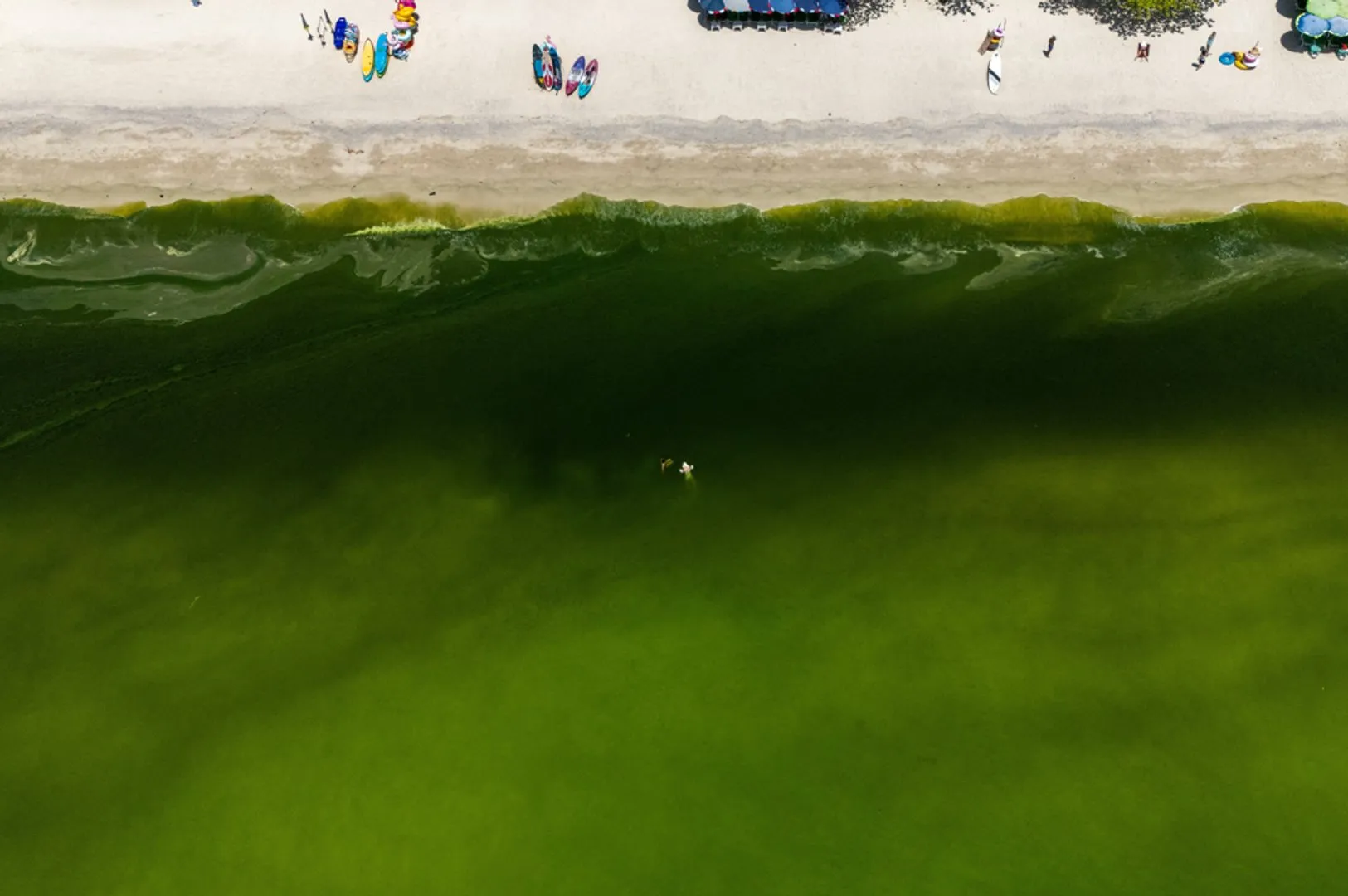
LONDON: The algae bloom that clogged intake pipes at Israel’s Mediterranean desalination plants in late August exposed the fragility of a water system that supplies not only Israel, but also Gaza.

Five of Israel’s six coastal desalination plants, which convert seawater into drinking water, shut down after microscopic algae clogged their intake systems, CNN reported on Sept. 4, citing Mekorot, Israel’s national water company.

The plants produce more than 80 percent of Israel’s drinking water, according to Israeli media.

Some privately owned plants have since resumed partial operations. But as of Sept. 3, only one was operating at full capacity. By Sept. 7, two plants remained closed and three others were operating at limited capacity for a ninth consecutive day, The Times of Israel reported.


Authorities responded by restricting water use, increasing withdrawals from reservoirs and the Sea of Galilee, and limiting supplies to agriculture, Haaretz reported.


Mekorot spokesperson Lior Gutman called the disruption unprecedented, according to CNN.

Scientists believe the bloom formed near Egypt’s Nile Delta before Mediterranean currents carried it north along Israel’s coast. The algae extended at least a dozen kilometers, said Edo Bar-Zeev, an associate professor of water research at Ben-Gurion University of the Negev. 

“This is the first time I saw something of this extent,” Bar-Zeev, who has tested coastal water for two decades, told CNN.

Environmental experts say untreated sewage from Gaza may be worsening the nutrient-rich conditions in which algae thrive. Gaza’s six wastewater treatment plants have been damaged or destroyed during the war, allowing untreated sewage to flow into the Mediterranean for months. 

Zalul Environmental Association, an Israeli nonprofit, said in a statement that satellite imagery suggested that pollution feeding the bloom came from both Gaza and the Nile Delta. 

But for Palestinians in Gaza, the crisis did not begin with an algae bloom, but with the destruction of water and sewage infrastructure during the war, compounded by Israeli restrictions on supplies and movement. 

Maysa Yousef, an artist and mother in central Gaza, said she first noticed green algae forming in bottles filled with Mekorot water, which is piped from Israel into Gaza through a network of transmission lines.

“Before Israel announced that the water had become contaminated, we already knew,” Yousef told Arab News. “Every morning, I filled the water bottles, then when I went to wash them in the evening, I found them all covered in algae.”

She said her husband initially dismissed her concern because the water came from Mekorot.

“I told my husband, ‘The water coming to us from Israel is contaminated. It is not clean,’” she said. “He said, ‘No, it is Mekorot water — it is desalinated and treated.’ I told him, ‘No, there is algae in it. Look inside the bottles.’”

Other Gaza residents have shared similar accounts on social media, reporting algae and small worms.

When Israel announced the desalination shutdowns in late August, Mekorot supplies to Gaza were cut off, Yousef said. For many families, the water had been one of the few comparatively safe sources available.

“Gaza relied on Mekorot water because it is close to drinking-water quality,” she said. “Some people drink it although it tastes awful.”

Her family used it for cooking and tea because safe drinking water was already scarce.

The World Health Organization said on Sept. 1 that microbiological contamination in Gaza water samples had risen from less than 6 percent in January to nearly 20 percent in August.

Since 2024, Gaza residents have faced severe water shortages. In many areas, people have reportedly resorted to makeshift latrines as sanitation systems failed.

Nearly 90 percent of Gaza’s water infrastructure, including desalination and wastewater treatment facilities, has been destroyed, according to UN agencies and media reports. Damaged sewage lines have also contaminated the aquifer on which many residents depend.

In February, the UN Office for the Coordination of Humanitarian Affairs said its partners reported that the Mekorot supply line was fully shut. The line had already been operating at reduced capacity because of two identified leaks, and repairs near a reservoir had not been completed.

Humanitarian groups have increased water trucking to affected neighborhoods, but access remains uneven. In Al-Mawasi, residents have complained that available water is visibly contaminated.

“If you put it in front of a donkey, it would refuse to drink it because it is so filthy and full of worms,” one local woman, whose name is being withheld at her request, said. “But we had no alternative. Otherwise, you die of thirst.” 

The WHO warned in early September that Gaza’s deteriorating water quality was raising the risk of disease outbreaks. Winter rains could further spread sewage and contaminated water through overcrowded displacement sites, the agency said.

Reinhilde Van de Weerdt, the WHO representative for the Occupied Territories, said microbiological contamination found in water samples had nearly tripled since the beginning of 2026.

Cases of acute watery diarrhea nearly doubled, from about 30,000 in March to more than 58,000 in August, she told a weekly briefing in Geneva. 

Yousef said her husband was among those who became ill after drinking contaminated water.

“About two weeks ago, my husband started having stomach pains,” she said. His condition worsened and he needed to go to the hospital. With no transportation available, the family walked to Al-Aqsa Martyrs Hospital in Deir Al-Balah. 

At the hospital, she said, care was being delivered in tents and essential services were scarce. After running tests, they discovered that he suffered from an inflammation of the stomach lining caused by consuming contaminated water. 

“Now he is forbidden from drinking water except imported bottled drinking water,” Yousef said. “No coffee, no soft drinks, and only limited vegetables and fruit, and so on.” 

Gaza’s health system has been devastated by the war, with hospitals and other medical facilities damaged or destroyed and restrictions limiting the entry of medicines, medical supplies and fuel.

For Gaza’s residents, the algae bloom was not an isolated environmental disruption but another sign of a broader collapse: a water system already battered by war, damaged infrastructure and the loss of basic public health protections.


Source link

‘Totally reliant on Mother Nature’: UK drought raises water security fears | Business and Economy News

London, United Kingdom – In a wheat field near High Wycombe in the rolling English countryside, Alex Nelms watched the harvest on his farm die in a matter of days.

His crop had looked strong until the first heatwave came in May, when temperatures surpassed 35 degrees Celsius (95 degrees Fahrenheit) just as his milling wheat entered its grain-fill phase, the critical weeks when the plant fattens its kernels.

Recommended Stories

list of 4 itemsend of list

“It just killed everything stone dead,” he told Al Jazeera. “Everything was finished really early, and when we were sort of full of optimism and hope, it was scuppered almost overnight.”

Nelms farms just over 2,000 acres (809 hectares) of arable land in south Buckinghamshire, on a business his grandparents founded in 1955. His uncle, who has worked the farm for more than 40 years, has just suffered the worst harvest of his career.

Last month, the Department for Environment, Food and Rural Affairs (Defra) said almost three-quarters of England, 71.3 percent, remained in drought. Rainfall in August reached just 34 percent of what would normally be expected by that point in the month, Defra said, and reservoir levels were 18.2 percentage points below where they should be for the time of year.

“We’re totally reliant on Mother Nature,” Nelms said, and nature did not deliver this year.

After a historically dry spring and a run of summer heatwaves, the farm is down roughly 1,000 tonnes on its average harvest, a shortfall of some $270,000 in revenue.

The farm, tucked in the Chiltern Hills, a steep, long ridge of white limestone rock, has no irrigation and never will.

“That has serious knock-on effects on our cash flow,” he said. A third consecutive difficult year would mean hard conversations with his bank and landlord, and farming to minimise risk rather than maximise output, “consequently, probably producing less food”.

‘Financial crisis point’

The National Farmers’ Union (NFU) says farmers are at a “financial crisis point” after the worst drought in 50 years, with historically low harvests, stunted grass growth, rising fuel and fertiliser costs, and a severe outbreak of bluetongue disease in livestock.

The union puts the gross production value loss of wheat at approximately $499m and the cost of replacing a shortfall in forage at roughly $45m.

NFU president Tom Bradshaw has said farmers now lack “breathing space” and are “increasingly exposed to geopolitical shocks, as well as repeated weather extremes, animal disease and global wars”.

He believes action is needed now to ensure the future of British farming “and enable the next generation to keep producing the nation’s food”.

To manage the risk, Nelms is diversifying, planting oilseed rape again on about 350 acres (142 hectares) for the first time in 20 years. He says that the crop’s usual insecticide protection, neonicotinoid seed treatments, is now banned, leaving it exposed to cabbage stem flea beetle and to game birds that can “absolutely nibble, eat, and destroy a crop”.

Growing it also means breaking a continuous wheat rotation that has kept a soil-borne disease called “Take-all”.

Tax allowances would make investing in grain storage and diversified income worthwhile, he said, as well as government-backed bridging loans, modelled on COVID-era support, to survive a bad year without permanent damage.

It is the kind of relief the NFU is pressing the government to provide nationally.

The union wants an interest-free “Keep Britain Growing” loan tied to drought losses, help covering the cost of disposing of livestock lost to bluetongue, faster planning permission for on-farm reservoirs, and clearer rules letting farmers access water as soon as levels allow, echoing Nelms’s case for storage on his farm.

“Drought conditions will continue to worsen until we receive sustained rainfall across the country and we still all have a role to play in conserving precious water supplies,” according to Philip Duffy, the Environment Agency’s chief executive, in a statement shared by Defra.

The Environment Agency has applied for a drought order to restrict abstraction from the River Severn, and 10 water companies, serving 30 million customers, now have restrictions in place.

“A few days or even weeks of wetter weather cannot reverse the impacts of several months of exceptionally dry conditions,” added Duffy.

Defra noted that the first meaningful rains since June have fallen but they have been patchy, so reservoirs and groundwater are still declining even as a handful of rivers see brief upticks in flow.

Despite the losses, Nelms is hopeful about farmers pulling together – sharing labour, machinery and market routes. He points to the Central Chiltern Farmer Cluster, where growers meet to talk through their problems and find solutions together.

“We’re working together, not competing with each other,” he said.

For a farm like Nelms’s, with no irrigation and no water in reserve, that patchiness is the problem. Soil parched from months without rain needs to absorb sustained rainfall before groundwater can even begin to recharge, let alone refill the reservoirs a future harvest might depend on.

“Our climate has changed,” Water Minister Emma Hardy, who chairs the National Drought Group, said late last month, “and we will continue to take all action necessary.”

Source link

Why Nepal is demanding climate justice and compensation after deadly floods | Climate Crisis News

Nepal is demanding “climate justice” and $20m in compensation after the recent devastating floods in the country and China’s Tibet region, which led to the deaths and disappearances of thousands of people.

The catastrophe, which scientists say was caused by the effects of climate change, was triggered when part of a mountain glacier collapsed and a torrent of water and mud flooded down into Nepal’s Rasuwa and Nuwakot regions, as well as into China’s Tibet region on August 26. More than 1,300 people have been confirmed dead and more than 5,000 remain missing.

Recommended Stories

list of 3 itemsend of list

“We are paying the ultimate price for a global crisis we did not create,” Nepal’s Foreign Minister Shisir Khanal said last week.

“Support for Nepal should not be seen from an angle of aid or charity, but should be seen from the perspective of climate justice,” he told the AFP news agency.

On Monday, the country’s President Ramchandra Paudel made a similar demand during an address to the nation.

“I make a heartfelt appeal to the international community not only to listen to the voices of ecologically vulnerable countries, including Nepal, but also to take concrete and effective steps to ensure climate justice for them,” he said.

Nepal’s Ministry of Finance and Ministry of Environment have written a joint letter to the United Nations, which set up a fund to respond to loss and damage caused by climate change in 2022 in line with the 2015 Paris Agreement on climate, with a request for $20m in damages.

The UN’s Loss and Damage Fund is, however, facing a $2.8bn funding gap as it prepares to approve its first climate recovery projects.

Interactive_Nepal_Glacial_collapse_Aug27_2026

‘Collective frustration’

Nepal’s leaders may have a point.

Nepal contributes less than 0.1 percent of global greenhouse gas emissions and generates most of its electricity from renewable sources of energy. Yet its geographical location in the Himalayas makes it particularly vulnerable to severe climate and weather events.

Last month’s catastrophic flooding in the country comes against a backdrop of rapid global warming and glacial loss across the Himalayas.

Glaciers across the Hindu Kush Himalaya mountain range – which spans Afghanistan, Bangladesh, Bhutan, China, India, Myanmar, Nepal and Pakistan – lost ice 65 percent faster between 2011 and 2020 than during the previous decade.

Nepal’s glaciers, which are sandwiched between two major carbon emitters – India and China – have lost close to one-third of their ice volume in roughly three decades due to global warming, the United Nations said in 2023.

Tanuja Pandey, a Nepal-based climate activist and lawyer, said there is collective frustration behind Nepal’s demand for climate justice.

“People here feel the world often pays attention to Nepal only when a climate disaster becomes impossible to ignore. It is deeply painful to people here that global attention intensifies when headlines report thousands of people dead or missing and in the end, their suffering does not generate any urgency to fight climate change,” she told Al Jazeera.

Shreya KC, a 28-year-old Nepali climate activist, said there is profound anger and sadness among people in Nepal who say that they must no longer continue to suffer the impact of climate change, which, as they see it, other countries are responsible for.

“My hometown is in Solukhumbu in eastern Nepal,” the activist told Al Jazeera. “It is a district of mountains and is also home to the world’s highest mountain, Mount Everest, and my home is also downstream. After the glacial collapse happened two weeks ago, people in my region have realised that this can now happen anywhere in Nepal since the Himalayas are warming and glaciers are melting faster.”

While Nepal has been actively fighting climate change, Shreya KC said she herself has been involved in projects in the country that focus on clean hydropower generation, forestry and other such climate advocacy programmes.

“Because of other countries,” she said, “today Nepalis are the ones most impacted by climate change. So people want justice.”

INTERACTIVE - Nepal floods satellite-1787827054
[Planet Labs PBC]

Is there such a thing as ‘climate justice’?

According to preliminary estimates from Nepal’s National Disaster Risk Reduction and Management Authority, the country’s property, housing and infrastructure losses in the floods amount to some $2.56bn.

But claiming compensation under a notion of “climate justice” won’t be straightforward, according to Joyeeta Gupta, a professor of Environment and Development in the Global South at the University of Amsterdam.

According to the United Nations, “‘climate justice’ is the moral and ethical principle that seeks to address the disproportionate impact of climate change on vulnerable communities and future generations”.

“I define it as a system of justice where others’ perspectives are taken into account, and no harm is caused to others,” Gupta told Al Jazeera.

Nepal is a country that has very low emissions, she said, but is facing the brunt of climate issues which it never created. “That is reason enough for Nepal to claim climate justice,” she noted.

But, practically speaking, can it? In the pre-1990 period, there was a lot of discussion among nations about the need for large emitters to compensate those that would be harmed, Gupta noted. But soon after that, the term “compensation” disappeared from the agenda of international climate treaties, which turned more to discussions about providing assistance to developing countries that need to tackle climate change instead.

In a July 2025 advisory opinion on climate change, the International Court of Justice (ICJ) declared that “all nations have binding legal duties under international law to prevent significant climate harm”.

The ICJ’s advisory opinion on climate change also says that states breaching their international climate obligations can be required to make full reparations, including financial compensation to “injured states” or countries impacted by climate change caused by the actions of other countries.

While the ICJ’s opinion is not legally binding, Gupta said, it is a statement in international law that could support Nepal’s government’s international appeal for climate justice and compensation.

‘No climate justice without internal justice’

Nepal’s rapper-turned-prime minister, Balendra Shah, is scheduled to travel to New York on September 22 to address the 81st session of the United Nations General Assembly (UNGA) on September 24. His country’s appeal for climate justice is expected to be a key part of his address.

For climate activist Shreya KC, while UN meetings and international conferences on climate change may hold some weight when it comes to discussing climate disasters, right now, what Nepal needs is money.

“So much of our money allotted for healthcare, education and to transition into a more developed nation is now being spent on fighting climate change. So countries who are causing emissions, especially from the global north, need to commit more money to the UN’s Loss and Damage Fund,” she said, adding that money from that fund should be disbursed to vulnerable communities in need, not as a loan but as compensation for bearing the brunt of climate change.

Pandey noted that this is not the first time a climate disaster has occurred in Nepal and said that the new government, which came into power in March this year on the back of Nepal’s Gen Z protests last year, has also failed to make climate a priority in its budget.

While it is a good sign that Nepali politicians are appealing for international climate justice, she said, they also need to address the country’s internal development model to fight climate change in the first place.

“There is no climate justice without internal justice within the country itself,” she said.

“I hope that even in our development, partners and investors stop treating climate resilience as an optional addition to development in Nepal just because we are economically vulnerable.

“Investing in Nepal without investing in sustainability is simply a bad investment.”

On Monday, Nepal declared a national day of mourning to remember the more than 1,300 people who are known to have died in last month’s catastrophic floods. Thousands more are still missing.

The country’s President Paudel used the opportunity to call on people to unite.

“This is not a time for division. Nor is it a time to blame one another or become entangled in political disputes and confrontation,” he said.

“This is a time to demonstrate national unity and solidarity. It is also a time for reconstruction, rehabilitation and economic recovery.”

But Gupta says Nepal’s biggest challenge right now is establishing a precedent for compensation for climate change-related disasters.

“It was recently a glacial collapse in the country, but soon, it will become a bigger issue as time goes on because the monsoon patterns will change, the sea level will rise,” she said.

As many other developing countries – notably island states that face being submerged altogether – are also likely facing similar climate change challenges, the damage could become huge.

“That is going to be a very big reason why many rich countries will probably be unwilling to pay compensation, because that would set a precedent for future issues,” Gupta said.

“But the issues countries like Nepal are facing are a very strong argument to try and convince the whole world to accelerate action to phase out fossil fuels and fight climate change.”

Source link

Deadly boiling river where water temperatures reach 99°C

This river was thought to be the stuff of legends – but it is very real

In a remote part of the Amazonian rainforest, there is a river so mired in myth that many thought it didn’t exist. However, thanks to the research and work of a celebrated geothermal scientist, the existence of the river has now been proven – and he’s fighting to protect it.

The Shanay-timpishka, commonly known as the ‘Boiling River of the Amazon’ is a tributary of the Pachitea River which flows towards the Amazon River. The river has been known to indigenous Peruvians who live in the Amazon, and it has been used for spiritual and healing rituals for centuries. They called it ‘Shanay-timpishka’ which translates to ‘boiled by the heat of the sun’.

The local Asháninka and Shipibo peoples believe the river is birthed by Yacumama, a gigantic mythical serpent thought to live in the Amazon. “a mythical enormous serpent believed to inhabit the Amazon Rainforest.”

Local shamans teach that Yacumama is the “Mother of the Waters”

Geothermal scientist Adrés Ruzo first heard of the scalding river from his grandfather who told him a legend about the Spanish conquistadors who ventured into the jungle and came back with tales of a river which boiled.

He was the first scientist permitted by the local shamans to map, study and legally help to protect the river. He travelled through the jungle in 2011, guided by his aunt and confirmed the existence of the river.

Ruzo worked to study the river, and also helped the local indigenous people secure their rights to it. The area is in massive danger from deforestation which destroys the forest and surrounding ecosystems.

Ruzo became an advocate for the ancestral people living in the region, and helped secure the legal titles to the land. He also founded the Boiling River Project – a non-profit organisation which advocates for the permanent protection of the river.

Content cannot be displayed without consent

One of the most fascinating things about this river is that it is an anomaly.

Usually, geothermal rivers and springs are heated by volcanic currents but in the case of Shanay-timpishka, the closest volcano is 700 kilometres away. Instead, the water is heated by the core of the Earth.

Rainwater seeps into the earth’s crust through fault lines where it is heated to boiling and then pushed back up into the river. At its hottest points, the river can reach close to 100°C, and boils anything which is unfortunate enough to fall in.

The river is littered with animal bones and bodies which have been cooked inside.

Tragically, it’s not only animals which have been killed by the boiling water. A Toronto woman died in 2025 after she fell into the river whilst meditating on a rock nearby.

Although Maya Moreno managed to escape from the water alive, she tragically died later in hospital after suffering burns to 70% of her body.

According to a GoFundMe for Maya, she had travelled to the river as part of a spiritual journey, and fainted beside the river which caused her to fall in.

Source link

‘People laughed at me’: Indian youth cleans up a trash-filled river | Environment

A 21-year-old student in India’s Madhya Pradesh, popularly known as ‘Bittu Tabahi’, has single-handedly cleaned up a trash-filled river. Despite ridicule, health risks and limited resources, his efforts have transformed the waterway and prompted government action.

Source link

She is still in the sea, mother describes losing daughter in ferry disaster | Transport News

Parents recount desperate attempts to save their children after a ferry capsized off Northern Cyprus on 30 August. As search operations continue, their 12-year-old daughter and six-year-old son are among the 18 people still missing, while at least eight people have died.

Source link