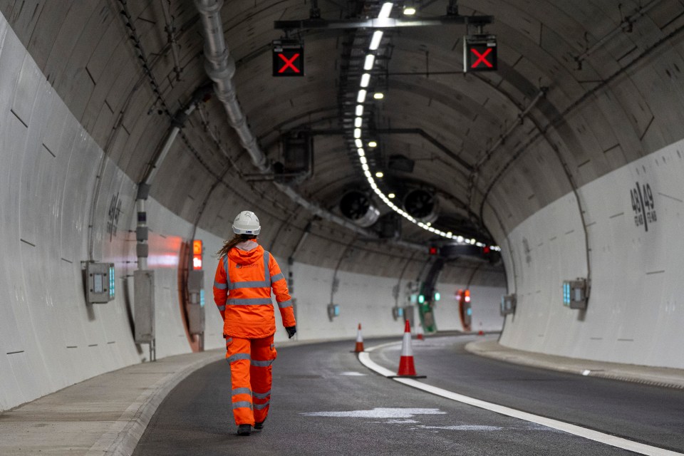
Future Works, a group of infrastructure experts, believe this tunnel can be done for just under £2bn and improve the links between key northern cities.
Michael Dnes, the co-founder of Future Works, said he had guilt about not getting this product off the ground years ago when he worked for the Department for Transport.
When he left in 2024, he looked to Norway for a way to get the plan up and running for cheaper than £10bn, the cost of a similar shelved government scheme.
A spokesperson for Future Works, said: “High demand for the route means that the project could pay for itself, without the need for Westminster funding.
“Scandinavian tunnels are often owned by local councils, who recover the costs through tolls. Equally, northern pension funds have hundreds of billions in investment capital that could be mobilised to build the project.
“They aim to create a shovel-ready scheme, and to bring this through the planning system faster than the 10+ year processes that have become the norm in UK planning.
“Work could begin before the end of the decade, with the road and railway open in the mid-2030s.”
TOURS are now available of a secret network of rivers located under a major UK city.
However, adventure-seekers will want to be quick as tickets are selling out fast.
The Sheaf & Porter Rivers Trust are currently running tours of the underground river systemCredit: The Sheaf and Porter Rivers TrustThe Trust has been working to restore the underground system, with ticket sales going towards fundingCredit: The Sheaf and Porter Rivers Trust
These tours will be run by volunteers, who will take explorers on twice-daily trips around Sheffield’s underground.
Sign up for the Travel newsletter
Thank you!
Dating back to the mid-1800s, the Megatron is a large maze of tunnels located under various parts of the city, including the railway station, BBC Sheffield, the Sheffield Archives, and Red Tape Studios.
The extravagent system was originally constructed to contain the overflow from the rivers Sheaf, Porter, and the Don.
Trust volunteers run the tours, which will take place twice daily throughout July, August, and SeptemberCredit: The Sheaf and Porter Rivers TrustTour tickets have already sold out for JulyCredit: The Sheaf and Porter Rivers Trust
However, the system of rivers eventually became polluted and even covered over the years.
Now, the Trust is working to uncover and restore these historic features, even taking those who dare venture into the depths of the Megatron on tours in order to fund the project.
On these tours, volunteers share their passion for the ecology of the city’s waterways and other interesting facts as they guide you on the two-mile water walk.
Ticket prices help to fund everything from river clean-ups to the installation of “light wells”, which cast some light onto the hidden rivers for the first time in 150 years.
If you’re looking to participate, make sure you have the proper attire before you embark on this underground adventure.
Varying water depths throughout the tour mean waders and sturdy footwear are recommend.
You will also want to be fairly agile for this experience, with lots to navigate, from slippery algae-covered rocks to tight gaps that require crouching.
This tour also provides glimpses into the city’s industrial past, with aged grindstones, crucible caps, even some tools found along the way.
You may also spot some stalactiteshanging from the tunnels, but make sure you don’t touch these.
And Broad Street West, the culvert transforms into a large single looming arch, named “Megatron” by urban explorers.
The name was chosen in response to Manchester’s “Optimus Prime” culvert, both of which took inspiration from after the comic and movie series “Transformers”.
While the first section of the culvert is built from huge stone blocks from theold Castlefolds Wholesale Market, a shorter stretch of blue brick under Exchange Street was built around 1890 to serve as a ramp for electric trams travelling from Rotherham to central Sheffield.
You may also spot some wildlife on your tour, with a variety of birds, invertebrates, and even the Daubenton’s bat taking up residence.
The public is advised that points of the water can reach chest height on this tour, with rainfall impacting both the current and depth.
While the Sheaf and Porter River Trust Megatron Tour has sold out for July, more information on ticket releases for August and September can be found here.
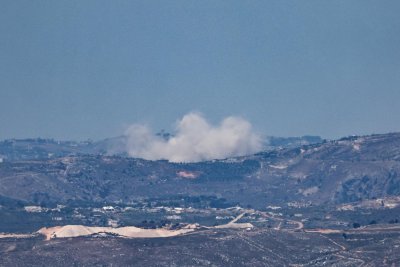
Smoke rises in late May as a result of an Israeli strike in the south of Lebanon as seen from the Israeli side of the border in the Upper Galilee, Israel. The Israeli military says it has trapped dozens of Hezbollah fighters in an underground complex in southern Lebanon. Photo by Atef Safadi/EPA
June 24 (UPI) — The Israeli military has surrounded an underground base in southern Lebanon in which dozens of Hezbollah militants are trapped, Israeli officials said.
The base is located under the village of Tebnit, in an area where fighting taken place despite an Israel-Hezbollah cease-fire, The New York Times reported. The standoff, if it escalates, could disrupt ongoing peace negotiations between the United States, which backs Israel, and Iran, which backs Hezbollah.
Israeli officials said the trapped militants were running out of supplies. On Tuesday, Israeli troops killed at least two people in the area. Israel said those targeted were Hezbollah operatives, while Hezbollah said they were civilians.
The underground base is beneath the Ali al-Taher ridge, not far from the border with Israel and a strategic point. Israeli officials said Hezbollah built the complex of tunnels over 20 years with Iran’s help.
“From this place, you can launch missiles and munitions at Israel,” Sarit Zehavi, president of the Alma Research and Education Center, said to The New York Times.
The Jerusalem Post reported that Israeli leaders are concerned that operatives in the area could carry out a kidnapping attack against Israel’s forces to help their negotiations for those trapped. Soldiers have been told to stay in pairs or groups at all times.
Israel once occupied the ridge after its 1982 invasion of Lebanon. It was once outside the “buffer zone” that Israel established in Lebanon near the border, but Israeli redrew the line last week to include the ridge, The New York Times reported. Israel considers any armed fighter south of the line a threat and a target.
SINGER Junior Andre, the son of Katie Price and Peter Andre, has hit back at nepo baby critics and insisted he “doesn’t want handouts” after getting a job on the London Underground.
Junior revealed earlier this year during an episode of ITV‘s The Princess Diaries that he secretly worked nights for TFL to help fund his music career.
Sign up for the Showbiz newsletter
Thank you!
Junior Andre has hit back at critics calling him a ‘nepo baby’Credit: GettyJunior Andre is the son of former glamour model Katie PriceCredit: PA
The 20-year-old opened up on his “hard” reality in a candid conversation with his sister.
He worked through the nights, full time, while he sorted out “differences” with his record label.
Now, in a new interview alongside his girlfriend, Jasmine, Junior has shut down trolls, making it clear that he’s paving his own way in the industry.
Junior said: “My dad was brought up very strict, so regardless of anything he says, ‘You’ve got to work son.’
“As much as he’s there for me, and my mum is there for me, I don’t want handouts. I need to learn life the proper way.
“So when things get hard, instead of sitting there doing nothing I was like, ‘I need to do what I’ve got to do.’ I threw myself in the deep end, but I never gave up on my dream.”
Junior has told how he ‘doesn’t want handouts’ from his famous parentsCredit: SplashReality TV star Princess is very close with her brother and he opened up about working for TFL on her showCredit: Getty
He continued: “It made me [the job] understand the value of money and grafting. People say, ‘You’ve never done a hard days work in your life,’ and I’m like ‘I have!”
Elsewhere in the chat, Junior and Jasmine, who have been together for two years, confessed their future plans as a couple.
Reality TV star Junior said: “I get scared if I think about kids, marriage, because we’re not there. There’s so much more we want to do before we think about that stuff.”
Jasmine added: “We’re on the same page in that they’re such big things. Having a child – that’s a full human!”
“We’ll know when the time is right,” added Junior.
Junior used to work for TFL, “grafting, lifting heavy metals, cutting, filing, painting,” so he could fund his music career.
Princess, 18, gushed over her brother saying: “So proud of Junior, his last two singles went in at number one , but while he was sorting differences out with his label he went to work through the nights and work a full time job so he was fully self sufficient.
“Which I’m super proud of.”
Junior has previously told fans that despite his parents celebrity status, he doesn’t want to live of them.
His dad, Peter, is a huge pop star, topping the UK charts in the mid-90s with his tunes “Mysterious Girl” and “Flava.”
And Junior’s mum, Katie, also shot to fame in the 90s but as a glamour model using the alter ego Jordan.
International cave rescue experts in Laos were in a race against time and the weather as day 7 of an operation to rescue seven people trapped in a flooded cave in a mineral rich region of the country came to a close. Photo by Metta Tham Kalasin Rescue/EPA
May 26 (UPI) — Authorities in Laos were in a race against time and the weather Tuesday as day 7 of an operation to rescue seven people trapped in a flooded cave in a mineral-rich region north of the capital, Vientiane, came to a close.
The group, all locals, became trapped by landslides triggered by heavy rains on Wednesday after entering the remote cave, which is accessible only on foot, in the central province of Xaysomboun on a hunting and gold prospecting mission.
The landslides blocked the cave entrance and caused it to flood with muddy water.
The group have not been heard from since, but one person who managed to reach safety reported at least one area of the cave was not underwater and specialist cave rescue divers from neighboring Thailand who had joined the operation said they had found pockets of air.
“I’m confident that they are still alive because there is still air in the cave,” said Metta Tham Rescue head of operations Kengkard Bongkawong.
He said that with water levels still rising after torrential rain forced rescuers to retreat Sunday night, they were pumping water out 24 hours a day and placing fixed ropes inside for rescuers to follow.
“The route is not complicated but the problem is the space. It’s so narrow that we have to crawl and tilt to pass through; also the rocks are really sharp,” said Kengkard.
Kengkard took part in the dive operation in 2018 to rescue 12 members of a youth football team and their coach after they had been trapped for more than two weeks in a flooded cave in Thailand’s Chiang Rai province.
The Metta Tham Rescue team was joined at the site Monday by Finnish diver Mikko Paasi, and Thai cave diver Norrased Palasing, also both veterans of the Tham Luang cave rescue in 2018.
The rescue turned into a huge international operation involving 10,000 specialists, from cave rescue and medical experts to Elon Musk, who had his engineers develop a mini rescue. submersible.
The mini sub was never used but two divers, both former Thai Navy SEALS, were killed in the operation.
Wreathes are seen amongst the statues at the Korean War Veterans Memorial during Memorial Day weekend in Washington on May 27, 2023. Memorial Day, which honors U.S. military personnel who died while in service, is held on the last Monday of May. Photo by Bonnie Cash/UPI | License Photo
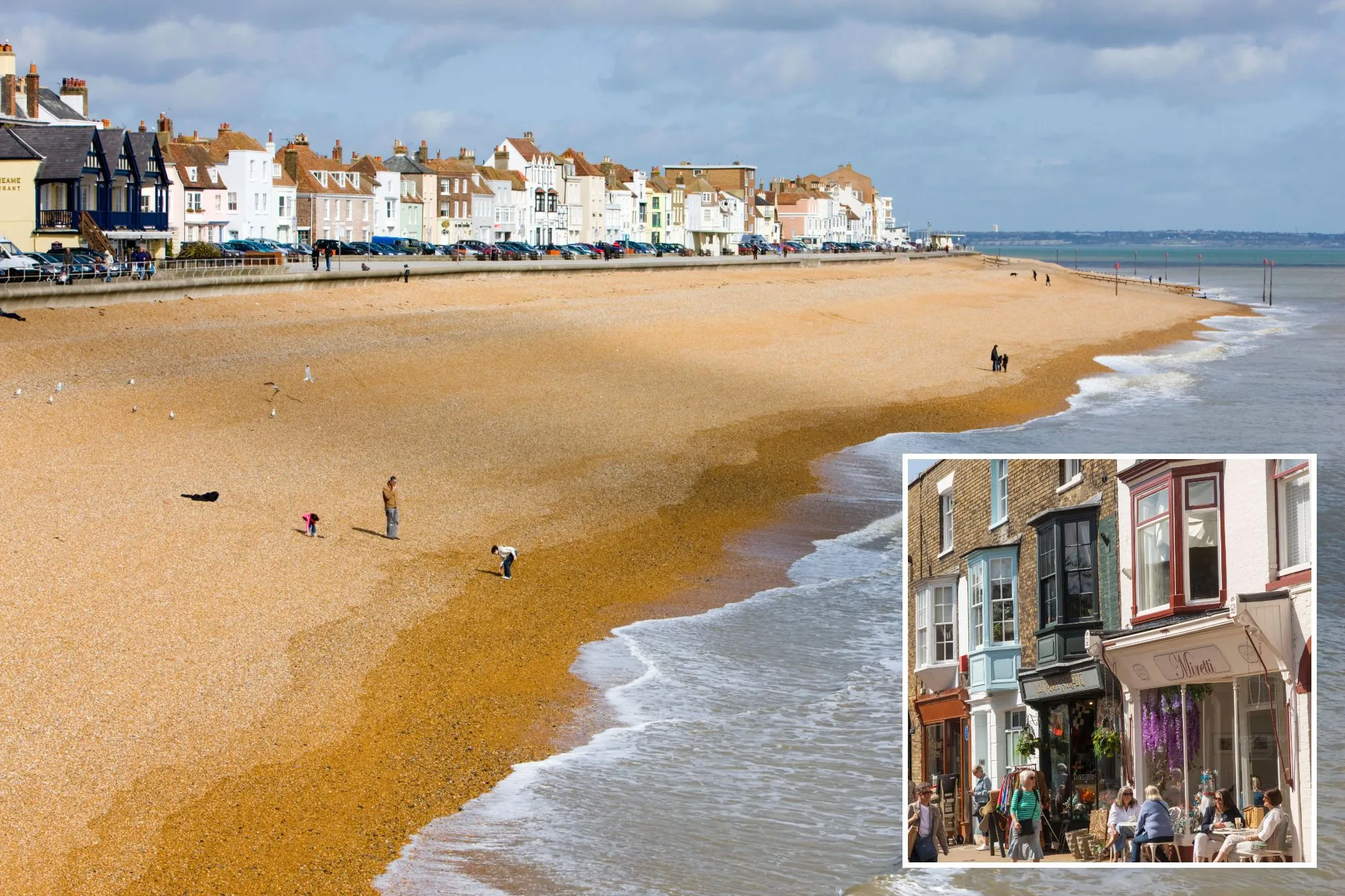
OUR Spotlight On column this week is chatting all things UK – this time the seaside town of Deal.
Based in Kent, the town has boomed in popularity in recent years as ex-Londoners ditch the city for the more laid-back life by the sea.
Sign up for the Travel newsletter
Thank you!
Here’s why you should plan a trip to DealCredit: Alamy
The Sun’s Deputy Travel Editor Kara Godfrey, who lives near Deal said: “I’m seriously impressed with the food scene – and that’s coming from someone who wouldn’t even class herself as a foodie.
“Some of the restaurants rival or even surpass London, yet retain it’s traditional, laidback ambience.
“Sure, you can get your arcade hit and fish and chips, but it has a great family feel too – and a beach so big you will never run be fighting for space”.
Here are some of her other top tips from bars to shops if deciding to visit Deal.
The brutalist Deal Pier has been through three iterations – one in 1838, destroyed by a storm, followed by one in 1864 which lasted until World War II.
The current surviving structure was opened by the then-Duke of Edinburgh in 1957.
It is worth the windy walk to the end where you can stroll past men fishing over the walls, or to grab a coffee at Deal Kitchen Pier.
Otherwise save some time for exploring the pretty high street littered with independent shops and galleries – head into Hoxton Store for the best trinkets, or Don’t Walk Walk (intentional repetition) for some unique artwork.
Deal Pier is the town’s main attractionCredit: Alamy
HIDDEN GEM
Visit on Saturday mornings to catch the bustling market that takes over Union Road car park.
It dates back to 1699 and is the kind of market that is impossible to leave without picking up something.
From flowers and soaps to groceries and sweet treats, or just your classic antiques and bric a brac, it truly has it all.
Visit early – it opens at 8am in the summer – to avoid the crowds (and get the freshest cinnamon buns).
BEST VIEW
Where better for a view of the ocean than from Deal Castle?
Built by Henry VII as a sea defence system, walk up the steps to the bastions for uninterrupted seascapes.
Send any fussy kids to the underground passageways, where they can pretend to fight off invaders with wooden muskets.
In the south-west of Munich, Schlachthofviertel is an area in flux; a jarring district that is home to a theatre, a techno club and a controversial active slaughterhouse.
In the 1870s, after the final cholera epidemic in Munich, a municipal slaughterhouse (Schlachthof) was built on what was then the outskirts of the city as part of a wider effort to improve hygiene standards. Although it is still in use today, the site has dramatically decreased in capacity, and creative entrepreneurs have been quick to see the potential of unused spaces.
In 2021, the Münchner Volkstheater (People’s Theatre) moved to the area, bringing a new cultural status and sparking fears of accelerated gentrification. For me, it’s a part of town I go to for a change of scene or just a loaf of double-baked rye bread. In summer, the open-air spaces come out of hibernation and show a much edgier side to Munich.
Where to eat and drink
Today, butcher’s shops and cult dive bars sit side by side. There has been a flurry of openings; my favourite recent addition is the female-run Mari on Adlzreiterstraße, the street Albert Einstein lived on for much of his childhood. The airy cafe serves a late breakfast, including a Korean option of marinated tofu and miso mayonnaise.
The Brotatelier bakery operates from a shipping container, and bakers use equipment on wheels to maximise the limited space. From the cinnamon buns to the French fougasse bread, all products are prepared with sourdough. “Everybody has time here; we haven’t had a single customer who was stressed or anything like that,” says co-founder Christof Teriete, whose bigger concern is the impact of the fluctuating container temperatures on the sourdough starters.
For drinks, start at Frisches Bier, run by craft brewer Tilman Ludwig. He has his own beers on tap, along with a small selection of other independent labels, such as Bierol from Tirol and Hoppebräu from southern Bavaria.
‘It’s not about comfort, it’s about maximum inspiration.’ Photograph: Fabian Christ
Cultural experiences
On one side of Zenettistraße is the decommissioned cattle market (Viehhof). The red brick walls are now home to the Volkstheater. Launched with a production of Christopher Marlowe’s Edward II, the diverse programme includes the Radikal jung festival, focused on emerging directors, and the U20 Poetry Slam, which invites young writers to present their work.
Next door is Bahnwärter Thiel, the heart of Munich’s underground scene, were graffitied shipping containers and the occasional caravan provide studios for DJs, artists, potters, goldsmiths, bakers (see above) and non-profits. “There’s no central heating or running water in the containers,” says Kati Legge from female creative office High Five, “but it’s not about comfort, it’s about maximum inspiration and the fascinating people around you.”
Raised garden beds add touches of green and upcycled materials are used for sculptures and makeshift walkways. There’s also a bar in an old tram, a restaurant in a train carriage and a techno club open till 6am weekends.
The Viehhof, the city’s decommissioned cattle market, is now home to the Volkstheater. Photograph: Sport Press Photo/Alamy
Where to shop
Rindchen’s Weinkontor has a huge selection of wine stored in a roomy, listed building. At Moss Concept Store on Thalkirchner Straße you’ll find ceramics, glassware and other home accessories.
Don’t miss
Actually quite hard to miss is Alte Utting, a former passenger ship that’s now a bar and event space that fills the length of a bridge over Lagerhausstraße. Destined for the scrapyard after years of service on Ammersee, it was rescued and relocated in 2017 by Wannda, the people behind Bahnwärter Thiel.
Where to stay
There’s little tourist accommodation in Schlachthofviertel, but there are hotels close to the nearby Oktoberfest site. Cocoon Theresienwiese has doubles from around €80 room-only.