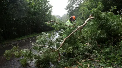
Storm

Lorena weakens to tropical storm off Mexican coast; flooding a threat

Tropical Storm Lorena weakened significantly over the past day, but heavy rainfall from the storm could produce flash flooding in Mexico, New Mexico and Arizona. Photo courtesy of National Oceanic and Atmospheric Administration

Sept. 4 (UPI) — Lorena weakened back to tropical storm strength Wednesday after spending about a day as a hurricane off the western Mexican coast, forecasters said.

The storm, which formed early Tuesday, was about 175 miles west of Cabo San Lazaro on the Baja California Peninsula, according to the National Hurricane Center in its 8 p.m. PDT update.

It had maximum sustained winds of 45 mph and was moving northwest at 5 mph.

The Mexican government canceled all watches and warnings associated with Lorena, but the NHC warned that areas in Baja California Sur and Sonora should monitor heavy rainfall across the region.

“This will increase the risk of life-threatening flash floods and mudslides across northwest Mexico,” the NHC said.

Forecasters also called for heavy rainfall in Arizona and New Mexico with flash flooding possible in Arizona.

Lorena, the 12th named storm in the Eastern North Pacific this year, formed as Hurricane Kiko continued to strengthen over the Pacific Ocean.

Source link

Dearica Hamby and the Sparks pull off thrilling comeback over Seattle

Dearica Hamby had 27 points and 11 rebounds, Rickea Jackson added 23 points and the Sparks beat the Seattle Storm 91-85 on Monday night.

Seattle led 85-80 with 2:47 to play but Hamby scored five points and Jackson four in an 11-0 closing run to pull the Sparks within 1½ games of the Storm and Indiana for the final two playoff spots. Seattle missed its last five shots.

Kelsey Plum added 14 points for the Sparks (19-20) and Rae Burrell had 11. Hamby had 11 rebounds as the Sparks dominated the boards 37-23. The also had a 60-30 advantage on points in the paint.

Nneka Ogwumike had 21 points on five first half three-pointers and two second half three-point plays for the Storm (22-20). Skylar Diggins also had 21 points and Ezi Magbegor added 11.

Gabby Williams had two baskets and an assist to fuel a 10-0 run for the Storm, who led 25-20 after one quarter.

Ogwumike had three three-pointers in less than a minute, making her five for five, for a 36-25 lead 3½ minutes into the second quarter. The Storm had six threes in the quarter, with Erica Wheeler’s in the closing seconds making it 53-39 at the half.

Sparks guard Kelsey Plum, left, drives to the basket in front of Seattle guard Erica Wheeler.

Sparks guard Kelsey Plum, left, drives to the basket in front of Seattle guard Erica Wheeler during the first half Monday.

(Steph Chambers / Getty Images)

Diggins opened the second half with a three for a 17-point lead, but the Sparks hit their first five shots and were 12 for 17 in the quarter. The final shot was a buzzer-beating one-handed three-pointer by Jackson from beyond the top of the key to cut the Storm’s lead to 73-68 entering the fourth quarter.

The Sparks play at second-place Atlanta on Wednesday and Friday. The Storm are home against New York on Friday.

Source link

Tropical Storm Kiko expected to strengthen into hurricane

Tropical Storm Kiko, seen here in satellite imagery, was expected to strengthen into a hurricane Tuesday. Photo courtesy of National Oceanic and Atmospheric Administration

Sept. 2 (UPI) — Tropical Storm Kiko is expected to strengthen into a hurricane in the next 24 hours, forecasters said.

Tropical Storm Kiko was located about 1,880 miles east of Hilo, Hawaii, with maximum sustained winds of 65 mph, while moving west at 7 mph, according to the National Hurricane Center’s 5 p.m. HST update.

“Steady strengthening is forecast during the next couple of days, and Kiko is expected to become a hurricane by tonight,” the NHC said.

Tropical storm-force winds extend 45 miles from the storm’s eye.

The NHC predicts the storm system will continue on its westerly track on Tuesday and move away from North America.

There were no weather watches or warnings in effect.

“Despite somewhat drier mid-level conditions along its forecast track, the combination of light vertical wind shear, warm sea surface temperatures and Kiko’s small compact core should allow for strengthening in the short term,” the NHC forecast said during its 11 a.m. update on Monday.

The storm formed on Sunday, making it the 11th named storm in the Eastern North Pacific this year.

Source link

Tropical Storm Kiko forms over Pacific Ocean

Tropical Storm Kiko formed Sunday over the Eastern Pacific Ocean. Photo courtesy of National Oceanic and Atmospheric Administration

Aug. 31 (UPI) — A new tropical storm formed over the Pacific Ocean on Sunday, making Kiko the 11th named storm in the Eastern North Pacific this year.

Tropical Storm Kiko formed early Sunday and had maximum sustained winds of 45 mph as of 5 p.m. HST Sunday, according to an update from the National Hurricane Center.

It was located about 1,120 miles west-southwest of the southern tip of Mexico’s Baja California and was moving west at 9 mph.

The forecasters said they expect Kiko to steadily strengthen over the next couple of days. An NHC discussion on Kiko states they believe it will likely cross into the central Pacific basin in four to five days.

It is expected to grow to hurricane strength in a day or two.

“Kiko is currently a compact system,” NHC forecaster John Cangialosi said in the discussion.

“Although it is forecast to get larger, the model guidance suggests that it will likely be on the smaller side through the week.”

Source link

Tropical Storm Fernand gains strength in Atlantic

1 of 2 | Tropical Storm Ferdinand should move well east of Bermuda and across the open waters of the subtropical North Atlantic. Photo by National Oceanic and Atmospheric Administration.

Aug. 24 (UPI) — The season’s sixth named storm, Tropical Storm Fernand, gained a bit of strength Sunday night in the Atlantic Ocean but is not expected to make landfall before dying out next week.

The tropical storm had maximum sustained winds of 50 mph while located about 320 miles east of Bermuda and moving north-northeast at 13 mph, the National Hurricane Center said in its 11 p.m. EDT advisory.

Tropical storm-force winds extend outward about 60 miles from the storm’s eye, the NHC said.

“On the forecast track, Fernand should move across the open waters of the subtropical central Atlantic well east and northeast of Bermuda,” it said.

No coastal watches or warnings were in effect, and the storm likely will remain at sea throughout its life.

The forecasters said in a discussion on the storm that they expect it to continue to increase in strength over the next 12 to 24 hours as it moves over warm water, though it should weaken starting late Monday or Tuesday as it travels over a sea surface where temperatures are expected to decrease significantly.

“This will cause the system to weaken, and become post-tropical on Wednesday,” the NHC said.

The storm system began forming as Hurricane Eric affected areas along the East Coast without making landfall last week. The hurricane was the season’s first and briefly reached Category 4 status with maximum sustained winds of up to 150 mph.

Colorado State University climatologists in April predicted this year’s storm season will produce 17 named storms, including nine hurricanes.

The climatologists predicted four hurricanes would reach “major” Category 3 storm status with maximum sustained winds of at least 111 mph.

The annual Atlantic storm season runs from June 1 to Nov. 30. Last year produced 18 named storms, including 11 hurricanes.

Five hurricanes became major hurricanes of Category 3 or higher, including the highly destructive Hurricanes Helene and Milton.

Source link

Tropical Storm Fernand becomes season’s sixth named storm

1 of 2 | Tropical Storm Ferdinand should move well east of Bermuda and across the open waters of the subtropical North Atlantic. Photo by National Oceanic and Atmospheric Administration.

Aug. 23 (UPI) — The season’s sixth named storm, Tropical Storm Fernand, has formed in the tropical Atlantic Ocean but is not expected to make landfall before dying out next week.

The tropical storm had maximum sustained winds of 40 mph while located about 405 miles south-southeast of Bermuda and moving northerly at 15 mph, according to the National Hurricane Center’s 5 p.m. EDT advisory.

Tropical storm-force winds extend outward about 105 miles from the storm’s eye, and the NHC said it should gain strength.

Fernand might reach hurricane strength on Monday, before starting to weaken on Tuesday, NHC forecasters said.

No coastal watches are warnings are in effect, and the storm likely will remain at sea throughout its life.

Forecasters expect the storm system to gain forward momentum while continuing on a north-northeast path over the next couple of days and move well east of Bermuda before turning northeasterly into the North Atlantic.

The storm system began forming as Hurricane Eric affected areas along the East Coast without making landfall. The hurricane was the season’s first and briefly reached Category 4 status with maximum sustained winds of up to 150 mph.

Colorado State University climatologists in April predicted this year’s storm season will produce 17 named storms, including nine hurricanes.

The climatologists predicted four hurricanes would reach “major” Category 3 storm status with maximum sustained winds of at least 111 mph.

The annual Atlantic storm season runs from June 1 to Nov. 30 and last year produced 18 named storms, including 11 hurricanes, in 2024.

Five hurricanes became major hurricanes of Category 3 or higher, including the highly destructive Hurricanes Helene and Milton.

Source link

Hurricane Erin to hit North Carolina with tropical storm conditions

Hurricane Erin was expected to bring tropical storm conditions to North Carolina on Wednesday evening and Virginia on Thursday. Photo courtesy of the National Oceanic and Atmospheric Administration

Aug. 20 (UPI) — Tropical storm conditions were descending upon the North Carolina coast late Wednesday, according to forecasters who are warning beachgoers against swimming at most U.S. East Coast beaches due to “life-threatening” surf and rip currents.

The Category 2 storm, described as “large” by the NHC, had maximum sustained winds of 110 mph, just shy of a Category 3 hurricane. The eye of the storm was located about 485 miles west of Bermuda and 215 miles southeast of Cape Hatteras, N.C., and was moving north at a rapid 16 mph, according to the NHC’s 11 p.m. EDT update.

A storm surge warning was in effect for from Cape Lookout to Duck, N.C., while a tropical storm warning was in effect for Beaufort Inlet, N.C., to Chincoteague, Va., including Pamlico and Albemarle Sounds.

Bermuda was under a tropical storm watch.

“Erin is expected to produce life-threatening surf and rip currents along the beaches of the Bahamas, much of the east coast of the U.S., Bermuda and Atlantic Canada during the next several days,” the NHC said. “Beachgoers in those areas should follow advice from lifeguards, local authorities and beach warning flags.”

Forecasters warned weather conditions were expected to deteriorate along the Outer Banks late Wednesday into Thursday. Storm surge and large waves could cause beach erosion and make some roads impassible.

Tropical storm conditions were expected to reach the Virginia coast Thursday and farther north through early Friday.

The season’s first Atlantic hurricane reached Category 5 status Saturday morning, the highest classification, after rapidly intensifying overnight Friday, when it became a Category 1 hurricane, the year’s fifth named storm.

Erin dropped to a Category 4 and then a 3 overnight into Sunday, but regained Category 4 strength late Sunday before again losing strength.

Erin became the first hurricane of the 2025 Atlantic storm season Friday morning.

There have been four named storms so far this season in the Atlantic. Tropical Storm Chantal caused major flooding in North Carolina but has been the only one of the four to make landfall in the United States this year.

The Atlantic hurricane season began on June 1 and ends on Nov. 30. The peak hurricane season runs from mid-August through September and into mid-October.

Ninety-three percent of hurricane landfalls along the U.S. Gulf Coast and the East Coast have occurred from August through October, the Weather Channel reported, citing data from the National Oceanic and Atmospheric Administration

Last year at this time, there had also been five named storms.

Source link

Thousands without power as Hurricane Erin batters Caribbean & barrels towards US amid warnings storm will strengthen

THOUSANDS were left without power after Hurricane Erin battered the Caribbean and hurtled towards the US – with the storm still expected to strengthen.

The hurricane, which is now category 3, brought heavy rainfall and vicious winds to Puerto Rico and the Virgin Islands on Sunday, cutting power for some 100,000 locals.

Truck driving through floodwaters on a road.

6

A truck drives through a flood as category 3 Hurricane Erin leaves the region in Naguabo, Puerto RicoCredit: AFP
Satellite image of Hurricane Erin, a Category 3 hurricane near Puerto Rico.

6

Hurricane Erin from satellite view on August 17Credit: Reuters
Flooded road in Naguabo, Puerto Rico.

6

The storm left 100,000 people without power, reports sayCredit: AP

Luma Energy, Puerto Rico’s private power grid operator, revealed that most of its customers on the island had working electricity by Sunday afternoon.

The operator said on X: “As of 5:00 p.m., 92.5% of customers have electrical service.

“The majority of affected customers are concentrated in the regions of Arecibo, Caguas, and San Juan, as the rain bands have been moving out of Puerto Rico.”

They added: “Our crews are working with precision to ensure safety and continuity of service.”

The storm caused “multiple interruptions across the island”, the company said earlier.

Hurricane Erin also saw two divers swept amid powerful waves near St. Croix in the US Virgin Islands.

They had to be rescued by local crews on Sunday, authorities announced.

Shocking footage showed taken by St. Croix Rescue Chief Jason Henry showed the divers being dramatically hauled over onto a boat.

On the island of Sint Maarten, footage showed palm trees swaying in violent winds.

Its local government said cleanup crews were clearing debris since Sunday morning.

Hurricane Erin intensifies to ‘catastrophic’ category 5 with 160mph winds

A large amount of Sargassum seaweed also reached the shore – which could contain harmful toxins poisonous to people and marine life.

Erin has been labelled category 3 after multiple fluctuations in the last several days.

On Saturday it was considered to be a catastrophic category 5 hurricane.

Outer bands are continuing to sweep over Puerto Rico and the Virgin Islands, pummelling coasts with heavy rain and strong winds.

Rainfall was recorded between two and four inches.

Up to six inches is likely to fall in some areas.

Fears are mounting that this could lead to flash flooding or mudslides.

Large waves crashing on a beach near palm trees during a hurricane.

6

Large waves crashing in the Dominican RepublicCredit: EPA
Vehicles driving through a flooded road in Naguabo, Puerto Rico.

6

The storm caused major floods in some areasCredit: AP

As of 5pm local time on Sunday, Erin was 275 miles north-northwest of San Juan, Puerto Rico.

It had maximum sustained winds of 125mph, and is reportedly currently moving west.

Puerto Rico Governor Jenniffer González-Colón warned residents to stay home if possible.

There are no reports of flooding on the island so far – but the worst weather is expected to impact the region within the next six hours, officials said.

Terrifying footage on X also showed heavy rain falling in Cidra in central Puerto Rico on Sunday.

The hurricane is expected to strengthen in the next two days before taking a north-ward turn on Monday and Tuesday.

The storm is then forecast to gradually weaken through the middle and latter half of next week as it passes between the US and Bermuda.

Tropical storm warnings have been issued in Turks and Caicos and the southeast Bahamas, according to authorities.

In Sierra Bayamón, Puerto Rico, a suspension insulator broke and a conductor fell to the ground because of the stormy weather.

Luma Energy also advised the public to avoid walking or driving through flooded areas, especially near downed power lines.

Person photographing rough seas during a hurricane.

6

The storm was downgraded to category 3Credit: EPA

Source link

US suspends visas for Gaza residents after right-wing social media storm | Israel-Palestine conflict News

State Department move comes as Israel’s war and induced-famine in Gaza reach new extremes, with 61,827 killed so far.

The United States has announced that it is halting all visitor visas for people from Gaza pending a “a full and thorough” review, a day after social media posts about Palestinian refugees sparked furious reactions from right-wingers.

The Department of State’s move on Saturday came a day after far-right activist and Trump ally Laura Loomer posted on X that Palestinians “who claim to be refugees from Gaza” entered the US via San Francisco and Houston this month.

“How is allowing for Islamic immigrants to come into the US America First policy?” she said on X in a later post, going on to report further Palestinian arrivals in Missouri and claiming that “several US Senators and members of Congress” had texted her to express their fury.

Republican lawmakers speaking publicly about the matter included Chip Roy of Texas, who said he would inquire about the matter, and Randy Fine of Florida, who described the alleged arrivals as a “national security risk”.

By Saturday, the State Department announced it was stopping visas for “individuals from Gaza” while it conducted “a full and thorough review of the process and procedures used to issue a small number of temporary medical-humanitarian visas in recent days”. It did not provide a figure.

The US issued 640 visas to holders of the Palestinian Authority travel document in May, according to the Reuters news agency. B1/B2 visitor visas permit Palestinians to seek medical treatment in the US.

Loomer greeted Saturday’s State Department announcement with glee.

“It’s amazing how fast we can get results from the Trump administration,” she said on Saturday, though she later posted that more needed to be done to “highlight the crisis of the invasion happening in our country”.

The decision to cut visas comes as Israel intensifies its attacks on Gaza, where at least 61,827 people have been killed in the past 22 months, with the United Nations warning that “widespread starvation, malnutrition and disease” are driving a rise in famine-related deaths.

Israeli Prime Minister Benjamin Netanyahu has been pushing to seize Gaza City as part of a takeover of the Strip, forcibly displacing hundreds of thousands of Palestinians to concentration zones.


Source link

Tropical Storm Erin forecast to be hurricane by Friday

Tropical Storm Erin is forecast to become a hurricane by 8 a.m. Friday and a major one by 8 p.m. Sunday. Image by National Hurricane Center

Aug. 13 (UPI) — Tropical Storm Erin is slightly intensifying and forecast to become a hurricane on Friday morning over the central tropical Atlantic with a chance of ultimately affecting the U.S. East Coast, the Bahamas and Bermuda next week, the National Hurricane Center said Wednesday.

For the first time since Erin became a tropical storm Monday morning, intensity increased, though just 5 mph, to maximum sustained winds of 45 mph, with gradual strengthening during the next two days forecast, the NHC said in its 5 p.m. EDT update.

In the 11 p.m. update, Erin remained at 50 mph.

Erin is forecast to reach hurricane status by 8 a.m. Friday with winds at least 74 mph, and a major hurricane, with winds of at least 111 mph, by 8 p.m. Sunday.

It would be the first hurricane of the Atlantic season. Beryl was the first hurricane last year on June 24.

The storm is about 1,095 miles east of the Northern Leeward Islands.

Erin was moving westward at 16 mph and will shift to a north-westward track beginning Thursday night and into the weekend, the NHC said. On the forecast track, the storm’s center will move over or near just north of the northern Leeward Islands.

The NHC’s “cone” doesn’t track Erin past Monday night, and NHC forecasters remind that they have an average error of 150 to 214 miles at days four and five.

In the latest discussion, NHC forecaster Jack Beven said there is a “greater than normal uncertainty about what impacts Erin may bring to portions of the Bahamas, the East Coast of the United States and Bermuda.”

But he said: “The risk of dangerous surf and rip currents across the western Atlantic basin next week is increasing.”

By this weekend, swells are forecast to cause life-threatening surf and rip current conditions, the NHC said.

Alex Sosnowsky, an AccuWeather senior forecaster, said there is concern that residents, visitors, cruise lines, and shipping and fishing ventures “could pass paths with a powerful hurricane.”

With a track farther to the east, Bermuda could be directly in the path as a major hurricane.

He said a farther west scenario would mean a greater risk of strong winds, rain and coastal flooding in the U.S., including eastern North Carolina, Long Island, New York and southeastern New England.

“Families heading to U.S. Atlantic beaches for a late-summer vacation next week need to be extremely cautious when venturing into the surf,” AccuWeather Lead Hurricane Expert Alex DaSilva said. “More than 50 people have lost their lives to rip currents and rough surf at beaches across the country so far this year, without any major hurricane nearby.”

There are no warnings or coastal watches in effect as tropical-force winds extend outward up to 60 miles. But those in the northern Leeward Islands, the Virgin Islands and Puerto Rico should monitor Erin’s progress.

The previous four named Atlantic storms this year were Andrea, Barry, Chantal and Dexter. None of them became hurricanes, and Chantal was the only one to make landfall in the United States, causing significant flooding in North Carolina.

Helene struck that state last year as a tropical storm, causing an estimated $53 billion in damage, after hitting western Florida as a Category 4 hurricane.

Four other hurricanes made landfall in the United States in 2024: Beryl, Debby, Francine and Milton.

Source link

Fast-moving Tropical Storm Erin heads toward U.S., Caribbean

Tropical Storm Erin is forecast to become a hurricane on Thursday. Image by National Hurricane Center

Aug. 11 (UPI) — Tropical Storm Erin is moving quickly and forecast to become the first hurricane of the Atlantic season by the “latter part of this week,” the National Hurricane Center said Monday.

Erin had maximum sustained winds of 45 mph and was moving west at 21 mph, according to the NHC in a 5 p.m. EDT update. That was the same strength three hours earlier when the NHC announced the fifth named storm of the season.

Erin was about 430 miles west-northwest of the Cabo Verde Islands in the central Atlantic Ocean near west Africa.

NHC added Erin’s storm coordinates show it heading west while some 2,155 miles east of the Northern Leeward Islands to the Caribbean.

“It is still too early to determine what impacts, if any, Erin may bring to the northern Leeward Islands, Bermuda, or the east coast of the United States,” NHC forecaster Philippe Papin said in a discussion.

An NHC tracking map shows Erin becoming a hurricane by Wednesday. It is then forecast to turn to the northwest from Thursday to Friday and become a major storm on Saturday.

Papin said that “Erin’s structure this afternoon looks like a tropical cyclone that is struggling with the nearby thermodynamic environment, with only a small patch of deep convection pulsing near the estimated center.”

Chad Merrill, an AccuWeather senior meteorologist, said: “Several factors are working in its favor, including lack of dust, warm water and a lack of disruptive breezes (wind shear).”

People in Bermuda and the Bahamas should closely monitor Erin’s progress, Merrill said.

There are no coastal watches or warnings in effect given how far out to sea the storm is now. Tropical force winds extend outward up to 35 miles from the center.

“It is far too early to determine what, if any, impacts for southeast Georgia and northeast Florida,” NWS Jacksonville said Monday.

The previous four named Atlantic storms this year were Andrea, Barry, Chantal and Dexter. None of them became hurricanes, and Chantal was the only one to make landfall in the United States, causing significant flooding in North Carolina.

Helene struck that state last year as a tropical storm, causing an estimated $53 billion in damage, after hitting western Florida as a Category 4 hurricane.

Four other hurricanes made landfall in the United States in 2024: Beryl, Debby, Francine and Milton.

Source link

Storm Floris clear up after power cuts and travel disruption

Reuters A man in a hi vis vest and orange hat stands behind a fallen tree on a road.Reuters

A worker removes a fallen tree on the A82 at Onich near Fort William

Storm Floris disruption is expected to continue on Tuesday as the clear-up continues after the amber weather alert.

Scottish and Southern Electricity Networks (SSEN) said it was continuing to restore supplies after about 50,000 homes were left without power.

Network Rail said teams had been working “tirelessly” to clear routes with 119 incidents reported on train lines across Scotland on Monday, amid gusts of up to 90mph in some parts.

Winds of up to 70mph were expected overnight in Orkney and Shetland, with a Met Office yellow warning in place until 08:00.

The Scottish government held an emergency meeting on Monday night in response to the “significant disruption” caused by the storm.

Home Affairs Secretary Angela Constance said travel should be avoided if possible until the danger had passed.

She said that power cuts were still affecting a “significant” number of properties, and that the recovery period would take time despite an improving forecast over the rest of the week.

“We will continue to receive updates throughout Tuesday and will have a better idea on public transport tomorrow morning,” she added.

ScotRail urged customers to check their journey via the app, website or JourneyCheck before travelling on Tuesday.

SSEN said Floris was “the most damaging summer storm in recent memory” with thousands of properties hit in the Highlands, Moray and Aberdeenshire.

Damage and disruption as Storm Floris crashes into UK

About 9,000 homes had been reconnected by Monday night, with SSEN engineers working to restore power to 43,500 more.

The firm said free hot food and drinks would be provided on Tuesday in areas where homes were awaiting reconnection.

Confirmed food locations are:

  • DINGWALL – Maryburgh Hub Hall
  • HUNTLY – Market Muir Car Park
  • WICK – Bilbster Hall
  • LAIRG -Village car park
  • KYLE OF LOCHALSH – Lochalsh Leisure Centre

Network Rail reported 75 tree-related incidents across the network, including trees falling on to overhead lines at King’s Park in Glasgow, Cornton near Stirling and Bishopton near Paisley.

It said some train disruption would continue as checks were carried out on Tuesday morning.

Network Rail Scotland A broken tree fallen onto a train track with a thin trunk splintered over an overhead line below a blue cloudy skyNetwork Rail Scotland

In Clackmannanshire, Network Rail cleared trees from lines near Alloa

Ross Moran, Network Rail Scotland’s route director, said: “Storm Floris has caused significant disruption to Scotland’s railway.

“As the storm passes our focus switches to inspecting routes which have been closed by fallen trees, debris and other damage.

“We’ll use two helicopters to assist engineers on the ground. We’re grateful to passengers for their patience whilst we do this.”

Flights and ferries were also suspended across Scotland on Monday with people urged to avoid travel.

Most of the country’s major road bridges were closed to high-sided vehicles.

Vehicles were blown over in Glasgow and Skye, while the Royal Edinburgh Military Tattoo and other major events were cancelled.

PA Media A crowd of about 20 people on a windy cobbled street, a woman holds down her hat while another woman has her hood blown from her head. Staff in high vis vests stand at a metal barrier.PA Media

Visitors were turned away from Edinburgh Castle after it closed on Monday

Edinburgh Fringe Festival said about 110 shows had been cancelled – mostly those in temporary structures.

In Glasgow, location filming for the superhero blockbuster Spider-Man: Brand New Day was suspended in the city centre.

The SQA also warned that the weather would delay the delivery of exam results letters on Tuesday for pupils on Scotland’s islands.

A Met Office amber warning, covering a wide area from the central belt to the Highlands, expired at 23:00 on Monday.

Western coastal areas saw the strongest early gusts with the high winds moving north-east later.

The Met Office said summer storms caused problems as trees were in full leaf and were more likely to be toppled with branches broken off.

Tuesday is forecast to be a calmer day as Storm Floris moves towards Scandinavia.

Source link

In the nation’s poorest congressional district, federal funding cuts create perfect storm

On a sweltering summer day, children leap between rocks along the Bronx River while cyclists pedal on newly paved paths. Kayaks rest on what was once an industrial dumping ground, now transformed into a bustling promenade along the city’s only freshwater river.

The Bronx River Greenway, a series of stitched-together waterfront parks built atop once largely abandoned and polluted wasteland, is a hard-fought victory for the country’s poorest congressional district — one that locals call a “beacon of environmental justice” built by federal dollars and water-pollution settlements from the borough’s wealthier neighbors.

Now, like thousands of nonprofits around the country, this organization’s future is in jeopardy. The Trump administration’s sweeping federal grant cuts have left nonprofits nationwide and the communities they serve in precarious straits. But few places face as stark a reckoning as the Bronx, where federal funding has proved indispensable for revitalizing green spaces, protecting survivors of domestic violence, and preventing youth violence.

Over 84% of the 342 nonprofits based in the Bronx rely on federal grants now at risk, according to an analysis by the Urban Institute. It’s a significant increase from the 70% of groups vulnerable to government defunding statewide.

In all but two of the country’s 437 congressional districts, the typical nonprofit could not cover its expenses without government grants. Nonprofits have increasingly served as contractors for government services — like operating homeless shelters — since the 1960s.

In the Bronx, if such grants were to disappear entirely, the borough’s nonprofits could face a collective deficit of nearly 30% — cuts that have begun to force layoffs and austerity on dozens of groups connecting Bronxites to low-cost health care, food assistance, and preschool slots.

“When America sneezes, the Bronx gets the flu,” said U.S. Rep. Ritchie Torres, the Democrat who represents the district. “I think we in the Bronx feel we have been and will continue to be the hardest hit by the impact of a Trump presidency.”

From revival to reversal

Nestled in a corner of parkland atop the site of an abandoned amusement park, the headquarters of the Bronx River Alliance is among the borough’s greenest buildings, boasting nature classrooms, samples of the river’s flora and fauna, and a storage space teeming with kayaks and canoes.

In March, the group received formal notice that it would lose $1.5 million in federal grants promised under the Inflation Reduction Act last year for improving water quality and climate-resilience projects. After years of rising momentum, cubicles now sit empty. Leaders held off on hiring in anticipation of cuts, and now they don’t know if they’ll be able to fill those roles.

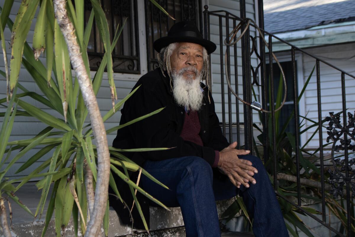
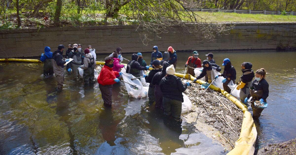
“I’ve met some of the folks who were pulling cars out of the river in the ’70s and ’80s,” said Daniel Ranells, the group’s deputy director of programs. Back then, the area was a “dumping ground” so inundated with industrial waste, tires, abandoned cars, ovens, and microwaves that “folks didn’t really understand there was a river there.”

That has shifted dramatically in recent years thanks in part to decades of federal investment. Just south of its headquarters, the organization restored salt marshes along the riverbanks of a shuttered concrete plant.

In 2007, the first beaver appeared on the Bronx River in over 200 years — named “José the Beaver” in honor of former Congressman José E. Serrano, who helped direct millions in federal funds to groups dedicated to the river’s restoration.

“The Bronx River is a shining light of environmental justice,” Ranells said, and millions in federal funding over the years has helped “make it a destination” after years of neglect.

Progress frozen

Now staffers at the Bronx River Alliance describe a sense of “whiplash” in seeing hard-fought funds dry up and grant language scrubbed of any allusions to racial or environmental justice.

The Bronx River Alliance has joined other nonprofits in suing the Trump administration to unfreeze funds, but the uncertainty has already disrupted years of planning, a reality that has rippled across the neighborhood, leaving few organizations untouched.

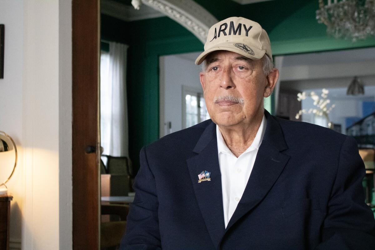
Up the street from the Alliance, the office of the Osborne Association, a group that has worked to prevent youth violence for nearly a century, has grown quieter. In April, an email from the Bureau of Justice Assistance stated the remaining $666,000 of a $2 million grant “no longer effectuates department priorities.”

The cut thrust the nonprofit into “triage mode,” said Osborne president Jonathan Monsalve, who was forced to lay off three staffers and reduce the number of participants in a diversion program offering young adults facing gun charges an alternative to jail time.

“It’s a lifeline for young people, and it’s no longer there for 25 more of them,” Monsalve said. “Without another alternative, it’s 25 young people that will see prison or jail time, and that’s incredibly frustrating.”

Why the Bronx bears the brunt

The Department of Justice has canceled over $810 million in similar grants to nonprofits working in violence prevention. The Environmental Protection Agency attempted to cancel $2 billion in grants for environmental justice work.

Nonprofit leaders say the cuts hit hardest in the places that can afford them the least. In the Bronx, almost 30 percent of residents live in poverty, the vast majority of whom are Black or Latino, and nearly one in six schoolchildren experience homelessness every year.

“We’ve had decades of disinvestment in these communities, and we had been starting to see some meaningful investment and community-based solutions that were actually working,” said Monsalve. “And then all of a sudden that support just gets yanked away.”

The federal government, he said, is essentially telling these communities: “You aren’t a priority anymore. You don’t fit the plan.”

For decades, a million-dollar federal grant allowed the victim-service organization Safe Horizon to operate a program that stationed domestic violence advocates in the borough’s criminal court.

When the grant came up for renewal this year, it came with new restrictions that CEO Liz Roberts described as “so extreme, so broad, so radical” that the organization chose to walk away rather than accept conditions which would have prohibited supporting transgender survivors or treating domestic violence as a systemic issue.

It was an agonizing decision given the volume of domestic violence in the Bronx, Roberts said.

It means that hundreds of survivors “may not have the opportunity to talk to an advocate about their options, about their rights, or about their safety,” she said.

Filling the void

Roberts said she’s bracing for more cuts — federal funds make up about 24% of the group’s budget — that could force the closure of shelters or reductions to a citywide hotline.

As nonprofits nationwide grapple with similar losses, Roberts said private philanthropy and local governments will need to “make some smart and thoughtful and principled decisions about where they can help to fill those gaps.”

In places like the Bronx, finding alternative funding is especially challenging. “The not-for-profit sector is often fragile, and nowhere more so than the Bronx,” Torres said of the district he represents, where organizations tend to be more dependent on government funding than wealthier enclaves.

“Organizations spent hundreds of thousands of dollars simply to apply for a contract and hired staff and made all these plans only to see the written contract disappear,” Torres said. “It’s deeply destabilizing.”

Sara Herschander is a senior reporter at the Chronicle of Philanthropy. This article was provided to the Associated Press by the Chronicle of Philanthropy as part of a partnership to cover philanthropy and nonprofits supported by the Lilly Endowment. The Chronicle is solely responsible for the content.
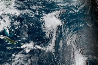
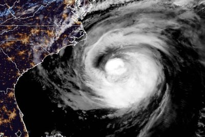
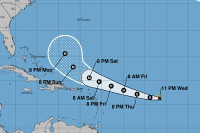
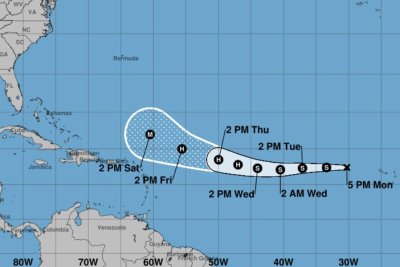
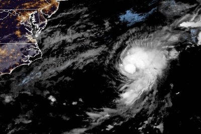
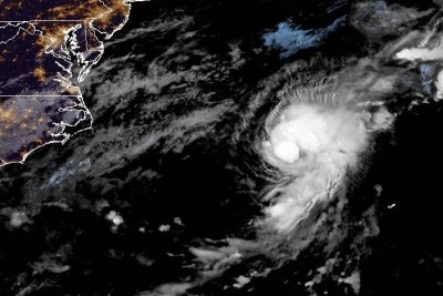
Source link

Storm Floris amber weather warning issued ahead of strong winds hitting UK

Elizabeth Rizzini

Lead Weather Presenter

PA Media Large wave crashing against a lighthousePA Media

Weather warnings have been upgraded to amber for most of Scotland as Storm Floris bears down on the UK.

The warning lasts from 10:00 BST on Monday through to 22:00 and warns of danger to life as damage to buildings and trees due to storm conditions is expected.

There is also a yellow warning across northern England, north Wales and Northern Ireland from 06:00 BST on Monday through to midnight.

Storm Floris is the sixth named storm of the 2024/25 season, and the first since January.

The storm is yet to develop but there will be a rapid drop in pressure as the system nears British shores on Sunday night.

It is expected to bring “unusually strong” west or north-westerly winds to much of Scotland.

The amber warning covers a wide area as far south as the country’s central belt – including Glasgow and Edinburgh and also the Highlands.

Gusts of 50 to 70mph are expected, even inland. Exposed coasts, hills and bridges could see gusts of 80 to 90mph, while some models have even suggested 100mph gusts which were last seen during Storm Éowyn in January.

The worst of the winds will be in the western coastal areas of the warning zone between late morning and early afternoon.

As the storm spirals away by late afternoon and early evening the strongest winds will move further eastwards to coastal areas of Aberdeenshire.

Trees are in full leaf at this time of year and are more likely to be toppled with branches broken off than during winter when the wind can whistle through them unimpeded.

Power disruption is also possible while heavy rain and flooding could be an additional hazard.

Weather graphic showing the areas covered by the yellow and amber warnings

The area affected by the yellow warning includes Yorkshire and Humber, north Wales, North West England, North East England, Northern Ireland and all of Scotland including Orkney and the Shetland Islands.

Many inland areas are likely to see gusts of 40 to 50mph with 60 to 70mph possible along exposed coasts and high ground.

Scottish Transport Secretary Fiona Hyslop said a meeting had been held on Friday to ensure Scotland was ready for the storm.

“Given the unusual timing, and the fact some people will be on holiday, travelling or perhaps unaware, we are trying to raise even more awareness than usual of this potentially disruptive storm.”

She added: “This is a slightly unusual situation for August, however the message is the same as winter – plan ahead, check your journey in advance, allow extra time and don’t take any unnecessary risks.”

National Rail has warned that speed restrictions are likely and warned journey delays and cancellations are possible.

Strong winds can also bring down trees that block tracks and damage power lines.

Scottish ferry operator CalMac has issued a series of cancellation warnings ahead of the storm.

In a post on X it said: “Disruption to sailings is expected across our network on Monday, August 4 due to forecasted strong winds across parts of Scotland’s west coast.”

Meanwhile, motorists are urged to slow down in poor weather and avoid exposed Highland and coastal routes.

Rod Dennis, from breakdown service RAC, said: “It’s the height of the holiday season, so those towing trailers and caravans, as well as those with roof and tent boxes, must ensure their loads are properly secured.”

Named storms in August are not that rare.

Last year, Storm Lilian struck the UK on 23 August just before the bank holiday weekend, closing stages at the Leeds Festival and cancelling Heathrow flights.

In 2023, Storm Antoni brought wet and very windy weather to south Wales and south-west England affecting events such as Brighton and Plymouth Pride. Less than two weeks later Storm Betty brought further disruption.

In 2020 there were also two August storms – Ellen and Francis – that the Met Office describes as “two of the most notable August storms in the last 50 years”.

These two storms brought wind gusts of 79mph and 81mph respectively with transport disruption, coastal flooding and power cuts.

The storm follows the UK’s fifth warmest July on record, according to provisional figures from the Met Office.

All four UK nations recorded one of their 10 warmest Julys, and July was the sixth consecutive month of above-average mean temperatures for the UK, the Met Office said.

The first day of the month brought the highest temperature of the year so far, with 35.8C in Faversham, Kent.

Source link

13-year-old Maryland boy drowns after being swept into storm drain

Aug. 1 (UPI) — A 13-year old boy in Maryland died after being swept into a storm drainage pipe and drowned during a heavy rainstorm.

The teen was found at 5:30 p.m. EDT Thursday in Mt. Airy, Maryland. Firefighters said he lived in one of the apartments in the area.

The boy was playing in the water with some friends around 5 p.m., police said. The water rose quickly and moved fast. Authorities got multiple calls about a child in distress.

Chadwick Colson, who lives just feet from where the tragedy happened, described the emotional toll on people in the area.

“It’s very devastating; it literally happened right outside my front door. I have to walk past it every day knowing that some young boy died right there… I have a daughter myself, she’s 18 months, so she’s not outside running around in the water, but obviously something I need to think about,” Colson told Fox5.

“I can tell you what I saw,” Colson said. “[First responders] were fighting with everything they could. Once the water started backing up against them, it changed the fight. There was really not a whole lot they could do.”

Fire spokesperson Doug Alexander said there is a storm drain tank outside of an apartment complex, and when it overflows, the water drains out into a grassy area.

Alexander said the water was chest to waist deep as first responders tried to pull the teen from the drain.

“The pipe is so small, and this is a child’s body that fits in there, was pushed in there by the current,” he said. “The current was extremely strong, according to the guys who were on the scene here. I’ve been with the Mt. Airy Fire Department for 58 years, and this is, this is one of the worst situations I’ve seen.”

Colson told CBS News that kids were “playing around, jumping across the water, because when it rains it really kind of comes through here like a river.”

He said his apartment was also flooded with water up to his ankles.

“I don’t know if we can stay here tonight,” Colson said. “One, the apartment’s flooded, and two, that’s 40 feet from my door. You would think it would be some type of metal bars, metal grate, something blocking the hole.”

Because flash floods happen quickly, it’s important to stay aware when storms like this come through.

“Take the warnings more seriously when they tell you to stay inside and get out, do what they say. That’s there for a reason,” Colson told CBS.

Source link

‘Hurricane Katrina: Race Against Time’ review: A focus on the victims

It’s been 20 years since Hurricane Katrina reshaped the city of New Orleans.

Spike Lee examined the disaster with two big HBO documentaries, the 2006 “When the Levees Broke: A Requiem in Four Acts,” just a year after the event, and a 2010 sequel, “If God Is Willing and Da Creek Don’t Rise” and he is involved with a new work for Netflix, “Katrina: Come Hell and High Water,” arriving in late August. Other nonfiction films have been made on the subject over the years, including “Trouble the Water,” winner of the grand jury prize at the 2008 Sundance Film Festival, Nova’s “Hurricane Katrina: The Storm That Drowned a City,” “Hurricane Katrina: Through the Eyes of the Children,” and “Dark Water Rising: Survival Stories of Hurricane Katrina Animal Rescues,” while the storm also framed the excellent 2022 hospital-set docudrama “Five Days at Memorial.” As a personified disaster with a human name and a week-long arc, it remains famous, or infamous, and indelible.

In the gripping five-part “Hurricane Katrina: Race Against Time,” premiering over two subsequent nights beginning Sunday at 8 p.m. on National Geographic (all episodes stream on Hulu and Disney+ on Monday), director Traci A. Curry (“Attica”) necessarily repeats many of Lee’s incidents and themes. But she finds her own way through mountains of material in the series that is at once highly compelling and difficult to watch — though I suggest you do.

Though there are many paths to take through the story, they lead to the same conclusions. Curry speaks with survivors, activists, scientists, officials and journalists, some of whom also appear in archival footage, but her eye is mainly on the victims: the people who lost their homes, people who lost their people, those unable to evacuate, for lack of money or transportation or the need to care for family members. If the storm itself was an assault on the city, most everything else — the broken levees, the flooded streets, the slow government response, the misinformation, the exaggerations and the mischaracterizations taken as fact — constituted an attack on the poor, which in New Orleans meant mostly Black people. (“The way they depicted Black folks,” says one survivor regarding sensational media coverage of the aftermath, when troops with automatic weapons patrolled the streets as if in a war zone, “it’s like they didn’t see us as regular people, law abiding, churchgoing, hard-working people.”)

Effective both as an informational piece and a real-life drama, “Race Against Time” puts you deep into the story, unfolding as the week did. First, the calm before the storm (“One of the most peaceful scariest things that a person can experience,” says one 8th Ward resident), as Katrina gained power over the Gulf of Mexico. Then the storm, which ripped off part of the Superdome roof, where citizens had been instructed to shelter, and plunged the city into darkness; but when that passed, it looked briefly like the apocalypse missed them.

Then the levees, never well designed, were breached in multiple locations and 80% of the city, which sits in a bowl between the Mississippi River and Lake Pontchartrain, found itself under water. Homes drown: “You’re looking at your life, the life that your parents provided for you, your belongings being ruined, your mother’s furniture that she prided is being thrown against a wall.” Residents are driven onto roofs, hoping for rescue, while dead bodies float in the water. This is also in many ways the most heartening part of the series, as neighbors help neighbors and firefighters and police set about rescuing as many as possible, going house to house in boats running on gasoline siphoned from cars and trucks. A Coast Guardsman tears up at the memory of carrying a baby in her bare arms as they were winched into a helicopter.

A man in black hat, dark jacket and jeans sits on the stoop of a house.

When Hurricane Katrina hit in 2005, Malik Rahim, a community organizer, was a resident of Algiers Point in New Orleans. (National Geographic)

An older man in a white shirt and blue blazer wearing a ball cap that says Army.

Lt. General Russel Honore served as commander of Joint Task Force Katrina and is widely credited for reestablishing order and evacuating the Superdome. (National Geographic)

And then we descend into a catalog of institutional failures — of governance, of communication, of commitment, of nerve, of common sense, of service, of the media — which, camped in the unflooded French Quarter or watching from afar, repeated rumors as fact, helping create a climate of fear. (Bill O’Reilly, then still sitting pretty at Fox News, suggests looters should be shot dead.) More people escaping the flood arrive at the Superdome, where the bathrooms and the air conditioning don’t work, there’s no food or water and people suffer in the August heat, waiting for days to be evacuated. Instead, the National Guard comes to town along with federal troops, which residents of this city know is not necessarily a good thing.

Many speakers here make a deep impression — community organizer Malik Rahim, sitting on his porch, speaking straight to the camera, with his long white hair and beard, is almost a guiding spirit — but the star of this show is the eminently sensible Lt. Gen. Russel L. Honoré (now retired), a Louisiana Creole who was finally brought in to coordinate operations between FEMA and the military. (We see him walking through the streets, ordering soldiers to “put your guns on your back, don’t be pointing guns at nobody.”) Honoré, who is free with his opinions here, had respect for the victims — “When you’re poor in America, you’re not free, and when you’re poor, you learn to have patience” — but none for foolish officialdom, the main fool being FEMA director Michael Brown, mismanaging from Baton Rouge, who would resign soon after the hurricane.

When buses finally did arrive, passengers were driven away, and some later flown off, with no announcement of where they were headed; family members might be scattered around the country. Many would never return to New Orleans, and some who did no longer recognized the place they left, not only because of the damage, but because of the new development.

The arrival of this and the upcoming Lee documentary is dictated by the calendar, but the timing is also fortuitous, given where we are now. Floods and fires, storms and cyclones are growing more frequent and intense, even as Washington strips money from the very agencies designed to predict and mitigate them or aid in recovery. Last week, Ken Pagurek, the head of FEMA’s urban search and rescue unit, resigned, reportedly over the agency’s Trump-hobbled response to the Texas flood, following the departure of Jeremy Greenberg, who led FEMA’s disaster command center. Trump, for his part, wants to do away with the agency completely.

And yet Curry manages to end her series on an optimistic note. Residents of the Lower 9th Ward have returned dying wetlands to life, creating a community park that will help control the next storm surge. Black Masking Indians — a.k.a. Mardi Gras Indians — are still sewing their fanciful, feathered costumes and parading in the street.

Source link

At least 17 killed after gunmen storm small-town bar in Ecuador | Crime News

The South American nation has reeled under a substantial increase in violent crime over the last several years.

Gunmen in Ecuador have killed at least 17 people, including a child, in an attack on a bar, the latest incident to underscore the South American nation’s challenges with rising violent crime.

The country’s attorney general said on Monday that more than 40 pieces of ballistic evidence were recovered from the bar in the small town of El Empalme, located about 160 kilometres [100 miles] north of the city of Guayaquil in the coastal province of Guayas.

Images shared by Ecuadorian media show bodies and pools of blood across the floor of the bar.

Ecuador has reeled from a surge in violent crime over the last several years, which experts say is largely driven by criminal groups sparring over territory and lucrative drug trafficking routes.

Police said that groups of gunmen in two trucks opened fire on the bar with pistols and rifles on Sunday night in an attack that also injured at least 11 people, with other reports putting the number as high as 14.

One minor hit in the attack ran more than a kilometre before collapsing in the street and dying from his wounds.

The news agency AFP reported that the trucks full of men also shot and killed two more people at a different location, and that the men shouted “Active Wolves!” during the attack on the bar.

El Empalme police chief Oscar Valencia said the term was a possible reference to the criminal group Los Lobos, which competes with another group, Los Choneros, for control of drug trafficking, extortion, kidnapping, and illegal mining operations.

Ecuador’s President Daniel Noboa has pushed for expanded powers for the executive and state security forces in the name of addressing crime, measures that have mostly won over public support despite concerns over potential abuses.

Source link

Israeli forces storm Gaza-bound aid ship Handala in international waters | Gaza

NewsFeed

Israeli soldiers have raided the Freedom Flotilla ship, Handala, carrying aid for Gaza in international waters. The husband of onboard activist Huwaida Arraf, who urged Israeli forces to stand down, spoke to Al Jazeera while the ship was being seized. He explained their goal, motivated by the lessons of the Holocaust, is to alleviate the starvation of civilians.

Source link