Hurricane

As hurricane season collides with immigration agenda, fears increase for those without legal status

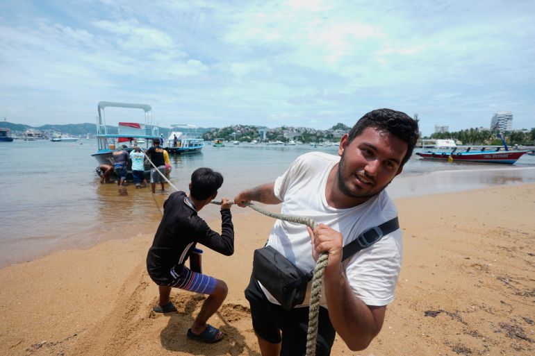
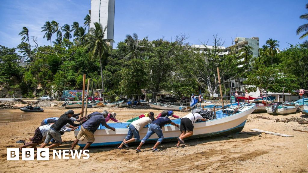
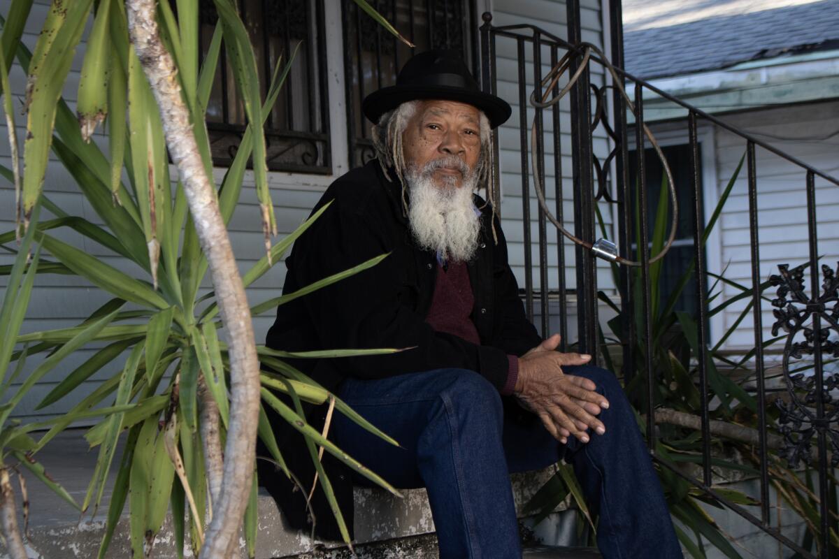
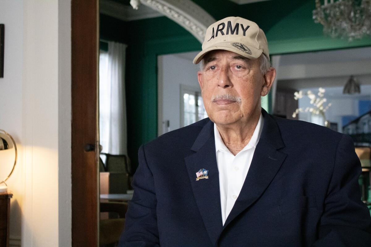
If a major hurricane approaches Central Florida this season, Maria knows it’s dangerous to stay inside her wooden, trailer-like home. In past storms, she evacuated to her sister’s sturdier house. If she couldn’t get there, a shelter set up at the local high school served as a refuge if needed.

But with accelerating detentions and deportations of immigrants across her community of Apopka, 20 miles northwest of Orlando, Maria, an agricultural worker from Mexico without permanent U.S. legal status, doesn’t know if those options are safe. All risk encountering immigration enforcement agents.

“They can go where they want,” said Maria, 50, who insisted the Associated Press not use her last name for fear of detention. “There is no limit.”

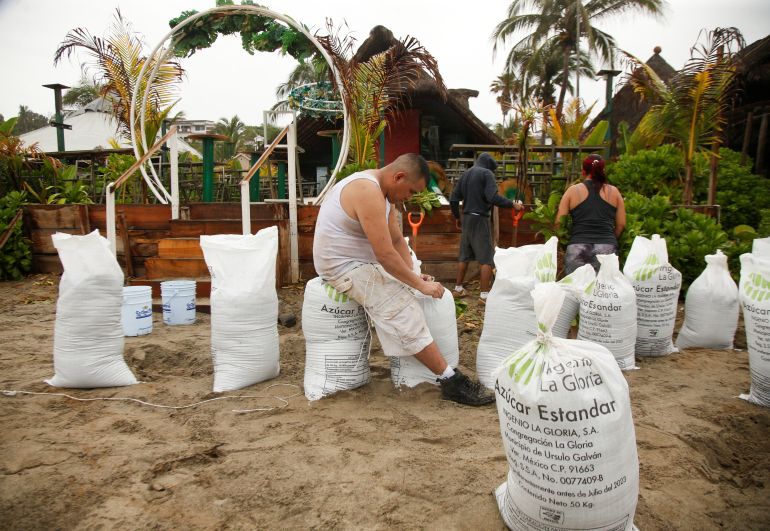
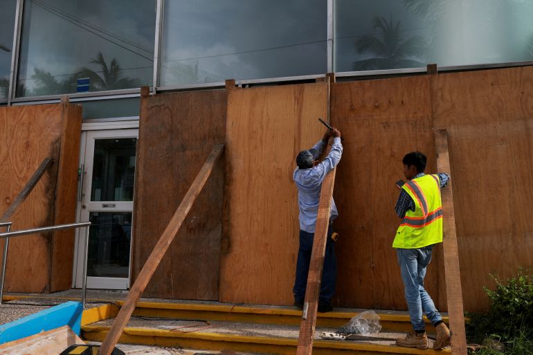
Natural disasters have long posed singular risks for people in the United States without permanent legal status. But with the arrival of peak Atlantic hurricane season, immigrants and their advocates say President Donald Trump’s robust immigration enforcement agenda has increased the danger.

Places considered neutral spaces by immigrants such as schools, hospitals and emergency management agencies are now suspect, and advocates say agreements by local law enforcement to collaborate with U.S. Immigration and Customs Enforcement make them more vulnerable and compel a choice between being physically safe and avoiding detention.

“Am I going to risk the storm or risk endangering my family at the shelter?” said Dominique O’Connor, an organizer at the Farmworker Association of Florida. “You’re going to meet enforcement either way.”

For O’Connor and for many immigrants, it’s about storms. But people without permanent legal status could face these decisions anywhere that extreme heat, wildfires or other severe weather could necessitate evacuating, getting supplies or even seeking medical care.

Federal and state agencies have said little on whether immigration enforcement would be suspended in a disaster. It wouldn’t make much difference to Maria: “With all we’ve lived, we’ve lost trust.”

New policies deepen concerns

Efforts by Trump’s Republican administration to exponentially expand immigration enforcement capacity mean many of the agencies active in disaster response are increasingly entangled in immigration enforcement.

Since January, hundreds of law enforcement agencies have signed 287(g) agreements, allowing them to perform certain immigration enforcement actions. Most of the agreements are in hurricane-prone Florida and Texas.

Florida’s Division of Emergency Management oversees building the state’s new detention facilities, like the one called “Alligator Alcatraz” in the Everglades. Federal Emergency Management Agency funds are being used to build additional detention centers around the country, and the Department of Homeland Security temporarily reassigned some FEMA staff to assist ICE.

The National Guard, often seen passing out food and water after disasters, has been activated to support U.S. Customs and Border Protection operations and help at detention centers.

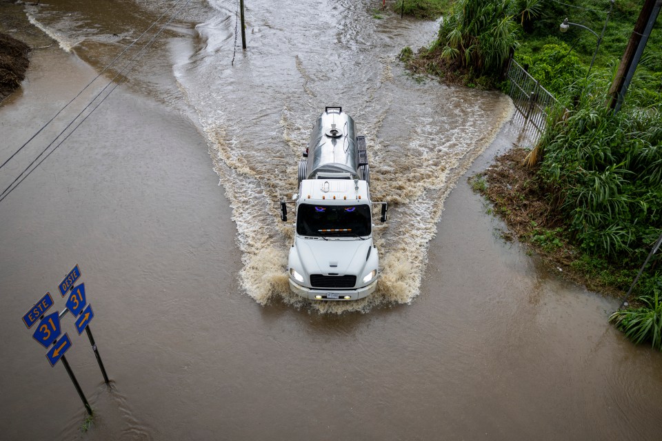
These dual roles can make for an intimidating scene during a disaster. After floods in July, more than 2,100 personnel from 20 state agencies aided the far-reaching response effort in Central Texas, along with CBP officers. Police controlled entry into hard-hit areas. Texas Department of Public Safety and private security officers staffed entrances to disaster recovery centers set up by FEMA.

That unsettled even families with permanent legal status, said Rae Cardenas, executive director of Doyle Community Center in Kerrville, Texas. Cardenas helped coordinate with the Mexican Consulate in San Antonio to replace documents for people who lived behind police checkpoints.

“Some families are afraid to go get their mail because their legal documents were washed away,” Cardenas said.

In Florida, these policies could make people unwilling to drive evacuation roads. Traffic stops are a frequent tool of detention, and Florida passed a law in February criminalizing entry into the state by those without legal status, though a judge temporarily blocked it.

There may be fewer places to evacuate now that public shelters, often guarded by police or requiring ID to enter, are no longer considered “protected areas” by DHS. The agency in January rescinded a policy of President Joe Biden, a Democrat, to avoid enforcement in places like schools, medical facilities and emergency response sites.

The fears extend even into disaster recovery. On top of meeting law enforcement at FEMA recovery centers, mixed-status households that qualify for help from the agency might hesitate to apply for fear of their information being accessed by other agencies, said Esmeralda Ledezma, communications associate with the Houston-based nonprofit Woori Juntos. “Even if you have the right to federal aid, you’re afraid to be punished for it,” Ledezma said.

In past emergencies, DHS has put out messaging stating it would suspend immigration enforcement. The agency’s policy now is unclear.

DHS Assistant Secretary Tricia McLaughlin said in an email that CBP had not issued any guidance “because there have been no natural disasters affecting border enforcement.” She did not address what directions were given during CBP’s activation in the Texas floods or whether ICE would be active during a disaster.

Florida’s Division of Emergency Management did not respond to questions related to its policies toward people without legal status. Texas’ Division of Emergency Management referred The Associated Press to Republican Gov. Greg Abbott’s office, which did not respond.

Building local resilience is a priority

In spite of the crackdown, local officials in some hurricane-prone areas are expanding outreach to immigrant populations. “We are trying to move forward with business as usual,” said Gracia Fernandez, language access coordinator for Alachua County in Central Florida.

The county launched a program last year to translate and distribute emergency communications in Spanish, Haitian Creole and other languages. Now staffers want to spread the word that county shelters won’t require IDs, but since they’re public spaces, Fernandez acknowledged there’s not much they can do if ICE comes.

“There is still a risk,” she said. “But we will try our best to help people feel safe.”

As immigrant communities are pushed deeper into the shadows, more responsibility falls on nonprofits, and communities themselves, to keep each other safe.

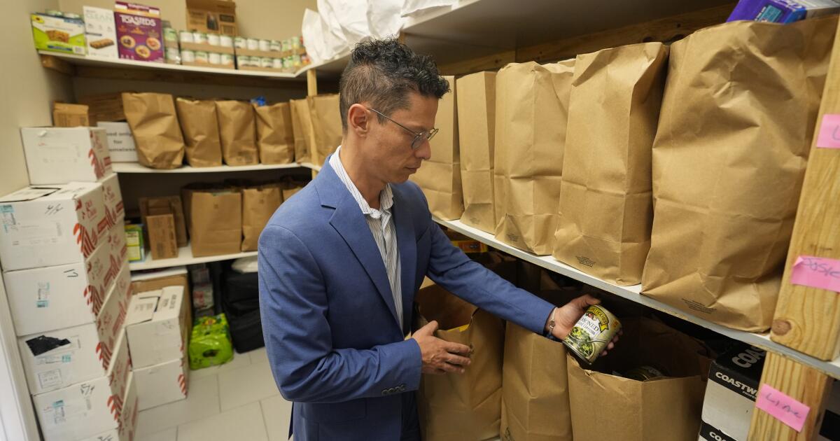
Hope Community Center in Apopka has pushed local officials to commit to not requiring IDs at shelters and sandbag distribution points. During an evacuation, the facility becomes an alternative shelter and a command center, from which staffers translate and send out emergency communications in multiple languages. For those who won’t leave their homes, staffers do door-to-door wellness checks, delivering food and water.

“It’s a very grassroots, underground operation,” said Felipe Sousa Lazaballet, the center’s executive director.

Preparing the community is challenging when it’s consumed by the daily crises wrought by detentions and deportations, Sousa Lazaballet said.

“All of us are in triage mode,” he said. “Every day there is an emergency, so the community is not necessarily thinking about hurricane season yet. That’s why we have to have a plan.”

Angueira writes for the Associated Press.
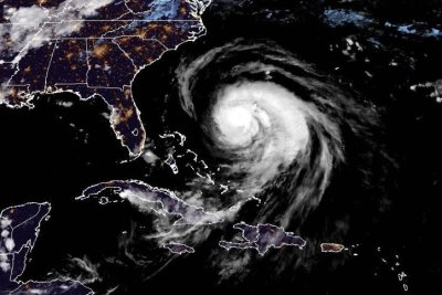
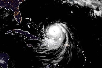
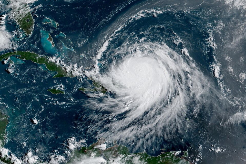
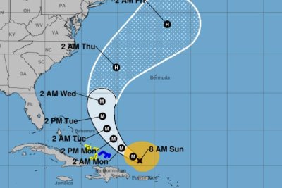
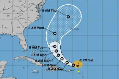
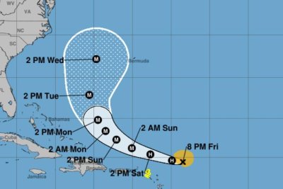
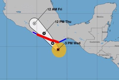
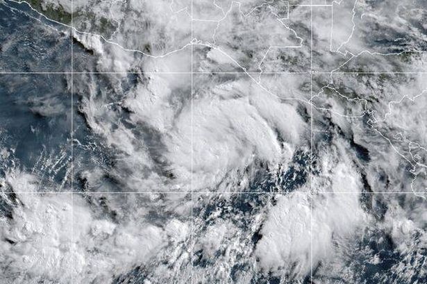
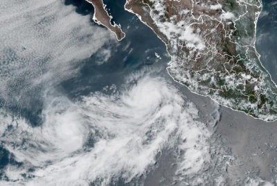
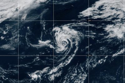
Source link

Hurricane Erin takes aim at U.S. East Coast

Hurricane Erin had maximum sustained winds of 105 mph Tuesday evening, and was expected to cause life-threatening rip currents along the U.S. east coast. Photo courtesy of the National Oceanic and Atmospheric Administration

Aug. 18 (UPI) — Hurricane Erin was taking aim at the U.S. East Coast on Tuesday evening, according to forecasters who are warning Americans of life-threatening rip currents along beaches that could persist for days.

The storm was located about 585 miles southwest of Bermuda and 540 miles south-southeast of Cape Hatteras, N.C., the National Hurricane Center said in its 11 p.m. EDT update.

Erin had maximum sustained winds of 100 mph, a Category 2 hurricane on the Saffir-Simpson Hurricane Wind Scale.

It was moving north-northwest at 12 mph.

A storm surge warning was in effect for from Cape Lookout to Duck, N.C., while a tropical storm warning was in effect for Beaufort Inlet to Duck, including Pamlico and Albemarle sounds.

North of Duck, N.C., to Chincoteague, Virginia, was under a tropical storm watch, as was Bermuda.

“On the forecast track, the center of Erin will pass to the east of the Bahamas tonight, and then move over the western Atlantic between the U.S. east coast and Bermuda on Wednesday and Thursday,” the NHC said.

Erin has been pummeling the Turk and Caicos, which are expected to see diminishing rainfall this evening, as should the Bahamas, the forecasters said, as they predict heavy rainfall for North Carolina starting Wednesday night and into Thursday. A potential 1 to 2 inches of rainfall is possible, they said.

Of greater worry are swells generated by Erin, which have the forecasters expecting life-threatening surf and rip currents affecting the Bahamas, Bermuda, Atlantic Canada and the U.S. east coast over the next several days.

“Beachgoers in those areas should follow advice from lifeguards, local authorities and beach warning flags,” the NHC said in a discussion on Erin.

“Storm surge flooding and tropical storm conditions are expected in the North Carolina Outer Banks beginning late Wednesday or Wednesday night, where tropical storm and storm surge warnings are in effect. The storm surge will be accompanied by large waves, leading to significant beach erosion and overwash, making some roads impassable.”

The season’s first Atlantic hurricane reached Category 5 status Saturday morning, the highest classification, after rapidly intensifying overnight Friday, when it became a Category 1 hurricane, the year’s fifth named storm.

Erin dropped to a Category 4 and then a 3 overnight into Sunday, but regained Category 4 strength late Sunday before again losing strength.

Erin became the first hurricane of the 2025 Atlantic storm season Friday morning.

There have been four named storms so far this season in the Atlantic. Tropical Storm Chantal caused major flooding in North Carolina but has been the only one of the four to make landfall in the United States this year.

The Atlantic hurricane season began on June 1 and ends on Nov. 30. The peak hurricane season runs from mid-August through September and into mid-October.

Ninety-three percent of hurricane landfalls along the U.S. Gulf Coast and the East Coast have occurred from August through October, the Weather Channel reported, citing data from the National Oceanic and Atmospheric Administration

Last year at this time, there had also been five named storms.

Source link

Hurricane Erin lashes Bahamas after regaining Category 4 strength

Hurricane Erin is expected to make a turn toward the north and northeast, skirting the Atlantic coast of the United States. Photo courtesy of the National Oceanic and Atmospheric Administration

Aug. 18 (UPI) — Hurricane Erin’s outer bands were beginning to lash the southeast Bahamas and the Turks and Caicos Islands early Monday after regaining Category 4 strength overnight.

The storm was located about 110 miles northeast of Grand Turk Island and 935 miles south-southeast of Cape Hatteras, N.C., the National Hurricane Center said in its 2 a.m. AST update.

It was moving northwest at 12 mph and was packing maximum sustained winds of 130 mph.

Forecasters are warning of life-threatening surf and rip currents across the eastern United States this week.

The season’s first Atlantic hurricane reached Category 5 status Saturday morning, the highest classification, after rapidly intensifying overnight. It became a Category 1 hurricane on Friday, the year’s fifth named storm.

Erin dropped to a Category 4 and then a 3 overnight into Sunday, but regained Category 4 strength late Sunday.

“Since the large-scale environment is expected to be favorable for about another day, re-strengthening is possible during that time period,” NHC forecaster John Cangialosi said. “However, it should be noted that predicting the intensity evolution from internal dynamics are challenging, and models often provide Little reliability in their solutions.”

The storm was skirting Puerto Rico overnight rather than hitting it directly.

On the forecast track, Erin’s core is projected to pass to the east and northeast of the Turks and Caicos Islands and the southeastern Bahamas over Monday, and then move between Bermuda and the U.S. east coast by the middle of the week

Erin’s outer bands will produce additional rainfall of 2 to 4 inches across the Virgin Islands and Puerto Rico, with isolated totals of up to 8 inches through Monday. “Locally considerable flash and urban flooding, along with landslides or mudslides, are possible,” the NHC said.

Also, swells will affect those places, as well as Hispaniola and the Turks and Caicos Islands, during the next couple of days, the agency said.

“Erin is expected to produce life-threatening surf and rip currents along the beaches of the Bahamas, much of the East Coast of the U.S., Bermuda, and Atlantic Canada during the next several days,” Cangialsi said.

He said interests along the North Carolina and mid-Atlantic coasts, as well are Bermuda “should monitor the progress of Erin as there is a risk of strong winds associated with the outer rainbands during the middle of next week.”

Alex Sosnowski, AccuWeather senior meteorologist, said portions of North Carolina’s Outer Banks and coastal Virginia will experience several feet of storm surge, leading to significant coastal flooding and beach erosion.

He said the closest landmass for Erin to hit could be southeastern Newfoundland in Canada on Friday.

Erin became the first hurricane of the 2025 Atlantic storm season two days ago.

There have been four named storms so far this season in the Atlantic. Tropical Storm Chantal caused major flooding in North Carolina but has been the only one of the four to make landfall in the United States this year.

The Atlantic hurricane season began on June 1 and ends on Nov. 30. The peak hurricane season runs from mid-August through September and into mid-October.

Ninety-three percent of hurricane landfalls along the U.S. Gulf Coast and the East Coast have occurred from August through October, the Weather Channel reported in citing data from the National Oceanic and Atmospheric Administration

Last year at this time, there had also been five named storms.

The U.S. East Coast is forecast to have rough ocean conditions through the middle of the week as the storm strengthens, the National Hurricane Center said. Tropical storm warnings were issued for the southeast Bahamas, about 300 miles east of Miami, and Turks and Caicos Islands.

Source link

Thousands without power as Hurricane Erin batters Caribbean & barrels towards US amid warnings storm will strengthen

THOUSANDS were left without power after Hurricane Erin battered the Caribbean and hurtled towards the US – with the storm still expected to strengthen.

The hurricane, which is now category 3, brought heavy rainfall and vicious winds to Puerto Rico and the Virgin Islands on Sunday, cutting power for some 100,000 locals.

Truck driving through floodwaters on a road.

6

A truck drives through a flood as category 3 Hurricane Erin leaves the region in Naguabo, Puerto RicoCredit: AFP
Satellite image of Hurricane Erin, a Category 3 hurricane near Puerto Rico.

6

Hurricane Erin from satellite view on August 17Credit: Reuters
Flooded road in Naguabo, Puerto Rico.

6

The storm left 100,000 people without power, reports sayCredit: AP

Luma Energy, Puerto Rico’s private power grid operator, revealed that most of its customers on the island had working electricity by Sunday afternoon.

The operator said on X: “As of 5:00 p.m., 92.5% of customers have electrical service.

“The majority of affected customers are concentrated in the regions of Arecibo, Caguas, and San Juan, as the rain bands have been moving out of Puerto Rico.”

They added: “Our crews are working with precision to ensure safety and continuity of service.”

The storm caused “multiple interruptions across the island”, the company said earlier.

Hurricane Erin also saw two divers swept amid powerful waves near St. Croix in the US Virgin Islands.

They had to be rescued by local crews on Sunday, authorities announced.

Shocking footage showed taken by St. Croix Rescue Chief Jason Henry showed the divers being dramatically hauled over onto a boat.

On the island of Sint Maarten, footage showed palm trees swaying in violent winds.

Its local government said cleanup crews were clearing debris since Sunday morning.

Hurricane Erin intensifies to ‘catastrophic’ category 5 with 160mph winds

A large amount of Sargassum seaweed also reached the shore – which could contain harmful toxins poisonous to people and marine life.

Erin has been labelled category 3 after multiple fluctuations in the last several days.

On Saturday it was considered to be a catastrophic category 5 hurricane.

Outer bands are continuing to sweep over Puerto Rico and the Virgin Islands, pummelling coasts with heavy rain and strong winds.

Rainfall was recorded between two and four inches.

Up to six inches is likely to fall in some areas.

Fears are mounting that this could lead to flash flooding or mudslides.

Large waves crashing on a beach near palm trees during a hurricane.

6

Large waves crashing in the Dominican RepublicCredit: EPA
Vehicles driving through a flooded road in Naguabo, Puerto Rico.

6

The storm caused major floods in some areasCredit: AP

As of 5pm local time on Sunday, Erin was 275 miles north-northwest of San Juan, Puerto Rico.

It had maximum sustained winds of 125mph, and is reportedly currently moving west.

Puerto Rico Governor Jenniffer González-Colón warned residents to stay home if possible.

There are no reports of flooding on the island so far – but the worst weather is expected to impact the region within the next six hours, officials said.

Terrifying footage on X also showed heavy rain falling in Cidra in central Puerto Rico on Sunday.

The hurricane is expected to strengthen in the next two days before taking a north-ward turn on Monday and Tuesday.

The storm is then forecast to gradually weaken through the middle and latter half of next week as it passes between the US and Bermuda.

Tropical storm warnings have been issued in Turks and Caicos and the southeast Bahamas, according to authorities.

In Sierra Bayamón, Puerto Rico, a suspension insulator broke and a conductor fell to the ground because of the stormy weather.

Luma Energy also advised the public to avoid walking or driving through flooded areas, especially near downed power lines.

Person photographing rough seas during a hurricane.

6

The storm was downgraded to category 3Credit: EPA

Source link

Hurricane Erin’s outer rainbands pound Puerto Rico, Virgin Islands

1 of 2 | Hurricane Erin dropped to a Class 3 hurricane as its outer rainbands pounded the Virgin Islands and Puerto Rico. Tracking by the National Hurricane Center

Aug. 17 (UPI) — Hurricane Erin weakened to a Category 3 storm with maximum sustained winds of 125 mph while the outbands pounded the Virgin Islands and Puerto Rico with gusty winds and heavy rains on Sunday.

The U.S. East Coast is forecast to have rough ocean conditions through the middle of the week, the National Hurricane Center said.

The storm is moving westerly at 14 mph and could affect the East Coast this week, the the NHC reported in an 8 a.m. EDT update.

The storm was located about 170 miles north-northwest of Puerto Rico and about 270 miles east of Grand Turk Island after passing the Leeward Islands on Saturday.

The season’s first Atlantic hurricane reached Category 5 status Saturday morning, the highest in the class, after rapidly intensifying overnight. It became a Category 1 hurricane on Friday, the years’ fifth named storm.

Erin dropped to a Category 4, and then 3 overnight into Sunday, but remained a major hurricane.

“Since the large-scale environment is expected to be favorable for about another day, re-strengthening is possible during that time period,” NHC forecaster John Cangialsi said in a discussion. “However, it should be noted that predicting the intensity evolution from internal dynamics are challenging, and models often provide Little reliability in their solutions.”

There is a tropical storm warning for the Turks and Caicos Islands and a tropical storm watch is in effect for the southeast Bahamas.

The storm was skirting Puerto Rico rather than hitting it directly.

Erin’s motion is expected to decrease in forward speed on Sunday, followed by a gradual turn to the north on Monday and Tuesday, NHC said.

On the forecast track, Erin’s core is projected to pass to the east of the Turks and Caicos Islands and southeastern Bahamas on Sunday and Monday.

By Thursday, the storm is forecast to be a few hundred miles west of Bermuda and just outside the big tracking cone. Erin is then forecast to travel north hundreds of miles from the East Coast.

Erin’s outer bands will produce rainfall of 3 to 6 inches across the Virgin Islands and Puerto Rico, with isolated totals of up to 8 inches. “Locally considerable flash and urban flooding, along with landslides or mudslides, are possible,” NHC said.

Also, swells will affect those places, as well as Hispaniola and the Turks and Caicos Islands, during the next couple of days, the agency said.

“Erin is expected to produce life-threatening surf and rip currents along the beaches of the Bahamas, much of the East Coast of the U.S., Bermuda, and Atlantic Canada during the next several days,” Cangialsi said.

He said interests along the North Carolina and mid-Atlantic coasts, as well are Bermuda “should monitor the progress of Erin as there is a risk of strong winds associated with the outer rainbands during the middle of next week.”

Erin became the first hurricane of the 2025 Atlantic storm season on Friday.

There have been four named storms so far this season in the Atlantic. Tropical Storm Chantal caused major flooding in North Carolina but has been the only of the four to make landfall in the United States this year.

The Atlantic hurricane season began on June 1 and ends on Nov. 30. The peak hurricane season goes from mid-August through September and into mid-October.

Ninety-three percent of hurricane landfalls along the U.S. Gulf Coast and the East Coast have occurred from August through October, the Weather Channel reported in citing data from the National Oceanic and Atmospheric Administration

Last year at this time, there also had been five named storms.

Source link

Erin downgraded to Category 3 hurricane, NHC says | Climate News

Erin is the fifth named storm of the Atlantic hurricane season, which runs from June 1 to November 30.

Hurricane Erin, the first hurricane of this year’s Atlantic season, is a Category 3, the United States National Hurricane Center (NHC) said, downgrading the storm from Category 4 as the wind speed eased slightly.

The storm was 330 miles (530km) southeast of Grand Turk Island packing maximum sustained winds of 125 mph (205 kph), the NHC added early on Sunday.

The hurricane had been gauged as high as a catastrophic Category 5 with maximum sustained winds of 160 mph (240 kph), then downgraded to a Category 4. It had earlier been forecast to strengthen into this week.

On Sunday, Erin was moving west-northwest at nearly 14 mph (22 kph) with a decrease in forward speed expected on Sunday and a turn to the north on Monday and Tuesday, the NHC said.

Swells generated by Erin will continue to affect parts of the northern Leeward Islands, the Virgin Islands, Puerto Rico, Hispaniola and the Turks and Caicos Islands for the next couple of days, the NHC said. These swells will spread to the Bahamas, Bermuda, the east coast of the United States, and Atlantic Canada during the early and middle portions of the week.

Rough ocean conditions will likely cause life-threatening surf and rip currents, the NHC added.

The Bahamas, which provides some meteorological services for the Turks and Caicos Islands, has issued a Tropical Storm Watch for the British islands to its southeast.

Hurricane
A surfer rides a wave at La Pared Beach as Category 5 Hurricane Erin approaches in Luquillo, Puerto Rico [File: Ricardo Arduengo/AFP]

Erin has also raised concerns about wildfire risks, if human-caused sparks ignite parched vegetation and strong dry winds fan the flames. BMS Group Senior Meteorologist Andrew Siffert said these conditions could arise if Erin grows into a powerful offshore storm prompted by colliding warm and cold air rather than tropical seas.

The US government has deployed more than 200 employees from the Federal Emergency Management Agency and other agencies as a precaution. Puerto Rico Housing Secretary Ciary Perez Pena said 367 shelters were inspected and ready to open if needed.

Officials in the Bahamas are also preparing shelters and urging people to monitor the storm’s progress.

Erin is the fifth named storm of the Atlantic hurricane season, which runs from June 1 to November 30 and is expected to be unusually busy. Six to 10 hurricanes are predicted for the season, including three to five reaching major status with winds of more than 177km/h (110mph).

Scientists have linked rapid intensification of hurricanes in the Atlantic to climate change. Global warming is causing the atmosphere to hold more water vapour and is spiking ocean temperatures, and warmer waters give hurricanes fuel to unleash more rain and strengthen more quickly.

Storms that ramp up so quickly complicate forecasting and make it harder for government agencies to plan for emergencies.

Source link

Hurricane Erin rapidly intensifies to Category 5 strength

1 of 2 | Hurricane Erin has become a Category 5 hurricane as it moves in the Atlantic in a northwestly direction and then turning northward. Tracking by the National Hurricane Center

Aug. 16 (UPI) — Hurricane Erin is now a Category 5 storm, the highest on the class, rapidly intensifying overnight into early Saturday morning as it threatens the Leeward Islands and Puerto Rico, then will move along the U.S. East Coast.

In an update at 11:20 a.m. EDT, the National Hurricane Center reported an Air Force Reserve Hurricane Hunter aircraft showed maximum sustained winds of 160 mph, which passes the 157 mph minimum for Category 5 on the Saffir-Simpson Hurricane Wind Scale.

In the NHC’s 2:00pm update, Erin remained a Category 5 storm with 160 mph after rapidly intensifying from a 75 mph-Category 1 storm on Friday morning to a 155 mph-Category 4 at the 11 a.m. advisory on Saturday morning.

The storm was located approximately 110 miles north of Anguilla and about 205 miles east-northeast of San Juan, Puerto Rico, and was traveling west at 16 mph.

The northern Leeward Islands include Anguilla, Antigua and Barbuda, the British and U.S. Virgin Islands, St. Martin, St. Barts, Saba, St. Eustatius, St. Kitts and Nevis, and Montserrat.

A tropical storm watch remains for St. Martin and St. Barthelemy, and Sint Maarten. Hurricane-force winds extend up to 30 miles from the center and tropical-force outward to 140 miles.

The storm is expected to skirt the Leeward Islands and Puerto Rico on Sunday rather than hit them directly, which could bring strong winds and up to 6 inches of rain through the day Saturday.

“Locally considerable flash and urban flooding, along with landslides or mudslides, are possible,” NHC said, in addition to the possibility of swells.

“Swells generated by Erin will affect portions of the northern Leeward Islands, the Virgin Islands, Puerto Rico, Hispaniola, and the Turks and Caicos Islands through the weekend,” the weather service said in its latest update. “These swells will spread to the Bahamas, Bermuda, and the East Coast of the United States early next week.

“These rough ocean conditions will likely cause life-threatening surf and rip currents.”

Forecasters are predicting the storm will make a west-northwest turn Saturday evening, which will come with a “decrease in forward speed,” ahead of an expected northerly early next week.

By Wednesday night, the storm was forecast to be a few hundred miles west of Bermuda and just outside the big tracking cone. Erin then is forecast to travel north hundreds of miles from the East Coast.

Forecasters predict the storm has the potential to affect the U.S. East Coast, including Florida, as well as the Bahamas and Bermuda, next week.

“Erin is expected to produce life-threatening surf and rip currents along the beaches of the Bahamas, much of the East Coast of the U.S., and Atlantic Canada next week,” NHC forecaster Jack Beven said in a discussion.

Erin became the first hurricane of the 2025 Atlantic storm season Friday. Forecasters had been expecting the storm to intensify into a hurricane since early in the week.

There have been four prior Atlantic named storms so far this season. Tropical Storm Chantal caused major flooding in North Carolina but was the only of the four to make landfall in the United States.

The Atlantic hurricane season began on June 1 and ends on Nov. 30. The peak hurricane season goes from mid-August through September and into mid-October. Ninety-three percent of hurricane landfalls along the U.S. Gulf Coast and the East Coast have occurred from August through October, the Weather Channel reported in citing data from the National Oceanic and Atmospheric Administration

Last year at this time, there also had been five named storms.

Source link

Erin to rapidly strengthen, reach major hurricane status this weekend

1 of 2 | Hurricane Erin is forecast to become a major hurricane by 2 a.m. Sunday. Tracking by the National Hurricane Center

Aug. 15 (UPI) — Erin became the first hurricane of the 2025 Atlantic season on Friday morning and is forecast to rapidly strengthen as it heads near the Leeward Islands, and later Puerto Rico and the Virgin Islands.

In its 10 a.m. EDT update, the National Hurricane Center said Erin became a hurricane with maximum sustained winds of 75 mph — just 2 mph above the tropical storm designation.

In the 7 p.m. update, Erin increased to 85 mph.

Erin was 310 miles east of the Northern Leeward Islands, and was moving west-northwest at 17 mph in warm waters.

The NHC said the motion is expected to continue through the weekend with some decrease in forward speed.

With rapid strengthening the next two to three days, Eric is forecast to become a major hurricane during the weekend with winds at least 111 mph.

On the forecast track, Erin is likely to go just north of the Northern Leeward Islands, the Virgin Islands and Puerto Rico over the weekend. Erin is forecast to reach Category 4 at 130 mph on Monday, the NHC said.

By 2 p.m., Wednesday, the storm was forecast to be a few hundred miles west of Bermuda and outside the big tracking cone.

“While the threat of direct impacts in the Bahamas and along the East coast of the United States appears to be gradually decreasing, there will still be a significant risk of dangerous surf and rip currents along western Atlantic beaches next week,” NHC forecaster Jack Beven wrote in a discussion.

Tropical storm warnings remain in effect for Anguilla St. Martin and St. Barthelemy, Saba and St. Eustatius, and Sint Maarten.

Hurricane-force winds extend up to 75 miles from the center, and tropical-force winds outward to 115 miles.

Marine warnings are in effect for the Atlantic, Caribbean and southwest Atlantic and the southwest North Atlantic.

The NHC said Puerto Rico and the northern Leeward Islands — which include Anguilla, Antigua and Barbuda, the British and U.S. Virgin Islands, St. Martin, St. Barts, Saba, St. Eustatius, St. Kitts and Nevis, and Montserrat — should expect heavy rainfall Friday night through Sunday. Rainfall totals of 2 to 4 inches are forecast with isolated totals of 6 inches. It could lead to flash and urban flooding, along with landslides and mudslides.

Swells will begin affecting this area and will spread to the western Atlantic next week.

Wind gusts or tropical storm-force winds are possible in rainbands over portions of the Virgin Islands and Puerto Rico this weekend.

“Do not underestimate the power of a major hurricane even passing by offshore,” Alex DaSilva, the lead hurricane expert with AccuWeather, said. “These massive storms produce very rough surf and lethal rip currents that can impact beaches even hundreds of miles away.”

The previous four named Atlantic storms this year were Andrea, Barry, Chantal and Dexter. None of them became hurricanes, and Chantal was the only one to make landfall in the United States, causing significant flooding in North Carolina.

Helene struck that state last year as a tropical storm, causing an estimated $53 billion in damage, after hitting western Florida as a Category 4 hurricane.

Four other hurricanes made landfall in the United States in 2024: Beryl, Debby, Francine and Milton.

Source link

Erin becomes first hurricane of Atlantic season

1 of 2 | Hurricane Erin is predicted to move over the northern Leeward Islands and Puerto Rico. It could cause problems on the east coast of the United States. Image courtesy of the National Hurricane Center

Aug. 15 (UPI) — Erin has become the first hurricane of the 2025 Atlantic season as it heads west toward the Leeward Islands and the Caribbean.

In its 10 a.m. EDT update, the National Hurricane Center said Hurricane Erin was 205 miles east of St. Thomas, U.S. Virgin Islands, and moving toward the northern Leeward Islands, the Virgin Islands and Puerto Rico, with maximum sustained winds at 75 mph.

Marine warnings are in effect for the Atlantic, Caribbean and southwest Atlantic and the southwest North Atlantic.

The update said Puerto Rico and the northern Leeward Islands — which include Anguilla, Antigua and Barbuda, the British and U.S. Virgin Islands, St. Martin, St. Barts, Saba, St. Eustatius, St. Kitts and Nevis, and Montserrat — should expect heavy rainfall Friday through Sunday. It could lead to flash and urban flooding, along with landslides and mudslides. Wind gusts or tropical storm-force winds are possible in rainbands over portions of the Virgin Islands and Puerto Rico this weekend.

While the threat of direct impacts in the Bahamas and the east coast of the United States appears to be gradually decreasing, forecasters say there is a significant risk of dangerous surf and rip currents along western Atlantic beaches next week.

Forecasters said Erin is in a favorable environment for strengthening, though there are still uncertainties. But, the global and regional hurricane models are in “good agreement” that Erin will become a powerful and increasingly large hurricane over the southwestern Atlantic.

The previous four named Atlantic storms this year were Andrea, Barry, Chantal and Dexter. None of them became hurricanes, and Chantal was the only one to make landfall in the United States, causing significant flooding in North Carolina.

Helene struck that state last year as a tropical storm, causing an estimated $53 billion in damage, after hitting western Florida as a Category 4 hurricane.

Four other hurricanes made landfall in the United States in 2024: Beryl, Debby, Francine and Milton.

Source link

Hurricane Erin threatens Puerto Rico, Virgin Islands with flooding | News

Heavy rains are forecast to start with the storm expected to become a major Category 3 storm over the weekend.

Hurricane Erin has formed in the Atlantic Ocean as it approaches the northeast Caribbean, as forecasters warn of possible flooding and landslides in Puerto Rico and the Virgin Islands.

The storm is expected to remain over open waters, although tropical storm watches were issued for Anguilla and Barbuda, St Martin and St Barts, Saba and St Eustatius and St Maarten.

Heavy rains were forecast to start late on Friday in Antigua and Barbuda, the US and British Virgin Islands, and southern and eastern Puerto Rico. Up to 10cm (four inches) are expected, with isolated totals of up to 15cm (six inches), according to the National Hurricane Center in Miami.

Forecasters also warned of dangerous swells.

The storm was located about 835km (520 miles) east of the Northern Leeward Islands. It had maximum sustained winds of 110km/h (70mph) and was moving west-northwest at 28km/h (17mph).

Erin is forecast to become a major Category 3 storm late this weekend.

The hurricane centre noted that “there is still uncertainty about what impacts Erin may bring to portions of the Bahamas, the east coast of the United States, and Bermuda in the long range.”

Fifth named storm

Dangerous surf and rip currents are expected to affect the US East Coast next week, with waves reaching up to five metres (16.4 feet) along parts of the North Carolina coast that could cause beach erosion, according to Accuweather.

“Erin is forecast to explode into a powerful Category 4 hurricane as it moves across very warm waters in the open Atlantic. Water temperatures at the surface and hundreds of feet deep are several degrees higher than the historical average,” Alex DaSilva, Accuweather’s lead hurricane expert, was quoted by The Associated Press news agency.

Erin is the fifth named storm of the Atlantic hurricane season, which runs from June 1 to November 30.

This year’s season is once again expected to be unusually busy and potentially perilous. The forecast calls for six to 10 hurricanes, with three to five reaching major status with winds of more than 177km/h (110mph).

Source link

Tropical Storm Erin forecast to be hurricane by Friday

Tropical Storm Erin is forecast to become a hurricane by 8 a.m. Friday and a major one by 8 p.m. Sunday. Image by National Hurricane Center

Aug. 13 (UPI) — Tropical Storm Erin is slightly intensifying and forecast to become a hurricane on Friday morning over the central tropical Atlantic with a chance of ultimately affecting the U.S. East Coast, the Bahamas and Bermuda next week, the National Hurricane Center said Wednesday.

For the first time since Erin became a tropical storm Monday morning, intensity increased, though just 5 mph, to maximum sustained winds of 45 mph, with gradual strengthening during the next two days forecast, the NHC said in its 5 p.m. EDT update.

In the 11 p.m. update, Erin remained at 50 mph.

Erin is forecast to reach hurricane status by 8 a.m. Friday with winds at least 74 mph, and a major hurricane, with winds of at least 111 mph, by 8 p.m. Sunday.

It would be the first hurricane of the Atlantic season. Beryl was the first hurricane last year on June 24.

The storm is about 1,095 miles east of the Northern Leeward Islands.

Erin was moving westward at 16 mph and will shift to a north-westward track beginning Thursday night and into the weekend, the NHC said. On the forecast track, the storm’s center will move over or near just north of the northern Leeward Islands.

The NHC’s “cone” doesn’t track Erin past Monday night, and NHC forecasters remind that they have an average error of 150 to 214 miles at days four and five.

In the latest discussion, NHC forecaster Jack Beven said there is a “greater than normal uncertainty about what impacts Erin may bring to portions of the Bahamas, the East Coast of the United States and Bermuda.”

But he said: “The risk of dangerous surf and rip currents across the western Atlantic basin next week is increasing.”

By this weekend, swells are forecast to cause life-threatening surf and rip current conditions, the NHC said.

Alex Sosnowsky, an AccuWeather senior forecaster, said there is concern that residents, visitors, cruise lines, and shipping and fishing ventures “could pass paths with a powerful hurricane.”

With a track farther to the east, Bermuda could be directly in the path as a major hurricane.

He said a farther west scenario would mean a greater risk of strong winds, rain and coastal flooding in the U.S., including eastern North Carolina, Long Island, New York and southeastern New England.

“Families heading to U.S. Atlantic beaches for a late-summer vacation next week need to be extremely cautious when venturing into the surf,” AccuWeather Lead Hurricane Expert Alex DaSilva said. “More than 50 people have lost their lives to rip currents and rough surf at beaches across the country so far this year, without any major hurricane nearby.”

There are no warnings or coastal watches in effect as tropical-force winds extend outward up to 60 miles. But those in the northern Leeward Islands, the Virgin Islands and Puerto Rico should monitor Erin’s progress.

The previous four named Atlantic storms this year were Andrea, Barry, Chantal and Dexter. None of them became hurricanes, and Chantal was the only one to make landfall in the United States, causing significant flooding in North Carolina.

Helene struck that state last year as a tropical storm, causing an estimated $53 billion in damage, after hitting western Florida as a Category 4 hurricane.

Four other hurricanes made landfall in the United States in 2024: Beryl, Debby, Francine and Milton.

Source link

‘Hurricane Katrina: Race Against Time’ review: A focus on the victims

It’s been 20 years since Hurricane Katrina reshaped the city of New Orleans.

Spike Lee examined the disaster with two big HBO documentaries, the 2006 “When the Levees Broke: A Requiem in Four Acts,” just a year after the event, and a 2010 sequel, “If God Is Willing and Da Creek Don’t Rise” and he is involved with a new work for Netflix, “Katrina: Come Hell and High Water,” arriving in late August. Other nonfiction films have been made on the subject over the years, including “Trouble the Water,” winner of the grand jury prize at the 2008 Sundance Film Festival, Nova’s “Hurricane Katrina: The Storm That Drowned a City,” “Hurricane Katrina: Through the Eyes of the Children,” and “Dark Water Rising: Survival Stories of Hurricane Katrina Animal Rescues,” while the storm also framed the excellent 2022 hospital-set docudrama “Five Days at Memorial.” As a personified disaster with a human name and a week-long arc, it remains famous, or infamous, and indelible.

In the gripping five-part “Hurricane Katrina: Race Against Time,” premiering over two subsequent nights beginning Sunday at 8 p.m. on National Geographic (all episodes stream on Hulu and Disney+ on Monday), director Traci A. Curry (“Attica”) necessarily repeats many of Lee’s incidents and themes. But she finds her own way through mountains of material in the series that is at once highly compelling and difficult to watch — though I suggest you do.

Though there are many paths to take through the story, they lead to the same conclusions. Curry speaks with survivors, activists, scientists, officials and journalists, some of whom also appear in archival footage, but her eye is mainly on the victims: the people who lost their homes, people who lost their people, those unable to evacuate, for lack of money or transportation or the need to care for family members. If the storm itself was an assault on the city, most everything else — the broken levees, the flooded streets, the slow government response, the misinformation, the exaggerations and the mischaracterizations taken as fact — constituted an attack on the poor, which in New Orleans meant mostly Black people. (“The way they depicted Black folks,” says one survivor regarding sensational media coverage of the aftermath, when troops with automatic weapons patrolled the streets as if in a war zone, “it’s like they didn’t see us as regular people, law abiding, churchgoing, hard-working people.”)

Effective both as an informational piece and a real-life drama, “Race Against Time” puts you deep into the story, unfolding as the week did. First, the calm before the storm (“One of the most peaceful scariest things that a person can experience,” says one 8th Ward resident), as Katrina gained power over the Gulf of Mexico. Then the storm, which ripped off part of the Superdome roof, where citizens had been instructed to shelter, and plunged the city into darkness; but when that passed, it looked briefly like the apocalypse missed them.

Then the levees, never well designed, were breached in multiple locations and 80% of the city, which sits in a bowl between the Mississippi River and Lake Pontchartrain, found itself under water. Homes drown: “You’re looking at your life, the life that your parents provided for you, your belongings being ruined, your mother’s furniture that she prided is being thrown against a wall.” Residents are driven onto roofs, hoping for rescue, while dead bodies float in the water. This is also in many ways the most heartening part of the series, as neighbors help neighbors and firefighters and police set about rescuing as many as possible, going house to house in boats running on gasoline siphoned from cars and trucks. A Coast Guardsman tears up at the memory of carrying a baby in her bare arms as they were winched into a helicopter.

A man in black hat, dark jacket and jeans sits on the stoop of a house.

When Hurricane Katrina hit in 2005, Malik Rahim, a community organizer, was a resident of Algiers Point in New Orleans. (National Geographic)

An older man in a white shirt and blue blazer wearing a ball cap that says Army.

Lt. General Russel Honore served as commander of Joint Task Force Katrina and is widely credited for reestablishing order and evacuating the Superdome. (National Geographic)

And then we descend into a catalog of institutional failures — of governance, of communication, of commitment, of nerve, of common sense, of service, of the media — which, camped in the unflooded French Quarter or watching from afar, repeated rumors as fact, helping create a climate of fear. (Bill O’Reilly, then still sitting pretty at Fox News, suggests looters should be shot dead.) More people escaping the flood arrive at the Superdome, where the bathrooms and the air conditioning don’t work, there’s no food or water and people suffer in the August heat, waiting for days to be evacuated. Instead, the National Guard comes to town along with federal troops, which residents of this city know is not necessarily a good thing.

Many speakers here make a deep impression — community organizer Malik Rahim, sitting on his porch, speaking straight to the camera, with his long white hair and beard, is almost a guiding spirit — but the star of this show is the eminently sensible Lt. Gen. Russel L. Honoré (now retired), a Louisiana Creole who was finally brought in to coordinate operations between FEMA and the military. (We see him walking through the streets, ordering soldiers to “put your guns on your back, don’t be pointing guns at nobody.”) Honoré, who is free with his opinions here, had respect for the victims — “When you’re poor in America, you’re not free, and when you’re poor, you learn to have patience” — but none for foolish officialdom, the main fool being FEMA director Michael Brown, mismanaging from Baton Rouge, who would resign soon after the hurricane.

When buses finally did arrive, passengers were driven away, and some later flown off, with no announcement of where they were headed; family members might be scattered around the country. Many would never return to New Orleans, and some who did no longer recognized the place they left, not only because of the damage, but because of the new development.

The arrival of this and the upcoming Lee documentary is dictated by the calendar, but the timing is also fortuitous, given where we are now. Floods and fires, storms and cyclones are growing more frequent and intense, even as Washington strips money from the very agencies designed to predict and mitigate them or aid in recovery. Last week, Ken Pagurek, the head of FEMA’s urban search and rescue unit, resigned, reportedly over the agency’s Trump-hobbled response to the Texas flood, following the departure of Jeremy Greenberg, who led FEMA’s disaster command center. Trump, for his part, wants to do away with the agency completely.

And yet Curry manages to end her series on an optimistic note. Residents of the Lower 9th Ward have returned dying wetlands to life, creating a community park that will help control the next storm surge. Black Masking Indians — a.k.a. Mardi Gras Indians — are still sewing their fanciful, feathered costumes and parading in the street.

Source link

Hurricane Erick upgraded to Category 4 storm as it approaches Mexico | Weather News

The United States National Hurricane Center has warned of the risk of ‘life-threatening flooding and mudslides’.

Hurricane Erick has become an “extremely dangerous” Category 4 storm, hours before it is expected to pummel Mexico’s Pacific coastline, the United States National Hurricane Center (NHC) has said.

In its latest bulletin, the meteorological centre said Erick could grow even more powerful before making landfall in the eastern part of Guerrero state and the western part of Oaxaca state on Thursday morning.

The major storm, which is travelling to the northwest at a rate of 15km/h (nine mph), will unleash destructive winds, flash floods and a dangerous storm surge, forecasters have predicted.

As it neared Mexico, the NHC reported that the hurricane’s maximum sustained winds had increased to about 230km/h (145mph), putting it within the Category 4 wind speed range of 209-251km/h (130-156mph).

Boats are removed from the water to Manzanillo beach ahead of the arrival of Hurricane Erick in Acapulco, Mexico
Boats are removed from the water ahead of the arrival of Hurricane Erick in Acapulco [Fernando Llano/AP Photo]

The NHC warned that Erick could unleash up to 16 inches (40cm) of rain on Oaxaca and Guerrero, bringing the risk of “life-threatening flooding and mudslides, especially in areas of steep terrain”.

The Mexican states of Chiapas, Michoacan, Colima and Jalisco could also be hit by up to 6 inches of rainfall, the Miami-based centre added.

Late on Wednesday, Erick’s projected path was revised, as it is headed closer to the resort city of Puerto Escondido in Oaxaca. A hurricane warning is in place for the entire coastal area between Acapulco and Puerto Angel.

Mexican authorities have scrambled to prepare residents and tourists ahead of Erick’s arrival. In a video message on Wednesday night, President Claudia Sheinbaum urged people to stay at home or move to shelters if they were in low-lying areas.

Some 2,000 temporary shelters have been set up in the states of Chiapas, Guerrero and Oaxaca to house those who have to leave their homes.

Meanwhile, Guerrero Governor Evelyn Salgado said that schools in her state would stay closed, and that fishing and tourism operators had been told to make their boats storm ready.

Hurricane Erick Mexico preparations
A man ties a sandbag ahead of Hurricane Erick’s arrival in Puerto Escondido, Oaxaca state, Mexico, on June 18, 2025 [Jorge Luis Plata/Reuters]

Residents in the Guerrero resort of Acapulco were among those steeling themselves for Erick’s landfall.

The city of almost one million people was devastated in October 2023 by Hurricane Otis, which killed at least 52 people and destroyed many homes and businesses.

Carlos Ozuna Romero, 51, lost his restaurant at the edge of an Acapulco beach in the 2023 hurricane. On Wednesday, he oversaw workers as they stored tables and chairs in preparation for the new storm.

“Authorities’ warnings fill us with fear and obviously make us remember everything we’ve already been through,” he said.

Elsewhere in the city, Veronica Gomez, a 40-year-old shipping company worker, suggested the city was much better prepared this time. “Now it’s not going to catch us by surprise,” she said.

Erick is likely to rapidly weaken as it reaches the mountains, and it is predicted to dissipate on Thursday night or early Friday, according to the NHC.

People cover a building with planks of wood as hurricane Erick strengthens off Mexico's Pacific Coast,
People are boarding windows of a business in Acapulco [Henry Romero/Reuters]

Source link

Hurricane Erick ‘extremely dangerous’ as it nears Mexico

Hurricane Erick has strengthened into an “extremely dangerous” Category 4 storm, as it heads towards Mexico’s Pacific coast, the US National Hurricane Center (NHC) says.

Maximum sustained winds in the storm had risen to 230km/h (145mph) late on Wednesday local time, with some additional strengthening possible.

Forecasters expect it to make landfall later on Thursday with the states of Oaxaca and Guerrero state most likely to be impacted by what the NHC says could be “devastating wind damage”.

Mexican President Claudia Sheinbaum told people in the storm’s path to “stay tuned to official communications, to stay indoors, and not go out”.

A hurricane warning is in effect for a 500km-strech (300 miles) of Pacific coast, from the resort town of Acapulco to Puerto Ángel.

Residents in Guerrero and Oaxaca have been warned of life-threatening floods and swells.

“If you are in low-lying areas, near rivers, near waterways, it is best for you to go to shelters, to the shelters that have already been set up for this situation,” Mexican President Claudia Sheinbaum said.

People living in mountainous areas have been told to beware of possible mudslides.

Around 2,000 shelters have been set up across the states of Chiapas, Guerrero, and Oaxaca and more than 18,000 first responders have been mobilised to prepare for the hurricane.

It is expected to be the first to make landfall in Mexico this season, which runs from the start of June to the end of November.

In October 2023, at least 50 people were killed during Hurricane Otis, a category 5 hurricane that battered Acapulco.

Otis intensified rapidly, meaning many people were unprepared when the hurricane made landfall.

Source link

Erick projected to become major hurricane, strike western Mexico

Erick was upgraded is projected to become a major hurricane and hit western Mexico. Image from National Hurricane Center.

June 18 (UPI) — Tropical Storm Erick is forecast to become a major hurricane in the Pacific Ocean and strike western Mexico one day after becoming named storm, the National Hurricane Center said Wednesday.

In its 3 p.m. CST advisory, the NHC said Erick had maximum sustained winds of 110 mph as a Category 2 storm, just 1 mph from becoming a major storm as a Category 3. Erick was about 85 miles south of Puerto Angel, Mexico, and about 185 miles southeast of Punta Maldonado, Mexico.

The storm, which was moving 9 mph northwest, became a hurricane Wednesday morning.

Erick is forecast to be a major hurricane when it reaches the coast of western Oaxaca or eastern Guerrero on Wednesday morning or early Thursday, NHC said.

“Erick has been rapidly strengthening for the past 12 hours, and given the extremely favorable atmospheric and oceanic conditions along Erick’s forecast track, further intensification in the short term appears very likely,” NHC forecaster Alex Hagen wrote in a discussion.

Devastating wind damage is possible as the core of the storm moves onshore, Hagen said.

Erick will produce heavy rainfall across portions of Central America and Southwest Mexico through this week with life-threatening flooding and mudslides likely, especially in steep terrain.

“A dangerous, life-threatening storm surge is expected to produce coastal flooding near and to the east of where the center crosses the coast, in areas of onshore winds,” Hagen said. “The surge will be accompanied by large and destructive waves.”

Acapulco to Puerto Angel is under a hurricane warning, while a hurricane watch has been issued for the area west of Acapulco to Tecpan de Galeana.

The region between Puerto Angel to Salina Cruz and West of Acapulco to Tecpan de Galeana is under a tropical storm warning.

Erick will produce 8 to 16 inches of rain across the Mexican states of Oaxaca and Guerrero, the NHC said.

Erick is the fifth named storm in the Pacific this year. No storms have formed in the Atlantic yet.

The hurricane season runs from June 1 to Nov. 30.

Source link

Hurricane Erick approaches Pacific coast, threatens Mexico with flooding | Weather News

Erick is expected to rapidly intensify and reach major hurricane strength as it approaches Mexico’s coast.

Hurricane Erick is forecast to bring heavy rain, strong winds, storm surge and possible mudslides to southern coastal Mexico, the United States National Hurricane Center (NHC) has said, causing potential “life-threatening flooding and mudslides.”

Initially a tropical storm, Erick grew into a Category 1 hurricane on Wednesday, packing maximum sustained winds of 120km/h (75 mph), the meteorological centre said. It was located 255km (158 miles) from the town of Puerto Angel in the southern Mexican state of Oaxaca.

“Rapid strengthening is expected today, and Erick may reach major hurricane strength when it approaches the coast of southern Mexico Thursday,” the NHC said.

Forecasts predicted rainfall across the Mexican states of Oaxaca and Guerrero, as well as less heavy rains for the states of Chiapas, Michoacan, Colima and Jalisco.

Mexican President Claudia Sheinbaum urged the population to be alert.

The storm’s projected path would take its centre near the renowned resort of Acapulco, which was devastated in October 2023 by Hurricane Otis, a Category 5 hurricane that killed at least 52 people, and left a trail of destruction, after the storm severely damaged almost all of the resort’s hotels.

John, a Category 3 storm that hit in September last year, caused about 15 deaths.

Source link

Tropical Storm Erick will upgrade to hurricane as Foreign Office warns against travel

The UK government has issued a new travel warning against all travel to parts of Mexico as Tropical Storm Erick has taken shape off the southern coast of the country

Erick
(Image: NOAA)

A fresh UK government travel warning has been issued for parts of Mexico due to Tropical Storm Erick which is forecast to develop into a hurricane by the afternoon of June 18th.

Erick is currently south-east of Punta Maldonado in Mexico and is expected to intensify into a hurricane with forecasters warning it could make landfall on Mexico’s Pacific coast.

Heavy rain is forecast to affect Guerrero, Oaxaca, Chiapas, and southern Veracruz, and a hurricane watch has been issued for the Pacific coast.

Forecasters said Erick was moving west-north-east at 12 miles per hour and will move closer to Mexico’s coastline by late Wednesday with maximum sustained winds of 40 miles per hour being reported on Tuesday.

The UK Foreign, Commonwealth and Development Office (FCDO) warned Britons that their travel insurance could be rendered invalid if they fail to adhere to the advice issued.

READ MORE: Heat health fears as Brits face hottest day since notorious 40C heatwave of 2022READ MORE: Exact date UK will be hotter than Barcelona as 32C heatwave bakes Brits

The FCDO’s website issued the following warning:

“Tropical Storm Erick is expected to make landfall on the pacific coast on 17 June with heavy rains affecting Guerrero, Oaxaca, Chiapas and the south of Veracruz.

“It is expected to gain strength and become a Category 2 hurricane by the afternoon of 18 June affecting an area along the southern pacific coast from Puerto Angel in Oaxaca to Punta Maldonado in Guerrero.”

Erick map
Addition of information about Tropical storm Erick to become a Category 2 Hurricane hitting the Paci(Image: FCDO)

The FCDO has warned: “You should closely monitor local and international weather updates from the US National Hurricane Center and follow the advice of local authorities and your tour operator, including any evacuation orders.”, reports the Express.

“See the tropical cyclones page for advice about how to prepare for travel during hurricane season and what to do ahead of a storm.

“In the aftermath of a hurricane, there can be flooding, high winds and continued rainfall.”

A previous warning states:

“The hurricane season in Mexico normally runs from June to November and can affect the Pacific and Atlantic coasts. Tropical storms and hurricanes cause floods, landslides and disruption to local services, including transport networks.

“After a hurricane there can still be continued flooding, high winds and rainfall. Monitor local and international weather updates from the US National Hurricane Center and follow the advice of local authorities and your tour operator, including evacuation orders.”

Source link

Barbara becomes first hurricane of Pacific season

Hurricane Barbara became the first hurricane of the 2025 season as it strengthened into a Category 1 storm Monday off the coast of Mexico. Image by NOAA

June 9 (UPI) — Hurricane Barbara emerged as the first hurricane of the Pacific hurricane season on Monday but National Hurricane Center forecasters said she has “peaked.”

In the 2 p.m. MST advisory, Barbara was in the eastern Pacific Ocean approximately 175 miles west-southwest of Manzanillo, Mexico.

The maximum sustained winds were reported to be at 75 mph at the minimum wind speed for a storm to reach Category 1 hurricane status, and was moving at 10 mph northwest.

A westward motion is expected to continue for the next couple of days, and six hours after the last advisory, Barbara has “become a little less organized.”

Forecasters said that “Barbara likely has peaked as a short-lived hurricane. The environmental conditions will become increasingly hostile along the forecast track with the storm crossing into cooler SSTs [Sea surface temperatures] and into a drier, more stable air mass.”

There are no coastal watches or warnings in effect.

Hurricane-force winds extend outward up to 10 miles from the center and tropical-storm-force winds extend outward up to 80 miles.

Swells will affect portions of the coast of southwestern Mexico during the next few days, forecasters say. They are likely to cause life-threatening surf and rip current conditions.

No named storms have been formed in the Atlantic.

The hurricane season began on June 1.

Source link