Spanish PM Pedro Sanchez warns the spending hike would undermine EU efforts to build its own security and defence base.
Spain has reportedly asked to opt out of NATO’s proposed defence spending target of 5 percent of GDP, risking disruption to a key agreement expected at next week’s alliance summit.
In a letter addressed to NATO Secretary-General Mark Rutte on Thursday, Prime Minister Pedro Sanchez urged the alliance to adopt a more flexible framework, according to media reports.
The letter, seen by the Reuters and Associated Press news agencies, called for either the target to remain optional or for Spain to be exempt entirely.
“Committing to a 5% target would not only be unreasonable, but also counterproductive,” Sanchez wrote, warning that it would undermine efforts by the European Union to build its own security and defence base. “As a sovereign Ally, we choose not to.”
Sanchez insisted Madrid does not intend to block the outcome of the upcoming summit. But any agreement on increased defence spending must be approved unanimously by all 32 NATO members, giving Spain leverage to delay or water down the deal.
Spain currently spends approximately 1.28 percent of its GDP on defence, the lowest among NATO members, according to alliance estimates. While Sanchez has pledged to accelerate the country’s path to NATO’s current 2 percent goal, he argues that going beyond that risks harming the welfare state and compromising Spain’s broader policy vision.
NATO’s push for higher spending follows calls by US President Donald Trump and others to share the burden more fairly across the alliance. Rutte has suggested a new formula that allocates 3.5 percent of GDP to core military spending and an additional 1.5 percent to broader security needs.
Pressure to increase defence spending
The United States, NATO’s largest military contributor and Ukraine’s main backer since Russia’s 2022 invasion, is estimated to have spent 3.38 percent of its GDP on defence in 2024. Trump has repeatedly claimed European allies are not pulling their weight, and has threatened to withhold support for those who fall short.
Sanchez, however, said rushing to meet a 5 percent target would force EU states to buy military equipment from outside the bloc, damaging the continent’s attempts to bolster self-sufficiency in defence.
The proposal also faces resistance from Spain’s political left. The left-leaning Sumar party, part of Sanchez’s coalition, opposes the move, while Podemos, not in government but often a key parliamentary ally, has also rejected it.
“If the government needs parliamentary support to approve spending, it will have a very difficult time in the current situation,” said Josa Miguel Calvillo, a professor of international relations at the Complutense University of Madrid, speaking to Reuters.
Italy has also raised concerns, reportedly seeking to shift the proposed deadline for the new target from 2032 to 2035 and drop the requirement to increase spending by 0.2 percent annually.
One senior European official told Reuters that Spain’s rejection complicates talks but said discussions are ongoing. “It doesn’t look good, indeed, but we are not over yet. Spain has demonstrated to be a steadfast ally so far.”
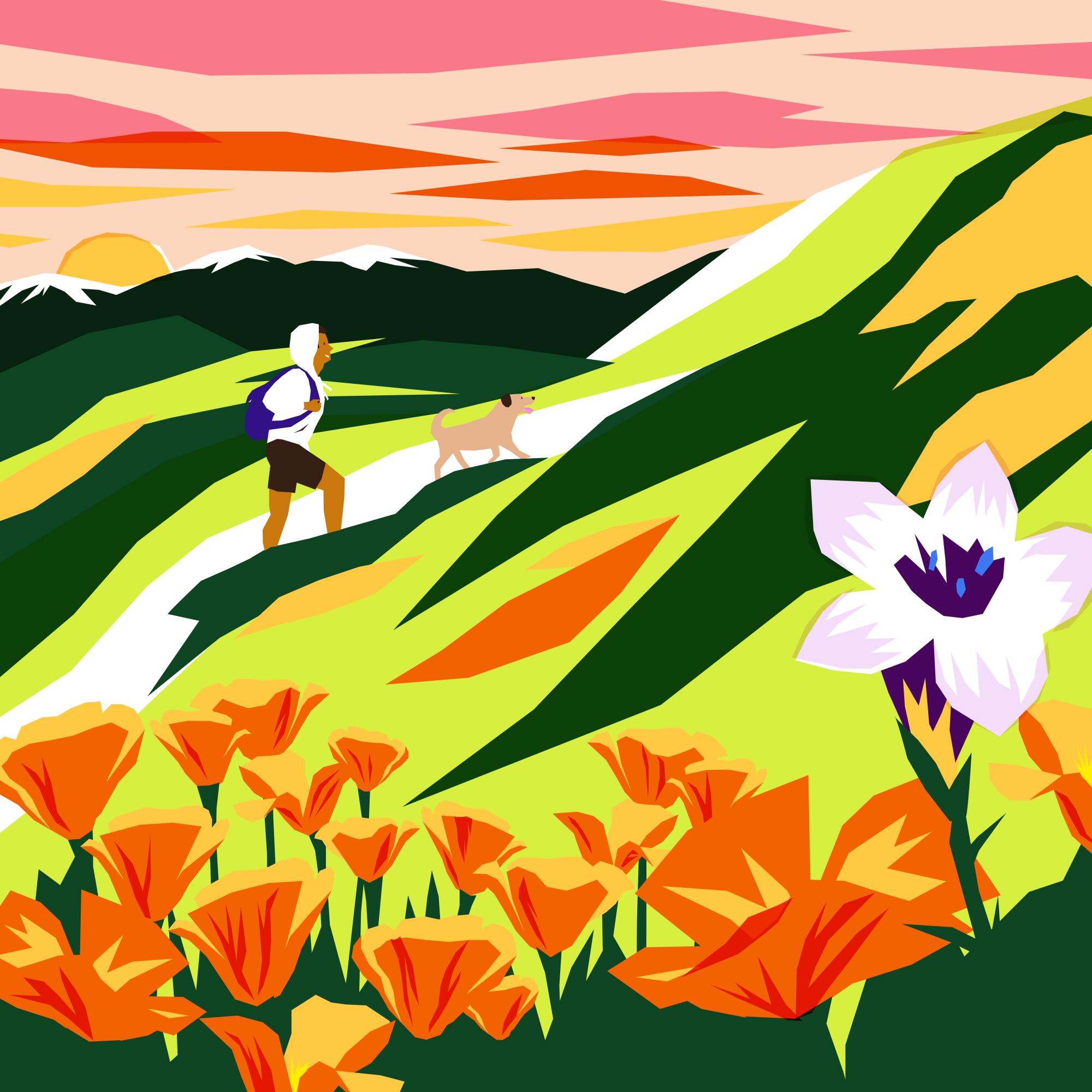
Whenever I’m feeling stressed out, heartbroken or scared over the state of our nation, the one place where I can find solace, however fleeting, is in the outdoors.
I’ve taken several mental vacations this past week back to the most beautiful hike I’ve ever traversed in California. I can close my eyes and feel the sun on my skin as I sit next to a massive waterfall, its roar filling my ears as my face turns misty from its blast. I’d like to take you there with me now and explain how, when and why you must go too.
Newsletter
You are reading The Wild newsletter
Sign up to get expert tips on the best of Southern California’s beaches, trails, parks, deserts, forests and mountains in your inbox every Thursday
You may occasionally receive promotional content from the Los Angeles Times.
In mid-May, I traveled three hours north of Sacramento to the Trinity Alps Wilderness so I could write a guide on how to explore the region. You’ll find everything you need to start planning your trip.
The Trinity Alps are about 540,000 acres, which is about 100,000 acres larger than the San Gabriel Mountains National Monument, and they feature massive waterfalls, crystal-clear rivers and creeks, and dozens of turquoise alpine lakes.
The Canyon Creek trail is the most popular in the Trinities, and for good reason, as it has each of those things.
Backpackers often take the path 8.5 miles to the Boulder Creek lakes or nine miles to the Canyon Creek Lakes. (Note: If you’d like to backpack the trail, please visit the Weaverville Ranger Station beforehand to gain clarity on where you should camp, as there are certain areas that have been damaged by overuse and should be avoided.)
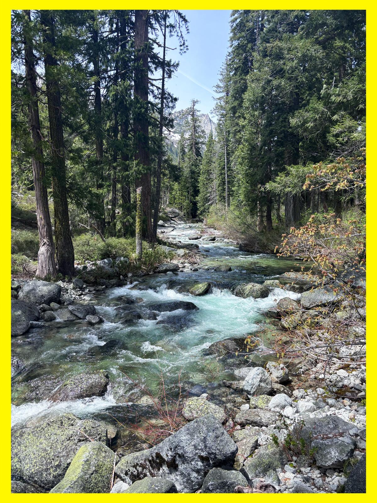
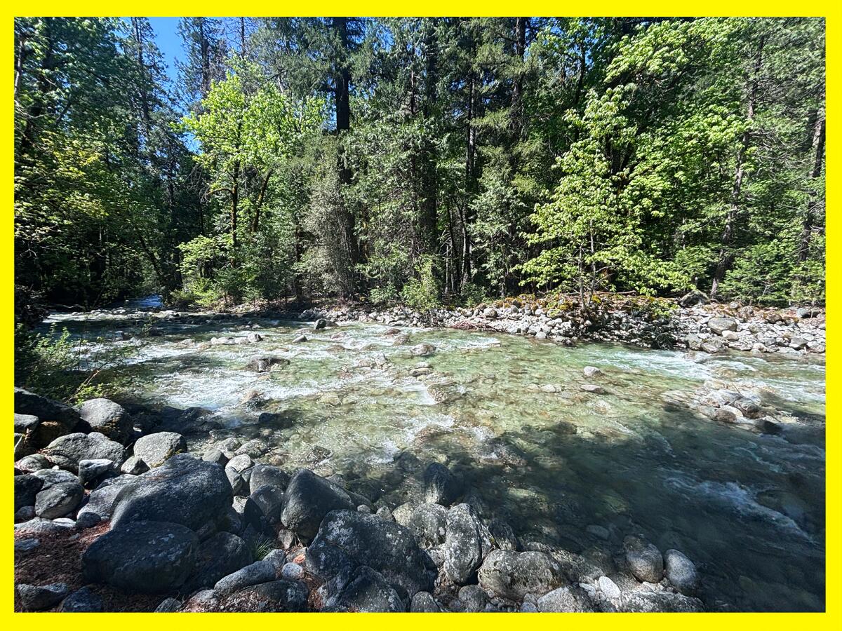
The blue-green water of Canyon Creek.
(Jaclyn Cosgrove / Los Angeles Times)
I took a 16-mile, round-trip day hike, ending my journey at the upper falls, but you certainly don’t have to go that far to see tremendous beauty here, as seemingly every mile traveled offers a new delight.
To reach the trailhead, you’ll take California 299 to Canyon Creek Road, a narrow two-lane thoroughfare that includes two one-lane bridges. You’ll pass through a rural community where signs request you to kindly watch your speed. It’s a good idea regardless of where you’re driving in the Trinity Alps, as deer are easy to spot on the highway (including eating in the middle of the road, which I couldn’t figure out).
You’ll need to arrive early if hiking the Canyon Creek trail on a weekend, as the parking lot can fill up. I went pre-season and had one of three vehicles in the large lot.
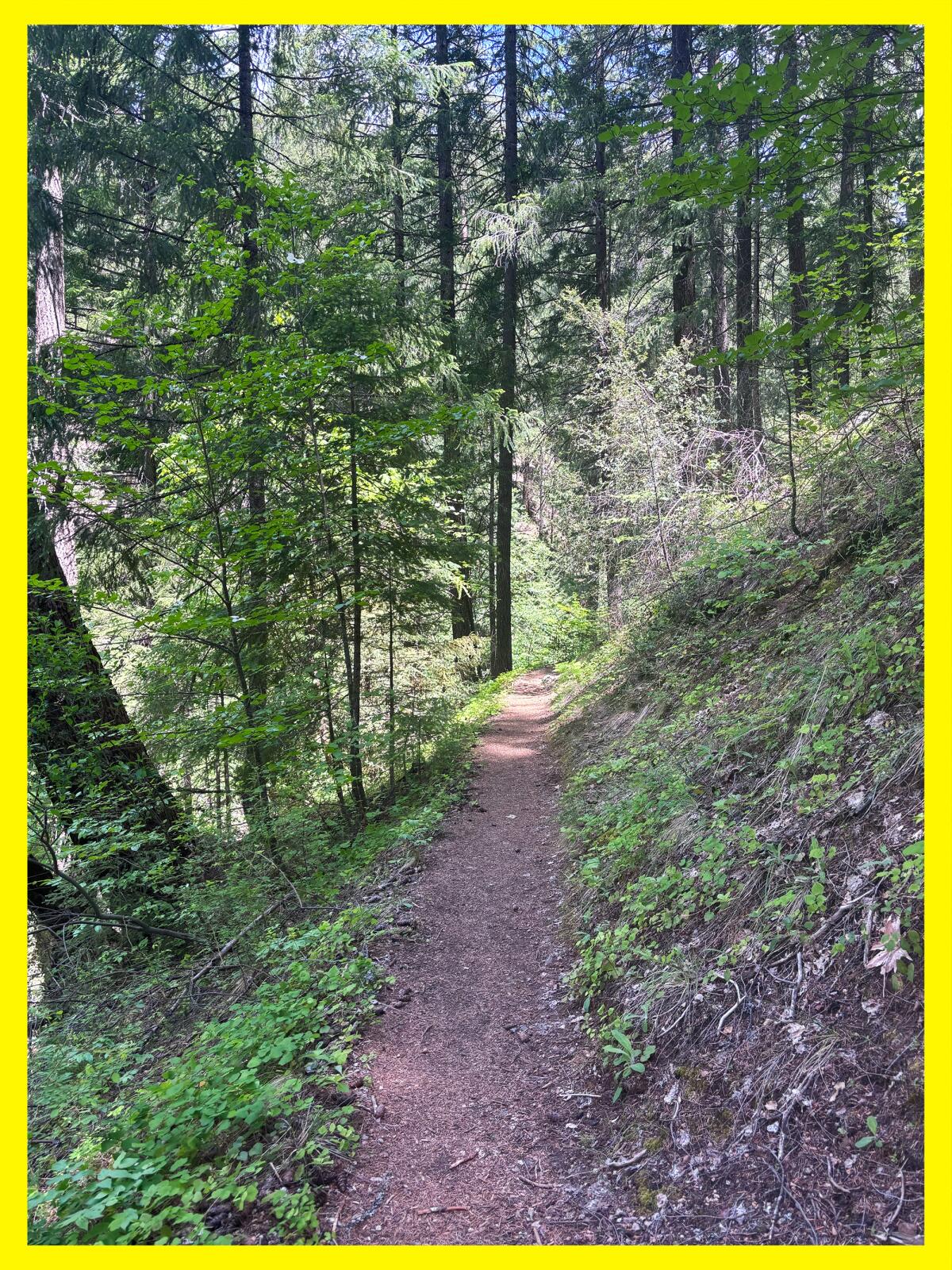
The first mile of the Canyon Creek trail is a gentle narrow dirt path.
(Jaclyn Cosgrove / Los Angeles Times)
From the trailhead, you’ll hike past an information board — during my visit, the forest service staff was warning of two food-motivated bears — and then past a large wooden Trinity Alps sign, a good selfie spot.
From here, you’ll start down a narrow mostly flat dirt path shaded by massive conifers and bigleaf maples. The path runs parallel to its namesake channel and includes several water crossings of varying sizes, so plan accordingly (i.e. pack extra socks!).
I visited before the Trinity Alps season starts, as it typically runs from June to October, but still noticed several flowering plants in this first mile of my hike, including western starflower, baldhip rose, longtube iris and some type of inside-out flower.
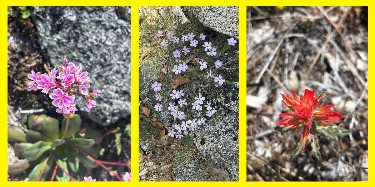
Cliff maids (lewisia cotyledon), spreading phlox and a paintbrush flower grow along the Canyon Creek trail.
(Jaclyn Cosgrove / Los Angeles Times)
About a mile in, you’ll come to your first major water crossing. On my way back, I did a great job letting the river’s current ram my toes into a boulder, so please take good care as you cross. This is a great turn-around spot if you’re hiking with little kids, as it has a few spots where you can splash around without getting pummeled by the river, along with rocks covered in bright green moss.
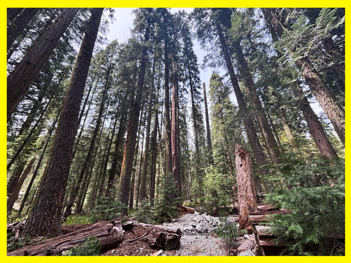
Massive conifers grow throughout the Canyon Creek area.
(Jaclyn Cosgrove / Los Angeles Times)
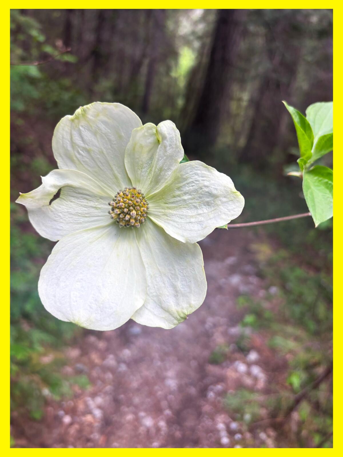
After the crossing, the trail started to remind me a bit of the Switzer Falls hike or the Valley Forge area of the Gabrielino trail, but with way more water and much taller trees. I spotted several deer tracks, and maybe smelled bear urine. I loved seeing the large white blooms of the dogwood trees.
The white bloom of a dogwood tree.
(Jaclyn Cosgrove / Los Angeles Times)
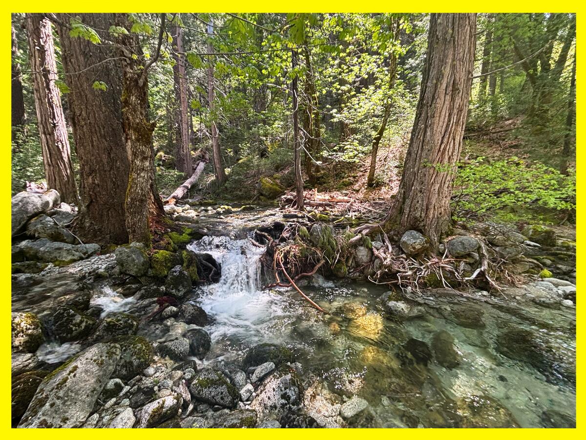
About three miles in, I reached a fork in the trail where I headed down to the Sinks for a short side trip. This area has nice, clear pools where you can take a dip, relax and explore.
It is another great turn-around spot, as you could easily spend the day lounging in the river, napping in a hammock and enjoying the sound of native birds and the river around you. I was almost pulled by the river siren’s call to just stay there. But I really wanted to see all three waterfalls!
The Sinks is an area just off the Canyon Creek trail that offers calmer areas to swim and spend the day.
(Jaclyn Cosgrove / Los Angeles Times)
Shortly after leaving the Sinks, I walked over a landslide. Alone, happily bored and a big Fleetwood Mac fan, I did sing as I crossed over it (but I did not see my reflection in the snow-covered hills). I later spoke to a forest service worker who said these obstacles were being cleared. So fingers crossed the landslide won’t be there when you arrive.
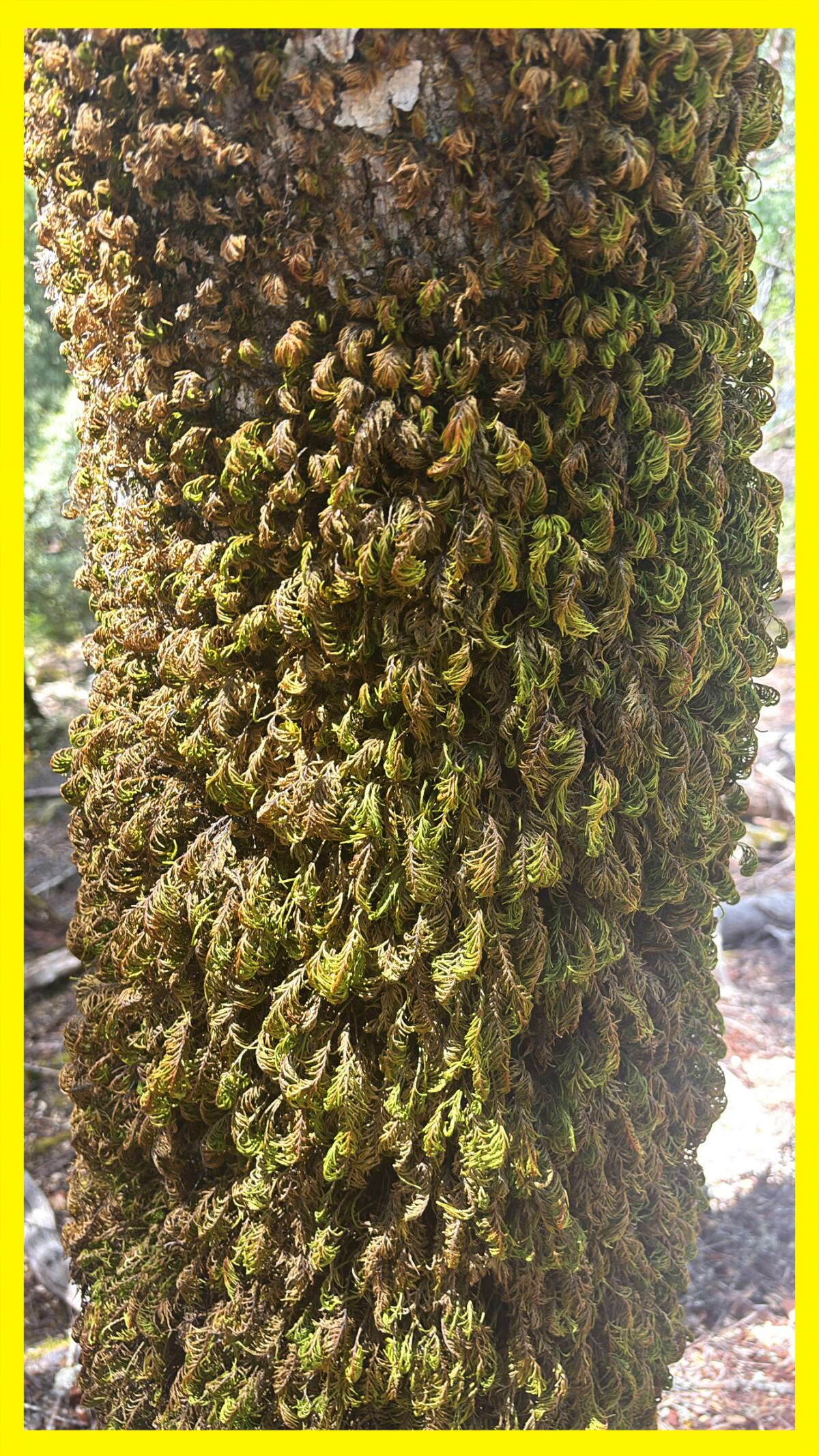
Dendroalsia moss growing on a tree near the Canyon Creek trail.
(Jaclyn Cosgrove / Los Angeles Times)
This segment of the trail felt like it was teeming with life. Several rocks I passed had dens beneath them for snakes, frogs and other creatures. The trees had holes where woodpeckers had or will store food. Also, several conifers had bark covered in furry moss. I am always reminded when in nature about our interconnections and how we can all support each other.
Soon, I ascended from the forested area onto a rockier part of the trail where I had clear views of the jagged canyon walls. You’re at just over 4,000 feet while the tops of the canyon walls are easily more than 2,000 feet higher in elevation. Also, this is a sunnier portion of the trail, so you’ll want to make sure to reapply sunscreen.
As you hike, I hope you’ll spot even more wildflowers than I did! I passed by large boulders covered in moss and bright pops of spring color, including a yellow small-leaved monkey flower, light purple spreading phlox, red paintbrushes and pink cliff maids.
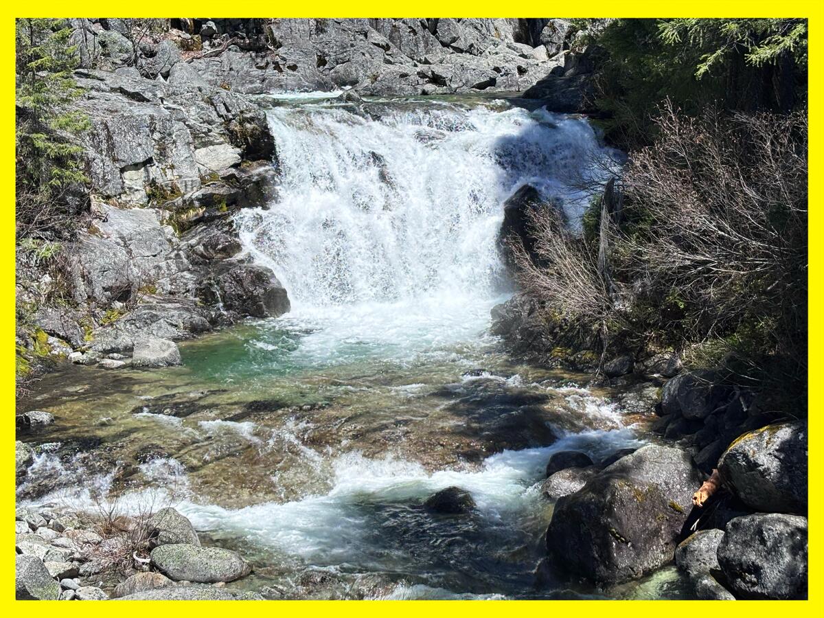
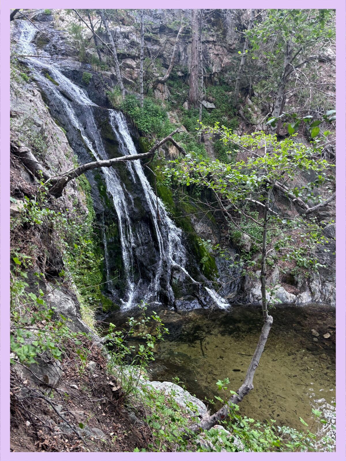
I could hear Canyon Creek Falls, or the lower falls, long before I arrived, calling to me like a music festival starring Mother Nature. And then, four miles in, I screamed in delight and briefly wondered if I’d somehow made it to the upper falls because of the size of the cascade before me. I stood in awe of the wide multi-story waterfall, watching hundreds of gallons of water rush over boulders into a deep turquoise plunge pool.
You’ll notice several jagged peaks like this one as you hike along Canyon Creek.
(Jaclyn Cosgrove / Los Angeles Times)
I talked to three backpackers from Northern California, one of whom was celebrating a birthday, as they debated where they’d camp. I saw a total of eight people all day.
The Canyon Creek Falls, or the lower falls, are reachable via an eight-mile round-trip hike.
(Jaclyn Cosgrove / Los Angeles Times)
As I gained elevation, I reentered another forested area with boulders at least 12 feet tall. About 4.5 miles in, you’ll pass by Upper Canyon Creek Meadow. Part of it appeared to be part wetlands, part meadow, looking like an ideal place for fish to hide if they can make it there. There was a substantial amount of bear scat in this area, so on the way back when I spotted a small cave nearby, I snapped a quick photo and skedaddled.
The trail was harder to find five miles in. I ended up off-trail multiple times, but it was usually easy to see where I’d gone wrong. Please download a map before heading out so you can check your outdoors app. And, yes, carry a paper map too just in case.
A meadow off the Canyon Creek trail.
(Jaclyn Cosgrove / Los Angeles Times)
At six miles in, you’ll find yourself standing mouth agape at the middle falls. This website claims this waterfall, which is easily more than 100 feet high, is “great for whitewater enjoyment.” This sounds terrifying to me, but I’m not going to yuck anyone’s yeehaw. There is a short trail (about 400 feet) you can take to the base of the middle falls. Please use caution as it’s crumbly and a bit technical.
I did not spend too much time here because, as mentioned, I had tunnel vision for the upper falls. But stopping here would provide you with a splendid 12-mile, round-trip hike where you would get to see two massive waterfalls, an absolutely stunning river with several pools, the Sinks, mountain views and wildflowers (and probably deer because they’re everywhere in the Trinity Alps).
A river flows near the Sinks, an area just off the Canyon Creek trail.
(Jaclyn Cosgrove / Los Angeles Times)
But if you want to keep going, a striking reward remains about a mile ahead. I knew I was getting tired, so I ate my favorite trail gummies and other snacks and headed past ancient trees and over rocky steps, reminding myself how lucky I was to be on the clock in the woods.
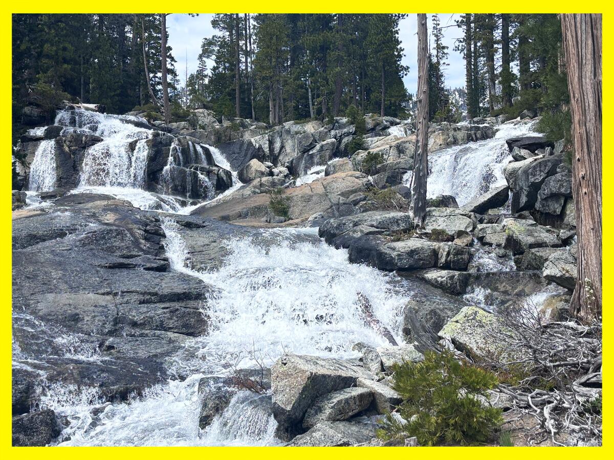
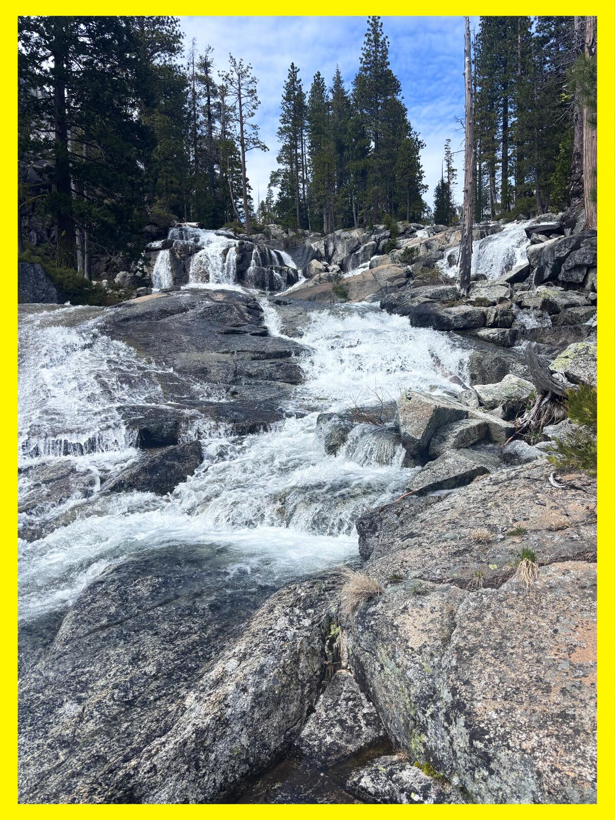
Near a large rock that resembled the Mandalorian’s helmet, I checked my map and found I’d almost made it. When I took my final turn, I could see rushing water past a stand of trees. I forged ahead and found myself standing (alone!) before 10 short cascades rushing over various sized boulders. I thought this was the upper falls, and I was impressed.
The upper falls at Canyon Creek start via a series of cascades before descending hundreds of feet down the mountain.
(Jaclyn Cosgrove / Los Angeles Times)
But I heard a loud roar of water and I couldn’t help myself. I carefully traveled around the rocky area and realized that those waterfalls were only the upper portion of the upper falls. The water continued racing down the mountain. In total, the upper falls are easily hundreds of feet.
The upper falls of Canyon Creek is a series of cascades that collectively fall more than 100 feet down the mountain.
(Jaclyn Cosgrove / Los Angeles Times)
I sat near the waterfall, enjoying what tasted like the best peanut butter and jelly sandwich I’d ever had, given the scenery and the journey I’d made to get there. I briefly toyed with the idea of hiking the additional 1.5 miles to the Canyon Creek Lakes, pulled by the allure of the larger of the two, which spans 25 acres and reaches a depth of 86 feet. But I knew that was foolish. I wanted to get back to my car before nightfall. And after falling deeply in love with the landscape, I know I will return to the Trinity Alps (hopefully many times).
On the hike back, I had to go slightly off trail through dense weeds to avoid some stagnant water pooled on the trail, which I’d already done once. This time, though, as I lifted my foot, one of the springy plants shot back up and slapped me right in the middle of my face. Stunned, I wondered whether my lip was bleeding. It felt a bit karmic, like the universe saying, “Hey, watch it!” I hope you’re laughing as much as I was.
It was impossible to bring my mood down after hiking in one of the most beautiful places in California and arguably the West.
3 things to do
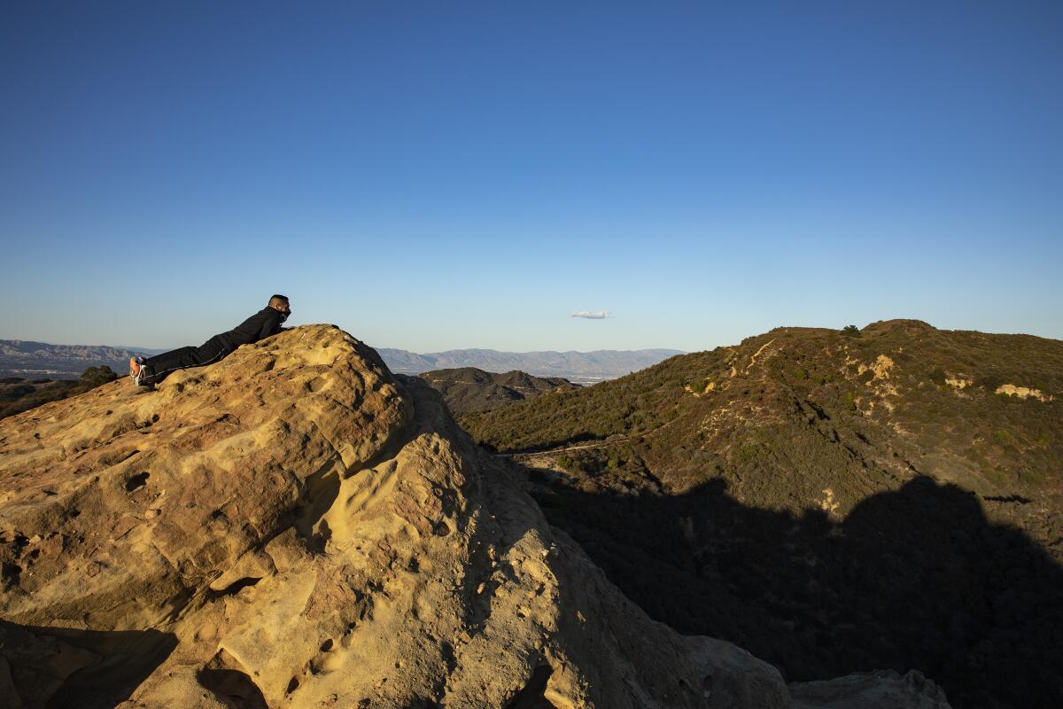
A lone hiker takes in sweeping views of the Santa Monica Mountains at Eagle Rock along the Backbone Trail in Topanga State Park.
(Brian van der Brug / Los Angeles Times)
1. Celebrate California State Parks Week across L.A. State parks across L.A. County (and California) are hosting events through Sunday to celebrate California State Parks Week. At Topanga State Park, the Santa Monica Mountains Task Force of the Sierra Club will host an introductory trail maintenance course from 8:30 a.m. to 12:30 p.m. Saturday. At Santa Susana Pass State Historic Park, visitors can attend a morning mindfulness hike from 9 to 11 a.m. or an evening hike from 5 to 7 p.m., both on Saturday. Find events near you at castateparksweek.org.
2. Sashay down the trail in Glendale A group of local nonprofits will host Pride Outside: San Gay-briel Mountains from 5 to 8 p.m. Saturday at Deukmejian Wilderness Park in Glendale. Organizers will offer a one-mile hike at 5 and 7 p.m. to prevent overcrowding on the trail. In between, the group will hear from local organizations and watch drag performances. Register at eventbrite.com.
3. Cut the mustard in La Crescenta The Arroyos & Foothills Conservancy needs volunteers from 8 to 10 a.m. Saturday at its Rosemont Preserve in La Crescenta. Participants will yank invasives like black mustard, water newly planted native plants and perform trail maintenance. Volunteers are welcome to bring shovels, spades, loppers, hatchets and clippers. Other tools will be provided. Register at arroyosfoothills.org.
The must-read
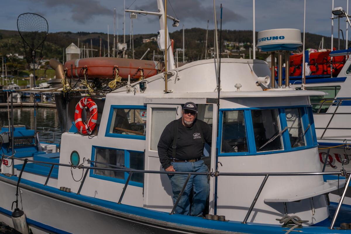
William “Captain Smitty” Smith at Pillar Point Harbor in Half Moon Bay.
(Loren Elliott / Los Angeles Times)
This past weekend, Californians were allowed to fish in the ocean for Chinook salmon, the first time the state allowed recreational fishing of the species since 2022. Times reporter Ian James spoke to William “Captain Smitty” Smith, who was busy preparing his charter fishing boat Riptide at Pillar Point Harbor in Half Moon Bay. Smith said the moment news broke in April that the state would allow a limited amount of fishing of Chinook salmon in the ocean, his regulars called and his boat was booked up. His plan was to take out 18 people both days. California Department of Fish and Wildlife is allowing up to 7,000 of the fish to be caught. If that quota wasn’t met this past weekend, then salmon fishing will be allowed until the limit is reached, likely on July 5-6, July 31-Aug. 3 and Aug. 25-31. Given the progress the state has made on improving the salmon’s environment (although climate change has more than made it challenging), Smith told James that he’s hopeful about what the future holds. “I want there to be a fishery for my grandson,” said Smith, who has worked in the charter boat industry for 50 years. “I want him to be able to experience the thrill of catching a fish in the ocean.”
Happy adventuring,
P.S.
L.A. County Parks and Recreation is hosting family campouts through the summer, including this month where participants can learn about fishing in our local lakes at four county parks. At Kenneth Hahn State Recreation Area, campers can participate in a night hike, and at Castaic Lake Recreation Area, kayaks will be available. Each event is $15 per person. Children 13 and younger are free. Register at bit.ly/OvernightCamping.
For more insider tips on Southern California’s beaches, trails and parks, check out past editions of The Wild. And to view this newsletter in your browser, click here.
Even though I’m technically a “professional” hiker, I do not excel at arriving to trailheads early.
Unless I’m camping.
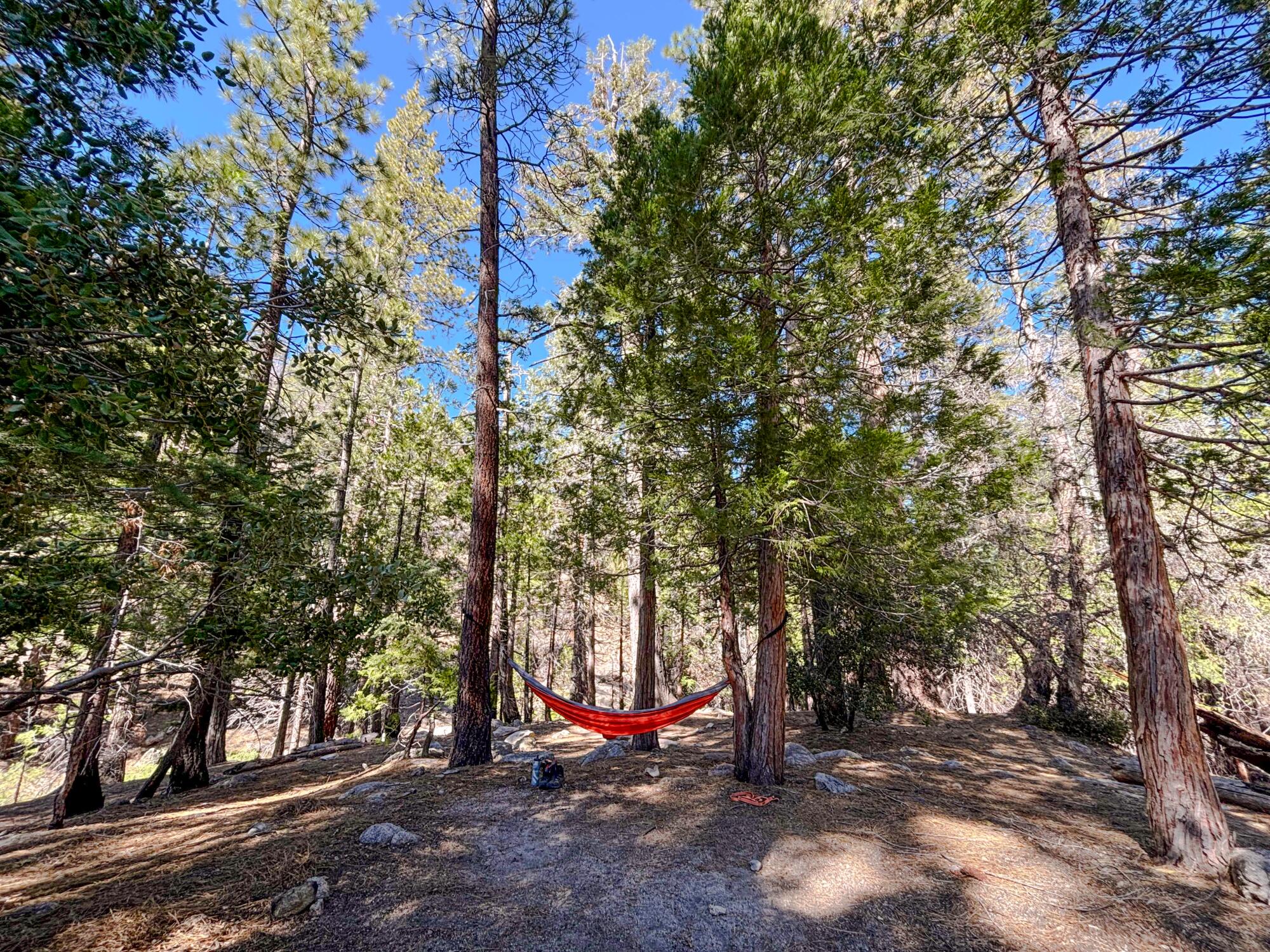
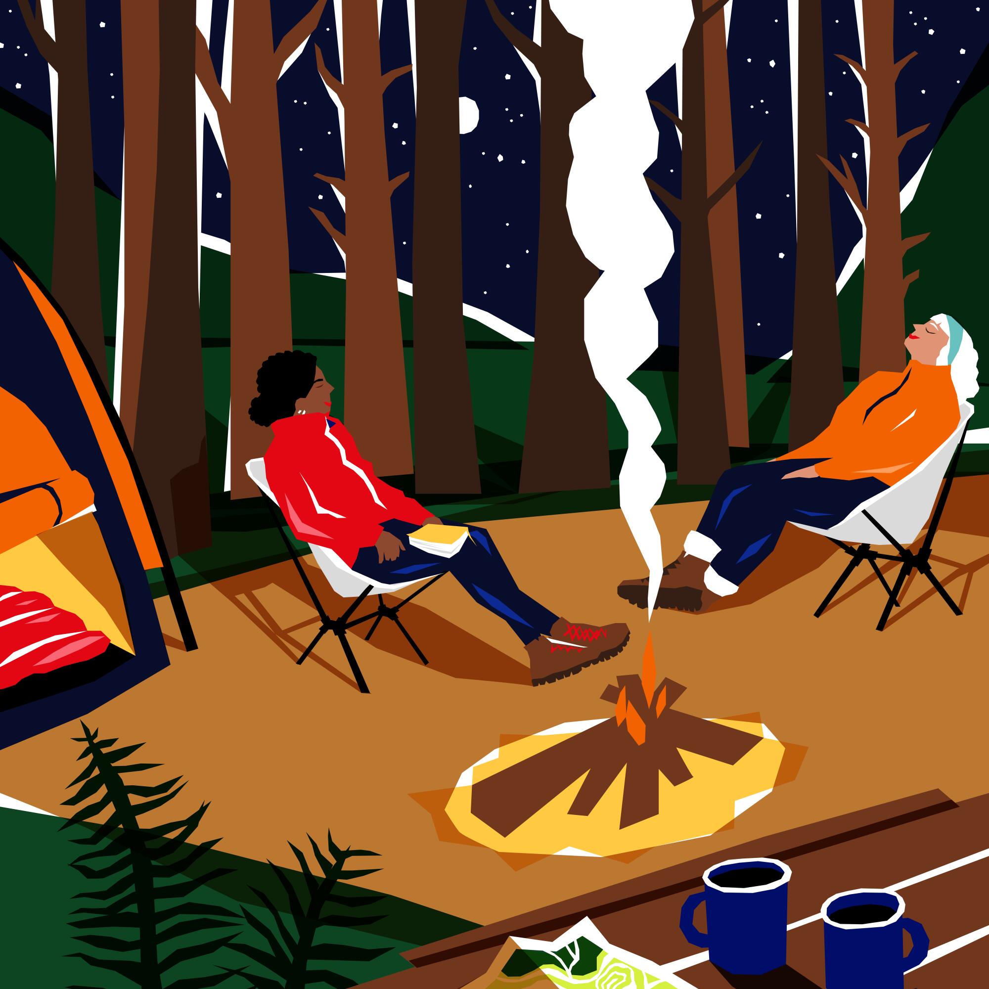
Camping removes all distractions and simplifies my morning. Wake up. Boil water for coffee on the butane stove. Sit. Listen to the birds. Leave for a hike after two precious cups of java.
I also go to bed much earlier. I’m not binging shows like Netflix’s “The Diplomat” with my wife or as interested in playing 17 rounds of Solitaire on my phone as a means to lull me to sleep. I simply lie down in the darkness, sleepy from an adventurous day and hot meal, and quickly fall asleep. Perhaps the version of myself I am while camping is something I should try to carry with me.
Newsletter
You are reading The Wild newsletter
Sign up to get expert tips on the best of Southern California’s beaches, trails, parks, deserts, forests and mountains in your inbox every Thursday
You may occasionally receive promotional content from the Los Angeles Times.
I know we’re all thinking about how we can squeeze every ounce of delight out of the summer. I’ve been daydreaming about campgrounds, including the three below.
These three spots will allow you to get up, make your coffee and get to the trailhead early (if you want to).
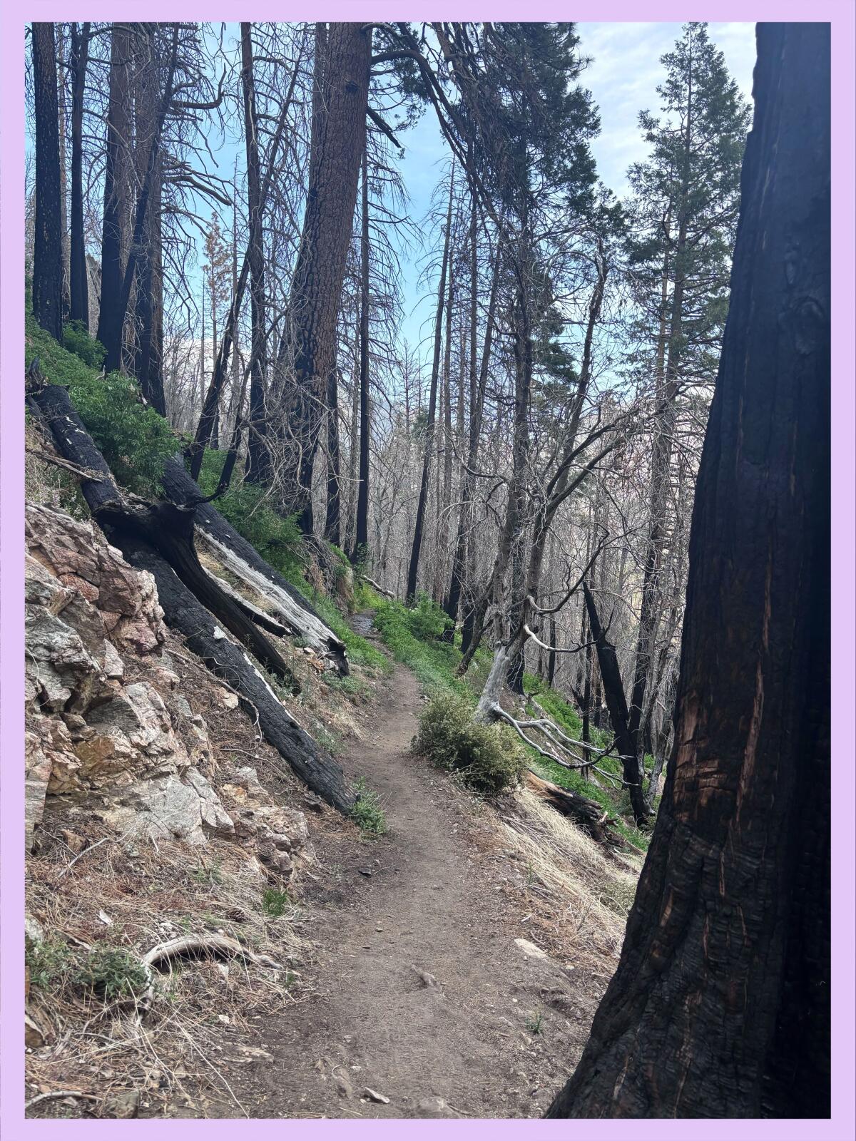
You’ll notice several blackened trees on the Burkhart trail that were burned in the 2020 Bobcat fire.
About an hour’s drive from L.A., Buckhorn is a 38-site, first-come, first-served campground shaded by large incense cedars and pine trees. It is $20 per night, payable by cash or check. It is situated along a creek just off California State Route 2 in Angeles National Forest.
The campground sits at around 6,500-feet elevation, providing a shady respite in the hottest summer months. Each camp site includes a picnic table, a fire ring and bear box, which you should use. It is a popular spot, so plan your arrival times accordingly. (Arriving before noon on a Friday should secure you a spot on a non-holiday weekend.)
Cooper Canyon Falls cascades down the hillside near the Burkhart Trail.
(Jaclyn Cosgrove / Los Angeles Times)
Waking up at Buckhorn, you’ll be a quick walk from the Burkhart Trail, an 11.3-mile point-to-point segment of the High Desert National Recreation Trail that ends at the Devil’s Punchbowl Natural Area. Most hikers take the Burkhart Trail 1.5 miles from its trailhead to Cooper Canyon falls, which descends about 30 feet into a refreshingly cold pool. On one camping trip, my friend Hannah and I plunged into the water together, screaming on our way up to the surface. Once the shock subsided, it felt great.
Other trails near the Buckhorn Campground include the Pacific Crest Trail, which you can take as far as you’d like, or the 53-mile Silver Moccasin National Recreation Trail. The trailhead for Mt. Waterman, which dedicated Wild readers will know is one of my faves, is across the street from Buckhorn.
Grinnell’s beardtongue, red columbine, grape soda lupine and sanddune wallflower on the Burkhart Trail.
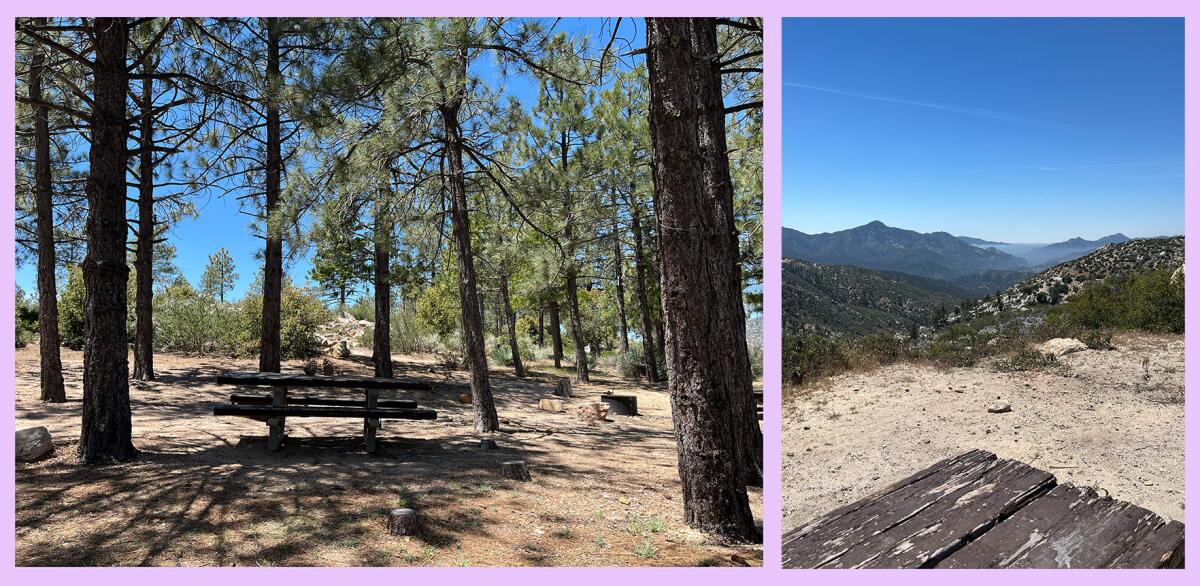
Chilao is an 84-site, first-come, first-served campground in Angeles National Forest. It is $20 per night, payable by cash or check. The campground features large boulders, sweeping views and, like the other two campgrounds listed, tall trees. You’ll need to bring your own water. Potable water is often available, but per the forest service, isn’t turned on right now.
1. One of the many shaded campsites at Chilao campground. 2. Some of the campsites at Chilao campground offer sweeping views of the surrounding mountains.
(Jaclyn Cosgrove / Los Angeles Times)
Chilao is one of my happy places. A cool breeze is blowing through my window right now, making it easy to close my eyes and remember lying in a hammock at my campsite here, looking up at the pine trees as I debated whether I would keep reading my book or take a nap.
From Chilao, you can take a portion of the Silver Moccasin Trail and some fire roads to Mt. Hillyer, a fun little spot with large boulders to scramble over. Another option is to take the Silver Moccasin Trail to other segments of the forest, including a 6.6-mile hike to the Vetter Mountain fire lookout, where you can be inducted into the Ancient and Honorable Order of the Squirrels.
Hikers head up the Devil’s Backbone Trail in their quest to reach Mt. Baldy.
(Jaclyn Cosgrove / Los Angeles Times)
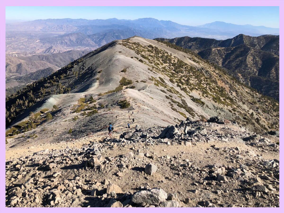
Manker Flat is a 21-site, first-come, first-served campground at 6,000-feet elevation near Mt. Baldy. It is $14 per night, payable by cash or check. Shaded by tall evergreens, each site has a picnic table and fire ring. The campground has vault toilets. Potable water isn’t presently available. Bears are known to frequent this campground, so plan accordingly.
Manker Flats will likely be my next trip, as I’ve been lusting over a trip up to Mt. Baldy since the route reopened. I envision hiking about 3.4 miles from my campsite up to Top of the Notch, having a quick bite and continuing the arduous but rewarding journey to the Mt. Baldy summit.
And instead of having to drive back home, I could simply arrive back at my tent, cook my dinner over a campfire and crash in my tent, looking up at the twinkling stars. That sounds like living!
The sunset from the trail to Mt. Baldy.
(Jaclyn Cosgrove / Los Angeles Times)
3 things to do
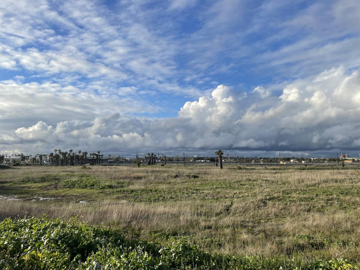
The southern Los Cerritos Wetlands.
(Jason Lustig)
1. Walk among raptors in Los Cerritos The Los Cerritos Wetlands Land Trust will host a free guided nature walk through the southern Los Cerritos Wetlands from 8 to 10 a.m. Saturday. Ecologists will teach walkers about raptor habitat in the area and native people who lived in the area and their role in recent restoration efforts. Guests must wear close-toed shoes. A $5 donation is requested for those who are able to give. Register at eventbrite.com.
2. Yank invasive plants in Griffith Park Friends of Griffith Park will host a trail maintenance day from 8:30 to 11 a.m. Saturday. The group will meet at the merry-go-round parking lot and then head to catch basins at the bottom of Fern Canyon where they’ll remove mustard, castor and other invasive plants. Volunteers should wear close-toed shoes or boots, long pants and sleeves, and bring a reusable water bottle, sunscreen and a hat. The organization will provide tools and water. Learn more and sign the waiver at friendsofgriffithpark.org.
3. Take a Dam good ride in El Monte ActiveSGV will host a 20-mile bike ride from 8 a.m. to noon Saturday exploring the hidden gems of the Santa Fe Dam. This ride will start and finish at the Jeff Seymour Family Center (10900 Mulhall St., El Monte) and include both city streets and bike paths. Riders will learn about the Emerald Necklace network, a 17-mile series of parks, greenways and trails. Participants can register to ride an e-bike for free. Register at eventbrite.com.
The must-read
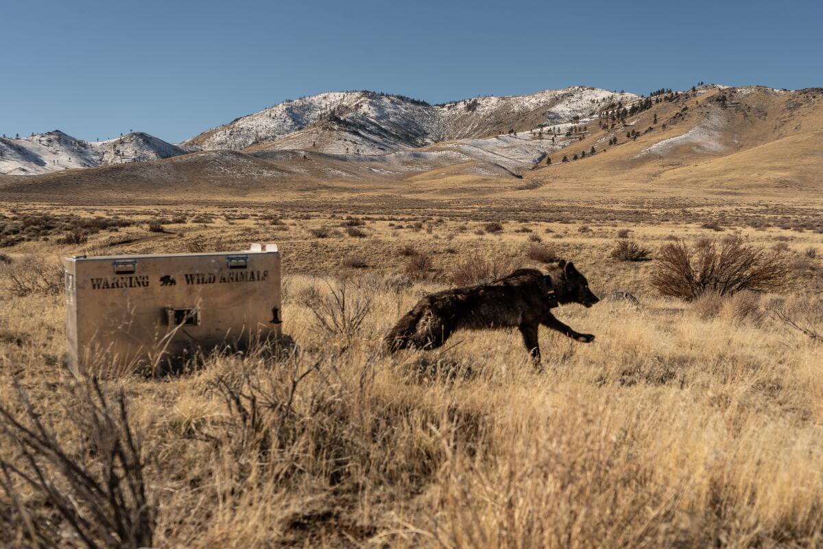
A recently collared wolf from the Beyem Seyo pack is released close to where she was captured by a helicopter team.
(Malia Byrtus / California Wolf Project/UC Berkeley)
One of the most remarkable things I’ve seen in the outdoors is a black wolf crossing a meadow in Yellowstone National Park and then leaping several feet in barely a second at a deer that likely became its next meal. It’s a sight that hikers in Northern California increasingly have the chance to see, as the state now has a confirmed 10 wolf packs. Times staff writer Lila Seidman talked to experts who said there could be more than 70 wolves in California now. This is cause for celebration in conservation circles. But the resurgence of wolves in California, hunted to extinction about 100 years ago, has led to an increasing number of the canines killing cattle instead of the deer and elk that state wildlife officials expected them to eat. Killing wolves is a crime, but Sierra County Dist. Atty. Sandra Groven recently told Times staff writer Jack Dolan that she would not prosecute a rancher who kills a wolf caught preying on cattle. “What are they supposed to do? Run up and wave their arms and say, ‘Go away’?” Groven said. But Axel Hunnicutt, the gray wolf coordinator at the California Department of Fish and Wildlife, cautions that the recovery of California’s wolf population is only occurring because they’re protected. “On the flip side, it would not take very much to completely topple these 10 packs,” Hunnicutt said.
Happy adventuring,
P.S.
If you’re concerned about the future of trails in the Santa Monica Mountains, consider attending the Santa Monica Mountains Fund’s event from 5 to 7 p.m. this Saturday at the Anthony C. Beilenson Interagency Visitor Center in Calabasas. Money from your $50 ticket will be spent on the fund’s “Trails Forever” campaign aimed at restoring and protecting hikes throughout the Santa Monicas. It’s great food for a great cause!
For more insider tips on Southern California’s beaches, trails and parks, check out past editions of The Wild. And to view this newsletter in your browser, click here.
The leaders of Canada and Mexico have criticised the latest hike in steel and aluminium tariffs under United States President Donald Trump, who increased import taxes on the metal from 25 to 50 percent.
The international condemnation came just hours after the latest tariff increase went into effect early on Wednesday.
Speaking to reporters on Wednesday, Canadian Prime Minister Mark Carney said the tariff increases were “unjustified”.
“They’re illegal. They’re bad for American workers, bad for American industry and, of course, for Canadian industry,” he said.
Mexican President Claudia Sheinbaum, meanwhile, pledged to pursue countermeasures if the Trump administration refuses to grant tariff relief. She warned that the tariffs would have a “huge impact” on Mexico’s steel and aluminium industries.
“This isn’t about an eye for an eye, but rather about protecting our industry and our jobs,” she added, without specifying what steps her government might take.
Canada calls for action
Wednesday’s tariff hike had been unveiled last Friday, when Trump held a rally with steelworkers outside Pittsburgh, Pennsylvania.
That region of the US is a part of the Rust Belt, an area that has been heavily affected by the decline in US manufacturing. Trump pledged to use tariffs and other measures to bring jobs and investments back to the area.
Previously, in March, Trump set tariffs on steel and aluminium at 25 percent. But he threatened to lift that rate to 50 percent specifically for Canadian imports of the metals, a plan he later appeared to walk back.
Those threats, however, roiled relations between the US and its northern neighbour in particular. Canada is the top supplier of steel to the US, followed by Brazil and then Mexico. South Korea and China also top the list.
Canada is also responsible for about 40 percent of aluminium imports to the US, followed by the UAE, Russia and Mexico. Carney’s government has pledged to pursue retaliatory measures so long as Trump’s tariffs remain in place.
On Wednesday, one of Canada’s largest labour unions, Unifor, called on Carney to take immediate action against the latest tariff hike, including by limiting the country’s exports of critical metals to the US.
“Unifor is urging the federal government to act without delay to defend Canada’s manufacturing sector and counter the escalating trade assault,” the union said in a statement.
Premier Doug Ford — who leads the top manufacturing province in Canada, Ontario — also called for Canada to respond in kind and “slap another 25 percent” on US steel imports.
“It’s tariff for tariff, dollar for dollar. We need to tariff the steel coming into Canada an additional 25 percent, totalling 50 percent,” Ford told reporters. “Everything’s on the table right now.”
Navigating global trade pacts
Both Canada and Mexico have been hard hit by Trump’s aggressive tariffs, which include a blanket 25-percent tax on all imports not subject to the US-Mexico-Canada free trade agreement (USMCA), as well as a separate 25-percent levy on automobile imports.
The three countries have highly integrated economies, with products like automobiles being built using supplies and factories from multiple locations.
The USMCA pact was agreed upon during Trump’s first term, from 2017 to 2021. But he has since signalled he hopes to renegotiate the free-trade deal to get more favourable terms for the US.
But the doubling of the US steel and aluminium tariffs is expected to have a global impact, well beyond North America.
The European Union is also bracing for the increase. The bloc’s trade commissioner, Maros Sefcovic, met US Trade Representative Jamieson Greer on the sidelines of a meeting for the Organisation for Economic Cooperation and Development (OECD) on Wednesday.
“We’re advancing in the right direction at pace – and staying in close contact to maintain the momentum,” Sefcovic wrote on X afterwards.
UK Trade Secretary Jonathan Reynolds also met with Greer, and he said steel and aluminium tariffs would remain at 25 percent for his country. The two countries have been in the process of forging a post-Brexit bilateral trade agreement, announcing a “breakthrough” last month.
“We’re pleased that as a result of our agreement with the US, UK steel will not be subject to these additional tariffs,” a British government spokesperson said.
‘Extremely hard to make a deal’
Trump’s latest tariff hike comes days after a federal court ruled that his so-called reciprocal tariffs — which imposed customised taxes on nearly all US trading partners — were illegal.
Trump had imposed those tariffs in April, only to pause them for 90 days. The court’s ruling was quickly paused while legal proceedings continued, and Trump’s tariffs have been allowed to remain in place for now.
One of the hardest hit countries has been China, which saw US tariffs against its exports skyrocket to 145 percent earlier this year.
The Trump administration, however, has since sought to reach a deal with China to end the trade war between the world’s two largest economies.
The White House said on Monday that Trump would speak to Chinese President Xi Jinping this week, raising hopes the duo could soothe tensions and speed up negotiations.
But on Wednesday, Trump appeared to dampen hopes for a quick deal.
“I like President XI of China, always have, and always will, but he is VERY TOUGH, AND EXTREMELY HARD TO MAKE A DEAL WITH!!!” he posted on his Truth Social platform.
When asked about the remarks during a regular news briefing, Chinese Foreign Ministry spokesperson Lin Jian said Beijing’s “principles and stance on developing Sino-US relations are consistent”.
A coalition of airlines, hotels and concession companies at Los Angeles International Airport filed paperwork Thursday to force a citywide vote on a new ordinance hiking the minimum wage of hotel and airport workers to $30 per hour by 2028.
The group, known as the L.A. Alliance for Tourism, Jobs and Progress, is hoping to persuade voters to repeal the ordinance. But first, the alliance would need to gather about 93,000 signatures within 30 days to qualify the measure for the ballot in an upcoming election.
Phil Singer, a spokesperson for the alliance, said the wage increase “threatens revenue Los Angeles urgently needs” — and its standing as the host of the 2028 Olympic and Paralympic Games.
“Small businesses will be forced to shut down, workers will lose their jobs, and the economic fallout will stretch across the city,” Singer said in an email. “We’re fighting for all of it: the city’s future, the jobs that sustain our communities, and the millions of guests the tourism industry proudly serves year after year.”
The new ballot measure campaign comes just two days after Mayor Karen Bass signed the minimum wage legislation into law.
The wage ordinance has been hotly opposed by an array of L.A. business organizations, which argue that it increases wages in the tourism industry too much and too quickly. However, it was welcomed by unions representing hotel and airport employees, which have supported many of the politicians who backed the measure.
The alliance’s campaign committee has received major funding from Delta Airlines, United Airlines and the American Hotel & Lodging Assn., Singer said. The group’s petition, submitted to the city clerk’s office, was signed by five businesspeople, including Greg Plummer, operator of an LAX concession company; Mark Beccaria, a partner with the Hotel Angeleno on L.A.’s Westside; and Alec Mesropian, advocacy manager with the organization known as BizFed.
The alliance is targeting a law that’s slated to push the hourly minimum wage to $22.50 on July 1 for housekeepers, parking attendants and hotel restaurant workers, as well as LAX skycaps, baggage handlers and concession employees. The wage would jump to $25 in 2026 and $27.50 in 2027.
The wage increase was spearheaded by Unite Here Local 11, the hotel and restaurant worker union, and by Service Employees International Union United Service Workers West, which represents private-sector airport workers.
Kurt Petersen, co-president of Unite Here Local 11, called the business group’s proposal “shameful” and promised his union’s members would go “toe to toe out on the streets” with the alliance’s signature gatherers.
“The hotel industry’s greed is limitless,” Petersen said. “They would rather spend millions getting them to sign this petition than pay their workers enough to live in Los Angeles. It’s shameful, but we’re confident that Angelenos will see through their deceptions and stand with workers.”
Under the city’s laws, hotel and airport workers have minimum wages that are higher than those who are employed by other industries.
For nearly everyone else in L.A., the hourly minimum wage is $17.28, 78 cents higher than the state’s. The federal minimum wage is $7.25 per hour.
Backers of the airport and hotel minimum wage hikes say they will help some of the region’s lowest paid workers cover the rising cost of rent and food, while also giving them more disposable income to spend locally, delivering a boost to the region’s economy.
Detractors say it will undermine efforts by L.A.’s tourism industry to recover from the decline in business that was sparked by the outbreak of COVID-19 five years ago. They contend the ordinance will lead to layoffs, while also chilling development of new hotels.
The ordinance also requires airport and hotel businesses to provide an hourly healthcare payment — on top of the minimum wage — that starts at $7.65 in July and is expected to go up each year. (Hotels will be exempted from that requirement until 2026.)
Once the healthcare requirement is included, some businesses will be required to pay their workers an additional 60% over a three-year period, opponents of the wage increase say.
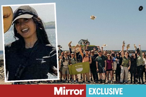
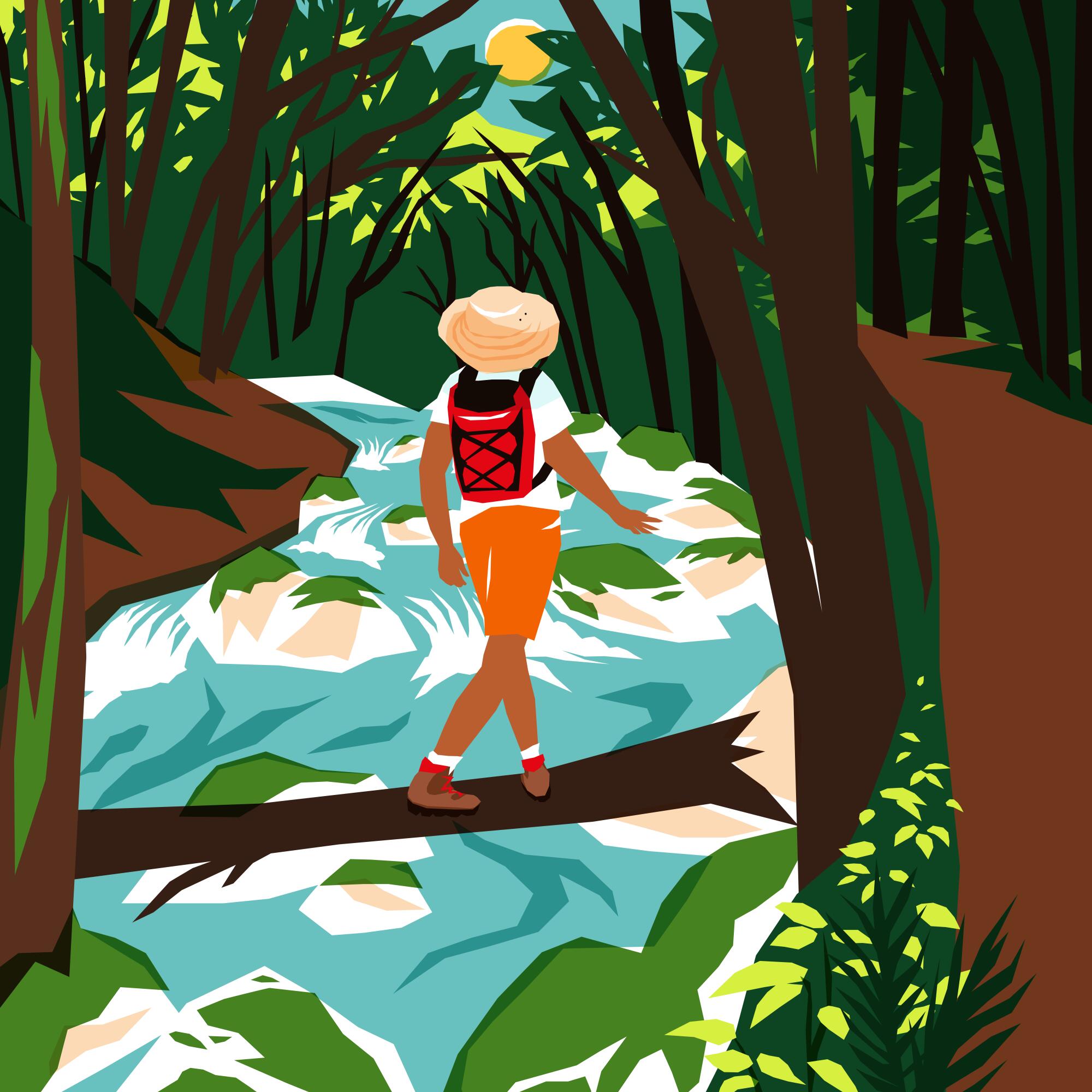
I tested myself if I could go a day without using my phone by participating on an 18-mile hike with nothing but a bottle of water – and what I discovered about myself was unexpectedly rewarding
I ditched my phone for my first hiking experience because of this one reason(Image: Columbia Sportswear)
I’m not the only one who says that I live attached to my phone and that everything I own and treasure is there. Realising that my screen time is higher than the average person’s, I wanted to prove to myself that I could go a day without it. So, when I saw the opportunity to go on a hike in the middle of nowhere with zero phone service, I couldn’t say no to it.
I wouldn’t consider myself a very sporty person, nor do I think I would have ever been interested in completing a hike by choice. With no expectations or preparations, except for a nice kit provided by Columbia Sportswear, I went for it – and let me tell you, it was so worth it.
The hiking trail took over three hours, completing a total of 18 miles(Image: Ashley Bautista)
Throughout the year, Columbia Hike Society hosts multiple “Hike Fests” across the world. The whole point is to walk for miles and miles until you reach your destination, where a reward awaits you.
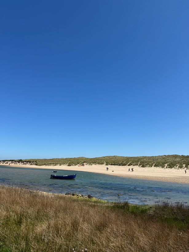
In our case, it was an emerging duo group called Lavender Music and Bombay Bicycle Club, an English indie rock band – and of course, a beautiful beach that looked like the ones in the Almafi Coast.
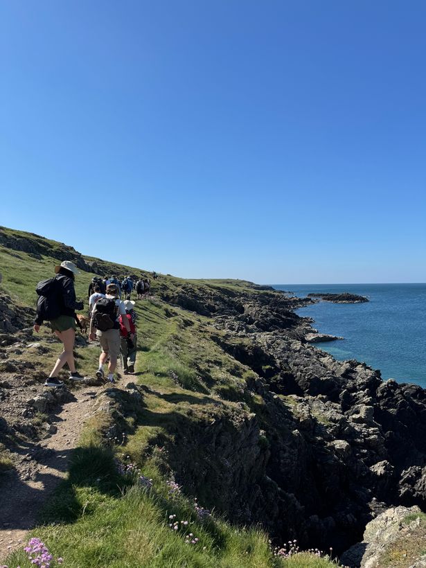
We walked through fields, along coastal paths and over sand dunes to an isolated area of Anglesey, located in north-western Wales. There was something so therapeutic about listening to the wind, the birds, the waves of the sea, and even the sound of the sole of the shoe touching the rocky ground.
Hiking is an underrated activity that is both engaging and relaxing. I appreciated the silence and being fully present in nature for three hours without using my phone and without listening to music. It’s also a social media trend called ‘rawdogging’, which is aslang term is used when undertaking an activity without any assistance, preparation or comfort.
Hiking is an underrated activity that is both engaging and relaxing, and it won’t be my last one participating (Image: Ashley Bautista)
Thankfully, my friend joined the trip, which made it much more bearable, with a few laughs in between. We kept stopping to take pictures, but the insane views can’t be as appreciated through the lens as much as they are through your own eyes. Being born and raised in Barcelona, and also being used to the busy London environment, I didn’t think that the UK had the potential to be so beautiful!
Once we arrived at the beach, we sat down to eat our lunch and enjoyed performances from Lavender and Bombay Bicycle Club as the clear blue skies and sunlight graced us. That’s when I realised that I was going to wake up the next morning with a stiff body and that I was so unfit and should probably start going to the gym – but that’s another story.
What started at 10am, ended at 13:46pm, to be exact. During those long hours of non-stop walking, it gave me plenty of time to think about a lot of things, and I learnt to enjoy my own company without wanting to check my phone notifications.
I’ve also learnt to live in the moment, something we sometimes forget to do because we spend most of our time focused on what’s happening on social media and don’t look at what’s right in front of us.
But the one thing that I appreciated the most about this hiking trip was the realisation of how little we actually invest into ourselves and our well-being, and although it was my first time hiking, it will definitely not be the last one.
Crude oil prices fell for a third consecutive trading day on Thursday ahead of the US-Iran nuclear talks. Traders are growing concerned about the possible return of oil supply from Iran, which holds around one-third of the world’s oil reserves.
Adding to the pressure, a Bloomberg report stated that the Organisation of the Petroleum Exporting Countries and its allies (OPEC+) is considering a third consecutive production hike in July, compounding fears of an oversupplied market.
Oil prices continued to decline during Friday’s Asian session. As of 4:40 am CEST, Brent futures were down 0.59% to $64.06 per barrel, while West Texas Intermediate (WTI) futures fell 0.6% to $60.83 per barrel—both touching their lowest levels in over a week.
Crude prices have experienced notable volatility in recent weeks as market participants weigh rising geopolitical tensions against mounting supply from major oil-producing nations. Broader macroeconomic factors—such as easing US-China trade tensions and renewed selling in US Treasuries—have also been influencing oil market movements.
Earlier in the week, prices briefly spiked following a CNN report that Israel was preparing to launch strikes against Iran’s nuclear facilities, citing intelligence from US sources. However, the rally proved short-lived, with analysts suggesting the warning may have been a strategic move by the US to exert pressure on Iran ahead of the nuclear negotiations.
The geopolitical boost was quickly overshadowed on Wednesday by data showing a surge in US crude inventories. According to the Energy Information Administration (EIA), US oil stockpiles rose to 443.2 million barrels in the week ending 16 May—the highest level since July 2024. The report also indicated that net US crude imports had increased for a third consecutive week, while domestic demand remained weaker than expected.
OPEC+ may accelerate production hike
News about OPEC+’s potential acceleration in production hike sent the oil price down further on Thursday. The oil production cartel is reportedly considering hiking crude output by 411,000 barrels per day (bpd) in July. The decision is yet to be finalised on 1 June when the group holds the next meeting.
The group, which accounts for around 40% of global oil supply, has jointly reduced production by approximately 2.2 million bpd in 2023. The quicker-than-expected phased rollback began with a 135,000 bpd increase in April, tripling to 411,000 bpd in May and June. The acceleration is seen as a punitive measure against members which failed to comply with agreed production quotas, with Kazakhstan and Iraq identified as recent overproducers.
Crude prices have consistently fallen following OPEC+ announcements of larger-than-expected production increases in both April and May. However, the potential July decision may already be priced in by markets—unless the group surprises traders with an even more aggressive supply boost.
Demand outlook remains weak
The demand outlook remains fragile amid ongoing concerns over slowing global growth, particularly driven by the US tariffs. Crude prices had previously dropped to a four-year low on 9 April and again on 5 May. The oil market rebounded following the US and China’s trade talks earlier this month, when the world’s two largest economies reached an agreement to pause high tariffs on each other for 90 days.
While near-term pressure remains supply-driven, there is cautious optimism that a sustained recovery in market sentiment, driven by further progress in US tariff negotiations, could support a rebound in oil demand.
“While the immediate pressure comes from the supply side, I believe that in the longer term, further progress on US tariff negotiations with key partners could revive demand and offer more meaningful support for oil,” Dilin Wu, a research strategist at Pepperstone Australia, said.
Howdy! I’m Jaclyn Cosgrove, an outdoors reporter at the L.A. Times. My job is to explore the mountains surrounding Los Angeles to find the best hikes, campgrounds and other adventures for you to tackle. I also write Between a Rock, where we feature outdoors survival stories every month, and The Wild, our (free!) weekly outdoors newsletter where I feature the absolute best things to do around L.A. and Southern California. In short, I’m outside a lot!
Would you like to join me sometime? How about later this month? The Times will host its fourth subscriber hike at 9 a.m. May 24 on a 3.5-mile hike to Sycamore Canyon Falls.
Tucked away in Point Mugu State Park, Sycamore Canyon Falls is a multi-tier 55-foot waterfall near Newbury Park. And hopefully with recent rainfall, it’ll still be flowing for us to enjoy.
There are multiple ways to reach the falls, but we will take the shortest and more direct way, starting in Rancho Sierra Vista/ Satwiwa in the Santa Monica Mountains. We’ll start at the Wendy Trail and wind our way through the park before entering Point Mugu State Park. Because we’re hiking through a state park, dogs aren’t allowed on this hike. (Trust me, I’m bummed too!)
I’ll lead a group of 30 subscribers to the falls, where we’ll hang out, snap images and maybe even share a snack or two. This hike is moderate and requires good footwear. I will probably bring along my poles for traction and welcome you to do the same.
Parking is free and easy. Please park at the Wendy Trail Head. We’ll meet at the start of the trail there.
We will have water bottles for attendees, but you’re also welcome to bring your own. You must be 18 or older and will be required to sign a waiver prior to attending. Grab a spot at Tixr.com.
Whenever friends or family visiting L.A. ask to go spend a day swimming in the ocean, I always take them to Leo Carrillo State Beach.
Unlike Santa Monica or Venice beaches, Leo Carrillo is not crowded. Parking is usually easy. And it’s a great place to swim and explore, with its tide pools where you can spot a starfish and scramble on its huge rocks (I may have had a goofy photo shoot or two with my friends there).
But until recently, I did not know that the adjoining Leo Carrillo State Park was home to a magnificent series of hiking trails where, when connected, provide you with a seven-mile trek with striking ocean views, wildflowers and birdsong. The halfway point is a pond and wetlands area where you can spot waterfowl and, if you’re lucky, listen to frogs! This is now the hike I take friends on when they want to both hike and have a beach day. I recommend you do the same.
Along with striking views of the Pacific Ocean, the Nicholas Flat Trail includes great vantage points of local peaks.
(Jaclyn Cosgrove / Los Angeles Times)
Newsletter
You are reading The Wild newsletter
Sign up to get expert tips on the best of Southern California’s beaches, trails, parks, deserts, forests and mountains in your inbox every Thursday
You may occasionally receive promotional content from the Los Angeles Times.
The hike that I took through Leo Carrillo State Park — which I would gauge as mostly moderate with a few short but hard stretches — connects a few different trails, and I will explain how you can even just do portions of it and still have a great time before heading over to the beach.
To begin, you’ll park at Leo Carrillo State Park. An all-day pass is $12, payable to the ranger at the gate or via the machine in the parking lot. Once parked, you’ll head northeast to the trailhead. You’ll quickly come to a crossroads. Take the Willow Creek Trail east to officially start your hike.
A western fence lizard perches on a hillside.
(Jaclyn Cosgrove / Los Angeles Times)
You’ll gain about 575 feet in a mile as you traverse the Willow Creek Trail. I took breaks along the way to gaze at the ocean, watching surfers bobbing on their boards and a kite surfer trying to gain traction. I spotted coast paintbrush and California brittlebush, a flowering shrub that features yellow daisy-like flowers, on the path, along with several lizards.
A mile in, you’ll come to a junction in the trail where you have three-ish options. You can continue west to a branch of the Nicholas Flat Trail that will take you a mile back down to the parking lot. You can head south onto ocean vista lookout point (which, though steep, I highly recommend). Or you can turn north onto another branch of the Nicholas Flat Trail.
Leo Carrillo State Beach is easy to spot from high points along the Nicholas Flat Trail.
(Jaclyn Cosgrove / Los Angeles Times)
I did a combination, hiking 235 feet up the lookout path, where I had one of those “Wow, I get to live here” moments. The ocean was varying shades of blue, from turquoise to cerulean to cobalt. I could clearly see in all directions, including about eight miles to the east to Point Dume. I was, once again, amazed to be alone in a beautiful place in a county of 10 million people.
Once I finished at this awe-inspiring point, I headed north onto the Nicholas Flat Trail, taking it about 2.3 miles — and about 1,100 feet up 🥵 — through laurel sumac and other coast sage scrub vegetation into the Nicholas Flat Natural Preserve. Along the way, I observed loads of deerweed covered in its orange and yellow flowers along with scarlet bugler (which I spotted hummingbirds feeding on during my way back), Coulter’s lupine and small patches of California poppies.
California poppies growing amid invasive weeds, Coulter’s lupine and Longleaf bush lupine in Leo Carrillo State Park.
(Jaclyn Cosgrove / Los Angeles Times)
If you need to catch your breath but don’t want to share that fact with your friends, just yell “Look at that view!” which is relevant for the hardest parts of the first stretch of this path, as the ocean grows only more beautiful and expansive as you climb.
About 2.5 miles in, you will see a path on your right that heads south. I’d skip this. It is a lookout point, but is washed out and looked sketchy to me. Instead, continue east-ish for another mile, and you’ll reach the charming little Nicholas Pond.
This is a great spot to sit, have a snack and observe the waterfowl and other birds, like red-winged blackbirds, song sparrows and lesser goldfinches (which are only lesser in their names). As I sat there eating my Trader Joe’s veggie sushi, I imagined decades ago when cattle probably drank from the pond, given a portion of the preserve resembles pasture and not native coastal sage scrub, and thus appears to have been used for ranching.
The Nicholas Pond in Nicholas Flat Natural Preserve near western Malibu.
(Jaclyn Cosgrove / Los Angeles Times)
I continued north and then west on the Nicholas Flat Trail through the preserve. You could also turn around at the pond and head back the way you came.
The walk through the preserve featured views of the pasture and some shade from large oak trees, but it didn’t delight me the same as the rest of the hike. Additionally, just before finishing this leg of my hike, I noticed a steep, washed out hill and thought, “Please don’t let that be the trail.” Dear Wilder, it was. There was a nice view once I cursed my way up, but I give you permission to, again, just turn around at the pond.
The Nicholas Flat Trail is steep in spots but worth it for the views.
(Jaclyn Cosgrove / Los Angeles Times)
At six miles in, or when you have only a mile left, you’ll return to the junction with the ocean vista lookout point. Instead of taking the Willow Creek Trail back the way I came, I took a right (northwest-ish) onto the last bit of the Nicholas Flat Trail. This trail also offered tremendous views and had patches covered in brittlebush with its yellow blooms.
I hiked this trail on a Thursday and did not see another human for the first six miles. It was just me, the western fence lizards, California quail and one very shy skinny silver striped snake who, upon hearing my footsteps, bolted into the bushes.
If you start this hike early enough in the day, you can simply trek back to your car and change into your swimsuit for an afternoon at the beach. And if the tide is out, you might also be able to walk around the tide pools. In the same day, you can hang out with both lizards and starfish, and when lucky, even spy an endangered bumblebee on the trail and an octopus on the beach. Please, go have yourself a remarkable Southern California day!
As the sun sets, golden light blankets the hillsides in Leo Carrillo State Park.
(Jaclyn Cosgrove / Los Angeles Times)
3 things to do
1. Pedal your heart out in Pico Union CicLAvia will host its 60th open streets event, CicLAmini—Pico Union, from 10 a.m. to 3 p.m. Sunday in Pico Union along Pico Boulevard between Normandie and Union Avenues. Guests are invited to travel the 1.4-mile pop-up park through their favorite people-powered mode of transport, whether that’s walking, jogging, biking, skating or shimmying. The route will feature booths from nonprofit organizations and photo opportunities and food. CicLAvia, a nonprofit whose events are always free, invites participants to show up anywhere along the route during the event to take the time to explore one of L.A.’s most historic neighborhoods. Learn more at ciclavia.org.
2. Observe waterfowl and more in Castaic An instructor-led bird walk and talk will be hosted from 8 to 10 a.m. Sunday at Castaic Lake. Guests should bring binoculars, sun protection and water, and wear comfy shoes for this relaxing stroll along paved pathways, sand and grass. Participants should meet at parking lot No. 4 and check in at the office. Register for free to this L.A. County site.
3. Fly a kite atLos AngelesState Historic Park Clockshop, an L.A. arts and culture nonprofit, will host its fifth Community & Unity People’s Kite Festival from 2 to 6 p.m. Saturday at Los Angeles State Historic Park. This free event will feature free arts workshops, live music and booths from local community organizations. There will be a kite competition where contestants will fly their handmade kite, to be judged by kite masters. A $5 donation to Clockshop is requested but not required. Register at clockshop.org.
The must-read
A western fence lizard, also known as a blue belly.
(James Maughn)
Anyone who has hiked for three minutes in L.A. has spotted a western fence lizard. They’re seemingly everywhere, scampering up a hillside, along the trail or on a rock. Turns out, Californians love documenting these little guys. Sean Greene, an assistant data and graphics editor at The Times, analyzed data from the citizen science app iNaturalist and found more than 130,000 verified identifications of the fence lizard in California. That’s way more than the number of poppies observed (almost 47,000) and red-tailed hawk (almost 76,500), two common and beloved things found in Southern California. “Outside California, iNaturalist users focus on other things,” Sean wrote. “Oregonians enjoy snapping pictures of ponderosa pines. In Washington, it’s mallards — the most commonly observed species worldwide. Nevadans have a thing for creosote bushes.” Biologist Giovanni Rapacciuolo told Sean that the fence lizard’s population on iNaturalist almost certainly comes down to “what human beings think is cool.” Like a large sunbathing lizard. As an added bonus, the piece features a video of a lizard doing push-ups, one of my favorite natural phenomenons to observe while hiking. So swole!
Happy adventuring,
P.S.
As we head into summer, the kind folks at Anza-Borrego Desert State Park remind us to check the ground temperature when hiking with pets. I often bring my dog, Maggie May, with me on trails. In the summer, I take the back of my hand and leave it on the ground for five seconds. If it’s too hot for me, it’s too hot for Maggie. If so, we just go find a swimming hole in the shade that we can both enjoy!
For more insider tips on Southern California’s beaches, trails and parks, check out past editions of The Wild. And to view this newsletter in your browser, click here.
When vacationing in Los Angeles, you can truly choose your own adventure.
Those in search of luxury can stay in a five-star hotel, sleeping on a plush bed, soaking in a deep bath tub and lounging on a balcony with sweeping mountain views. But, among the mountains that surround L.A., a different kind of luxury is within reach. There you can sleep above the clouds, swim in deep river pools and watch the sun set over the same mountains seen from those nearby hotel balconies. And often, it’s free.
L.A.’s proximity to public lands offers the unique opportunity to slip away for a weekend backpacking trip with ease. In the same day, you could savor breakfast tacos in Grand Central Market and fall asleep under the stars at your campsite. In fact, in under an hour’s drive, you can start a hike to one of around 20 backpacking sites in Angeles National Forest or the Santa Monica Mountains.
But it can be hard to know where to start. Backpacking, unlike camping, requires you to be entirely self-reliant. If you forget your toothbrush, there’s no 7-Eleven or camp store nearby to save you. It also means leaving behind certain luxuries, like a campground host to sell you firewood or the ability to pack every possible Trader Joe’s snack in your car. Everything you need must fit in your pack.
Not to worry, I’ve put together a comprehensive guide to becoming a competent — perhaps even expert — backpacker. It includes both a list of how to plan ahead to ensure you’re safe and ready, a curated list of backpacking sites near L.A. organized by the difficulty of the hike to reach them and how much “roughing it” each site requires.
I chose these spots, in part, because you don’t have to drive too far, they’re all first come, first served, the roads to reach them are paved and trails to reach each site are generally well-maintained. They’re also delightful hikes on their own, featuring wildflowers, native trees and loads of local birds and other critters. Each spot is isolated enough to make you feel like you’re outside the city without being so devoid of human life that it feels like you’re auditioning for the next season of “Naked and Afraid.”
Before diving in, though, let’s go over how to set yourself up for success when seeking sanctuary in our local mountains.
Unlike car camping, where you can pack every sweater, blanket and spoon you could imagine needing into your trunk, backpacking requires you to be selective. That is, unless you plan to carry 100 pounds of gear through the forest. What you will need to be self-sufficient will vary, and there are many great lists to guide you in what gear to bring, but I’ll run through the absolute necessities.
First, plan to bring enough calories to get you through your stay in the woods. It is generally recommended to pack between 1.5 to 2.5 pounds of food (2,500 to 4,500 calories) per day. (There’s a handy calculator here to determine your body weight, level of activity and amount of calories you’ll need.)
For the majority of the sites listed below, you will either need to bring your water or treat your water, for which there are several options. When it comes to the amount of water to bring, it will depend on the weather, your body’s preferences and the difficulty of the hike you’re taking to reach your campground. Some suggest one liter of water for every two hours you’ll hike, while others say it’s one liter of water for every five miles you’re traveling.
Campfires are not allowed on federal land in the Santa Monica Mountains. In Angeles National Forest, the fire danger level dictates when and what types of fire and fuel sources are allowed. As of this spring, the risk is “very high,” down from “extreme,” which means burning campfires in established fire pits and using most backpacking stoves is allowed. Before heading out, make sure you register for a California campfire permit, print it and have it on your person. It is required, regardless of wildfire risk.
Lastly, assume you won’t have cell service in Angeles National Forest or the Santa Monica Mountains, where the below campgrounds are located. You should fill out this form and share it with a friend, spouse or family member to ensure someone knows where you’re going. Also be sure to leave a copy on your vehicle’s window in case a rescue team needs to look for you. It’s important that you know where the closest fire or law enforcement station is to your campground — Angeles National Forest has a handful.
You should consider bringing a satellite communicator. Some newer model iPhones and Android devices can connect to satellites to send text messages. It’s best to test this while on a hike before planning to use it on a backpacking trip.
Getting there
Before heading out, check the weather and for road closures. Download your driving and hiking routes on your navigation apps. For example, Google Maps allows you to download a section of a map to use offline.
You should also bring a paper map. You can buy one at an outdoors outfitter or print one from a mapping site like CalTopo. I’ve downloaded a map from CalTopo and then printed it on waterproof paper at a FedEx office store. Having a physical map of the area will also allow you to see and navigate nearby trails, should you want to explore beyond your campsite.
(Marie Doazan for The Times)
For the seasoned car camper who’s backpacking-curious (beginner)
At each of these beginner-level backpacking sites, you will generally find water, either from a nearby stream or, in one spot, piped in. Their campsites feature picnic tables and have restrooms (including, in one case, flushing toilets!). The hikes to reach these two trail camps are short and, as a bonus, quite pleasant. You’ll likely spot wildflowers, including lupines and goldenrod, and you’ll be near trails to explore more, should you choose to venture out of your haven in the woods.
Cooper Canyon Trail Camp
The Cooper Canyon Trail Camp in Angeles National Forest.
(Jaclyn Cosgrove / Los Angeles Times)
The Cooper Canyon Trail Camp is a backcountry group campground shaded by towering old pine trees. It has five sites and features vault toilets, campfire rings, klamath stoves and large picnic tables. And unlike most of the spots on this list, bear-proof boxes are available to store food and scented items.
There is no piped water. Campers can pack in water, or filter water from the seasonal stream that flows next to the campground. Just over a mile east of the campground, this stream meets up with Little Rock Creek, which flows about 17 miles from the San Gabriel Mountains to the Mojave Desert. Cold plunges are optional but highly encouraged.
The trail camp can be reached three main ways:
Starting at the Cloudburst Summit trailhead, taking the Pacific Crest Trail mostly downhill 2.5 miles northeast to the trail camp.
Starting at the Cloudburst Summit trailhead, taking the fire road 1.5 miles down to the trail camp.
Starting at the Burkhart trailhead from the day use parking lot on the eastern end of the Buckhorn Campground. You will hike 1.5 miles north on a downhill path and then turn west onto the Pacific Crest Trail (also a part of the Silver Moccasin Trail). You will travel one mile uphill, gaining about 540 feet in elevation, before reaching the trail camp. (This is the most challenging of the three routes.)
Because it sits along the Pacific Crest Trail, the campground is also used by thru-hikers, including those taking the entire trail from Mexico to Canada. Perhaps you’ll make a new friend!
While at the campground, you could take a side trip to Cooper Canyon falls, or continue exploring the Pacific Crest Trail. Or, simply hang up a hammock and sway to the sound of the stream, songbirds and the gentle swoosh of the wind through the trees. Cooper Canyon has long been a beloved place to spend nights outdoors.
“If there is a moon, the nights are like a sparkling fairyland, and if no moon, one may see a million stars which those in the cities never know,” outdoorsman Will Thrall wrote of the area in 1936 in his Times column, “Your Hike Today.”
L.A. and its surrounding area have substantially more light pollution almost 90 years later, but the skies above Cooper Canyon Trail Camp will still delight any overnight visitor.
Musch Trail Camp
Musch Trail Camp is a small but charming campground in Topanga State Park that recently reopened after being spared by the Palisades fire.
The 82-acre Trippet Ranch, as it is known today, was originally called “Rancho Las Lomas Celestiales” by its owner Cora Larimore Trippet, a founding member of the Hollywood Bowl and once a national officer in the Woman’s Christian Temperance Union, according to her obituary and the Valley Relics Museum. She was married to judge Oscar A. Trippet.
The Musch Trail Camp is a small but charming site in Topanga State Park.
(Jaclyn Cosgrove / Los Angeles Times)
The property’s name translates to “Ranch of Heavenly Hills,” which still rings true today. You’ll hike the moderate Musch Trail from the Trippet Ranch parking lot of Topanga State Park, feasting your eyes on those aforementioned hills. In spring, the area will be dotted with wild blooms of sticky monkey flower, canyon sunflower and golden yarrow.
Unlike every other site on this list, Musch Trail Camp has flush toilets, sinks and potable water. What a luxury! The only caveat is, per a park staffer I spoke with, maintenance staff turns the water on when they know campers are coming. Before heading out, please call the Angeles District of California State Parks at (818) 880-0363 to ask them to have the water turned on.
On top of having potable water, it’s only a mile hike to reach this site. You’ll park in the Trippet Ranch lot in Topanga State Park and pay the parking fee ($10 per night). The trailhead is in the northeast corner of the lot near the small pond. Enjoy the lush flora along the way. Upon arrival, drop your camping fee ($7 per night) in the iron ranger.
While at the campground, I felt a bit like Snow White as I sat quietly observing quail, hummingbirds and moles, and heard something crunching on a leafy meal (probably a deer). Though this little nook in Topanga State Park is likely safe from evil queens.
(Marie Doazan for The Times)
Our intermediate sites are a bit farther to reach than the beginner options, and in one case, requires you to bring your own water. They both have picnic tables and tall shade trees where you can rest with a book or journal. They also both have vault toilets and, when I visited, were even stocked with toilet paper. Both allowed me alone time with nature that’s rare to find on L.A.’s more heavily trafficked urban trails. The surrounding hillsides and old trees were excellent company in themselves, and made me feel at peace. I hope you find a similar serenity on your travels!
Valley Forge Trail Camp
The Valley Forge Trail Camp is a refreshing refuge of mighty pines next to the pristine West Fork of the San Gabriel River. It has six group campsites with picnic tables and campfire rings, and has four well-maintained vault toilets. At night, it offers clear views of the starry sky.
One of a handful of sites at the Valley Forge Trail Camp in Angeles National Forest.
(Jaclyn Cosgrove / Los Angeles Times)
It has all those things. But it does not have piped water. Campers will need to either bring their own or treat the water in the river (when flowing).
To reach the campground, you have the choice of two routes:
Parking at the Red Box Picnic Area and taking the Gabrielino National Recreation Trail about 2.4 miles down. This moderate hike follows the West Fork of the San Gabriel River and features large oak trees and other gorgeous native foliage.
Parking at Red Box Picnic Area and taking the Rincon Red Box Road, a fire road, about 3.2 miles down. On the way back, you’ll gain about 1,200 feet in elevation.
And as a bonus, because both routes start near the Red Box Picnic Area, you can take one up and one down if you’d like a change of scenery on the way back.
The campsite’s name is a reference to the Valley Forge Lodge, which operated in the area in the early 1900s. It was advertised as “the camp with real old Western hospitality” and featured dinner dances, badminton and trout fishing. Its guest list included celebrities like actor Lon Chaney, “the man of a thousand faces,” who in the summer of 1927 was among those lucky enough to catch trout.
The sunset from the trail to reach the Valley Forge Trail Camp.
(Jaclyn Cosgrove / Los Angeles Times)
Even though the lodge is gone, its description in a 1937 advertisement holds true: “Cool and delightfully wooden location” with bubbling streams. These days the trout are few, but you’ll fall asleep listening to the nearby frogs and toads serenading the night from their river homes.
Sulphur Springs Trail Camp
Sulphur Springs Trail Camp sits at 5,300 feet in Angeles National Forest and features about six tent-camping sites. Just off the Pacific Crest Trail, its campsites are shaded by tall pine trees, ideal for hanging a hammock. It has vault toilets but no potable water or bear boxes.
Although the South Fork of Little Rock Creek runs through the campground, the water was, to use a scientific term, kind of gross. Portions of the creek appeared clear, but other parts were full of algae and made me question whether even filtering would make the water safe to drink.
There’s a faucet on the eastern end of the campground where water from the creek is piped, but upon my arrival, the trough where the water came out was covered in thick green algae. A sign next to it reads “Water not tested, Boil for 5 minutes before use.” Although there might be water available in late winter and early spring, I would not expect there to be much come summer. And even then, I will still plan to bring my own water.
The sites at Sulphur Springs Trail Camp in Angeles National Forest feature picnic tables and fire pits, along with tall pine and other native trees.
(Jaclyn Cosgrove / Los Angeles Times)
To reach the campground, you’ll park at Three Points and cross the street to access the trailhead. There was a large tree blocking my view of the trailhead when I visited in early April, but upon squinting at my map, I found it. I hope it’s cleared when you go!
Sulphur Springs Trail Camp
You’ll take the Pacific Crest Trail about 3.6 miles to reach the trail camp. There are several boulders in the first mile of the hike, including one area where you can scramble about just under half a mile in. Be mindful of rattlesnakes, as it looks like the perfect spot for them to nap.
The trail seems to transverse through an ecotone, a transitional zone between plant communities, switching between high desert and pine forest ecosystems. You’ll pass through patches of manzanita and yucca and then forested parts with Coulter pines, all the while with a view of the valley below.
When I left the trail camp late in the day, the golden sun blanketed the tree-lined mountainsides. I was reminded of just how many shades of green can be seen when one takes time to explore — to escape — into the forest. It was a five-star experience.
(Marie Doazan for The Times)
For those seeking self-sufficiency — and a break from noisy neighbors (advanced)
The campsites below are the farthest hikes on the list, but both of the hikes to reach them are spectacular. One provides tremendous ocean views while the other is a stunning paved path through the dense forest. As a bonus, you can bike to the second site if bikepacking is something you’re into.
The only amenity both offer is a picnic table. One site does have a single vault toilet.
That said, these two sites are a true escape, and you’ll likely see wildlife like mule deer and hear the howls of coyotes.
La Jolla Walk-In Campsite
The La Jolla Walk-In Campsite is a small campground in dense chaparral in Point Mugu State Park in the Santa Monica Mountains. It has three small sites featuring a picnic table with a metal box attached for food and scented items. There is a seasonal stream, but it’s often dry. Campers should plan to pack water in. There are no fires allowed and unfortunately dogs are not invited to join. It costs just $10 per night, a fee campers prepay at the La Jolla/Ray Miller parking area.
The campground is half a mile off the Backbone Trail in the Santa Monica Mountains, offering an overnight option for those wanting to tackle more of the iconic trail than can be accomplished in a day.
You can reach the campground by parking at the lot off Highway 1. Although it’s possible to leave your car outside the park for a day hike, parking isn’t allowed on the shoulder daily from 10 p.m. to 5 a.m.
The campsites at La Jolla Walk-In Campsite are rustic but provide privacy and clear views of the night sky.
(Jaclyn Cosgrove / Los Angeles Times)
You’ll start at the Ray Miller Trailhead, named after California State Park’s first official campground host, and take the route, also known as the Backbone Trail, about 4.6 miles before turning west onto the La Jolla Valley Fire Road, which will take you the half mile to the trail camp.
The scenery along the way is stunning and diverse. For the first 2.5 miles of the hike, you’ll be rewarded with better and better ocean views as you gain elevation, including two miles in when you can see a gorgeous stretch of coast line.
You will transition from the Ray Miller Trail to the Overlook Fire Road — all still the Backbone Trail — about 2.6 miles in. At this point, you’ll mostly lose the ocean view but be greeted by a diversity of local plants, including wildflowers like spreading phlox, and varieties of poppies, lupines and paintbrushes.
La Jolla Walk-In Campsite
This trail camp is also reachable by starting at the Chumash Trail, but given that trail’s steepness, this reporter isn’t advising that as an option for backpackers. (Even if it is a shorter route to reach the campground.)
Glenn Camp Campground
The Glenn Camp Campground is a 10-site forested haven next to the West Fork of the San Gabriel River. It is open year round and features picnic tables, grills and fire pits.
There is no piped water. Campers will need to either bring their own or filter water from the nearby river.
The Glenn Camp Campground in the San Gabriel Mountains in Angeles National Forest.
(Jaclyn Cosgrove / Los Angeles Times)
The restrooms are, unfortunately, closed until further notice. You’ll need to relieve yourself ideally 200 feet from the river, especially when you have to — hey, let’s just say it! — poop. You’ll want to bring a trowel, and have a plan for toilet paper. (This how-to video is worth watching before heading out) The best practice is to pack it out. If you plan to use natural elements for wiping, make sure you know what poison ivy and other unfriendly plants look like. Not something you want to explain to the doctor at urgent care!
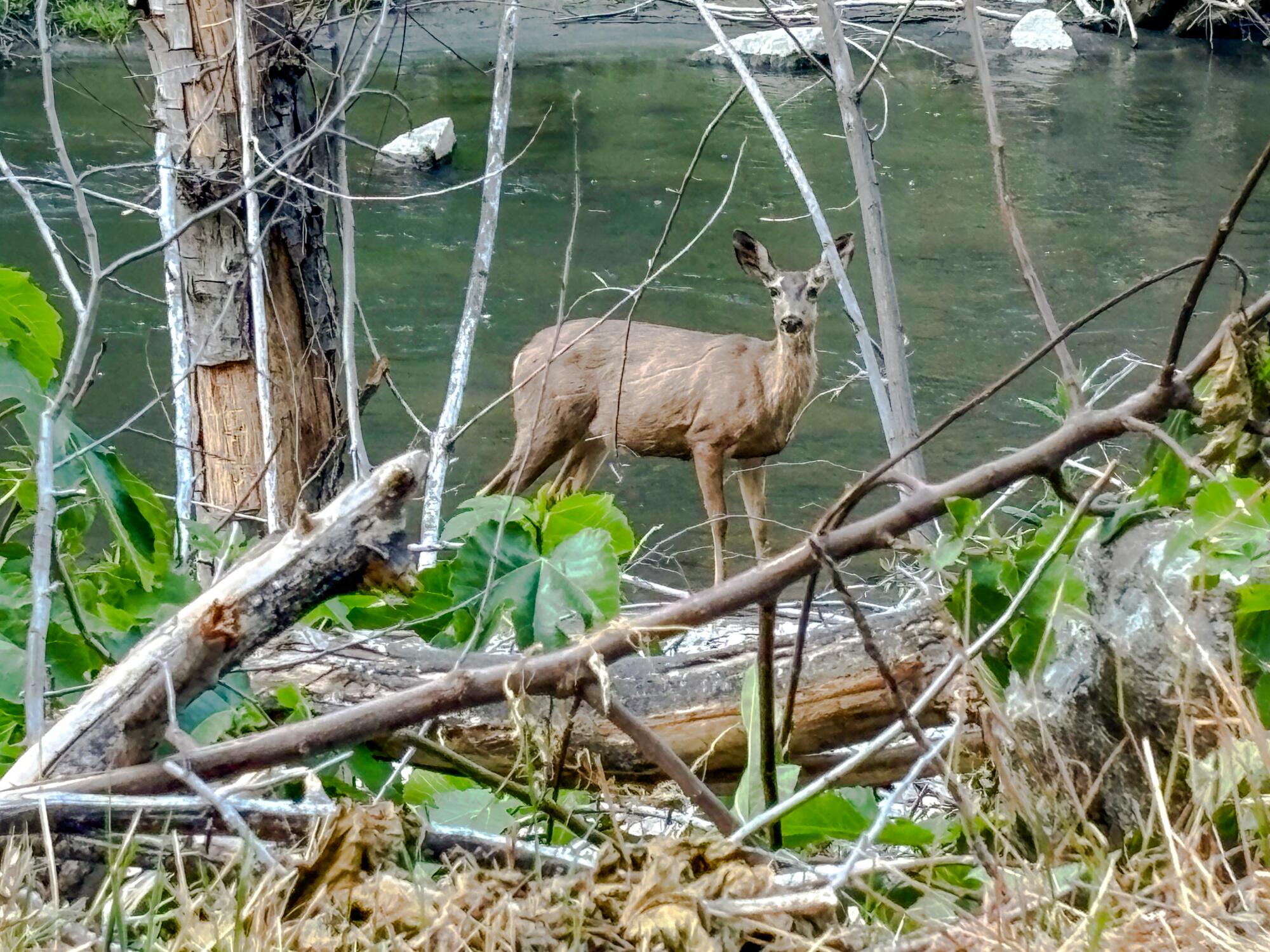
A deer stands on the bank of the West Fork of the San Gabriel River near the Glenn Camp Campground.
(Jaclyn Cosgrove / Los Angeles Times)
This campground was previously open only on the weekends because of nearby construction, but that restriction has ended.
To reach the campground, you can either hike or bike the seven-mile West Fork National Scenic Bikeway. You will gain just over 500 feet in elevation as you travel along this mostly paved path that runs parallel to the West Fork of the San Gabriel River. After a good rain, waterfalls run down the hillsides next to the path. Yes, it is as heavenly as it sounds.
The campground sits next to the river and is shaded by old-growth trees, including at least one you could climb into and read a book. Yeah, that’s freedom!
Remember
In a world where our phones can quickly provide us with anything we’re willing to pay a delivery fee for, backpacking can offer a necessary reset for our over-reliance on technology. Stepping away into the L.A. mountains, you’ll be greeted with a sound bath from crickets and birds as the smell of pine, sage and bay laurel fills your nostrils. It is an opportunity to be present with yourself and those around you, and worry yourself only with questions of whether someone should throw another log on the fire. Deep bathtub be damned, that sense of presence is the greatest luxury of all.