California voters will decide 14 statewide propositions in the Nov. 3 election, measures placed on the ballot mostly by either powerful interest groups or lawmakers that will affect the lives of millions of Californians.
While a proposed tax on state billionaires has dominated headlines, voters will also have a chance to weigh in on a number of consequential issues, from healthcare to voter identification requirements and more.
Californians are accustomed to legislating by the ballot and often face a list of propositions. But even by the standards of the state’s direct democracy process, the 2026 election stands out. The campaigns supporting and opposing the ballot measures have already collected more than $100 million in contributions, and are expected to use their money to inundate the television airwaves, livestreams and social media feeds and to flood mailboxes with glossy campaign mailers over the coming months.
Here are the measures on the Nov. 3 ballot:
Proposition 1: The Veterans and Affordable Housing Bond Act of 2026
Spurred by the state’s affordable housing shortage, state lawmakers are asking voters to approve an $11.25-billion bond to boost affordable housing construction around the state.
Advocates say the funds would help build more than 40,000 shovel-ready affordable homes that are unable to move forward because of a financing gap and help preserve thousands of other existing units.
Proposition 1 includes specific funding for high-need groups, including $1.25 billion for a veterans’ home loan program, $1.15 billion for supportive housing for homeless people, $350 million for student housing at state universities, $450 million for farmworker housing and $200 million for Native American tribes.
“In California, we don’t turn away from the needs of our people — we meet them head-on,” said Gov. Gavin Newsom in a statement about the measure. “We are giving voters the power to help shape the future of housing in our state. This bond is about building communities, expanding access and affordability in California, where every family has a fair shot at a place to call home.”
Some Republicans took issue with the measure’s title — “The Veterans and Affordable Housing Bond Act of 2026” — arguing that it included veterans to have broader appeal while doing little to actually help homeless veterans.
“It’s a sad thing to say that you have to use the veterans as bait to get the people of the state of California to approve an $11-billion bond, and I just think that’s shameful,” said Sen. Shannon Grove (R-Bakersfield), an Army veteran. “Call it what it is. It’s a homeless bond, and it does include some veterans’ benefits, but it is not a veterans bond.”
Proposition 2: Save for California’s Future Act
This measure would give California lawmakers more flexibility over state spending and allow them to save money that could otherwise go back to taxpayers.
The measure, supported by Newsom, seeks to exempt deposits into state savings accounts from a spending limit that voters adopted through a series of ballot measures dating back to the late 1970s, and to increase the share of tax revenue that can be put into the rainy day fund.
Under an existing state appropriations restraint, also known as the Gann Limit, lawmakers cannot spend more than an amount determined by a formula that takes annual tax proceeds, changes to the population and cost of living into consideration. Tax revenue above the limit must be divided between schools and refunds to taxpayers.
The measure could incentivize lawmakers to save more money because funds tucked away in the rainy day fund would no longer be considered expenditures counted toward the spending limit. By allowing lawmakers to set aside more money that is not subjected to state spending limits, it could also allow them to hold onto money that otherwise would be returned to taxpayers under current law.
This proposed constitutional amendment was placed on the ballot by state lawmakers.
Proposition 3: Fund schools and healthcare
If passed, this proposition would make permanent an existing tax on high-income Californians.
The existing tax, passed by voters in 2012 and extended in 2016, is set to expire in 2031. It applies to people who earn more than $360,000 for single filers, $721,000 for joint filers, and $490,000 for heads of household. It adds between 1% to 3% to these high earners’ personal income tax rates.
According to the initiative text, the funds are largely earmarked for local school districts and community colleges, with some portion of the money going to California’s rainy day reserves — which the state uses to prevent cuts to healthcare and other services when revenues decline. The measure says revenues cannot be spent on state bureaucracy or administrative costs.
The state’s nonpartisan Legislative Analyst’s Office expects the measure to bring in between $5 billion and $15 billion annually, depending on how the stock market is performing, with the amount expected to grow over time.
Proposition 4: Public financing of campaigns
This measure would allow the state and local governments to offer public campaign financing to candidates running for elected office. Candidates receiving the funding must abide by expenditure limits and adhere to the criteria set by statute, ordinance or charter to demonstrate broad support, such as demonstrate a large number of small dollar contributions.
None of the public campaign financing can come from funds designated for education, transportation or public safety. The financing cannot discriminate based on party or whether a candidate is a challenger or an incumbent. The public funds cannot be used for legal costs, fines or to pay back personal loans to a campaign.
This measure was placed on the ballot by the California Legislature and governor.
Proposition 5: Recall elections
This measure would change the way recall elections are conducted in California. Under this proposed constitutional amendment, during a recall election, voters would decide solely whether a politician should be removed from their elected position. If the recall is successful, that office would remain vacant until it is filled in accordance with existing law — either by a separate election or by appointment.
Under current law, voters make two separate decisions during a recall election: Whether to remove the subject of the recall from office and, if they are booted, which candidate running to replace them should fill the position. The candidate who receives the most votes wins, even if they receive far less than 50% of the vote.
The proposed constitutional amendment would also allow the recalled politician to run in the next election to fill the vacancy, though they cannot be appointed to their former post. Under the current system, office holders targeted in a recall are barred from being a candidate to replace themselves in that same election.
The proposal comes in the wake of the unsuccessful, Republican-led recall campaign against Gov. Gavin Newsom in 2021, which in part tested voter sentiment about his response to the COVID-19 pandemic. One of the sponsors of the recall-reform measure was Sen. Josh Newman (D-Fullerton), who was recalled from office in 2018 after he voted to increase gas taxes for road repairs, legislation pushed by then-Gov. Jerry Brown. Newman won back his seat in 2020.
This proposed constitutional amendment was placed on the ballot by the California Legislature.
Proposition 37: Homeownership loan program
Proposition 37 would create a down payment assistance program to help middle-class Californians buy a new home.
The measure, spearheaded by former state Senate Majority Leader Bob Hertzberg, would allow middle-class California residents — defined as anyone who makes less than 200% of an area’s median income — borrow most of their down payment for a new home that they plan to live in. It is designed to boost construction of single-family homes.
A down payment is traditionally about 20% of the purchase price of a home. If passed, the measure would create a state-administered loan program that offers qualified homebuyers a second mortgage of up to 17% of a home’s sale price.
The proposition would allow the California Housing Finance Agency to issue up to $25 billion in revenue bonds to administer the program.
The Legislative Analyst’s Office does not anticipate the measure to result in direct state or local costs because the costs are meant to be covered by homeowners’ mortgage payments.
Proposition 38: Immunology research bond
Proposition 38 asks voters to approve an $8.4-billion bond to support research in the burgeoning fields of immunology and immunotherapy, which study the human immune system and how it can be used to prevent, treat and cure diseases.
If approved, half of the funding would go toward the creation of a new immunology and immunotherapy research institute affiliated with the University of California. The other half would fund research grants for other California-based universities and nonprofit medical research institutions to study potential treatments for cancer, Alzheimer’s disease and heart disease.
The measure has a built-in discount program for Californians — it requires that any technology or drugs developed from bond-funded research be sold to California patients for a price at least 20% below the national average.
Backers of the proposal include the Alzheimer’s Assn., National Multiple Sclerosis Society and other healthcare groups. Supporters argue the funding would facilitate research that could save lives and save patients “billions of dollars in health care costs by preventing and curing a range of debilitating diseases and illnesses,” according to the initiative text.
Proposition 39: Voter identification
Proposition 39 would require Californians to show government-issued identification every time they vote at the polls.
Currently, Californians must affirm under penalty of perjury that they are U.S. citizens and provide information to verify their identity, such as their birth date, driver’s license or Social Security number, when registering to vote, but they don’t have to present identification when they cast their ballot.
Under this measure, voters would also need to present government-issued ID each time they vote in-person at the polls or, if voting by mail, provide the last four digits of a “unique identifying number from government-issued identification” that matches the one they provided when they registered to vote. California would be required to provide free voter ID cards on request, and state and county election officials would be required to verify registered voters are U.S. citizens by using government data.
The voter ID measure has support from Assemblymember Carl DeMaio (R-San Diego), who has framed it as necessary to prevent voter fraud and restore trust. It comes as President Trump is pushing for stricter voter identification requirements and severe limits on voting by mail.
Democrats and voting rights groups, including the American Civil Liberties Union, oppose the measure, saying California’s elections are already secure — voter impersonation and noncitizen voting cases are rare — and that it would make voting harder for many eligible voters, including people who have changed names, move frequently or face housing instability.
According to the Legislative Analyst’s Office, the measure would make election administration more expensive, costing state and local governments anywhere from tens of millions to low hundreds of millions of dollars annually, plus tens of millions in upfront implementation costs.
Proposition 40: Billionaire tax
This proposition, supported by a healthcare worker union, would impose a one-time tax of 5% on taxpayers and trusts with assets valued at more than $1 billion.
According to a state-prepared summary of the measure, 90% of the tax revenues would be spent on healthcare and 10% would fund food assistance or education-related programs. California’s richest residents would be able to spread the payments over five years.
The Legislative Analyst’s Office estimates it would generate “tens of billions of dollars” spread over several years, but would lead to an annual decrease in state income tax revenues of “hundreds of millions of dollars or more.”
Newsom has publicly opposed the tax, arguing it would lead wealthy residents to leave the state and lead to future budget problems. Other opponents include Planned Parenthood, the California School Boards Assn. and a nonprofit called Building a Better California that is backed by tech execs and venture capitalists.
Some billionaires have already proactively moved themselves or their businesses out of the state because of the proposal, which as written would retroactively apply to residents of the state as of Jan. 1.
Proposition 41: Requires limits and audits on new state special taxes
This is one of two ballot measures crafted by opponents of the proposed initiative to impose a new tax on California billionaires, and it would in effect undercut or curtail that wealth tax.
This proposed ballot measure would also prohibit any new state taxes from being excluded from the state’s current voter-approved spending limit. The proposed billionaire tax would have such an exclusion. If the billionaire tax proposal is approved by voters but this proposal receives more votes, the billionaire tax measure would be voided.
The measure would require the state auditor to conduct a financial and performance audit of proposed ballot initiatives and of the programs they fund. The measure would require audits of any program that would receive funding from the special tax in the proposed initiative to assess the efficiency of the program and recommend who ought to reduce its annual costs by 10%. If the measure passes, the costs of the audits would be paid via the revenues generated by the special tax.
This ballot initiative is one of two so-called poison pills to sink the billionaire tax that is being bankrolled by Building a Better California, which has raised well over $100 million from the state’s most affluent. The largest donor is Sergey Brin, a co-founder of Google, who has reportedly moved out of California because of the tax proposal. He donated at least $82 million to the group as of late June.
Proposition 42: Ban on new state personal property taxes
This is one of two ballot measures created by opponents of the proposed initiative to impose a tax on California billionaires, and it would in effect void that wealth tax.
This proposed ballot measure would prohibit new taxes on personal property, intellectual property, retirement accounts and other assets and would limit situations in which a ballot measure or state lawmakers can impose or raise taxes retroactively — both of which are essential parts of the billionaire tax initiative.
If the billionaire tax proposal is approved by voters but this proposal receives more votes, the billionaire tax ballot measure would be voided.
This ballot initiative is one of two so-called poison pills to sink the billionaire tax that is being bankrolled by Building a Better California, which has raised well over $100 million from the state’s most affluent. The largest donor is Sergey Brin, a co-founder of Google, who has reportedly moved out of California because of the tax proposal. He donated at least $82 million to the group as of late June.
Proposition 43: Voting thresholds for special taxes
The measure would prohibit local governments from imposing new special taxes unless the proposed tax receives approval from two-thirds of voters. The restriction also applies to citizen initiatives, which currently only need a simple majority vote to be approved.
It would also limit cities’ ability to impose taxes on property sales. In charter cities, the measure would prevent voters from approving any real estate transfer taxes beyond the state’s existing rate of 0.11% of a property’s sale price. It would also cancel some existing property-related taxes.
The Howard Jarvis Taxpayers Assn. supports Proposition 43. The advocacy group has characterized the measure as an effort to “save” 1978’s Proposition 13, the landmark initiative that capped California property tax increases and required a super-majority of votes to approve most future tax increases.
Assemblymember Buffy Wicks (D-Oakland), who authored the legislation that became Proposition 43 — ACA 22 — opposes the measure and has urged Californians to vote against it. She said the only reason she crafted the bill was because it was a necessary bargaining chip to torpedo another ballot measure backed by the Howard Jarvis Taxpayers Assn. that would have devastated revenues for local governments and retroactively rescinded some local tax increases.
“I authored ACA 22 not because I wanted it to become law — but because it was the only path left to get the more dangerous initiative off the ballot before time ran out,” Wicks posted on social media.
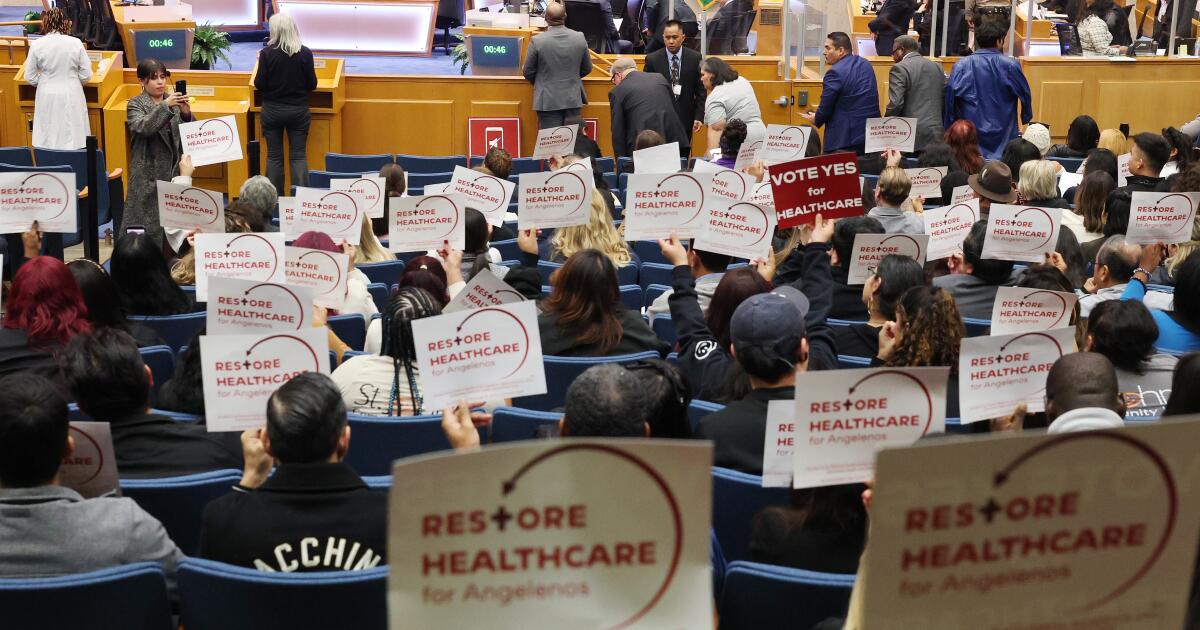
Proposition 44: Regulate health clinic spending
If passed, Proposition 44 would require federally qualified health centers to spend 90% of their revenue on “program services advancing their charitable purpose” rather than management and overhead. Community clinics that fail to comply would be penalized, with fines placed in a state-managed fund to be spent on clinic workforce programs.
Advocates say clinics spend too much on executive pay and other administrative costs and not enough on patient care. The measure, which would dictate how clinics spend money, is designed to fix that. The measure is backed by the Service Employees International Union-United Healthcare Workers West, an influential healthcare workers union, which argues it will help hold clinics accountable.
In May, the California Primary Care Assn., which represents more than 2,300 community health clinics, sued to block the ballot measure. The state’s powerful doctors’ lobby, the California Medical Assn., also opposes the measure, arguing it would ban clinics from keeping funding in reserves and hamper their ability to upgrade equipment or expand to new locations.
The Legislative Analyst’s Office estimates that enforcing the measure would cost the government up to the low tens of millions annually, and that much of the cost would be paid for through penalties and fees charged to affected clinics. The office says the measure has “uncertain” impacts and could lead to clinic closures.
This proposition would amend the California Environmental Quality Act, or CEQA, and speed up the process for projects deemed “essential,” including certain housing, water, health, public safety, energy and transportation projects.
Jails, detention facilities and oil or natural gas production facilities would not be considered “essential” projects, according to the measure text.
If passed, the measure would set deadlines for public agencies to complete environmental review, allow expedited review of a project’s environmental impacts — currently, public agencies are required to consider a range of feasible alternatives to reduce environmental impacts — and establish deadlines for filing and resolving lawsuits.
CEQA lawsuits have often been used to block construction of housing in the state. For instance, in Berkeley, neighbors used CEQA — citing potential noise impact from partying students — to delay, for years, UC Berkeley’s construction of student dorms on People’s Park.
The Legislative Analyst’s Office estimates that the state and local government implementation will cost in the tens of millions of dollars for the first several years. It notes the legislation would probably result in net savings in the long term due to reduced administrative and legal workload.
Times staff writers Seema Mehta and Phil Willon contributed to this report.