THE daughter of a legendary Hollywood director and her husband have been mysteriously found dead inside a running car parked on a highway.
Judith “Judy” Wyler Sheldon, 84, and her husband Wylie Sheldon, 86, were discovered unresponsive in a Jeep Compass on Interstate 5 near Redding, California.
Sign up for the Showbiz newsletter
Thank you!
Judith ‘Judy’ Wyler Sheldon, pictured here in her youth, was found dead inside a running carJudy with Wylie Sheldon, 86, in 2019Credit: Jana Asenbrennerova for Drew Altizer Photography
A California Highway Patrol officer made the grim discovery on the shoulder of the northbound carriageway, just north of Fawndale Road, at approximately 5.46pm on Monday.
Judy, a prominent San Francisco arts patron, is the daughter of famous filmmaker William Wyler.
She was found behind the wheel, while her husband was in the passenger seat.
Despite emergency medical personnel attempting life-saving measures, both were declared dead at the scene.
The circumstances surrounding the tragedy remain unclear, and investigators are working to determine what happened inside the vehicle.
The California Highway Patrol’s Northern Division Investigative Services Unit has taken over the case.
While authorities have not publicly disclosed any indication of foul play or a medical emergency, the deaths occurred during a period of extreme heat.
The National Weather Service had issued a warning for the Redding area, where temperatures soared to 109 degrees Fahrenheit (43C) on the day the couple were found, though investigators have not confirmed if the weather played a role.
Most read in Entertainment
The couple were found dead on Interstate 5 near Redding, California (stock)Credit: GoogleJudy is the daughter of famous Hollywood director William WylerCredit: Getty
The news has stunned California’s arts and film communities, where Judy spent decades championing silent-film preservation.
She was the long-time chair and former president of the San Francisco Silent Film Festival.
Anita Monga, the festival’s artistic director, said the community was “reeling” from the devastating loss.
“Judy and Wylie were very dear to us, supportive and a positive presence at all our events,” she said, recalling how the couple regularly opened their home to visiting film archivists and musicians.
“Judy would allow, actually encourage, our visiting guests to pose for pictures with her father William Wyler’s Oscars.
The perfect hosts.”
Born Judith Wyler in Los Angeles, she briefly appeared on screen during the 1950s with credits in The Errol Flynn Theatre, The Buccaneers, and BBC Sunday-Night Theatre.
However, her lasting legacy was behind the scenes.
Judy’s passion for film preservation intensified after attending a 2007 retrospective of her father’s silent-era films in Pordenone, Italy.
Her cultural influence also extended to other institutions, including serving as a gala co-chair for San Francisco Performances.
The tragedy carries a deep resonance due to Judy’s family’s monumental place in cinema history.
Her father, William Wyler, remains one of the most acclaimed directors in American film, directing classics such as Roman Holiday, Ben-Hur, The Best Years of Our Lives, Mrs. Miniver, and Wuthering Heights.
William won three Academy Awards for Best Director, a feat achieved by only a handful of filmmakers.
A small plane crashed onto a highway in Laredo, Texas. Witnesses rushed to rescue passengers trapped inside the burning aircraft. Five people survived and one was reported killed.
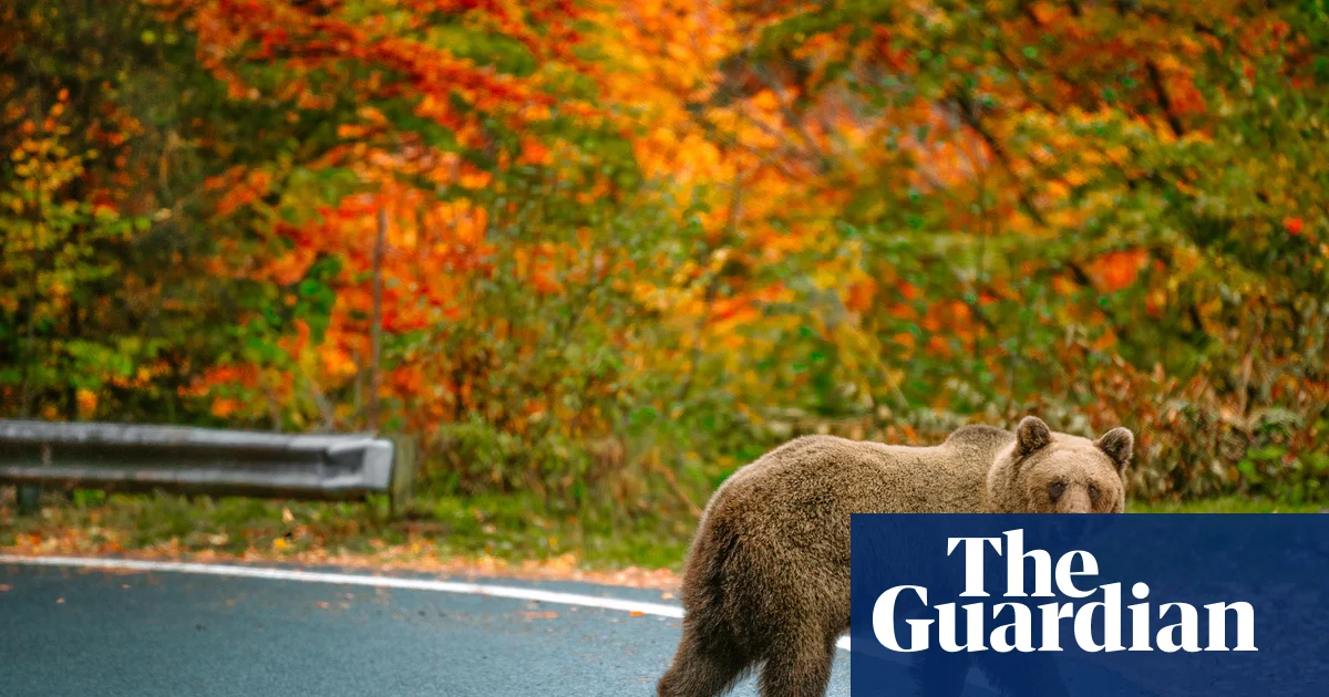
Jeremy Clarkson described Romania’s Transfăgărășan Highway as “one unbroken grey ribbon of motoring perfection”. The route (the second highest in Romania after the Transalpina) with its hairpin bends and climbs over the mountain was thrilling. Although we’d been told bear sightings were possible, we didn’t anticipate spotting them literally on the roadside, with one hanging over a stone wall posing for photographs, taken through the car window. Because of the harsh winters in the southern Carpathian Mountains, the section of the road to Bâlea Lake is open only for a few summer months – it proved particularly beautiful. Helen Jackson
Profile
Readers’ tips: send a tip for a chance to win a £200 voucher for a Coolstays break
Show
Guardian Travel readers’ tips
Every week we ask our readers for recommendations from their travels. A selection of tips will be featured online and may appear in print. To enter the latest competition visit the readers’ tips homepage
–
Highlights of Ireland
The karst landscape of the Burren. Photograph: Hemis/Alamy
In 2022 my wife and I set off on a 1,000-mile road trip around the island of Ireland after taking the overnight ferry from Liverpool to Belfast. After exploring Belfast, we stopped in Dublin, Kilkenny, Waterford, Cork, Dingle, Ennis, Galway, Castlebar, Sligo, Donegal, Derry and back to Belfast. We stayed in youth hostels, B&Bs, spare rooms, hotels (the Ellison Hotel in Castlebar was our favourite) and holiday lets. The scenery was incredibly varied, with the peninsula drive on the Ring of Kerry and the karst landscape of the Burren in Co Clare being particularly memorable. There were beautiful beaches (the wild sands of Glassilaun in Co Galway was our favourite), rich history and culture, superb food, characterful towns and cities, and, of course, the best pubs, and such friendly, warm people. Joe
Around the fjords of Norway
The Norwegian village of Flåm. Photograph: Beachmite Photography/Getty Images
My wife and I drove from Bergen to Vossevangen along the Hardangerfjord (the second-longest fjord in Norway), with a diversion to Flåm for a sauna and dip. Then we took the Myrkdalen road, which includes hairpin bends, waterfalls and an exciting descent into Vikøyri. We visited Nese, a secluded village on the western shore of the Arnafjorden. Then we took the car ferry over to Dragsvik, on to the village of Rysjedalsvika, then along the northern shore of the Sognefjord (Norway’s longest and deepest fjord) for another car ferry over to stay in Dingja on the coast, to do some fishing. Then all the way back to Bergen. Nick Martin
Geothermal bliss on Iceland’s ring road
View of Iceland’s southern mountains from Route 1. Photograph: Paul Brough/Getty Images
We started from Reykjavík and drove around the whole country on the ring road. We have done a few road trip holidays – this one was the most interesting. Every day we saw multiple dramatic landscapes and weather conditions, as well as very few other cars (we went in May). Iceland is an expensive country but being able to whale-watch and swim in geothermal pools made it worth it. Jess
The road to Orkney
Dunnet Head, Caithness. Photograph: Markus Keller/Getty Images
We drove up to Orkney, taking our time, stopping in Glasgow, Falkirk, Perth and Tain. As lovers of history and design, we stopped at the Falkirk Wheel and the Kelpies, as well as Scone Palace just outside Perth and Dunrobin Castle in Sutherland, the most northerly of Scotland’s great houses. But, really, you’re spoilt for choice with castles, brochs and standing stones. For us, the spectacular Caithness coastline was the main attraction – not least Dunnet Head, mainland Britain’s most northerly point. There are oodles of excellent eateries along the way – we loved the River Bothy in Berriedale and Paesano Pizza in Glasgow. Tania
Romance in Bavaria
Schloss Neuschwanstein castle in the Bavarian Alps. Photograph: Alamy
The Romantische Strasse (Romantic Road) was an early postwar successful example of a themed tourist route. It covers 286 miles through Bavaria from Würzburg to Schwangau. We drove the entire route, diligently following the tourist signs. On the way, we visited picturesque medieval towns, climbed the clock tower at the medieval walled town of Nördlingen – built entirely inside a meteor crater – and ended at the fairytale castle of Schloss Neuschwanstein. We sampled the hearty Bavarian cuisine, firmly centred on pork and sausages, enjoyed the local beer, and stayed in simple local hotels. Marilyn
Winning tip: traversing Italy’s Abruzzo Apennines
Lago di Barrea in the Abruzzo national park. Photograph: Valerio Mei/Getty Images
Abruzzo’s Valle del Sagittario snakes between narrow limestone cliffs, giving a peek into Italy’s wild heart. From vertiginous Anversa degli Abruzzi, head south to Scanno, pausing to solve its riddle of stone stairways and cobbled alleys, made famous by photographers and artists (including Maurits Cornelis Escher). Continue through mountain pastures, still traversed by shepherds and flocks and the region’s endangered brown bear population. Take a deep breath at the Godi mountain pass (1,630 metres) and relish the sparkling turquoise of Lago di Barrea below. As you begin the beech-clad descent into the national park, look out for the aptly named roadside hotel: Paradiso. Emma de Heveningham
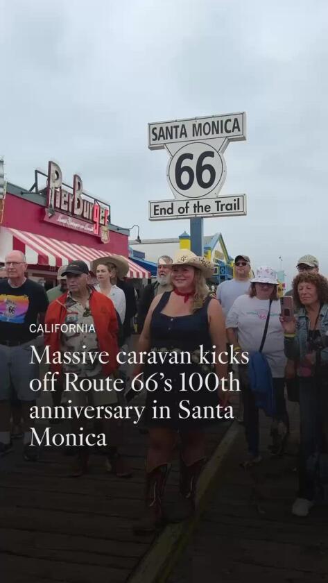
Around 7 a.m. Saturday, in a lot beside the shuttered Santa Monica Civic Auditorium, a strange set of cars and trucks began to gather. Three Model A’s. A couple of ’60 convertibles. A 1964 Chevrolet Impala station wagon. Also, a big bull on trailer wheels.
“Am I in the right place?” asked a man in one of the Model A’s.
“Going to Chicago?” asked a guy in a white Denali.
“I wish I could do the whole thing,” said Joe Hernandez of Pasadena, wistfully standing by.
Share via
This was the starting line for roughly 70 drivers who gathered to celebrate the centennial of Route 66 with a 2,448-mile, 20-day caravan to Chicago. Most had come from outside California to share an adventure with fellow “roadies” and boost awareness of the classic scenery and independent businesses along the eight-state route.
But soaring gas prices and hesitant international travelers have added uncertainty to a trip that was always going to be a logistical challenge. Day 1 alone might terrify an L.A. commuter: From the Pacific to Pasadena by surface streets, including miles on Santa Monica and Colorado boulevards.
“I don’t know how it’s all going to happen,” said Gary Daggett, president of the Old Route 66 Assn. of Texas. But he and his wife, Stephanie, have more than a little Route 66 experience to draw upon.
Mike and Lisa Visket of Prescott, Ariz., pose in Santa Monica at the pier in their Route 66 clothing on June 6, 2026.
“This is our 30th trip over 20 years,” Daggett said. “You can’t see everything. There’s so much…. You start meeting the people, you get hooked on the people.”
Shortly before their 8:30 departure time, organizer Rhys Martin called drivers together.
“Leaving here is going to be a little complicated,” he said.
Martin, who is part of the Route 66 Road Ahead Partnership, is president of the Oklahoma Route 66 Assn., and serves as manager of the National Trust for Historic Preservation’s Preserve Route 66 initiative. For the journey, he is driving a ’64 Chevy Impala station wagon with a GPS unit inside so that armchair travelers can follow his journey on the web.
“It’s going to be impossible to keep everybody together,” he said during preparations. “We’re encouraging people to spread out and support independent businesses rather than all going to one place and demolishing the kitchen.”
William Cooke of Pinon Hills participates in a caravan from Santa Monica Pier to Chicago, celebrating the centennial of Route 66.
In song and literature, the route is celebrated as an east-to-west journey. This caravan, running in the opposite direction, will travel from California through Arizona, New Mexico, Texas, Oklahoma, Kansas and Missouri to Illinois.
From Santa Monica, the Day 1 schedule took drivers to Beverly Hills City Hall, Grand Central Market downtown for lunch, the Chicken Boy statue and Galco’s Soda Pop Stop in Highland Park, then an overnight in Pasadena.
Day 2 takes the group from Pasadena to Barstow. Day 3, from Barstow to Needles. On June 25, the caravan is due to arrive in downtown Chicago.
The loose procession was led by a core group of 15 cars, including representatives of all eight states on the route. Since anyone can join or leave the caravan at any time, the number of vehicles will vary by the hour.
Through the decades, the road has grown from an American artifact into a global symbol of small-town Americana. Many merchants, restaurateurs and hoteliers along 66 now say that their summer customers are mostly travelers from abroad, especially Europe. One of the caravan’s drivers, in a rented pickup truck, was Dries Bessels, co-founder of the Dutch Route 66 Assn.
Brady Wilson of Amarillo, Texas, displays an assortment of Route 66 pins on his cowboy hat. Wilson is part of a caravan of Route 66 enthusiasts who set out from Santa Monica Pier on June 6, 2026, for Chicago.
Though the Model A’s will surely raise eyebrows on the road, the caravan’s most startling element is the fiberglass bull representing the Amarillo-based Big Texan Steak Ranch restaurant, one of the event’s sponsors.
“It’s the same one my dad brought home in ’71. His name is Big Moo,” said Danny Lee, who co-owns the restaurant with his brother, Bobby Lee. “He’s 12 and a half feet high. About 500 pounds. It’s all fiberglass.”
In 21 cities along the drive, the Big Texan team aims to stage nightly steak-eating contests, giving free dinners to anyone who can eat 72 ounces of steak, a baked potato, three shrimp, a side salad and a roll in 60 minutes.
The caravan’s first challenge came at the Santa Monica Pier, where there was no room for the cars due to a construction project, World Cup preparations and a Children’s Hospital fundraiser. Instead, the caravan gathered by the Santa Monica Civic Auditorium. Drivers strolled over the pier for a photo op, then returned to their cars.
“Herding cats,” said George Kulakowski of Huntington Beach, at the wheel of a 1931 Ford Model A Panel Delivery truck.
Participants in a Route 66 centennial caravan pose for a photo before they depart from Santa Monica Pier on June 2, 2026, for Chicago along the historic highway.
Another challenge awaited in West Hollywood, where Santa Monica Boulevard (aka Route 66) was busy with crowds for the city’s WeHo Pride Street Fair. By plans laid ahead of time, most caravan vehicles detoured around the party while select caravan cars followed a police escort through the action.
This way, Martin said, “another community along Route 66 gets to share its identity with the community at large.”
Allison Lehn of Boston participates in a caravan from Santa Monica Pier to Chicago, celebrating the centennial of Route 66.
By 11:15 a.m., Martin’s car had reached Sunset Boulevard in Silver Lake. Meanwhile, assorted other parades and caravans are traveling Route 66 in other states this year; most of them concentrate on short segments.
By 12:45 p.m., caravaners had met the mayor of Beverly Hills and rolled through West Hollywood’s Pride festivities, arriving at Grand Central Market, running slightly ahead of time.
On May 30, an estimated 3,596 classic cars joined a “Capital Cruise” on Route 66 in Tulsa, Okla., becoming a Guinness Book of World Records holder for the largest parade of classic cars, drawing an estimated 100,000 spectators and overwhelming local traffic.
In Arizona, the Williams Historic Route 66 Car Show was set for Friday and Saturday. In Texas, the Amarillo-based Texas Route 66 Festival is running Thursday through June 13.
William Cooke of Pinon Hills, left, and Sarah Jane Woodall of Tecopa, Calif., drive along Wilshire Boulevard in a 1960 Edsel Ranger Convertible as part of a Route 66 centennial caravan.
In those states and beyond, the caravan from Santa Monica will find hotels and motels in every kind of condition, vintage neon, road food, blue states, red states and purple states.
As a package of Times stories described in May, some landmarks date to the highway’s days as a scene of Depression desperation in the 1930s, others to its giddy postwar years in the late 1940s and ‘50s.
Route 66 was created in 1926 as a highway stitching together hundreds of local roads. Nicknamed “the Main Street of America” by its boosters and “the Mother Road” by John Steinbeck in “The Grapes of Wrath,” the highway inspired Bobby Troup’s song “(Get Your Kicks on) Route 66” in 1946.
But economic life along Route 66 has been precarious since the late 1960s, when interstate highways and chain hotels began stealing traffic away from the older, slower road. After Route 66 was decommissioned as a highway in 1985, about 85% of the old route remained in use, often as small-town thoroughfares, country highways and frontage roads alongside Interstate 40.
Efforts to save and rebuild the route as a historic resource began in the late 1980s and gained ground after the 2006 release of the Pixar/Disney animated features “Cars,” which tells the story of the highway’s rise and fall. In small towns such as Tucumcari, N.M., and Seligman, Ariz., the highway remains central to local identity and economy.
A vehicle in the Route 66 caravan is photographed June 6, 2026.
This year’s centennial improvements along the route “are things that are going to go into the future,” Martin said. “The real impact is going to be next year and the years after.”
On a 75-mile cliff-hugging stretch of highway in California, traffic is way up, despite soaring gas prices. And locals expect the busiest summer in years.
The road is Highway 1 in Big Sur, which reopened in January after three years of repair and reconstruction following a pair of landslides. Drivers can once again embark on the state’s most famous road trip, covering the 100 miles between Cambria to the south and Carmel to the north without leaving the two-lane coastal highway. And they’re heading out in big numbers.
Caltrans estimates that as of May, Big Sur restaurant and retailer guest counts are up 40% from last year, and that northbound traffic at Ragged Point, the southern gateway to Big Sur, has risen 900% year-over-year.
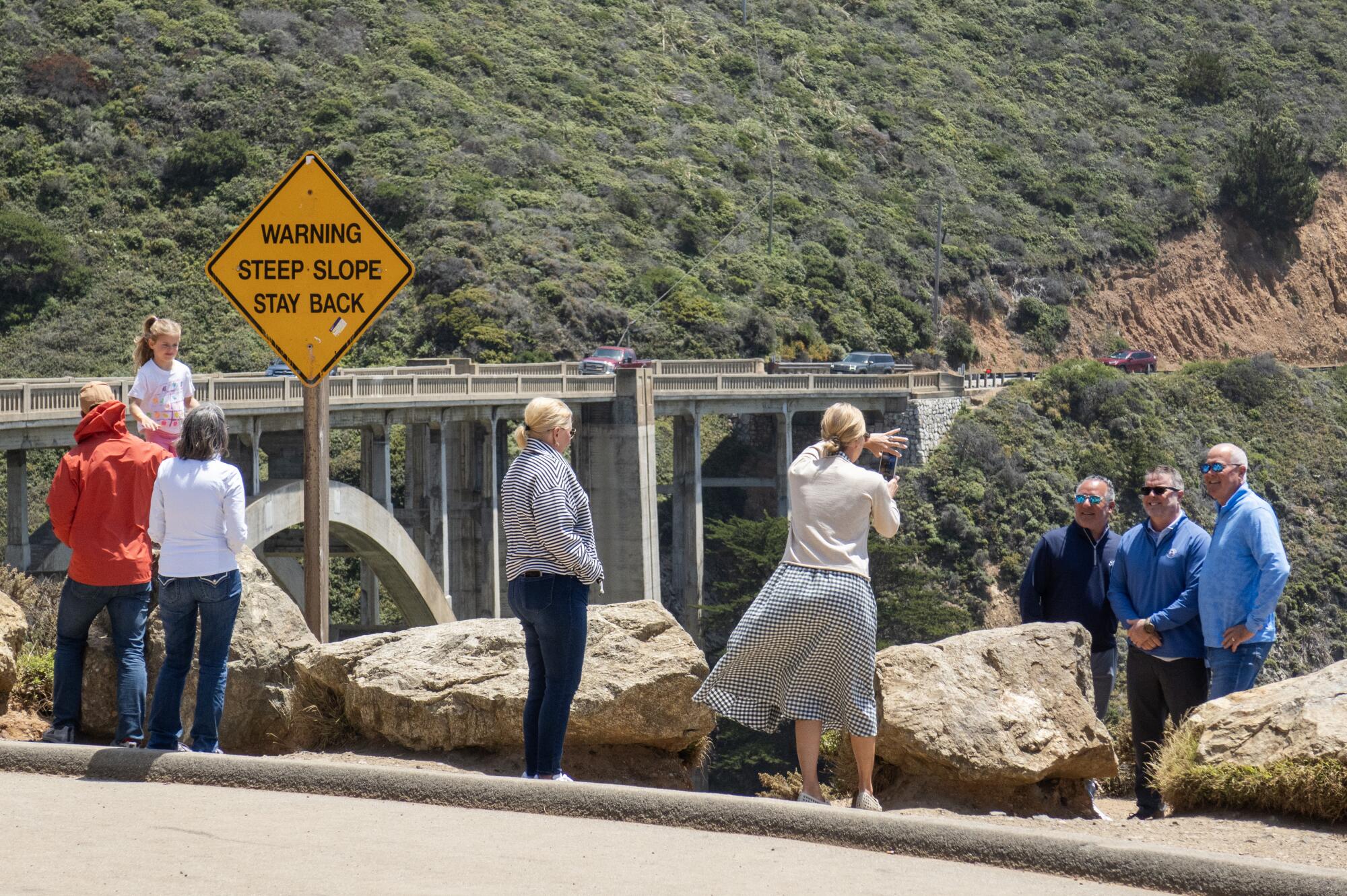
People pose for photos near Bixby Bridge. Monterey County’s Board of Supervisors voted to explore a 12-month ban on parking around the bridge.
Safety cones prevent parking along Coast Road near the Bixby Bridge.
“Take your time,” said Kirk Gafill, co-owner of the popular Nepenthe restaurant and president of the Big Sur Chamber of Commerce, offering advice to travelers. “You’re going to be sharing the road with a number of people.”
As travelers rediscover the road, the cost of driving has been shooting skyward. California’s average gas price ($6.11 per gallon as of May 26) is up 26% from the year before. In early April, rates hit $9.99 at the isolated gas station in the Big Sur community of Gorda.
For spring and summer travelers, these numbers would seem to pose a stark question: Stay home and save money, or head for the coast because the road is finally open and it’s still cheaper than flying?
So far, the latter answer is winning big.
Fog lingers off the coast of Highway 1.
“We are definitely seeing a huge uptick in our reservations,” said Megan Handy, assistant general manager at the upscale Treebones resort. She estimated that bookings are 30% or more ahead of last year, and rates are unchanged since then. But “it’s still not feeling super crowded, which is nice. Everything still feels kind of calm.”
But added traffic has raised some anxiety. On May 19, Monterey County’s Board of Supervisors voted to explore a 12-month ban on parking at Bixby Bridge, one of the region’s top photo spots.
Over the years, the number of cars parking near the bridge — often illegally, sometimes impeding emergency vehicles — has risen. The proposed parking moratorium won’t take effect until the supervisors discuss it further.
Share via
Busy as things are, several business owners pointed out that many international travelers have not yet returned — perhaps because most make their plans more than six months ahead, perhaps because of global politics, perhaps a little of each.
The biggest challenge for businesses during this resurgence? “Restaffing and retaining,” said Handy at Treetops.
At Nepenthe, Gafill said his business has seen a 45% boost in guest volume since the road’s reopening. Gafill said he would have expected a 35% pickup, “simply by virtue of reopening the highway.” The additional 10%, he said, might be “all that pent-up demand,” aided by “a very beautiful and very dry winter,” followed by a mild spring.
A lunch crowd dines at popular restaurant Nepenthe.
Another possible factor: Nobody can be sure how long the road will remain open.
To cope with the influx of people, Gafill said, “everybody is trying to recruit and retain their existing staff.”
At the Ragged Point Inn, where rates dropped as low as $149 nightly last fall, rates are back over $200 and staffers are suggesting that customers book at least six months ahead. The inn has reopened its snack bar for the first time since early 2023, and management is investing in capital upgrades and staging live music on weekends throughout the summer.
Business “is up over 100%,” said Diane Ramey, whose family owns the inn. “I know not all of our neighbors are having the same lift, but everybody is doing better.”
Traffic approaching Bixby Bridge.
A visitor poses in an oversized chair at Big Sur River Inn.
Even at the New Camaldoli Hermitage, a Benedictine monastery above Lucia, the road’s reopening and coming summer season have made a difference. Bookings are up an estimated 30% at the hermitage, which rent rooms and cottages (for two nights or more) to visitors who agree to its requirement of silence.
Big Sur business owners advise visitors to travel on weekdays for less traffic and the best hotel rates, and to get on the road as early as possible.
Since its opening in 1937, the highway has been vulnerable to landslides and shifting ground, operating on a longstanding cycle of landslide, closure, repair, reopening and then another landslide, or sometimes a fire. The U.S. Geological Survey has identified the Big Sur coastline as one of the most landslide-prone areas in the western United States. The 2023-2026 closure was the longest in the highway’s history.
Over time, road crews have used increasingly sophisticated strategies. In the most recent efforts, Caltrans said, it used drones to help survey the slopes and remotely operated bulldozers and excavators to reduce risks to workers.
During the closure, no traffic was allowed on 6.8-mile span from just north of Lucia until about a mile south of the Esalen Institute. Drivers detoured inland by way of U.S. 101.
I stood last week in the middle of a highway, marveling as construction workers used large excavators to repair the collapsed roadway.
I was walking a segment of Angeles Crest Highway that closed about five months ago when winter storms pummeled the roadway, ripping off hunks of pavement and collapsing large sections of the road. I wanted to survey the damage and also enjoy a car-free highway in the beautiful backcountry.
In this edition of The Wild, The Times’ weekly outdoors newsletter, I will share what I observed and include details about how you can repeat my trip. I’d say it is a rare opportunity, but it’s starting to feel, especially as human-caused climate change worsens, like Angeles Crest Highway is closed more often than it’s open.
You are reading The Wild newsletter
Sign up to get expert tips on the best of Southern California’s beaches, trails, parks, deserts, forests and mountains in your inbox every Thursday
By continuing, you agree to our Terms of Service, which include arbitration and a class action waiver. You agree that we and our third-party vendors may collect and use your information, including through cookies, pixels and similar technologies, for the purposes set forth in our Privacy Policy such as personalizing your experience and ads.
Angeles Crest Highway, completed in 1956 (in part by prison labor), is a 66-mile curvy road that climbs from around 1,300 feet to nearly 8,000 feet, taking travelers from La Cañada Flintridge to the mountain town of Wrightwood. A large segment, 55 miles, received federal distinction in 1990 as a National Scenic Byway.
For the record:
4:04 p.m. May 21, 2026A previous version of this article said Angeles Crest Highway climbs from 800 feet. The highway begins at an elevation of around 1,300 feet.
In case, like me, you’ve lost the plot of the many recent closures and reopenings of Angeles Crest Highway, here’s a brief refresher.
Winter 2022/spring 2023: Winter and early spring storms, including atmospheric rivers, blow out multiple sections of the roadway, prompting several closures, including: from near Mt. Wilson Red Box Road to Upper Big Tujunga Road; from Upper Big Tujunga Road to Islip Saddle; and from Islip Saddle to Vincent Gap.
October 2023: A 20-mile stretch from Upper Big Tujunga to Islip Saddle reopens; road remains closed from Mt. Wilson Red Box Road to Upper Big Tujunga, requiring drivers to take a detour to reach a newly open section; segment from Islip Saddle to Vincent Gap remains closed.
July 2024: Mt. Wilson Red Box Road to Upper Big Tujunga reopens, ending the need for a detour.
A portion of Angeles Crest Highway where the curved shoulder broke off.
(Jaclyn Cosgrove / Los Angeles Times)
The hiking community celebrated when that final 10-mile stretch from Islip Saddle to Vincent Gulch reopened. The closure blocked access to Dawson Saddle and made the drive to Vincent Gulch to hike the Mt. Baden-Powell trail much longer, as you had to take multiple freeways to maneuver from L.A. around the San Gabriels.
For the first time in three years, all of Angeles Crest Highway was open — for about five months.
Grape soda lupine, left, Grinnell’s beardtongue, snow plant and western wallflower.
(Jaclyn Cosgrove / Los Angeles Times)
Last December, Southern California experienced another round of a damaging atmospheric river. “More than 10 inches of rain fell in parts of the San Gabriel Mountains in Los Angeles County during a 48-hour period,” The Times reported.
Soon, photos emerged of washed-out segments of Angeles Crest Highway, and the California Department of Transportation announced that, yet again, the highway was closed, this time from 3.3 miles east of Newcomb’s Ranch to State Route 138.
Curious to see the damage for myself, I headed up the highway last week to walk a segment of the closure. My plan was to park at the large lot at the 6,000-foot snow play area and then walk along Angeles Crest Highway for about 4½ miles to Buckhorn Campground, a forested enclave where I’ve spent many nights staring up at the stars.
After having lunch at Buckhorn, I planned to backtrack to Cloudburst Summit where I would take the Pacific Crest Trail back to where I parked. The total trip is just shy of nine miles and gains about 1,200 feet in elevation.
The closed gate near the 6,000-foot snow play area in Angeles National Forest.
(Jaclyn Cosgrove / Los Angeles Times)
I walked from the lot past the closed gate, appreciating several grape soda lupine, one of my favorite native wildflowers, blooming along the hillside.
I was alone on the empty highway, a scene that was stunningly gorgeous and eerily dystopian. For the first three-fourths of a mile, the road appeared to be in good condition. But then, I trudged around a bend and observed the first segment of collapsed roadway on my trip.
For anyone considering cycling this route, I am happy to report that CalTrans and its contractors have done a nice job creating dirt and rock berms around the damaged portions of road that I observed. I mention that in case, like me, you watched the 1991 TV series “Land of the Lost” and developed an illogical fear of dropping through a crack in the road and unknowingly discovering a time portal to the Jurassic period.
I continued past this first damaged section, listening to the dark-eyed junco and mountain chickadee, laughing as the chipmunks scampered to and fro.
An excavator works to repair a segment of Angeles Crest Highway.
(Jaclyn Cosgrove / Los Angeles Times)
Soon, at 1.2 miles, I encountered construction workers driving excavators to move earth and repair a drainage area where it appeared water had rushed down the steep mountains and blasted the road away. As you hike or bike, please respect instructions from construction workers and also make sure they see you before you try to pass them.
Just a fifth of a mile farther, and I saw more portions of the roadway that had collapsed, although these sections were smaller than the area the heavy machine operators were trying to repair.
As you hike along, you’ll likely realize that the pavement warms up quickly. It’s important to either start this journey early in the day or on a cooler day — and pack plenty of water.
At about 1.75 miles in, you will reach a junction where the Pacific Crest Trail, a 2,650-mile route that spans from Mexico to Canada, intersects with the roadway. You can turn and head back to your car here if you’d like by taking the PCT. You’ll initially walk west before the trail starts moving southward.
I continued eastward on the highway, pausing at times to appreciate the vista points that you can only observe for a few seconds in a car. At one turnout, I paused to smell the delicious bark of a Jeffrey pine, which has an aroma similar to butterscotch or vanilla.
A view of the San Gabriel Mountains and desert beyond.
(Jaclyn Cosgrove / Los Angeles Times)
For about a mile-and-a-half, there’s minimal damage, enough of a break to briefly forget why the road is closed. But as you near the Buckhorn Campground entrance, you’ll find serious damage, including where the Mt. Waterman ski lifts used to take travelers up the mountain.
I turned off the highway onto the Buckhorn Campground road, finding it to be in fairly good condition — until you get to the creek crossing. A massive chunk of the road is just gone, washed away presumably by water charging down the steep hillsides. This is the only technically tricky part of the hike, and you’ll want to take good care to discern the best path here. There are a lot of branches and boulders that aren’t stable and could be napping spots for rattlesnakes.
Past here, you’ll find rocks and other debris scattered along the roadway. As I neared the campground, I noticed a Stellar’s jay observing me. Maybe it misses the days when all it had to do for food was wait for clumsy campers to drop bits of sandwiches and trail mix that it could swoop down and enjoy.
A washed-out segment of the road that leads to Buckhorn Campground in Angeles National Forest.
(Jaclyn Cosgrove / Los Angeles Times)
I sat atop a picnic table at Buckhorn, comforted that the campsites and tall old pines that I’ve camped under multiple times were still there. Although much of the campground remains intact, some campsites near the creek were washed away. I’ve always wanted to camp there. This is why you shouldn’t put off adventure!
After enjoying lunch and chatting with a few PCT hikers, including one who was lost and grateful for my map, I headed back down the highway. Just over a mile in, you’ll turn left near Cloudburst Summit onto the PCT. Your feet will thank you from this break from pavement.
As I trudged along, the quiet monotony of the day allowed me to make oh-so-brilliant observations to myself, like, “Wildflowers are like spring’s Christmas lights,” a note I left for my future self to remember. I bet you’re glad I wrote that down.
Grape soda lupine blooms along the Pacific Crest Trail in Angeles National Forest.
(Jaclyn Cosgrove / Los Angeles Times)
I was pleased to see so many wildflowers still in bloom along the trail, including several grape soda lupine plants, the alienlike snow plants and a bit of Grinnell’s beardtongue.
Returning to my car, I thought about how much I enjoyed the walk but also how special Highway 2 is, regardless of how you traverse it.
There is no timeline of when the road will reopen. The analysis from CalTrans of what it will take to repair Highway 2 is grim.
“To date, Caltrans crews have identified approximately 40 locations requiring repair, though this number may increase as assessments continue. In several areas, portions of the highway were washed out and remain temporarily inaccessible,” according to the CalTrans website.
A damaged segment of Angeles Crest Highway near the Buckhorn Campground entrance.
(Jaclyn Cosgrove / Los Angeles Times)
It’s becoming increasingly difficult to remain optimistic that we won’t see a growing number of closures along Angeles Crest Highway.
Highway 2 seems to face similar challenges to its coastal cousin, California’s Highway 1, which is increasingly plagued by storms exacerbated by human-caused climate change.
My colleague Grace Toohey spoke to an expert about Highway 1, who made a point that’s unfortunately equally applicable to the plight of Highway 2.
“If our storm and other conditions were normal, we would expect closures and losses at some points,” said Michael Beck, director of UC Santa Cruz’s Center for Coastal Climate Resilience. “The challenge is that we’re now clear that the events that are going to cause impacts — these particularly extreme events — are getting more common. … Climate change is here and now, it’s no longer a problem of the future.”
3 things to do
Hikers head up Icehouse Canyon Trail.
(Brian van der Brug / Los Angeles Times)
Editor’s note: Because of recent wildfires, events might be canceled on short notice. Check event pages before heading out.
1. Eliminate trail obstacles near Mt. Baldy The San Gabriel Mountains Trailbuilders need volunteers on Sunday to help clear fallen trees and remove overgrown brush along the Chapman Trail in Icehouse Canyon near the Mt. Baldy community. Volunteers will meet at 7:30 a.m. at the Glendora Park and Ride before heading to the worksite. Volunteers will hike between four miles and seven miles with an elevation gain of up to 2,000 feet. Register at meetup.com.
2. Mosey past movie scenes near Calabasas Retired park ranger Mike Malone will guide a three-mile moderate hike from 10 a.m. to 12:30 p.m. Sunday through Malibu Creek State Park, highlighting locations where the park served as a backdrop for film and TV productions. Malone will also share history about when the park was owned by 20th Century Fox from 1946 to 1974. Hikers should meet at 10 a.m. at the park’s main trailhead by the restrooms. Learn more at parks.ca.gov.
3. Hike along historical routes in Chatsworth A docent at Santa Susana Pass State Historic Park will host a 3½-mile hike from 8 to 11 a.m. Monday through the Santa Susana Mountains. Hikers will learn about the park’s ancient quarry, Indigenous culture and the Butterfield Overland Stagecoach route. Hikers will meet at the Andora trailhead in Chatsworth. Learn more and register at meetup.com.
The must-read
A trash interceptor made by the Dutch nonprofit the Ocean Cleanup grabs trash from Ballona Creek that could otherwise end up in the Pacific Ocean. Since its installation in 2022, the interceptor has collected more than 200 tons of trash.
(Christina House / Los Angeles Times)
It can be peaceful to take a stroll along the San Gabriel or Los Angeles rivers amid the cottonwood trees, willows and herons. But it’d be impossible not to notice the garbage too. For years, our local rivers have suffered at the hands of humans and the heaps of waste we produce. That could change. “By the 2028 Olympics, a coalition of city, county, state and private partners hopes to change that by deploying trash-intercepting devices in the Los Angeles and San Gabriel rivers, officials announced [last] Wednesday,” Times staff writer Lila Seidman wrote. “The plan is to prevent hundreds of tons of garbage from getting to the ocean.” Could our rivers be clean that soon?
Happy adventuring,
P.S.
Will Southern California’s roving wolf ever find a mate? I can’t be the only one stressing about this. BEY03F, affectionately called “bae” or “Valentine” by some, has been making headlines since early this year when she became the first wolf to enter L.A. County in more than 100 years. She has since traversed hundreds of miles and through multiple counties, with her latest travels bringing her to Sequoia National Park. This again marks the first time in a century that a wolf was documented there. BEY03F keeps making history because humans wiped out her canine kin. Will she ever find a connection that helps her repair some of the harm done?
For more insider tips on Southern California’s beaches, trails and parks, check out past editions of The Wild. And to view this newsletter in your browser, click here.
Richard Mitchell, 84, of Albuquerque in 2016. Mitchell used the Green Book to drive across the United States in 1964. The travel guide “assured protection for Negro travelers.”
(Photo by Craig Fritz / For The Times )
Forty-four of the 89 counties along Route 66 were sundown towns, communities where it was encouraged for Black people to leave before dark — or else. Route 66 diners, motels and gas stations routinely refused service to Black travelers. In 1936, a Harlem postal worker named Victor Green began publishing the Negro Motorist Green Book, a guide to the hotels, restaurants and gas stations along the route that would serve Black travelers. More than 1,400 tourist homes (private residences that took in guests when hotels wouldn’t) were listed during the guide’s run.
For Black families on Route 66, the Green Book was as essential as a spare tire. In Tulsa, the Greenwood District was once known as “Black Wall Street.” White thugs destroyed it in the 1921 Race Massacre. The community rebuilt and became a hub of Black commerce near the route. Springfield, Ill., was one of the first cities on Route 66 to offer services to Black travelers. It was also the site of the 1908 Race Riot, which helped spur the founding of the NAACP.
A vintage photo of the Hayes Motel in Los Angeles. It was featured in the Green Book, which listed places that served African Americans during the era of segregation.
(Brian van der Brug / Los Angeles Times)
See what remains today: Only about 30% of Green Book sites along Route 66 are still standing. The DuBeau in Flagstaff, Ariz., once a Green Book listing, now operates as a motel. The recently shuttered Clifton’s in downtown Los Angeles sits at 7th and Broadway, the original terminus of Route 66. Route History Museum in Springfield is the only museum in the country dedicated to the Black experience on Route 66, housed in a 1930s Texaco station one block off the road. It offers a virtual reality experience that walks visitors through the Green Book cities of Illinois, including sundown towns.
Beyond the Green Book, other businesses that are worth a visit include Threatt Filling Station in Oklahoma, a Black-owned gas station (and safe haven for Black travelers) during the era of segregation, and the neon sign from Graham’s Rib Station, a beloved Black-owned restaurant for many years. It’s located at the local History Museum on the Square in Springfield, Mo.
Colombia’s President Gustavo Petro has blamed a ‘narco-terrorist group’ led by a former FARC fighter for the attack.
Published On 28 Apr 202628 Apr 2026
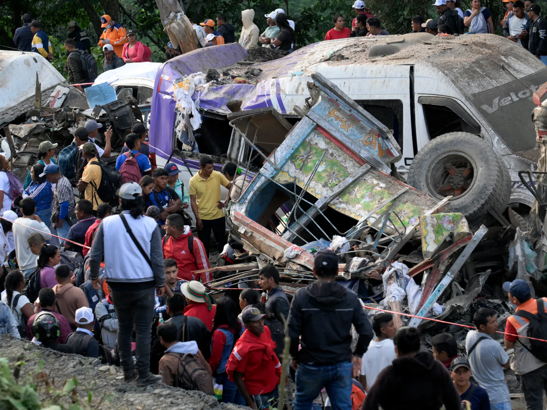
The death toll from a deadly highway bombing in southwestern Colombia has risen to at least 20, the governor of the Cauca region has said.
Governor Octavio Guzman said on Monday that the death toll included 15 women and five men.
Recommended Stories
list of 4 itemsend of list
There were also 36 people injured, including three who remained in intensive care as of Monday and “five minors who are out of danger”, Guzman said in an update shared on social media.
Some media reports put the death toll from the lethal explosion, near a tunnel on the Pan-American Highway, at 21 as of late on Monday.
A dozen of the victims were from a village near the town of Cajibio, where hundreds of mourners held a vigil on Monday.
The mourners were dressed in white and waved white sheets or balloons as a sign of peace.
“Please, no more death, no more violence,” Joao Valencia, 42, a relative of a woman killed in the attack, told the AFP news agency, holding up her picture.
“These kinds of women should die of old age, not have their lives taken from them in such a tragic way,” he added.
The bombing was one of the deadliest attacks in Colombia since the now-defunct Revolutionary Armed Forces of Colombia (FARC) blew up a Bogota nightclub in 2003, killing 36 people.
Colombia’s President Gustavo Petro said a “narco-terrorist group” was responsible for the attack, specifically naming a group led by Nestor Vera, commonly known as Ivan Mordisco, one of Colombia’s most wanted men.
Mordisco is a dissident former member of FARC, which signed a landmark peace agreement with the government in 2016.
The attack comes just more than a month before national elections, in which voters will pick a successor to President Gustavo Petro.
A highway bomb attack in southwestern Colombia has killed 19 people and injured at least 38, the latest spate of violence ahead of next month’s presidential election.
Buses and vans were left mangled in the blast Saturday on the Pan-American Highway, in the restive southwestern Cauca department.
Several cars were flipped over by the force of the explosion and a large crater was blown out of the roadway.
The department’s governor on Saturday evening provided a death toll of 14, with more than 38 injured, but the National Institute of Legal Medicine and Forensic Sciences said Sunday morning it had begun the examination of 19 bodies.
Military chief Hugo Lopez told a news conference on Saturday that the bomb had exploded after assailants stopped traffic by blocking the road with a bus and another vehicle.
The attack comes just over one month ahead of national elections, in which voters will pick a successor to President Gustavo Petro.
Petro blamed the bombing on Ivan Mordisco, the South American country’s most-wanted criminal, whom the president has compared to late cocaine kingpin Pablo Escobar.
The violence came after a bomb attack on Friday on a military base in Cali, Colombia’s third-largest city, injured two people and set off a string of attacks in the Valle del Cauca and Cauca departments.
According to Lopez, 26 attacks have been recorded in the two departments over the past two days.
Authorities have boosted military and police presence in the areas, Defence Minister Pedro Sanchez said.
Security is one of the central issues of the May 31 presidential election. Political violence was brought into sharp focus last June, when young conservative presidential frontrunner Miguel Uribe Turbay was shot in broad daylight while campaigning in the capital Bogota and later died from his wounds.
Leftist Senator Ivan Cepeda, an architect of Petro’s controversial policy of negotiating with armed groups, is ahead in polls.
He is trailed by right-wing candidates Abelardo de la Espriella and Paloma Valencia, both of whom have pledged to take a hard line against rebel groups.
All three have reported receiving death threats and are campaigning under heavy security.