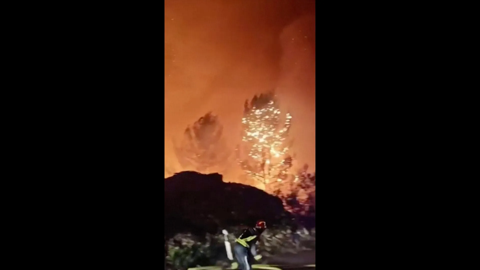
Croatian authorities have issued an emergency alert as a wildfire rages on Brac Island, off the Dalmatian coast. Strong winds have hampered efforts to stop the blaze near the island village of Milna.
Nepal is demanding “climate justice” and $20m in compensation after the recent devastating floods in the country and China’s Tibet region, which led to the deaths and disappearances of thousands of people.
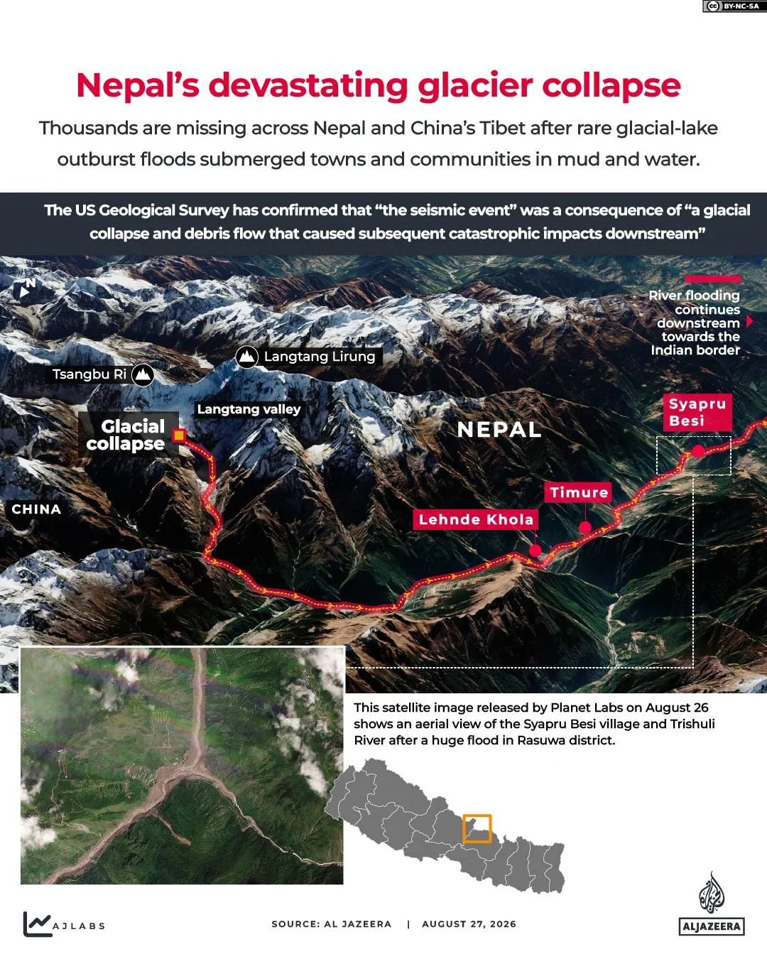
The catastrophe, which scientists say was caused by the effects of climate change, was triggered when part of a mountain glacier collapsed and a torrent of water and mud flooded down into Nepal’s Rasuwa and Nuwakot regions, as well as into China’s Tibet region on August 26. More than 1,300 people have been confirmed dead and more than 5,000 remain missing.
Recommended Stories
list of 3 itemsend of list
“We are paying the ultimate price for a global crisis we did not create,” Nepal’s Foreign Minister Shisir Khanal said last week.
“Support for Nepal should not be seen from an angle of aid or charity, but should be seen from the perspective of climate justice,” he told the AFP news agency.
On Monday, the country’s President Ramchandra Paudel made a similar demand during an address to the nation.
“I make a heartfelt appeal to the international community not only to listen to the voices of ecologically vulnerable countries, including Nepal, but also to take concrete and effective steps to ensure climate justice for them,” he said.
Nepal’s Ministry of Finance and Ministry of Environment have written a joint letter to the United Nations, which set up a fund to respond to loss and damage caused by climate change in 2022 in line with the 2015 Paris Agreement on climate, with a request for $20m in damages.
The UN’s Loss and Damage Fund is, however, facing a $2.8bn funding gap as it prepares to approve its first climate recovery projects.
‘Collective frustration’
Nepal’s leaders may have a point.
Nepal contributes less than 0.1 percent of global greenhouse gas emissions and generates most of its electricity from renewable sources of energy. Yet its geographical location in the Himalayas makes it particularly vulnerable to severe climate and weather events.
Last month’s catastrophic flooding in the country comes against a backdrop of rapid global warming and glacial loss across the Himalayas.
Glaciers across the Hindu Kush Himalaya mountain range – which spans Afghanistan, Bangladesh, Bhutan, China, India, Myanmar, Nepal and Pakistan – lost ice 65 percent faster between 2011 and 2020 than during the previous decade.
Nepal’s glaciers, which are sandwiched between two major carbon emitters – India and China – have lost close to one-third of their ice volume in roughly three decades due to global warming, the United Nations said in 2023.
Tanuja Pandey, a Nepal-based climate activist and lawyer, said there is collective frustration behind Nepal’s demand for climate justice.
“People here feel the world often pays attention to Nepal only when a climate disaster becomes impossible to ignore. It is deeply painful to people here that global attention intensifies when headlines report thousands of people dead or missing and in the end, their suffering does not generate any urgency to fight climate change,” she told Al Jazeera.
Shreya KC, a 28-year-old Nepali climate activist, said there is profound anger and sadness among people in Nepal who say that they must no longer continue to suffer the impact of climate change, which, as they see it, other countries are responsible for.
“My hometown is in Solukhumbu in eastern Nepal,” the activist told Al Jazeera. “It is a district of mountains and is also home to the world’s highest mountain, Mount Everest, and my home is also downstream. After the glacial collapse happened two weeks ago, people in my region have realised that this can now happen anywhere in Nepal since the Himalayas are warming and glaciers are melting faster.”
While Nepal has been actively fighting climate change, Shreya KC said she herself has been involved in projects in the country that focus on clean hydropower generation, forestry and other such climate advocacy programmes.
“Because of other countries,” she said, “today Nepalis are the ones most impacted by climate change. So people want justice.”
[Planet Labs PBC]
Is there such a thing as ‘climate justice’?
According to preliminary estimates from Nepal’s National Disaster Risk Reduction and Management Authority, the country’s property, housing and infrastructure losses in the floods amount to some $2.56bn.
But claiming compensation under a notion of “climate justice” won’t be straightforward, according to Joyeeta Gupta, a professor of Environment and Development in the Global South at the University of Amsterdam.
According to the United Nations, “‘climate justice’ is the moral and ethical principle that seeks to address the disproportionate impact of climate change on vulnerable communities and future generations”.
“I define it as a system of justice where others’ perspectives are taken into account, and no harm is caused to others,” Gupta told Al Jazeera.
Nepal is a country that has very low emissions, she said, but is facing the brunt of climate issues which it never created. “That is reason enough for Nepal to claim climate justice,” she noted.
But, practically speaking, can it? In the pre-1990 period, there was a lot of discussion among nations about the need for large emitters to compensate those that would be harmed, Gupta noted. But soon after that, the term “compensation” disappeared from the agenda of international climate treaties, which turned more to discussions about providing assistance to developing countries that need to tackle climate change instead.
In a July 2025 advisory opinion on climate change, the International Court of Justice (ICJ) declared that “all nations have binding legal duties under international law to prevent significant climate harm”.
The ICJ’s advisory opinion on climate change also says that states breaching their international climate obligations can be required to make full reparations, including financial compensation to “injured states” or countries impacted by climate change caused by the actions of other countries.
While the ICJ’s opinion is not legally binding, Gupta said, it is a statement in international law that could support Nepal’s government’s international appeal for climate justice and compensation.
‘No climate justice without internal justice’
Nepal’s rapper-turned-prime minister, Balendra Shah, is scheduled to travel to New York on September 22 to address the 81st session of the United Nations General Assembly (UNGA) on September 24. His country’s appeal for climate justice is expected to be a key part of his address.
For climate activist Shreya KC, while UN meetings and international conferences on climate change may hold some weight when it comes to discussing climate disasters, right now, what Nepal needs is money.
“So much of our money allotted for healthcare, education and to transition into a more developed nation is now being spent on fighting climate change. So countries who are causing emissions, especially from the global north, need to commit more money to the UN’s Loss and Damage Fund,” she said, adding that money from that fund should be disbursed to vulnerable communities in need, not as a loan but as compensation for bearing the brunt of climate change.
Pandey noted that this is not the first time a climate disaster has occurred in Nepal and said that the new government, which came into power in March this year on the back of Nepal’s Gen Z protests last year, has also failed to make climate a priority in its budget.
While it is a good sign that Nepali politicians are appealing for international climate justice, she said, they also need to address the country’s internal development model to fight climate change in the first place.
“There is no climate justice without internal justice within the country itself,” she said.
“I hope that even in our development, partners and investors stop treating climate resilience as an optional addition to development in Nepal just because we are economically vulnerable.
“Investing in Nepal without investing in sustainability is simply a bad investment.”
On Monday, Nepal declared a national day of mourning to remember the more than 1,300 people who are known to have died in last month’s catastrophic floods. Thousands more are still missing.
The country’s President Paudel used the opportunity to call on people to unite.
“This is not a time for division. Nor is it a time to blame one another or become entangled in political disputes and confrontation,” he said.
“This is a time to demonstrate national unity and solidarity. It is also a time for reconstruction, rehabilitation and economic recovery.”
But Gupta says Nepal’s biggest challenge right now is establishing a precedent for compensation for climate change-related disasters.
“It was recently a glacial collapse in the country, but soon, it will become a bigger issue as time goes on because the monsoon patterns will change, the sea level will rise,” she said.
As many other developing countries – notably island states that face being submerged altogether – are also likely facing similar climate change challenges, the damage could become huge.
“That is going to be a very big reason why many rich countries will probably be unwilling to pay compensation, because that would set a precedent for future issues,” Gupta said.
“But the issues countries like Nepal are facing are a very strong argument to try and convince the whole world to accelerate action to phase out fossil fuels and fight climate change.”