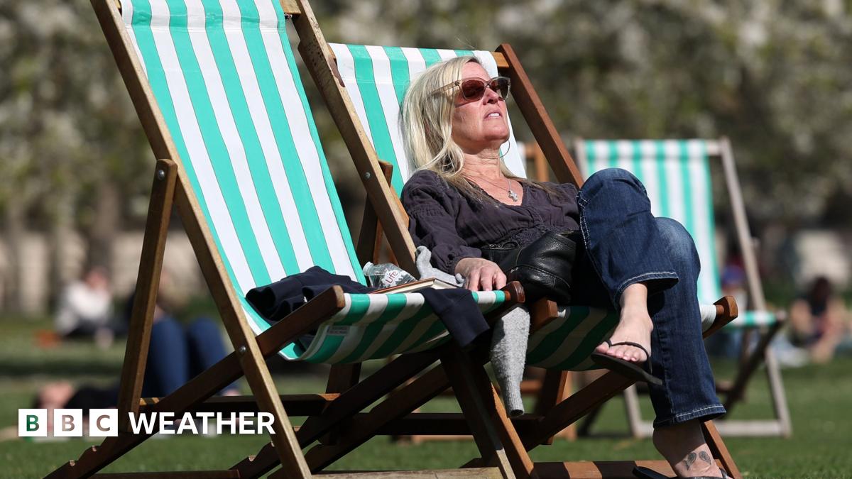
BBC Breakfast’s weather presenter promised it wasn’t all bad news for this holiday weekend
BBC Breakfast: Naga Munchetty apologises to Carol Kirkwood
One of the hosts of BBC Breakfast shared their own warning to viewers who might be planning an Easter egg hunt this weekend.
The morning show returned to screens on Saturday (April 4) for another regular instalment despite it being an extended bank holiday weekend. As usual, it delivered the day’s top stories from the UK and across the world, including the latest from Iran and updates over the Artemis II launch.
Today’s show was presented by Naga Munchetty and Charlie Stayt as they provided the latest on the headlines and more. One of the biggest stories of the latest edition of the show was weather updates ahead of the expected arrival of Storm Dave hitting the country.
Ahead of the latest update Naga had her own message for viewers at home. She told the audience: “It is Easter weekend. If you’re out on an Easter egg hunt, perhaps you may need to time it. I think Louise is going to tell us more about that.”
It seems that Naga was advising those at home they may have only a limited time to mark Easter Sunday before the effects of Storm Dave are felt. However, BBC Breakfast’s weather presenter Louise Lear began her report by saying: “I don’t want you all to think the weather is going to be hideous because of Storm Dave.”
She emphasised that it is later today that the storm is due to hit, addressing those who might be wondering when the worst of the weather is due to begin. She added: “There is some tricky weather out there, particularly overnight.”
Multiple weather warnings are currently in place across the UK over the weekend with gusts between 70 – 90mph from later today until tomorrow morning.
This could threaten many people’s plans for this Easter holiday weekend and, as Naga hinted, present limited time if you often take part in Easter egg hunts outside.
Storm Dave is due to hit parts of the UK over the weekend and could cause disruption to travel plans. It is expected to hit hardest on Saturday evening, before beginning to weaken on Sunday as it moves into the North Sea. Louise did end her report by predicting that Easter Monday will be the ‘better’ day of the three this weekend.
The Met Office’s forecast said: “A rapidly deepening area of low pressure, Storm Dave, will cross Scotland on Saturday night before clearing into the North Sea on Sunday.”
Those travelling during the warning period have been told there could be disruption on the roads as well as on rail, air and ferry services. There could also be dangerous conditions from large waves along the coastline as well as gusts of up to 90mph in exposed areas.
The Met Office also warned some areas could experience power cuts, while warning “injuries and danger to life from flying debris are possible”. Earlier, the RAC predicted it would be the busiest Easter on the roads since 2022.
BBC Breakfast airs daily from 6am on BBC One and streams on iPlayer.
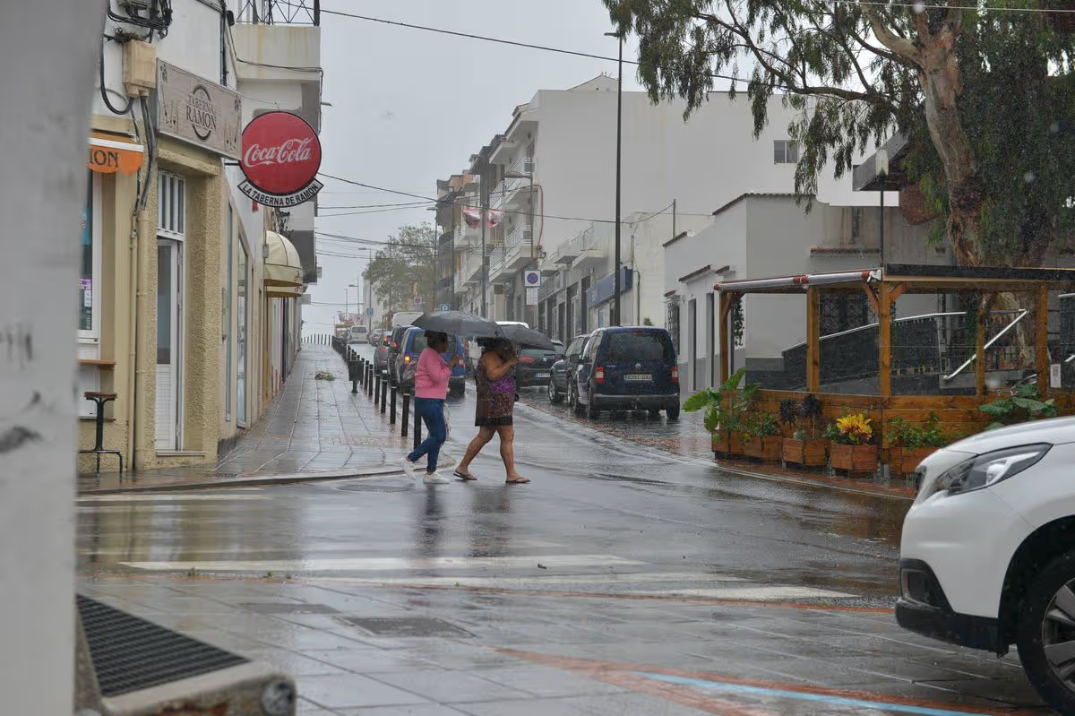
People in the Canary Islands have been warned to stay indoors, stay hydrated, and keep their windows shut to protect themselves from an incoming weather phenomenon.
15:00, 31 Mar 2026Updated 16:11, 31 Mar 2026
People in the Canaries have been warned to stay indoors (stock)
(Image: Getty Images)
Six different types of tourists have been urged to exercise extra caution as the Canary Islands brace for potentially hazardous weather. People in the Canaries have been warned to stay indoors, stay hydrated and keep their windows shut to protect themselves against incoming Saharan dust.
As of Yesterday (March 30), reports warned of a massive dust plume that was expected to be carried towards the Canary Islands by strong winds, merely days after Storm Therese brought unprecedented rainfall. The haze was due to arrive at 12 noon yesterday, with yellow weather warnings in place across the region.
In response, the Canary Islands Health Department, working via the General Directorate of Public Health of the Canary Islands Health Service, has issued advice to those who may be impacted by the dust, which is due to strike several islands over the coming days. Suspended dust is expected to negatively impact the air quality, weather forecasts indicate.
An “adverse weather phenomenon” has been linked to the event, prompting the regional government to issue a “calima” alert status (a term used to refer to these types of Saharan dust events). Health authorities have urged people to refrain from staying outside for extended periods, keep windows shut, and steer clear of heavy physical exertion outside.
Spanish news site Canarias7 explained that this is due to its potential impacts on health, with high concentrations of particles able to lead to mild symptoms such as nasal and throat irritation, itchy eyes, and coughing. However, it can also result in more serious issues, including asthma attacks and problems for those with respiratory or cardiovascular diseases, with the risk of respiratory infections also raised.
It was further noted that this advice applies particularly to the six most vulnerable groups:
Minors
Elderly people
Those with chronic respiratory or cardiac conditions, like asthma or bronchitis
Pregnant women
Outdoor workers
Smokers
Hospital visits increase during these events, “even up to five days after the episode ends”. Other recommendations include cleaning surfaces with damp cloths, taking your usual prescribed medication, avoiding humid settings, monitoring official information on the event, and calling 112 if respiratory symptoms worsen. People in the Canary Islands have also been advised to check the Air Quality Index (AQI) of the Canary Islands Government’s Air Quality Monitoring Network.
Meanwhile, there are other regional weather warnings specifically for coastal conditions, activated when strong winds, rough seas, and large swells are expected to impact shorelines and ferry operations. It means that people should take precautions when near beaches and harbours.
As for the Saharan dust, the warnings affect the top destinations of Gran Canaria, Lanzarote, and Fuerteventura, with coastal and wind advisories for Tenerife, El Hierro, La Gomera, La Palma, Lanzarote, and Gran Canaria. Much-loved by UK tourists, the Canaries welcomed 6.3 million Brits in 2024.
Island president Rosa Dávila emphasised that safeguarding the public remains a priority after emergency alerts were received by phones in northern Tenerife. Rosa said: “We are facing a changing situation, with a storm that maintains an unstable behaviour. Our priority is to anticipate and protect the public.”
It follows the impact of Storm Theresa, which hit the region hard, generating upwards of 700 litres of rain per square metre in some spots. In addition, the so-called “storm of the decade” reportedly transformed streets into rivers and affected tourist areas.
At least 28 people are killed in Afghanistan and 17 in Pakistan after heavy rainfall causes severe flooding.
Published On 30 Mar 202630 Mar 2026
Heavy rain that has caused severe flooding and landslides has killed at least 45 people in Afghanistan and Pakistan over the past five days, authorities say.
Afghanistan’s National Disaster Management Authority (ANDMA) said on Monday that 28 people have been killed in the floods and 49 injured with more than 100 homes destroyed.
Recommended Stories
list of 3 itemsend of list
Most of the deaths in Afghanistan were reported in central and eastern provinces, including Parwan, Maidan Wardak, Daikundi and Logar, according to ANDMA.
The authority added in a statement that weather conditions remained “unstable” in parts of the country and there is a continued risk of more rain and flooding in some areas.
“In total, 1,140 families have been affected,” ANDMA said.
Police spokesperson Sediqullah Seddiqi told the AFP news agency a 14-year-old boy died after being struck by lightning in the northwestern province of Badghis.
He added that in the same province, three people had drowned while trying to gather driftwood to be used for heating.
At the same time in Pakistan’s Khyber Pakhtunkhwa province, which shares a border with Afghanistan, 17 people were killed and 56 wounded, the Provincial Disaster Management Authority said.
A man clears the rubble of his house, which collapsed after heavy rains in Bannu, Khyber Pakhtunkhwa province, in Pakistan [Ehsan Khattak/Reuters]
Extreme weather
Heavy rainfall has continued to sweep across Afghanistan since Thursday, causing floods and landslides in multiple provinces.
The weather prompted the closure of several highways, according to officials in central and eastern Afghanistan. Further rains and storms are forecast for Tuesday.
Afghanistan’s National Disaster Management Authority has warned citizens to refrain from using “rivers and flooded streams, and follow the weather forecast seriously”.
In the central province of Daikundi, the local disaster management department said a five-year-old was killed when a roof collapsed. A woman was also killed in the same circumstances in the eastern province of Nangarhar, police spokesperson Sayed Tayeb Hamad said.
Afghanistan is vulnerable to extreme weather, particularly heavy rainfall and monsoon seasons, which trigger floods and landslides in remote areas with fragile infrastructure.
In January, flash floods and snowfall caused the deaths of at least 17 people and killed livestock.
Storm Therese has wreaked havoc across the Canary Islands, but a British expat is urging holidaymakers not to cancel as he claims big changes are coming at the start of April
Alice Sjoberg Social News Reporter
15:21, 25 Mar 2026
Holiday paradise Tenerife was recently hit by severe weather in Storm Therese (stock image)(Image: Getty Images)
Weather chaos has been wreaking havoc across Spain recently as Storm Therese sweeps through the Canary Islands, particularly Tenerife and La Palma – prompting numerous holidaymakers to abandon their plans after anticipating days basking in the sunshine.
The storm is currently bringing an unusual mix of torrential rain, 100 km/h (62 mph) winds, and significant snowfall at higher elevations. Authorities have issued a full-scale emergency in Tenerife, calling it one of the most serious storms to strike the archipelago in more than a decade. Despite this, it appears locals are beginning to see light at the end of the tunnel, as they’re encouraging people to maintain their holiday plans.
Taking to TikTok, one British expat named Mattie Barnett posted on the Tenerife First Excursions account, where he works, to reveal that a major shift is anticipated to arrive in Tenerife in April.
“Bollocks to the rain in Tenerife,” Mattie declared at the opening of the video, before briefly outlining that they’d been forced to endure days of rainfall in the Spanish holiday hotspot. But now, the sunshine had finally returned.
Content cannot be displayed without consent
Gesturing towards the popular Playa del Camisón beach, he remarked: “There were people queuing at eight this morning to get the sun beds after half a day of rain.”
Mattie, who hails from Lincolnshire, went on to predict that the weather will likely remain sunny with pleasant temperatures of around 24 degrees through to the weekend. While early April may bring some overcast conditions, Mattie expressed optimism that the warm summery weather would return shortly afterwards.
It appears holidaymakers are placing their trust in Mattie’s forecast, as numerous people confirmed they’re pressing ahead with their travel plans.
“Coming next Wednesday. Need to be seeing blue skies, palm trees and everything in between,” one person commented. Another user stated: “I come on the 28th hopefully still good weather.”
Spain’s meteorological agency, AEMET, is forecasting that the rainfall will cease by Friday, 27 March, when sunshine will return, with temperatures hovering around 21 degrees for the remainder of the week and throughout Easter weekend, which is typical for this period.
Meanwhile, weather maps from WXCharts suggest that portions of the UK could be battered by heavy snowfall and temperatures plummeting to -9C between April 3 and April 5 – Easter weekend.
Weather charts indicate the snow zone stretching approximately 480 miles from the Scottish Highlands across northern England and the Midlands down towards areas of southern England.
At least 12 major cities could find themselves in the trajectory of the wintry conditions, which may trigger worries about travel chaos, school closures and hazardous driving conditions.
Storm Therese is battering the Canary Islands with heavy rain, 100km/h winds and snow at high altitudes, causing flight cancellations and travel disruption, with some holidaymakers even cancelling their breaks
Samantha Bartlett Assistant Editor, Social News
11:02, 22 Mar 2026Updated 12:32, 22 Mar 2026
Many people have branded Tenerife South Airport as ‘chaos’ (stock image)(Image: DESIREE MARTIN, AFP via Getty Images)
Many people book a holiday to Spain for some much-needed sunshine, however some are now choosing to cancel their trips as Storm Therese is currently causing chaos across the Canary Islands, particularly Tenerife and La Palma.
The storm is currently delivering an unusual combination of heavy rain, 100 km/h (62 mph) winds, and substantial snow at high altitudes. Authorities have declared a full-scale emergency in Tenerife, describing it as one of the most severe storms to hit the archipelago in over a decade. Spain’s meteorological agency, AEMET, has issued several alerts that will stay active throughout the weekend. Orange (high risk) warnings have been dispatched for northern Tenerife and parts of La Palma due to wind gusts reaching 90–100 km/h and heavy rainfall.
Meanwhile, yellow warnings are in effect across all seven islands for rain, thunderstorms, and choppy seas with waves reaching up to 6 metres (20 feet).
Content cannot be displayed without consent
Unusually for this time of year, significant snowfall has also covered Mount Teide and surrounding peaks above 1,800–2,000 metres.
One Tenerife resident, known as @theknightstrider1 on TikTok, took to his account on Saturday (March 21) to discuss the ‘wild’ weather in the area.
The car hire and bar owner filmed himself as he said: “The Tenerife weather is just wild at the moment. It’s on for another at least four days this crazy weather. He explained the Santa Cruz de Tenerife area had just experienced a “torrential downpour”, but then he turned the other way to reveal “blue skies with the sun shining”. However, he noted, within the next minute, the rain is “bouncing down” again.
The Tenerife resident also mentioned the drains “just can’t handle” the rainfall and they end up “bursting up” fairly regularly.
He continued: “The good news is, it is mixed. I suppose that’s kind of good news, you can get a bit of sunshine, but it was absolutely hammering it down a minute ago.
“So there you go, another four days or so of this. If you’re here, expect a mixed bag – heavy rain, a bit of sunshine now… towards Las Americas looks alright. But you’re going to want to do your indoor activities.”
He stated when the sun is out, it’s “about 22 degrees”, but it’s “around 18 degrees” in the shade, the rain and the wind.
Numerous followers amongst his 115,000-strong audience who were heading on Tenerife holidays confessed they were concerned about their break.
One person commented: “When will it be finished? We come Friday.”
Content cannot be displayed without consent
Whilst another added: “Praying it passes by Tuesday.”
A third chimed in: “I’m coming Monday, really hope it picks up!”
Nevertheless, others admitted they were calling off their breaks as the Tenerife resident posted another clip of the rainfall, with one person writing: “We cancelled our week away at the last minute.”
Another replied: “Snap – we’ve rebooked for April 12 onwards.” The storm has resulted in widespread cancellations and safety shutdowns across the islands. Over 40 flights were cancelled or diverted by Friday, 20 March, mainly at Tenerife North and South airports. Travellers are urged to verify their flight status via Flightradar24 or their airline.
Numerous individuals on TikTok and Facebook have branded Tenerife South Airport as ‘chaos’, claiming that the luggage queue is taking hours and some people are missing their flights.
Others have also alleged that the E-gates aren’t functioning and hundreds of people have been queuing “to see one passport officer who was having to re-scan face/finger prints”.
Sharing another video from Tenerife South Airport, @theknightstrider1 described it as “rammed” in the caption and said arrivals was particularly crowded so holidaymakers should “be prepared”.
He added in the clip: “If you’re wondering if Tenerife is busy, it certainly is. This is the arrivals area and it’s absolutely rammed. People are still pouring in.
“If you come to the airport, I do recommend you get here nice and early if you’re leaving, there’s bound to be queues when you’ve got this many people around.”
Aena said in a comment: “In Spain border control is the responsibility of the National Police, not the airport. The airport has provided the necessary infrastructure for the implementation of the Entry Exit System but its availability depends primarily on the number and performance of police officers at the border post.”
When will Storm Therese be over?
Storm Therese is expected to subside across most of its affected areas by Monday, 23 March 2026. While the worst of the weather occurred between Thursday and Saturday, some impacts and weather warnings will persist through early next week.
Storm effects are currently continuing today (Sunday March 22) with rain and strong winds. Orange wind warnings (up to 100 km/h) remain in place for Tenerife, La Gomera, El Hierro, and western La Palma.
Weather is forecast to “ease off” on Monday (March 23) with wind speeds dropping and rainfall decreasing significantly. However, yellow and orange warnings remain active for several islands, and some schools in El Hierro, La Gomera, and parts of Tenerife will stay closed as a precaution. Conditions are expected to improve throughout the week.
Storm Therese is battering the Canary Islands with heavy rain, 100km/h winds and significant snowfall, with over 40 flights cancelled and schools closed across the islands
Samantha Bartlett Assistant Editor, Social News
10:41, 21 Mar 2026
Storm Therese is currently battering the Canary Islands (stock image)(Image: Europa Press News, Europa Press via Getty Images)
Storm Therese is currently wreaking havoc on the Canary Islands, particularly Tenerife and La Palma, with an unusual mix of heavy rain, 100 km/h (62 mph) winds, and significant snowfall at high altitudes. Authorities have declared a full-scale emergency in Tenerife, labelling it as one of the most severe storms to batter the archipelago in over a decade.
Spain‘s meteorological agency, AEMET, has issued several alerts that will remain active throughout the weekend. Orange (high risk) warnings have been dispatched for northern Tenerife and parts of La Palma due to wind gusts reaching 90–100 km/h and heavy rainfall. Concurrently, yellow warnings are in place across all seven islands for rain, thunderstorms, and choppy seas with waves reaching up to 6 metres (20 feet).
Unusually for this time of year, significant snowfall has also blanketed Mount Teide and surrounding peaks above 1,800–2,000 metres.
Content cannot be displayed without consent
The storm has led to widespread cancellations and safety closures across the islands. Over 40 flights were cancelled or rerouted by Friday, March 20, primarily at Tenerife North and South airports. Travellers are advised to check their flight status via Flightradar24 or their airline.
Schools and universities in Tenerife, Gran Canaria, and several other islands were shut on Thursday and Friday, whilst key roads, including access to Teide National Park and the TF-445 to Punta de Teno, are closed due to ice and snow.
Major international events such as the Tenerife Bluetrail 2026 race have been cancelled or postponed.
Providing an update on the weather situation on Friday (March 20), one Tenerife resident known as @theknightstrider1 on TikTok took to the platform to share details with his 115,000 followers.
The car hire and bar owner, who is based in Playa de las Américas, was heard saying: “A little weather update for you then, it’s raining… it’s pretty grim and it’s gone really overcast as well.
“The rain showers are on and off, we haven’t really had any rain until now. It was okay this morning, but yeah it is raining. The current temperature’s around 18 degrees, not too cold but the umbrella’s are out, people are sheltering and it’s really not that nice.”
Content cannot be displayed without consent
He added: “Bear in mind, you might get caught in the rain, have a brolly with you. Maybe some of the rain macs as well if you’ve got any, if not buy some because it’s on and off.”
One person wrote: “Weather’s been awful the last three days, can’t wait to go home.”
Whilst another added: “Arrive tomorrow, packed a brolly.”
A third chimed in: “This makes me so happy as someone who was going to go this week and changed to last week! Phew.”
Whilst a fourth asked: “Why is it every time it’s sunny in the UK it rains in Tenerife?”
Another resident of the Canary Islands also posted a weather update on TikTok from Santa Cruz de Tenerife, captioning the clip, ‘Rain, wind and choppy ocean. Flights cancelled and diverted. Flooding in El Médano and roads closed. The storms Theresa and Samuel are hitting Canary Islands.’
He then said in the video: “Here if your weather update from Tenerife South on Friday March 20th, 2026. The two storms – Theresa and Samuel – are hitting the Canary Islands with force.
“As you can see here, we have quite a lot of waves here in the Troya area of Las Americas. The storms have caused quite a few incidents on the island, we have had 11 flights cancelled yesterday, 10 flights have been cancelled during the day today.
“We have had quite a few flights deviated to other airports as well and we have had ferries that have been cancelled because of the conditions out on the see.”
He explained the temperature was currently hovering around 19 degrees and there had been some rain which was “coming and going” along with overcast skies.
Are flights from the UK to Tenerife being cancelled?
Yes, flights from the UK to Tenerife are currently experiencing cancellations and significant disruptions due to severe weather from Storm Therese.
As of Saturday, 21 March 2026, authorities in Tenerife have declared an island-wide emergency due to extreme conditions including heavy rain, strong winds, and rare snowfall over high ground.
Over 36 flights were cancelled earlier this week, with further disruptions reported today. While many cancellations involve inter-island services, several international flights have been diverted or cancelled due to poor visibility and high winds.
Currently, the most affected airport is Tenerife North (TFN), which has seen the greatest impact, though Tenerife South (TFS) – where most UK flights land –is also experiencing delays and some rerouted services.
Conditions are expected to remain hazardous through Saturday, with a gradual improvement predicted for Sunday, 22 March.
Major airlines serving the UK to Tenerife route, such as Ryanair, easyJet, Jet2, and TUI, are urging passengers to check their flight status before heading to the airport
If your flight is cancelled, contact your airline immediately to discuss rebooking or refund options.
Travelling with kids can be stressful, but a new data analysis has revealed some of Europe’s most child-friendly city breaks which offer accessibility and plenty to keep kids entertained
The city is a family-friendly choice(Image: Getty Images)
With the Easter break, May half-term, and bank holidays coming up, many parents will be looking for ways to keep the kids entertained. While you might not have considered taking younger kids on a city break, it can be a fun option if you’re looking for a short break.
That’s why LateRooms has put together the Family Breaks Index– a data analysis that pulls together information that’s of interest to people travelling with young children, such as flight and transfer times, walkability, accessibility for those bringing pushchairs, and the child-friendly attractions on offer.
Coming in at number three is a Spanish city that has long been popular with Brits for city breaks, and its short flight time and easy walkability have seen it score highly for family trips too.
Barcelona flights are just over two hours from the UK, and on arrival, visitors can hop on the airport train to the centre, which takes just 25 minutes. This makes it ideal for people travelling with young children who wouldn’t be able to do a long journey.
The city has a flat, walkable centre, with many major tourist attractions just a short walk apart. This means it’s easy to navigate with a buggy, and little legs won’t get worn out from a day of sightseeing.
According to LateRooms, the city has about 400 family-friendly attractions, so you won’t have to deal with kids complaining they are bored. To start, there are classic tourist attractions such as the Sagrada Família and Gaudí’s unique and colourful Park Güell, both of which are impressive enough to keep kids enthralled.
Kids love science museums, and Cosmocaixa is an unforgettable day out. One of Barcelona’s largest museums, the entire experience is interactive, full of engaging activities that teach kids about the creation of the cosmos. The museum takes visitors on a journey through the natural world, from the past to the present.
Tibidabo Amusement Park is a great place to see views of the city and enjoy charmingly old-fashioned fairground rides. It’s set on a hill that overlooks Barcelona, and as you ride the Ferris wheel or drop rides, you can enjoy seeing the city below.
A dream day out for kids could well be the Museu de la Xocolata, the chocolate museum, where you can see huge sculptures made from chocolate, including kids’ TV and film characters. It also runs chocolate tasting and making workshops, and once you’ve explored, you can indulge your sweet tooth at the café with a rich and creamy hot chocolate.
One advantage of Barcelona over other city breaks is that it also has a beach nearby, so you can explore the city in the morning and let the kids swim or build sandcastles in the afternoon. The seaside neighbourhood of La Barceloneta is popular with families thanks to its access to a long sandy beach, and it has its own metro station, making it easy to get around the city.
In May, flights to Barcelona start from just £27 one way based on flights from London-Luton with Wizz Air. The weather in May often hits highs of 23C with little rain, making it an ideal time of year to explore.
A ‘stylish Spanish’ city that is packed with ‘character’, has been recommended by a TUI travel expert for a serene escape with sprawling beaches and seawater pools
A TUI travel expert has hailed a Tenerife city as a must-visit (Image: Getty Images)
It’s not easy finding the right destination for that sun-soaked getaway, but a travel expert highly recommends a vibrant city in Tenerife, where you can grab a bottle of wine for around £5 and bask in the balmy 24C in April.
TUI travel advisor, Natasha Mooney, has booked holidays to Tenerife for more than a decade and lives there part-time with her husband, Javier, who hails from the Spanish island.
“I’ve been a TUI travel advisor for 10 years, now working as a homeworking retail expert. Javi and I split our time between the UK and Güímar in northern Tenerife, so I can genuinely call it my speciality,” Natasha said.
As a Tenerife expert, Natasha certainly knows a thing or two about where to go, particularly for those looking to ditch the crowds and opt for a quieter escape. One destination that Natasha can’t recommend more is the coastal city of Puerto de la Cruz, with its incredible seawater pools, black-sand beaches, a charming harbour and historic old town.
“This is Tenerife at its most authentic,” the expert explains. “Puerto de la Cruz, on the north coast, is the place I recommend for travellers who want a stylish but genuinely Spanish experience. There’s a relaxed elegance to it. A pretty harbour, historic streets, colonial-style restaurants serving modern Canarian cuisine, and cocktail bars with live music.”
The city offers that desirable beach escape, alongside a town bursting with character, eateries, and cafés, against its colourful architecture and vibrant Spanish atmosphere. Adding to its allure is the promise of blistering rays of up to 24C in April.
One of the city’s most striking features is the iconic saltwater pool complex, Lago Martiánez, designed by Canarian architect César Manrique. The outdoor interconnected pools, with four for adults and three for children, are filled with Atlantic water, framed by volcanic rock and palm trees.
It’s been beautifully designed to incorporate natural elements against the backdrop of the rugged terrain of the striking volcano, Mount Teid, alongside views of the sea, for a spectacular day spent in the basking heat. There are plenty of terraces and sun loungers with umbrellas dotted around the leisure complex for extra comfort, along with kiosks and restaurants for a bite to eat.
Of course, there are plenty of beaches to uncover in the area, with Playa Jardín, Playa Martianez and Playa del Castillo, all with their striking black sand and blue waters for an inviting dip. The city itself is packed with character from its Puerto Street Art Project, where vibrant artwork lines the street, to the art installation of the Agatha Christie Steps, with printed titles of her most famous books.
There are botanical gardens, including Sitio Litre Garden, to wander around during a leisurely afternoon, along with colourful streets lined with bars offering drinks al fresco. Natasha noted that visitors could even bag themselves a bottle of wine for a mere £5, and advised holidaymakers to look out for Listán Blanco or Malvasía whites and Listán Negro reds.
“You’ll often find good bottles in local restaurants and shops from around €6–€10 (£5.19 to £8.60). It’s a brilliant way to taste the island for very little money,” she explained.
The food scene is another highlight across Tenerife, as Natasha said: “Tenerife has Michelin-starred restaurants, but most visitors fall in love with the guachinches. They’re family-run eateries serving traditional Canarian food with their own local wine. They’re always authentic and very affordable too.”
If you’re tempted by a trip to Puerto de la Cruz, you can grab a flight from London Stansted to Tenerife from as little as £18 one-way. There are also affordable flights from Birmingham, Bristol, Glasgow and various UK airports, making it even easier to jet off to this charming coastal city.
TUI also offers a seven-night package at Hotel Rui Garoe from £634 per person, based on two adults sharing on a half-board basis. It includes travel from Birmingham Airport on Tuesday, 28 April with TUI Airways, along with overseas transfers, 10kg of cabin luggage, and a 20kg checked-in bag.
Do you have a travel story to share? Email webtravel@reachplc.com
This time of year – close to the spring equinox – day length increases and the Sun moves higher in the sky. You might notice the Sun feeling stronger. With largely clear skies forecast, UV levels will rise to medium across England, Wales and eastern Scotland on Wednesday. Cloudier conditions will keep UV levels low elsewhere.
It is easy to get caught out in the spring months because, although temperatures aren’t as high as later in the summer, ultraviolet (UV) levels in late March are actually just as strong as they are in September.
Whilst exposure to small amounts of UV radiation is essential to produce vitamin D, the World Health Organization warns “overexposure may result in acute and chronic health effects on the skin, eye and immune system”.
Advice from the NHS, external is to “strike a balance between protecting yourself from the Sun and getting enough vitamin D from sunlight”. This includes spending time in the shade between 11am and 3pm, and covering up with suitable clothing and sunglasses.
Keep an eye on the UV forecast on the BBC Weather app or website.
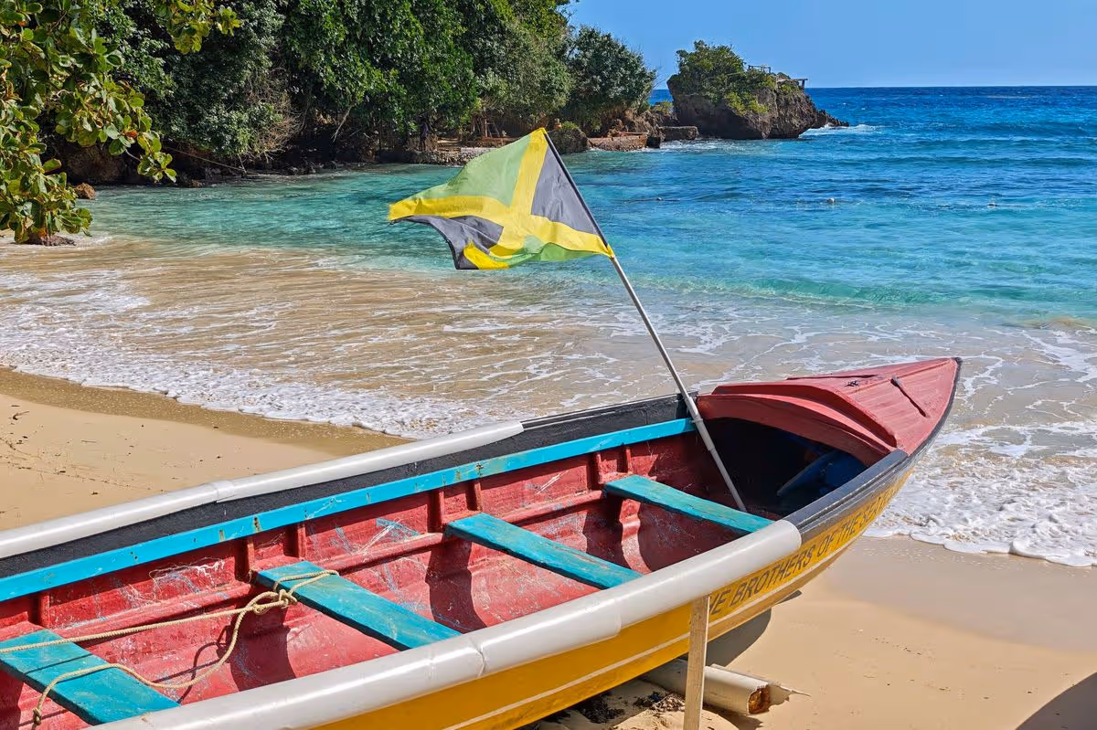
Jamaica has seen a spike in demand from UK holidaymakers seeking sunshine destinations, with TUI offering direct flights from the UK and temperatures reaching 30C in April
11:44, 17 Mar 2026Updated 11:44, 17 Mar 2026
Jamaica has seen a surge in popularity with Brits(Image: Getty)
Brits are trading Dubai for a sun-drenched island offering direct flights and balmy 30C temperatures in April. This shift comes as holidaymakers begin to seek out traveldestinations that bypass the Middle East.
Travellers bound for the region have faced disruption due to ongoing instability and conflict in Iran. British Airways has already confirmed that flights to Dubai, Bahrain, Tel Aviv and Amman in Jordan have been suspended until at least 31 May. This has triggered a surge in bookings for locations such as Portugal, Spain, France and certain US states.
However, one Caribbean island has seen a notable increase in interest. Alongside destinations like the Dominican Republic, Phuket in Thailand and Goa in India, Jamaicahas experienced a boom in demand, according to Neil Swanson, managing director of TUI UK and Ireland, who spoke to the BBC.
The airline provides direct flights from Manchester to this sunny isle. However, passengers should brace themselves for a journey expected to exceed 10 hours, reports the Express.
Once they’ve landed on this petite island, home to approximately 2.8 million inhabitants, Brits can bask in the sunshine and immerse themselves in the local culture. The average daytime temperature in Jamaica for April fluctuates between 25 to 30C, dipping to around 22 to 24C at night.
Travel expert Mark Wolters reckons visitors to Jamaica rarely need to pack a jacket. In a YouTube video on his Wolter’s World channel, he explained: “You’re going to be fine with shorts and a t-shirt all-year round, that’s not going to be a problem.
“The busy season here starts January, December and it goes through March. The time when you don’t want to come here is July/August because it is insanely hot.”
According to Visit Jamaica, tourists “feel the vibe” the moment they arrive on the island, becoming absorbed in the music, nightlife, and cuisine. It states: “Tasting your way through the island is a great way to connect with the history of Jamaica as you learn more about what makes our food so special with each dish you try.
“Savour every delicious bite and come back to ‘Mmmmm!’ Jamaicans celebrate life with food, so you know it is made with love.”
Jamaica features an impressive selection of stunning beaches that extend for miles. Negril’s Seven Mile Beach is celebrated for its spectacular sunsets and lively atmosphere whilst Montego Bay Marine Park is favoured by holidaymakers keen to discover the underwater realm showcasing vibrant wildlife.
The Blue Mountains rise majestically above Jamaica and consistently draw outdoor enthusiasts. Those visiting the mountains can even taste the world-famous Jamaican Blue Mountain Coffee.
The island also boasts captivating waterfalls and verdant rainforests. In April, it plays host to a unique carnival that parades through the streets of Kingston.
The carnival season is accompanied by a week of breakfast parties, soca cruises, Jamaican music and extravagant costumes. Besides being reachable by plane, Jamaica is a favoured destination for cruise holidays.
March 16 (UPI) — Even before a round of mid-May blizzards started blanketing an area stretching from South Dakota to northern Michigan on Saturday, a partial government shutdown already was making air travel miserable for Americans.
Extreme winter weather snarled all manner of transportation across the Midwest, while airports in Atlanta, Charlotte and elsewhere on the East Coast were slowed by pounding rain, on top of an increasing number of TSA employees either calling out sick or quitting their jobs because they are not getting paid.
As of early evening on Monday, there were 21,549 total flights delayed in the United States and 5,159 flights that were canceled, Flight Aware reported.
The Department of Homeland Security, which is home to the Transportation Security Administration, has not been funded since Jan. 30 amid a debate in Congress over funding the Department of Homeland Security, of which TSA is a part.
Democrats and Republicans in Congress disagree on adding guardrails for DHS agencies involved with immigration amid a crackdown by the Trump administration, which has left TSA unfunded.
The nation’s air traffic controllers, customs agents and TSA agents missed their first paycheck over the weekend, which has led to hundreds of TSA employees quitting their jobs, the New York Post reported.
The partial shutdown already had affected security and other services at airports, leading to long lines and advice that travellers arrive at the airport even earlier because of how backed up they have been.
On Sunday afternoon, as airports, travellers and millions at home prepared for winter weather to roll through overnight, the trade association Airlines for America, which represents both passenger and cargo airlines, sent an open letter to Congress pleading for them to fund TSA on predictions of what is already happening.
The CEOs, which include the leaders of the biggest U.S. passenger airlines, as well as FedEx and UPS, said that without funding TSA they expect travel issues during spring break, the World Cup and other national travel dates to be as chaotic as they were last year during the longest government shutdown in history.
Making matters worse has been a wide range of extreme weather across the country, from steady showers and a tornado watch shutting down Charlotte Douglas International Airport several times this morning — with the same occurring at major airports in Atlanta, Newark, Washington, D.C., Chicago, Detroit and Minneapolis, the Charlotte Observer reported.
The weather is not expected to let up, either, with the National Weather Service predicting that while the Midwest will get a bit of a break, severe thunderstorms with damaging winds and some tornadoes — as of early afternoon more than 34 million people were under tornado watches between Florida and New Jersey — expected later into the evening.
Melody Ashby jumps into a snow pile as her sister and mother look on, Sunday in Wadsworth Ohio. Photo by Aaron Josefczyk/UPI | License Photo
Have fun with the family or unwind your mind with TUI deals for March and April
This article contains affiliate links, we will receive a commission on any sales we generate from it. Learn more
Feel the sand beneath your toes with a last-minute holiday(Image: TUI)
Getting away for a beach break in March or April is a great way to enjoy sunny skies and mild temperatures before the summer crowds arrive, as well as ditch the British rain. It’s the perfect time to relax on golden sands, explore charming coastal towns and soak up the early-season Mediterranean vibes.
As one of the UK’s best-known holiday companies, TUI uses Gatwick to offer direct flights to some of Europe’s best resorts, making it ideal for a spring break. Right now, TUI is offering couples the chance to save up to £250 on selected holidays, departing from Gatwick Airport in March and April.
This offer applies to 7-, 10-, 11- and 14-night stays in 2026, making it the perfect time for an early-season getaway. Even before the first flourish of summer, beach breaks in Lanzarote, Turkey and Portugal offer the perfect mix of sun, sand, and family-friendly fun.
READ MORE:
From stunning coastal locations with pools and entertainment to panoramic Portuguese views and spa treatments, we’ve picked just three of our favourites from TUI that can be booked today.
TUI BLUE Flamingo Beach, Lanzarote
Perched on the sun-drenched coastline of Playa Blanca, Lanzarote, TUI BLUE Flamingo Beach sits just steps from soft sands and calm, turquoise waters, ideal for safe swimming. Designed to look like a charming whitewashed Canarian village, a scenic seafront promenade connects the resort to Rubicon Marina and the town centre with stunning Atlantic views.
The resort is perfect for families, offering multiple pools, a splash park and professional childcare and teen hangouts. Dining is varied, from international buffets to local specialities, while fitness classes and evening entertainment ensure a lively mix of relaxation and fun under the Lanzarote sun.
For the best value break at Flamingo Beach, sunseekers looking to getaway after Easter can enjoy a 7-night break for £642.42* per person. Departing on April 13, this price is based on two people sharing on an all-inclusive basis and includes a whopping £1082.16* discount. Alternatively, a 14-night stay departing on April 14 is also available for the higher price of £1619*.
One visitor left a five-star review on TripAdvisor that said: “This hotel is excellent for families with children 0-10. The location is perfect, right next to Flamingo Beach. The children enjoyed the main pool, where activities took place, and the quiet pool, which was heated. The apartments were clean and spacious with a bedroom and lounge/kitchen”
Another added: “Great Location. Our room was very quiet. Our rate included an excellent breakfast so good value for money.”
A different guest, however, agreed that the location is “brilliant”, but they also felt “let down by amenities not being open. Pool snack bar, pool bar in another area closed. And only one evening bar with no other areas to sit.”
A returning guest highly recommends the Flamingo Beach resort, saying: “Best Place. The location is fantastic, near lovely beach, rooms are fine and clean and the staff are so friendly, the area is very clean and not too much noise. We been coming here nearly every year, the last 25 years. This is where we feel like home.”
Lanzarote is always popular with holidaymakers and there are plenty of deals to choose from. One the Beach is offering a 7-night stay at the five-star Iberostar Selection Lanzarote Park with prices from £1605*, a saving of £425. An upscale all-inclusive resort, guests love the location just a little further along the bay.
For sunseekers on a budget, a last-minute break at the Blue Sea Costa Bastian in Costa Teguise is available for £519* per person through Love Holidays. With flights from Gatwick, accommodation and breakfast included, the hotel is surrounded by beautiful Canary gardens and offers magnificent views over the Atlantic Ocean.
Blue Bay Platinum, Marmaris, Turkey
Blue Bay Platinum in Marmaris blends modern style with central convenience, just 70 meters from the beach with its own private sandy stretch and clear waters. The lively local area, including shops, bars, the marina and old town, is all within easy walking distance.
The resort offers four outdoor pools, including waterslides and a dedicated adult “chill pool,” plus a full-service spa for ultimate indulgence. Guests can enjoy international and local dining, sunset cocktails and stylish ocean-themed rooms with live music and shows, creating the perfect vibrant Mediterranean getaway.
Offering excellent value for money, a seven-night stay at this contemporary hotel in a central location could cost as little as £418* per person. Departing on Wednesday, April 18, the deal includes flights and accommodation on an all-inclusive basis.
With hundreds of five-star reviews on TripAdvisor, one visitor called it a “Stunning, luxury stay”, adding: “Blue Bay Platinum Hotel in Marmaris was absolutely exceptional from start to finish. The hotel itself is beautiful – modern, stylish, and perfectly maintained with a luxurious atmosphere throughout. Room was very comfortable and always clean. Will definitely stay here again.”
Another added: “Booked again for April this year. This will be our 10th visit to Marmaris. We have stayed at the supposedly other top hotels nearby. None of them beat the Blue Bay for overall experience.”
While one visitor did note that they felt uncomfortable at the resort due to the “expectation that tips should be given,” another loved it, saying: “It’s a very nice place to stay. I like this hotel and especially the relaxing swimming pool. There is a great bar.”
Turkey appeals to Brits with its mix of sunny beaches, rich history, delicious cuisine and excellent value for money. Another favourite Marmaris resort for upscale holidaymakers is the five-star Green Nature Diamond Hotel that sits within easy striking distance of the beach.
With a wide range of facilities and comfortable accommodation, this luxurious hotel can be booked through Love Holidays for a seven-night stay in April from £429* per person. Elsewhere, the nearby Prime Beach Hotel has pools with waterslides and a private stretch of beach with prices starting from £490* per person on April 2.
Longevity Health & Wellness Hotel, Portugal
Perched on a hillside with panoramic views over Alvor Bay and the Atlantic, the Longevity Health & Wellness Hotel is a state-of-the-art retreat in the charming village of Alvor. Guests are perfectly placed to enjoy golden beaches, scenic boardwalks and nearby world-class golf courses, all while staying in a serene, high-tech sanctuary.
The hotel is a pioneer in wellness, featuring a rooftop infinity pool and a world-class spa and wellness centre. With sunrise yoga, detox treatments, and healthy Mediterranean cuisine at the rooftop Pure Cafe, every detail is designed for ultimate relaxation and rejuvenation.
While the thought of complete rest and relaxation may be priceless, a stay at the Longevity Resort is worth every penny. For a 10-night stay, departing on March 23, prices start from £891.12* per person, on a bed and breakfast basis. Shorter stays are also available with a seven-night break costing £663* departing on the same day.
Guests who have already found their zen with a stay at the Longevity Health & Wellness Hotel have shared their experiences online. One said: “Absolutely superb place for relaxing stay, very modern, clean, quiet location with 5 mins drive to local beaches and town of Alvor… Fantastic breakfast with great choice. Access to spa facilities included. Would definitely recommend.”
Another added: “A lovely, relaxing stay in a beautiful hotel. We came back feeling revitalised. The cleanliness and the staff at the hotel were everything.”
While one less impressed visitor said: “The restaurant is very expensive for portions,” another was far more impressed exclaiming: “This hotel is truly exceptional, I cannot say enough about this wonderful place only that we cannot wait to return.”
Alternatively, the Falesia Hotel is a sophisticated adults-only retreat in Albufeira, offering elegant rooms, a full-service spa, and both indoor and outdoor pools. Perfectly positioned for relaxation, it sits just a short walk from pristine beaches and the Pine Cliffs Golf Course, and prices for a seven-night stay start from £439 with Love Holidays.
For those who want a family holiday, Portugal is a perfect location for this too. Offering waterslides, a kids club, a water park and plenty of entertainment, theJupiter Albufeira Hotel has something for everyone. Located in the popular resort of Albufeira, prices start from £630* per person, departing on April 21.
Find out more about deals on spring holidays with TUI as well as the full T&Cs here.
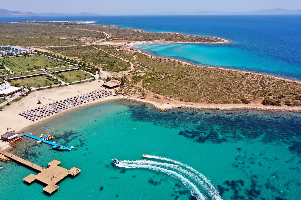
Many European destinations and warming up, and spring is definitely on the way. But which short-haul spot is most likely to give you sunshine and dry days over Easter? Here’s the destination with the best odds.
This article contains affiliate links, we will receive a commission on any sales we generate from it. Learn more
This is the destination to book for the best possible chance of Easter sunshine(Image: Ferdi Uzun/Anadolu via Getty Images)
It feels like winter has dragged on forever this year, and many parts of the country are only just emerging from months of endless rain and grey skies to see a little bit of sunshine. With Easter on the way, which can be an unpredictable time for UK weather, many people will be looking to get away to the sunniest spot they can find for a few days.
Luckily, TUI has put together a list of the Easter getaways that are most likely to give you the ideal weather conditions, analysing historic data on the average rainfall, wind speed, and temperature in early-April to work out a Good Weather Score. Brits will be pleased to hear that topping the rankings is a destination just over four hours away from the UK that’s expected to see highs of 19C over the next couple of weeks.
According to TUI’s rankings, Turkey historically has the “most ideal weather conditions” during the Easter holidays, usually offering holidaymakers average temperatures of 18C. It’s also the destination where you’re least likely to be caught in an April shower. In the Easter holiday months, the amount of rainfall is just 0.01mm on average.
When the data was broken down into individual destinations, Marmaris in Turkey was the place most likely to give holidaymakers the best Easter weather conditions. It often reaches highs of 19C around Easter, and is usually dry with only light winds. Marmaris is in southwest Turkey in an area dubbed the Turkish Riviera. This lively port town has a marina, bustling grand bazaar, and historic sites such as the 16th-century Marmaris Castle.
Marmaris also has an amazing selection of sandy beaches that sit alongside its turquoise seas. Marmaris Long Beach (Uzunyali), is around six miles long, starting at the city centre, and has a lively promenade full of hotels, restaurants, and bars. A quieter alternative can be found at İçmeler Beach, just south of the city, where you’ll find sandy coves and incredible mountain views.
Second on the list for good weather was Greece, and this time of year brings mean temperatures of around 16C and long sunny days. Meanwhile, Bulgaria ranked third for its “pleasant and balanced climate”. Like Turkey it offers light winds and low rainfall, and Easter can be a good time to explore as tourist don’t have to contend with the intense summer heat. Bulgaria is becoming a major hiking destination, especially around the Rila and Pirin mountain ranges which combine gentle trails with more intense, steep climbs.
Bulgaria is also known for its stunning beaches. The Black Sea coast has 200 beaches to choose from and resorts to suit all sorts of holidaymakers. Sunny Beach is known for its lively nightlife and cheap drink deals, while Varna is a historic and cultural hub that has soft golden sand beaches and clear blue seas.
Anyone planning an Easter break can also check TUI’s holiday weather guide, which gives a breakdown of weather by month for popular tourist spots.
Europe’s top 10 destinations for good Easter weather
Turkey
Greece
Bulgaria
Spain
Croatia
Italy
Hungary
Portugal
Montenegro
Gibraltar
Have a story you want to share? Email us at webtravel@reachplc.com
British tourists who’ve jetted off to Tenerife to make the most of the island’s reputation as the “island of eternal spring” have been experiencing a “disappointing” holiday because of one issue
Jess Flaherty Senior News Reporter
15:58, 13 Mar 2026Updated 15:58, 13 Mar 2026
Brits holidaying in Tenerife have been left disappointed by one unexpected issue (stock image)(Image: Marco Bottigelli via Getty Images)
For those looking to escape the drizzle and freezing conditions of dreary Britain weather in favour of sand, sun, and some well-deserved rest, Tenerife is usually a safe bet. However, many visitors heading to the Spanish island – the largest of the popular Canary Islands and a firm favourite among Brits – this month have been left “disappointed”.
Tenerife is famed for its many beaches, holiday resorts, bars, restaurants, and stunning landscapes made up of volcanic mountains, vast national parks, and much more. It’s a perfect location for hiking, relaxing and observing the stars.
It’s appealing thanks to its reputation as the “island of eternal spring“, which comes from its temperate and stable climate all year round, where temperatures typically hover between 20 and 28 degrees.
Yet many Brits who’d been anticipating some sunshine and warmth are instead dealing with an unexpected chill. On the popular TikTok account Tenerife First Excursions, one man shared a first-hand account.
Speaking directly to the camera, he said: “If you’re wanting to know what the weather is like at the moment in Tenerife then I’m gonna disappoint you.”
Content cannot be displayed without consent
He turned the camera to reveal thick grey clouds above, although there were patches of blue sky and bright sunshine breaking through in certain areas. He went on: “It has been like this for the last four or five days now, with a little bit of sunshine for an hour or so in between.”
He continued: “It’s been a disappointing week but then again, a lot of people are here for Cheltenham [Festival] so everyone’s in the bars, day drinking, having a good time. The sunshine is back on the weekend, though. I said to someone the other day, they absolutely love it. I said, ‘I absolutely love it when the sun’s back and I’d leave it with that.'”
In the comments section, fellow social media users were keen to share their views. One said: “Can’t believe how lucky I was. I was there for two weeks in Feb and it was scorching every day. Brilliant sunshine every day.”
Another wrote: “We come Sunday praying it gets warmer.” A third said: “I’m here on Tuesday! Hoping it improves!”
A fourth posted: “Here now and I did not bring enough warm clothes.” Someone else said: “It was c*** when I was there a couple of weeks ago. Roll on June.”
Another commented: “Dontttt I was there in Jan and it was perfect so I booked to come back again next week. I hope it gets better.”
One TikTok user revealed: “Mum and dad arrived yesterday and they are cold!! Been sat in hoodies in [the] apartment.”
Another said: “Been like that for 10 days now.” Someone else shared: “We left on Tuesday been there a week was absolutely gutted, no hot days till we were leaving, just my luck.”
However, one person added: “Absolutely love [Tenerife] whatever the weather.”
This article contains affiliate links, we will receive a commission on any sales we generate from it. Learn more
This is the best beach for spring(Image: Patricia Hamilton via Getty Images)
As temperatures begin to climb, thoughts naturally turn towards seaside escapes. There’s nothing quite like the sound of crashing waves and the sensation of sand between your toes – but with countless stunning locations dotted around the UK, how do you decide where to visit?
For an ideal spring beach getaway, you’ll want maximum sunshine, pleasant temperatures and minimal rainfall – and that’s precisely where the specialists at Go Outdoors come in. They’ve put together a ranking of Britain’s finest beaches based on average spring temperatures, precipitation levels, hours of sunshine and Googlereviews to identify the absolute cream of the crop.
Every beach featured received a rating out of 10 according to its weather conditions, rainfall and visitor feedback.
Taking the top spot is Cuckmere Haven with an impressive score of 9.60. This breathtaking beach sits in East Sussex and boasts a remarkable 7.8 hours of daily spring sunshine alongside just 52mm of monthly rainfall.
Those visiting the beach can first take in spectacular views of the Seven Sisters — England’s famous white cliffs overlooking the channel — before embarking on a picturesque stroll along the Cuckmere River as it winds its way towards the coast. Hear the cries of seagulls circling above, and feel the fresh sea breeze against your skin, reports the Express.
Claiming second position is Southwold Beach with a rating of 8.68 out of 10. This expanse of sand extends from the River Blyth’s mouth, passing Southwold Pier which offers plenty to discover.
There are arcade games and numerous cafés and restaurants where you can pop in for refreshments or a bite to eat. Securing the third spot, and boasting the highest Google review rating amongst all the beaches, is Druridge Bay Beach.
Google reviews rate this beach at a stellar 4.9 out of five, and the Go Outdoors research awarded it an impressive overall score of 8.53 out of 10.
The beach itself extends for seven miles, and the adjacent woodlands are teeming with wildlife such as roe deer and red squirrels.
‘Supercell’ thunderstorms hit Illinois and Indiana, after eight people killed by tornadoes in US Midwest last week.
Published On 11 Mar 202611 Mar 2026
Share
Two people have been killed in tornadoes in the Midwest region of the United States amid a spate of extreme weather, according to authorities.
At least four tornadoes touched down as intense “supercell” thunderstorms swept across northern Illinois and northwestern Indiana on Wednesday, according to the National Weather Service (NWS).
Recommended Stories
list of 3 itemsend of list
“Supercells” are the rarest form of thunderstorms. They are known to be particularly devastating for their prolonged durations and their “high propensity to produce severe weather, including damaging winds, very large hail, and sometimes weak to violent tornadoes”, according to the NWS.
In Indiana, local officials said an elderly couple had been killed when a tornado hit their home in the town of Lake Village.
Several residents in the wider Newton County were rescued by emergency responders, as the storm knocked down at least 70 utility poles and left some roads impassable.
Toppled trees and utility poles lie across a road in the aftermath of a powerful storm in Lake Village, Indiana [Nam Y Huh/The Associated Press]
In a video posted to social media late Tuesday, Sheriff Shannon Cothran warned people about trying to access the damaged areas.
“Please do not come here. Do not try to help right now,” Cothran said, standing in front of the couple’s destroyed home.
Parts of Illinois, Indiana, Kentucky and Ohio remained on tornado watch into the afternoon.
About 40km (25 miles) east of Lake Village, another tornado touched down in Kankakee County, Illinois, late Tuesday.
Officials said the tornado caused extensive damage as it travelled across the suburb of Aroma Park. At least nine people were injured, but no deaths were reported, according to local officials.
Cassidy Sinwelski, 23, told The Associated Press that the storm hit Kankakee harder than expected.
Debris covers a home in Lake Village, Indiana [Nam Y Huh/The Associated Press]
She and her husband took shelter in their home’s bathroom.
“We went into the bathroom, got a piece of plywood, and within minutes, I closed my eyes, the lights flickered, and we just — there was nothing,” Sinwelski said.
Then came loud rumbles and the sound of shattering glass.
“I just kept crying out for God, because I didn’t know what else to do,” she said.
The latest round of extreme weather comes after eight people were killed by tornadoes in the US states of Michigan and Oklahoma last week.