A British man in Spain has shared one big difference between the UK and Spain, claiming it’s something you’ll only notice once you leave the UK – but not everyone agreed with him
Alice Sjoberg Social News Reporter
14:38, 03 Mar 2026
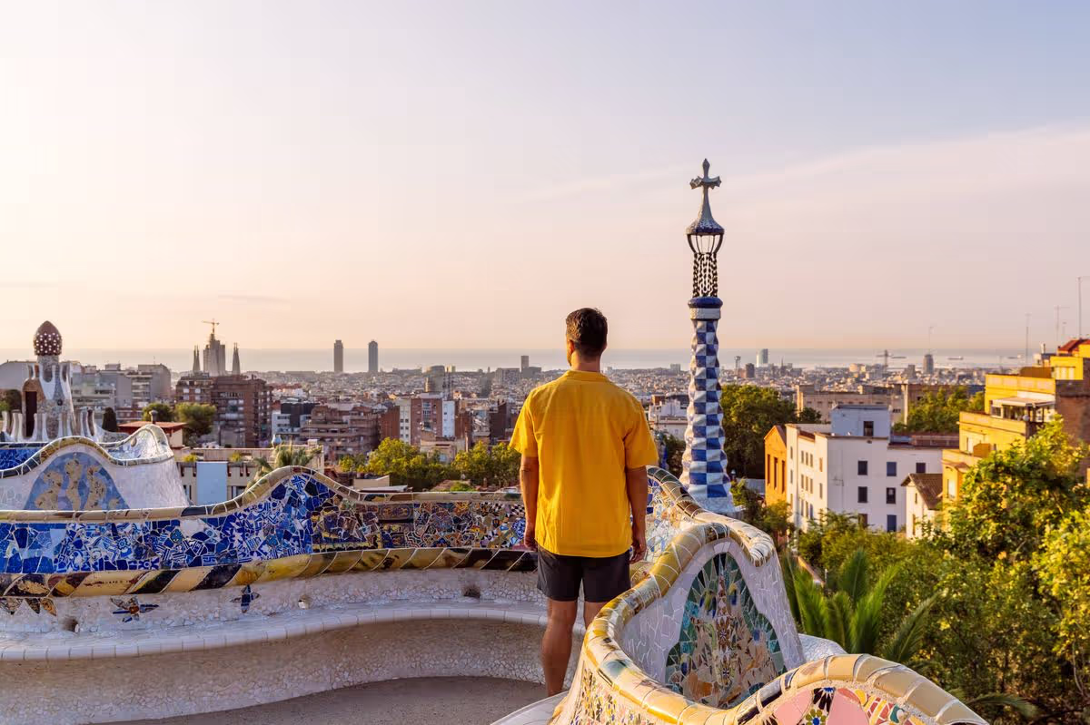
A British man spotted a big difference between the UK and Spain you’ll only notice when you leave the UK (stock image)(Image: Getty Images)
Spain has remained a firm favourite amongst Brits seeking a sun-soaked getaway for several years in a row. And It’s not just the brief flight time that appeals for holidaymakers, as the country also enjoys glorious weather throughout the entire year.
Data from the Office of National Statistics reveals that Brits clocked up more than 17.8 million trips to the Mediterranean nation in 2024, with figures projected to have climbed to 19.1 million in 2025. These holidays included trips to the Canary Islands and Costa Blanca, home to Benidorm. Further hotspots include the various Costas, the Balearic Islands, whilst the Northern regions are also seeing a surge in popularity.
Whilst the prospect of swapping Britain’s bleak and overcast winter months for brighter, warmer climes is undeniably attractive, there are certain contrasts many travellers might not have considered.
A British expat has now highlighted one major distinction between Spain and the UK, which may well explain why countless Brits are lured to the southern European nation.
Content cannot be displayed without consent
On TikTok, a man called Mark posted footage of himself strolling through British streets back in January, showcasing murky skies with the sun conspicuously absent.
“You don’t realise how depressing it is until you leave the UK,” he captioned the clip, which then switched to show him wandering through Spain’s bright streets, lined with palm trees along the pavements.
“Why does the UK have a grey filter?” he pondered in the post’s caption.
Is the UK weather more grey than Spain?
From March 2026, the UK is forecast to see average temperatures ranging between 9C and lows of 2C, though some regions might also benefit from sunny spells with temperatures reaching up to 17 degrees in Eastern England on 5 March, according to the Met Office’s long range forecast.
Northern parts of England and Scotland are anticipated to face rain and storms, and potentially even some snow on higher ground, with overnight frost still possible between 4-13 March.
In contrast, Spanish March days are typically sunny, offering 6-8 hours of sunshine daily, alongside average temperatures of between 12-18 degrees. However, occasional brief rain showers should be expected, according to Tui.
Southern regions like Andalusia and the Canary Islands are the warmest (up to 21°C), whilst central and northern areas are cooler, creating perfect conditions for exploring the spring-blooming countryside.
Despite Mark’s post, numerous people quickly flocked to the comment section of his video to argue the UK weather isn’t as ‘depressing’ as he suggested.
“will never understand why people think grey skies are depressing,” one viewer commented.
Multiple people also pointed out that the UK can be equally sunny and warm at times, and that it’s unfair to judge the weather based on cold and overcast winter days, as the sunny summer days we experience deserve recognition.
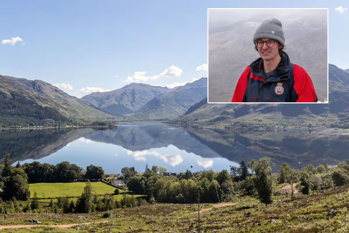
Met Office names Glenshiel Forest the UK’s wettest place below 200m with 3,778mm of rain a year – but the Scottish beauty spot offers red deer, historic battlefields and breathtaking mountain views
This article contains affiliate links, we will receive a commission on any sales we generate from it. Learn more
Milo Boyd spent his formative years being rained on
Britain’s wettest location also happens to be one of its most stunning destinations.
It has been a truly miserable winter. Cornwall and County Down recorded their wettest January on record, while Northern Ireland saw its wettest January is 149 years. Across the UK, 26 stations set new monthly records for highest January rainfall. Daily records also fell. Plymouth recorded its wettest January day in 104 years. And February has been no better so far. As of February 9, southern England had seen 72% of its monthly average.
In the midst of such sogginess, the prospect of venturing towards a region notorious for precipitation might not sound particularly appealing. However, in my view, the nation’s rainfall champion deserves a visit regardless of the season.
My initial trip to Glenshiel Forest in Ross and Cromarty, Scotland, occurred when I was four years old, during a family getaway to the neighbouring village of Glenelg. Those familiar with Scotland’s western coastline throughout the year will recognise how weather systems shift with astonishing speed compared to elsewhere in Britain.
Sunshine and azure skies can transform into torrential downpours within moments, sending everyone scrambling for waterproofs.
Glenshiel Forest takes this phenomenon to extraordinary heights. Rainfall batters the foliage and trees lining the nine-mile glen with remarkable intensity, only to abruptly cease as clouds disperse above the surrounding peaks, before resuming their assault once more.
Due to their intensity and frequency, the Met Office has designated Glenshiel Forest as Britain’s dampest location below 200m elevation, recording 3,778mm of precipitation annually. This dwarfs London’s approximately 500ml yearly average, making Glenshiel Forest roughly seven times wetter. It’s also roughly four times wetter than the UK as a whole.
But don’t let that deter you from pulling on your wellies, slipping into some galoshes and paying a visit to the Scottish forest. The area has been largely untouched by human activity, giving it a wonderfully remote and pristine feel. Red deer roam freely among native tree species such as common alder, downy birch, sessile oak and rowan.
History buffs will be captivated by the area’s rich past. “There’s a powerful sense of history in Glen Shiel, with steep mountains rushing upwards from an historic battlefield where British government forces and an alliance of Jacobite and Spanish troops fought in 1719,” notes the Woodland Trust.
“You can also access a mountain path to the Five Sisters of Kintail ‘ a classic ridgewalk with three Munros (mountains over 3000 feet / 914 metres).”
For 15 years, I spent my Easter holidays in the nearby village of Glenelg, which is most easily reached by traversing the stunning 339m tall Ratagan Pass – the only route into the sea-loch side settlement for several months of the year when the iconic Glenelg-Skye turntable ferry isn’t in operation.
The vista from the summit of the Ratagan, gazing down upon Glenshiel’s drenched woodlands in one direction and Glenelg in the other, is utterly unforgettable once witnessed. Few thrills can match cresting the hill after navigating the treacherously narrow, serpentine roads and beholding the village’s whitewashed cottages dotted along a loch’s shore, its waters remarkably azure, set against the backdrop of Skye’s mountains and the landscape beyond.
Perhaps the only thing that surpasses it – and another reason my family kept making pilgrimages to this remote corner of Britain year after year until the bungalow we considered our holiday retreat eventually crumbled into complete disrepair – is the panorama from the Glenelg Inn’s garden. Should you ever venture to the area, savour a pint from the local brewery whilst seated at the Inn’s picnic tables, taking in the spectacular scenery – at least until the heavens open.
For those who’d rather not brave the elements and venture into the sodden outdoors, Sykes Cottages has numerous properties available that are perfect for settling in and shutting out the dreary world beyond.
One particularly appealing option is Silver Birch Lodge, a six-person cottage that can be yours for less than £100 a night. Travel a little further north and you’ll get to the spacious Old Distillery Lodge, which sits in the stunning Caingorns National Park.
As rainy as parts of Scotland can be, they pale in comparison to the world’s soggiest area. Mawsynram is a town unlike any other. Nestled amidst the lush green forests of the Khasi Hills in the far east of India above Bangladesh, it is a beautiful area but an absolutely soaking one. Mawsynram receives about 11,873 mm of rainfall annually, which is close to 11 times more than the 1,109mm that falls on famously sodden Glasgow.
Jyotiprasad Oza is a lifelong resident of the town who makes a living leading groups of curious holidaymakers around with TourHQ. People come from far and wide to experience what life is like in the rainiest place on Earth, with visitors regularly making the trip from the US and UK.
“We get about 10,000 tourists a year. During rainy time people like to visit because it’s very heavy rainfall, especially June to September,” Jyotiprasad told the Mirror just as the rain clouds – somewhat predictably – began to open above him.
The rain in Mawsynram is not like the rain in most places. When it starts sometimes it doesn’t stop for days on end. Often residents will dash inside when the heavens open, only to find that there has been no let up for a week straight. And it isn’t just the duration that makes it stand apart.
In one single June day last decade 1,003mm of rain fell on the town – twice as much as London receives in a single year. The impacts on Mawsynram of such intense rainfall can be quite devastating.
“During the time of heavy rainfall, it is impossible to go outside. We can’t do our daily walk. We are not supposed to go outside during the rainy time. Sometimes children can’t go to school during the rain. It is quite dangerous,” Jyotiprasad explained.