‘I’m hoping to meet a river goddess’: a wild journey through Britain’s mythic waterways | United Kingdom holidays
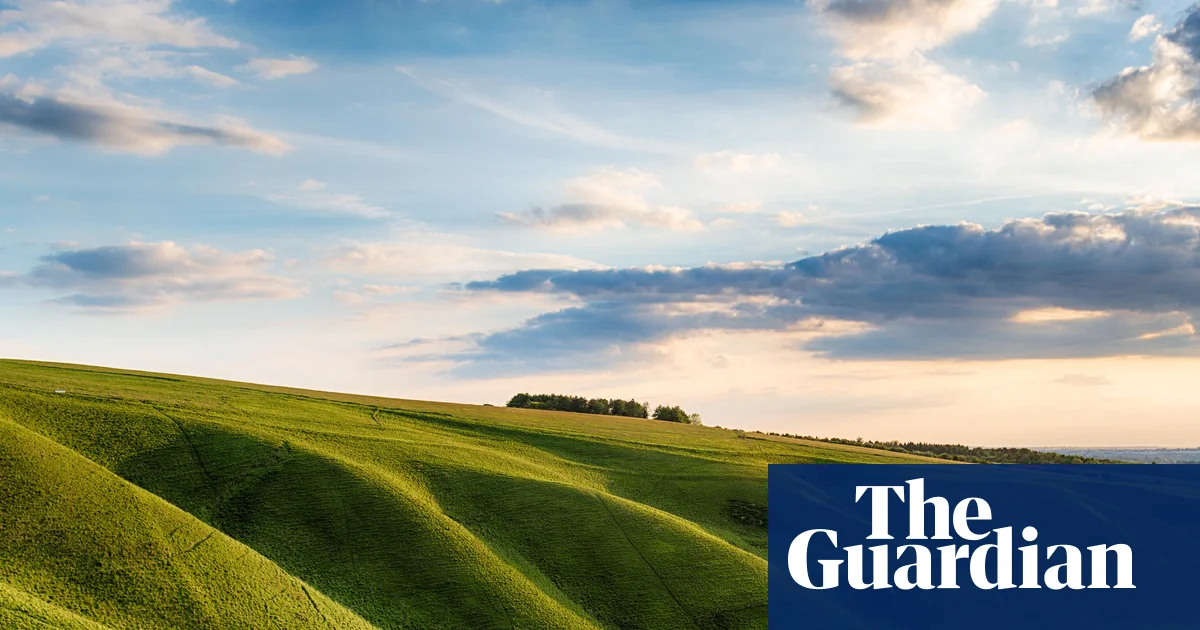
It’s just past midday and I appear to be inside a rain cloud. Soaked to the skin, my walking boots squelching through tufts of grass and black bog mud, I can hear hundreds of streams rolling off this wide mid-Wales peak, each vying to be the fastest. I’ve hiked around more than 8 miles (13km) of Hafren Forest trails to the top of Mount Pumlumon Fawr (Plynlimon), to reach a wooden post carved with the words Source of the Severn. And I’m here, alone, because I’m hoping to meet a river goddess.
It’s perhaps not as strange as it first sounds. Starting about 150 years ago, the folklorist John Rhys travelled across Wales to archive as many local myths as possible, and among them was the very tale that brought me to this peak: the story of the birth of the River Severn, in which three sisters – Hafren (Severn), Rheidolyn (Rheidol) and Gwy (Wye) – each choose their own route to the sea. My trip to the river’s source was itself a moment of mythically inspired travel, something that has been common practice in the British Isles for as long as we’ve told stories, not least as a means of passing them on.
Folklore is experiencing a revival in Britain, whether it’s in wild tales told around festival campfires or in the rise of Mabinogion-inspired romantasy fiction. I was here on my own adventure, travelling around the islands to rediscover our lost goddess myths and what they mean for modern womanhood, for my new book, No Fair Maidens. My journey took me from Somerset to Skye, from Gower to Eryri, and was less about archaeological sightseeing and more a journey into the landscape and waterways themselves: the river sources, lakesides, spring wells and seashores that feature so vividly in old lore.
Water, it seems, is often the site of powerful women and magical happenings. In Roman and perhaps pre-Roman times, Britannia was a network of waterways represented by goddesses, from Sulis’ hot spring in Bath to Coventina’s well near Carrawburgh on Hadrian’s Wall. For centuries, wells and river sources have been places of pilgrimage for people to bring their wishes, throwing in stones and coins and asking for help from forces unseen. They are also places where magic can sometimes cross over. In local Welsh myth, the Ffynone waterfall is regarded as a portal to the mystical Otherworld, where the goddess Rhiannon lived before riding her white horse into the real world to choose a husband. Up the road at Llyn y Fan Fach in the Bannau Brycheiniog (Brecon Beacons), the mountain lake is known as the home of a beautiful nymph who agrees to marry a mere mortal, only to return to the waters, taking her large dowry with her, when he breaks their covenant.
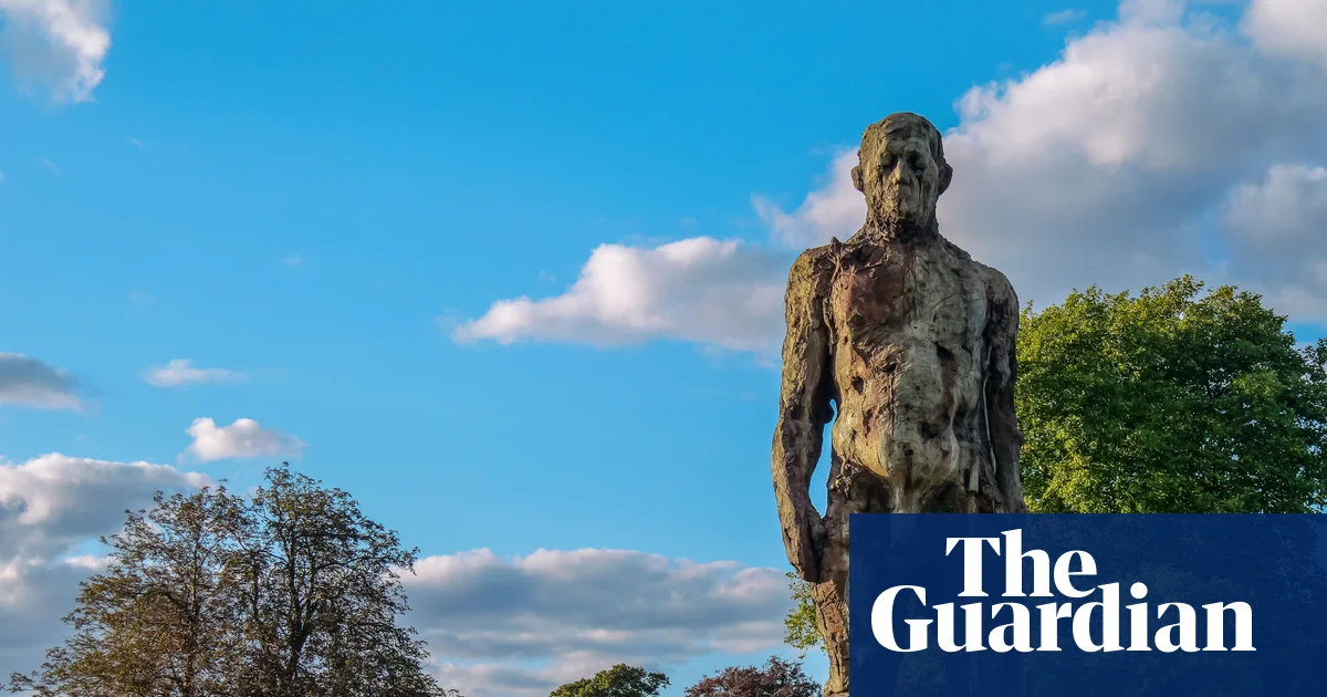
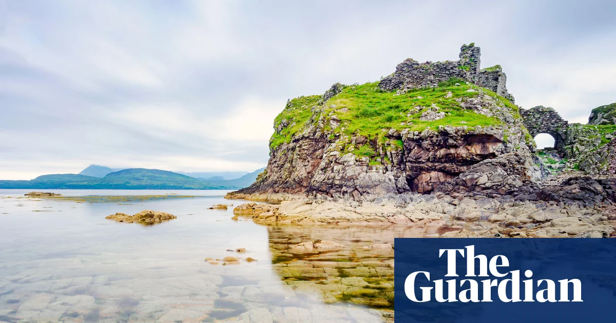
The shores are also home to some of our most renowned female fighters. On the Isle of Skye, in the dark ruins of Dunscaith Castle on the edge of Loch Eishort, we meet Scáthach: a fearsome Scottish warrioress from eighth-century Irish mythology, who was tasked with training Celtic princes to become warriors. She was said to be invincible, wielding supreme combat skills and a giant spiked spear, leading many a man to seek out her tutelage. Today, it is easy to picture her on the battlements, battered by wind and rain, wearily awaiting the next wannabe hero.
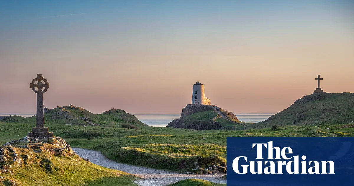
Indeed, as I travel across the island, powerful women weave through our folklore so readily that they feel like a source code, even though their stories are mostly unmarked in the landscapes from which they come. In England on the River Stour, I hear the 12th-century legend of Gwendoline, who was said to have raised an army in Cornwall and seized the crown from her cheating husband’s dead hands, making her the mythic first queen of a peaceful, united England. Further down the road as I climb Glastonbury Tor, it’s the matriarchal myth of Avalon that’s calling me, the tale of a magical island of sisters bound by the powers of shapeshifting, healing and prophecy. It’s wild to imagine that Britain might once have been home to that benevolent circle of women.
It seems as if, across Britain, the landscape is brought to life through story. As I discuss in my book, exploring the island through the lens of myth and folklore invites us to see Britain in a different light; as a place full of wonder, where wild and strange things are possible. And with more of us investigating how to build a stronger, healthier connection with the natural world, folklore and myth can create a kind of bridge, inviting us to see waterways less as “resources” and more as living beings with their own stories and a curious will of their own. This is Britain, but not as you know it; and perhaps by travelling through the landscape with myths as our guides, we might find new inspiration too.
Back on Mount Plynlimon, I was never quite sure how to go about meeting a river goddess, lacking the rituals and training our ancestors might once have known. But perhaps it was enough simply to know her story, so I could appreciate the land a little better. Whenever I see a river now, I can’t help saying hello, still in awe of how vast she has become, and how quickly she grew from nothing.
Kim Willis is the author of No Fair Maidens: A Wild Journey with the Lost Goddesses of Britain (Doubleday, £20). To support the Guardian, order your copy at guardianbookshop.com. Delivery charges may apply.