Hurricane

Humberto strengthens into hurricane, could impact Bermuda

Hurricane Humberto is expected to intensify into a major hurricane sometime Saturday. Photo courtesy of NOAA

Sept. 26 (UPI) — Humberto strengthened into a hurricane Friday morning and could reach major hurricane status by the weekend, the National Hurricane Center said.

The eye of the storm was located about 465 miles northeast of the northern Leeward Islands. It had maximum sustained winds of 75 mph and was moving northwest at 3 mph, the NHC said in its 5 a.m. AST update.

The forecast track has Humberto moving northward toward the island of Bermuda in the coming days.

The NHC described Humberto as “better organized” over the previous several hours, with signs of “steady-to-rapid intensification.”

No coastal watches or warnings were in effect.

Humberto became the Atlantic hurricane season’s eighth named storm Wednesday. It’s the third official hurricane after Erin and Gabrielle.

In August, Erin intensified into a Category 5 hurricane with 160 mph winds spreading across a 500-mile area. It did not make landfall in the United States but caused dangerous surf, rip currents and coastal flooding along the East Coast, with the worst conditions in North Carolina and Virginia.

Gabrielle formed in mid-September and also became a major hurricane, a Category 4. The storm dissipated into a post-tropical cyclone near the Azores on Friday.

Tropical Storm Chantal was the only storm to make landfall in the U.S. — South Carolina on July 6.

Source link

Urgent Foreign Office warning for UK tourist hotspot over Hurricane Gabrielle

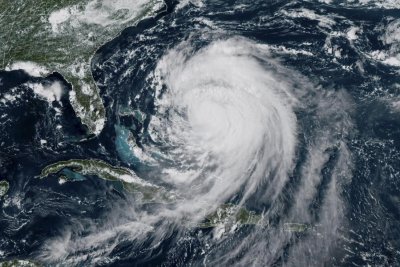
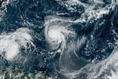
Hurricane Gabrielle could even have knock-on effects on the weather in the UK with reports of heavy rainfall on its way

The Foreign, Commonwealth and Development Office (FCDO) has issued an urgent travel update for anyone planning to visit a popular Portuguese hotspot or its surrounding regions. It comes amid a warning published today (September 25) with the government department alerting travellers to an approaching storm that’s expected to hit very soon.

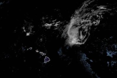
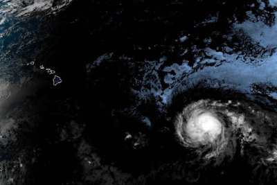
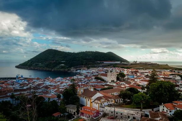
Its update forms part of the Foreign Office’s Portugal travel advice which also includes Madeira, Porto Santo and the Azores. In its latest advisory, it noted that a tropical storm warning has been issued specifically for the Azores, where adverse weather conditions are anticipated to develop rapidly – and where around four million tourists visit a year, with Brits the top nation for visitors.

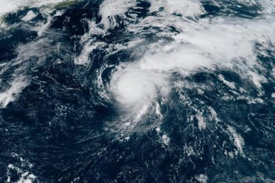
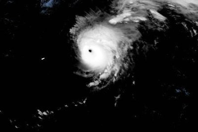
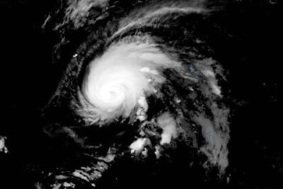
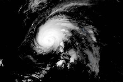
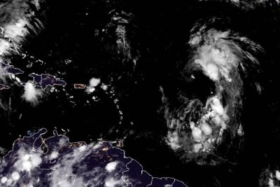
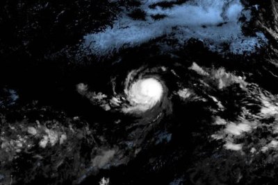
The travel experts highlighted that Hurricane Gabrielle is forecast to reach the Azores during the afternoon of September 25, urging travellers in the region to stay informed and take precautions if needed. Because of the expected weather conditions, there could “be disruption to services due to hurricane force winds and possible coastal flooding.” People are being urged to take care and read up on the latest advice over the next few days.

Noting that “hurricanes can change course and intensity”, it stated that the situation is being closely monitored by the US National Hurricane Center. It further advised people follow the guidance of their local authorities, adding: “If you are due to travel, check for updates from your travel provider.”

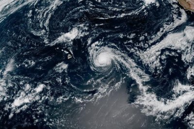
The US National Hurricane Center website warned travellers that currently, “a hurricane warning is in effect for all of the islands of the Azores, and hurricane conditions are likely tonight into Friday. Significant hurricane-force wind gusts are likely across portions of the Azores even after the center passes.”

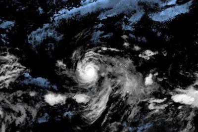
The warning continues: “A dangerous storm surge is expected to produce significant coastal flooding in areas of onshore winds in the Azores. The surge will be accompanied by large and destructive waves.”

As well as this, “heavy rainfall from Gabrielle could produce flash flooding across the terrain of the central Azores tonight through Friday morning. Swells generated by Gabrielle will continue to affect Bermuda during the next couple of days, and the east coast of the United States from North Carolina northward and Atlantic Canada for the next day or so.”

Guidance from the experts concluded: “These swells are likely to cause life-threatening surf and rip current conditions. Please consult products from your local weather office.”

What to do if you are affected by flooding or a storm

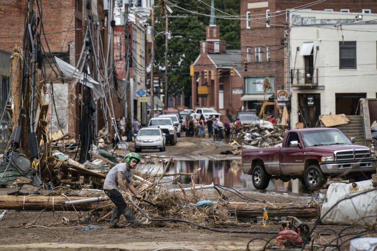
Flooding may result from heavy rainfall, tropical cyclones, or tsunamis. These events can cause extensive damage, including loss of life and major disruption to transport networks. During a flood, there is a significant risk of drowning and after, the likelihood of contracting water-borne diseases such as malaria or typhoid fever increases.

People can find out more about flooding from TravelHealthPro (from the UK’s National Travel Health Network and Centre), the World Health Organisation and the Met Office. In addition to flooding, tropical cyclones cause “considerable loss of life” every year. They can also cause “immense damage to property, and damage transport, electricity and communication infrastructure.”

Tropical cyclones gain energy from the heat released when moist air rises into the atmosphere. Hurricane season takes place during the months when sea surface temperatures in a given region are at their peak.

Highest risk:

  • June to November in the Northern Hemisphere Tropics (Caribbean, Atlantic, Southeast Asia, Pacific, Far East)
  • November to April in the Southern Hemisphere Tropics (for example, East Africa coast)

Tropical cyclones can cause:

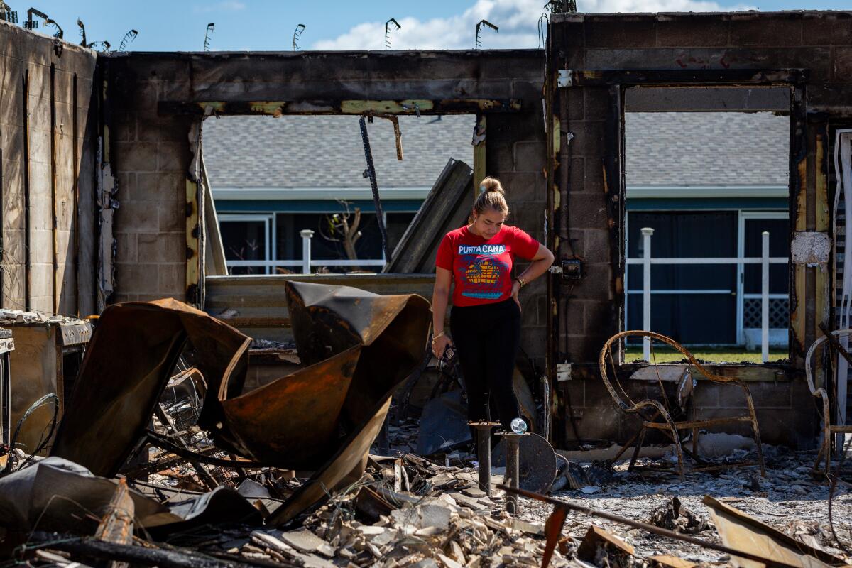
  • high winds: buildings can be damaged or destroyed; trees, power and telephone lines fall; flying debris becomes dangerous
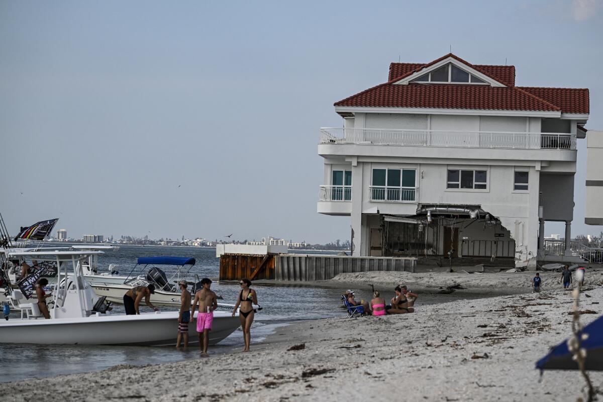
  • storm surge: a hurricane can cause a temporary rise in sea level of several metres which can flood coastal areas and damage buildings on the shoreline
  • very heavy rainfall: this can cause localised or widespread flooding and mudslides

You can find the latest Portugal travel advice here. Please keep an eye on the Foreign Office before and during your holiday.

Source link

Gabrielle: Hurricane conditions to reach Azores overnight

Hurricane Gabrielle is expected to reach the Azores on Thursday. Photo courtesy of NOAA

Sept. 25 (UPI) — The Azores were expected to be hit with hurricane conditions starting Wednesday night, the National Hurricane Center said, as Hurricane Gabrielle continued across the Atlantic Ocean.

The eye of the storm was located about 855 miles west of the Azores, the NHC said in its 3 a.m. GMT Thursday update.

It was moving east at a blistering 31 mph and had maximum sustained winds of 85 mph, a significant decrease from Tuesday when it was a Category 4 storm on the Saffir-Simpson Hurricane Wind Scale. As of Thursday morning, it was a Category 1 hurricane.

The government of Portugal had issued a hurricane watch for all of the Azores, an autonomous region of the European nation, due to Gabrielle on Tuesday, but upgraded it to a warning on Wednesday.

A hurricane warning is generally issued 36 hours before the anticipated first impact of tropical-storm-force winds and is signals that one should complete storm preparations.

“On the forecast track, the center of Gabrielle will approach the Azores today and move across the island chain tonight into early Friday,” the NHC said.

Gabrielle had been traveling northwest and turned north toward Bermuda as it gathered strength last week. But the storm shifted east on Monday and passed east of the island Monday night.

It has steadily weakened over the last few days, and forecasters said it could lose a bit of strength, but it is expected to regain some before moving over the Azores.

The swells from the storm will continue to reach the U.S. eastern coast from North Carolina northward, as well as Atlantic Canada, the NHC said, adding that they are expected to persist for another day or so.

“These swells are likely to cause life-threatening surf and rip current conditions,” it said.

Gabrielle is the seventh named storm of the 2025 Atlantic hurricane season.

Last month, Erin became a Category 5 hurricane with 160-mph winds spreading across a 500-mile area.

Source link

Gabrielle heads toward Azores; hurricane warning issued

Hurricane Gabrielle is expected to reach the Azores on Thursday. Photo courtesy of NOAA

Sept. 22 (UPI) — Hurricane Gabrielle was expected to continue rapidly moving toward the Azores in the Atlantic on Wednesday, where the government has upgraded a hurricane watch to a warning.

The eye of the storm was located about 1,360 miles west of the Azores, the National Hurricane Center said in its 5 a.m. AST update.

It was moving east-northeast at a blistering 25 mph and had maximum sustained winds of 115 mph, a significant decrease from Tuesday when it was a Category 4 storm on the Saffir-Simpson Hurricane Wind Scale. As of Wednesday morning, it was a Category 3 hurricane.

The government of Portugal had issued a hurricane watch for all of the Azores, an autonomous region of the European nation, due to Gabrielle on Tuesday, but upgraded it to a warning on Wednesday.

A hurricane warning is generally issued 36 hours before the anticipated first impact of tropical-storm-force winds and is a signal that one should complete storm preparations.

“On the forecast track, the center of Gabrielle will approach the Azores during the day on Thursday, and move across the island chain Thursday night into Friday,” the NHC said.

Gabrielle had been traveling northwest and made a turn to the north toward Bermuda as it gathered strength last week. But the storm made a turn toward the east on Monday and passed east of the island Monday night.

Forecasters said Gabrielle was weakening and will continue to do so as it travels over the northeastern Atlantic.

The swells from the storm will continue to reach the U.S. eastern coast from North Carolina northward, as well as Atlantic Canada, the NHC said, adding that they are expected to continue through this week.

“These swells are likely to cause life-threatening surf and rip current conditions,” it said.

Gabrielle is the seventh named storm of the 2025 Atlantic hurricane season.

Last month, Erin became a Category 5 hurricane with 160-mph winds spreading across a 500-mile area.

Source link

Major Hurricane Gabrielle moves into open Atlantic

Hurricane Gabrielle was moving into the opean central Atlantic Ocean early Tuesday. Photo courtesy of NOAA

Sept. 22 (UPI) — Gabrielle, a major Category 4 hurricane, was moving northeastward toward the open central Atlantic Ocean early Tuesday, after having passed Bermuda overnight, the National Hurricane Center said.

The eye of the storm was located about 305 miles east-northeast of Bermuda and about 1,855 miles west of the Azores, the NHC said in its 5 a.m. AST update.

It was moving northeast at 13 mph and had maximum sustained winds of 140 mph, up 20 mph from Monday morning, making it a Category 4 storm on the Saffir-Simpson Hurricane Wind Scale.

No coastal watches or warnings were in effect, but interests in Azores were urged to monitor Gabrielle’s progress.

Gabrielle had been traveling northwest and made a turn to the north toward Bermuda as it gathered strength last week. But the storm made a turn toward the east on Monday and passed east of the island Monday night.

Forecasters described Gabrielle as “an impressive hurricane” that is expected to gradually weaken over the next 24 hours.

“Gabrielle is forecast to approach the Azores late on Thursday,” the NHC said in a discussion on the storm. Interests in the Azores should monitor the progress of Gabrielle though it is too soon to specify the magnitude of potential wind, rainfall and wave impacts,” the NHC said in a discussion on the storm.

In its update, the NHC said Gabrielle is expected to see little change in strength through Tuesday, followed by gradual weakening into Wednesday.

The swells from the storm will continue to reach the U.S. eastern coast from North Carolina northward, as well as Atlantic Canada, the NHC said, adding that they are expected to continue through early this week.

“These swells are likely to cause life-threatening surf and rip current conditions,” it said.

Gabrielle is the seventh named storm of the 2025 Atlantic hurricane season.

Last month, Erin became a Category 5 hurricane with 160-mph winds spreading across a 500-mile area.

Source link

Hurricane Gabrielle continues to strengthen as it nears Bermuda

Hurricane Gabrielle is forecast to continue strengthening through Monday. Photo courtesy of the NOAA

Sept. 22 (UPI) — Hurricane Gabrielle is forecast to continue strengthening early Monday as it nears Bermuda, and residents are being urged to monitor forecast updates.

The storm’s center was located about 210 miles southeast of Bermuda with maximum sustained winds of 90 mph, making it a Category 1 on the Saffir-Simpson scale, the National Hurricane Center said during its 5 a.m. AST Monday advisory.

It was moving north-northwest at 10 mph, it added.

No coastal watches or warnings were in effect, but interests in Bermuda were urged to monitor Gabrielle’s progress.

Though modeling shows the storm is expected to remain well east of the island, the swells it generates will continue to affect the island over the next few days. “Gusty winds and showers” are also possible for Bermuda on Monday as the storm passes to its east, the NHC added in a discussion.

Forecasters said the storm is expected to rapidly strengthen over the next 24 hours, with Gabrielle to become a major hurricane by Monday night.

The swells from the storm have begun to reach the U.S. eastern coast from North Carolina northward, as well as Atlantic Canada, the NHC said, adding they should continue through early this week.

“These swells are likely to cause life-threatening surf and rip current conditions,” it said.

Gabrielle is the seventh named storm of the 2025 Atlantic hurricane season.

Last month, Erin became a Category 5 hurricane with 160-mph winds spreading over 500 miles.

Source link

Bad Bunny says goodbye to Puerto Rico after historic residency, while marking hurricane anniversary

Bad Bunny fans drowned out memories of Hurricane Maria in one booming voice on the anniversary of the devastating storm.

Saturday was a concert for Puerto Ricans by Puerto Ricans to remind the world about the power of la isla del encanto — the island of enchantment.

“We’re not going to quit. The entire world is watching!” Bad Bunny thundered into his microphone as he looked into a camera streaming his last show in Puerto Rico this year to viewers around the world, concluding a historic 30-concert residency in the U.S. territory.

The crowd roared as thousands watching via Amazon Music, Prime Video and Twitch joined them, marking the first time Bad Bunny was streamed across the globe.

The residency was more than just a series of concerts. Saturday marked the end of an extended love letter that Benito Antonio Martínez Ocasio sang to his homeland. He tapped into what it means to be Puerto Rican, to delight in the island’s beauty, to defend its land and fight for its people.

“This is for you,” Bad Bunny said from the rooftop of a famed Puerto Rican house installed at the concert venue as he raised his glass and the crowd raised their glasses in return.

‘We are still here’

Saturday marked the eighth anniversary of Hurricane Maria, which slammed into Puerto Rico as a Category 4 storm on Sept. 20, 2017.

An estimated 2,975 people died in the sweltering aftermath of the storm that crippled the island’s electric grid, leaving some communities without power for up to a year. Anger and frustration over the pace of reconstruction continues to simmer as chronic power outages persist.

In a report issued Sept. 11, the U.S. Office of Inspector General found that 92% of approved and obligated projects related to Puerto Rico’s crumbling grid were incomplete and that $3.7 billion of available funds had not been obligated.

“Over seven years after Hurricane Maria, FEMA does not know when Puerto Rico’s electrical grid will be completely rebuilt. The grid remains unstable, inadequate, and vulnerable to interruptions,” the report stated.

On Saturday, the number of estimated deaths was printed on the backs of T-shirts and written on Puerto Rican flags that the crowd waved.

“We are still emotional and carry the trauma of having gone through a horrible thing,” said Marta Amaral, 61, who attended Saturday’s concert. “Beyond the sadness and remembering the negativity of having gone through a traumatic event, this is a celebration that we are still here, standing.”

A surprise guest

At every concert this summer, Bad Bunny invited new celebrities — among them LeBron James, Penélope Cruz, Darren Aronofsky, DJ Khaled and Kylian Mbappé — and sang with different musicians, including Rubén Blades, Residente, Gilberto Santa Rosa, Rai Nao and Jorge Drexler.

But Saturday, the noise from the crowd hit new levels as Bad Bunny rapped with Puerto Rico heavyweights Ñengo Flow, Jowell y Randy, Dei V and Arcángel and De la Ghetto. Thousands of fans flexed their knees in unison to thumping rap and reggaetón.

Then, the crowd gasped in disbelief as Marc Anthony appeared on stage after Bad Bunny pleaded with his fans to join him because he was going to sing a song he hadn’t sung in public in some 20 years.

“Yo te quiero, Puerto Rico!” the crowd cried as the two singers embraced at the end of the iconic “Preciosa,” whose lyrics say, “I love you, Puerto Rico.”

‘An emotional night’

Thousands gathered outside the concert venue Saturday hours before the concert, with Puerto Rico’s national flower, the flor de maga, tucked behind their ears and the traditional straw hat known as a pava set at a jaunty angle on their heads.

But not all were celebrating.

Darlene Mercado milled around, asking strangers if they knew of anyone with tickets she could buy for herself and her daughter, who had flown in from New Jersey.

They were around number 122,000 in a virtual waiting line to buy tickets for Saturday’s sold-out concert and weren’t able to get any after waiting eight hours online.

“This is not only the anniversary of the hurricane, but it’s also the anniversary of me no longer having cancer and it’s my birthday. We wanted to celebrate everything with a bang,” Mercado said.

Saturday’s concert was open only to residents of Puerto Rico, as were the first nine concerts of Bad Bunny’s residency, but the others were open to fans around the world.

Overall, the concerts attracted roughly half a million people, generating an estimated $733 million for Puerto Rico, according to a study by Gaither International.

Most foreign visitors came from the Dominican Republic, Colombia and Spain, with an average stay of nearly nine nights, the study found. Overall, about 70% of concertgoers were female, with an average age of 33, according to the study.

Among those attending was Shamira Oquendo. “It’s going to be an emotional night,” the 25-year-old said, noting that Hurricane Maria was her first hurricane. “It was very sad. A lot of people around me lost their things.”

‘Yo soy boricua!’

Puerto Rico’s party with Bad Bunny ended early Sunday, but the superstar who recently clinched 12 Latin Grammy nominations will go on a worldwide tour in December, with concerts planned in Costa Rica, Mexico, Brazil, Australia, Spain, France and Sweden. Notably, he is skipping the mainland U.S., citing concerns over the federal government’s immigration arrests.

On Saturday, Bad Bunny thanked his fans for their love.

“I’m going to miss you a lot. I’m going to miss this energy,” he said as he urged the crowd to embrace love no matter the situation.

At that moment, friends and family in the crowd began to hug one another, some with tears in their eyes.

After more than three hours of singing with Bad Bunny, fans were not quite ready to let go. As the crowd filed down the stairs and into the night, one man yelled, “Yo soy boricua!” and the crowd responded, “Pa’ que tú lo sepas!”

It’s a traditional cry-and-response yell that lets people around them know they’re Puerto Rican and proud of it.

Coto writes for the Associated Press.

Source link

Gabrielle expected to become hurricane by Sunday

Sept. 17 (UPI) — Tropical Storm Gabrielle is strengthening and is expected to reach hurricane status either Saturday night or Sunday, according to the National Hurricane Center.

The storm’s center was located about 575 miles north-northeast of the Leeward Islands and about 500 miles south of Bermuda with maximum sustained winds of 65 mph, while moving northwesterly at 10 mph, the NHC said during its 5 p.m. AST advisory.

Tropical storm-force winds extend up to 140 miles outward from the storm’s center and mostly to the east.

The NHC expects Gabrielle to continue on its current track through Saturday night, followed by a turn toward north-northeast on Sunday.

Forecasters predict the storm will continue gaining strength and as it passes east of Bermuda on Sunday night or early Monday.

Gabrielle likely will make another turn to the north and northeast on Monday or Monday night.

Forecasters earlier in the week called Gabrielle a “poorly organized” tropical storm as it continued to form over the Atlantic Ocean.

Gabrielle sat just over 900 miles from Bermuda on Friday, and local news outlets on the island were warning of the potential impact, although there were hopes the storm could pass around 200 miles east of the island.

Gabrielle is the seventh named storm of the 2025 Atlantic hurricane season.

Last month, Erin became a Category 5 Hurricane with 160-mph winds spreading over 500 miles.

Source link

Gabrielle expected to become hurricane Sunday

Sept. 17 (UPI) — Tropical Storm Gabrielle is strengthening and expected to reach hurricane status this weekend, the National Hurricane Center said in its latest update Friday.

Maximum sustained winds were at about 50 mph, with higher gusts, as of the latest update issued at 11 a.m. AST.

The storm is moving at about 12 mph and is expected to continue in a northwest direction through Saturday.

Forecasters earlier in the week called Gabrielle a “poorly organized” Tropical Storm as it continued to form over the Atlantic Ocean.

“A gradual turn towards the north-northwestward is expected by Saturday night, followed by a northward motion by Sunday night,” the weather center said in the update.

“On the forecast track, the center of Gabrielle is expected to pass east of Bermuda Sunday night and Monday.”

Gabrielle sat just over 900 miles from Bermuda on Friday, and local news outlets on the island were warning of the potential impact, although there were hopes the storm could pass around 200 miles east of the island.

Tropical-storm-force winds were extending around 150 miles from the storm’s center on Friday.

“Swells generated by Gabrielle are expected to reach Bermuda tonight and build through the weekend. These swells are likely to cause life-threatening surf and rip current conditions,” the National Hurricane Center said in its update.

Gabrielle is the 7th named storm of the 2025 Atlantic hurricane season.

Last month, Erin became a Category 5 Hurricane with with 160-mph winds spreading over 500 miles.

Source link

Chaos inside FEMA as death threats distract from hurricane response

As a major storm rushed toward Florida last October, the head of the Federal Emergency Management Agency at the time faced a different kind of threat. Police had shown up in force to a rental property she owned as a result of a prank call, in a potentially dangerous attack known as “swatting.”

Back-to-back Hurricanes Helene and Milton had sparked a torrent of online conspiracies, with FEMA officials facing harassment and death threats, according to hundreds of pages of agency emails and other documents obtained via a Freedom of Information Act request by Bloomberg News. The records shed new light on how disaster-related misinformation affects the government’s emergency response, sucks up internal resources, and puts staff at risk.

Deanne Criswell, who ran FEMA under President Joe Biden, learned about the swatting situation as she was about to brief TV viewers on Milton, one of the most powerful storms on record to develop in the Gulf of Mexico. “It was a very unsettling feeling,” she said in a recent interview, thinking back on how she juggled her concern for her renters along with preparing Floridians for the storm.

FEMA Administrator Deanne Criswell testifies during the Senate Appropriations Committee hearing

FEMA Administrator Deanne Criswell testifies during a Senate Appropriations Committee hearing, November 20, 2024.

(Tom Williams/CQ-Roll Call, Inc via Getty Images)

Many of the attacks outlined in the documents have not previously been reported, including the doxxing of at least seven senior FEMA staffers. In those incidents sensitive personal information, such as home addresses, was published online for the purpose of harassment. The records also reveal challenges the agency faced as it tried to control the situation.

The incidents followed an online wave of disinformation suggesting FEMA was mishandling the response to the hurricanes that pummeled Florida and North Carolina in the lead up to the presidential election. Among the debunked claims swirling at the time were reports that agency workers had seized property from survivors and confiscated donations.

The offensive diverted agency time and resources to set the record straight and protect personnel. “It made my staff nervous,” said Criswell. “It made people in the community nervous. They didn’t know who to believe. They didn’t know who to trust.”The threat of misinformation continues to loom over the agency at a time when President Donald Trump and Department of Homeland Security Secretary Kristi Noem have made steep cuts to its staffing and funding, including pulling back on some of the resources FEMA used last fall to combat threats. In the aftermath of deadly Texas floods in July, for example, conspiracy theories online blamed cloud seeding.

“The profit-driven platform model, where sensational falsehoods outperform factual updates in emergencies, ensures this problem persists across political cycles and it can put lives at risk,” said Callum Hood, head of research at the nonprofit Center for Countering Digital Hate.

A FEMA spokesperson said in an email the agency “uses internal DHS resources to identify and mitigate any personal threats to employees.”

A trail of disinformation

Workers, community members, and business owners clean up debris in the aftermath of Hurricane Helene

Workers, community members, and business owners clean up debris in the aftermath of Hurricane Helene in Marshall, North Carolina, Sept. 30, 2024.

(Jabin Botsford/The Washington Post via Getty Im)

Hurricane Helene made landfall in the middle of the night on Sept. 26 as a Category 4 storm, causing historic flooding far inland and killing at least 250 people. Western North Carolina was particularly hard hit. Flood waters swept away small towns and cut off others, while Asheville lost water for more than a month. Almost immediately, FEMA staff had to confront false rumors circulating online, including that it had stopped accepting housing assistance applications from survivors and didn’t have enough funds to help them.

FEMA officials and experts attribute the quick spread of disinformation to historic government mistrust in the area, as well as social media platforms ratcheting back moderation. High-profile figures including X owner Elon Musk and Trump, then in the late stages of his bid to retake the White House, repeated some of the false claims. Trump, for example, said multiple times during his campaign rallies FEMA was directing disaster funds to immigrants.

For example, the agency shared a screenshot taken from a TruthSocial post from Oct. 5 that stated: “Deanne Criswell needs to be executed for crimes against humanity and treason!” An Oct. 6 post on Gab, a social media site favored by the far right, called for the “Mussolini treatment” of various officials. “The only question: Is there enough rope?” read one of the responses.

Jacyln Rothenberg, the agency’s spokesperson at the time, was among the most heavily targeted, leading Homeland Security to loan Customs and Border Protection agents to provide security at her home. “Because the doxxing was so severe and my safety was at risk, I had to stop tweeting,” she said. “I had to stop doing interviews. I had to stop putting myself on the record.”

FEMA staff also found what it called “far-right” users posting possible personal information for numerous officials, including Criswell, Coen and Rothenberg, internal documents show.

Attacks on FEMA Offline

As a second powerful hurricane — Milton — developed off the coast of Florida, the attacks on staffers’ started migrating from the internet to their homes. After Criswell’s rental property was swatted, among other “serious threats,” then-DHS Secretary Alejandro Mayorkas signed off on a government vehicle and extra security to protect the embattled FEMA chief.

Then it happened to someone else. “My deputy Jenna Peters’ home was swatted,” Coen told FEMA’s security team in an email on Oct. 11. Peters did not respond to a request for comment.

The most high-profile incident involved a man allegedly “hunting” FEMA staff in North Carolina’s disaster zone. On Criswell’s orders, she said in an email to other top Biden officials: “All FEMA staff and contractors working to interact with survivors and conducting housing inspections, as well as search and rescue teams stood down following the initial reports.”

Elena Gonzalez, 37, looks at their burned-out home after Hurricane Milton's landfall

Elena Gonzalez, 37, looks at their burned-out home after Hurricane Milton’s landfall on October 14, 2024, in Fort Myers, Florida.

(Eva Marie Uzcategui/The Washington Post via Getty Im)

Afterwards, FEMA put together a Workplace Protection Task Force involving security, intelligence and communications professionals to manage incoming threats. Protective measures included using specialized software to flag personnel previously targeted online as at risk of more harassment. But there were limits to how far the government could influence content moderation. At the time, outspoken Republicans led by House Judiciary Committee Chair Jim Jordan were investigating tech companies, alleging that the platforms were censoring conservative viewpoints under federal government pressure.

After initially approving ZeroFox to assist with facilitating takedowns, FEMA later asked that the company end all social media content removal requests. Per internal documents, the move came after staff discussions that it wasn’t advisable for the agency to contract for services that took any action beyond passive threat monitoring. ZeroFox declined to comment.

people sit on a beach as they attend a boat parade near a damaged house

Supporters of 2024 Republican presidential candidate Donald Trump attend a boat parade near a house damaged in Hurricane Milton, Siesta Key, Florida, October 26, 2024.

(Chandan Khanna/AFP via Getty Images)

Trump’s team has already overseen a massive scale back of FEMA’s staffing, funding and programming. As part of a review of contracts, FEMA ended its agreement with ZeroFox, according to a former official familiar with the situation. A FEMA spokesperson confirmed that it ended the ZeroFox contract in April. For Melissa Ryan, founder of Card Strategies, a consulting firm that researches disinformation, the current political climate — in which public officials who attempt to provide transparency are often politicized and attacked — is a bigger obstacle than budget cuts in the fight against false claims. “So many of the new government appointees are Trump loyalists, and attempting to actually respond effectively to disinformation would make whoever made the attempt a target for MAGA and the administration,” she said.

Hirji, Alba and Leopold write for Bloomberg.

Source link

Hurricane Kiko steadily weakens as it moves toward Hawaii

Hurricane Kiko, shown here off the coast of Hawaii, has been downgraded to a Category 1 storm, and is likely to pass north of the islands. Photo courtesy of NOAA

Sept. 9 (UPI) — Hurricane Kiko was steadily weakening on Monday but remained a Category 1 storm, according to forecasters who predict it will pass north of the Hawaiian Islands in the next two days.

The storm had maximum sustained winds of 75 mph and was located about 300 miles east-northeast of Hilo, Hawaii, and 450 miles east of Honolulu, the National Hurricane Center said in its 5 p.m. HST update.

It was moving northwest at 14 mph, the center said.

On the forecast track, Kiko was expected to pass north of the Hawaiian Islands on Tuesday and Wednesday, the NHC said.

However, swells generated by the storm were gradually building from east to west across Hawaiian waters and are expected to peak Monday night through Wednesday.

“While the risk of direct impacts on the islands continues to decrease, interests should continue to monitor Kiko’s progress and the latest forecasts,” the NHC said in a discussion on the storm

The forecasters said they expect the storm to be downgraded to a tropical storm overnight.

Kiko had intensified to a Category 4 hurricane early last week, but was later downgraded as it weakened off the coast.

No watches or warnings were in place, the NHC said.

Source link

Hurricane Kiko may miss Hawaii but ‘life-threatening’ surf still likely

1 of 2 | Hurricane Kiko, shown off the coast of Hawaii, has been downgraded to a Category 3 storm, and is likely to pass north of the islands early this week. Photo courtesy of NOAA.

Sept. 7 (UPI) — Hurricane Kiko, packing winds in excess of 110 mph, is forecast to approach the Hawaiian islands early this week, but is predicted to pass to the north, meteorologists said Sunday.

“The forecast track currently for Kiko is to pass north of Hawaii,” the National Weather Service said in a public advisory on social media. “It is still too soon to determine the exact location/magnitude of potential impacts from Kiko. Interests in the island should continue to monitor Kiko’s progress.”

As of Sunday morning, the Category 3 storm was about 715 miles east of Hilo and moving to the west-northwest at about 13 mph, generating what forecasters said could be life-threatening surf in the Hawaiian islands.

Kiko had intensified to a Category 4 hurricane early last week, but was later downgraded as it weakened off the coast. Forecasters said it could degrade into a Tropical Storm by Tuesday, but will still be capable of creating heavy rain, gusty winds and dangerous surf through the first half of the week.

There are currently no watches or warnings in place, the NHC said.


Source link

Hurricane Kiko remains a Category 3, tracks toward Hawaii

Hurricane Kiko was expected to continue on the path toward the Hawaiian Islands over the next several days, but it’s unclear to what extent it might impact the state. Photo courtesy of National Oceanic and Atmospheric Administration

Sept. 4 (UPI) — Hurricane Kiko continues to track in the general direction of Hawaii while maintaining its Category 3 status with 120 mph winds on Saturday afternoon.

Kiko weakened slightly and was located about 935 miles east-southeast of Hilo, Hawaii, and 1,135 east-southeast of Honolulu, while moving west-northwest at 12 mph, the National Hurricane Center reported in its 5 p.m. EDT update.

Hurricane-force winds extend about 25 miles from the storm’s eye, while tropical-storm-force winds extend outward by up to 80 miles.

The hurricane is expected to continue moving toward the west-northwesterly and gradually weaken over the next several days.

No coastal watches or warnings are in effect, but “interests in the Hawaiian Islands should monitor the progress of Kiko,” NHC forecasters said.

“Swells generated by Hurricane Kiko are expected to reach the Big Island and Maui by Sunday,” the NHC announced.

“These swells will gradually build and are forecast to peak along east-facing exposures of the Hawaiian Islands late Monday through midweek, potentially producing life-threatening surf and rip currents,” the NHC forecasters said.

Officials in Hawaii declared a state of emergency on Saturday to prepare for a possible strike by Kiko and other storm-related effects.

The state of emergency is in effect through Sept. 19, unless it is terminated sooner or extended beyond that date.

The storm formed on Sunday, making it the 11th named storm in the Eastern North Pacific this year.

Source link

Hurricane Kiko weakens to Category 3, heads toward Hawaii

Hurricane Kiko was expected to continue on the path toward the Hawaiian Islands over the next several days, but it’s unclear to what extent it might impact the state. Photo courtesy of National Oceanic and Atmospheric Administration

Sept. 4 (UPI) — Hurricane Kiko weakened to a Category 3 hurricane late Thursday as it made its way northwest toward the general direction of Hawaii, forecasters said.

Kiko had reached Category 4 strength late Wednesday but weakened to 125 mph maximum sustained winds in the National Hurricane Center’s 3 p.m. HST update. Despite the weakening, the storm is still considered a major hurricane that could cause severe damage if it reaches land.

The eye of the storm was located about 1,360 miles east-southeast of Hilo, Hawaii, and 1,565 miles east-southeast of Honolulu. It was traveling west at 9 mph and was expected to continue in that direction and toward the northwest over the next several days.

“Kiko is forecast to approach the Hawaiian Islands during the early to middle portion of next week,” the NHC said in a statement Thursday.

“The risk of direct impacts from wind and rainfall is increasing. However, it is too soon to determine the exact location or magnitude of these impacts, and interests there should continue to monitor the progress of this storm.”

The NHC said swells generated by Kiko could reach the Hawaiian islands toward the end of the weekend, causing life-threatening surf and rip currents.

There were no weather watches or warnings in effect because it was well away from land Thursday.

The storm formed on Sunday, making it the 11th named storm in the Eastern North Pacific this year.

Source link

Lorena gains hurricane strength as it aims for Baja California

Tropical Storm Lorena formed south of Baja California on Tuesday. Photo courtesy of National Oceanic and Atmospheric Administration

Sept. 3 (UPI) — Lorena gained hurricane strength early Wednesday as it moved north toward the Baja California Peninsula, according to forecasters who are unsure if the storm will make landfall.

The storm, which formed early Tuesday, was located about 120 miles south of Cabo San Lucas, Mexico, on the Baja California Peninsula, the National Hurricane Center said in its 11 p.m. MST update.

It had maximum sustained winds of 75 mph and was moving northwest at 14 mph, it said.

The government of Mexico issued a tropical storm warning for the west coast of Baja California from Santa Fe to Cabo San Lazaro and a tropical storm watch for the peninsula’s coast north of Cabo San Lazaro to Punta Abreojos.

A tropical storm watch was already in effect for the west coast of Baja California from Cabo San Lucas north to Cabo San Lazaro.

“On the forecast track, the center of Lorena is expected to move parallel to the west coast of the Baja California Peninsula today and Thursday and then could approach the coast on Friday,” the NHC said.

However, an NHC discussion on the storm states: “There is significant uncertainty as to whether Lorena will make landfall in Baja California Sur.

“If it does, the system should continue weakening and dissipate over northwestern Mexico by 120 [hours],” it said.

If it doesn’t make landfall, then the storm is expected to dissipate west of the peninsula in five days, the forecasters added.

Rapid strengthening is forecast overnight, though it is expected start weakening Thursday and could be a tropical storm by Friday.

“Steady to rapid intensification is likely during the next 24 [hours],” the NHC said in a discussion on the storm. “After that time, Lorena is forecast to move over cooler sea surface temperatures and into an area of southwesterly vertical shear. This should cause significant weakening, and Lorena is expected to weaken back to a tropical storm by 60 [hours].”

Baja California is expected to be inundated with rain from Lorena starting Wednesday, with storms potentially persisting through Friday, producing between 5 and 10 inches of rainfall, with maximum amounts of 15 inches, according to the NHC.

Heavy rainfall concerns across Arizona will begin late Wednesday through Friday, it said, which could cause flash flooding in areas of the state.

Lorena, the 12th named storm in the Eastern North Pacific this year, formed as Hurricane Kiko continued to strengthen over the Pacific Ocean.

Source link

Hurricane Kiko reaches Category 2 status

Tropical Storm Kiko (pictured in satellite imagery) strengthened into a hurricane Tuesday. Photo courtesy of National Oceanic and Atmospheric Administration

Sept. 3 (UPI) — Tropical Storm Kiko strengthened into a Category 2 hurricane on Tuesday, according to forecasters who expect it to become a major hurricane in the next day or two.

The storm had maximum sustained winds of 105 mph, the National Hurricane Center said in its 5 p.m. HST update.

It was located about 1,740 miles east of Hilo, Hawaii, and was moving westerly at 7 mph, and was expected to continue moving in that direction along open waters in the eastern Pacific Ocean, the forecasters said.

“The main steering feature continues to be a subtropical ridge located to the north of Kiko,” the NHC said.

“A slow westward motion should continue for the next couple of days,” followed by a “turn toward the west-northwest” in three to four days, the NHC forecast said.

There are no weather watches or warnings in effect because the hurricane is expected to stay over the waters of the Pacific Ocean.

It’s forecast to enter drier air and cooler waters in three or four days, but gain strength until it does. It is expected to remain a hurricane for at least five days.

The storm formed on Sunday, making it the 11th named storm in the Eastern North Pacific this year.

Source link

Tropical Storm Kiko expected to strengthen into hurricane

Tropical Storm Kiko, seen here in satellite imagery, was expected to strengthen into a hurricane Tuesday. Photo courtesy of National Oceanic and Atmospheric Administration

Sept. 2 (UPI) — Tropical Storm Kiko is expected to strengthen into a hurricane in the next 24 hours, forecasters said.

Tropical Storm Kiko was located about 1,880 miles east of Hilo, Hawaii, with maximum sustained winds of 65 mph, while moving west at 7 mph, according to the National Hurricane Center’s 5 p.m. HST update.

“Steady strengthening is forecast during the next couple of days, and Kiko is expected to become a hurricane by tonight,” the NHC said.

Tropical storm-force winds extend 45 miles from the storm’s eye.

The NHC predicts the storm system will continue on its westerly track on Tuesday and move away from North America.

There were no weather watches or warnings in effect.

“Despite somewhat drier mid-level conditions along its forecast track, the combination of light vertical wind shear, warm sea surface temperatures and Kiko’s small compact core should allow for strengthening in the short term,” the NHC forecast said during its 11 a.m. update on Monday.

The storm formed on Sunday, making it the 11th named storm in the Eastern North Pacific this year.

Source link

Hurricane Erin triggers states of emergency in N.J. and N.C.

Hurricane Erin triggered state-of-emergency declarations in New Jersey and North Carolina as it passes along the East Coast on Thursday afternoon and creates life-threatening conditions that are expected to last through the weekend. Photo by EPA/NOAA

Aug. 21 (UPI) — Hurricane Erin’s effects have triggered state-of-emergency declarations in New Jersey and North Carolina as the storm system moves along the East Coast.

New Jersey Governor Phil Murphy declared a state of emergency Thursday afternoon, while North Caroline Governor Josh Stein declared one on Tuesday that remains in effect.

“Over the past couple of days, we have seen the effects of Hurricane Erin along the Jersey Shore in the form of dangerous rip tides,” Murphy said in a news release.

“As the storm moves past New Jersey over the next 23 hours, we are expecting high surf and rip currents, coastal and flash flooding, and a high erosion risk in parts of the state,” Murphy added.

North Carolina officials expect similar conditions to continue there after Hurricane Erin already has impacted Hatteras Island.

“Dangerous conditions, including rip currents and coastal flooding, are expected through the weekend,” Stein said in an online announcement on Thursday.

“With flooding peaking tonight, please avoid driving on roads with standing water,” he added.

An evacuation order was issued on Tuesday for residents and others along the Outer Banks.

Stein said state officials are monitoring the situation, and an emergency response team is working to keep roads clear and people safe.

Among emergency preparations, the North Carolina National Guard is on standby, and the state’s emergency response team has search-and-rescue teams ready to deploy if needed.

State Highway 12 on Hatteras Island is closed due to extensive ocean overwash and dune breaches in multiple locations, according to Dare County, N.C., officials.

The northern ends of Hatteras Village and Buxton, and along Pea Island, are especially impacted by the hurricane.

North Carolina Department of Transportation crews are working to clear sand and water from the state highway and repairing damaged dunes.

The highway will stay closed until NCDOT officials say it’s safe to travel on the roadway.

The Category 2 Hurricane Erin had maximum sustained winds of 100 mph while positioned 370 miles east-northeast of Cape Hatteras, N.C., late Thursday afternoon, according to the National Hurricane Center.

Erin is moving northeasterly at 20 mph and away from the East Coast, but its effects include storm surges of between 2 feet and 4 feet and related flooding along coastal areas from North Carolina to Sandy Hook, N.J.

The storm system also is creating dangerous rip tides alongmuch of the East Coast, which makes swimming very dangerous.

Source link

Hurricane Erin to hit North Carolina with tropical storm conditions

Hurricane Erin was expected to bring tropical storm conditions to North Carolina on Wednesday evening and Virginia on Thursday. Photo courtesy of the National Oceanic and Atmospheric Administration

Aug. 20 (UPI) — Tropical storm conditions were descending upon the North Carolina coast late Wednesday, according to forecasters who are warning beachgoers against swimming at most U.S. East Coast beaches due to “life-threatening” surf and rip currents.

The Category 2 storm, described as “large” by the NHC, had maximum sustained winds of 110 mph, just shy of a Category 3 hurricane. The eye of the storm was located about 485 miles west of Bermuda and 215 miles southeast of Cape Hatteras, N.C., and was moving north at a rapid 16 mph, according to the NHC’s 11 p.m. EDT update.

A storm surge warning was in effect for from Cape Lookout to Duck, N.C., while a tropical storm warning was in effect for Beaufort Inlet, N.C., to Chincoteague, Va., including Pamlico and Albemarle Sounds.

Bermuda was under a tropical storm watch.

“Erin is expected to produce life-threatening surf and rip currents along the beaches of the Bahamas, much of the east coast of the U.S., Bermuda and Atlantic Canada during the next several days,” the NHC said. “Beachgoers in those areas should follow advice from lifeguards, local authorities and beach warning flags.”

Forecasters warned weather conditions were expected to deteriorate along the Outer Banks late Wednesday into Thursday. Storm surge and large waves could cause beach erosion and make some roads impassible.

Tropical storm conditions were expected to reach the Virginia coast Thursday and farther north through early Friday.

The season’s first Atlantic hurricane reached Category 5 status Saturday morning, the highest classification, after rapidly intensifying overnight Friday, when it became a Category 1 hurricane, the year’s fifth named storm.

Erin dropped to a Category 4 and then a 3 overnight into Sunday, but regained Category 4 strength late Sunday before again losing strength.

Erin became the first hurricane of the 2025 Atlantic storm season Friday morning.

There have been four named storms so far this season in the Atlantic. Tropical Storm Chantal caused major flooding in North Carolina but has been the only one of the four to make landfall in the United States this year.

The Atlantic hurricane season began on June 1 and ends on Nov. 30. The peak hurricane season runs from mid-August through September and into mid-October.

Ninety-three percent of hurricane landfalls along the U.S. Gulf Coast and the East Coast have occurred from August through October, the Weather Channel reported, citing data from the National Oceanic and Atmospheric Administration

Last year at this time, there had also been five named storms.

Source link

Hurricane Erin’s outer bands reach North Carolina’s Outer Banks

Hurricane Erin was expected to bring tropical storm conditions to North Carolina on Wednesday evening and Virginia on Thursday. Photo courtesy of the National Oceanic and Atmospheric Administration

Aug. 20 (UPI) — The outer bands of Hurricane Erin neared North Carolina’s Outer Banks on Wednesday evening, prompting the National Hurricane Center to issue warnings against swimming at most East Coast beaches.

The Category 2 storm, described as “large” by the NHC, had maximum sustained winds of 110 mph, just shy of a Category 3 hurricane. The eye of the storm was located about 490 miles west of Bermuda and 245 miles south-southeast of Cape Hatteras, N.C., and was moving north at 14 mph, according to the NHC’s 8 p.m. update.

A storm surge warning was in effect for from Cape Lookout to Duck, N.C., while a tropical storm warning was in effect for Beaufort Inlet, N.C., to Chincoteague, Va., including Pamlico and Albemarle Sounds.

Bermuda was under a tropical storm watch.

“Erin is expected to produce life-threatening surf and rip currents along the beaches of the Bahamas, much of the east coast of the U.S., Bermuda and Atlantic Canada during the next several days,” the NHC said. “Beachgoers in those areas should follow advice from lifeguards, local authorities and beach warning flags.”

Forecasters warned weather conditions were expected to deteriorate along the Outer Banks late Wednesday into Thursday. Storm surge and large waves could cause beach erosion and make some roads impassible.

Tropical storm conditions were expected to reach the Virginia coast Thursday and farther north through early Friday.

The season’s first Atlantic hurricane reached Category 5 status Saturday morning, the highest classification, after rapidly intensifying overnight Friday, when it became a Category 1 hurricane, the year’s fifth named storm.

Erin dropped to a Category 4 and then a 3 overnight into Sunday, but regained Category 4 strength late Sunday before again losing strength.

Erin became the first hurricane of the 2025 Atlantic storm season Friday morning.

There have been four named storms so far this season in the Atlantic. Tropical Storm Chantal caused major flooding in North Carolina but has been the only one of the four to make landfall in the United States this year.

The Atlantic hurricane season began on June 1 and ends on Nov. 30. The peak hurricane season runs from mid-August through September and into mid-October.

Ninety-three percent of hurricane landfalls along the U.S. Gulf Coast and the East Coast have occurred from August through October, the Weather Channel reported, citing data from the National Oceanic and Atmospheric Administration

Last year at this time, there had also been five named storms.

Source link