IMF and World Bank’s annual meeting explores economic resilience amid climate risk, debt pressure, and AI.
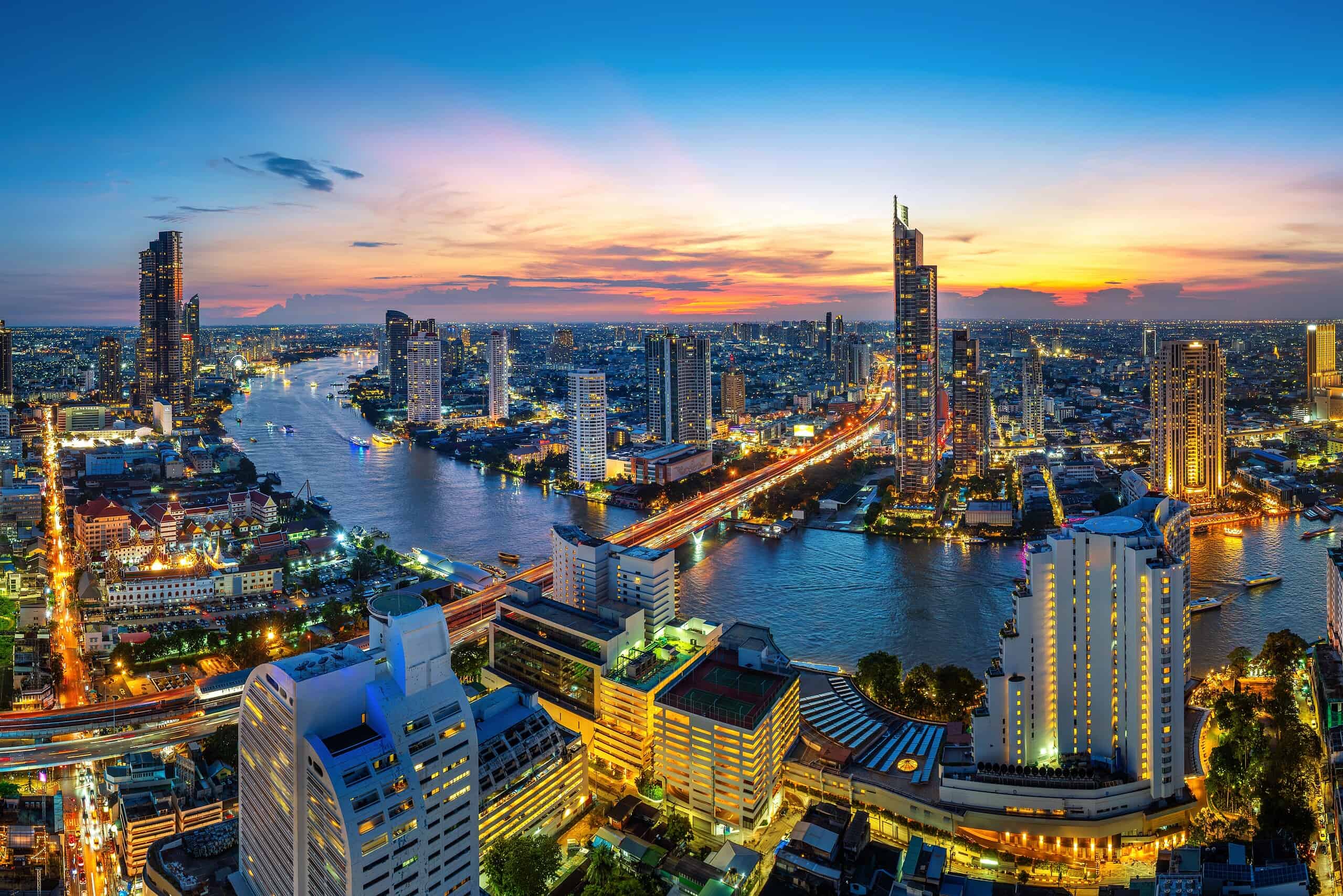
While walking around central Bangkok, it’s easy to miss the damage that prompted IMF and World Bank officials at their annual meeting to consider postponing this week’s event.
No evidence of the extreme flooding elsewhere in the city, which caused so much damage and loss of life just a week ago, is visible. Life goes on—scooters buzz and trucks barrel down the expressways and narrow streets where vendors hawk exotic foods and trinkets. Bangkok officials did an admirable job cleaning up to prepare for the arrival of some 15,000 attendees, and the area surrounding the convention center is as dry—and secure—as it’s probably ever been.
Inside the meetings, though, the question was how much more disruption—climate-related or otherwise—the global economy can absorb, and who can afford to recover when the next shock arrives.
At Tuesday’s World Economic Outlook briefing, IMF Chief Economist Silvana Tenreyro described a world economy being pulled in two directions. Conflict in the Middle East has pushed energy prices higher, while investment in artificial intelligence has helped drive growth. The IMF outlook projects global growth of 3.1% this year, but that headline figure masks sharp differences among countries. Energy exporters and countries driving the AI boom are better positioned, she said, than those that must import fuel or have little stake in the massive technology surge.
“The economy has been resilient, but that resilience is reaching its limits,” Tenreyro said at the briefing.
The economy is holding up, in part, because countries and companies have navigated disruptions by rerouting supplies, drawing down inventories, improving efficiency, and finding alternatives. Without those adjustments, the IMF estimates global growth would be closer to 2.5%.
But these measures have limits. Inventories run down. Efficiency gains can only go so far. And another shock—whether geopolitical or climate-related—could arrive before economies have recovered from the last one.
G-24’s Climate and Debt Dilemmas
The Intergovernmental Group of Twenty-Four on International Monetary Affairs and Development, or G-24, which represents emerging-market and developing economies, brought the issue closer to home. Nigeria’s finance minister and G-24 chair, Taiwo Oyedele, cited the flooding in Thailand to argue that climate commitments need to be backed by money, not just promises.
“Our appeal to world leaders is to put their money where their mouth is,” he said in a separate briefing shortly after WEO’s.
For businesses, resilience has a price. Holding extra inventory, diversifying suppliers, and keeping cash on hand can seem like unnecessary costs when markets are stable. But during a disruption, they can keep production moving and prevent higher costs from affecting the business.
Countries face a similar trade-off but lack the same resources. Developing economies need funding for infrastructure, climate preparedness, and basic services, even as debt payments consume a large share of public funds. Oyedele cited estimates that developing countries pay roughly $500 billion more in debt costs than developed economies. His broader point is clear: The countries that need to invest in resilience often face the highest financing costs.
Iyabo Masha, director and head of the Secretariat of the G-24, described the dilemma this way: “Debt is something that restrains growth.” When governments spend so much on creditors, she said, they have less left to invest in their economies.
The AI Factor
Another uncertainty in the IMF’s outlook is that AI investment may boost growth, but its benefits do not necessarily translate into jobs. Oyedele warned that countries with younger populations could see growth alongside rising unemployment if they do not plan carefully. Growth, he said, “has to be job rich; it has to be inclusive.”
That’s a broad definition of resilience—not simply keeping an economy growing, but ensuring people benefit and that governments retain the capacity to respond when circumstances change.
In Bangkok, the discussions have ranged from growth forecasts to debt and climate finance. But the underlying question is who can afford to prepare for the next disruption and who will be left to pay for recovery.
Central Bangkok shows little sign of the recent flooding, but that doesn’t mean the damage elsewhere was any less severe. The same holds for the global economy: A resilient growth forecast doesn’t mean every country is equally prepared for the next shock. The question is how much each can afford to absorb—and what it might have to give up to recover.
Paul Curcio is the editor of Global Finance Magazine. Contact him at paul.curcio@gfmag.com.
Rescue operation underway after flash floods swept away home, bridges and parts of the Manaslu trekking trail.
Published On 13 Oct 202613 Oct 2026
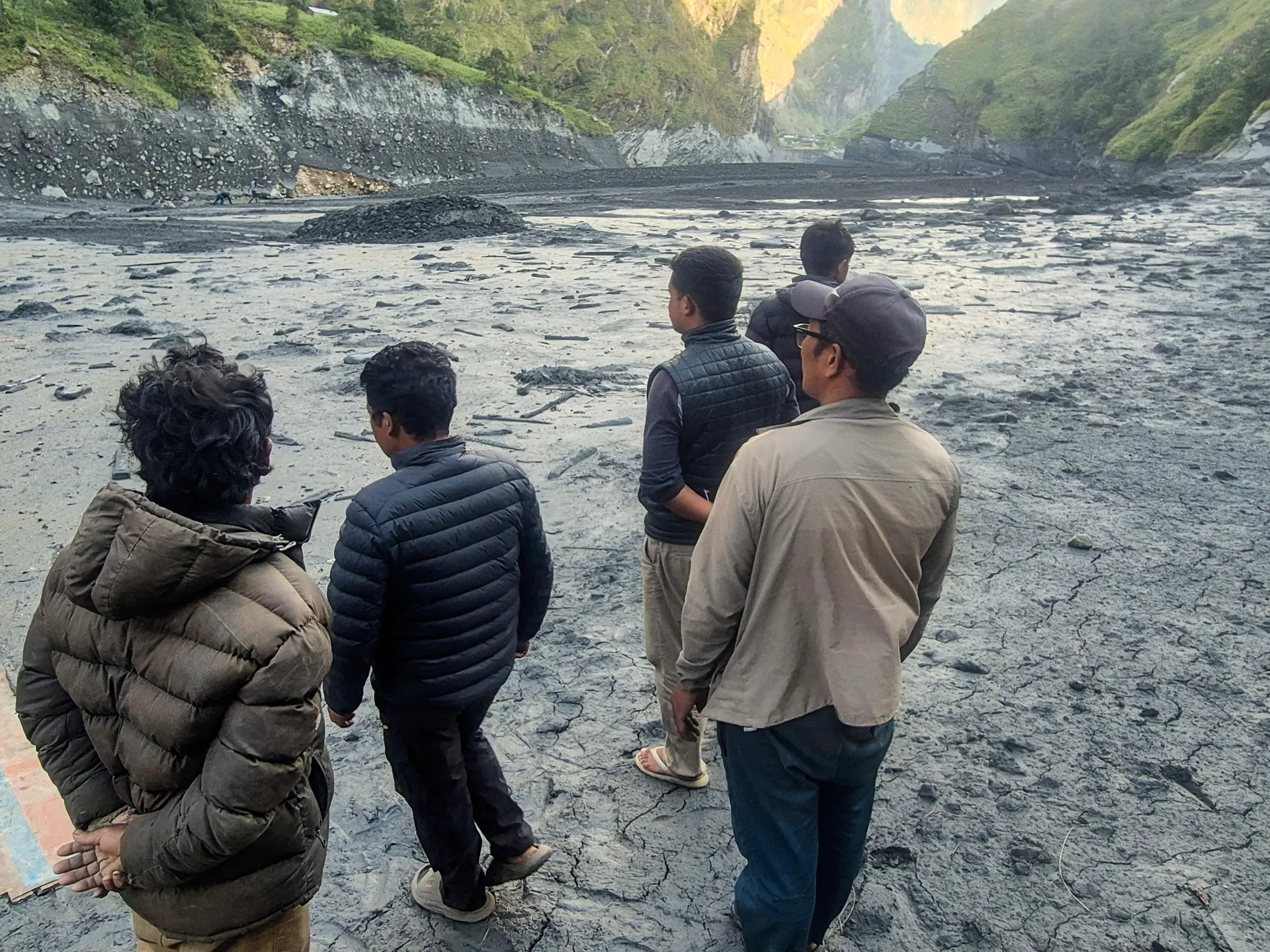
More than 100 foreign trekkers have been stranded in central Nepal, according to a local official, a day after flash floods in the Gorkha district washed away bridges, hiking trails and hundreds of homes.
Bhuwan Raj Ojha, an official of the Manaslu Conservation Area Project, told the Reuters news agency on Monday that the trekkers were stranded in different areas of the popular Manaslu trekking trail because part of the route had been swept away.
Recommended Stories
list of 3 itemsend of list
“Those hikers who want to return because of the flood need to be rescued. Those who want to continue their trekking can do so from locations that are safe,” he told Reuters from Gorkha.
“There are restaurants and tea houses along the route. They are safe”.
The flash floods hit on Sunday, when a predawn landslide blocked the Budhi Gandaki River in the Gorkha district, about 100km (62 miles) west of the Nepalese capital, Kathmandu.
Authorities rescued 321 people, including 12 foreigners, on Monday, and the army said the rescue operation would continue on Tuesday, even as the water level in the river receded.
The river is a tributary of the Trishuli River, downstream from another tributary where a glacier collapse caused a catastrophic flood in August that killed 1,457 people, with thousands still missing.
There were no reports of deaths in the latest flood, but five villagers were out of contact after black muddy sludge and debris washed away more than 200 homes and damaged infrastructure, including three hydroelectric plants, national disaster authorities said.
Md Shahadat Hossain, a Bangladeshi trekker stranded in Jagat village, told the Anadolu news agency that nine Bangladeshis were waiting for a possible evacuation by helicopter.
“We have been stranded in Jagat since yesterday. A flash flood came down from above the village and flowed through its lower part,” he said.
“We are safe, but there has been no electricity since yesterday, communication with the outside world has been disrupted, and food supplies are gradually running short,” he added.
Gorkha district authorities have asked villagers living along the riverbanks downstream to evacuate.
National disaster authorities had also alerted people living along the river in the Gorkha, Tanahun, Chitwan, East Nawalparasi and West Nawalparasi districts about the flood.
Simon caps a Pacific season of record-breaking intensity, as deadly storms wreak havoc from Hawaii to Mexico.
At least two people have died in Mexico after Hurricane Simon and former tropical storm Rachel brought torrential rain and catastrophic flooding to Pacific coast communities.
At a Monday news briefing, Guerrero Governor Evelyn Salgado confirmed that a 71-year-old man had died during Hurricane Simon after a retaining wall collapsed under the weight of intense precipitation.
Recommended Stories
list of 3 itemsend of list
According to the Guerrero-based news agency IRZA, the man, identified by his family as Albino Moreno Jimenez, had been feeding his animals on the western outskirts of Chilpancingo when a wall came crashing down on him.
A second death was announced later in the day in the state of Baja California along Mexico’s western coast. There, Governor Marina del Pilar said that a young girl had died from the effects of what was once Hurricane Rachel, which peaked in early October as a Category 3 storm.
At least 10 more people remain missing in Baja California, according to the governor. Eight were reported missing in the city of Ensenada, on the Pacific coast, and two in the fishing town of San Felipe on the Gulf of California.
The figures remain preliminary, with local newspaper La Jornada reporting a higher death toll of two in Baja California and 11 missing.
Death toll expected to rise
Rachel made landfall in the Mexican state as a post-tropical cyclone, and its remnants have travelled north through southern California in the southwestern United States.
Hurricane Simon, meanwhile, has churned off the coast of Mexico since the weekend. By late Monday morning, it had weakened from a powerful Category 4 storm to a Category 2.
Its maximum sustained winds had slowed slightly to around 155km/h (100mph), according to the US National Hurricane Center. Its centre was about 115km west-southwest of Cabo Corrientes, a cape in the state of Jalisco, drifting west at 3km/h.
Forecasters predict Simon could make landfall on Thursday or Friday. Hurricane warnings remain in effect for western Mexico, which is vulnerable to landslides and deadly surf conditions as a result of the storm.
Experts warn the death toll from both storms could rise, and officials have called on residents to exercise caution amid the devastation wrought by downed trees, high winds and floodwaters.
The Spanish newspaper El Pais reported the death of a cliff diver, Juan Patines, who was killed in Mazatlan, the northwestern state of Sinaloa, after jumping into the sea on Saturday night.
According to Mexican media, the heavy surf hampered his efforts to return to shore amid dangerous coastal conditions associated with Hurricane Simon. Local authorities later halted cliff-diving at the site due to hazardous sea conditions.
Officials have yet to confirm whether his death was directly linked to Hurricane Simon.
A record Pacific storm season
Rachel and Simon have battered Mexico’s western coast as part of an extraordinary stretch of hurricane activity across the Pacific.
The northeastern and central Pacific Ocean has experienced a record storm season this year, fuelled in part by the El Nino weather phenomenon, which results in warming waters in parts of the region. Twenty-one named storms have been recorded in the Pacific so far.
On Sunday, Simon tipped the region to a historic high for accumulated cyclone energy (ACE), a metric of the combined strength and longevity of tropical storms. This year has already surpassed the previous high set in 2018.
The US island chain of Hawaii has been among the hardest-hit places. In August, Hurricane Lala unleashed ruinous flooding on Hawaii’s Big Island as a Category 1 storm, killing a 93-year-old woman and destroying some 100 homes, according to state officials.
A few weeks later, Hurricane Lowell, a Category 4 hurricane at its peak, struck the Hawaiian islands of Kauai and Niihau, where powerful winds, storm surge and flooding overwhelmed towns and roads.
Roughly 90 percent of Kauai’s power customers were plunged into darkness as a result of electricity outages. At least two deaths were linked to Lowell.
In late September, Hurricane Nolo brought another round of flooding and landslides to the Hawaiian islands, though it did not make landfall.
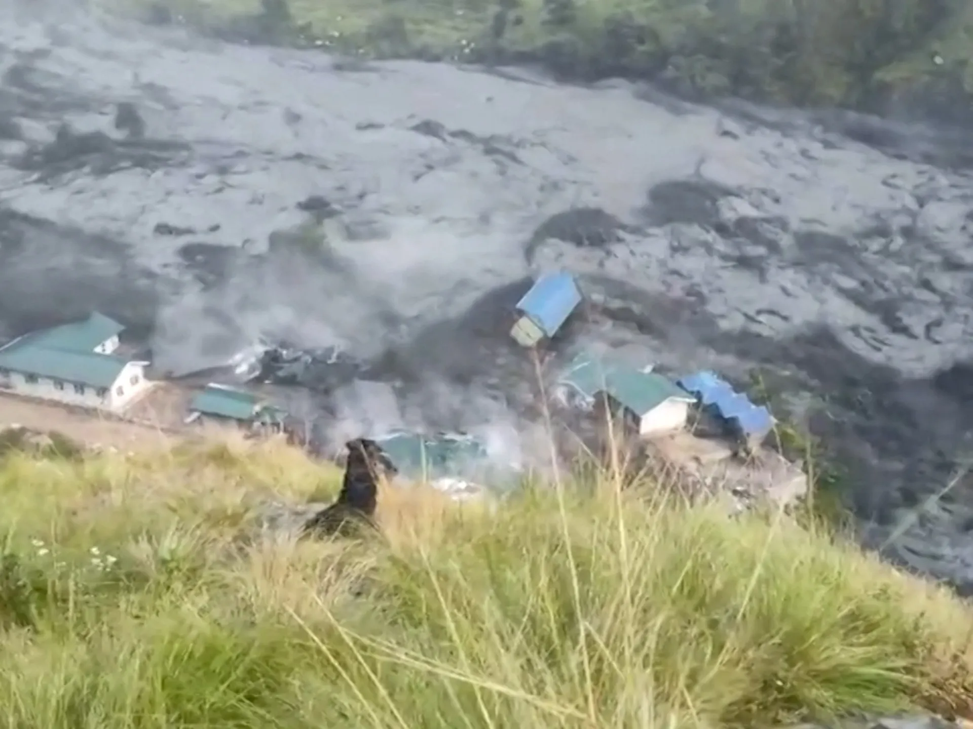
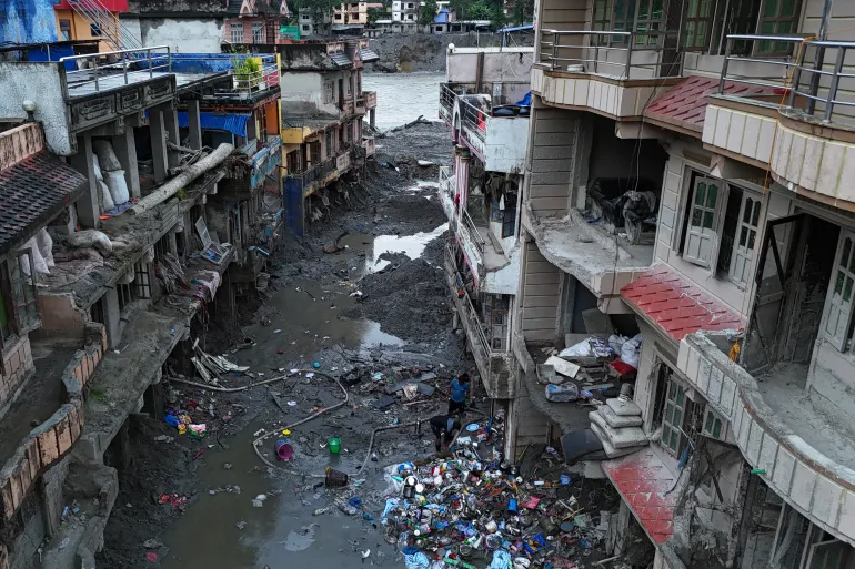
Flash floods along Nepal’s Budhi Gandaki River swept away homes and bridges, forcing residents to flee to higher ground. Five people are missing, and six have been rescued, authorities said.
The Mexican community of Cabo Corrientes faces the risk of a direct hit as the Category 4 storm churns off Jalisco.
By Reuters and The Associated Press
Published On 11 Oct 202611 Oct 2026
Mexican President Claudia Sheinbaum has urged residents along the Pacific Ocean to stay indoors as Hurricane Simon’s powerful winds and heavy rains pound coastal communities.
As of Sunday, the hurricane’s eye was moving offshore of Mexico’s Jalisco state, with winds of at least 240km/h (150mph).
Recommended Stories
list of 4 itemsend of list
Torrential rain has already battered residents living between the Sierra Madre mountain range and the ocean. Communities in hilly and mountainous areas have been warned to brace for mudslides.
Simon reached Category 4 strength, on a scale of five, on Saturday, as part of an unusually active Pacific hurricane season.
“With the approaching impact of Category 4 Hurricane Simon, we urge residents of coastal municipalities in Jalisco, Colima, Nayarit and Michoacan to remain sheltered until authorities officially declare that the danger has passed,” Sheinbaum wrote in a post on the social media platform X on Sunday.
In a midday advisory, the United States’ National Hurricane Center (NHC) warned that Simon could produce “additional rainfall totals of 8 to 16 inches (20 to 41 cm) over portions of southwestern Mexico”.
Precipitation totals as high as 76 cm (30 inches) were possible in areas of Michoacan, Colima, and Jalisco until Monday.
It’s not clear whether the storm will make landfall. But the greatest risk of a direct hit lies at the moment with Cabo Corrientes, a town that sits on a cape in Jalisco, jutting into the Pacific Ocean.
A man boards up a shop as Hurricane Simon approaches Puerto Vallarta, Mexico, on October 10 [Fernando Llano/AP]
Mexico’s National Civil Protection Coordination (CNPC) placed 28 municipalities in Jalisco and Colima under its highest cyclone alert level, while another 93 municipalities were under a high alert level, according to civil protection bulletins.
Classes were suspended in the affected areas, and efforts to evacuate residents were under way.
Businesses in popular tourist destinations like Puerto Vallarta boarded up windows and placed sandbags at entrances as the storm approached.
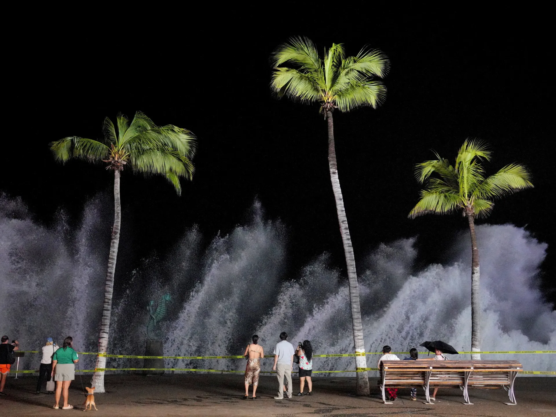
Jalisco’s Governor Pablo Navarro warned that the high-powered hurricane was creating “high-risk marine conditions” along the coast of his state, with waves reaching as high as eight metres (26 feet).
On Sunday, he also shared video on social media of the storm surge crashing onto sidewalks and flooding waterways.
“Here is the current state of Jalisco’s beaches this morning — from Barra de Navidad to Puerto Vallarta — as Hurricane Simon passes through,” he wrote in the video’s caption.
“I ask everyone to heed official instructions, take precautions and avoid putting themselves at risk. The safety of Jalisco’s families is the top priority.”
Authorities urge villagers to move to safer places after a river bursts its banks in the central part of the country.
Published On 11 Oct 202611 Oct 2026
Flash floods have hit central Nepal, sweeping away houses and leaving at least five people missing, according to officials, weeks after devastating flooding in the country that killed hundreds.
A landslide in Chumnubri village in Gorkha district, about 100km (62 miles) west of Kathmandu, blocked the Budhi Gandaki River on Saturday, leading to downstream flooding, authorities said.
Recommended Stories
list of 4 itemsend of list
Two women and three men were unaccounted for, and there are no reports of casualties, said the National Disaster Risk Reduction and Management Authority (NDRRMA).
According to the agency, at least 82 people, including nine foreigners, have been rescued from the affected areas.
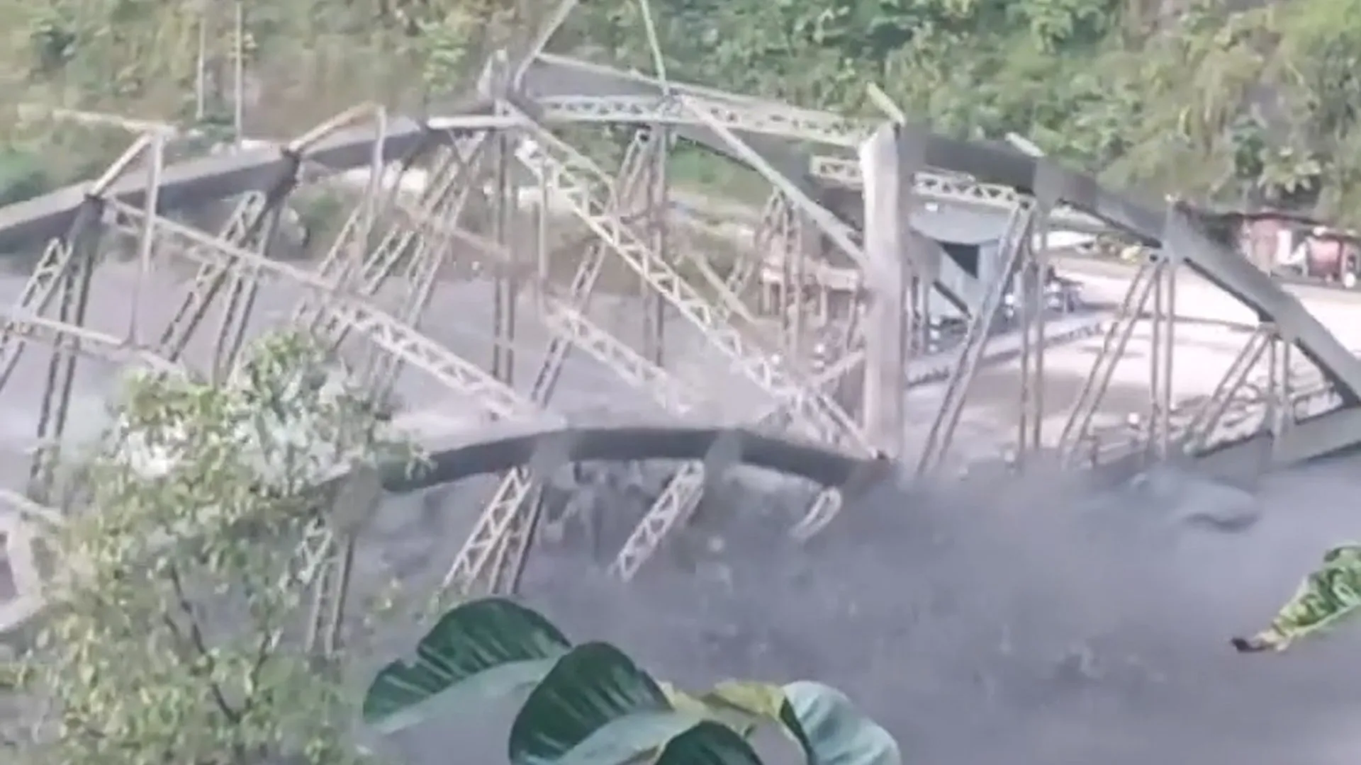
The flood swept away about a dozen houses and two suspension bridges and damaged a hydroelectric project camp, carrying some of the construction equipment away, authorities said.
A muddy torrent washed away a highway bridge connecting Gorkha with the neighbouring Dhading district, said NDRRMA Chief Executive Dharam Raj Uprety.
Evacuation order
The Budhi Gandaki is a tributary of the Trishuli River, downstream from another tributary where a glacier collapse caused a catastrophic flood in August that killed 1,457 people, with thousands still missing.
“We have asked villagers living along the riverbanks downstream to evacuate and remain safe,” said Dharmendra Kumar Mishra, Gorkha district’s most senior bureaucrat.
National disaster authorities alerted people living along the river in the Gorkha, Tanahun, Chitwan, East Nawalparasi and West Nawalparasi districts about the flood.
“Please help ensure that people in at-risk areas are moved to safe locations in time and assist search and rescue operations as needed,” the NDRRMA said in a social media post.
Officials said army and police rescue personnel had reached the area and were also monitoring the situation from a helicopter.
“The flood looked similar… It was very scary, and it still feels like a nightmare for us,” said local official Laxmi Gurung of Chumnubri rural municipality.
“Our house is gone, we have no electricity… but there have been no casualties.”
Heavy rainfall in late September also triggered floods and landslides, killing at least 21 people, according to the disaster agency.
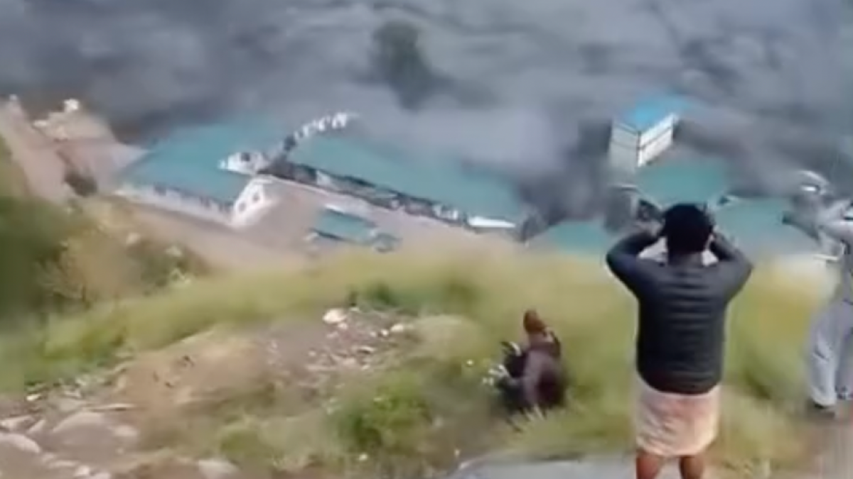
Flash flooding in Nepal has swept away buildings along the Budhi Gandaki river on Sunday. Terrified onlookers in Gorkha district filmed from higher ground, after a landslide triggered downstream flooding that also swept away a bridge and homes.
Storm damage stretches across Florida and Alabama as officials warn of continued flooding and possible tornadoes.
Published On 10 Oct 202610 Oct 2026
Hurricane Isaias, the first hurricane of the 2026 Atlantic season, has killed two people and left hundreds of thousands of customers without power across the southeastern United States.
The storm made landfall near Destin, Florida, on Friday evening as a Category 2 hurricane before weakening as it moved inland through Alabama overnight.
Recommended Stories
list of 3 itemsend of list
One person died in Birmingham, Alabama, when a tree fell on a house overnight, according to local emergency officials. A second person was killed in Escambia County, Florida, after a tree fell during the storm, according to local authorities.
Florida Governor Ron DeSantis said on Saturday that state officials had not confirmed any storm-related fatalities, including the report from Escambia County.
Isaias hit land with sustained winds of 169km/h (105mph), bringing powerful gusts and heavy rain to the Florida Panhandle. By Saturday morning, the storm had weakened to a post-tropical cyclone with wind speeds of about 55km/h (35mph).
Relaxing in a hotel lobby in Pensacola, Florida during a power outage ahead of the arrival of Hurricane Isaias, October 9, 2026 [Marco Bello/Reuters]
More than 900,000 electricity customers in Florida, Alabama and Georgia were without power early Saturday morning. That number has since gone down to under 800,000, according to PowerOutage.us.
Fallen trees and downed power lines caused widespread disruption, while flooding forced road closures in parts of southern Alabama, including Houston County. Alabama Governor Kay Ivey said on Saturday morning that her team was concerned about “strong winds, heavy rain and possible spinoff tornadoes”.
Local officials in Pensacola, Florida reported strong winds that damaged an airport and tore the roof off a hotel. Trees and power lines also came down across the city, leaving some residents without electricity and roads blocked.
Wind, rain, and flying debris as seen from a hotel lobby in Pensacola, Florida on Friday before the hurricane hit [Marco Bello/Reuters]
Despite the storm’s weakening, officials warned that dangerous conditions could persist. Heavy rainfall threatened flash flooding across parts of the Southeast.
“The flooding story is not over,” DeSantis said on Saturday, warning that saturated ground and continued rainfall could cause dangerous flooding a day or two after the storm passed. He said state search and rescue resources would remain available in case rapidly rising waters required emergency rescues.
Florida Attorney General James Uthmeier also warned residents to be alert for contractors seeking to exploit storm victims as homeowners begin repairing damaged properties.
Florida Power & Light worker Yosvany Quintero clears downed tree branches on Saturday [Octavio Jones/AP]
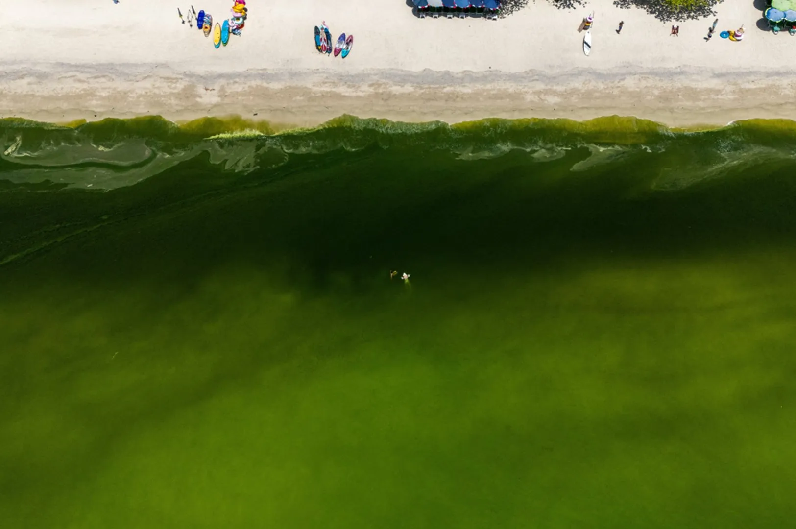
The water off Thailand’s Ko Lan island has turned a vibrant shade of green thanks to a plankton bloom, keeping many tourists out of the water. But scientists say the bigger concern may be what’s happening beneath the surface, where oxygen levels are falling.
The nor’easter causes another round of flooding in low-lying areas in New Jersey and New York City and knocks out power to tens of thousands of homes into New England.
Published On 27 Sep 202627 Sep 2026
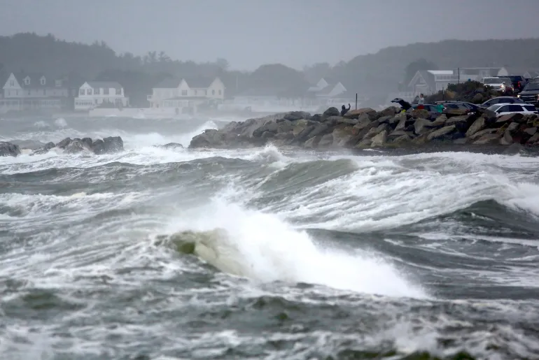
A powerful storm is pummelling the shoreline in the northeastern United States for a second day, causing another round of flooding in low-lying areas and knocking out power to tens of thousands of homes.
Tidal surges swamped low-lying neighbourhoods in New Jersey on Sunday, while wind gusts toppled trees on New York’s Long Island, damaging homes and bringing down utility poles.
Recommended Stories
list of 3 itemsend of list
In New York City, streets in the Howard Beach neighbourhood of Queens were inundated.
The slow-moving storm, which killed a New York City housing authority worker when a tree fell on Saturday, was expected to linger through Sunday, with heavy rain, strong winds and dangerous surf all the way to New England.
Extreme amounts of rain – more than 10cm (4 inches) since Friday in some spots in New Jersey – combined with a surging ocean led to flooding amounts not seen for close to a decade in places used to dealing with high water, residents said.
The storm, known as a nor’easter, triggered memories of Hurricane Sandy, which left behind more than $60bn in damage across the eastern US in 2012. While this storm’s impact has been nowhere near that, it could be the first of several along the East Coast this fall because of an El Nino climate pattern disrupting this year’s weather.
Images of waves crashing into sea walls and onto beaches raised concerns about coastal erosion.
More than 100,000 customers were without power across the Northeast and mid-Atlantic at times on Sunday, according to PowerOutage.us. The most widespread outages were in counties along the coast from New Jersey to Connecticut.
Numerous flights were cancelled or delayed up and down the coast. More than 250 flights had been cancelled at Boston Logan International airport by late Sunday morning as wind gusts reached 64km/hour (40 mph), according to the Massachusetts Port Authority.
The worst of the remaining rainfall was expected on Sunday from northern New Jersey into southern New England.
While the storm was gradually weakening, tidal flooding would stay through high-tide cycles Sunday night, said Bob Oravec, a lead forecaster with the National Weather Service in College Park, Maryland.
People watch the ocean as a nor’easter storm hits Rye, New Hampshire, US, on September 27, 2026 [Caleb Jones/AP Photo]
A month after catastrophic floods tore through Nepal, 5,285 people remain missing and more than 1,100 are still in holding centres. Fresh rains are now worsening conditions for displaced families living in temporary shelters, as the country faces a $4.78bn rebuilding bill.
Authorities report increasing death toll over three days as rivers rise above danger levels across parts of neighbouring countries.
Published On 27 Sep 202627 Sep 2026
Heavy rainfall has triggered floods and landslides that have killed at least 56 people in the northern Indian state of Uttar Pradesh in recent days while 12 people have been reported dead in neighbouring Nepal.
Hrishikesh Bhaskar Yashod, Uttar Pradesh’s relief commissioner, said on Sunday that India’s most populous state had registered 66.5mm (2.6 inches) of rain from Friday to Sunday morning, compared with a normal 7.6mm (a quarter of an inch) for the period.
Recommended Stories
list of 3 itemsend of list
The deaths, in addition to 46 injuries, were reported during a spell of “exceptionally heavy rain that has affected much of Uttar Pradesh”, according to the commissioner’s office.
More than 1,000 houses were damaged after “a depression over the Bay of Bengal moved inland and intensified rainfall across the region,” it added.
Home to more than 240 million people, Uttar Pradesh is frequently hit by rain and thunderstorms during the annual monsoon season from June to September.
In India’s eastern state of Odisha, more than 70,000 people living in low-lying areas were evacuated after rivers rose due to heavy downpours, the NDTV news network reported. The rains have damaged bridges and culverts, forcing officials to shut down Devkund, a popular tourist spot in the state.
Separately, India’s Central Water Commission said 30 river-monitoring stations across seven states were in a “severe situation”. Major rivers that flow through India, including the Ganga, Gandak, Kosi, Bagmati and Narmada, had risen above danger levels.
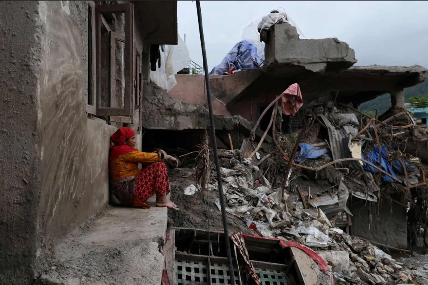
People salvage items from sludge on September 26, 2026, next to deluged houses in Nepal’s Nuwakot district in the aftermath of last month’s flash flooding [Prakash Mathema/AFP]
In Nepal, where a devastating flood in late August killed more than 1,400 people and left thousands missing, a new wave of flooding and landslides has killed at least 12 people since Thursday, according to officials, with several others missing.
Authorities warned of possible flash floods in 49 of the country’s 77 districts, with more than half facing high flooding or flash-flooding risks as water levels in major rivers and tributaries continued to rise.
Power supplies have been disrupted in the Manang, Mustang, Myagdi and Baglung districts, with authorities working to restore electricity, officials at the Ministry of Energy, Water Resources and Irrigation said.
Flooding of the Rahuganga River damaged the structure and transmission-line towers of a 40-megawatt hydropower project, Water Resources and Energy Minister Biraj Bhakta Shrestha said.
Shanti Mahat, a spokesperson for the National Disaster Risk Reduction and Management Authority, said Rasuwa and Nuwakot, areas hit by last month’s deadly floods, should remain “alert” but were not currently considered high-risk areas.
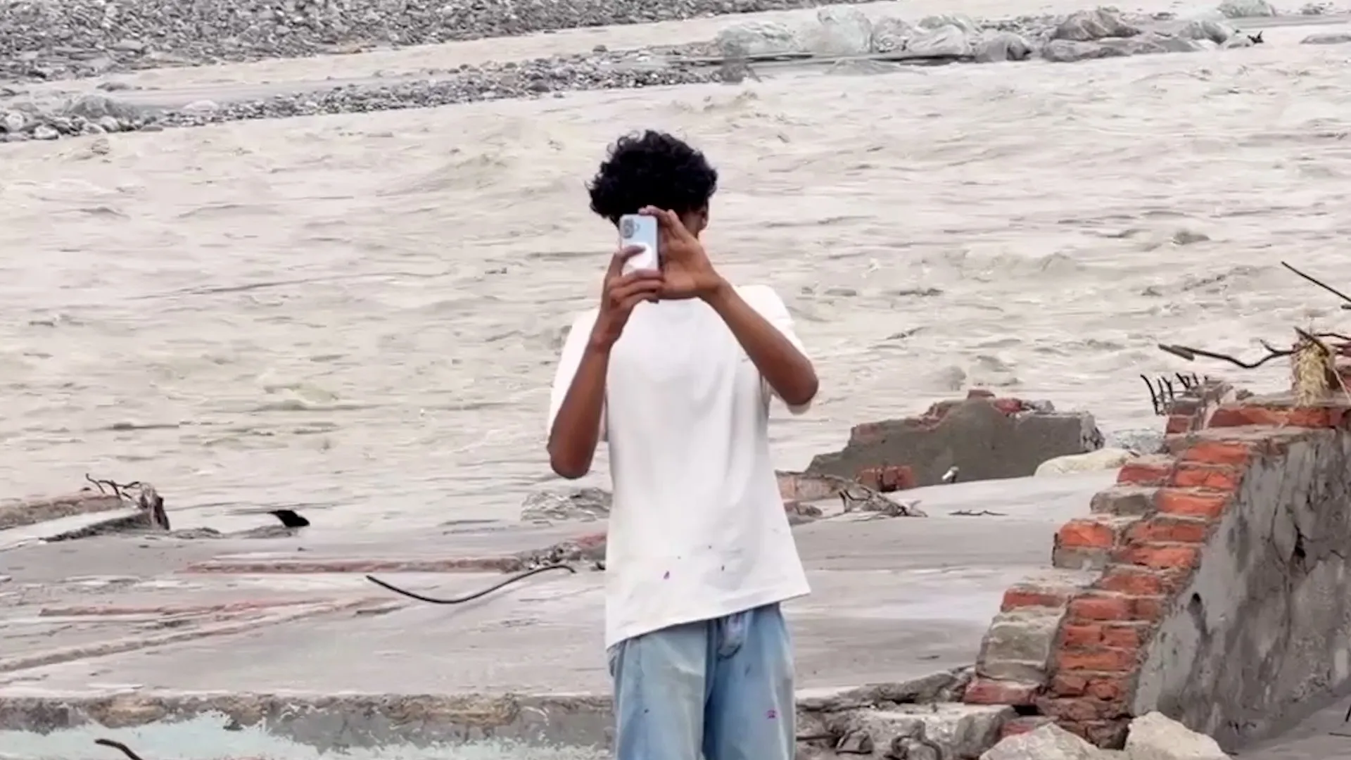
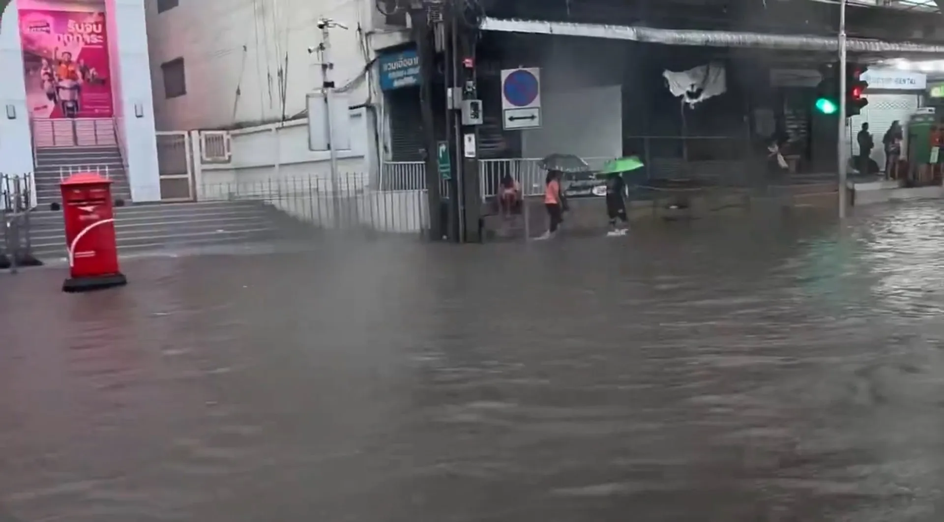
Bangkok has officially been declared a disaster zone after relentless rains triggered widespread flooding in the Thai capital. Up to 300 millimetres of rain fell in some areas overwhelming the city’s canals and drainage system.
Nonstop rain since Thursday has submerged Thai capital’s roads and canals, sending water into many homes and stores.
Published On 26 Sep 202626 Sep 2026
Bangkok authorities have declared a disaster zone across all 50 districts of Thailand’s capital after three consecutive days of rainfall caused heavy flooding.
The disaster designation, which gives local organisations authority to take action, came on Saturday after Governor Chadchart Sittipunt said almost 300mm (11.8 inches) of rain had fallen since Thursday afternoon.
Recommended Stories
list of 4 itemsend of list
The nonstop rain inundated roads and canals with water, sending water into many homes and stores alongside them, according to reports. Photos and videos showed major roads submerged and cars abandoned after drivers were unable to move through the rising water.
Chadchart said the east of the city was most impacted and warned that more rain was forecast again on Saturday. He added that flooding should recede once the rain subsides, as city officials work to drain floodwaters as quickly as possible.
“The rain keeps falling and we are doing our best. We are trying to pump the water out, but the water in canals are full,” he said on social media. “The risk areas are those who live near canals. Every canal is now filled.”
Later on Saturday, the government said the flooding situation had “stabilised” but added it would still take two or three days for the water to drain, as long as the rain held off. “If more rainwater doesn’t fall in the area, it will be solved,” he said.
People walk past abandoned vehicles on a flooded Phetchaburi Road in Bangkok on September 26, 2026 [Lillian Suwanrumpha/AFP]
Chadchart also advised residents to move their cars to higher ground, as Bangkok’s public transport authority offered free access to MRT train “park and ride” carparks to store their vehicles until October 2.
Reporting from a flooded street in Bangkok, Al Jazeera’s Tony Cheng said the Thai capital is no stranger to heavy rain during the monsoon season, but the continuous rainfall had locals worried.
“What usually happens is we get heavy downpours for a couple of hours, then you’ll see the street often flooded but it would flow away into the drains quickly, and it would only happen in isolated areas too,” he said.
“What’s happening here is … happening all across the city. This is not a flash flood; this is persistent heavy rain since Thursday evening, and it shows no sign of letting up.”
Somkid Pheuk-ngam, 67, a vendor who lives near a canal just north of central Bangkok, said she had to close her shop for two days.
“The water keeps coming in. It’s hard to go out now. It’s at my waist level,” she told the AFP news agency. “I cannot go anywhere,” she said, adding that this was “worse than the 2011 flood.”
Widespread flooding across Thailand in 2011 killed more than 500 people and damaged millions of homes.
The Department of Disaster Prevention and Mitigation has warned of low pressure across eastern, northeastern and central Thailand until Sunday, saying there was a risk of flash floods, forest runoff, mudslides and river overflow.
Persistent heavy downpours over a 48-hour period have triggered widespread flooding and severe traffic disruptions in Bangkok, Thailand. Authorities have issued red alerts in the worst affected areas.
Prime Minister Balendra Shah told the UN that world leaders must act on climate change.
Published On 25 Sep 202625 Sep 2026
Nepal’s Prime Minister Balendra Shah has appealed for action to combat the rising threat of climate change, calling the flood that devastated his country last month “a warning to the world”.
Shah made the comments during his address to the 81st Session of the United Nations General Assembly in New York on Thursday night. He told the gathering that the August disaster “was not just a local tragedy”, asking them the question, “Have you really heard that warning?”
Recommended Stories
list of 3 itemsend of list
Political leaders “have been negligent to translate those warnings in action at the speed and scale that the vulnerable people require,” he said.
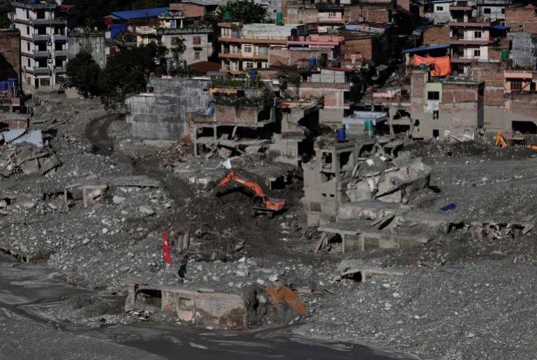
An excavator clears mud from damaged houses following deadly flash floods and a mudslide, in Nuwakot district, Nepal, on September 21, 2026 [Navesh Chitrakar/Reuters]
At least 1,453 people died when a torrent of mud, rock and water struck northern Nepal and the China-Tibet border on August 26, triggered by a glacial collapse.
According to Nepal’s National Disaster Risk Reduction and Management Authority, 5,500 people were still missing and 13,795 had been rescued.
Researchers from the World Weather Attribution (WWA) group said in a report released last week that the disaster was not caused by a single extreme weather event, but rather a “compound crisis” shaped by long-term warming, glacier retreat, permafrost thaw and geological instability.
Shah said climate change was hurting people not responsible for the crisis but who “are paying a colossal price for it”.
He said Nepal contributed less than one-tenth of 1 percent of the heat-trapping gases behind climate change. About 99 percent of the country’s electricity comes from hydropower, and many workers were trapped in tunnels by the flooding.
“Our glaciers are retreating, our mountain slopes are becoming unstable, our rivers are becoming less predictable, and every major disaster threatens to erase years of development,” Shah said.
Nepal Prime Minister Balendra Shah addresses the 81st United Nations General Assembly at UN headquarters in New York City, US, on September 24, 2026 [Eduardo Munoz/Reuters]
Shah urged the international community to help bear the cost of helping Nepal adapt to climate change.
He proposed to create a ‘Himalaya Climate Resilience Mechanism’ which would include Nepal and neighbours India and China, and would allow them to share satellite data and expertise, monitor glacial lakes and strengthen joint early warning systems.
Nepal has asked the UN’s loss and damage fund for $20m in aid, the maximum allowed, but a tiny fraction of what it needs. A preliminary assessment by the government has placed the cost of the disaster at $5bn.
The fund, established in 2022 in the aftermath of catastrophic floods in Pakistan, has yet to make even its first disbursement, and observers see Nepal as a key test of its credibility.
Earlier this week, the United States pledged an additional $31m in new flood recovery support.
Storm is moving northeast of Japan’s eastern coast across the Pacific, leaving a path of destruction behind.
Published On 22 Sep 202622 Sep 2026
A powerful storm has triggered evacuation advisories for more than 1.6 million people, causing widespread travel chaos, flooding and landslides near Tokyo.
On Monday, Typhoon Dujuan packed wind speeds of about 144 kilometres (89 miles) per hour as it moved 130km (80 miles) south of Katsuura, near the Japanese capital, cutting power to thousands of households.
Recommended Stories
list of 3 itemsend of list
Two people have been confirmed dead, Kyodo News reported, citing local authorities.
By early Tuesday, the storm had shifted away from the coast and was heading northeast out to sea towards the Aleutian Islands, with slightly diminished winds, the Japan Meteorological Agency (JMA) said.
In areas where warnings have been issued, “there’s a risk the rain will continue as the typhoon moves north”, the JMA’s Takuya Hosomi said.
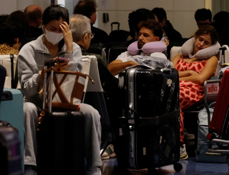
Passengers rest at Haneda Airport in Tokyo, Japan, as many flights are delayed and cancelled because of Typhoon Dujuan on September 21, 2026 [Kim Kyung-Hoon/Reuters]
Passengers were stranded at airports after Japan Airlines cancelled 135 flights and All Nippon Airways scrapped 140 on Monday.
Some rail services were suspended, including bullet train services connecting Tokyo and Osaka, Japan Railways said.
The JMA warned on Sunday that rain and winds were expected to intensify even before the typhoon’s arrival.
“The total rainfall through Tuesday could exceed the average monthly rainfall for September, resulting in record-breaking heavy rain,” the agency said.
Social media posts showed images of flooded roads in front of Kamakura station, a popular sightseeing spot.
“There is flooding in various parts of the city, so travelling by car is dangerous,” Kamakura Mayor Takashi Matsuo said on X.
Floodwaters also inundated parts of Ichikawa, east of Tokyo.
Dujuan forced the early closure of the Tokyo Game Show, one of the world’s biggest video game trade fairs, on Monday, its final day.
The area around a ramen restaurant is flooded by heavy rain as Typhoon Dujuan approaches Oamishirasato, Chiba Prefecture, Japan, on September 21, 2026 [Kyodo/Reuters]
A major outdoor music festival and a baseball match, both scheduled to be held in Chiba, were also cancelled.
Dujuan is Japan’s 25th typhoon this year. The country often sees strong typhoons in the late summer and early autumn.
New Delhi, India – On the morning of August 26, the Himalayan landscape above Nepal’s Rasuwa district changed in minutes.
A mass of ice and rock broke loose high in the mountains and sent a violent surge of water, mud and debris down the Lhende Khola River. The torrent travelled through valleys, swept away settlements and infrastructure and eventually reached the Nepal-China border.
What followed was not simply a flood.
It was a chain reaction.
By mid-September, more than 1,400 people had been reported dead and at least 6,000 remained missing in Nepal and across the border in Tibet. Twelve hydropower plants were destroyed, while roads, bridges and homes were buried or washed away.
The scale of the destruction has left scientists and disaster managers confronting a difficult question: How do you warn communities about a disaster whose trigger may occur high above them, in terrain that is difficult to monitor and where there may be only minutes to react?
Basanta Raj Adhikari, director of the Centre for Disaster Studies at Tribhuvan University in Kathmandu, described the event to Al Jazeera as unprecedented in size, affected area and mechanism. His estimate suggested that the energy involved was greater than that released by the Hiroshima atomic bomb, a comparison intended to illustrate the scale of the physical forces involved rather than suggest that the event was equivalent to a nuclear explosion.
For scientists who study the Himalayas, the disaster demonstrated how quickly an event originating in a remote, high-altitude environment can become a regional catastrophe.
And Nepal is not alone.
The warning problem
A warming climate is altering glaciers, snow cover, permafrost and high-altitude lakes. At the same time, roads, hydropower projects, tourist facilities and settlements have pushed deeper into mountain valleys.
That combination is creating a new risk landscape in which one hazard can trigger another.
An avalanche can block a river. A blocked river can form a temporary lake. A sudden release can become a debris flow. That debris can destroy a road or bridge, block another river and create another flood downstream.
The August disaster in Nepal showed how quickly such a sequence can unfold. It also exposed a weakness in the way early-warning systems are often designed.
Many systems are built around a particular hazard: rainfall, river level or glacial lake outburst flood. But the Himalayas do not always respect those categories.
In July, the International Centre for Integrated Mountain Development, or ICIMOD, warned that a below-normal monsoon should not be interpreted as a safer one.
“The biggest misunderstanding is that less seasonal rainfall means lower flood risk,” said Saswata Sanyal, a disaster risk reduction specialist at ICIMOD.
“A drier monsoon can still be a dangerous monsoon,” he added, warning that seasonal averages cannot capture the cloudbursts capable of producing catastrophic flooding in mountain valleys.
The Nepal disaster went a step further.
The immediate trigger was not simply heavy rainfall.
Scientists have been examining an ice-rock avalanche and other possible processes that temporarily obstructed the river system before releasing a destructive surge. ICIMOD has described the event as an ice avalanche rather than a conventional glacial lake outburst flood, while other scientists have examined the role of local seismic activity and other high-altitude processes.
That distinction matters.
A warning system waiting for rainfall or a rising river may not provide enough time when the real trigger happens several kilometres upstream and above the line of sight of the communities below.
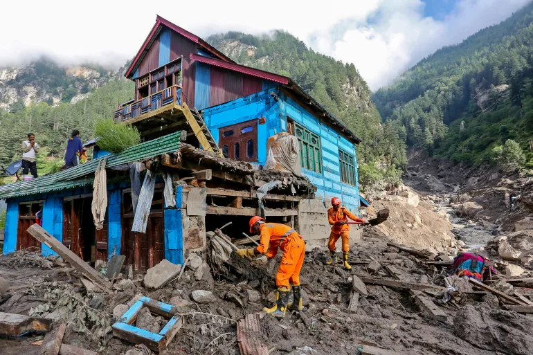
Indian National Disaster Response Force (NDRF) personnel conduct a search and rescue operation at the site of a flash flood at a village in the Kishtwar district of Indian-administered Kashmir on August 16, 2025 [AFP]
Kashmir’s warning signs
Thousands of kilometres away, scientists studying Kashmir’s Himalayas are seeing another part of the same problem.
A study published in the Journal of Glaciology this year mapped 155 glacial lakes above 2,500 metres (8,200ft) across the Himalayas in Indian-administered Kashmir.
The researchers found that the area of ice-contact proglacial lakes – bodies of water that form directly against the margin of a melting glacier, trapped by moraine ridges, bedrock basins, or ice dams – had increased by 26 percent between 1992 and 2024.
Five lakes were classified as having very high susceptibility to glacial lake outburst floods.
An outburst from those lakes, the researchers found, could threaten several thousand buildings, 15 major bridges, roads and a hydropower project.
More significantly, the study warned that hazards could occur in chains, with an upstream lake outburst potentially triggering secondary events downstream.
For Irfan Rashid, a glaciologist and associate professor at the University of Kashmir who co-authored the study, the implications extend beyond individual lakes.
Rashid recently told Al Jazeera that without action, the melting, thinning, and destabilisation of glaciers, seasonal snow cover, and permafrost along the Hindu Kush-Himalayas system would increase, and water shortages could become a major problem across the Upper Indus, Ganga and Brahmaputra basins by the end of the century.
That is why the Nepal disaster resonates in Kashmir.
The landscapes are different, the rivers are different and the individual hazards may differ. But the underlying problem is increasingly similar: Communities living downstream of a rapidly changing high-altitude environment may have little time to respond when something breaks loose above them.
The challenge is particularly acute in places where roads, bridges and hydropower projects occupy narrow valleys.
Once a mountain river begins carrying enormous quantities of rock, ice and mud, infrastructure designed for conventional floods can quickly become irrelevant.
Volunteers rescue flood-affected victims along with their livestock using a boat following heavy rains and overflowing of the Sutlej River, on the outskirts of Multan in Punjab province, Pakistan, on September 4, 2025 [Shahid Saeed Mirza/AFP]
Pakistan has already begun building a warning network
The same concern runs across the western Himalayas and Karakoram ranges.
The Gilgit-Baltistan region in Pakistan-administered Kashmir contains hundreds of glaciers and glacial lakes, while communities and infrastructure sit along valleys exposed to sudden floods and landslides.
Pakistan has responded by expanding early-warning infrastructure.
Under a United Nations-supported programme, early-warning systems, evacuation shelters, disaster-management centres and other protective measures have been established in vulnerable valleys.
But technology alone cannot solve the problem. A sensor can detect a change. Someone still has to receive the message. Someone has to understand what it means. And people downstream have to have a route to safety.
That last part is often the weakest link. A siren is useful only if the people hearing it know where to go. An automatic warning is useful only if it arrives before the flood. A satellite image is useful only if the information can be converted into a decision quickly enough to save lives.
This is why disaster scientists increasingly talk about anticipatory action rather than simply disaster response.
“The era of preparing for a single, predictable hazard is over,” Sanyal said earlier this year. “Anticipatory action and early warning must now be the foundation.”
Nepal army soldiers work during a search and rescue operation outside a tunnel near a hydropower project site, following deadly flash floods and mudslides, in Rasuwa district, Nepal, on September 1, 2026 [Reuters]
The infrastructure trap
The Himalayas are also becoming more heavily engineered.
Hydropower is central to Nepal’s economy. Roads are being expanded. Border crossings are growing in importance. Tourism is pushing deeper into remote valleys.
The benefits are obvious. So are the risks.
The August disaster struck an area where hydropower infrastructure was concentrated along the river corridor. At least 900 workers were believed to have been inside tunnels and other facilities in the aftermath, making rescue operations extraordinarily difficult. Two workers were eventually pulled alive from a hydropower tunnel nine days after the disaster.
The question is no longer simply whether infrastructure can withstand a flood. It is whether planners have adequately considered what happens when a flood is carrying an enormous mass of rock and ice, when a river changes course, or when one mountain hazard triggers another.
For decades, engineering risk assessments have often relied on historical records. But history becomes a less reliable guide when the physical conditions producing disasters are changing.
A river that flooded once every several decades may no longer behave according to the same pattern. A glacier that appeared stable from satellite imagery may sit beneath an increasingly unstable slope. A lake that was considered remote may suddenly become a threat to a road, village or power plant hundreds of metres below.
Relatives of victims and missing people react outside the morgue of the Tribhuvan University Teaching Hospital (TUTH), in Kathmandu, Nepal, August 29, 2026 [Narendra Shreshtha/EPA]
The border problem
There is another complication that no satellite can solve on its own.
Borders.
The Himalayas are divided among countries with different political systems, security concerns and approaches to sharing information. But rivers do not stop at international boundaries. Neither do floods.
The August disaster reached the Nepal-China border and damaged the Gyirong crossing, an important trade and pilgrimage route. The disaster also raised questions about how quickly information about hazards in high mountain areas can move between countries.
This is where regional cooperation becomes more than a diplomatic slogan, experts say. A sensor positioned in one country can provide warning to people in another. A satellite image collected over one mountain range can reveal a developing hazard that threatens a valley downstream. A river gauge can provide critical information before floodwaters reach a settlement.
The technical capability already exists in many cases. The missing piece is often the architecture connecting it.
A 2026 assessment of Himalayan disaster risks has argued for stronger monitoring, early-warning systems and regional coordination because hazards are increasingly interconnected.
The idea is simple: Information about a mountain hazard should not stop at the same line where a political boundary begins.
Buildings are inundated after flash floods triggered by sudden heavy rainfall swamped Rangpo town in Sikkim, India, Friday, October 6, 2023 [Prakash Adhikari/AP Photo]
From Nepal to Sikkim to Kashmir
The August disaster in Nepal isn’t a tragedy belonging to one country, point out experts.
The Kashmir Himalayas study has already identified lakes capable of producing destructive outburst floods and has warned of cascading processes.
Northeast India’s Sikkim provides another example.
Today, 40 high-risk glacial lakes have been identified in Sikkim, including 16 placed in the highest-risk category, with authorities working on drainage, flood-retention and other protective measures.
But the lesson from each disaster is broadly the same: Waiting for a disaster to prove the risk is the most expensive form of preparedness.
The world’s second largest mountain, the 8,611-metre- (28,251ft-) high K2 (seen in the distance), and the 8,051-meter- (26.414ft-) high Broad Peak (R), are illuminated by the moon at Concordia, the confluence of the Baltoro and Godwin-Austen glaciers, in the Karakoram mountain range in Pakistan, September 7, 2014 [Wolfgang Rattay/Reuters]
The Third Pole test
The Himalayas are sometimes called the Third Pole because they contain one of the world’s largest concentrations of snow and ice outside the Arctic and Antarctic.
Major Asian rivers depend on water originating in these mountains. Hundreds of millions of people live downstream.
That makes the changing Himalayas not only an environmental issue but a security, infrastructure and humanitarian one.
The August disaster demonstrated the most frightening version of that future. A mountain can collapse without warning. A river can become a weapon of debris. A hydropower tunnel can become a trap. A border crossing can disappear in minutes. And by the time people downstream understand what is happening, the water may already be there.
It’s a future that a region stretching from northeast India, spanning Tibet, Nepal, Kashmir and Pakistan, can no longer ignore. Yet disaster management remains largely divided by national boundaries. That contradiction is becoming harder to navigate.
The next glacial collapse could begin in Kashmir. It could begin in Pakistan’s high mountains. It could begin in Sikkim, Nepal or Tibet.
Wherever it starts, the same question will follow the mountain downstream: Who knew, how early did they know, and did the warning reach the people in time?
For a region entering an era of increasingly complex mountain hazards, that may be the real measure of whether the Third Pole is prepared.
‘Aid influencers’ are being accused of exploiting Nepal flood victims to boost social media followers, as organisations explore new ways to raise awareness and funds for relief efforts. Al Jazeera’s Nicolas Haque reports.
Recurring floods disrupt daily life in Tunis, raising questions about drainage, transport and flood preparedness.
Published On 18 Sep 202618 Sep 2026
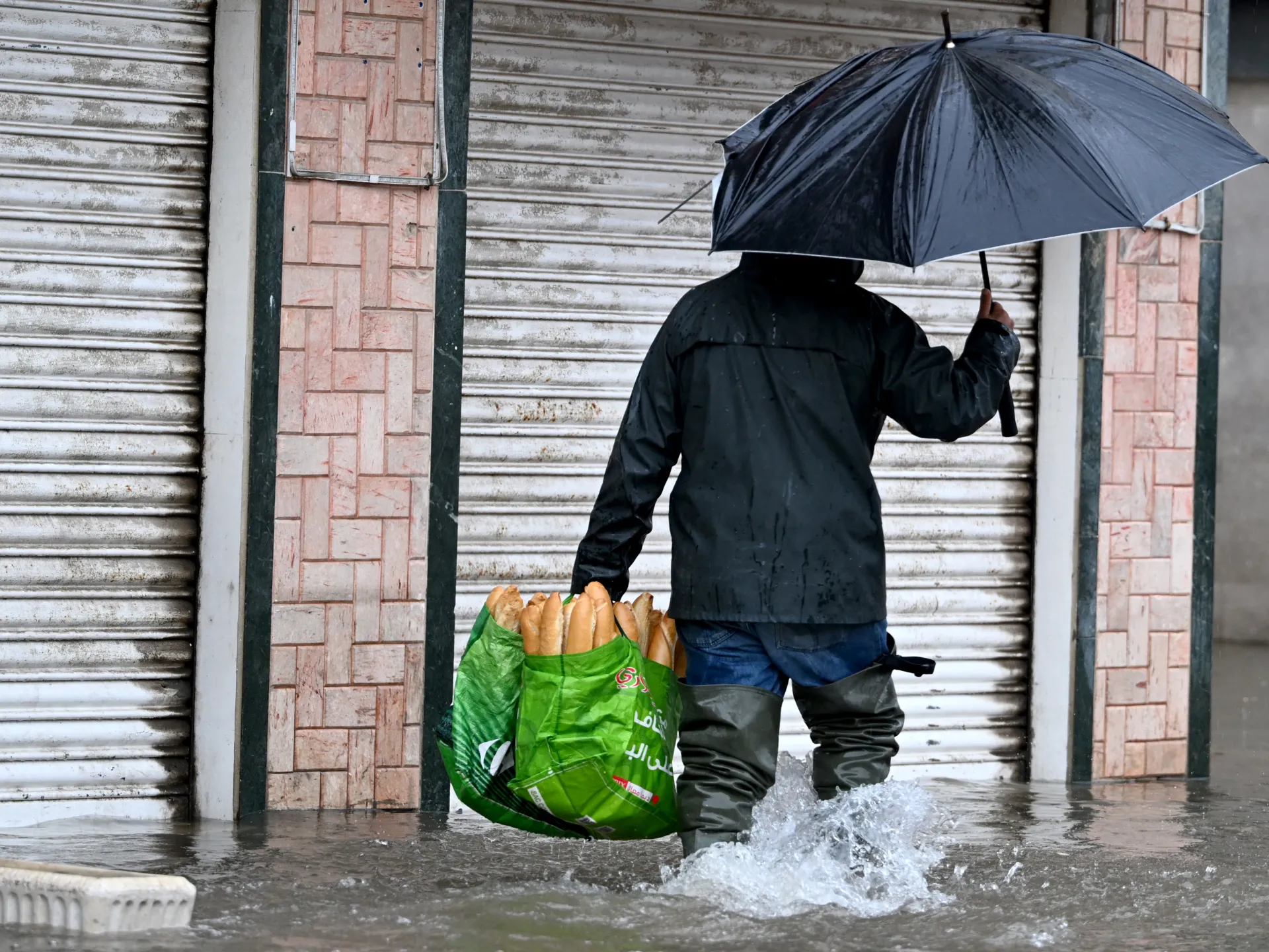
Tunis, Tunisia – Heavy rain brought parts of Tunisia’s capital to a standstill on Thursday, flooding roads and homes, trapping people in cars and disrupting electricity and internet services.
Home to nearly three million people, the Greater Tunis region has faced repeated flooding in recent years. Thursday’s flooding came only months after severe January rains caused widespread disruption across the capital and other parts of the country, leaving several people dead and causing significant damage.
Weather warnings had been issued in advance, but the decision to suspend classes in Tunis was announced only shortly before it took effect. Parents rushed to schools to collect their children as the rain intensified and traffic backed up across the capital.
Videos shared online showed flooded streets, cars stranded in rising water and what appeared to be power lines catching fire. Residents also reported power and internet cuts and water entering homes.
‘The road became almost unrecognisable’
Fatma, a 35-year-old employee in Tunis, said the situation deteriorated quickly as she struggled to get home safely.
“At about 4pm, the road became almost unrecognisable. The tunnel leading to Bab Saadoun was completely closed because of the rain,” she told Al Jazeera.
“Most people were stranded by the roadside for hours, waiting for public transport that never came. I saw three cars that filled with water and broke down, and people carrying their children on their shoulders.”
“Every season, the same thing happens. Roads close and traffic comes to a complete standstill. All the drains start overflowing with waste,” she said.
The National Institute of Meteorology had warned of locally heavy thunderstorms on Thursday, including heavy rain over short periods that could cause flooding, disrupt traffic and overwhelm drainage networks. It also warned of potential power cuts.
Residents question flood preparedness
“Tunisia has become used to these disasters. Every year, we end up flooded even when there is little rain,” said Intissar, 33, from the Lafayette area of Tunis.
She blamed local authorities for failing to carry out preventive work before the rainy season.
“This is work that should have been done during the summer,” she said.
But she also acknowledged the role of residents.
“We cannot deny the responsibility of citizens who dump waste that blocks drainage channels,” she said.
At a government meeting in August, officials called for drainage networks and waterways to be cleaned and flood-protection work to be accelerated. The government said 29 flood-protection projects were under way across the country.
The flooding comes as Tunisia prepares for a national march in Tunis on Saturday, with organisers calling for the release of four activists detained in connection with the Al-Soumoud Flotilla. The march is scheduled for 5pm, as rain is forecast to continue through Saturday.
A struggle to get home
Fatma said the lack of reliable public transport, combined with repeated flooding, was making it increasingly difficult for people to manage without cars.
“The problem makes people look for their own solutions. That is why most people are trying to find a way to buy a car, because it has become difficult to live without one with these recurring problems,” she said.
The flooding also came as students returned to schools and universities this week, adding pressure to roads and public transport.
For Fatma, the disruption is becoming a familiar pattern.
“This shows that the state has no vision. It is caught off-guard just like citizens are,” she said.
Native authorities issue condolences after two adults and a child swept away by floodwaters in southwestern US state.
Published On 17 Sep 202617 Sep 2026
Indigenous authorities in the United States have said that three people have been killed in flooding in the southwestern state of New Mexico, where heavy rains left roadways blocked by water.
Navajo Nation President Buu Nygren said on Wednesday that police had responded to reports of people being swept away by floodwater at 12:30am (06:30 GMT) near the community of Newcomb in northwestern New Mexico.
Recommended Stories
list of 3 itemsend of list
Nygren said that two adults and a child were killed in the incident and offered condolences to the community, while advising residents to exercise caution in areas impacted by rainfall.
“There are no words that can ease the pain of losing a loved one so suddenly, and our hearts are especially heavy knowing that three lives were lost,” Nygren said. “To the family, relatives, and loved ones who are grieving today, we offer our deepest condolences. We pray that you are surrounded by strength, comfort, and the love of your family and community in the difficult days ahead.”
The National Weather Service (NWS) in Albuquerque, New Mexico, issued a special briefing on Tuesday warning of the possibility of widespread thunderstorms in the coming days. The service repeated those warnings on Wednesday, noting that moisture levels are expected to be at record levels for mid-September.
“A Flash Flood Watch is in effect for the western third of New Mexico and the South Central Mountains today,” NWS Albuquerque said in a social media post on Wednesday. “However, flash flooding could occur anywhere in central and northern New Mexico today.”
Heavy rainfall is predicted across parts of Arizona, New Mexico, Colorado and Utah through Thursday. Flash flood warnings were issued for parts of northwestern New Mexico, along with flash flood watches for large areas of central and northern Arizona.
The deaths on Wednesday come several weeks after three hikers were swept away and dozens were rescued after heavy rainfall caused flooding at the Grand Canyon, a popular destination for tourists and outdoor recreation in Arizona.





![People watch the ocean as a nor'easter storm hits Rye, New Hampshire, US on Sunday, September 27, 2026 [Caleb Jones/AP Photo]](https://i0.wp.com/occasionaldigest.com/wp-content/uploads/2026/09/AP26270677753401-1790545375.jpg?w=640&ssl=1)



![An excavator clears mud from damaged houses following deadly flash floods and a mudslide, in Nuwakot district, Nepal, September 21, 2026 [Navesh Chitrakar/Reuters]](https://i0.wp.com/occasionaldigest.com/wp-content/uploads/2026/09/2026-09-25T021410Z_709369844_RC2ENNAUM1TN_RTRMADP_3_NEPAL-FLOODS-BALEN-UN-1790312192.jpg?w=640&ssl=1)
![Nepal Prime Minister Balendra Shah addresses the 81st United Nations General Assembly at UN headquarters in New York City, US, September 24, 2026 [Eduardo Munoz/Reuters]](https://i0.wp.com/occasionaldigest.com/wp-content/uploads/2026/09/2026-09-25T002524Z_1559668133_RC20QNACRCWK_RTRMADP_3_UN-ASSEMBLY-1790312740.jpg?w=640&ssl=1)


![Indian National Disaster Response Force (NDRF) personnel conduct a search and rescue operation at the site of a flash flood at a village in the Kishtwar district of Indian-administered Kashmir on August 16, 2025 [AFP]](https://i0.wp.com/occasionaldigest.com/wp-content/uploads/2026/09/afp_68aac36f5150-1756021615.jpg?w=640&ssl=1)