The fast-spreading Norte Fire in Orange County is fuelled by intense warm winds and unseasonably high temperatures.
Published On 17 Oct 202617 Oct 2026
A fast-spreading wildfire in Orange County, in Southern California, has engulfed several coastal properties and prompted widespread evacuation orders.
The Orange County Fire Authority said on Friday that the Norte Fire had scorched about 188 hectares (465 acres), with the state’s Cal Fire agency putting it at about 231 hectares (570 acres) by the evening, and that at least six homes had been damaged or destroyed in the San Juan Capistrano area.
Recommended Stories
list of 3 itemsend of list
The fire authority said firefighters were “aggressively attacking the fire from the ground and air” and issued pleas for people to stay clear of the area.
Unseasonably high temperatures and low humidity are fuelling the rapid growth of the fire, the AFP news agency reported.
The Norte Fire started in the coastal city of San Clemente on Friday and moved to the city of San Juan Capistrano, with some 6,000 homes and 16,000 residents under evacuation orders by the evening. An evacuation shelter has opened in each city while helicopters attempt to douse the flames.
Intense warm winds
The Norte Fire is one of several in the region driven by Santa Ana winds, intense warm gusts that blow from the southwest US interior towards the California coast.
The Santa Ana winds typically arrive in the autumn, right when Southern California’s vegetation is at its driest after a long, rainless summer, according to The Weather Channel.
Forecasters said winds blew at between 55km/h and 90km/h (35mph and 55mph) within coastal areas.
The strongest winds were expected through Friday, but the high heat and low humidity conditions that contribute to the growth of the fire are expected to last through Saturday night.
Tens of thousands of people in Los Angeles County were left without power as authorities attempted to lessen the possibility of electrical sparks that the heavy wind gusts could carry.
Other ongoing fires
California firefighters were also busy battling the Bryson Fire, which broke out on the outskirts of the Malibu beach community in Los Angeles County on Thursday. As of Friday, the fire had burned about 59 hectares (147 acres) and was 17 percent contained, according to Cal Fire.
The Henderson Fire was 20 percent contained and had burned 842 hectares (2,080 acres) in San Diego County by Friday, Cal Fire said. The blaze impacted Marine Corps Base Camp Pendleton and prompted freeway closures.
Data show a 42 percent drop in forest clearance from a year earlier, giving Lula a boost before the election run-off.
Published On 17 Oct 202617 Oct 2026
Deforestation in Brazil’s Amazon rainforest has fallen to its lowest level since records began in 1988, according to official figures that give a boost to President Luiz Inacio Lula da Silva days before a presidential run-off.
Brazil’s space research agency, Inpe, said on Friday that 3,335 square kilometres (1,288 square miles) of forest were cleared in the 12 months through July, about 42 percent less than the year before.
Recommended Stories
list of 3 itemsend of list
The previous record low was 4,571 sq km (1,765 sq miles) in 2011-12, while annual losses peaked at nearly 30,000 sq km (nearly 11,600 sq miles) in the mid-1990s, according to Inpe’s Prodes satellite programme, which measures from August to July because cloud cover is lower in mid-year.
“It’s an absolutely stratospheric drop…it’s like a dream,” Environment Minister Joao Paulo Capobianco said at a news conference in Brasilia.
Marcio Astrini of the climate advocacy group Observatorio do Clima called the figures “a historic achievement” and said they show that “with political will, it is possible to curb deforestation and greenhouse gas emissions”.
President Lula wrote on X: “Our goal is to achieve zero illegal deforestation by 2030.”
Lula took office in 2023 pledging to end illegal deforestation by 2030, after clearing soared to a 15-year high under his far-right predecessor, Jair Bolsonaro. The Amazon lost about 11,600 sq km (about 4,480 sq miles) a year on average during Bolsonaro’s 2019-2022 term, almost 60 percent more than in the previous four years.
Deforestation has fallen every year since 2022 and is down 71.2 percent over four years. The AFP news agency attributes the drop to greater monitoring and stiffer penalties for illegal logging.
Lula faces Bolsonaro’s eldest son, Senator Flavio Bolsonaro, in the election run-off on October 25, with polls showing them neck and neck.
Flavio pledged in his manifesto to strengthen environmental oversight in the Amazon, focus enforcement on organised crime rather than extractive workers and small farmers, and end “illegal deforestation” by 2029.
He has also praised his father, who is serving a 27-year sentence under house arrest for coup plotting, for opposing what he calls a “radical environmental agenda”.
Deforestation in the Cerrado savanna, south of the Amazon, also fell by about 24 percent, to 5,517 sq km (2,130 sq miles), the lowest since records began in 2001.
Move comes as haze from Indonesian fires makes Singapore and Kuala Lumpur the world’s most polluted cities.
Published On 13 Oct 202613 Oct 2026
Firefly, a Malaysian low-cost airline, has extended the suspension of its flights between Kuala Lumpur and Singapore through Wednesday as smoke from fires in Indonesia continued to blanket the region.
The announcement came as IQAir, an air quality monitor, ranked Singapore and the Malaysian capital Kuala Lumpur as the world’s two most polluted cities on Tuesday.
Recommended Stories
list of 2 itemsend of list
Firefly said in a statement that flights between the Sultan Abdul Aziz Shah Airport (SZB) near Kuala Lumpur and the Seletar Airport in Singapore (XSP) have been cancelled up to Wednesday due to “weather and haze conditions”.
It called the action a “proactive safety measure”.
The fires, mostly on the Indonesian islands of Sumatra and Borneo, are the country’s most intense in 11 years. They have been spurred by El Nino, a weather pattern expected to be among the strongest in four decades.
IQAir, a Swiss air quality monitoring company, said Air Quality Index in Singapore stood at 199 on Tuesday and 183 in Kuala Lumpur. Readings above 150 are generally considered unhealthy, and those above 300 are classified as hazardous.
Firefly, a subsidiary of Malaysia Aviation Group, which includes Malaysia Airlines, first announced the flight cancellations on October 10, citing “low visibility” due to the haze conditions.
Firefly said that affected passengers were being rebooked on Malaysia Airlines flights between Kuala Lumpur International Airport and Singapore’s Changi Airport, subject to seat availability.
The Singapore government has reintroduced subsidised care for haze-related illnesses, as it last did in 2015, when smoke from Indonesian fires hung over the region for weeks.
In Malaysia, schools reopened in most states on Tuesday as air quality improved slightly, but they remain closed in three states, one federal territory and several districts.
Malaysia’s foreign minister, Mohamad Hasan, said on Monday that he would press for stronger regional mechanisms when foreign ministers of the Association of Southeast Asian Nations (ASEAN) meet next month.
“We already have an ASEAN mechanism for natural disasters, but haze is not included or classified as a natural disaster,” he told reporters in Sepang, according to Bernama, Malaysia’s state news agency.
The Philippines, which chairs the bloc this year, confirmed that the issue would be on the agenda.
“It’s in the agenda,” Dominic Xavier Imperial, a spokesman for the Philippine Department of Foreign Affairs, said of the November meeting, which will precede the 49th ASEAN summit in Manila.
Mohamad, the Malaysian minister, said Indonesia had deployed about 60,000 personnel to fight the fires, but thick smoke had grounded 34 aircraft, including planes and helicopters.
Remote terrain and limited water supplies have also hindered the effort, he said, and cloud seeding is not possible without suitable rain clouds. He acknowledged Indonesia’s efforts but urged more effective action, citing the toll on Malaysian communities.
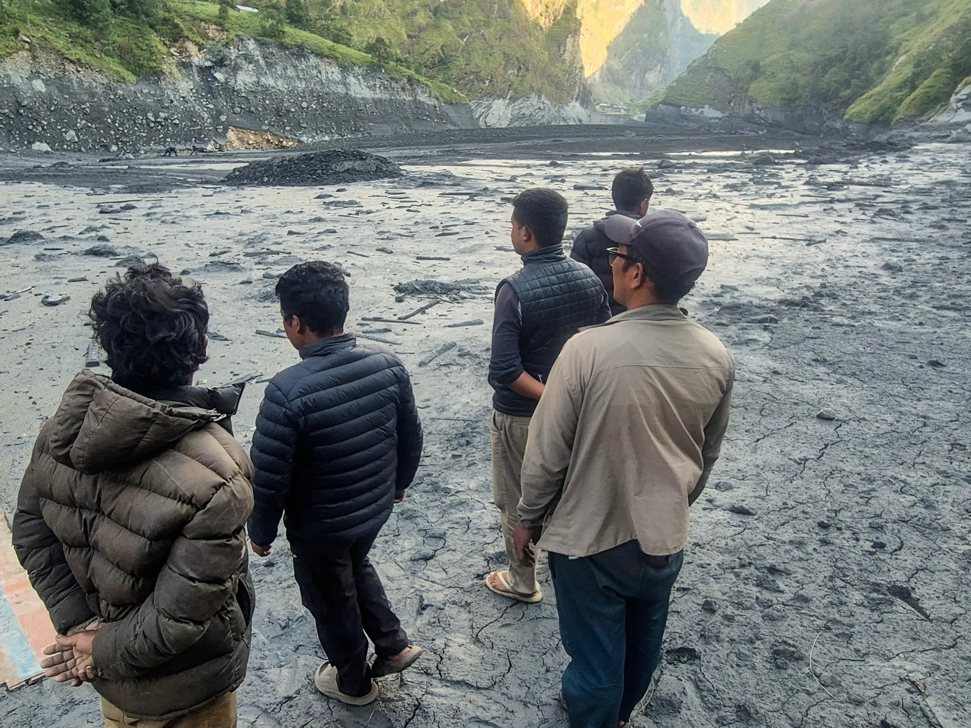
Rescue operation underway after flash floods swept away home, bridges and parts of the Manaslu trekking trail.
Published On 13 Oct 202613 Oct 2026
More than 100 foreign trekkers have been stranded in central Nepal, according to a local official, a day after flash floods in the Gorkha district washed away bridges, hiking trails and hundreds of homes.
Bhuwan Raj Ojha, an official of the Manaslu Conservation Area Project, told the Reuters news agency on Monday that the trekkers were stranded in different areas of the popular Manaslu trekking trail because part of the route had been swept away.
Recommended Stories
list of 3 itemsend of list
“Those hikers who want to return because of the flood need to be rescued. Those who want to continue their trekking can do so from locations that are safe,” he told Reuters from Gorkha.
“There are restaurants and tea houses along the route. They are safe”.
The flash floods hit on Sunday, when a predawn landslide blocked the Budhi Gandaki River in the Gorkha district, about 100km (62 miles) west of the Nepalese capital, Kathmandu.
Authorities rescued 321 people, including 12 foreigners, on Monday, and the army said the rescue operation would continue on Tuesday, even as the water level in the river receded.
The river is a tributary of the Trishuli River, downstream from another tributary where a glacier collapse caused a catastrophic flood in August that killed 1,457 people, with thousands still missing.
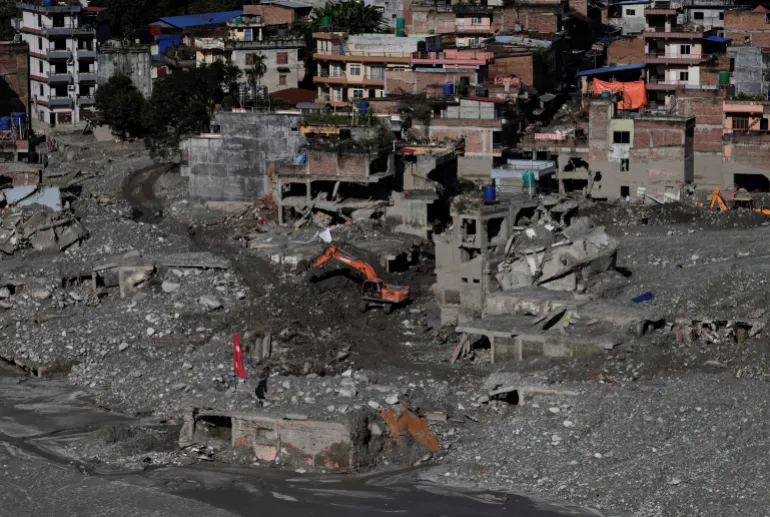
There were no reports of deaths in the latest flood, but five villagers were out of contact after black muddy sludge and debris washed away more than 200 homes and damaged infrastructure, including three hydroelectric plants, national disaster authorities said.
Md Shahadat Hossain, a Bangladeshi trekker stranded in Jagat village, told the Anadolu news agency that nine Bangladeshis were waiting for a possible evacuation by helicopter.
“We have been stranded in Jagat since yesterday. A flash flood came down from above the village and flowed through its lower part,” he said.
“We are safe, but there has been no electricity since yesterday, communication with the outside world has been disrupted, and food supplies are gradually running short,” he added.
Gorkha district authorities have asked villagers living along the riverbanks downstream to evacuate.
National disaster authorities had also alerted people living along the river in the Gorkha, Tanahun, Chitwan, East Nawalparasi and West Nawalparasi districts about the flood.
Prime Minister Mark Carney’s Thanksgiving message comes a week ahead of Alberta’s vote on a separatism referendum.
Published On 12 Oct 202612 Oct 2026
Prime Minister Mark Carney has used his Thanksgiving message to Canadians to call for national unity, a week before the oil-rich province of Alberta is set to vote on a proposal to secede from Canada.
“We can’t build big things on fault lines,” Carney said in his video message on Monday, warning that Canada faces threats to its economy, security and way of life.
Recommended Stories
list of 3 itemsend of list
“We have to be strong, and we are stronger together.”
His comments come as Albertans head to the polls on October 19 to decide whether to begin the process of seeking independence. The initial referendum is non-binding, but it proposes to hold a binding vote in the future to decide whether Alberta should secede.
The question facing voters is: “Should Alberta remain a province of Canada, or should the Government of Alberta commence the legal process required under the Canadian Constitution to hold a binding provincial referendum on whether or not Alberta should separate from Canada?”
The vote follows a growing push by a vocal group of separatists, fuelled by longstanding grievances over federal energy and environmental policies.
The secessionist movement has accused the Canadian government of unfairly targeting Alberta’s oil and gas industry, the cornerstone of the province’s economy.
The movement is also being watched south of the border, as Canada’s relationship with the United States under President Donald Trump has become strained.
An investigation by The Globe and Mail earlier this month revealed that US Republican operatives met with secession organisers in Alberta to talk about campaign strategies. Separatist leaders had reportedly offered access to the province’s water and oil royalties in exchange for US support for independence. Separatist leaders have disputed those claims.
Carney’s comments also come after another secessionist movement, the Parti Quebecois, won the most seats in a provincial election in Quebec last week, allowing it to return to power after more than a decade.
The Parti Quebecois, however, only won 59 seats out of a total of 129 in Quebec’s National Assembly, leaving it short of a majority government.
Still, following that victory, US tech entrepreneur Elon Musk, considered the richest man on the planet, applauded the results. He has been known to use his wealth and influence to support political causes, particularly on the far right.
“Good. Quebec should separate,” Musk wrote on social media. “They would be better off. Alberta and Saskatchewan should separate too.”
Carney, who grew up in Alberta, said he was filming the message from a classroom at his former school, St Francis Xavier High School in Edmonton.
“I’m back home a lot these days because we are building big things again in Alberta: thousands of new homes, high-speed rail, a new pipeline to the West Coast that will create lasting opportunity and prosperity for hundreds of thousands of people in this province and across the country,” he said.
Despite the secessionist movement’s growing visibility, polls suggest most Albertans oppose independence.
The Mexican community of Cabo Corrientes faces the risk of a direct hit as the Category 4 storm churns off Jalisco.
By Reuters and The Associated Press
Published On 11 Oct 202611 Oct 2026
Mexican President Claudia Sheinbaum has urged residents along the Pacific Ocean to stay indoors as Hurricane Simon’s powerful winds and heavy rains pound coastal communities.
As of Sunday, the hurricane’s eye was moving offshore of Mexico’s Jalisco state, with winds of at least 240km/h (150mph).
Recommended Stories
list of 4 itemsend of list
Torrential rain has already battered residents living between the Sierra Madre mountain range and the ocean. Communities in hilly and mountainous areas have been warned to brace for mudslides.
Simon reached Category 4 strength, on a scale of five, on Saturday, as part of an unusually active Pacific hurricane season.
“With the approaching impact of Category 4 Hurricane Simon, we urge residents of coastal municipalities in Jalisco, Colima, Nayarit and Michoacan to remain sheltered until authorities officially declare that the danger has passed,” Sheinbaum wrote in a post on the social media platform X on Sunday.
In a midday advisory, the United States’ National Hurricane Center (NHC) warned that Simon could produce “additional rainfall totals of 8 to 16 inches (20 to 41 cm) over portions of southwestern Mexico”.
Precipitation totals as high as 76 cm (30 inches) were possible in areas of Michoacan, Colima, and Jalisco until Monday.
It’s not clear whether the storm will make landfall. But the greatest risk of a direct hit lies at the moment with Cabo Corrientes, a town that sits on a cape in Jalisco, jutting into the Pacific Ocean.
A man boards up a shop as Hurricane Simon approaches Puerto Vallarta, Mexico, on October 10 [Fernando Llano/AP]
Mexico’s National Civil Protection Coordination (CNPC) placed 28 municipalities in Jalisco and Colima under its highest cyclone alert level, while another 93 municipalities were under a high alert level, according to civil protection bulletins.
Classes were suspended in the affected areas, and efforts to evacuate residents were under way.
Businesses in popular tourist destinations like Puerto Vallarta boarded up windows and placed sandbags at entrances as the storm approached.
Jalisco’s Governor Pablo Navarro warned that the high-powered hurricane was creating “high-risk marine conditions” along the coast of his state, with waves reaching as high as eight metres (26 feet).
On Sunday, he also shared video on social media of the storm surge crashing onto sidewalks and flooding waterways.
“Here is the current state of Jalisco’s beaches this morning — from Barra de Navidad to Puerto Vallarta — as Hurricane Simon passes through,” he wrote in the video’s caption.
“I ask everyone to heed official instructions, take precautions and avoid putting themselves at risk. The safety of Jalisco’s families is the top priority.”
Storm damage stretches across Florida and Alabama as officials warn of continued flooding and possible tornadoes.
Published On 10 Oct 202610 Oct 2026
Hurricane Isaias, the first hurricane of the 2026 Atlantic season, has killed two people and left hundreds of thousands of customers without power across the southeastern United States.
The storm made landfall near Destin, Florida, on Friday evening as a Category 2 hurricane before weakening as it moved inland through Alabama overnight.
Recommended Stories
list of 3 itemsend of list
One person died in Birmingham, Alabama, when a tree fell on a house overnight, according to local emergency officials. A second person was killed in Escambia County, Florida, after a tree fell during the storm, according to local authorities.
Florida Governor Ron DeSantis said on Saturday that state officials had not confirmed any storm-related fatalities, including the report from Escambia County.
Isaias hit land with sustained winds of 169km/h (105mph), bringing powerful gusts and heavy rain to the Florida Panhandle. By Saturday morning, the storm had weakened to a post-tropical cyclone with wind speeds of about 55km/h (35mph).
Relaxing in a hotel lobby in Pensacola, Florida during a power outage ahead of the arrival of Hurricane Isaias, October 9, 2026 [Marco Bello/Reuters]
More than 900,000 electricity customers in Florida, Alabama and Georgia were without power early Saturday morning. That number has since gone down to under 800,000, according to PowerOutage.us.
Fallen trees and downed power lines caused widespread disruption, while flooding forced road closures in parts of southern Alabama, including Houston County. Alabama Governor Kay Ivey said on Saturday morning that her team was concerned about “strong winds, heavy rain and possible spinoff tornadoes”.
Local officials in Pensacola, Florida reported strong winds that damaged an airport and tore the roof off a hotel. Trees and power lines also came down across the city, leaving some residents without electricity and roads blocked.
Wind, rain, and flying debris as seen from a hotel lobby in Pensacola, Florida on Friday before the hurricane hit [Marco Bello/Reuters]
Despite the storm’s weakening, officials warned that dangerous conditions could persist. Heavy rainfall threatened flash flooding across parts of the Southeast.
“The flooding story is not over,” DeSantis said on Saturday, warning that saturated ground and continued rainfall could cause dangerous flooding a day or two after the storm passed. He said state search and rescue resources would remain available in case rapidly rising waters required emergency rescues.
Florida Attorney General James Uthmeier also warned residents to be alert for contractors seeking to exploit storm victims as homeowners begin repairing damaged properties.
Florida Power & Light worker Yosvany Quintero clears downed tree branches on Saturday [Octavio Jones/AP]
A 200-year-old cottonwood tree has been cut down to make way for an expansion of a US-Mexico double border wall. Activists staged protests for months and camped at the tree to prevent it from being cut down.
Turkiye’s first domestically produced electric SUV, the Togg T10X burst into flames at a charging station. No one was injured and the operator says the car was not charging when the fire started. EVs reportedly accounted for 52% of new car sales in Turkiye so far this year.
The water off Thailand’s Ko Lan island has turned a vibrant shade of green thanks to a plankton bloom, keeping many tourists out of the water. But scientists say the bigger concern may be what’s happening beneath the surface, where oxygen levels are falling.
Switzerland’s glaciers are rapidly receding due to a combination of winters with too little snow and record-high temperatures across Europe this summer, scientists say. In all, one of the world’s top ski destinations has lost nearly one-fifth of its glacial ice in just five years.
In a report (PDF) published by the Swiss Glacier Monitoring Network (GLAMOS) and the Swiss Commission for Cryosphere Observation of the Swiss Academy of Sciences (SCNAT) on Thursday, researchers said Swiss glaciers lost 5.5 percent of their ice volume over the hydrologic year ending September 30, 2026, and nearly 20 percent since 2021.
Recommended Stories
list of 3 itemsend of list
Why is Switzerland, famed for its Alpine terrain and winter sports, losing its glaciers and what does this mean for the country?
Here’s what we know.
What have scientists discovered?
In September, a GLAMOS team visited 23 glaciers in Switzerland to record end-of-summer measurements of ice melt and snow accumulation.
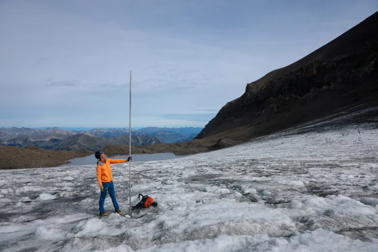
Visiting one glacier named Scex Rouge in the Western Swiss Alps in early September, GLAMOS chief Matthias Huss, one of the report’s researchers, told the Reuters news agency that a measuring pole, about four metres (13 feet) high, was drilled into the ice in July to provide the team with a point of reference.
“Now when we have come back here, we saw the pole was out by three metres [10ft]. So just in August and September of this year, even excluding the heatwaves of June and July, we have lost three metres of ice at an elevation of almost 3,000 metres [9,843ft],” he explained.
“This clearly indicates these conditions that we had this summer, they are just inconsistent with the survival of these small glaciers in the Alps,” he added.
Glaciologist at ETH Zurich and head of GLAMOS Matthias Huss holds a pole that indicates four metres of ice lost over the past year on the Scex Rouge glacier amid climate change at Glacier 3000 in Les Diablerets, Switzerland [File: Denis Balibouse/Reuters]
Why are glaciers in Switzerland losing ice?
According to the report, the total mean thickness of individual glaciers in Switzerland has fallen by between 2.5 and four metres in 2026. At glacier tongues – narrow glacial extensions of a glacier which project from land into a body of water – it had decreased by as much as 10 metres in some places over the summer.
“We can clearly attribute the massive ice loss to the warming, and thus anthropogenic [caused by humans] climate change. The summer has been the hottest on record in Switzerland. In addition, there was little snow in winter, and therefore the glaciers were poorly protected when the heat started,” GLAMOS chief Huss told Al Jazeera.
He noted that while their measurements have indicated that the melting has affected all glaciers in Switzerland equally, the effects were most visible on smaller glaciers.
“Those shrink very quickly and sometimes even completely disappeared. Also, large glaciers lost an enormous quantity of ice, but they remain impressive,” he added.
The report’s scientists warned that the glaciers also lost a total of about 2.2 trillion litres of water (581 billion gallons) between July and September alone.
“This is more than four times the annual drinking water consumption of all Swiss households,” the report’s researchers said and warned this could impact the country’s future water supply.
What does this mean for Switzerland?
Switzerland is a country known for winter sports and Alpine tourism, which depends on the glaciers. About 4 percent of the country’s entire workforce is employed in the tourism sector.
“This affects tourism and also how we perceive the mountains – they are no longer white but increasingly grey and black,” he told Al Jazeera.
He added that the water provided by glaciers is also important for the economy. “It is used to fill up hydropower lakes that produce clean energy, and supplies the biggest streams of Europe,” he said.
“We’re not yet seeing the full consequences as glaciers are still around and they contribute water when we need it. But this potential is soon being lost,” he added.
Harry Zekollari, a glaciologist and associate research professor at the Department of Water and Climate at the Vrije Universiteit Brussel, shared a similar view.
He stressed that glaciers are important natural water suppliers, as they provide water when people need it most – in summer, when it is hot and dry.
“With climate change, glaciers initially provide more water during summer as they rapidly melt. However, as glaciers become smaller, there is less ice to be melted, and as such the water supply in summer decreases. This peak in water supply has now been passed for glaciers in the European Alps, meaning that we expect glaciers to provide less and less water in the coming years,” he told Al Jazeera.
“Glacier changes can also cause natural hazards, and since most of the ice lost turns into water that reaches the oceans, the consequences of glacier loss [in Switzerland and elsewhere] will be felt for coastlines all around the globe,” he added.
Is there a solution?
Yes. According to Zekollari, in order to save as much glacier ice as possible in Switzerland, the world needs to stabilise rising temperatures as soon as possible.
“Projections for the European Alps and Swiss glaciers show that if we are able to rapidly stop emissions, we may still be able to save about one-third of their ice mass. However, in a case with strong warming, these glaciers are projected to lose more than 90 percent of their volume by 2100,” he said.
He noted that the situation is less grim globally as some glaciers in other regions are more persistent.
“However, even globally, future emissions play a big role and will decide whether we lose about 25 percent of glacier mass by 2100 – that’s the good case, with limited warming – or rather 50 percent – the bad case, with more warming,” he said.
“The losses in the longer term – past 2100 – are even larger due to the long response of glaciers, but also here it is the future warming that decides how much remains. Every 0.1 degree Celsius warming matters.”
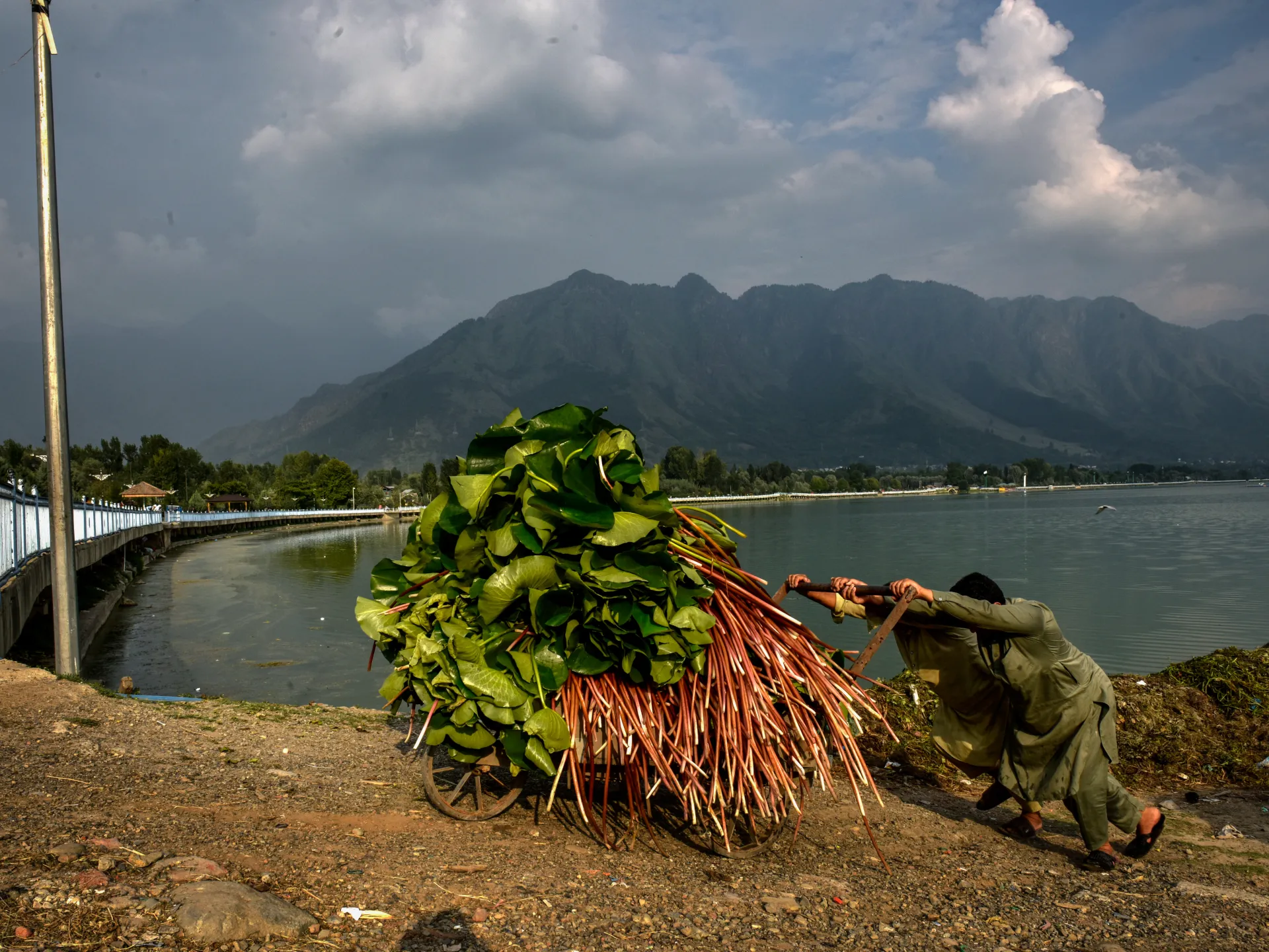
Dal Lake in Srinagar, the heart of tourism and cultural life in Indian-administered Kashmir, is slowly giving way under mounting population and environmental pressures.
Once renowned for its clear waters, floating gardens and houseboats, the lake is now clogged with untreated sewage, plastic waste and rampant weed growth, even as thousands of residents and businesses rely on it for transport and their livelihoods.
Unregulated construction along its shores, land encroachment and the expansion of nearby neighbourhoods have reduced its surface area and further damaged its fragile ecosystem.
The impact of climate change, including erratic rainfall and rising temperatures, is accelerating the lake’s decline.
Despite periodic clean-up campaigns and official conservation schemes, the future of Dal Lake remains uncertain, reflecting a wider environmental crisis across the Kashmir Valley.
The nor’easter causes another round of flooding in low-lying areas in New Jersey and New York City and knocks out power to tens of thousands of homes into New England.
Published On 27 Sep 202627 Sep 2026
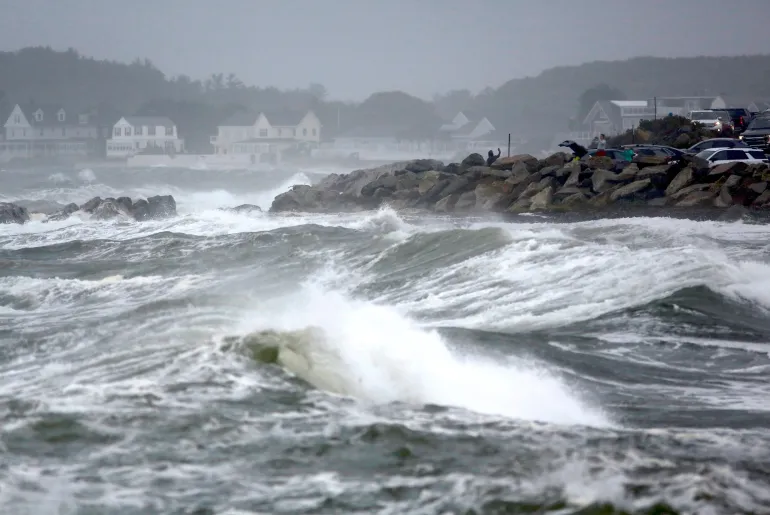
A powerful storm is pummelling the shoreline in the northeastern United States for a second day, causing another round of flooding in low-lying areas and knocking out power to tens of thousands of homes.
Tidal surges swamped low-lying neighbourhoods in New Jersey on Sunday, while wind gusts toppled trees on New York’s Long Island, damaging homes and bringing down utility poles.
Recommended Stories
list of 3 itemsend of list
In New York City, streets in the Howard Beach neighbourhood of Queens were inundated.
The slow-moving storm, which killed a New York City housing authority worker when a tree fell on Saturday, was expected to linger through Sunday, with heavy rain, strong winds and dangerous surf all the way to New England.
Extreme amounts of rain – more than 10cm (4 inches) since Friday in some spots in New Jersey – combined with a surging ocean led to flooding amounts not seen for close to a decade in places used to dealing with high water, residents said.
The storm, known as a nor’easter, triggered memories of Hurricane Sandy, which left behind more than $60bn in damage across the eastern US in 2012. While this storm’s impact has been nowhere near that, it could be the first of several along the East Coast this fall because of an El Nino climate pattern disrupting this year’s weather.
Images of waves crashing into sea walls and onto beaches raised concerns about coastal erosion.
More than 100,000 customers were without power across the Northeast and mid-Atlantic at times on Sunday, according to PowerOutage.us. The most widespread outages were in counties along the coast from New Jersey to Connecticut.
Numerous flights were cancelled or delayed up and down the coast. More than 250 flights had been cancelled at Boston Logan International airport by late Sunday morning as wind gusts reached 64km/hour (40 mph), according to the Massachusetts Port Authority.
The worst of the remaining rainfall was expected on Sunday from northern New Jersey into southern New England.
While the storm was gradually weakening, tidal flooding would stay through high-tide cycles Sunday night, said Bob Oravec, a lead forecaster with the National Weather Service in College Park, Maryland.
People watch the ocean as a nor’easter storm hits Rye, New Hampshire, US, on September 27, 2026 [Caleb Jones/AP Photo]
Prime Minister Balendra Shah told the UN that world leaders must act on climate change.
Published On 25 Sep 202625 Sep 2026
Nepal’s Prime Minister Balendra Shah has appealed for action to combat the rising threat of climate change, calling the flood that devastated his country last month “a warning to the world”.
Shah made the comments during his address to the 81st Session of the United Nations General Assembly in New York on Thursday night. He told the gathering that the August disaster “was not just a local tragedy”, asking them the question, “Have you really heard that warning?”
Recommended Stories
list of 3 itemsend of list
Political leaders “have been negligent to translate those warnings in action at the speed and scale that the vulnerable people require,” he said.
An excavator clears mud from damaged houses following deadly flash floods and a mudslide, in Nuwakot district, Nepal, on September 21, 2026 [Navesh Chitrakar/Reuters]
At least 1,453 people died when a torrent of mud, rock and water struck northern Nepal and the China-Tibet border on August 26, triggered by a glacial collapse.
According to Nepal’s National Disaster Risk Reduction and Management Authority, 5,500 people were still missing and 13,795 had been rescued.
Researchers from the World Weather Attribution (WWA) group said in a report released last week that the disaster was not caused by a single extreme weather event, but rather a “compound crisis” shaped by long-term warming, glacier retreat, permafrost thaw and geological instability.
Shah said climate change was hurting people not responsible for the crisis but who “are paying a colossal price for it”.
He said Nepal contributed less than one-tenth of 1 percent of the heat-trapping gases behind climate change. About 99 percent of the country’s electricity comes from hydropower, and many workers were trapped in tunnels by the flooding.
“Our glaciers are retreating, our mountain slopes are becoming unstable, our rivers are becoming less predictable, and every major disaster threatens to erase years of development,” Shah said.
Nepal Prime Minister Balendra Shah addresses the 81st United Nations General Assembly at UN headquarters in New York City, US, on September 24, 2026 [Eduardo Munoz/Reuters]
Shah urged the international community to help bear the cost of helping Nepal adapt to climate change.
He proposed to create a ‘Himalaya Climate Resilience Mechanism’ which would include Nepal and neighbours India and China, and would allow them to share satellite data and expertise, monitor glacial lakes and strengthen joint early warning systems.
Nepal has asked the UN’s loss and damage fund for $20m in aid, the maximum allowed, but a tiny fraction of what it needs. A preliminary assessment by the government has placed the cost of the disaster at $5bn.
The fund, established in 2022 in the aftermath of catastrophic floods in Pakistan, has yet to make even its first disbursement, and observers see Nepal as a key test of its credibility.
Earlier this week, the United States pledged an additional $31m in new flood recovery support.
Leopardus tilcayo is the first new living cat species named and described in more than a century.
Published On 18 Sep 202618 Sep 2026
A tiny wild cat that lives in Bolivia’s lush cloud forests has been identified as a previously unknown species, marking the first time in more than a century that a new living feline species has been formally named and described.
Called “tilcayo” by local communities, the cat is part of a group called tiger cats, which are found across much of South America.
Recommended Stories
list of 2 itemsend of list
It was discovered in the Yungas forest, a mountainous region where forests are often covered by clouds and surrounded by high humidity, according to the researchers.
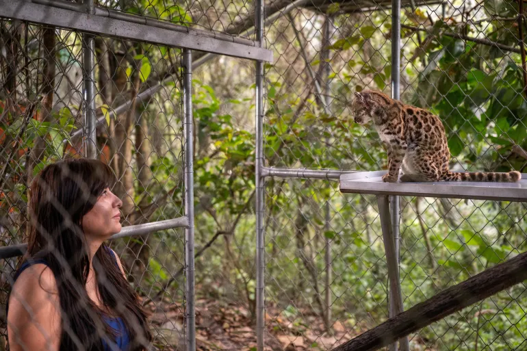
Given the scientific name Leopardus tilcayo, the cat measures 46cm (18 inches) long and weighs about 1.4kg (3 pounds), making it smaller than an average domestic cat.
“Its fur is light brown … with irregularly shaped rosettes across its body,” according to Paola Nogales-Ascarrunz, a National Geographic Explorer and one of the authors of the study describing the newly identified species published on Thursday in the journal Current Biology.
Little is known about the cat’s biology and lifestyle. Remains of small rodents in scat samples suggest they may form part of its diet, while camera-trap evidence indicates it could be more active at night, Nogales-Ascarrunz said.
Tiger cats are so-called cryptic species, meaning they cannot easily be distinguished merely by appearance, evolutionary biologist and study co-lead author Jonas Lescroart of the University of Antwerp in Belgium said.
National Geographic Explorer Paola Nogales Ascarrunz, who led the research that identified Leopardus tilcayo as a new species, observes the cat at the Senda Verde animal refuge in the Yungas region, in Bolivia, September 1, 2026 [Handout/Fernando Faciole/Reuters]
Observing the Bolivian cat drew interest because “its characteristics did not match the descriptions, most of them based on Brazilian cats”, Nogales-Ascarrunz said. “This made us wonder, what tiger cat do we actually have in Bolivia?”
The team analysed DNA from 38 cats sampled across several South American countries, including eight museum specimens. The study found that tiger cats are in fact five genetically distinct species.
“We never expected this Bolivian tiger cat to be a separate species, and no one had ever proposed it as a different animal, subspecies or otherwise,” Jonas Lescroart said.
Genetic analysis suggested that the tilcayo lineage separated from other tiger cats about 1.4 million years ago.
The research team also described a new tiger cat subspecies in Peru’s Yungas, naming it Leopardus tigrinus antisuyo, after Antisuyu, the region of the old Inca Empire that included the area it inhabits.








![People watch the ocean as a nor'easter storm hits Rye, New Hampshire, US on Sunday, September 27, 2026 [Caleb Jones/AP Photo]](https://i0.wp.com/occasionaldigest.com/wp-content/uploads/2026/09/AP26270677753401-1790545375.jpg?w=640&ssl=1)
![An excavator clears mud from damaged houses following deadly flash floods and a mudslide, in Nuwakot district, Nepal, September 21, 2026 [Navesh Chitrakar/Reuters]](https://i0.wp.com/occasionaldigest.com/wp-content/uploads/2026/09/2026-09-25T021410Z_709369844_RC2ENNAUM1TN_RTRMADP_3_NEPAL-FLOODS-BALEN-UN-1790312192.jpg?w=640&ssl=1)
![Nepal Prime Minister Balendra Shah addresses the 81st United Nations General Assembly at UN headquarters in New York City, US, September 24, 2026 [Eduardo Munoz/Reuters]](https://i0.wp.com/occasionaldigest.com/wp-content/uploads/2026/09/2026-09-25T002524Z_1559668133_RC20QNACRCWK_RTRMADP_3_UN-ASSEMBLY-1790312740.jpg?w=640&ssl=1)
![National Geographic Explorer Paola Nogales Ascarrunz, who led the research that identified Leopardus tilcayo as a new species, observes the cat at the Senda Verde animal refuge in the Yungas region, in Bolivia, September 1, 2026 [Fernando Faciole/Handout via Reuters]](https://i0.wp.com/occasionaldigest.com/wp-content/uploads/2026/09/2026-09-17T154150Z_381273466_RC2N9NAU7NUJ_RTRMADP_3_SCIENCE-CAT-1789702964.jpg?w=640&ssl=1)