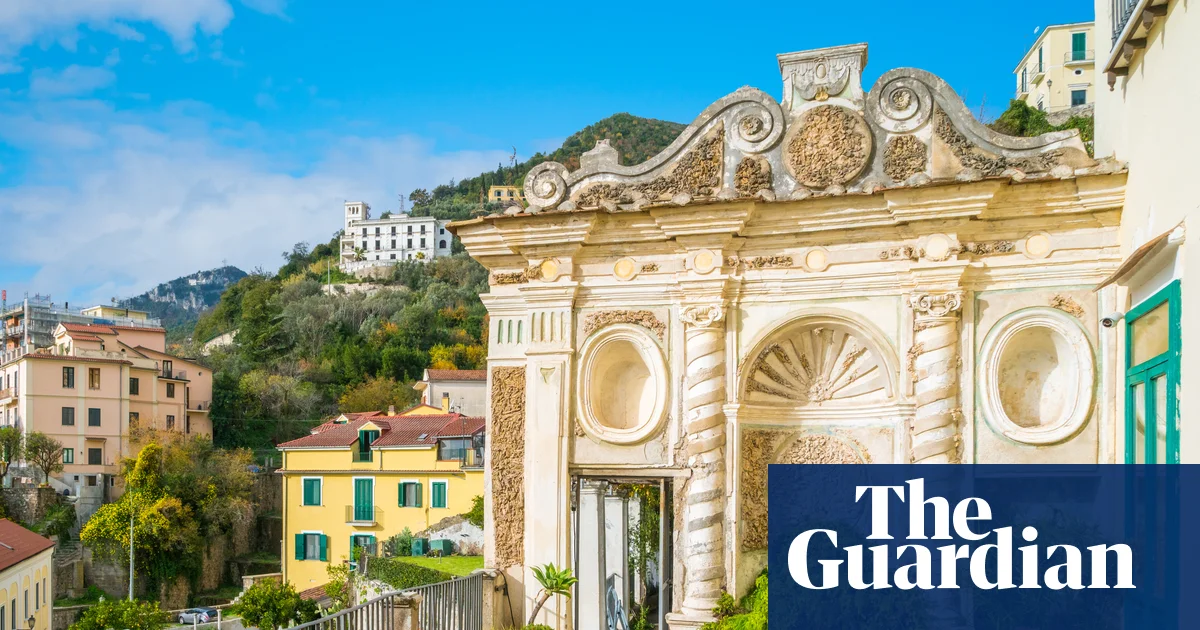
The wonderful Amalfi coast is like heavenCredit: Getty – ContributorThe elegant town of Ravello with its cobbled streets lined with pottery and linen shops leading off the main squareCredit: Getty
They adorn tea towels, shirts, skirts, dresses, trousers, and bags galore.
Our base on Travelsphere’s eight-day tour of the Amalfi Coast, Pompeii and Capri was the charming, laid-back seaside village of Minori, at the excellent family-run 4* Hotel Villa Romana.
Just three miles and a glorious 15- minute boat ride from Amalfi itself, Minori is quieter and classier, with stylish and affordable restaurants and bars.
Surprisingly for a village of its size, Minori has an 18th-century neoclassical domed cathedral. Surrounded by lemon groves, of course.
One of my highlights was walking the Path of Lemons, which connects Minori to the larger neighbouring village of Maiori.
The trek takes around 90 minutes, with an initial climb up several hundred steps and a similar descent.
But the view of the village and sea is spectacular and worth every straining leg sinew.
The beauty of our schedule is that there is still plenty of free time for you to pursue your own holiday agenda.
You’ll get the chance to indulge at Minori’s sumptuous Sal De Riso patisserie or watch the famed limoncello being made at the Liquorificio Mansi Carlo.
Alternatively, stop by at one of Minori’s beachside bars and watch the tide roll in.
But the best place to see the Amalfi Coast is from the sea and the area is served by efficient, reasonably-priced ferry operators.
It is only from the clear blue waters that you fully appreciate the stunning coastline and its tumble-down towns with pastel-coloured houses perched precariously atop majestic cliffs.
Our first trip was to the historic town of Amalfi itself, dramatically set below those same cliffs.
On arrival at Amalfi, we had the freedom to see the town for ourselves.
The main square and its streets were packed with sightseers.
But climb a few steps up one of the alleyways and you will find peace and quiet and cheaper restaurants.
Amalfi Town and beachCredit: GettyThe undoubted gem of the tour was our visit to Pompeii, destroyed when Mount Vesuvius erupted in 79AD
A lunch of cured meats and seafood, in cool stone surroundings behind a church, cost £21.50 a head with drinks.
By the time we had finished, the crowds had thinned out at Amalfi’s magnificent medieval cathedral, which holds the remains of St Andrew.
But there was no escaping the crowds at Capri, a gorgeous 90-minute boat trip from Minori.
The island has been home to the international jet set for decades and it’s not difficult to see why.
A walk down to the gardens of Capri Town was followed by a look, from outside anyway, at the amazing designer boutique shops.
A glass of fresh orange and lemon juice from a stall was a cheaper alternative to buying a designer Patek Philippe watch — and then it was time to get our minibus to Anacapri.
This village, with views of the Bay of Naples, is much quieter and more affordable than Capri Town.
We got the chairlift up to the highest point of the island, almost 1,800ft above sea level with a view to die for.
There are optional tour trips to the lively lemon-filled town of Sorrento and the gorgeous cliffside village of Positano.
Or you could take the 45-minute ferry from Minori to Salerno, a bustling coastal city where we had a superb fish lunch at Mama Rosa.
The undoubted gem of the tour was our visit to Pompeii, destroyed when Mount Vesuvius erupted in 79AD.
The last agonies of victims frozen in time when they suffocated from poison gases are captured in plaster moulds created from their remains.
Sun man Mike Sullivan with a cool lemonadeCredit: SuppliedWalking through stunning lemon orchardsCredit: Getty
It is a powerful experience.
And yet the humanity of this once prosperous and thriving coastal Roman city, discovered in 1748, shines through from the haunting remains.
The municipal buildings, public baths, grand villas, lead pipe water system and amphitheatres paint a picture of an advanced society on which much of our own world today is based.
Our last scheduled trip was to the gorgeous medieval mountainside village of Ravello, with its cobbled streets lined with pottery and linen shops leading off the main square and 11th-century cathedral.
The journey up to the 1,200ft-high village involves navigating hairpin bends with sheer drops below.
It was not a drive I would have relished but in the expert hands of our driver I felt safer than being on the M25.
A delicious lunch followed at the Il Rifugio family-run restaurant in Tramonti, a 15-minute drive from Ravello up into the Lattari “Milk” Mountains — so-named because of the goats which graze there.
After taking in the spectacular view of the sea, and sampling local wines, we were then driven to a small local vineyard to see how it was produced.
All too soon it was time for the journey home from Naples Airport, with its abundance of lemon gifts and souvenirs.
Fortunately, you don’t get a hangover from vitamin C.
GO: AMALFI COAST
GETTING / STAYING THERE: Travelsphere’s eight-day escorted tour of the Amalfi Coast, Pompeii and Capri starts in Naples and visits Amalfi, Capri, Minori, Sorrento, Pompeii, Positano, Ravello and the Amalfi Hills.
Seven nights is from £1,699pp, including return flights from London, overseas transfers, seven nights’ half-board in a 4* hotel, select meals and a welcome drink as well as Travelsphere holiday director and specialist local guide.
Former German player’s comments that ‘African football’ is ‘a bit unorthodox sometimes, a bit wild’ sparked controversy.
Published On 26 Jun 202626 Jun 2026
Even in one of the most joyous moments in his country’s footballing history, Ivory Coast manager Emerse Fae found himself managing sadness over the remarks of a former role model that have sparked debate about potential racist connotations.
But afterwards, Fae was asked to respond to analysis given by former German midfielder Bastian Schweinsteiger on German public TV ahead of Germany’s 2-1 win over the Ivorians in both teams’ second Group E match in Toronto.
Here is how DW.com characterised what Schweinsteiger said: “Ahead of the Group E clash in Toronto, which Germany won 2-1, Schweinsteiger said in his role as a pundit for German public broadcaster ARD that the Ivorians played ‘African football’, which he characterised as ‘a bit unorthodox sometimes, a bit wild, not quite as tactical.’”
In his response, Fae noted how he once admired the former Bayern Munich man so much that he sometimes was called “Bastian” by his friends.
“I think it’s sad,” said the 42-year-old Fae, who is only several months older than the 41-year-old Schweinsteiger. “He was a very, very good player; a great player.
“I’ve always loved him, personally. As a midfielder, I’ve always liked the way he played, the way he understood football. … So when I heard his comments, I was disappointed, disappointed in the man.
“Because when you know football the way he knows it, it’s odd that you would speak that way, which we could call racist if we were calling a spade a spade, but that’s the way it is.”
Schweinsteiger played parts of 13 seasons for Bayern Munich, helping the German club giants win eight league titles and one UEFA Champions League crown. Internationally, he was a key contributor to Germany’s 2014 World Cup-winning squad.
He has not publicly commented on the remarks in the days since.
On Thursday, Fae’s side got the better of one of the game’s most famous managers, the 78-year-old Dick Advocaat, who, in guiding Curacao, was managing in his third World Cup.
Fae’s group also earned a 1-0 victory to open the tournament against Ecuador, a team that came into this World Cup unbeaten in 19 matches and hailed for its defensive solidity.
“I can’t change the way he talks,” Fae said of Schweinsteiger.
“But all I can do is show on the pitch that Africa is not just the physical game. We are very technical as well, very tactical. And all I can hope is that this was just a clumsy statement, that it wasn’t particularly reflective of what’s in his mind.”
A Coast Guard MH-60 Jayhawk helicopter, like the one seen here, crashed in Alaska on Monday with four people on board. File Photo by Petty Officer 3rd Class Connie Terrell/U.S. Coast Guard/UPI
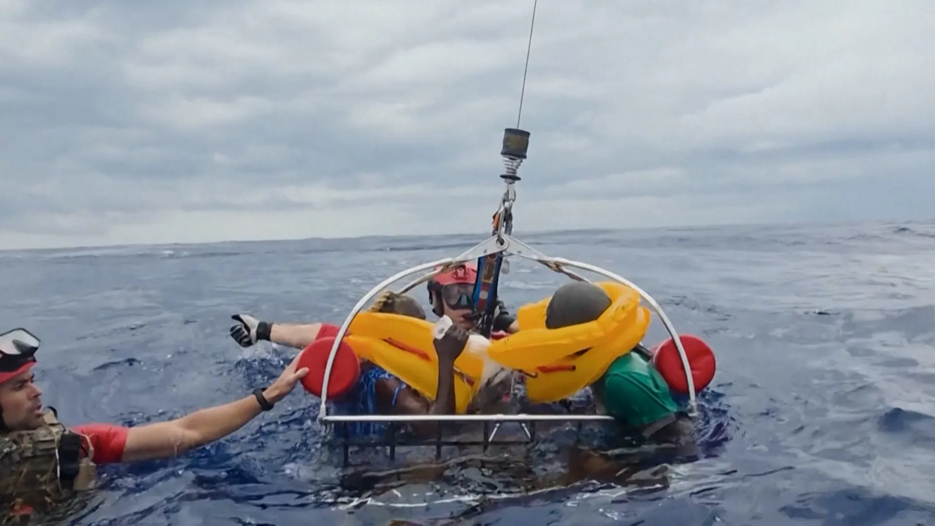
June 23 (UPI) — All four Coast Guard members aboard a helicopter that crashed in Alaska sustained only minor injuries, the maritime law enforcement agency said.
The Coast Guard MH-60 Jayhawk helicopter crashed Monday morning during a training flight near Harbor Mountain, Sitka, Alaska, the Coast Guard said in a statement.
The first reports of the crash were received at the Arctic District command center shortly after 10 a.m. local time, officials said.
Deployed responders reached the aircraft at about 11 a.m. local time, the Coast Guard said, and were able to transport the helicopter’s four occupants to Mt. Edgecumbe Medical Center.
U.S. Coast Guard Arctic later Monday said that the four Coast Guard members involved in the crash sustained only minor injuries.
“We are incredibly relieved our crew members survived with only minor injuries,” Rear Adm. Bob Little, commander of the Coast Guard’s Arctic District, said in a statement.
“We are grateful for the swift response by the Sitka Fire and Rescue, who assisted us during this critical time.”
In response to the crash, Coast Guard Air Station Kodiak will be repositioning a helicopter and crews to Coast Guard Air Station Sitka to maintain operational readiness in the Southeastern Alaska region, officials said.
Germany come from behind to beat Ivory Coast 2-1 in Group E, sealing FIFA World Cup 2026 knockout place.
Published On 20 Jun 202620 Jun 2026
Deniz Undav scored two goals off the bench as Germany pulled off a thrilling comeback to beat Ivory Coast 2-1 in their World Cup Group E match, securing their place in the knockout stage for the first time since they won the title in 2014.
After having two goals disallowed in the first half on Saturday, Germany did not lose focus and used intricate passing to find their way, while the West Africans produced their dynamic brand of attacking football in a wild Group E clash.
Recommended Stories
list of 4 itemsend of list
Undav levelled the score with a controlled, volleyed finish in the 68th minute and struck again when he received a pass on the turn, before swivelling and firing home a ball that Yahia Fofana had no chance at stopping.
The versatile striker now has nine goals in his last eight matches.
Simon Adingra had a late chance for Ivory Coast, but he failed to get a shot off in the area before Germany charged back down the field and Fofana blocked a low shot from Nathaniel Brown.
Ivory Coast had opened the scoring in the first half when Franck Kessie slotted home a rebound off a shot by Amad Diallo on a play created when Yan Diomande charged down the left side and sent in a cross.
With more than 100,000 people of German ancestry living in Toronto, Julian Nagelsmann’s men enjoyed plenty of support but were a frustrated group at the interval with nothing to show for their eight attempts on goal.
Germany looked to have opened the scoring when midfielder Aleksandar Pavlovic rose to meet a short corner in the 25th minute but was deemed to have fouled Fofana in the process.
The ruling left Pavlovic with his hands atop his head in disbelief while Fofana received some attention after the collision, and the partisan German crowd made their disdain for the referee’s decision known.
Shortly after, it was Ivory Coast who finally broke through with Kessie’s goal. The West Africans have scored in their last seven matches at the tournament – the longest such sequence on the global stage in their history.
Germany once again put the ball in the back of the net, but their celebrations were cut short as the referee determined that Jamal Musiala had fouled Odilon Kossounou in the buildup.
Germany top Group E with six points and are through to the last 32, while Ivory Coast remain on three after two matches. Ecuador and Curacao meet in Kansas City later on Saturday.
Germany will close out the group stage against Ecuador on Thursday in New Jersey, while Ivory Coast face Curacao in Philadelphia.
The ferry from Salerno to Amalfi town was set to take about 35 minutes, and we were debating whether to risk the windswept top deck, fearful our packed lunches might fly into the Tyrrhenian Sea. (My father and I were taking a pragmatic approach on our Italian holiday, opting for light midday meals to save space for the primo and secondo courses at dinner, and ample lemony desserts.)
As our ferry sped across glittering water, we admired the views as the Amalfi coast unfolded, incandescent with charm. But we could also see the crawling traffic on the narrow roads that cling to the cliffs. That could have been us, up there in one of those toy-sized rental cars, squeezed between a tourist coach and a fed-up local leaning on their horn. Thankfully, we were on a boat instead, sea breeze in hair and coffee in hand.
Illustration: Guardian Graphics
The Amalfi coast has a reputation that draws tourists from all over the world. It seems everybody wants to see this string of sorbet-coloured towns, to wander the narrow streets where houses climb the hills like stacked blocks, and to sip limoncello while gazing out across the impossibly bright, blue waters. But as eager as I had been to experience these famous graces, the idea of white-knuckling it on hairpin turns in a Fiat 500, inches from certain ruin, didn’t seem like my idea of fun. That’s when an Italian friend gave me some priceless advice: stay in Salerno – it’s a nice town with good restaurants, and you can do all your excursions via public transport from there.
Salerno is tucked just under the Sorrentine peninsula and about half an hour south of Naples on the fast train. It’s an ideal base for jumping on trains to inland attractions such as Pompeii and Paestum, but also for catching ferries to every destination along the Amalfi coast, as well as Capri and Sicily. What’s more, Salerno is a more affordable base than the honeypot towns of Positano or Ravello, where accommodation and restaurant prices are around double what you’d pay here.
Ornately decorated streets in Vietri Sul Mare. Photograph: Sean Pavone/Getty Images
Originally a Roman colony, Salerno was reshaped by the Normans in the 11th century. It’s a pleasant and relaxed town to wander, its wide and luxurious promenade dotted with palm trees, benches and street performers. What it lacks in Amalfi glamour, it makes up for with a more authentic tableau of local Italian life. (After a day of eating overpriced ice-cream from hollowed-out Amalfi lemons, we found Salerno’s lack of performance refreshing.)
Dad and I got a holiday rental on the edge of the historic centre, near Salerno Cathedral, which houses the relics of Saint Matthew. We wandered in one morning and were surprised to find that although the duomo is on the modest side, the crypt is a real showstopper, with intricate marble details from top to bottom. The town is also home to the Schola Medica Salernitana, which dates back to the 9th century and was the pre-eminent source of medical knowledge in its heyday, before closing in 1811. Today, the adjacent Garden of Minerva botanical terrace is the city’s most picturesque attraction. Its organising principle is the four humours of man (the Ancient Greeks theorised that our temperament and health are dictated by a balance of blood, phlegm, black bile and yellow bile). That’s certainly something to think about while wandering the gardens, where the plants are labelled according to which “mood” they affect.
But Salerno is all about the food for me, most notably the glistening, black squid ink pasta dish I ate at La Botte Pazza and still salivate over months later. The menu, scribbled on a tiled wall, described the dish simply as spaghetti mare. The wine came out of taps in the wall, and the buzzy atmosphere only got louder as the evening progressed. The bonhomie was all the more welcome after spending the day wandering among the ghosts of Pompeii (40 minutes up the coast by train), which was buried in ash when Mount Vesuvius erupted nearly 2,000 years ago.
Ihe intricate marble detail of the crypt at Salerno Cathedral. Photograph: Francis Canker/Getty Images
Another worthwhile rail excursion is to Vietri sul Mare – the first town in the string of pearls that make up the Amalfi coast, and the only one that can be reached by train. We hopped on an eight-minute service out of Salerno for a wander through the town famous for its colourful ceramics, but also because I wanted to swim – Salerno’s seafront has a nice promenade, but beach lovers are left wanting.
You can swim in Amalfi town too, but the beach in this more famous spot was already getting busy when we visited in late March. As much as I enjoyed Amalfi, I felt relieved to be there early in the season – its narrow streets weren’t built for crowds.
Vietri sul Mare is sleepy in comparison, and I was thrilled to find a peaceful stretch of sand, where I changed quickly under the arches before running in for a bracing dip in the turquoise water.
For Dad, who takes a dim view of anyone who goes in the sea in March, Paestum was more of a highlight. After speeding south for about half an hour, the train dropped us off in the middle of nowhere, by a gravel road that promised a 10-minute walk to the ruins of the once-great Greek city. We were in our element now – at Paestum, visitors can wander about freely as the approximately 27-hectare (66 acre) site unfolds, with the occasional noticeboard sharing a story of what used to be here, but mostly leaving it to your imagination.
Paestum’s crown jewels are the three temples looming large and golden in the landscape; they are about 2,500 years old yet very well preserved. Dad was pleased to find a working model of Archimedes’ screw, an ancient hydraulic tool for elevating water, while I was tickled by the Tomb of the Diver, with its fresco of a gentleman diving into a pool, starkers.
The 2,500-year-old Temple of Athena at Paestum. Photograph: Nick Brundle/Getty Images
Osteria Canali gave us our last meal in Salerno, and again we had the pleasure of being surrounded by local people in an inviting neighbourhood taverna. The regional menu was rich with aubergine and mozzarella, and then came the main course of baccalà – a piece of white fish with figs, wrapped in paper and simmering in its own juices. More creamy Amalfi lemon desserts to finish, of course, and we figured we should try the limoncello as well – when south of Rome, right? But as much as I like a citrus tang, this was finally too much lemon for me.
Choosing Salerno as our base opened up a different side of the Amalfi coast, allowing us to come and go by boat and train without the stress of traffic jams and impossible parking situations. We only missed a train once, but another came along half an hour later, and while we waited there was nothing to worry about except where to go for ice-cream.
Intercity trains run from Naples Central to Salerno and take about 35 minutes (€9.50). Regional trains from Salerno central take about 40 minutes to Pompeii (€2.80); 30 minutes to Paestum (€3.40); and eight minutes to Vietri sul Mare (€1.40). Timetables at trenitalia.com. Several ferry companies run year-round services from Salerno to the towns along the Amalfi coast. The Travelmar passenger ferry sails direct to Amalfi town from Salerno’s Concordia terminal (35 minutes, €26 return). Plan your journey with FerryHopper
Ecuador looked strong before Diallo broke through in the 90th minute with a clinical left-footed shot to seal the win.
Published On 15 Jun 202615 Jun 2026
Amad Diallo scored in the 90th minute to lift Ivory Coast to a 1-0 victory over Ecuador in their first World Cup appearance in a dozen years.
The teams combined to hit the crossbar three times before the Manchester United winger broke the deadlock to secure three points for his team at the Philadelphia Stadium on Sunday.
Recommended Stories
list of 4 itemsend of list
Diallo – who entered as a substitute in the 56th minute – broke through with a left-footed shot from just inside the penalty area that beat diving goalkeeper Hernan Galindez. Wilfried Singo set up the goal with a strong run down the right side.
Making their fourth appearance in the World Cup and the first since 2014, Ivory Coast took a big step towards reaching the knockout stage for the first time.
Elye Wahi hit the crossbar in the 52nd minute for Ivory Coast, after Ecuador’s John Yeboah and Nilson Angulo did the same in the opening half.
Ecuador, making their fifth World Cup appearance and looking to reach the knockout round for the second time, were playing a virtual home game at the stadium, otherwise known as the Lincoln Financial Field, with most of the capacity crowd of 68,274 wearing the yellow shirts of La Tri.
Ecuador looked strong before Diallo’s goal. Their best chance after halftime came in the 68th minute on Gonzalo Plata’s hard shot from about 25 yards out, which was parried away by goalkeeper Yahia Fofana.
Ivory Coast were bolstered by the forward play of Yan Diomande as the Leipzig attacker created several scoring chances, particularly down the right side. That included Wahi’s near-goal on a flick following Diomande’s hard cross.
Ivory Coast, who did not concede a goal while going 8-0-2 in 10 qualifying matches, will next face four-time World Cup champions Germany, who defeated Curacao 7-1 earlier on Sunday in Group E.
Ecuador will meet Curacao. Both matches will be played June 20 .
Taiwan has accused China of carrying out a “provocative act” after Chinese Coast Guard vessels conducted patrols in waters east of the island. The operation followed announcements by Japan and the Philippines that they would begin formal talks on maritime boundary delimitation, a move Beijing views as involving waters linked to Taiwan.
Chinese state media described the deployment as a special maritime law-enforcement operation. Taiwan responded by dispatching Coast Guard vessels, which reportedly warned the Chinese ships away from restricted waters. Defence Minister Wellington Koo characterized the patrols as both a challenge to Taiwan’s sovereignty and an example of “cognitive warfare” aimed at reshaping perceptions of territorial control.
The incident comes amid sustained Chinese military activity around Taiwan, including frequent air and naval operations. Taiwan is also monitoring the movements of the Chinese aircraft carrier Liaoning, which is operating in the Western Pacific near waters east of the Philippines.
Why It Matters
The patrols represent more than a routine maritime operation. They signal China’s growing willingness to extend its presence beyond the Taiwan Strait and into areas east of Taiwan that have traditionally been viewed as strategically important for the island’s defence.
The move also demonstrates Beijing’s opposition to emerging regional cooperation among U.S. partners and allies. The maritime boundary discussions between Japan and the Philippines reflect increasing efforts among regional states to clarify maritime rights and strengthen coordination in contested waters.
For Taiwan, Chinese Coast Guard activities present a complex challenge. Unlike military operations, law-enforcement patrols operate within a legal grey zone that allows Beijing to advance territorial claims without triggering a conventional military confrontation. Such actions can gradually normalize China’s presence in disputed areas while increasing pressure on Taiwan’s security apparatus.
The incident further highlights the growing integration of maritime, legal, and information-based strategies in China’s approach to territorial disputes across the Indo-Pacific.
Stakeholders
Taiwan
Protecting maritime sovereignty and territorial claims.
Maintaining freedom of navigation and security in eastern waters.
China
Expanding operational presence around Taiwan.
Reinforcing sovereignty claims through maritime law-enforcement activities.
Japan
Engaged in maritime boundary discussions with the Philippines.
Monitoring Chinese activities that could affect regional security.
Philippines
Seeking greater legal clarity over maritime boundaries.
Increasing security cooperation with regional partners.
United States
Maintaining stability in the Taiwan Strait and broader Indo-Pacific region.
Supporting freedom of navigation and regional deterrence efforts.
Regional Security Partners
Including Australia and other Indo-Pacific states concerned about changing maritime dynamics.
Strategic Implications
The patrols illustrate China’s increasing reliance on so-called “grey-zone” tactics, which fall below the threshold of open military conflict while steadily advancing strategic objectives. By deploying Coast Guard vessels rather than naval forces, Beijing can challenge Taiwan’s authority while reducing the risk of immediate military escalation.
The incident also reflects the expanding geographical scope of cross-strait competition. Traditionally concentrated in the Taiwan Strait, tensions are increasingly extending into the Western Pacific, where control of maritime approaches carries significant strategic value for both China and Taiwan.
Furthermore, the timing of the operation suggests that Beijing is seeking to influence regional maritime diplomacy. By responding directly to Japan-Philippines boundary discussions, China is signaling its opposition to initiatives that could strengthen legal and political frameworks contrary to its territorial claims.
The episode reinforces concerns among regional governments that maritime disputes are becoming increasingly interconnected, linking Taiwan, the East China Sea, and the South China Sea into a broader strategic contest.
What’s Next?
Several developments warrant close attention in the coming weeks:
Taiwan is likely to increase coordination between its military and Coast Guard to strengthen maritime surveillance and response capabilities.
China may continue deploying Coast Guard vessels east of Taiwan as part of a sustained effort to normalize its operational presence in the area.
Japan and the Philippines are expected to proceed with maritime boundary discussions despite Beijing’s objections, potentially drawing further diplomatic responses from China.
Increased activity by the Liaoning carrier group could provide additional indications of China’s broader military objectives in the Western Pacific.
The United States and regional partners may intensify maritime monitoring and security cooperation to deter unilateral attempts to alter the status quo.
Future outcomes
The incident reflects a broader shift in regional security dynamics, where maritime law-enforcement operations are increasingly being used as instruments of strategic competition. Rather than relying solely on military pressure, China is employing a combination of legal, political, and operational tools to reinforce its territorial claims and shape the regional security environment.
For Taiwan, the challenge extends beyond the immediate presence of Chinese vessels. The longer-term concern lies in preventing the gradual normalization of Chinese activities in areas that Taipei considers vital to its sovereignty and security. As regional actors deepen cooperation on maritime governance and security, incidents of this nature are likely to become an increasingly important indicator of the evolving balance of power in the Indo-Pacific.
This location is the perfect day trip from London as you can enjoy the colourful coastline, admire the turquoise waters and hop on board a chairlift with the most breathtaking views
You’ll want to visit this gorgeous pier(Image: Getty Images)
But now if you’re tempted to head down south, there’s the “most breathtaking” ride in England that promises absolutely spectacular scenery. This destination truly has everything – from turquoise waters to a vibrant coastline which feels completely “unreal”. One content creator recently documented his day trip to the Isle of Wight, which is surprisingly straightforward to reach from London.
Samual told his TikTok followers: “I think I’ve found the most breathtaking ride in England.”
In his caption, he continued: “The chair lift at The Needles on the Isle of Wight is honestly one of the most breathtaking rides I’ve experienced.
“Gliding down the cliffs at Alum Bay with views of the famous Needles cliffs, turquoise water and colourful coastline feels unreal. This is the perfect day trip from London.”
Content cannot be displayed without consent
How to get to the Isle of Wight:
If you’re travelling from London, you’ll have to take a South Western Railway train to Portsmouth Harbour, which takes around 2 hours. Next you’ll need to hop on board the ferry to Ryde Pier Head, a journey of roughly 22 minutes.
Any other areas of the UK will require you to drive down to Portsmouth before you can take the ferry. Meanwhile, a journey in the car might take a little longer, in some cases around 3-4 hours depending on what area you’re leaving from.
What to do in the Isle of Wight:
The island boasts a wealth of attractions, including iconic landmarks such as Alum Bay and The Needles. You can also travel back in time at Carlsbrooke Castle, where King Charles I was held prisoner, or hop aboard the Isle of Wight Steam Railway.
For family entertainment, marvel at 300,000 specimens at the Dinosaur Isle Museum in Sandown, or let the kids run wild at the UK’s oldest theme park at Blackgang Chine.
Round off your visit by tackling the breathtaking coastal trails, wandering through the lush surroundings of Ventnor Botanic Garden, or simply soaking up the sun at Compton Beach.
Ivory Coast defeats France 2-1 in friendly ahead of the 2026 World Cup, as Manchester United’s Amad Diallo seals win.
Published On 4 Jun 20264 Jun 2026
France has brushed aside concerns over their World Cup readiness after suffering a surprise 2-1 defeat by Ivory Coast in a tournament warm-up match, insisting the setback will serve as a useful reminder rather than a cause for alarm.
Didier Deschamps’s side led through a superb first-half goal from Rayan Cherki on Thursday, but they were overrun after the break as Guela Doue and Amad Diallo turned the game around for the Elephants in Nantes.
Recommended Stories
list of 4 itemsend of list
With France opening their World Cup campaign against Senegal in New York on June 16, midfielder Aurelien Tchouameni said the result should be viewed in the context of preparations.
“It’s a pity to lose, but we’re in a preparation phase; we stay confident,” Tchouameni said.
“There is no conclusion to draw from this game, even if we had won it. We will be ready.”
France fielded an experimental side, with several Paris Saint-Germain players rested after last weekend’s Champions League final triumph, and made numerous changes after halftime.
Defender Lucas Hernandez also played down the significance of the defeat.
“We always want to win, but we’re in a phase of preparation, and there were a lot of substitutions,” Hernandez said.
“We’re in good spirits.”
Deschamps, however, admitted that his side had lost control of the contest after an encouraging opening 45 minutes and warned that France would face opponents with similar qualities to Ivory Coast in the United States.
“A defeat is never pleasant, even if we did some good things in the first half,” Deschamps said.
“In the second half we made a lot of changes, but that’s no excuse. We were not as good after the break, and they brought a lot of pace.
“We will face the same type of team on June 16.”
The France coach said the result could prove useful if it prevented his players from becoming complacent before the tournament.
“It’s a reminder, if we needed one, not to think we’re better than we are,” he said.
Cherki added: “It’s a little warning, and I can tell you we’re not going to the World Cup thinking we’re favourites, but we’re going to crush everyone.”
From the graveyard of St Michael’s in Ynys, Wales, the view was ravishing: the Italianate oddity of Portmeirion sparkled on the opposite shore; the peaks of Eryri (Snowdonia) rippled in the distance; and, within the River Dwyryd’s broad swirl, sat the tidal island of Ynys Gifftan. “No one’s lived there for years,” said a passerby pointing to the isle, “but it’s just been put up for sale – £350,000, if you fancy it.”
I rather did, but sadly my modest savings don’t stretch that far. Wales’s “armpit”, geographically speaking – which is how some people refer to that chunk of Gwynedd where estuaries perspire into Cardigan Bay before it curves round the outstretched Llŷn peninsula – looked like a spectacular place to be marooned.
I’d come here because I thought it might be a particularly good place for coastal exploring by rail and on foot. The Cambrian Line, which starts in Shrewsbury, runs west to the bay, before turning north along Gwynedd’s shore. Here, it’s accompanied by the Wales Coast Path and, launched in 2024, the Cadfan Way, a 128-mile (206km) pilgrimage following sixth-century St Cadfan from his church in the seaside town of Tywyn to the ruins of the monastery he founded on Ynys Enlli (Bardsey Island), off the Llŷn’s tip.
I began in Machynlleth. This handsome market town by the River Dyfi is where the Cambrian Line begins to feel connected to the sea. It also has a disproportionate number of excellent indie shops, and one of the country’s best restaurants – though I skipped Gwen’s 20-course, £295 feast and grabbed supplies from the Royal House deli instead (very tasty, very good value). Then I boarded the train.
I was soon rattling through an increasingly saturated land. The mouth of the Dyfi began to yawn into bird-beloved mudflats, salt marsh and sandbanks; the train passes right between the Dyfi Osprey Project’s 360-observatory and the osprey nests it observes. Wider and wider the waterway became until, eventually, at white-washed Aberdyfi, the line hit the coast, sometimes running so close to the sea’s edge that you couldn’t see the join.
We pootled north, via towns like Tywyn – starting point for St Cadfan pilgrimages – and teeny halts like Tonfanau, site of an army base during the second world war, now sheep-grazed ruins. Like many Cambrian Line stops, Tonfanau is request only; those on the platform should stick out an arm.
At Harlech, no requests are necessary – the train itself couldn’t help but be halted by the vision of Harlech Castle. Edward I’s crag-top stronghold was started in 1282, took seven years to build and still looks fearsome. I disembarked here, hiked up to the fortress and entered with ease via the modern floating bridge; back in the day, would-be intruders faced concentric walls, portcullises and a “killing zone” where arrows were fired from the sides, missiles dropped from above. The weather was gloomy, curtailing the views but piling on atmosphere. I spiralled up the dark stone staircases and circled the battlements, alone but for the hooded jackdaws. It gave me the shivers.
Portmeirion, which celebrates its centenary this year. Photograph: Mieneke Andeweg-van Rijn/Getty Images
I spent the night at Y Branwen hotel, in the castle’s shadow, and left Harlech the next day on foot, murk replaced by blazing sunshine. I was headed north along the coast, although the rocky Rhinogs rising behind the village looked tempting … “There’s no one in those hills,” Branwen’s owner David Penny told me. However, I stuck to Plan A, and wasn’t disappointed. Rounding Harlech Point, I was slapped by that view down the Dwyryd, soon passing isolated St Michael’s and my fantasy island.
Following the Cadfan Way for a while, I hiked from Ynys to St Tecwyn’s, an even lonelier church, seemingly ministering to no one from its eyrie above the estuary. It was here that poet and priest Jim Cotter was inspired to found the Small Pilgrim Places network; he wrote of St Tecwyn’s: “I’m at what must be one of the most extraordinary places in the whole of Wales.”
I had to agree, though Portmeirion, across the Dwyrydestuary, gives it a run for its money. This fantastical resort village, the trippy creation of Sir Clough Williams-Ellis, celebrates its centenary this year and remains wonderfully weird, with its candy palette, tricks of perspective and salvaged architectural paraphernalia. I popped into the Prisoner Shop, which sells memorabilia related to the cult TV show of the same name, filmed here in the 1960s. I wondered if it was still popular? “Oh yes,” the cashier confirmed. “Even with young people, they watch it on YouTube. Its themes – surveillance, freedom – feel relevant today.”
I stayed at Portmeirion’s Castell Deudraeth, a Gothic pile with big rooms, a good restaurant and The Prisoner looping on channel 801. But best was strolling into the village at sunrise, no one around, watching the sun crack the opposite hills, hit the top of the campanile and flood into the hot-pink camellia groves.
Porthmadog station wasn’t far, a short walk through the woods and across the mile-long cob that fords the Glaslyn estuary, Eyri summits keeping watch. From here on, I used a mix of train and boot to reach Pwllheli, the end of the Cambrian Line.
Plas Glyn-y-Weddw in Llanbedrog, one of the oldest art galleries in Wales. Photograph: Kirsty Ford/Alamy
That wasn’t always the case. A horse-drawn tramway, built in the 1890s by businessman Solomon Andrews, used to run farther west to his estate in Llanbedrog. Andrews turned the site’s Victorian mansion, Plas Glyn-y-Weddw, into an art gallery and charged a shilling for a combined tram and gallery ticket. Now, 130 years later, I paid nothing at all. The old tramway track is part of the Wales Coast Path – an easy, breezy four-mile stroll along the bay – and Plas Glyn-y-Weddw is free entry. Saved from ruin in the 1980s, it’s one of the oldest galleries in Wales, showcasing work by Welsh artists, and serving great cake inside its modern cafe, which squats beside the house like a giant silver sea urchin.
I scoffed a scone, then ambled through the Winllan woods on trails first developed by Andrews for his paying visitors. Andrews also placed the figurehead of an old ship on Mynydd Tir y Cwmwd, the heathery headland above. It was eventually destroyed and now the twisted metal Tin Man, or Iron Man, stands in its place, enjoying quite the spot. I could retrace my route from here, Cardigan Bay arcing away into a mountain-backed haze. It made a pleasing journey’s end, with the knowledge that getting home meant riding that charming train line back again.
The trip was supported by the Wales Coast Path. Cambrian Line tickets are cheaper bought in advance; a day rover ticket costs £21. Y Branwen in Harlech has doubles from £110B&B. Castell Deudraeth has doubles from £208B&B, including Portmeirion entry
May 30 (UPI) — A meteor exploded just off the coast of Massachusetts, causing a loud boom, Saturday afternoon.
Locals reported on social media that they heard a loud blast at about 2 p.m. EDT, and meteorologists have said it was likely a meteor.
Officials at the National Weather Service told WBUR that it was up to NASA to confirm that it was a meteor, but it may require finding pieces of debris to confirm it, 1 Degree Outside meteorologist Danielle Noyes told the station.
The U.S. Geological Survey did not detect an earthquake, Noyes added.
Meteorologist Nick Stewart posted on X, showing images from the National Oceanic and Atmospheric Administration: “The flash density product really shows this anomalous ‘flash,’ which is pretty distinctive of a bolide/meteor reentry. East of Boston. This is the likely source of the loud boom/explosion.”
Reports of an explosion hears around Boston I believe are going to be a rather significant bolide/meteor entering the atmosphere. Very large “flash” detected by GOES-19 GLM that does not correlate with active thunderstorms. #MAwxpic.twitter.com/EHKVxCc2vU— Nick Stewart (@NStewWX) May 30, 2026
WBZTV in Boston posted on its Instagram account that meteors cause a sonic boom because, “They enter Earth’s atmosphere at anywhere from 25,000 to 160,000 miles per hour, and larger space rocks can travel deep enough to create pressure waves.”
The station’s meteorologist Eric Fisher posted about the blast on his Instagram account. “CONFIRMED: Meteor exploding on entry caused that big boom across the Boston area Saturday afternoon!”
“Yes, I did, thought it may have been an explosion from the power plant next door. It vibrated my apartment. Though it lasted about 3 to 4 seconds … longer than most explosions. Did not sound like thunder,” one viewer said.
Another said there were two explosions.
“I was outside in Framingham with my dog. Heard and felt two huge blasts. Felt the shockwave. Definitely not thunder. Was from the east/southeast from where I was standing. Scared the crap out of us,” another viewer told the TV station.
Comedian, actor and podcaster Adam Carolla touches his star during an unveiling ceremony honoring him with the 2,846th star on the Hollywood Walk of Fame in Los Angeles on May 27, 2026. Photo by Jim Ruymen/UPI | License Photo
The first swallows are swooping round the headland as I follow the coast path along the western side of the Holy Island of Lindisfarne. There are ringed plovers on the beach and a couple of grey seals bobbing out at sea. A barefoot guy is splashing along the tidal Pilgrim’s Way, an ancient post-marked path across shining sands. Lindisfarne is only accessible when receding tides uncover this path and the curving causeway road nearby.
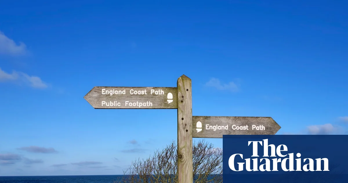
The original 62 miles of Northumberland coast path, which opened 20 years ago, bypassed the island, so I’ve been looking forward to walking this stretch of the England coast path, which opened two years ago.
Very few of us will walk the full 2,700 miles of the King Charles III England coast path, which was inaugurated in March, but a four-mile stroll around Holy Island is an adventure in itself, a shifting landscape of wader-foraged mudflats, dunes, beaches, whinstone cliffs and a reedy blue-and-gold lough.
Waymarked posts lead through grassy sand dunes, freckled with cowslips. Skylarks and stonechats clack and chirrup, while courting lapwings tumble over the fields. Gertrude Jekyll’s little walled garden, on the hillside facing the clifftop castle, is bright with marigolds and purple rock cress.
Edward Hudson, founder of Country Life magazine, bought Lindisfarne Castle in 1901 and hired architect Edwin Lutyens to turn it into a home. Inside the craggy fortress, there are four-postered bedrooms and an elegant drawing room in the old gunpowder store. From the ramparts, a telescope shows the seal colony near two obelisks guiding boats into Holy Island harbour.
Just over the fields are the red sandstone arches of Lindisfarne Priory; these ruins date from the 12th century but a monastery was founded here by Saint Aidan in Northumbria’s seventh-century heyday. I walk past stacks of lobster pots to visit the museum with its carved stone crosses and fossil rosaries. Nearby Pilgrims Coffee offers fancy brews and fresh focaccia.
Lindisfarne Castle, looking west from Beblowe Crag. Photograph: Alamy
A stream of cars crosses Lindisfarne causeway, but you can arrive instead on bus 477 from Berwick-upon-Tweed (Mon-Sat in school holidays; otherwise Wed-Sat). A bus ticket gets you 10% off at the castle and 20% off at the priory. With good transport links, Berwick makes an excellent base for exploring this end of the coast path.
Getting off bus X18 at Budle Bay campsite the next day, I continue walking south towards Bamburgh. The original coast path runs inland from Lindisfarne, but there are now 10 miles of seasonally sensitive coastal access, open in June and July, plus this short new year-round path on the south-eastern edge of Budle Bay.
Wading birds forage in the mudflats and miles of moss-green salt marsh. Past ruined lime kilns and coconut-scented gorse, I cross cliffs into dunes, where a grasshopper warbler whirrs among roses and honeysuckle.The Walled Garden cafe, opposite St Aidan’s church, serves huge crab sandwiches with lemon and herbs. Nearby, the Norman keep of Bamburgh Castle has towered for nearly 900 years over the wide yellow sands.
Transport for this trip was provided by LNER. The nearest mainline station to Lindisfarne is Berwick-upon-Tweed. The Walls B&B (doubles from £130B&B) overlooks the Tweed, or there is a YHA hostel next door (private rooms from £57) Phoebe Taplin
Around the Wash,Norfolk and Lincolnshire
Sir Peter Scott Lighthouse, also known as the East Lighthouse, on the River Nene, at Sutton Bridge, Lincolnshire. Photograph: Alan Barr/Alamy
From King’s Lynn To Sutton Bridge Distance 15 miles
Isolation is claimed to be one of the latest trends in luxury travel. If true, then the stretch of the King Charles path around the Wash must be the most extravagant pleasure you can enjoy in England.
For hours I traversed a landscape of no people. No walkers, no workers, no houses, no cars, no noise except the shrill cry of redshank and the babble of skylarks drifting on the wind. If you’re weary of chatter and conflict, this undeniably desolate walk is for you. Every view of vast horizontals of green, brown and blue could be the cover for an album entitled Nowhere.
I set out from King’s Lynn, one of England’s most vibrant ports in the 13th century, which retains a wealth of medieval buildings. The coast path around the Wash, England’s biggest natural bay, requires excursions inland to cross the rivers that feed the largest multiple estuary system in Britain. Several miles can be sliced from the King’s Lynn section by taking the ferry across the Great Ouse from the old port to West Lynn.
I find no sign of life at the bottom of Ferry Lane, only a mysterious notice: “If you require the ferry please make yourself seen BEFORE the time NOT AFTER”. After 15 minutes pondering its meaning, I spot a small boat crossing the turbulent brown water.
I’m ferryman Ben’s only passenger and he’s convinced I’ll be cold in my shorts. “No shelter out there,” he warns. It’s a blustery May day, and I head up the western bank of the river.
The King’s Lynn foot ferry on its way to West Lynn, across the Ouse. Photograph: Adrian Chandler/Alamy
The Ouse sparkles silver and blue, but there is only a distant line of bronze representing the retreating North Sea. The sea views are underwhelming yet the effect is rather like being at sea, the seabank a kind of ship, ushering us between the vast prairie fields of the reclaimed Fens on one side and epic salt marshes on the other.
Most of this 15-mile stretch between King’s Lynn and Sutton Bridge borders the Wash. The south-eastern corner of this national nature reserve was first recognised as a precious home for stupendous flocks of wintering wildfowl and breeding waders by Sir Peter Scott, the 20th-century conservationist and artist who helped found the World Wide Fund for Nature.
He would be delighted by the wealth of little and great white egrets along the seabank, and it is only birds I have for company (I encounter just three walkers all day). I eat my packed lunch in the shelter of a stunted hawthorn – notices warn walkers there are no toilets, cafes or public transport on this section.
The grand liminal arena of the Wash, where land and sea blur into one, plays tricks on distances and perspectives. Faraway trees pop up like a mirage above the blue horizon. For a while I entertain myself with “ship or tractor?” when spying a distant machine. I see both.
I pass a mysterious island, identified on the map as the Outer Trial Bank, a test to see if more land might be wrenched from the sea. When I follow the path inland again alongside the River Nene, and pass the old lighthouse where Scott once lived, it is like returning to land after a sea voyage.
Other stretches of the coast path are unquestionably more scenic, but there’s something glorious and trance-like about walking for so long in such space and solitude. On the bus back to King’s Lynn, I glow from this unique experience.
Accommodation is limited around the Wash, but King’s Lynn is a good option, with day walks either side (Hunstanton to King’s Lynn is 17 miles with buses to get you out/back).The Bank House (doubles from £165 B&B) is in the historic old town Patrick Barkham
The west Somerset coast
The view from Kilve Beach and coast path towards St Audries Bay, Blue Anchor Bay and Minehead, Somerset. Photograph: Alan Gardiner/Alamy
From Minehead To St Audries Bay Distance 11 miles
Minehead may be the birthplace of the science fiction writer Arthur C Clarke, but it’s a coastal, rather than cosmic, odyssey I’m beginning here, walking 11 miles east to St Audries Bay.
Despite this being one of Somerset’s most well-trodden stretches of coast, few tackle it in one go; tides dictate when beach paths are passable, and return journeys rely on a public transport system that doesn’t yet stretch to moonbuses, so many visitors opt for circular hikes instead. Until now I’ve done the same, but the opening of the England coast path has inspired me to pull on my walking boots and lace together the sections I’ve skipped.
It’s not a propitious start. Coastal erosion has forced a 1½-mile diversion leaving Minehead. Instead of clamouring gannets and the rush of waves, I’m trailed by the rumble of engines as the route follows the A39. It’s not far to Dunster, however, where the soundtrack switches to lawnmowers and willow warblers, and I’m soon at the beach.
Clattering shingle underfoot, I’m buffeted along to the village of Blue Anchor, with its huddle of beach chalets. Along the promenade, I meet angler Steve, who’s hoping for dogfish or conger.
“Will you eat them,” I ask?
“I’m soft,” he smiles. “I throw them back. If I want fish, I go to the chippy.”
From here on, the path gets steeper and prettier, detouring around the headland through woods trimmed with blossom and birdsong. Midweek, the trail is quiet, despite the herds of caravans corralled in adjacent fields.
Approaching Watchet, the path spills on to the grassy earthworks of Daw’s Castle, a clifftop fortress founded by King Alfred to stave off Viking raiders. Fossil hunting is another long tradition along this coast, and when I stop at the town’s Market House Museum, I’m transfixed by a huge ammonite, found on a nearby beach a century and a half ago.
It’s market day in Watchet, and the trail leads past a rainbow of striped awnings to East Quay, the town’s social enterprise arts hub. In its cafe I order a charred sweetcorn and courgette salad and a cheese scone almost as gargantuan as that ammonite.
Rhiannon Batten on the path between Doniford and St Audries Bay. Photograph: Rhiannon Batten
I’d like to visit East Quay’s art gallery and Watchet’s boat museum, but time and tide wait for no woman along this shoreline. Two hours before low tide, the route across neighbouring Helwell Bay is passable, but I’m cautious as I step over rocks and slippery kelp, mesmerised by the swirling mud and serrated shoreline below my boots as I play seaweedy hopscotch.
Leaving the beach near Doniford Farm Park, the trail winds through a maze of caravans then out into fields before dropping into St Audries Bay. I feel the waterfall here before I see it, its icy spray a reminder not to linger.
Retracing my steps to Doniford Halt, a request stop on the West Somerset Railway, I arrive just in time to flag down a steam train to take me back to Minehead. As we puff along, the landscape I have walked is rewound through the window. There are better coastlines in England for swimming than these estuarine bays, but as a tidal immersion on foot this walk has been stellar.
Train from Doniford Halt to Minehead is £17.50 one-way (west-somerset-railway.co.uk). Doubles at the Foxes hotel in Minehead from £120 B&B Rhiannon Batten
Chichester harbour, Hampshire and West Sussex
West Wittering beach, West Sussex. Photograph: Stephen Tattersall/Alamy
From Prinsted To West Wittering Distance 16½ miles
Wild, windswept wetlands stretch to the horizon. Human figures are outnumbered by birds. Church spires and thatched roofs signpost scattered settlements. Can this really be the crowded south coast of England?
My boyfriend and I are walking part of a 35-mile stretch of the King Charles III England coast path, linking South Hayling in Hampshire to East Head in West Sussex, which opened in February. This section includes Chichester harbour, a protected estuary with open water and sheltered inlets, reedbeds, salt marshes, mudflats, shingle banks, sand dunes and a wooded shoreline.
We join the path at pretty Prinsted, after coffee (and directions) from the Southbourne farm shop. We set off east around Chidham peninsula, trying to spot the birds pictured on the information boards. Tens of thousands of wading birds and waterfowl spend the winter here, and in summer it’s a breeding ground for threatened species of seabirds and waders. Early April may not be peak time for birdwatching, but we still see a plethora of gulls and ducks, plus oystercatchers, curlews and a kestrel.
After rounding the peninsula and making our way up the other side, the day’s destination comes into sight across the water. Bosham, a cluster of buildings crowding up to the quayside, looks close enough to touch, but the winding coastal path is deceptive, and we still have a way to go (8½ miles in total).
We are glad to reach the Millstream, a 31-room hotel made from converted cottages, set in a lovely garden. Our room is in a tiny thatched cottage, reached by a little bridge over the stream.
Bosham (pronounced “Bozzum”) is ancient – believed to predate the Romans. Some think this is where King Canute tried to turn back the tide. King Harold II is depicted in the Bayeux tapestry praying at Bosham church, and the manor is recorded in the Domesday Book as one of the wealthiest in England. We visit the Saxon church and see the plaque to Canute’s eight-year-old daughter, who is said to have drowned and been buried here.
Rachel Dixon on the trip from Ferry Hard to Itchenor jetty in Chichester Harbour. Photograph: Neil Clive Fowler
More cheerfully, we stop for a pint at the ivy-clad Berkeley Arms before dinner at the harbourside Anchor Bleu. The latter, family-run inn has been welcoming weary travellers since 1741 and has a daily changing, seafood-heavy chalkboard menu. The inspired kelp, samphire and seaweed “seacakes” mean that vegetarians don’t miss out, either.
The next morning, we walk across the harbour (a walkway appears at low tide) and continue south for a couple of miles. The wind is howling and it’s hard going – thankfully the route is flat and the formerly muddy tracks are now smooth paths. Areas along the trail that previously flooded at high tide have boardwalks above the water level, made from recycled bottles, and the paths are designed to be easily “rolled back” in the event of coastal erosion.
We battle the wind to the water’s edge and wave down the ferryman on the far shore. For hundreds of years, travellers have taken the Itchenor Ferry (AKA the Itchy Bosom) across the Chichester Channel to save them a 13-mile detour by foot. Today, the ferry also operates as a taxi service for people going to and from their boats, and on our crossing a bonus spin up the channel to pick up a couple of sailors is included in our £3.50 fare.
We disembark at West Itchenor and stop for coffee and cake at the Quarterdeck Cafe in the bustling boatyard. From here, it’s a six-mile shoreline stroll to the dunes at East Head spit, and the adjacent sandy beach at West Wittering. We are no longer alone – the car park is packed – but the beach is so vast, we don’t mind sharing.
Southbourne station is within walking distance of the start of the walk and Chichester station is a bus ride from the end. Accommodation was provided by the Millstream hotel (doubles from £200B&B) Rachel Dixon
The Fylde coast, Lancashire
Huge flocks of shimmering lapwings and other migratory birds have arrived to feed on the Ribble Marsh nature reserve. Photograph: Media World Images/Alamy
From St Annes-on-the-Sea To Freckleton Distance 11½ miles
Two avocets dip their scimitar beaks into the lagoon. An egret hops on to the bank. A herd of cattle wade knee-deep. In the hazy light it might be a remote outpost on the Pampas. But it is Lancashire, and Preston is just around the corner.
Some walks exhilarate partly because your expectations are quite low. I imagined the coast from St Annes-on-the-Sea to Freckleton to be suburban seaside, with the occasional moment of peace, beauty or wildness perhaps. But it is all of this and more.
I have a few childhood memories of St Annes from visiting my grandad. It still has a 1970s atmosphere: quietish, residential, conservative. Local businesses are sprucing up frontages and gardens for the coming season. A litter-picking campaign has set up shop near the pier.
We walk on the sandy beach until it segues into a greener area, with dunes on the left and salt marsh on the right. The path between is busy with dog walkers and families enjoying the morning sun. Groups of nordic walkers speed past. Two detectorists bleep below the prom. On Fairhaven Lake the pedalos and boats are out.
The pier at St Annes-on-the-Sea. Photograph: Kevin Walsh/Alamy
Soon we come to Lytham, smart and gentrified. We buy coffees from a kiosk on the front before strolling along the Mussel Tank Memorial to visit the free museum inside the windmill. The birdlife is already good – oystercatchers, curlews, herons – and it only gets better as we leave built-up areas behind and stride out on to the edges of the Ribble Estuary national nature reserve – also designated a site of special scientific interest, a European special protection area and international Ramsar wetland site.
Why all the titles? Because this estuarial Eden happens to be the most important site in the UK for wintering wildfowl, supporting more than a quarter of a million ducks, geese, swans and wading birds; it’s internationally important for 16 species of wintering visitors. Spring isn’t bad, either. I’ve remembered my binoculars. As well as the wondrous avocets, we see and/or hear redshanks, skylarks, linnets, sedge warblers, shelducks, goldfinches, swallows, peewits, kestrels – and hares.
I have brought a hat, too, which is lucky. Coast walks are great – you can proceed without navigating or having to look down – but there’s not much cover. As we approach Warton airbase, the path follows a causeway. We have passed lots of benches (and loos), but here we sit on the grass to enjoy a picnic and birdsong.
The Lancashire coast is known for resorts rather than beaches, nature, cliffs or birdlife. The towns are famous; the bits in between overlooked. The King Charles III England coast path could alter this, which would be a good thing; it will spread visitors out, perhaps explode a few cliches. The Lancs littoral turns out to be as generous with fresh air, flora and fauna as it is with fun and frolics.
The Lancashire section isn’t fully open or waymarked, but work is afoot and Cicerone has published a guide and map. The 68bus runs between Blackpool and Preston, stopping at St Annes, Lytham and Freckleton. The stretch between Freckleton and Preston is best done by bus as the path is forced on to a main road. Trains connect Blackpool, St Annes-on-the-Sea, Lytham and Preston. The Rooms Lytham has doubles from £110
A GRAND new multi-million hotel is opening in Cornwall right by the beach and it will transport you straight to Italy.
Officially opening on June 15, The Nici in Newquay is “inspired by the sun-soaked glamour of the Amalfi Coast” and has the “indulgence of a Mediterranean escape”.
Sign up for the Travel newsletter
Thank you!
The Nici Newquay will open on June 15Credit: NiciThe hotel has an Amalfi feel, with indoor and outdoor poolsCredit: Nici
The clifftop heated pool is the star of the show, with amazing views over the ocean as well as a poolside bar.
But the hotel will also have a spa described as a “coastal cocoon” with a heated indoor pool, hot tub, an aromatherapy sauna, a steam room and a hydrotherapy suite.
A cinema room and kids club will also be on-site to both adults and kids occupied.
In the restaurant – aptly named Amalfi’s – guests will be able to enjoy Italian-inspired such as handmade pizzas and salads.
A second restaurant is planned for 2027, called Tucker Rocks – a more casual dining spot meant to resemble a “clifftop Italian cafe” with live music and even a gelato counter.
And a unique feature at the hotel is the rare Victorian bathing lift that has been restored, so guests can get to Great Western Beach directly from the clifftop hotel.
Inside the hotel there will be 82 refurbished bedrooms and suites, some of which will have sea views.
Otherwise they will all be kitted out with the extras from Nespresso machines, Bluetooth speakers and fancy toiletries in the bathroom.
For those who like to keep fit, the hotel has a fully-equipped gym and fitness studios and juice bar for post-workout refreshments.
Guests can sign up to The Nici Club and get unlimited access to the spa, as well as exclusive events, too.
Inside there is also a spa with an aromatherapy sauna and steam roomCredit: NiciThe hotel also has a restaurant and cafe as wellCredit: Nici
Rooms at The Nici Newquay cost from £155 per night.
The destination used to be called Hotel Victoria before The Nici took it over and spent £20 million on transforming it.
The hotel is just a five-minute walk from Newquay train station, as well as a five minute walk from Great Western Beach.
If you want to head to one of the most popular beaches in the area – Fistral Beach – then it is just a six minute walk away.
There’s plenty to do in the surrounding area as well, with the hotel just steps away from Great Western Beach – a golden cove which is great for both surfing and rock pooling.
And if you fancy a cheap £1.99 pint, right by the hotel is The Towan Blystra, a Wetherspoons pub.
There’s direct access from the hotel to Great Western Beach tooCredit: Alamy
The Nici Newquay isn’t the only one to open in June, as The Nici New Forest will also open on June 15.
Sitting at the edge of the New Forest in the historic town of Lymington, the hotel is “inspired by the laidback sophistication of the Hamptons”.
Around the hotel, guests can explore woodland trails as well as heading down to the beach.
Another Nici hotel will also be opening in the New Forest on June 15Credit: Nici
She said: “Its chic-as interiors are super-Instagrammable – rooms are fresh white with bold, palm-print textiles and brass lighting, while ice-cream pastels, glitterballs and eye-catching artwork adorn the communal areas.
“As well as the beautiful pool, there’s a dinky cinema showing four films each day and a petite playroom with table football, giant Jenga and board games.
“Some rooms come with hot tubs, while others have freestanding baths – bag one with a sea view and you’ll wake up thinking you’re in the South of France!”
IF YOU’RE looking for your next holiday spot, one sunny destination should be at the top of your list.
From November 2, TUI is launching holidays between a major UK city and one of the best-value winter sun spots.
Sign up for the Travel newsletter
Thank you!
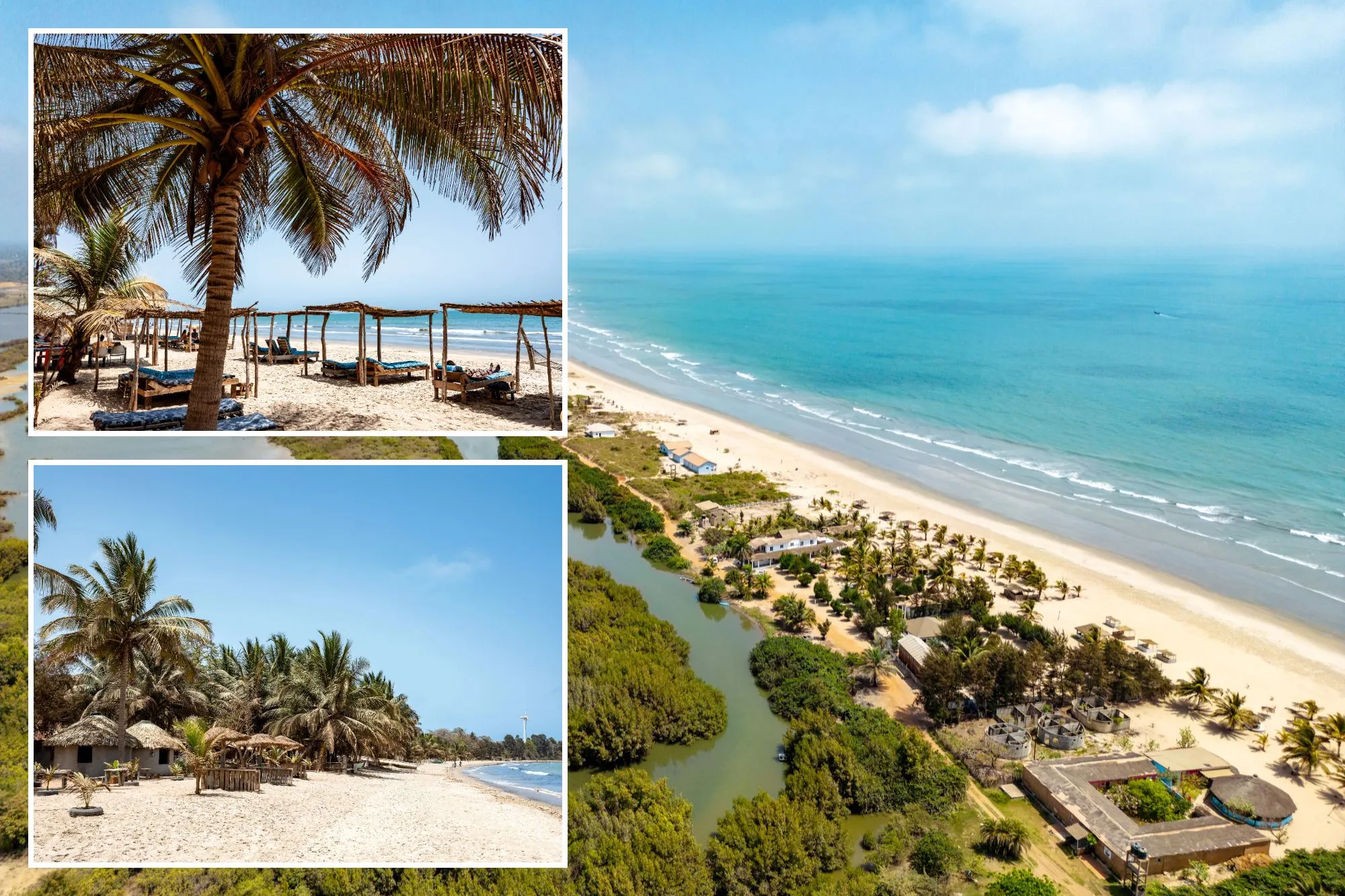
TUI is launching direct flights to The Gambia from Birmingham AirportCredit: Ben G Waller
Weekly flights between Birmingham and Banjul, The Gambia, will fly on Mondays – with the journey only taking six hours.
Between November and April, temperatures usually hit 30C in The Gambia and to make the most of it, you can explore the country’s golden beaches and warm seas.
Dubbed the ‘Smiling Coast of Africa’, visitors can head off on a boat cruise to spot wildlife and mangroves, along The Gambia River, which runs through the country.
And if you want to see more wildlife, then you can visit the Kachikally Crocodile Pool in Bakau or explore Abuko Nature Reserve which spans around 260 acres just south of Banjul and is home to more crocodiles as well as monkeys.
For history lovers, there’s Kunta Kinteh Island – a UNESCO World Heritage site that used to be a former slave-trading post.
TUI’s Linda Sharrocks, recently visited The Gambia and said: “I chose The Gambia for winter sun without having to fly as far as the Caribbean or Thailand, and it completely delivered.
“You’ve got guaranteed sunshine, beautiful sandy beaches and some of the friendliest, happiest people I’ve ever met.”
She added: “Kololi Beach was a highlight for me – it’s quieter but still close to everything.”
Other popular beaches include Kotu Beach, which is known for being a family-friendly spot with gentle waves and Sanyang Beach – which is also known as Paradise Beach – with a number of beach bars and local fishing boast bobbing in the water.
Linda also revealed that The Gambia is cheap when there, with a meal and drink costing just a few quid.
The Gambia is just six hours from the UK and boasts 30C tempsCredit: Ben G Waller
“There are loads of amazing restaurants and bars to try like Scala and Ginger for food, and Mkais for a drink and live music,” she shared.
“I loved visiting the local markets and just soaking up the laid-back atmosphere.
“My biggest tip is to get out and explore the local restaurants and bars, that’s where you really get a feel for the place.”
Holiday packages with TUI to The Gambia start from £800 per person and include flights, accommodation, transfers, luggage and all-inclusive food and drink.
And while there, your meals will only cost you a few quidCredit: Ben G Waller
Chris Logan, Commercial Director at TUI UK, said: “We know Brits are looking for winter sun that delivers great value without the long flight times, and destinations like The Gambia are seeing real growth as a result.”
Matt Hazelwood, Chief Commercial Officer at Birmingham Airport said: “We are delighted to welcome The Gambia back to our list of direct destinations with TUI.
“This popular winter sun getaway is easily accessible from Birmingham Airport, offering beautiful sandy beaches, stunning scenery, and nature reserves rich in Gambian wildlife, all just a six-hour flight from BHX.”
Don’t worry if you aren’t close to Birmingham though, as TUI also has flights to The Gambia from London Gatwick and Manchester airports.
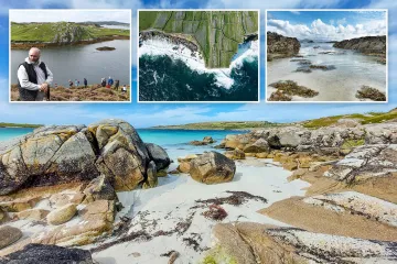
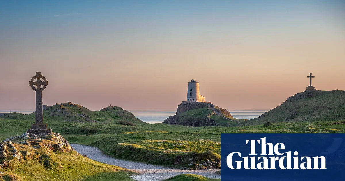
With an impressive mix of mountain and sea views, the 130-mile Anglesey Coastal Path is a must-do for those who love a good walk. But like most locals, my perennial favourite is the offshoot trail out to the tidal island Ynys Llanddwyn. Having grown up on Ynys Môn but now living in London, for me it has become something of an annual pilgrimage in the summer months. The mile-long walk along the main beach to the island is manageable and fun for grandparents and grandkids alike – with the white-washed lighthouses offering a rewarding end viewpoint. Pack a picnic, swim in the clear waters and relax – just make sure you’ve checked the tide times! Lavinia Brydon
Profile
Readers’ tips: send a tip for a chance to win a £200 voucher for a Coolstays break
Show
Guardian Travel readers’ tips
Every week we ask our readers for recommendations from their travels. A selection of tips will be featured online and may appear in print. To enter the latest competition visit the readers’ tips homepage
–
Castles, beaches and forest bathing in Dumfries and Galloway
The coast path above Portpatrick. Photograph: Vincent Lowe/Alamy
We’ve totally fallen for the pretty coastal village of Portpatrick on the west coast of the Rhins of Galloway, where the 212-mile Southern Upland Way starts and ends. Turn right or left at the port and you’ll hit awe-inspiring stretches of coastal path with dramatic rocky cliffs, which in spring are carpeted with stunningly bright wildflowers and nesting birds. See the sun set behind the ruins of Dunskey Castle and dip your toes into the water at one of the little sandy beaches. On a clear, sunny day, the water is the bluest of blue, leading the eye to the coastline and mountains of Ireland. And if a bit of forest bathing is in order, it’s oh-so-easy to return on the enchanted bluebell-scented forest path through Dunskey Glen. David
Birds and seals in East Yorkshire
Hornsea beach. Photograph: Eye35/Alamy
The circular Hornsea walk is a superb, accessible route. It’s been really well thought out with ramps and wheelchair-easy pathways on all levels, from the clifftops to the promenade and beach. There are fantastic viewpoints to see the seals or the many species of birds that inhabit the coastline, and the view across to Flamborough Head is magnificent. The blue-flag beach has a gentle slope, allowing full participation in seaside activities for all ages and abilities. There are accessible toilets, changing facilities, plenty of seats along the route, and a free car park. Elizabeth
Industrial horizons on Teesside
Redcar wind farm is just off the coast at South Gare. Photograph: Peter Oliver/Alamy
From Redcar (seven miles east of Middlesbrough) wander through Coatham Marsh nature reserve then head to the grassy dunes that lead to the South Gare breakwater. Enjoy the undulating paths and stand atop higher mounds to see wind turbines out at sea and the former industrial landscape before you. Pass the fishers’ huts and walk the last stretch to witness this enigmatic coast at work and play. After refreshment at the South Gare Marine Club, return to Redcar via Coatham Sands. Watch the nimble wading birds work the shoreline and reward your arrival with a tangy lemon top ice-cream. Leigh
Cliff and cave drama on the Isle of Man
Walking above the Chasms. Photograph: Jon Sparks/Alamy
The southern coastal walk is a beauty. Start in Port St Mary and climb to the top of dramatic cliffs atop beautiful secluded beaches. Gigantic sea caves surrounded by huge fissures in the rocks – known as the Chasms – are a highlight. At the far end of the peninsula, look across to the bird sanctuary, on the small island the Calf of Man. Then wend your way up very different cliffs on the west coast and finish at Port Erin, all the while seeing glimpses of Northern Ireland on the horizon. The Sound Cafe at the midway point really is the icing on this particular cake. Ben
Coast path bliss in Pembrokeshire
Skrinkle Haven. Photograph: Christopher Nicholson/Alamy
I like to walk short sections of coastal paths so I can appreciate every beautiful and inspiring footstep. This spring I did a 9-mile section of the Pembrokeshire coastal path from Manorbier to Tenby – a moderate four-hour walk. I started at the medieval Manorbier Castle, heading slowly past the dramatic Church Doors Cove and sandy Skrinkle Haven, then enjoyed sweeping views of Caldey Island from Giltar Point. By halting for a sip of water or fruit and a chat to fellow walkers, I could appreciate the walk more as I took in views of stunning sandstone cliffs, dramatic crashing waves and vibrant wildflowers while sharing travel tips with other hikers. I ended with a beautiful entry into Tenby via South beach and rewarded myself with a pint and fish and chips at the Lifeboat Tavern, in the maze of streets in the old town. Nicoletta
The Bristol Channel, from Portishead to Clevedon
Clevedon’s pier. Photograph: Adrian Sherratt/Alamy
One of my favourite paths begins inconspicuously in Portishead, then winds and bobs for 7 miles to Clevedon’s weathered and elegant Victorian pier. Time and again the luscious undergrowth swallowed me up while the trail narrowed to single file, then deposited me into open meadows. Even on a balmy July day, the tranquillity was amazing – I passed exactly one person walking their dog. The Bristol Channel on my right was a constant if moody companion: steely pewter when cloudy, then suddenly shimmering and alive in the sun. Bring water and snacks as there is nothing until Clevedon’s beach-facing cafes. Anna
Southend’s shellfish and salty air
Chalkwell is on the coast route heading east from Leigh-on-Sea. Photograph: Robert Harding/Alamy
When people think of Southend-on-Sea, they usually picture the pier and the amusements. Start instead at the Old Town, Leigh-on-Sea, where wooden cockle sheds line the waterfront and the air smells of salt and shellfish. Walk east through Chalkwell and Westcliff, and note how the walk keeps reinventing itself: mudflats and fishing boats give way to a wide Victorian prom. The Thames estuary is vast and surprisingly beautiful here, with Kent shimmering on the horizon. Two hours (if you make it all the way to Shoebury Common beach), a pot of cockles from Osborne’s at the start, and a complete change of perspective. Rebecca
Life’s a breeze in south Devon
On the coast path near East Prawle. Photograph: Sean Burke/Alamy
Friends and I are slowly walking the South West Coast Path. Hope Cove to Torcross in south Devon (about 22 miles) is the current favourite section – a two-day walk that can be happily extended. It offers fabulous views, lunch and a ferry in Salcombe, tucked-away beaches including the sometimes-bright-blue waters of Moor Sands for a welcome swim stop, and the bonus of a glorious campsite at East Prawle to break the journey. A short detour provides a perfect post-walk dinner at the wonderful Pig’s Nose. Day two brings seal-spotting at Start Point, finishing at history-making (and geographically interesting) Slapton Sands, with perfect chips from Start Bay Inn. Amy
Winning tip: dolphin spotting in the Highlands
The Sutors of Cromarty with second world war pillboxes visible. Photograph: Douglas Lander/Alamy
Starting from the village of Cromarty (20 miles north of Inverness), home to a tiny volunteer-run cinema and community sauna, follow the coast around the headland known as the Cromarty Sutor for a brilliant 5-mile stroll. The path climbs through woodland and passes second world war pillboxes. Views across to Easter Ross are spectacular, and the area is a prime spot for bottlenose dolphins. Eventually, the route descends from the clifftops to MacFarquhar’s Bed, a sea arch where smugglers supposedly tied their ships. The circuit completes back in Cromarty, where you can head for a pizza at Sutor Creek. Tomos
WITH three boisterous boys who like to keep busy on seaside staycays, we were spoilt for choice at Parkdean’s Highfield Grange.
It’s a balancing act finding fun for all the family when you’ve got a six-year-old daredevil, a tween who’s too cool for school and a teen moving towards late nights and lie-ins.
Sign up for the Travel newsletter
Thank you!
Midweek Easter stay at Parkdean’s Highfield Grange is packed with entertainment, and boasts a Ferris wheelCredit: AlamyThe new outdoor activities complex at Parkdean features a towering high ropes course alongside a sports dome, playground and bounce parkCredit: Parkdean Holidays
But thanks to £5million of investment at the family resort in Clacton-on-Sea, Essex, Parkdean offers something for everyone.
You can’t miss the new outdoor activities complex — the high-ropes course towers above its surroundings and you’ve got a sports dome, playground, bounce park, Off-Road Rangers, Bear Grylls escape rooms and an al-fresco eating area below.
Inside, a fairground-themed adventure golf course has been created in one corner of Hat Tricks sports bar and interactive darts and shuffleboard have been added, as well as a soft play area for under-fives.
We stayed midweek over the Easter holiday and I was wowed by how many activities were on offer — we could have done something different every day and still not have tried everything.
On the entertainment front, the highlights included live wrestling, a panto and a guest talent show, as well as bingo, gameshows, children’s discos and live music.
As a family, we thought the indoor golf was the best we’ve been to, thanks to the clever theming around fairground favourites like the ghost train, helter skelter and ferris wheel.
We tackled both the high and low ropes — it’s great that you can book them separately or together, particularly if you have no head for heights.
It meant I could try out the lower course first then decide whether to head up higher — although I found the low ropes more challenging than the upper course.
The best value is the £100 Ultimate bundle, which covers 16 paid-for activities and can be shared by friends and family in the same holiday partyCredit: Parkdean HolidaysTry out the Thunderbird Strip Shack for chicken and chips with outdoor seating under cover in the new activity hubCredit: Parkdean Holidays
My six-year-old completed both, with a little bit of help from his dad.
If you’re after holiday staples like pedalling around the park on a kart or splashing in the pool, Parkdean has kept the core caravan-site classics and added lots of exciting new experiences on top.
As a mum with an eye on the budget, I liked the range of activity passes that Parkdean had to offer.
The best value is the £100 Ultimate bundle, which covers 16 paid-for activities and can be shared by friends and family in the same holiday party, bringing the cost of each session down to £6.25.
Other activity passes sre also available.
There’s a big choice of accommodation, too, from value two or three-bedroom caravans to luxury lodges.
If your staycay style is using your caravan as a base and being out and about exploring all day, this could be the perfect park for you.
The bright lights of Clacton Pier, with rides, arcades and attractions galore, are just five minutes away by car, 20 minutes by bus or a 45- minute stroll.
And from here, the beaches all the way up the Essex Sunshine Coast are easily accessible.
We enjoyed a swim or an activity in the morning, before heading out for the day then going back to the site to watch a show, grab some food or enjoy the arcade of an evening.
There are loads of food options for those who fancy giving cooking a miss, including Scoop for sweet treats and the Thunderbird Strip Shack for fried chicken, with its outdoor seating under cover in the new activity hub.
But we stumbled across the best fish and chips we’ve had in a while on our way back from the pier.
Skinners — on a parade of shops just round the corner from Highfield Grange — was packed with locals and there were a couple of picnic benches outside where you could eat your chippy tea.
If you’re visiting during school term time, take a look at the all- inclusive offer Parkdean launched at the end of last year at some of its sites, including Highfield Grange.
For £100 per adult and £40 per child, you can order three meals a day at the on-site restaurant on a four-night midweek break, plus unlimited soft and hot drinks.
Even though alcohol, starters and puddings aren’t included, it’s great value for money.
Parkdean certainly packs a punch when it comes to offering affordable family fun and food on a best-of-British break.
GO: CLACTON-ON-SEA
STAYING THERE: Four nights’ self-catering in a Bronze two-bed caravan sleeping four at Parkdean Resorts’ Highfield Grange Holiday Park is from £158. See parkdeanresorts.co.uk.
NEW LONDON, Conn. — President Trump told the U.S. Coast Guard Academy’s graduates on Wednesday that they show “unbelievable heroism and exceptional selflessness” but that the cadets will “be tested further” as they embark on their military careers.
Trump’s remarks to the class of 2026 were the first time he has given a commencement address at one of the nation’s military academies after sending U.S. troops to fight a new war.
He told the cadets that they will be America’s “first defenders” and “first responders.”
“You’ve all been tested. You’ll be tested further and probably at higher levels as your career goes on,” Trump said.
During his address, Trump quickly touched on the war with Iran, now in its 12th week, as a sign of U.S. success from “the hottest country anywhere in the world.”
“The only question is, do we go ahead and finish it up or are they going to be signing a document? Let’s see what happens,” Trump said.
The Republican president had threatened to launch renewed strikes on Iran this week as talks with Tehran seemed to have stalled and a fragile ceasefire appeared to be teetering. But Trump on Monday said he was giving Iran a few more days because “serious negotiations” were underway.
He has not offered details and has in the past backed away from following through on threats to Iran, citing breakthroughs in talks that have not publicly materialized.
Earlier Wednesday, he told reporters that he’s “in no hurry” to strike a deal to wrap up the war because of political concerns and the November midterm elections.
The commencement was held on a day with scorching heat and there was little shade available as the crowd waited for the ceremony to begin.
At least one person required medical attention after passing out. Others pleaded with organizers for elderly attendants to sit in the shade under tents. Chilled water bottles were distributed freely but quickly became warm.
Trump, who spoke at the academy’s graduation in 2017 during his first term, said he was proud to be the first president to give two commencement addresses at the school.
“We’re going to have to try it maybe a third time, too, to keep that record intact,” Trump said Wednesday.
The president and vice president traditionally speak at one of the military service academies every year. Vice President JD Vance is set to give the commencement address on May 28 at the U.S. Air Force Academy.
Before he flew to Connecticut, Trump told reporters that his message to the cadets would be, “Just enjoy your life.”
“You know, you don’t really realize how important Coast Guard is until you have a hurricane,” Trump said as he praised the maritime service.
Price and Kruesi write for the Associated Press. Price reported from Washington.
YOU CAN swap the Aegean coast for a cheaper rival destination that hits 25C in June and is just three hours from the UK.
Come summer or winter, Bulgaria is a great European destination to visit, but one spot in particular boasts a Mediterranean feel for less – Obzor Beach.
Sign up for the Travel newsletter
Thank you!
Obzor Beach in Bulgaria is a cheaper alternative to the Aegean CoastCredit: AlamyThe beach in Obzor stretches nearly five milesCredit: Getty
Follow The Sun’s award-winning travel team on Instagram and Tiktok for top holiday tips and inspiration@thesuntravel.
Found in the Bourgas region of the country, Obzor Beach sprawls across nearly five miles and boasts a Blue Flag status, recognising the beach for its safe feel and picturesque vibe.
Just to add to the prettiness of the spot, the beach is also backed by mountains.
And the great news is that the sunny destination is cheaper than many popular Mediterranean spots and even, less crowded too.
According to First Choice, an all inclusive stay costs just £459 per person at Obzor Beach, whereas along Turkey‘s Aegean Coast – including destinations like Bodrum – you’d be likely to spend around £400 more per person for a similar holiday in June.
Obzor used to be known as Heliopolis, meaning the City of Sun before later becoming the Roman settlement of Templum Iovis.
Some of the settlement can still be seen today, such as column fragments found in local parks.
And if you visit Obzor Beach, you shouldn’t be short for space to spread out as the beach is one of the longest in Bulgaria.
The beach is split into sections open to the public and other sections managed by bars and hotelsCredit: Getty
When heading to the beach, visitors can choose between free public spots where they can put up their own parasol or head to one of the sections managed by nearby hotels and beach bars where they can hire a sunbed.
One recent visitor said: “One of the most beautiful beaches in the whole of Bulgaria.
“Relatively clean and well maintained with a lot of activities to do.
“Waves are amazing and fun to fight.”
Make sure to visit Sloboda Square in the old town too, where you can enjoy an immersive dining experience at Hanove, complete with castle-like entrances and stone clad walls.
Alternatively, you could opt to visit The House Bar & Dinner, which is the top rated restaurant in the area on TripAdvisor, with traditional Bulgarian dishes including Bulgarian potatoes with cheese and bacon.
In the town visitors can find a museum as well, which recounts the history of Obzor and its inhabitants including an ancient village.
In the old town, tourists can also see the remains of an ancient settlementCredit: Getty
There’s also the beachfront promenade where visitors will find an abundance of bars, shops and restaurants to explore.
Want to be away from the main hustle and bustle? Then make sure to stay at the four-star Hotel Sol Luna Bay, with three pools, a waterpark and spa.
Sarah Jooste, Product Portfolio Executive at First Choice said: “Not many people think of Bulgaria for a relaxing beach break.
“Many have heard that Sunny Beach is a great option for nightlife, but for a chilled holiday people reach for the classics like Greece and Turkey.
“But Obzor beach averages about 25C in summer and from London the flight time is about three hours and 20 minutes – so not only is it cheaper than the EU classics, but it’s closer too.”
IF you don’t fancy the faff of an airport this summer, why not pop over to one incredible coastline that’s mere hours away from the UK?
You can get to the beautiful French region of Normandy by ferry or the Channel Tunnel to explore its beaches and pretty fishing villages – so there’s no need to even set foot on a plane.
Sign up for the Travel newsletter
Thank you!
Normandy is hours from the UK with beautiful coastal spots like Mont Saint-MichelCredit: AlamyThe ‘trending’ destination has pretty fishing villages too – like BarfleurCredit: Getty
Follow The Sun’s award-winning travel team on Instagram and Tiktok for top holiday tips and inspiration @thesuntravel.
Airbnb has revealed the trending destinations this summer and for Brits, one spot that is increasing in popularity is Normandy.
It stated that not only is the French countryside in demand, but so are “rural coastal bookings”.
The Normandy region is generally much quieter than other tourist hubs in France like Paris, the Côte d’Azur, or the Dordogne.
If you’re tempted to visit, here are some places to consider – one Sun Writer discovered “village life” in peaceful Pourville.
She stayed in a beachside boutique hotel called Vue Sur Mer where guests can expect a basket of warm pastries, jams, juice and strong coffee to start the day.
The former fishing village is backed by towering chalk cliffs and has a pebble-sand beach perfect for a picnic, or having a paddle.
Pourville’s scenery even made it into artwork thanks to Claude Monet who painted ‘Cliff Walk at Pourville’ in 1882.
When it comes to sightseeing, a must-see along the Normandy coastline is Mont-Saint-Michel.
For Disney fans, the tidal island is said to have inspired the backdrop for Tangled.
Deauville is less rural but a glitzy town along the coastlineCredit: Alamy
It has a huge abbey at the very top and is surrounded by museums, shops and restaurants.
The island is best explored by foot and when the tide comes in, it’s cut off from the mainland.
Further down the coast, Barfleur is often considered one of the prettiest villages in France.
It’s a traditional Norman fishing port with granite houses and little restaurants that sit around the harbour.
Any fans of seafood will love it as Barfleur is where you can try moules de Barfleur – these are wild mussels which are usually accompanied with crusty bread and a glass of wine.
Or, if you’re after glitz and glamour, then a trip to Deauville could be on the cards.
The seaside town is a classic Norman resort with a huge beach and it even pulls incelebrityvisitors – the likes of Clint Eastwood and George Clooney have all been there.
On the beachfront is a huge casino with 300 slot machines as well as roulette and blackjack tables.
US Air Force footage showed the rescue of 11 people after a private plane from the Bahamas crashed into the Atlantic Ocean off Florida. Survivors were found in a life raft as a storm approached and were airlifted to hospital.
The King Charles III England Coast Path, which launches officially this year, is opening up miles of previously inaccessible coastal terrain to walkers in England. We’d love to hear about your favourite coastal walks all around the UK, from the White Cliffs of Dover to the Western Isles of Scotland.
The best tip of the week, chosen by Tom Hall of Lonely Planetwins a £200 voucher to stay at a Coolstays property – the company has more than 3,000 worldwide. The best tips will appear in the Guardian Travel section and website.
Keep your tip to about 100 words
If you have a relevant photo, do send it in – but it’s your words we will be judgingfor the competition.
We’re sorry, but for legal reasons you must be a UK resident to enter this competition.
The competition closes on Monday 18 May at 10am BST
Your responses, which can be anonymous, are secure as the form is encrypted and only the Guardian has access to your contributions. We will only use the data you provide us for the purpose of the feature and we will delete any personal data when we no longer require it for this purpose. For alternative ways to get in touch securely please see our tips guide.
If you’re having trouble using the form click here. Read terms of service here and privacy policy here.
Southern Russia is facing one of the largest environmental disasters in its modern history. In April, repeated Ukrainian strikes on Russian oil infrastructure in Tuapse triggered massive refinery fires and oil spills along the Black Sea coast, including near Sochi. Residents described “black rain” falling from the sky as smoke and petroleum residue spread across the region. Weeks later, wildlife is still dying, beaches remain polluted and volunteers trying to respond say their efforts have often been obstructed. The authorities, meanwhile, have focused less on confronting the scale of the catastrophe than on silencing those speaking out about it. Despite the ongoing environmental damage, officials are already discussing reopening the beaches and launching the tourist season.
The catastrophe raises difficult questions about environmental destruction during wartime. Ukraine, which has experienced countless environmental catastrophes related to Russia’s all-out war, has been among the leading actors advocating for the recognition of ecocide as an international crime, even though the concept has yet to be formally codified in international law. Following the April strikes, however, some environmental activists in Russia and beyond are now also accusing Ukraine of hypocrisy and causing long-term environmental harm through strikes on oil infrastructure. There is a real debate over whether such actions can be justified, even when targeting an aggressor, if their environmental consequences may last for decades.
But focusing exclusively on Ukrainian strikes risks obscuring the deeper structural causes of the disaster. Russia’s oil infrastructure is deeply embedded in its war economy, and environmental damage of this magnitude does not occur in a vacuum. It is shaped by years of deregulation, lack of oversight and the systematic dismantling of environmental protections. These trends have only intensified during the full-scale invasion, as environmental safeguards have increasingly been cancelled in order to sustain the war economy. This includes recent legislative changes affecting the protection of Lake Baikal — a unique ecosystem that contains around 23 percent of the world’s unfrozen freshwater — raising concerns among experts about long-term environmental risks.
For years, environmental organisations in Russia have been labelled “foreign agents” or declared “undesirable”, independent environmental movements have been dismantled and activists forced into exile. The current catastrophe is unfolding in a country where ecological disasters are often silenced rather than addressed.
What is striking in the current situation is not only the scale of the damage but the response of the authorities. Rather than responding with transparency and accountability, Russian officials have largely attempted to silence discussion around the disaster. This recalls earlier patterns, including the initial response to the Chornobyl disaster, where secrecy and delayed disclosure significantly worsened the human and environmental consequences.
In this sense, responsibility does not lie only in the immediate cause of the disaster, but also in the absence of preparedness, regulation and accountability.
This disaster has also triggered an unusual wave of discussion within Russia itself, much of it unfolding online, despite increasing censorship. Volunteers on the ground have reported being obstructed and, in some cases, harassed while trying to rescue wildlife. Journalists attempting to document the situation have faced detention. Even as the catastrophe unfolds, the space to speak about it remains tightly controlled.
Yet the public reaction is telling. Much of it is happening on Instagram, which is banned in Russia, and on other social media platforms, with people still using VPNs to speak out and read real news. Rather than turning primarily into accusations against Ukraine, much of this discussion has been directed at the Russian authorities. The disaster is being used, implicitly and sometimes explicitly, to question the lack of coordination, the absence of transparency and the broader political system that allows such crises to happen.
This is significant. In a country where even calling the war a war is effectively prohibited, environmental catastrophe has become one of the few channels through which criticism can still surface.
The situation also exposes a deeper problem that goes beyond Russia. It highlights a fundamental gap in international law: the lack of effective mechanisms to address large-scale environmental destruction in the context of war.
Recent events illustrate the consequences of this gap. The destruction of the Kakhovka Dam caused massive ecological damage, yet failed to generate sustained legal or political accountability at the international level. Since then, environmental destruction has continued to accompany the war, without clear mechanisms to address it.
More broadly, the issue is being sidelined. The war in Ukraine has become so heavily politicised globally that discussions of its environmental consequences are often reduced, avoided or absorbed into larger geopolitical narratives. From the perspective of an environmental activist from Russia, this creates a deep sense of helplessness. These issues are becoming harder to raise, not because they are less important, but because they are competing with an overwhelming number of global crises.
This frustration is also visible within parts of the Russian antiwar movement, where there is a growing perception that international actors are more focused on the economic consequences of the conflict than on addressing its deeper causes and risks that go beyond military threats.
Meanwhile, environmental destruction across Russia, a country that spans one-10th of the Earth’s land surface, continues with little international attention. This includes not only wartime damage, but also longstanding patterns tied to extractivism, colonial governance in national republics, and the systematic marginalisation of Indigenous communities. These are not separate issues. They are part of the same underlying problem, one that remains largely unaddressed.
Environmental exploitation in Russia’s regions has long been tied to older imperial patterns of control and dispossession. These same southern regions are also the regions where the Russian Empire committed genocide against the Indigenous Circassian people, exterminating and expelling more than 95 percent of the local population in the late 19th century. And now, what the Russian authorities seem to care about is not the environmental devastation itself, but reopening the beaches so the region can continue generating income.
While Europe is preparing to spend hundreds of billions of euros responding to what it sees as a growing Russian military threat, far less attention is being paid to the political and economic structures sustaining environmental destruction inside Russia itself. From the perspective of an environmental activist and someone finishing a master’s degree in international affairs, there is a striking gap in how the root causes of this crisis are being addressed.
Too little attention is paid to the deeper structures that sustain it: Russia’s colonial governance and extractivist economic model in the regions of Russia. These issues remain underexplored not only in political decision-making but also in academia and media coverage. This gap is particularly visible in the missed opportunities to engage with emerging Russian decolonial movements and Indigenous activists from national republics, who have long been raising precisely these concerns. Their perspectives remain marginal, even though they are essential for understanding both environmental destruction and political instability in the region.
Many international organisations and NGOs have also scaled down or abandoned work related to Russia’s internal environmental and human rights issues, as well as broader regional dynamics in Eastern Europe and Central Asia. As a result, entire areas of expertise are disappearing at the very moment they are most needed. Voices that could contribute to a deeper understanding, and potentially to long-term solutions, are increasingly sidelined or ignored.
And when catastrophe comes, people are left asking how it became possible for oil to fall from the sky.
The views expressed in this article are the author’s own and do not necessarily reflect Al Jazeera’s editorial stance.