A young orangutan has been rescued from wildfires on Borneo Island in Indonesia. She suffered burns to her hands and feet and is now being treated in an animal hospital. Dozens of orangutans have been rescued from fires that have caused massive habitat destruction.
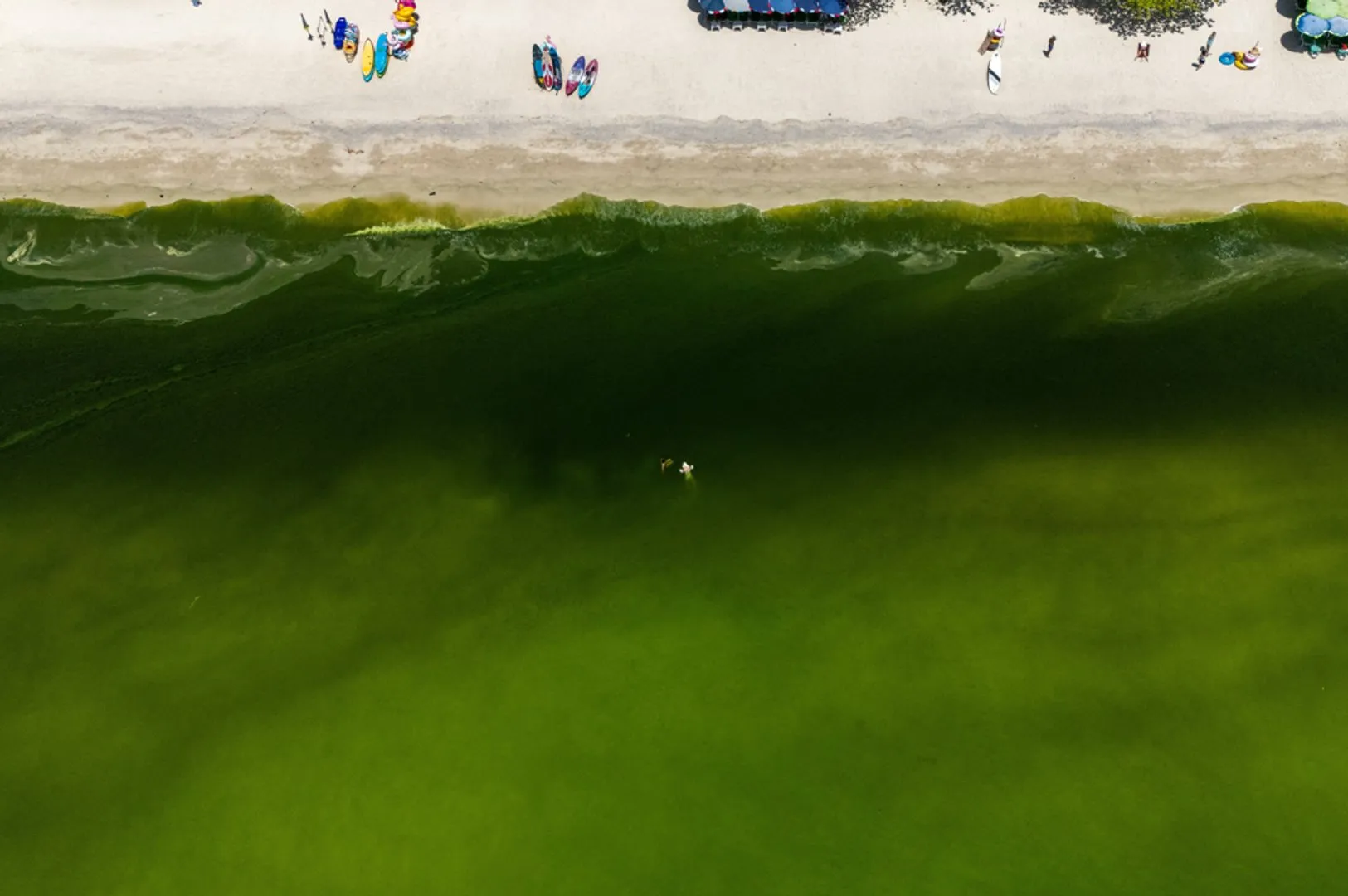
The water off Thailand’s Ko Lan island has turned a vibrant shade of green thanks to a plankton bloom, keeping many tourists out of the water. But scientists say the bigger concern may be what’s happening beneath the surface, where oxygen levels are falling.
Switzerland’s glaciers are rapidly receding due to a combination of winters with too little snow and record-high temperatures across Europe this summer, scientists say. In all, one of the world’s top ski destinations has lost nearly one-fifth of its glacial ice in just five years.
In a report (PDF) published by the Swiss Glacier Monitoring Network (GLAMOS) and the Swiss Commission for Cryosphere Observation of the Swiss Academy of Sciences (SCNAT) on Thursday, researchers said Swiss glaciers lost 5.5 percent of their ice volume over the hydrologic year ending September 30, 2026, and nearly 20 percent since 2021.
Recommended Stories
list of 3 itemsend of list
Why is Switzerland, famed for its Alpine terrain and winter sports, losing its glaciers and what does this mean for the country?
Here’s what we know.
What have scientists discovered?
In September, a GLAMOS team visited 23 glaciers in Switzerland to record end-of-summer measurements of ice melt and snow accumulation.
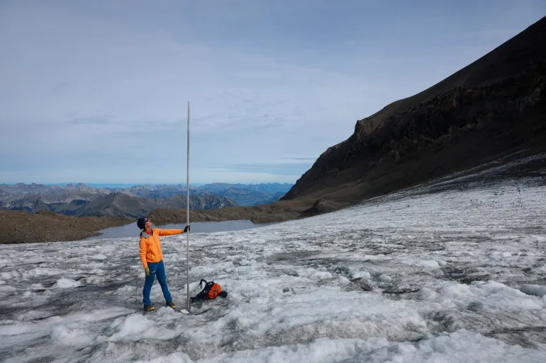
Visiting one glacier named Scex Rouge in the Western Swiss Alps in early September, GLAMOS chief Matthias Huss, one of the report’s researchers, told the Reuters news agency that a measuring pole, about four metres (13 feet) high, was drilled into the ice in July to provide the team with a point of reference.
“Now when we have come back here, we saw the pole was out by three metres [10ft]. So just in August and September of this year, even excluding the heatwaves of June and July, we have lost three metres of ice at an elevation of almost 3,000 metres [9,843ft],” he explained.
“This clearly indicates these conditions that we had this summer, they are just inconsistent with the survival of these small glaciers in the Alps,” he added.
Glaciologist at ETH Zurich and head of GLAMOS Matthias Huss holds a pole that indicates four metres of ice lost over the past year on the Scex Rouge glacier amid climate change at Glacier 3000 in Les Diablerets, Switzerland [File: Denis Balibouse/Reuters]
Why are glaciers in Switzerland losing ice?
According to the report, the total mean thickness of individual glaciers in Switzerland has fallen by between 2.5 and four metres in 2026. At glacier tongues – narrow glacial extensions of a glacier which project from land into a body of water – it had decreased by as much as 10 metres in some places over the summer.
“We can clearly attribute the massive ice loss to the warming, and thus anthropogenic [caused by humans] climate change. The summer has been the hottest on record in Switzerland. In addition, there was little snow in winter, and therefore the glaciers were poorly protected when the heat started,” GLAMOS chief Huss told Al Jazeera.
He noted that while their measurements have indicated that the melting has affected all glaciers in Switzerland equally, the effects were most visible on smaller glaciers.
“Those shrink very quickly and sometimes even completely disappeared. Also, large glaciers lost an enormous quantity of ice, but they remain impressive,” he added.
The report’s scientists warned that the glaciers also lost a total of about 2.2 trillion litres of water (581 billion gallons) between July and September alone.
“This is more than four times the annual drinking water consumption of all Swiss households,” the report’s researchers said and warned this could impact the country’s future water supply.
What does this mean for Switzerland?
Switzerland is a country known for winter sports and Alpine tourism, which depends on the glaciers. About 4 percent of the country’s entire workforce is employed in the tourism sector.
“This affects tourism and also how we perceive the mountains – they are no longer white but increasingly grey and black,” he told Al Jazeera.
He added that the water provided by glaciers is also important for the economy. “It is used to fill up hydropower lakes that produce clean energy, and supplies the biggest streams of Europe,” he said.
“We’re not yet seeing the full consequences as glaciers are still around and they contribute water when we need it. But this potential is soon being lost,” he added.
Harry Zekollari, a glaciologist and associate research professor at the Department of Water and Climate at the Vrije Universiteit Brussel, shared a similar view.
He stressed that glaciers are important natural water suppliers, as they provide water when people need it most – in summer, when it is hot and dry.
“With climate change, glaciers initially provide more water during summer as they rapidly melt. However, as glaciers become smaller, there is less ice to be melted, and as such the water supply in summer decreases. This peak in water supply has now been passed for glaciers in the European Alps, meaning that we expect glaciers to provide less and less water in the coming years,” he told Al Jazeera.
“Glacier changes can also cause natural hazards, and since most of the ice lost turns into water that reaches the oceans, the consequences of glacier loss [in Switzerland and elsewhere] will be felt for coastlines all around the globe,” he added.
Is there a solution?
Yes. According to Zekollari, in order to save as much glacier ice as possible in Switzerland, the world needs to stabilise rising temperatures as soon as possible.
“Projections for the European Alps and Swiss glaciers show that if we are able to rapidly stop emissions, we may still be able to save about one-third of their ice mass. However, in a case with strong warming, these glaciers are projected to lose more than 90 percent of their volume by 2100,” he said.
He noted that the situation is less grim globally as some glaciers in other regions are more persistent.
“However, even globally, future emissions play a big role and will decide whether we lose about 25 percent of glacier mass by 2100 – that’s the good case, with limited warming – or rather 50 percent – the bad case, with more warming,” he said.
“The losses in the longer term – past 2100 – are even larger due to the long response of glaciers, but also here it is the future warming that decides how much remains. Every 0.1 degree Celsius warming matters.”
Beef prices are soaring in China. Across the Pacific Ocean in the United States, cattle farmers are complaining that their businesses are becoming increasingly unsustainable. And in India, poultry rearers are slashing their production targets because they cannot afford feed.
More than 90 percent of the world’s population eats meat in one form or another — and a looming meat crisis threatens to affect what they buy at the market, what they cook at home, and what’s served on the table.
At the heart of this is a chain of decisions and uncertainties that consumers rarely see. A cow has to be raised for years before it can become beef. Chickens need feed, much of it tied to global grain and soya bean markets. Farmers need land, water and weather conditions that allow them to keep animals alive and productive.
When any link in this chain is disrupted, a spiralling crisis ensues.
So what is putting the pressure on meat production, and what does it mean for billions of people around the world?
Declining cattle stocks in Brazil, US and China
Brazil, the US and China are the world’s three biggest beef producers, together supplying more than half of the world’s beef. But their cattle herds are shrinking at the same time.
According to a March estimate by the US Department of Agriculture (USDA), Brazil’s total herd this year is estimated at 177.4 million cattle — a nearly 8 percent drop from 192.5 million in 2024.
Over in the US, cattle numbers are at a historic low.
The USDA counted 86.2 million cattle and calves on farms on January 1, 2026. The number of beef cows — the females needed to produce future calves — was 27.6 million, down 1 percent from a year earlier. The 2025 calf crop was also down 2 percent.
In China, the USDA estimated a cattle head count of 94 million in January 2026, down 14 percent from 105 million in January 2024.
In all three cases, beef production is also projected to be down in 2026.
The USDA predicts a 2 percent decline in Brazil’s beef production and a 5 percent fall in exports. As for the US, beef production in 2026 is likely to be 4 percent lower than last year. China’s total beef supply this year is projected to be 12 percent lower than 2024.
The decline in domestic production, coupled with shrinking supplies that can be imported, has sent prices soaring in China — the world’s largest beef consumer and importer.
What’s driving down cattle herds and beef production?
The reasons are many, and they vary from country to country.
Brazil counts China and the European Union as two major markets for its beef exports. But both have imposed import restrictions that have disincentivised Brazilian beef manufacturers. That is partly responsible for the country’s decreased cattle head count, according to an analysis by Augusto Neto at S&P Global, the market intelligence firm.
Additionally, Brazil is currently in what is known as a cattle reversion cycle — when rearers reduce the slaughter of animals and instead try to preserve their female stock to help rebuild their herd — according to the USDA.
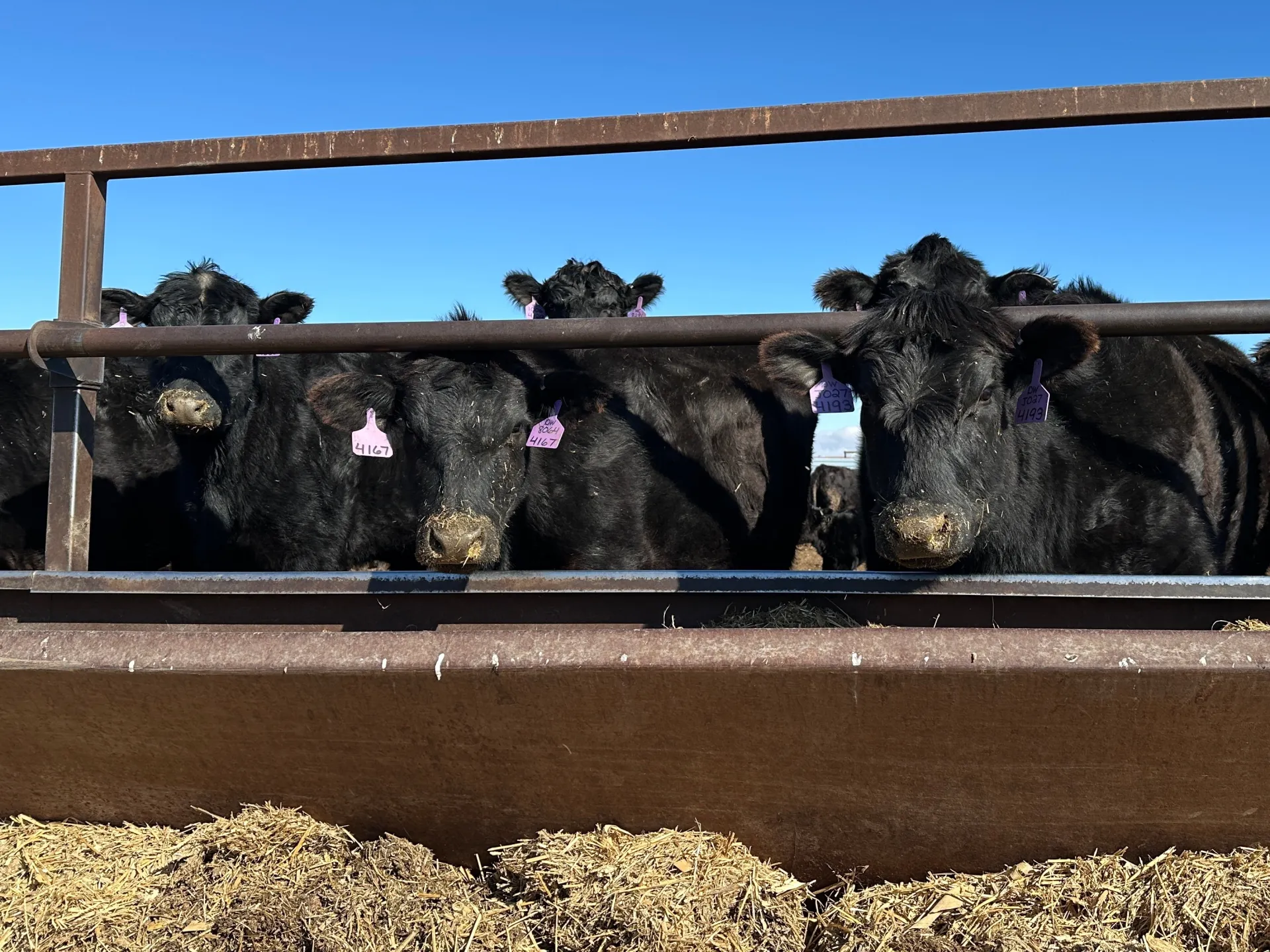
In the US, droughts have hit 60 percent of the country’s cattle-rearing area, according to a report by Sampad Nandy of S&P Global. With grazing areas decreasing, feed costs have risen.
Three major organisations, representing breeders in the states of Texas, Oklahoma and Kansas, issued a joint statement this week arguing that Immigration and Customs Enforcement (ICE) raids were disrupting their already strained operations. The meat industry depends heavily on immigrant workers.
If beef prices are rising, shouldn’t rearers want to produce more beef?
In theory, yes. But in practice, high prices do not automatically mean that more cattle can be produced quickly.
Cattle production is constrained by biological supply cycles, Kenneth Foster, professor of agricultural economics at Purdue University, told Al Jazeera. It can take a couple of years for a producer who receives a signal from the market to expand production and actually see the resulting animals enter the beef supply. The quickest way to rebuild a herd is to keep female cattle that might otherwise have been sold and use them for breeding. That is what Brazil is now doing.
But that creates a difficult economic calculation. A producer can sell an animal today at a high price, or keep it for breeding and wait for the next generation. That means carrying the costs and risks of keeping the animal while waiting for it to reproduce.
The result is a market in which strong demand and limited supply can persist even when prices are already high.
The USDA expects the cattle herd to begin rebuilding in the US, but the process is gradual.
The US and Brazil cases illustrate one of the central problems facing meat production: sometimes the constraint is not technology, land or money.
It is time.
Europe’s move from beef to poultry
Meanwhile, Europe presents a different picture. The continent is witnessing a structural change in what consumers are eating.
The EU produced about 42.7 million tonnes of meat in 2025. But EU meat production is projected to decline by about 3 percent between 2025 and 2035, with beef production projected to fall by 10 percent and pork by 7 percent. Poultry is the exception: production is projected to rise by 5 percent.
This shift is also visible in consumption.
Consumption of EU beef and pigmeat is projected to decline through 2035, while poultry consumption is expected to increase by 9 percent.
Beef and pork require longer production cycles and face different economic and environmental pressures. Poultry, by contrast, can respond much more quickly to changes in demand because chickens reach market weight within weeks rather than years.
That difference is becoming increasingly important. The OECD-FAO Agricultural Outlook expects poultry to be the fastest-growing major meat category globally over the next decade, helped by its relatively low cost and short production cycle.
Europe is therefore becoming an example of how a meat system can adapt without simply producing more of everything. Some forms of meat become harder or more expensive to produce, while others expand to fill part of the space.
Poultry has problems too — as India shows
Yet the poultry industry faces its own challenges, with India offering an example.
In June, a large section of India’s poultry industry announced plans to cut production by 25 percent after soya meal prices rose by more than 40 percent in a month.
The decision was announced by the All India Poultry Breeders’ Association after producers faced sharply higher feed costs and a seasonal decline in demand. Producers also began culling parent breeder stocks — birds needed to produce future generations of poultry.
Soya meal is an important protein source in animal feed. When its price rises sharply, poultry producers face a choice: absorb higher costs, raise prices, or reduce the number of birds they produce.
In India’s case, producers chose to cut production.
The consequences extended beyond individual farms. The Reuters news agency reported in May that Indian soya meal prices had risen 41 percent in one month to a four-year high of 66,000 rupees ($687.5) per tonne. India subsequently cancelled 25,000 tonnes of soya meal export contracts and began turning to soya bean imports from African countries.
The takeaway: a shock in one part of the agricultural system can move quickly through the meat supply chain globally.
As farmers try to protect their livelihoods and families try to keep food on the table, changing climates, rising prices, shifting dietary preferences and growing trade barriers are together reshaping the future of meat — and what we eat.
Ugandan climate activist Vanessa Nakate says Africa is paying a high price for a crisis it did not create. She has taken her fight for climate justice from the streets of Kampala to the halls of power. She has been front and centre in the global climate movement, urging world leaders to act, taking part in protests and speaking at international conferences about the dangers of global warming.
However, Nakate admits progress has been slow. As a UNICEF goodwill ambassador, she has seen firsthand how communities are affected, and insists the major polluters should be held accountable. She is determined to raise awareness about how global warming is affecting African countries in particular. She says the continent is often left out of discussions.
Nakate admits she sometimes feels hopeless about the state of the world, but she is encouraged by grassroots initiatives that are bringing about change.
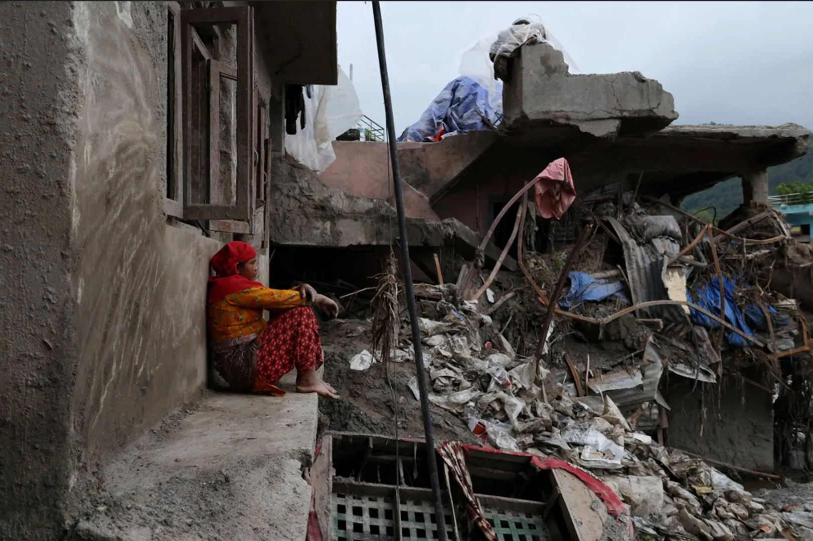
A month after catastrophic floods tore through Nepal, 5,285 people remain missing and more than 1,100 are still in holding centres. Fresh rains are now worsening conditions for displaced families living in temporary shelters, as the country faces a $4.78bn rebuilding bill.
Authorities report increasing death toll over three days as rivers rise above danger levels across parts of neighbouring countries.
Published On 27 Sep 202627 Sep 2026
Heavy rainfall has triggered floods and landslides that have killed at least 56 people in the northern Indian state of Uttar Pradesh in recent days while 12 people have been reported dead in neighbouring Nepal.
Hrishikesh Bhaskar Yashod, Uttar Pradesh’s relief commissioner, said on Sunday that India’s most populous state had registered 66.5mm (2.6 inches) of rain from Friday to Sunday morning, compared with a normal 7.6mm (a quarter of an inch) for the period.
Recommended Stories
list of 3 itemsend of list
The deaths, in addition to 46 injuries, were reported during a spell of “exceptionally heavy rain that has affected much of Uttar Pradesh”, according to the commissioner’s office.
More than 1,000 houses were damaged after “a depression over the Bay of Bengal moved inland and intensified rainfall across the region,” it added.
Home to more than 240 million people, Uttar Pradesh is frequently hit by rain and thunderstorms during the annual monsoon season from June to September.
In India’s eastern state of Odisha, more than 70,000 people living in low-lying areas were evacuated after rivers rose due to heavy downpours, the NDTV news network reported. The rains have damaged bridges and culverts, forcing officials to shut down Devkund, a popular tourist spot in the state.
Separately, India’s Central Water Commission said 30 river-monitoring stations across seven states were in a “severe situation”. Major rivers that flow through India, including the Ganga, Gandak, Kosi, Bagmati and Narmada, had risen above danger levels.
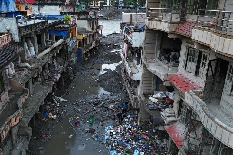
People salvage items from sludge on September 26, 2026, next to deluged houses in Nepal’s Nuwakot district in the aftermath of last month’s flash flooding [Prakash Mathema/AFP]
In Nepal, where a devastating flood in late August killed more than 1,400 people and left thousands missing, a new wave of flooding and landslides has killed at least 12 people since Thursday, according to officials, with several others missing.
Authorities warned of possible flash floods in 49 of the country’s 77 districts, with more than half facing high flooding or flash-flooding risks as water levels in major rivers and tributaries continued to rise.
Power supplies have been disrupted in the Manang, Mustang, Myagdi and Baglung districts, with authorities working to restore electricity, officials at the Ministry of Energy, Water Resources and Irrigation said.
Flooding of the Rahuganga River damaged the structure and transmission-line towers of a 40-megawatt hydropower project, Water Resources and Energy Minister Biraj Bhakta Shrestha said.
Shanti Mahat, a spokesperson for the National Disaster Risk Reduction and Management Authority, said Rasuwa and Nuwakot, areas hit by last month’s deadly floods, should remain “alert” but were not currently considered high-risk areas.
Nonstop rain since Thursday has submerged Thai capital’s roads and canals, sending water into many homes and stores.
Published On 26 Sep 202626 Sep 2026
Bangkok authorities have declared a disaster zone across all 50 districts of Thailand’s capital after three consecutive days of rainfall caused heavy flooding.
The disaster designation, which gives local organisations authority to take action, came on Saturday after Governor Chadchart Sittipunt said almost 300mm (11.8 inches) of rain had fallen since Thursday afternoon.
Recommended Stories
list of 4 itemsend of list
The nonstop rain inundated roads and canals with water, sending water into many homes and stores alongside them, according to reports. Photos and videos showed major roads submerged and cars abandoned after drivers were unable to move through the rising water.
Chadchart said the east of the city was most impacted and warned that more rain was forecast again on Saturday. He added that flooding should recede once the rain subsides, as city officials work to drain floodwaters as quickly as possible.
“The rain keeps falling and we are doing our best. We are trying to pump the water out, but the water in canals are full,” he said on social media. “The risk areas are those who live near canals. Every canal is now filled.”
Later on Saturday, the government said the flooding situation had “stabilised” but added it would still take two or three days for the water to drain, as long as the rain held off. “If more rainwater doesn’t fall in the area, it will be solved,” he said.
People walk past abandoned vehicles on a flooded Phetchaburi Road in Bangkok on September 26, 2026 [Lillian Suwanrumpha/AFP]
Chadchart also advised residents to move their cars to higher ground, as Bangkok’s public transport authority offered free access to MRT train “park and ride” carparks to store their vehicles until October 2.
Reporting from a flooded street in Bangkok, Al Jazeera’s Tony Cheng said the Thai capital is no stranger to heavy rain during the monsoon season, but the continuous rainfall had locals worried.
“What usually happens is we get heavy downpours for a couple of hours, then you’ll see the street often flooded but it would flow away into the drains quickly, and it would only happen in isolated areas too,” he said.
“What’s happening here is … happening all across the city. This is not a flash flood; this is persistent heavy rain since Thursday evening, and it shows no sign of letting up.”
Somkid Pheuk-ngam, 67, a vendor who lives near a canal just north of central Bangkok, said she had to close her shop for two days.
“The water keeps coming in. It’s hard to go out now. It’s at my waist level,” she told the AFP news agency. “I cannot go anywhere,” she said, adding that this was “worse than the 2011 flood.”
Widespread flooding across Thailand in 2011 killed more than 500 people and damaged millions of homes.
The Department of Disaster Prevention and Mitigation has warned of low pressure across eastern, northeastern and central Thailand until Sunday, saying there was a risk of flash floods, forest runoff, mudslides and river overflow.
‘Hit by the climate we didn’t warm, hit by the wars we didn’t start.’
Nepal’s Prime Minister Balendra Shah was applauded at the UN General Assembly, as he highlighted how the world is failing countries on the frontline of the climate crisis.
Prime Minister Balendra Shah told the UN that world leaders must act on climate change.
Published On 25 Sep 202625 Sep 2026
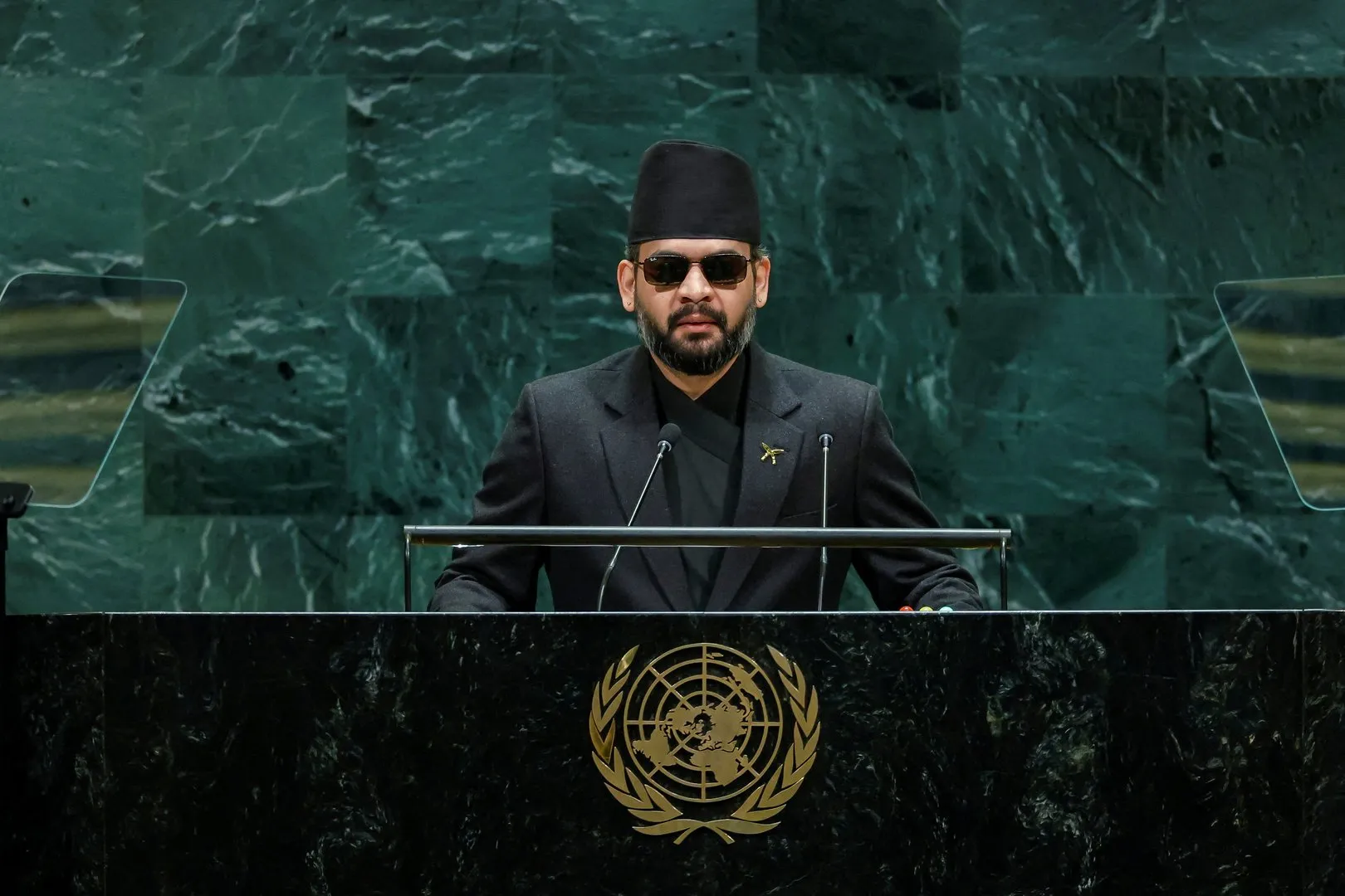
Nepal’s Prime Minister Balendra Shah has appealed for action to combat the rising threat of climate change, calling the flood that devastated his country last month “a warning to the world”.
Shah made the comments during his address to the 81st Session of the United Nations General Assembly in New York on Thursday night. He told the gathering that the August disaster “was not just a local tragedy”, asking them the question, “Have you really heard that warning?”
Recommended Stories
list of 3 itemsend of list
Political leaders “have been negligent to translate those warnings in action at the speed and scale that the vulnerable people require,” he said.
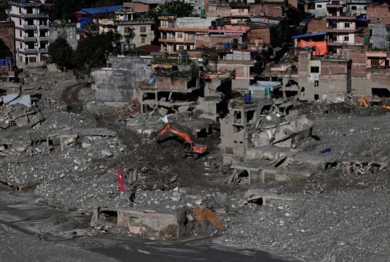
An excavator clears mud from damaged houses following deadly flash floods and a mudslide, in Nuwakot district, Nepal, on September 21, 2026 [Navesh Chitrakar/Reuters]
At least 1,453 people died when a torrent of mud, rock and water struck northern Nepal and the China-Tibet border on August 26, triggered by a glacial collapse.
According to Nepal’s National Disaster Risk Reduction and Management Authority, 5,500 people were still missing and 13,795 had been rescued.
Researchers from the World Weather Attribution (WWA) group said in a report released last week that the disaster was not caused by a single extreme weather event, but rather a “compound crisis” shaped by long-term warming, glacier retreat, permafrost thaw and geological instability.
Shah said climate change was hurting people not responsible for the crisis but who “are paying a colossal price for it”.
He said Nepal contributed less than one-tenth of 1 percent of the heat-trapping gases behind climate change. About 99 percent of the country’s electricity comes from hydropower, and many workers were trapped in tunnels by the flooding.
“Our glaciers are retreating, our mountain slopes are becoming unstable, our rivers are becoming less predictable, and every major disaster threatens to erase years of development,” Shah said.
Nepal Prime Minister Balendra Shah addresses the 81st United Nations General Assembly at UN headquarters in New York City, US, on September 24, 2026 [Eduardo Munoz/Reuters]
Shah urged the international community to help bear the cost of helping Nepal adapt to climate change.
He proposed to create a ‘Himalaya Climate Resilience Mechanism’ which would include Nepal and neighbours India and China, and would allow them to share satellite data and expertise, monitor glacial lakes and strengthen joint early warning systems.
Nepal has asked the UN’s loss and damage fund for $20m in aid, the maximum allowed, but a tiny fraction of what it needs. A preliminary assessment by the government has placed the cost of the disaster at $5bn.
The fund, established in 2022 in the aftermath of catastrophic floods in Pakistan, has yet to make even its first disbursement, and observers see Nepal as a key test of its credibility.
Earlier this week, the United States pledged an additional $31m in new flood recovery support.
Heavy rains could cause life-threatening flooding and landslides on Mexico’s Pacific Coast, the US National Hurricane Center warned.
Published On 24 Sep 202624 Sep 2026
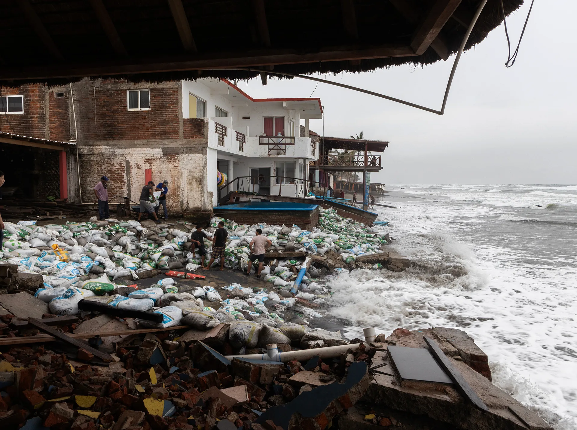
Hurricane Polo has sent heavy rain and strong waves across Mexico’s Pacific coast, while Tropical Storm Nolo is approaching Hawaii with the potential for catastrophic flooding.
Early on Thursday, the hurricane was swirling about 130 miles (209 kilometres) south-southwest of the Mexican city of Zihuatanejo. It was moving northwest at 7mph (11kph) and forecast to turn west-northwest later in the day, taking it further out to sea, before turning northwest on Saturday.
Polo was forecast to maintain Category 5 strength as it moves along Mexico’s coast over the next few days.
While the eye and the strongest winds were expected to remain at sea, the heavy rains could cause life-threatening flooding and landslides, warned the US National Hurricane Center in Miami.
A hurricane watch was issued for Hawaii county and disaster preparations are under way because Tropical Storm Nolo could hit the island on Friday or Saturday, warned the National Weather Service.
John Bravender, a weather service warning coordination meteorologist, said during a news conference on Wednesday afternoon that the tropical storm could develop into a major hurricane.
Hawaii County Mayor Kimo Alameda told residents in a video message that they should start preparing for the storm. He urged them to put together emergency kits with food, water and medications, as well as trim vegetation and clear drains.
“This is a very serious situation,” he said. “We do believe that the rain is going to come. It’s coming already.”
Governor Josh Green’s office said public schools and state and county offices across Hawaii’s Big Island will close on Thursday and Friday, while Maui County will shut them on Friday ahead of the threat of heavy rain, winds and flooding.
The country has battled multiple wildfires amid record-breaking temperatures fueled by El Nino and intense drought conditions.
Published On 20 Sep 202620 Sep 2026
A massive wildfire has broken out in central Colombia, threatening the popular tourist town of Villa de Leyva, according to local officials.
The forest fire is near the Andean town in the Boyaca department, with flames engulfing the San Marcos hillside above the colonial architecture and cobblestone streets that attract more than a million visitors annually.
The blaze has already consumed 40 hectares of native forest, sending massive plumes of smoke that are visible from the town’s central square, according to Colombian authorities.
On Saturday night, Colombian President Abelardo de la Espriella posted on X that “Villa de Leyva is not alone”, pledging to mobilise all state resources to fight the fire and protect “this historical jewel” and “beautiful city that is the pride of Colombia”.
To combat the flames, the Boyaca department government said it is dispatching two aircraft. A military helicopter will also join the effort, along with firefighters from the capital, Bogota, Interior Minister Rodrigo Lara said.
The mayor of Bogota, Carlos Fernando Galan, will be sending a team of firefighters to join local crews from Tunja and Boyaca, reinforcing containment efforts and securing the urban centre, Lara said.
In the equatorial Andes, forest fires peak during the dry season, but this year they are fuelled by a severe El Nino weather pattern. Record high temperatures and lack of moisture have turned vast expanses of the Andean vegetation into tinderboxes. That has intensified a crisis that has already started 18 active wildfires across the country, according to the latest official data from Colombia’s National Unit for Disaster Risk Management (UNGRD).
The impacts of El Nino, a natural weather pattern, are felt globally and do not affect the entire South American continent in the same way, inducing extreme droughts in some regions and torrential flooding in others. This year, it comes supercharged by the effects of climate change, which is worrying many scientists, governments and aid workers.
The warming of the adjacent Pacific has triggered catastrophic flash floods and landslides in countries such as Peru and Ecuador.
Unlike in the southern part of the continent, where countries including Argentina, Chile and Uruguay have been expecting unseasonably heavy rainfall, El Nino has the opposite effect in the northern part of the continent. A significant reduction in rainfall leads to severe drought conditions which can suppress cloud formation and displace normal rain patterns, driving average temperatures well above normal.
The soaring heat rapidly evaporates moisture from the ground and water basins, leaving countries such as Colombia with extended periods of drought and critically low precipitation.
“El Nino can bring devastating climate extremes on its own, but it’s unfolding today on a much warmer planet, increasing the likelihood that heat, drought, floods and fires will push communities and ecosystems beyond anything they have experienced before,” said Stephanie Roe, lead climate scientist with the World Wildlife Fund.
New Delhi, India – On the morning of August 26, the Himalayan landscape above Nepal’s Rasuwa district changed in minutes.
A mass of ice and rock broke loose high in the mountains and sent a violent surge of water, mud and debris down the Lhende Khola River. The torrent travelled through valleys, swept away settlements and infrastructure and eventually reached the Nepal-China border.
What followed was not simply a flood.
It was a chain reaction.
By mid-September, more than 1,400 people had been reported dead and at least 6,000 remained missing in Nepal and across the border in Tibet. Twelve hydropower plants were destroyed, while roads, bridges and homes were buried or washed away.
The scale of the destruction has left scientists and disaster managers confronting a difficult question: How do you warn communities about a disaster whose trigger may occur high above them, in terrain that is difficult to monitor and where there may be only minutes to react?
Basanta Raj Adhikari, director of the Centre for Disaster Studies at Tribhuvan University in Kathmandu, described the event to Al Jazeera as unprecedented in size, affected area and mechanism. His estimate suggested that the energy involved was greater than that released by the Hiroshima atomic bomb, a comparison intended to illustrate the scale of the physical forces involved rather than suggest that the event was equivalent to a nuclear explosion.
For scientists who study the Himalayas, the disaster demonstrated how quickly an event originating in a remote, high-altitude environment can become a regional catastrophe.
And Nepal is not alone.
The warning problem
A warming climate is altering glaciers, snow cover, permafrost and high-altitude lakes. At the same time, roads, hydropower projects, tourist facilities and settlements have pushed deeper into mountain valleys.
That combination is creating a new risk landscape in which one hazard can trigger another.
An avalanche can block a river. A blocked river can form a temporary lake. A sudden release can become a debris flow. That debris can destroy a road or bridge, block another river and create another flood downstream.
The August disaster in Nepal showed how quickly such a sequence can unfold. It also exposed a weakness in the way early-warning systems are often designed.
Many systems are built around a particular hazard: rainfall, river level or glacial lake outburst flood. But the Himalayas do not always respect those categories.
In July, the International Centre for Integrated Mountain Development, or ICIMOD, warned that a below-normal monsoon should not be interpreted as a safer one.
“The biggest misunderstanding is that less seasonal rainfall means lower flood risk,” said Saswata Sanyal, a disaster risk reduction specialist at ICIMOD.
“A drier monsoon can still be a dangerous monsoon,” he added, warning that seasonal averages cannot capture the cloudbursts capable of producing catastrophic flooding in mountain valleys.
The Nepal disaster went a step further.
The immediate trigger was not simply heavy rainfall.
Scientists have been examining an ice-rock avalanche and other possible processes that temporarily obstructed the river system before releasing a destructive surge. ICIMOD has described the event as an ice avalanche rather than a conventional glacial lake outburst flood, while other scientists have examined the role of local seismic activity and other high-altitude processes.
That distinction matters.
A warning system waiting for rainfall or a rising river may not provide enough time when the real trigger happens several kilometres upstream and above the line of sight of the communities below.
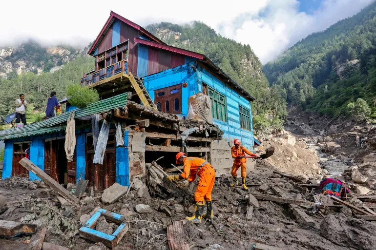
Indian National Disaster Response Force (NDRF) personnel conduct a search and rescue operation at the site of a flash flood at a village in the Kishtwar district of Indian-administered Kashmir on August 16, 2025 [AFP]
Kashmir’s warning signs
Thousands of kilometres away, scientists studying Kashmir’s Himalayas are seeing another part of the same problem.
A study published in the Journal of Glaciology this year mapped 155 glacial lakes above 2,500 metres (8,200ft) across the Himalayas in Indian-administered Kashmir.
The researchers found that the area of ice-contact proglacial lakes – bodies of water that form directly against the margin of a melting glacier, trapped by moraine ridges, bedrock basins, or ice dams – had increased by 26 percent between 1992 and 2024.
Five lakes were classified as having very high susceptibility to glacial lake outburst floods.
An outburst from those lakes, the researchers found, could threaten several thousand buildings, 15 major bridges, roads and a hydropower project.
More significantly, the study warned that hazards could occur in chains, with an upstream lake outburst potentially triggering secondary events downstream.
For Irfan Rashid, a glaciologist and associate professor at the University of Kashmir who co-authored the study, the implications extend beyond individual lakes.
Rashid recently told Al Jazeera that without action, the melting, thinning, and destabilisation of glaciers, seasonal snow cover, and permafrost along the Hindu Kush-Himalayas system would increase, and water shortages could become a major problem across the Upper Indus, Ganga and Brahmaputra basins by the end of the century.
That is why the Nepal disaster resonates in Kashmir.
The landscapes are different, the rivers are different and the individual hazards may differ. But the underlying problem is increasingly similar: Communities living downstream of a rapidly changing high-altitude environment may have little time to respond when something breaks loose above them.
The challenge is particularly acute in places where roads, bridges and hydropower projects occupy narrow valleys.
Once a mountain river begins carrying enormous quantities of rock, ice and mud, infrastructure designed for conventional floods can quickly become irrelevant.
Volunteers rescue flood-affected victims along with their livestock using a boat following heavy rains and overflowing of the Sutlej River, on the outskirts of Multan in Punjab province, Pakistan, on September 4, 2025 [Shahid Saeed Mirza/AFP]
Pakistan has already begun building a warning network
The same concern runs across the western Himalayas and Karakoram ranges.
The Gilgit-Baltistan region in Pakistan-administered Kashmir contains hundreds of glaciers and glacial lakes, while communities and infrastructure sit along valleys exposed to sudden floods and landslides.
Pakistan has responded by expanding early-warning infrastructure.
Under a United Nations-supported programme, early-warning systems, evacuation shelters, disaster-management centres and other protective measures have been established in vulnerable valleys.
But technology alone cannot solve the problem. A sensor can detect a change. Someone still has to receive the message. Someone has to understand what it means. And people downstream have to have a route to safety.
That last part is often the weakest link. A siren is useful only if the people hearing it know where to go. An automatic warning is useful only if it arrives before the flood. A satellite image is useful only if the information can be converted into a decision quickly enough to save lives.
This is why disaster scientists increasingly talk about anticipatory action rather than simply disaster response.
“The era of preparing for a single, predictable hazard is over,” Sanyal said earlier this year. “Anticipatory action and early warning must now be the foundation.”
Nepal army soldiers work during a search and rescue operation outside a tunnel near a hydropower project site, following deadly flash floods and mudslides, in Rasuwa district, Nepal, on September 1, 2026 [Reuters]
The infrastructure trap
The Himalayas are also becoming more heavily engineered.
Hydropower is central to Nepal’s economy. Roads are being expanded. Border crossings are growing in importance. Tourism is pushing deeper into remote valleys.
The benefits are obvious. So are the risks.
The August disaster struck an area where hydropower infrastructure was concentrated along the river corridor. At least 900 workers were believed to have been inside tunnels and other facilities in the aftermath, making rescue operations extraordinarily difficult. Two workers were eventually pulled alive from a hydropower tunnel nine days after the disaster.
The question is no longer simply whether infrastructure can withstand a flood. It is whether planners have adequately considered what happens when a flood is carrying an enormous mass of rock and ice, when a river changes course, or when one mountain hazard triggers another.
For decades, engineering risk assessments have often relied on historical records. But history becomes a less reliable guide when the physical conditions producing disasters are changing.
A river that flooded once every several decades may no longer behave according to the same pattern. A glacier that appeared stable from satellite imagery may sit beneath an increasingly unstable slope. A lake that was considered remote may suddenly become a threat to a road, village or power plant hundreds of metres below.
Relatives of victims and missing people react outside the morgue of the Tribhuvan University Teaching Hospital (TUTH), in Kathmandu, Nepal, August 29, 2026 [Narendra Shreshtha/EPA]
The border problem
There is another complication that no satellite can solve on its own.
Borders.
The Himalayas are divided among countries with different political systems, security concerns and approaches to sharing information. But rivers do not stop at international boundaries. Neither do floods.
The August disaster reached the Nepal-China border and damaged the Gyirong crossing, an important trade and pilgrimage route. The disaster also raised questions about how quickly information about hazards in high mountain areas can move between countries.
This is where regional cooperation becomes more than a diplomatic slogan, experts say. A sensor positioned in one country can provide warning to people in another. A satellite image collected over one mountain range can reveal a developing hazard that threatens a valley downstream. A river gauge can provide critical information before floodwaters reach a settlement.
The technical capability already exists in many cases. The missing piece is often the architecture connecting it.
A 2026 assessment of Himalayan disaster risks has argued for stronger monitoring, early-warning systems and regional coordination because hazards are increasingly interconnected.
The idea is simple: Information about a mountain hazard should not stop at the same line where a political boundary begins.
Buildings are inundated after flash floods triggered by sudden heavy rainfall swamped Rangpo town in Sikkim, India, Friday, October 6, 2023 [Prakash Adhikari/AP Photo]
From Nepal to Sikkim to Kashmir
The August disaster in Nepal isn’t a tragedy belonging to one country, point out experts.
The Kashmir Himalayas study has already identified lakes capable of producing destructive outburst floods and has warned of cascading processes.
Northeast India’s Sikkim provides another example.
Today, 40 high-risk glacial lakes have been identified in Sikkim, including 16 placed in the highest-risk category, with authorities working on drainage, flood-retention and other protective measures.
But the lesson from each disaster is broadly the same: Waiting for a disaster to prove the risk is the most expensive form of preparedness.
The world’s second largest mountain, the 8,611-metre- (28,251ft-) high K2 (seen in the distance), and the 8,051-meter- (26.414ft-) high Broad Peak (R), are illuminated by the moon at Concordia, the confluence of the Baltoro and Godwin-Austen glaciers, in the Karakoram mountain range in Pakistan, September 7, 2014 [Wolfgang Rattay/Reuters]
The Third Pole test
The Himalayas are sometimes called the Third Pole because they contain one of the world’s largest concentrations of snow and ice outside the Arctic and Antarctic.
Major Asian rivers depend on water originating in these mountains. Hundreds of millions of people live downstream.
That makes the changing Himalayas not only an environmental issue but a security, infrastructure and humanitarian one.
The August disaster demonstrated the most frightening version of that future. A mountain can collapse without warning. A river can become a weapon of debris. A hydropower tunnel can become a trap. A border crossing can disappear in minutes. And by the time people downstream understand what is happening, the water may already be there.
It’s a future that a region stretching from northeast India, spanning Tibet, Nepal, Kashmir and Pakistan, can no longer ignore. Yet disaster management remains largely divided by national boundaries. That contradiction is becoming harder to navigate.
The next glacial collapse could begin in Kashmir. It could begin in Pakistan’s high mountains. It could begin in Sikkim, Nepal or Tibet.
Wherever it starts, the same question will follow the mountain downstream: Who knew, how early did they know, and did the warning reach the people in time?
For a region entering an era of increasingly complex mountain hazards, that may be the real measure of whether the Third Pole is prepared.
Magdalena Andersson will likely face several challenges as she tries to get Sweden’s other left-wing parties to unite.
Published On 18 Sep 202618 Sep 2026
Sweden’s opposition leader has officially begun talks to form a coalition government after the country’s left-wing bloc won a slim majority in last week’s election.
Magdalena Andersson, leader of the centre-left Social Democrats, was asked by Parliament Speaker Andreas Norlen on Friday to begin efforts to form a new government.
Recommended Stories
list of 3 itemsend of list
Norlen’s request follows the resignation of centre-right Prime Minister Ulf Kristersson, who stepped down on Thursday after the general election result was confirmed.
“I have now been tasked with exploring the possibility of forming a government. A task I undertake with great humility and will act constructively to put together a new government,” Andersson said in a statement posted on Instagram.
“My approach to the work that is now taking place is that all political forces now need to put party tactics aside and put Sweden and the Swedish people first.”
Andersson will likely face a series of challenges as she tries to persuade Sweden’s other left-wing parties to unite and form a new administration. The left-wing bloc won 176 of Parliament’s 349 seats in last week’s vote, securing a razor-thin majority of three seats.
Andersson is expected to seek the support of three other left-wing parties: the Greens, the Centre Party and the Left Party.
The socialist Left Party says Andersson will have to award some of its MPs cabinet posts to win their support. However, the liberal Centre Party insists it will not support such a government.
Andersson has until September 28 to form a government. If she fails, Kristersson, whose centre-right bloc won 173 seats, will try to form a coalition.
Coalition and minority governments are common in Sweden because the country has two major left- and right-wing blocs, both of which contain four parties.
The process of forming a government following the 2022 election took more than a month.
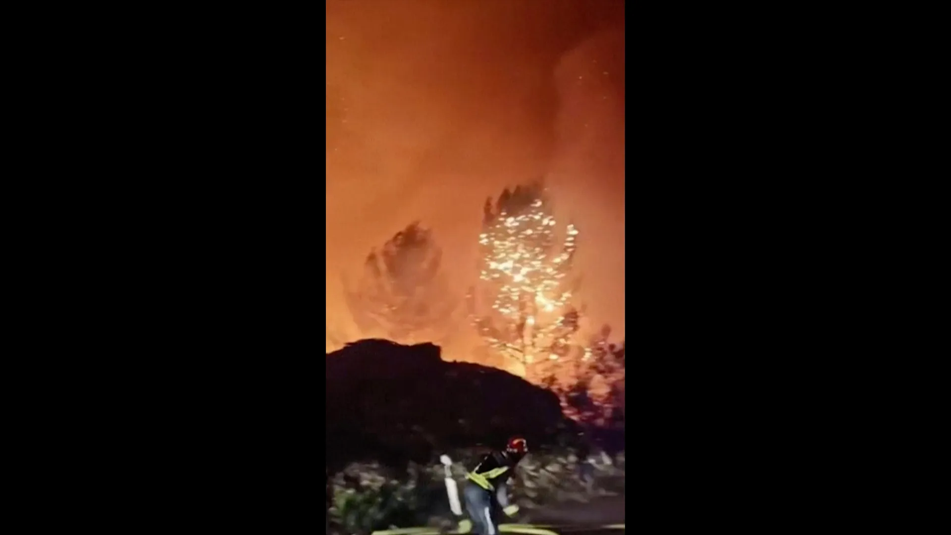
Croatian authorities have issued an emergency alert as a wildfire rages on Brac Island, off the Dalmatian coast. Strong winds have hampered efforts to stop the blaze near the island village of Milna.





![An excavator clears mud from damaged houses following deadly flash floods and a mudslide, in Nuwakot district, Nepal, September 21, 2026 [Navesh Chitrakar/Reuters]](https://i0.wp.com/occasionaldigest.com/wp-content/uploads/2026/09/2026-09-25T021410Z_709369844_RC2ENNAUM1TN_RTRMADP_3_NEPAL-FLOODS-BALEN-UN-1790312192.jpg?w=640&ssl=1)
![Nepal Prime Minister Balendra Shah addresses the 81st United Nations General Assembly at UN headquarters in New York City, US, September 24, 2026 [Eduardo Munoz/Reuters]](https://i0.wp.com/occasionaldigest.com/wp-content/uploads/2026/09/2026-09-25T002524Z_1559668133_RC20QNACRCWK_RTRMADP_3_UN-ASSEMBLY-1790312740.jpg?w=640&ssl=1)
![Indian National Disaster Response Force (NDRF) personnel conduct a search and rescue operation at the site of a flash flood at a village in the Kishtwar district of Indian-administered Kashmir on August 16, 2025 [AFP]](https://i0.wp.com/occasionaldigest.com/wp-content/uploads/2026/09/afp_68aac36f5150-1756021615.jpg?w=640&ssl=1)