The Roman road is 2000 years old and takes you on a stunning journey filled with history

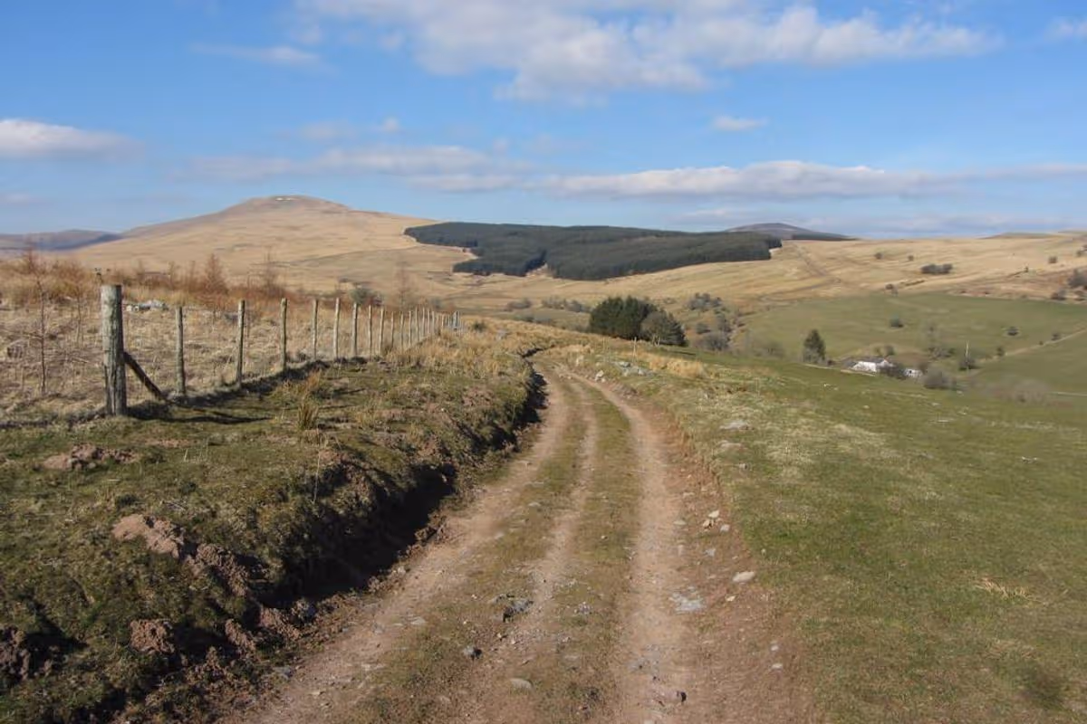
Sarn Helen near Fan Nedd, between Neath and Brecon(Image: Gareth James/CC BY-SA 2.0 DEED)
One of Wales‘ best-kept secrets is a living slice of history sitting right beneath our feet – yet even those who live along it remain largely unaware of its existence.
This ancient Roman road, running from Neath in the south all the way to Conwy in the north, is a remarkable, semi-hidden treasure.
Sarn Helen, among the most intact Roman roads in Wales, still reveals its cobbled stone foundations in places, laid bare by centuries of wear and tear. A firm favourite with ramblers, Sarn Helen was built nearly 2,000 years ago.
It’s believed to be named after Celtic princess Elen Lwy-ddawg – or Saint Elen, an early founder of churches across Wales – who married Magnus Maximus, the formidable Roman emperor who arrived in Britain around 368AD.
As the daughter of Romano-British ruler Octavius, legend has it she persuaded her husband to build roads throughout the country, allowing his troops to protect it more efficiently from would-be invaders.
Imposing standing stones, some soaring to 13ft in height and dating back long before the Roman conquest of Britain, are dotted along certain sections of the route.
One stone, known as Maen Madoc, still bears an ancient Latin inscription reading: “Dervacus, son of Justus. Here he lies.”
Nestled within the Bannau Brycheiniog National Park, it’s perfectly positioned in line with the area’s largest standing stone, Maen Llia, which sits at the head of the Llia Valley.
Indeed, were it not for the forestry in between, you could see one stone from the other with ease, despite them being roughly two miles apart.
Maen Llia is thought to date back to the Bronze Age. Considering a quarter of the stone is buried deep underground, the sheer effort needed to haul this enormous monument into place would have been immense.
What these stones were actually for remains hotly debated among experts, with suggestions including basic route markers, Stone Age boundary markers, or gravestones commemorating those who died by the wayside.
Yet while the theories surrounding them are as well-worn as Sarn Helen itself, the real answer probably lies just below the surface, frustratingly out of reach.
In 2020, writer Tom Bullough took on the challenge of walking the full length of Sarn Helen, starting his trek in Neath. At what was once the beginning point stands Roman Way, a modern housing estate, though locals there appeared oblivious to its historical importance when Tom asked around.
Next to the current road sits a small section of stone wall surrounded by railings, all that’s left of the ancient Roman fortification that once stood on the spot.
Bullough describes his journey in his book, fittingly entitled ‘Sarn Helen’, “It is not until you reach Hirfynydd, the hill running north-east away from Neath, that you first encounter Sarn Helen,” he observes.
“A grass-stripped track framed by broken walls, it follows the ridge through puddles and swamps, over occasional passages of stone once laid down by Roman legionaries. Some of them still have a distinct surface, with neat kerbs to either side.”
He goes on to detail the paths that meander gently among the wildlife and sheep, dating back to the early days of Roman occupation in Britain. The battle for dominance over South Wales was brutal, with the indigenous Silures tribe holding out for decades.
Ultimately, following their defeat of the second legion, the Romans founded Neath’s fort around AD74, placing the road’s construction at approximately that period. The route runs straight in sections, now marked by the trails of bikes and off-road vehicles.
The road terminates at the Conwy estuary, as Bullough writes: “Here, 1,900 years ago, the Roman galleys would ride the tides to land or collect their supplies and men. Here it was that Sarn Helen ended and the rest of the world began”.