What’s the edgiest region in the UK? I don’t mean in the sense of sketchy or fashionable, but where on the map of these four nations feels most at the margins of everywhere else? For my money, the north Cumbrian coast is a strong contender. Hemmed in by the Lake District fells on one side and the Solway Firth and Irish Sea on the other, this strip of towns and villages, farms and nature reserves, clinging to the low-lying littoral, has been battling nature, weather, geology and geography throughout its history.
Coastal erosion is part of the challenge. Like the railway navvies before them, the planners and builders of the England Coast Path (ECP) have done sterling work at plotting a viable footpath and shoring it up. But there are and always will be sections that are compromised and even impassable. I chose a section that would take three days, walking southwards, and my final destination, St Bees, was only reachable via a diversion. It’s all part of the adventure, and we’re lucky to have the ECP as a national trail, as it means issues and obstacles on the English coast will usually be promptly addressed.
The harbour at Maryport. Photograph: John Morrison/Alamy
I began my walk at Maryport, a natural choice as it’s where the Cumbrian Coast Line, travelling south from Carlisle, meets the seashore. I resisted the urge to jump off the train and set off walking, instead taking time to look around. I’m glad I did. It’s a lovely place, in a ramshackle way, and quite fascinating. The Romans, who called it Alauna, built a fort here; the Senhouse museum boasts Britain’s largest collection of Roman altars and inscriptions found at a single site.
An LS Lowry trail takes in places he painted. I followed it from the church beside the quay, up the steep town steps, and along some of the streets he worked into his compositions. Information panels celebrated less well-known, similarly gifted local painters: Sheila Fell, from nearby Aspatria, and Percy Kelly, born in Workington, known for his thick lines and dark landscapes, who played for Workington AFC under Bill Shanklyand, in later life, became Roberta Penelope.
Out on the coast path, I took in my first views of Dumfriesshire to the north. There were few walkers on the empty strand. At Flimby, the “path” was just a line of kelp on a pebble beach, bordered by flowering sea kale. Clouds of cabbage white and small blue butterflies sprang up as I walked. West Cumbria is the only area where the latter can be found in northern England. An unfamiliar call and a flutter of white wings sent me to my birder app. It was a pair of sandwich terns – an “amber” status bird on the RSPB website.
There were patches of heather and rosehip, occasional dunes and a few birds. Swallows picked off flies. Herring gulls shouted. Black-headed gulls planed. Carrot-beaked oyster catchers fluted their alarm calls. On my left, above the marram grass, I could see industrial plants and old workers’ terraces. The Cumbria coast is more Morrissey lyric than Countryfile fantasy. Boulders have been arrayed to protect against storms. Two teenage girls bronzed (or pinked) themselves on rocks in the midday sun.
St Bees Lighthouse, near Whitehaven. Photograph: Alan Novelli/Alamy
Workington welcomed me, after seven miles. I’d been here before, for a “Where tourists seldom tread” feature for this newspaper, but it felt new arriving on foot and from the shore. Workington looks as its name sounds. Decades of industry have made the people steely and friendly. I spent the night above town at the Hunday Manor hotel, which has superb views over the coast and back to the fells.
The next day’s walk to Whitehaven was the longest at about 12 miles. The opening stretch, back down into Workington, was a pleasant surprise. From above town, I’d noted fuel silos, warehouses and industrial estates, but around the harbour the land was all grassy knolls. I could see Scafell Pike rising up to the south-east, and Scotland shimmering to the north. In the distance were cliffs and a wide inlet – my destination, Whitehaven.
I undertook this walk during the the UK’s fifth heatwave, one of the driest, warmest periods in living memory in these parts. As the mercury rose, I climbed up on to the clifftops, pausing at the Howe, a hill originally created from industrial slag, to gulp down water and look up at a 3-metre steel and wood crucifix put up by a local man in memory of his wife. From here, there was a messy section with scant waymarking, but I eventually came to Harrington, a bonny little suburban village, with kite flyers on the bluff and smart little terraces marching up the side streets. I ate lunch and watched trains come and go; they’re regular enough that you can always cut short a walk and hop on one.
Up on the cliffs again, I passed a large windfarm, and approached the village of Parton on a bridleway that sliced through sheep fields. The air was filled with the hairy seeds of thorns, bursting in the heat.
A path beneath dramatic sandstone cliffs guided me into Whitehaven. One of northern England’s loveliest towns, it has all the amenities a tired walker needs. But while it caters to visitors, it hasn’t sold its entire soul to tourism – which is the case with some Lakeland towns.
Whitehaven used to be an industrial powerhouse, shipping tobacco, coal, ceramics, iron ore, limestone and textiles, and it was the fifth most active British port involved in the transatlantic slave trade. The older streets are lined with crumbling mansions. Victorian-era lighthouses and a chimney known as the Candlestick are unmissable landmarks; between these are ghostly traces of tenements, coastal batteries and long-silenced engine houses. Silting and larger ships led to the town being eclipsed by the deepwater ports of Liverpool and Glasgow. Shipbuilding moved to Belfast. Nostalgia, grit, grandeur and decay all mingle in Whitehaven’s collective maritime memory.
The coastal path, with St Bees in the distance. Photograph: Simon Evans/Alamy
I swotted up on Whitehaven’s layered history at The Beacon, one of the UK’s finest and most rejuvenating town museums. Underneath the museum, the Howling Wolf Bakery and cafe serves delicious cakes, toasties and coffee. There are great restaurants all over town – I can recommend The Peddler, in the former bus station, and Zest on the waterside – and every kind of pub, chippy and cafe.
The Edge hotel, which opened last October, will bolster Whitehaven’s ambitions to compete with the Lake District. It was created as a base for coastal activities; the harbour commission, which owns the property, is committed to supporting walkers, cyclists, musicians and community groups. There are 16 ensuite rooms looking out over the marina – an attractive mix of historic quays and jetties (known as tongues), and modern add-ons. The Edge’s irregular polyhedral shape is striking and yet apt. Rust-coloured, it looks post-industrial but also like a storm barrier. Its air-source underfloor heating and solar panels are in keeping with a region famed for renewable energy.
An alternative route was in place for the final leg, with erosion on the footpath forcing me inland. But I was too elated to be bothered by a minor diversion. My coast walk (23 miles direct, but considerably more with walks around towns and hikes to/from the Workington hotel) culminated at St Bees Head with views of spectacular coves, secret beaches and sheer cliffs.
Where the ECP crossed paths with the recently inaugurated Coast to Coast National Trail, I met a few walkers, Aussies rather than Brits, all heading inland for Ennerdale and Helvellyn, there to encounter crowds and join queues. My only company was fulmars, cormorants, herring gulls, ravens and kestrels. When I came across a little colony of kittiwakes nesting on tiny ledges, I decided it was time to sit down too, and soak up the gentle sea breezes and the wide, all-encompassing silence.
The trip was supported by Cumbria Tourism, Avanti, Northern and Stagecoach buses. Stagecoach has DayRider and 3-day Explorer passes. Doubles at The Edge from £117 B&B and at Hunday Manor Country House hotel from £125 B&B.
Netflix and AMC Global Media, the network that originally aired the zombie series, inked a new five-year co-streaming deal, according to a press release on Thursday. Both companies will be able to show the original “The Walking Dead” series and its six spinoffs on Netflix and AMC+. The deal is valued at $500 million, AMC Global Media said in its second-quarter earnings report.
“This deal creates a global destination for this universe — all shows, all episodes — making the franchise more accessible than ever to fans around the world. In addition, the co-exclusive agreement allows us to bring the original series to AMC+ for the first time early next year,” Kristin Dolan, the company’s chief executive, said in a statement. “This agreement is a fantastic result for our companies, for the fans and for this timeless IP.”
AMC Global Media is renting the franchise, not selling it. The five-year licenses run separately for each show, with start dates that vary based on territory and the expiration of existing streaming deals. The rights to “The Walking Dead” revert to AMC Global Media when the term ends.
The company also keeps global rights to run the “Walking Dead” universe on its own services throughout. Dolan told investors the agreement would supply what she called “a meaningful source of cash flow for years to come,” framing it as evidence that the company’s library still commands premium prices even as its cable business shrinks.
The agreement will extend the franchise’s reach on Netflix in places like the U.K., Italy, Australia and New Zealand — making episodes available beginning in 2027.
“The Walking Dead” premiered on the AMC network in 2010, introducing audiences to the high-stakes world of a zombie apocalypse. In 2011, the series began streaming exclusively on Netflix in the U.S. The show aired for 11 seasons and became one of AMC’s most influential shows. Other popular programs from the network include “Mad Men” and “Breaking Bad.”
“Audiences have discovered and loved ‘The Walking Dead’ on Netflix for nearly 15 years and the show continues to attract new fans,” Lori Conkling, Netflix’s vice president of licensing, said in a statement.
The deal landed alongside a rough quarter. AMC Global Media reported second-quarter revenue of $547 million, down 9% from a year earlier, and a loss of 51 cents a share, compared with 91 cents in profit in the same period last year. Operating income fell to about $16 million from $64 million.
Netflix’s second-quarter earnings showed mixed results. The company‘s revenue rose 13% to $12.6 billion; its net income was $3.4 billion, up 9% from a year ago; and its advertising business is on track to reach $3 billion in revenue this year, double the amount in 2025.
The same filing offered some details on Netflix’s acquisition of InterPositive, the AI post-production startup founded by Ben Affleck, for $587 million in cash in March.
The Lake District and the Peak District have been notoriously known as England’s walking hotspots, but a picturesque destination with rolling hills has emerged as a new favourite
With rolling hills and river valleys, this region is the best destination for a walking holiday (Image: Getty Images/iStockphoto)
England’s best walking destination has been named – and it’s not the Lake District or Peak District.
Every year, thousands of Brits flock to the Lake District for a rambling retreat, thanks to its pristine glacial waters against its dramatic mountain backdrop and rolling valleys. Meanwhile, the Peak District offers scenes of purple heather moorland, rugged rocks, and winding river valleys, making it a haven for hikers.
They are undoubtedly two of the most popular places to venture around during a scenic walking holiday, with ramblers rewarded with spectacular views. However, they’ve now been outshone by a new region – and it has its own renowned walking trail.
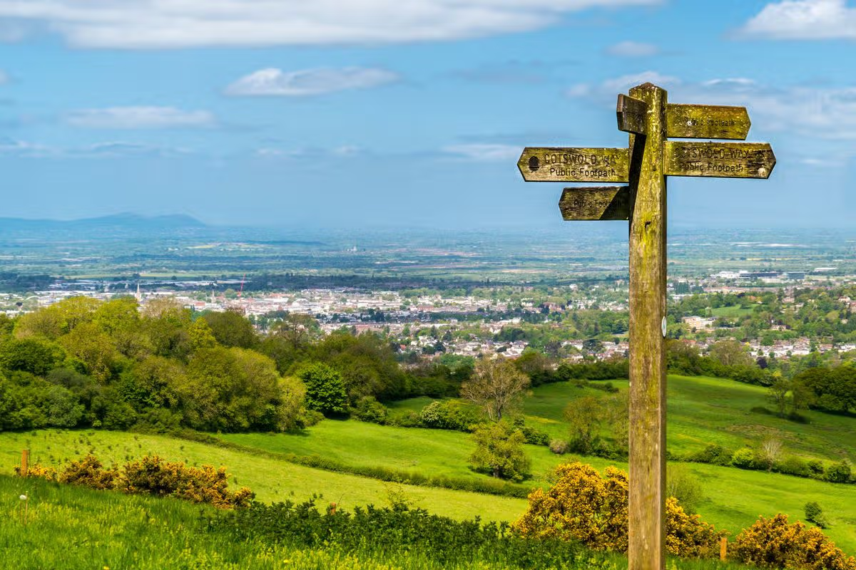
The Cotswolds has been named as the ‘best place to go walking in England’, by Responsible Travel, thanks to its scenes of ancient woodlands, tranquil river valleys, rolling hills and honey-coloured cottages. Spanning across 800 square miles, measuring around 90 miles in length and 25 miles in width, there are ample walking trails to explore in England’s largest Area of Outstanding Natural Beauty (AONB).
In its guide, Responsible Travel said: “It is not surprising that great writers from Shelley to Waugh have been inspired by the Cotswolds. Like their literary worlds, walking here transports you to a serene and soothing place.
“Walk through ancient towns such as Stow-on-the-Wold or Bourton-on-the-Water, where even the names evoke time gone by. Well known for its slow food ethos, you won’t be short of fine inns and food as you wander through village and vale.”
As the Cotswolds span six counties, Gloucestershire, Oxfordshire, Warwickshire, Wiltshire, Worcestershire, and Somerset, there’s a plethora of charming towns and idyllic villages to visit while on one of the many routes and trails. And of course, a bundle of cosy country pubs and beer gardens to stop by for that refreshing restbite.
A major walking route in the region is the Cotswolds Way, which stretches 102 miles from Chipping Campden in Gloucestershire to Bath in Somerset. Following the western edge of the Cotswold Hills, the trail passes by the stunning scenes that make up the renowned region, alongside grand manor homes, historic battle sites, Neolithic burial barrows and honey-hued villages.
One of the most popular villages to stop by in the Cotswolds is Bibury, with its Arlington Row, which has garnered worldwide attention for its picture-postcard setting. The village has also been dubbed the ‘most beautiful village in England’ by artist and writer William Morris, and it attracts thousands of tourists every year.
Another favourite spot is the village of Bourton-on-the-Water, renowned as the ‘Venice of the Cotswolds’, with its crystal-clear meandering river and quaint stone bridges. Castle Combe is another village that feels like a scene from a fairy tale, with preserved medieval cottages frozen in time since 1600, with no TV aerial in sight and wires hidden underground to maintain its beauty.
Top 12 walking destinations in England
Cotswolds
Dorset
Lake District
Peak District
Pilgrims Way
Shakespeares Way
South West Coast Path
Suffolk coast
Sussex & the South Downs
Thames Path
White Cliffs of Dover & Kent coast
Yorkshire
Do you have a travel story to share? Email webtravel@reachplc.com
“I’m not going to wake her up,” I hiss at my 12-year-old son who’s standing half naked in a dark corridor of a Victorian house. “Please, Mum. She said we could come at any time! I don’t want to get Lyme disease,” he begs.
This is not the kind of drama I was expecting when I signed up to a family walking holiday in Exmoor. A few meltdowns about an extra mile or a blister perhaps, but not a night mission to one of the guides to request a tick removal.
The door opens and Jill comes out brandishing her tweezers. “Have you found another one?” she says cheerily as she whips out the bug that’s buried its head in my son’s torso.
As we trot back to our room, I feel as though I’ve walked into one of the Enid Blyton boarding school books I devoured as a child, returning from a visit to matron with the warm fuzzy feeling of being safe and looked after. Everything about this HF Holidays trip, based at Holnicote House, near Selworthy, feels as though I’ve stepped into a little piece of British history. From the morning briefings in the boot room to pre-dinner hula-hooping on the lawn, we could easily have time travelled to 1956.
The company – a cooperative – has been around since 1913, when Lancashire pastor Thomas Arthur Leonard founded the Holiday Fellowship to give working people access to countryside walking holidays. More than a century later, much of that original spirit survives: communal dining tables, organised walks, evening entertainment and the feeling that everyone has collectively agreed to leave behind modern life for a few days.
The holiday is based at Holnicote House. Photograph: Andrew Hasson/Alamy
I’ve come with my two daughters, 10 and 14, and my son in the hope that one of them might turn into a new walking buddy. Since marrying my husband 18 years ago, holidays have tended towards the accessible – he has partial paralysis – and long hikes, ridge walks and muddy scrambles are things I associate with a previous version of myself. This time I’ve left him at home and have four days (and four walks) to turn the kids on to the pleasures of the great outdoors. We share two rooms with Victorian sash windows and built-in cupboards, simple but spacious. The house has been an HF Holidays property since 1952 and has 32 rooms (14 are singles), sleeping up to 50. This week, there are about 40 of us.
Over scones and cream at the arrival briefing, the kids scour the room for children their age, while I clock other solo parents and grandparents along with a couple of multigenerational family groups. Each day, we can choose from four walks graded in difficulty from level one (about 3 miles), to level four (about 10 miles and with the steepest ascent).
We quickly find our stride: ticking boxes to order packed lunches; attending evening briefings to choose the next day’s walk; joining in organised nightly activities. It’s an introduction for my children to a particular brand of Britishness – one of tea in the drawing room and snacks in brown paper bags, of camaraderie and can-do. And although they are the only mixed-race children here, they easily fold into the tribe of HF Holidays repeaters. Their presence speaks to the history of this country mansion, which during the second world war became Britain’s first mixed-race orphanage, established for children born to Black American GIs and white British mothers at a time when many faced open hostility and rejection.
Two of the writer’s children. Photograph: Antonia Windsor
My children’s initial resistance to the idea of a walking holiday turns to enthusiasm when they realise we’re all in it together and friends made out on the lawn are also on the walks with them. Each day, we’re out for five or six hours. The walks are so brilliantly paced with snack stops, paddle stops, tree climbing stops and the promise of ice-cream at the end, that even my youngest, the most reluctant, happily keeps pace and asks questions about trees and flowers. Mary, our guide, was a geography teacher and imparts her encyclopaedic knowledge engagingly, getting us to count rings on felled trees to determine their age or to guess which leaves come from which tree. We’ve borrowed some binoculars and enjoy identifying the white feathers of a buzzard’s belly and working out the name of a cargo ship far away in the Bristol Channel.
The walks, which are largely circular, cover varied landscapes: fields of buttercups and noisy sheep, pine forests and cliff paths. A particular favourite is a walk that starts by travelling two stops on the steam train of the West Somerset Railway and ends with a visit to Dunster Castle, which emerges fairytale-like from a deer-filled field.
Panorama view of Dunster castle in England. Photograph: Pavel Dudek/Alamy
As a solo parent I’m never lonely. Long conversations on walks lead to shared meals and drinks. The children bag “kids tables” at dinner, forcing us adults to mingle. I share one meal with a father who’s with his youngest while the older children are home revising, another with a woman who’s brought her grandchildren (up to three under-11s stay for free with a paying adult). Nearly everyone has been on an HF Holiday before; many came themselves as children. The food is surprisingly good with nightly three-course dinners; my son loves the soups, my eldest the salads and the youngest feels too grown up for the kids menu of burgers and nuggets and opts instead for fish and couscous, or chicken and potato gratin.
The holiday ends with dancing to a live ceilidh band. The final song has Sally walking down an alley and meeting a man from Tennessee. I think of those young English girls and their GI lovers, and for all the old-fashioned fun of the past few days I feel grateful I’ve had my children in a different era. Watching my daughters line dance with pensioners, I vow that this is where I, too, will bring my grandchildren, if I’m lucky enough to have them. But until then, I will bring my son, who tells me on the drive home that he preferred this holiday to any beach holiday we’ve had – despite the ticks. I think I may just have found myself a new walking buddy.
The trip was provided by HF Holidays. The next four-night Exmoor Family Walking Adventuresare on 17 and 24 August, £909pp (under-11s free), including full board and daily guided walks. Book now for discounts of up to £172pp for Easter, August and October 2027
We’re sipping chestnut kir on a terrace overlooking the Tarn River in southern France when we hear excited voices from the table beside us: “Regards! C’est un castor!” Below us, a beaver the length of my leg is languidly swimming upstream. We don’t need our binoculars because the Tarn is so clean that almost every fish, frog, pebble and ribbon of weed can be seen with the naked eye, magnified by the clarity of the water. This meandering, jade-green river – which winds from its source in the Cévennes national park to Moissac, just north of Toulouse – is home to trout, perch, carp, otters, frogs, toads, kingfishers and herons. We add “beavers” to our list.
Above us, huge vultures have been drifting all day, cruising the thermals in groups of nine or 10. And when our eyes haven’t been on the river or the sky, they have been welded to the many orchids on the bank: including monkey, bee, military, butterfly, pyramidal and fragrant orchids. Later, we discover that 30 varieties have been recorded in this orchid hotspot.
Enticed by the cooler microclimate provided by the double whammy of a river and a deep gorge, we’re walking a five-day section of one of France’s newest long-distance hiking routes (April, May, early June and late September are among the best times to tackle it). The 300km GR736 officially opened in 2023 and runs from the Tarn’s source to the city of Albi. Three days of the route run directly through the Gorges du Tarn, Europe’s longest and most dramatic canyon, a 33-mile (53km) limestone gully of rock formations and towering cliffs that often rise 500 metres above the river. The gorge is also home to more than 3,000 vultures, as well as cuckoos, nightingales, red-billed choughs and owls.
Many beavers inhabit the Tarn riverbank. Photograph: Kiszon Pascal/Getty Images
Besides exceptional wildlife, a succession of medieval towns, abandoned hamlets, deserted churches, ruined castles, crumbling terraces and jaw-dropping architectural oddities are dotted along the gorge. Most must be reached on foot, via “balcon” paths often dizzyingly (albeit safely) whittled from the gorge itself.
Our walk begins in Le Pont-de-Montvert, a bustling historic town amid the expansive heathery uplands of Mont Lozère, from where the Tarn springs. For two days we traverse an unpeopled, wind-blown wilderness of menhirs, boulders, broom and heather, before descending to wildflower meadows and forests of beech and pine. We walk about 10 to 15 miles a day, unimpeded by bulky backpacks as our luggage is transported in a minivan that arrives promptly at 9am every morning.
It’s only as we descend into the gorge on day three that we begin to encounter a myriad of human-made curiosities. The first is Castelbouc, a semi-troglodytic hamlet of narrow, cobbled streets, watched over by the remnants of a castle balanced on a vertiginous spur.
Chateau and abandoned village of Castelbouc. Photograph: Michal Sikorski/Alamy
From here, we briefly cross the gorge to Sainte-Enimie, one of France’s celebrated “plus beaux villages” (its steep cobbled streets are lined with honey-coloured houses hung with pink roses), which is thriving thanks to the road that winds along the gorge’s right bank. Then it’s back to the left bank with its single-file footpath and cooling canopy of chestnut trees. We stop for the night in the restored village of Saint-Chély-du-Tarn, which has an original village bread oven, waterwheel, 12th-century church and miniature chapel carved into the rock. We dine at Auberge de la Cascade (the only place to eat in the village), feasting on Tarn-caught trout and ice-cream made from the local châtaigne, a small sweet chestnut and essential ingredient in the region’s most delicious aperitif, kir à la châtaigne – white wine with a dash of chestnut liqueur.
The following day’s gorge walk feels weirdly Jurassic, thanks to the sulphurous-yellow rocks, thickly mossed tree trunks and enormous ferns. At the hamlet of Hauterives, we spot a rigged cable-and-basket for hoisting goods over the river: someone appears to be living in this isolated spot. A couple of miles of ascending and descending brings us to the waterside town of La Malène, where we relax in a flat-bottomed boat while a professional batelier (boatman), Clément, punts us four miles downriver, pointing out the beaver families that inhabit every half-mile of riverbank, and four varieties of resident vulture (griffon, black, bearded and Egyptian), whose young will fledge throughout the summer.
Clément puts us ashore at Cirque des Baumes, where we scramble up the almost sheer bank using a series of ropes – an exhilarating experience. Here, we encounter yet another hauntingly abandoned village where miniature houses perch – precariously and mind-bogglingly – on limestone plinths. Signs of life (washing on a line) suggest that someone also lives in this ghost village – without electricity, gas or mains water.
Le Pont de Montvert, where the writer began her walk. Photograph: Hemis/Alamy
We stroll on, past miles of neglected retaining walls, which once held terraced orchards of cherry and chestnut trees; now, the place is home to deer, boar, pine martens and muskrats. After a cooling dip in the river, we walk to Les Vignes and our charming hotel, Le Parisien – pink-and-white striped walls, vintage framed photographs, antique brass beds. The chef, Amélie, tells us that she hopes the new GR736 will bring more people to the area, providing new life for these dying villages.
On our final day, the gorge slowly unfolds and flattens, opening out into a verdant valley of twisted triffid-like trees draped in luxurious moss, and glistening banks of black volcanic stone spill across our path. We follow the river to its confluence with the Jonte and spend our last evening in Peyreleau (designated “une petite cité de caractère”), strolling ancient cobbled streets and exploring medieval churches and towers with far-flung views. From the terrace of Hôtel Doussière, we watch swallows and swifts skimming the river below, and agree that Robert Louis Stevenson was right when he wrote: “If the garden of Eden exists, it’s in the valley of the Tarn …”
Annabel travelled independently. On Foot Holidays offers a week-long, self-guided trip with baggage-carrying service from £1,245pp. More information atgr-infos.com
Annabel is the author of The Walking Cure, published by Bloomsbury Tonic (£10.99).To support the Guardian buy a copy at guardianbookshop.com. Delivery charges may apply
‘Uh oh, look at these!” I call to my friends, Annie and Mike. “Ominous,” remarks Annie. Mike raises an eyebrow. We’re hiking the Pevensey Levels, marshland first drained in 772, home now to sheep and cattle, but also water spiders, living underwater in air-filled webs. The ground is pocked with endless impressions of horseshoes.
“It’s almost as if an army came this way,” I say.
And we laugh, but only because we missed that army by 959 years. Annie, Mike, Fflos the dog, and I are on our first day of following the 1066 Country Walk across East Sussex, beginning at Pevensey, ending in Rye. At the midpoint is the town of Battle, where we have rented an outbuilding conversion for three nights. Battle is known as the probable site of the Battle of Hastings: the brutal killing field where about 2,000 Normans, 4,000 Anglo-Saxons and 700 horses died one day in October 1066, according to various sources, leading to William the Conqueror defeating King Harold for the crown of England.
Battle Abbey. Photograph: Maciej Olszewski/Alamy
History commands an immediacy outdoors that it doesn’t in books. You ask different questions on foot. We were on the Levels at the same time of year, September, as the Normans: did they note the blackthorn heavy with sloes? Spot blackbirds feasting on blood-red hawthorn berries? Hear the wind in the rushes alongside the River Pevensey? Did they remark how faded yet abundant this land was on the cusp of autumn? Doubtful, but the contradictions of war-making in such a gentle place – gentle light, gentle breeze, birdsong and river currents – make an impression on us. We notice how the landscape offers the same russet, sage and ochre hues as the Bayeux tapestry.
The 1066 Walk covers 31 miles, and we’ve given it four days: Pevensey to Herstmonceux, 6 miles; Herstmonceux to Battle, 11; Battle to Icklesham, 9; and Icklesham to Rye, 5. Our second day is the longest and steepest, and yet my favourite, as it establishes a pattern that continues throughout. We pick up the well-signposted route in the green secrecy of Wartling Wood, carpeted in acorns, lined by blackberries, and follow it around sunny fields. We emerge into the neat village of Boreham Street, plunge down a holloway guarded by beeches, and roll out into more fields with windswept, distant horizons. The impression is of a settled, well-inhabited landscape – a feeling augmented by morning tea at the Ash Tree Inn in the hamlet of Brownbread Street – but another deeper, more enduring impression underlies it.
Perhaps because the route is designed to call the distant past to mind, with every shift of scene we experience a slippage of time. One moment we’re walking down a contemporary street being passed by speeding cars, then we slip through a small opening in a hedge and plunge not only into fields or woods, but out of the present into time immemorial. There’s a constant weaving in and out of darkness and light, wildness and cultivation, close-grown tunnels of greenery and wide-open, windy spaces, and with each shift comes a hurtling from present to past and back again. The effect is of a temporal quilt sewn with our own footsteps. We encounter few other walkers to break the spell.
Colour saturated … St Thomas church in Winchelsea. Photograph: Nelson Art/Alamy
Elasticity of time is most apparent on Tent Hill, where, as Mike puts it, “the reward to effort ratio is quite good”. Sources suggest one army or the other – no one knows which – camped here, hence the name. Instead of troops, we discover an ancient horse chestnut with branches so immense they have touched the ground and put down roots of their own, creating a family of trees around a living, central ancestor. Joining their company is occupying past and present at once.
Because Mike has had the good sense to rent accommodation at Abbey View Cottages – there is indeed a view of Battle Abbey’s towers – we set forth on day three from our own digs. Another plunge off a country lane lands us on a bridle path in Battle’s Great Wood, where Mike announces: “My fungi sense is twitching.” Soon he is giving a mushroom tutorial: fly agarics; edible boletes and parasols; great penny buns (“the Rolls-Royce of mushrooms,” Mike pronounces).
And then the temporal hopscotch continues. One minute we’re crossing a golf course, the next we’re in deep countryside with venerable oasthouses tucked into hill folds. Shortly before arriving at the welcoming Three Oaks pub, we come upon one of artist Keith Pettit’s 10 Bayeux tapestry-inspired sculptures on the route: six hollow, Celtic-carved oak pillars planted inside with hawthorn. Together they form a circle of growing, living wonder on a hillcrest.
Rye: ‘A town of Henry James, antique shops and good food’. Photograph: Jenifoto/Getty Images
Our final hike brings us to medieval Winchelsea, rebuilt by Edward I in the 1280s after the original town was washed away. We have traversed apple orchards and spent the morning in mellowness reminiscent of Dutch landscape paintings. To our joy, the modern stained glass windows of Winchlesea’s St Thomas church, created by Douglas Strachan as memorials following the first world war, bloom on the route like colour-saturated rainbows.
From Winchelsea, we head to Rye across the silted-in, coastal lowland that would have been underwater in Edward’s day. With Rye in eyeshot, we depart from the official 1066 Country Walk to detour past the ruin of Camber Castle, pressed into the flatland by a big, heavy sky. Begun in 1512, finished in 1544 and demolished in the 1640s by parliamentary forces in the English civil war, it’s a reminder of vulnerability – the waves and threats of invasions this coast has seen – and hubris, simultaneously.
With a final shift of perspective – pastureland to townscape – we fetch up in pretty, comfortable Rye, town of Henry James, antique shops and good food. We are more energised than exhausted, and grateful we didn’t have to conquer this place with anything more than our imaginations.
The Bayeux tapestry is on display at the British Museum from 10 September to 11 July 2027’ tickets now on sale. Abbey View Cottages sleeps four, from £200 a night; rooms as the Ship Innin Rye from £75.
Pamela Petro is the author of The Long Field,published by Little Toller (£14). To support the Guardian buy a copy at guardianbookshop.com. Delivery charges may apply.
Amid stiff competition, the Bernese Oberland is probably the Swiss Alps – perhaps any Alps – at their best. Here, the Jungfrau, Mönch and Eiger loom in thrilling cohort, lakes dazzle in extraordinary shades, waterfalls tumble down elvish valleys and picturesque villages teeter at dizzying heights. And, this being Switzerland, everything is connected by efficient PostBuses, gondolas, mountain railways and, of course, walking trails.
Summer is the best trekking season – trails are snow-free, mountain huts are open, the weather is most settled. Route options are numerous. Cicerone’s new trekking guide, The Bernese Oberland, recommends a nine-stage, 74-mile tour of the Jungfrau region, a magnificent moderate-grade, hut-to-hut loop from the mountain village of Grindelwald.
Those shorter on time could spend a few days walking between cute, car-free Mürren and Wengen, Kleine Scheidegg (from where the Jungfraubahn railway grinds up to 3,454m), Grindelwald and Schynige Platte – the hike to this mountain ridge, with views up to snowy peaks and down to lakes Thun and Brienz, is arguably Europe’s finest day walk.
How to do it Accommodation is plentiful; berths in Swiss Alpine Club huts can be booked in advance at sac-cas.ch. Macs Adventure offers an eight-day Grindelwald Trail trip from £1,510pp.
The Alpe Adria, the ultimate pleasure trail, Slovenia and Italy
The Soča river in Slovenia, on the Alpe Adria trail. Photograph: Yuliia Burlachenko/Alamy
Distance up to 465 miles Duration 7-9+ days
If you’ve got all summer, the Alpe Adria is a hiker’s dream: more than 450 miles of leisurely ambling, from the base of Grossglockner, Austria’s highest mountain, to the shores of the Adriatic.
If you don’t have time for the whole route, go for a one week chunk in Slovenia’s Julian Alps. Despite being scenically spectacular, and cheaper than, say, Switzerland or France, Slovenia’s mountains still tend to be quieter than other regions in summer.
The section from the resort of Kranjska Gora to Cividale del Friuli, over the border in Italy, packs in the high peaks and passes of Triglav national park, the emerald-hued Soča River, mountain villages and the Isonzo Front, where Italian and Austro-Hungarian forces clashed in the first world war; old bunkers can still be seen. It’s a moderate-to-challenging 80-mile, six-day hike, but well worth the effort, with one of the best views saved for last: the final ascent over the Kolovrat mountain ridge delivers a panorama taking in both Alpine peaks and the Adriatic Sea.
Near Porto, on the coastal route to Santiago de Compostela. Photograph: Ivoha/Alamy
Distance 170 miles Duration 2 weeks
If you’re set on a summer pilgrimage to Santiago de Compostela, make it this coastal one. The route from Porto to the tomb of Saint James is the third most popular camino, offering plenty of peregrino camaraderie, but less human traffic than the busy Camino Francés. Plus Atlantic gusts keep things a little cooler, with lots of opportunities for refreshing dips.
Starting from Porto, the trail follows the coast, via fishing villages and swathes of blond sand, up to Caminha, where a boat across the River Minho deposits walkers in Spain. The trail continues to hug the coast to Vigo, the 100km-to-Santiago mark. Many pilgrims start here, the minimum distance required to earn a completion certificate. Soon after, the camino leaves the sea, finishing with an inland stretch, past the hot springs of Caldas de Reis and the hot peppers of Padrón.
How to do it Municipal pilgrims’ hostels can’t be pre-booked (they’re first come, first served). Private hostels and hotels should be booked in advance in summer. Exodus offers a 15-day self-guided Portuguese Coastal trip from £1,839pp
Along the Lech, an untamed Alpine river inAustriaand Germany
The River Lech near Forchach, Austria, with the Lechtal Alps in the distance. Photograph: PK-Photos/Getty Images
Distance 78 miles Duration 7-10 days
It feels cooler, walking by water. Which makes the river-tracing, shade-bathed Lechweg a good option for a summer stroll. The easy-to-moderate route was the first to be designated a Leading Quality Trail by the European Hiking Federation, an indicator of its excellent infrastructure and waymarking.
It follows the River Lech from its source in the mountains (at 1,793m, so the trail can only be accessed in full from mid-June to early October) near Austria’s Formarinsee lake to the Lechfall waterfall in Füssen, in Germany’s Bavarian Alps. Soon after that, the river becomes tamer, dammed to serve hydroelectric power stations. But before Füssen, the Lech – one of Europe’s last remaining stretches of wild river – runs free, its turquoise waters braiding over gravel plains, fed by Alpine streams, roaring through gorges and frothing amid pine forest and soaring peaks.
However, while the landscape feels untouched, facilities are plentiful, with a succession of mountain towns and villages offering comfy lodging, historic churches and artisans producing everything from beer to cheese.
How to do itLechweg.com has details of trails and accommodation. Walkers’ Britain offers an eight-day, self-guided Lechtal trip from £990pp.
The Beara Way, a quieter and wilder side of south-west Ireland
Uragh Stone Circle on the Beara peninsula, Ireland. Photograph: Vibbily/Alamy
Distance up to 128 miles Duration 3-10 days
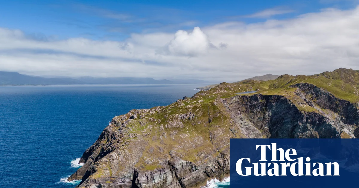
South-west Ireland’s remote Beara peninsula offers a respite from summer temperatures elsewhere: cooled by Atlantic breezes, it’s rarely too hot down here. And, dangling below the better-known Dingle and Iveragh peninsulas, Beara escapes some of the crowds, too.
The Beara Way makes a loop of this rugged finger of land, using tracks, bog roads and boreens (country lanes) to negotiate hills and valleys, ancient stone circles, early Christian churches, 19th-century copper mines, even a Tibetan Buddhist retreat. The full Beara Way, beginning and ending in Glengarriff, can be done in around 10 days. Or you could spend a few days tackling a selection of the route’s 15 spin-off circular walks. These include taking Ireland’s only cable car over the sea to Dursey, to make a nine-mile loop of this largely deserted isle, or catching the ferry from Castletownbere to make a circuit of Bere, an island-cum-open air museum, home to Martello tower forts, gun batteries, a lighthouse and a harbour fortified by Vikings.
Ramsvikslandet, on Sweden’s Kuststigen trail. Photograph: Fredrik Schenholm
Distance up to 234 miles Duration 2-5+ days
The Kuststigen isn’t a continuous hike along West Sweden’s Bohuslän coast; it is 44 well-marked stages (some connected, some not, with most easily accessible by ferry or bus) showcasing this knockout shoreline’s sapphire seas, pink granite outcrops, bright-painted fishing villages and some of its 8,000 idyllic isles and skerries. This makes it an easy trail to dip into for a few days’ sea-breezy summer hiking.
The Swedish holiday season runs from July to mid-August, so go in late August to early September (or next June) when the weather will still be mild and the coast crowd-free.
Which sections to choose? Stage 22 (7 miles) loops Ramsvikslandet, a striking peninsula nature reserve known as the Kingdom of Rocks. Combine it with stage 24, the linear Kungshamn-Tullboden route (10 miles), then a ferry hop to complete stage 25, a circuit of Bohus-Malmön (6 miles), via ancient monuments and swimming lagoons. For city-accessible strolling, take the free ferry from Gothenburg’s Lilla Varholmen terminal to Hönö, to walk stages 1-3 (17 miles in total), an unfurling of flowery meadows, sandy beaches, swim spots and seabirds.
The Sheep’s Head peninsula is clearly a good place to be a skylark. They seem to warble overhead at every turn, singing their little hearts out – and who could blame them? The hills here are high and heathery, the sea breeze is warmed by the Gulf Stream and the edge-of-the-world scenery is a realm of wild green slopes and endless blue Atlantic. If you had to choose a sky to lark in, the one that crowns this County Cork headland is a bona fide wing-quiverer.
The peninsula wows hikers, too. I’ve come to one of the south-westernmost points on the Irish mainland to trek the Sheep’s Head Way, a long-distance trail opened by the local community 30 years ago this summer. It took serious work to complete – more of which later – but it’s a delight. I’m walking the original 55-mile (88km) loop around the peninsula, although a longer, 63-mile option is now considered the official route.The way attracts a fraction of the numbers drawn to the Kerry Way and Dingle Peninsula trail further north, and thanks to its untrammelled paths and rampant, cliff-edged scenery, the rewards are grand, in every sense.
“Ah, you’ll love it,” enthuses Thérése Linehan of Doire Liath B&B in Bantry, having fuelled me with poached eggs and soda bread for breakfast. “People do.” This colour-splashed harbour town, at the landward end of the peninsula, is the route’s start and end point. I’m setting off on a Friday and the waterside square is busy with market stalls: fresh seafood, local artworks, turbo-strength flat whites. A statue of 18th-century revolutionary Wolfe Tone stares out to sea. I dawdle a while in the chilly May sunshine, then walk west.
The early miles wind up into the range of rounded drumlins that form the spine of the peninsula. Wildflowers speckle the gorse verges; boggy paths squelch underfoot. Soon, the views open up. Bantry Bay to the north, Dunmanus Bay to the south and a belt of shaggy-grassed peaks stretching out ahead. Swallows are cavorting in the wind. I turn and see nothing but hills, ridges and sea. Where is everyone?
The harbour town of Bantry, seen from the Abbey Graveyard. Photograph: Radnor Images/Alamy
Despite being almost at the westernmost limits of the European map, the region is no historical hinterland. Folklore holds that Bantry Bay was the place where feet were first planted on Irish soil, in 2680BC. Millennia later, in 1796, the same bay witnessed an attempted landing by a vast French fleet looking to help local resistance forces against English rule, only to be thwarted by storms. I’m luckier with the weather. Today the bay is sun-stippled and marble smooth.
The themes of this first day – near-empty trails, unbridled scenery, spring birdlife and heady history – set the tone for those that follow. The loop walk is traditionally split into five or six days – I’m doing it in five. For the first two, with crags and coastal meadows cascading around me, I pass only sheep. Cuckoos sound from woodland patches, stonechats flit between rocks, squadrons of hooded crows glide overhead. High, lonely stiles come in their dozens; abandoned 1840s stone homesteads stand sentry above the sea.
At one point the trail ascends to a 345m (1,130ft) viewpoint known as Finn McCool’s Seat, where the legendary giant is said to have sat and rested. I do the same, gazing at the peninsulas further north. I don’t know whether, like me, McCool was sapped enough to wolf down two packets of Taytos while he lingered.
There are few settlements on the first half of the anticlockwise route, so prearranged road transfers take me to and from Bantry to the trail on the first two days. The town has the advantage of myriad pubs and restaurants. Ma Murphys bar, 185 years old, does a fine drop of Murphy’s – which often outsells Guinness in these parts – and sets things up nicely for what is arguably the scenic climax (and far and away the busiest part) of the walk, a roller-coaster trek on Day 3 out to the lighthouse on the promontory’s furthest cliffs.
Roancarrigmore Lighthouse, Bantry Bay. Photograph: Richard Cummins/Alamy
I reach it in early afternoon. The sea is huge and aglitter. Gannets patrol the waves. To the south, across Dunmanus Bay, is Mizen Head, traditionally the last finger of Irish land seen by people sailing to North America. The Sheep’s Head path now spins on its heel and heads east, past a wayside shrine and a tea-and-toasties cafe. Within half an hour the trail is deserted again, its yellow markers leading back into the tussocky green of the hills.
The trail is so well signed that it’s easy to overlook the complexity of shaping a hike around an entire peninsula. The Sheep’s Head Way has an office in the village of Kilcrohane, my base for that night, where I meet local farmer James O’Mahony. Now 82, he was one of the original mid-1990s founders of the trail, along with the late Tom Whitty, a Philadelphian who fell in love with the region. They envisaged a hike that would promote the peninsula’s charms to the full, benefiting not just walkers but local communities. Setting it up, however, required effort.
“There’s no crown land in Ireland, it’s all freehold,” explains James, speaking softly in a thick Cork accent. “We had 265 different landowners to speak to, all on the route. Some of the farmers couldn’t believe their land might appeal to hikers. They’d say, ‘Why would anyone want to walk my old hill?’” He chuckles. “One of the aims was also to keep our old pathways alive. Lots of them were funeral paths, mass paths, church paths. That was very important.”
Yellow waymarkers show the way on the main ridge of the Sheep’s Head Way, Ireland Photograph: Ben Lerwill
The trail took 18 months to complete.While never overcrowded, it has won wide recognition, including a European Destination of Excellence Award in 2009 for “respecting its protected environment while meeting the needs of local residents and visitors”. All landowners on the route still receive an upkeep payment from the government’s rural affairs department, a committee of volunteers oversees the trail and a small, grant-funded team of workers is tasked with maintaining it.
The next day, I’m back on the trail. The 11-mile stretch from Kilcrohane to Durrus, my last staging post before a final day’s walk back to Bantry,is as all-enfolding as all that’s come before. There are historical gems – including a bronze age stone circle and the ruins of a bardic school that, by some local accounts, can claim to be one of Europe’s oldest universities – and more of those coastal views.
There’s a feeling you get when you complete a long-distance trail, a sweet fatigue that holds a sense of the miles walked. This is a special corner of a special county, and the trail that snakes its way around the peninsula – soggy in places, steep in others, but rarely less than spectacular – is one to be celebrated.
The trip was provided by Tourism Ireland and Ireland Walk Bike Hike, which offers seven-day Sheep’s Head Way sel-guided packages, with five days of hiking, B&B accommodation, transfers and luggage transfers from €885. Five-day packages also available. For more information on the Sheep’s Head Way, visit thesheepsheadway.com
We took Atlantic all the way to the Pacific, traveling from the San Gabriel Valley to Long Beach on foot. On the last morning of May, a group of us set out at 7:45 a.m. from a barren In-N-Out parking lot in Alhambra, where Atlantic Boulevard begins. We kept walking until we reached the water, 12 hours and more than 55,000 steps later.
In all, our group passed eight freeways, two highways, and one river, twice. We walked through a dozen cities: Alhambra, Monterey Park, Commerce, Vernon, Maywood, Bell, Cudahy, South Gate, Lynwood, Compton, Long Beach and, of course, Los Angeles.
We spent only about 1.5 miles, a half-hour, in the city of Los Angeles itself, all in East L.A. We spent more time in Lynwood than Los Angeles. We spent far more time — more than a third of our day — in Long Beach.
Share via
To walk Atlantic was to connect the dots about how our region functions economically, from the port to the factories to the suburbs. It was also to realize just how expansive and multifaceted Long Beach is.
This is the sixth such walk of one lengthy street that, ending at the ocean, we’ve completed across Los Angeles. Our pursuit began in 2022 with Wilshire’s 16 miles, continued in 2023 withSunset’s 25, maxed out in 2024 withWestern’s 28-plus miles, and stepped back in 2025 withPico’s 15.5 miles. Earlier this year, roughly 30 of us strolled all of Santa Monica’s14.5 miles.
This time, we started with a group of 16, ranging in age from 20-something to sexagenarian, and finished with 12. Some walkers left and joined us along the way. Ten, including one Long Beach local, completed the street.
1
2
3
4
1.Pedro Moura, center, gives a pep talk before leading a group on a 25-mile walk the length of Atlantic Boulevard.(Scott Strazzante/For The Times)2.In so-L.A. fashion, a Tesla Cybertruck rolls past a pile of possessions flooding the sidewalk in front of an apartment building.3.Josiah Fields, 15, earns money by cleaning car windshields at the intersection of Atlantic and Alondra Boulevards.4.During the final mile of the their 25 mile walk, Chloe Stepney and Trevor O’Brien lead the way past Louis Burgers III on Atlantic Avenue.(Scott Strazzante/For The Times)
We’ve been playfully calling our annual jaunts the Big Walk. This one, we called the Bigger Walk. I suppose that makes Western the Biggest. We’ve come to believe the ideal distance for an all-day effort is about 20 miles. That seems long enough for it to feel like a real feat and short enough to include more interested folks and ample break time.
After a tranquil time on Santa Monica, I wrote that we expected Atlantic to be the opposite experience — “unwieldy, at times unwelcoming, and excessively industrial.” That was an overstatement at best and factually wrong at worst.
We did visit Vernon, the city that proudly promotes itself as “exclusively industrial.” But by one measure, Atlantic was literally the most welcoming street we’ve done yet. Many more people greeted us. The actual street was at least as pedestrian-friendly as Western or Sunset. At no point did we have to walk on the road or in a minuscule median.
We did, though, have to cross five crosswalks just to continue on Atlantic at one point, at an absurd intersection with Ferguson Drive, Goodrich Boulevard, Telegraph Road and Triggs Street. Railroad tracks and the famed old East L.A. Union Pacific Station stood to our left, and the 5 freeway to our right. Clearly, pedestrian convenience had not been front of mind during the area’s planning.
Oil might be the simplest way to illustrate how Atlantic differs from more famous L.A. streets. On Pico Boulevard, there are oil derricks hidden behind elaborate, towering facades. Along Atlantic, the derricks are just everywhere in plain sight for a while. We did walk atop both the Long Beach Oil Field, a mega giant field, and the Wilmington Oil Field,the third-largest oil field in the contiguous United States.
That’s Atlantic, lacking in pretense, not hiding anything, but exceeding our expectations. We saw more plants native to our region, including Cleveland sage and Sacred datura, than along Santa Monica. And we kept encountering vibrant pockets where we did not know they would be. Monterey Park was the first to impress us, with gorgeous Cascades Park tucked into a lush little valley.
A rose peeks through a fence at St. Rose of Lima Church on Atlantic Boulevard.
Lykayla Melendez poses in her quinceañera dress at Cascades Park along Atlantic Boulevard.
In East L.A., chilaquiles, tamales, tejuino and ribs were all available street-side, and one of our members noticed the newer location of the famed La Azteca Tortilleria in a strip mall near the Metro station. Azteca has been the No. 1 seed in Times columnist Gustavo Arellano’s tortilla tasting tournaments with KCRW; we picked up a couple dozen to go.
Farther south, Bell is best known locally as thehome of brazenly corrupt city officials earlier this century. When we passed through, the shade provided by a pocket park in the city center became a crucial respite for our lunch break. Across the street, a community market was just starting up for the afternoon. We caught a couple songs from a talented mariachi band.
Once we crossed the 105 overpass, we quickly encountered four sizable parks, each no more than two miles from the last. We saw one pump track, two tennis courts and skate parks, several sports fields, and an impressive number of food trucks, including Instagram-famous Kitchen’s Corner BBQ. At least another dozen food vendors seemed to be setting up for evening service as we marched by in the late afternoon.
By the third park we passed, we were in Long Beach, specifically North Long Beach. The fourth, Scherer Park, is a sprawling, 26-acre gem. Soon enough we were in Bixby Knolls, where, for more than a decade now, Long Beach officials have beeninvesting in improving bicycle and pedestrian access. It shows. We had a delightful happy hour on Ambitious Ales’ front patio overlooking Atlantic.
August Fagerstrom and Pedro Moura fist bump a well-wisher on Atlantic Avenue.
Official lists of the longest L.A.-area streets are almost impossible to find. Often, such lists are kept by cities. The longer the street, the less likely that all of it is within one city’s limits.
We can say this: There are not many stretches of a single street with the same name longer than Atlantic in the L.A. Basin. Western Avenue, definitely. Imperial Highway, depending on your perspective on what constitutes a street. Sunset is about the same length. And that’s about it.
Unless you want to be particularly persnickety and disqualify Atlantic on the grounds that it technically has two names. For its northern 10 miles, Atlantic is a boulevard. For its southern 15, it’s an avenue. Where Maywood becomes Bell, it switches. But it’s Atlantic all the same, and that was good enough for us.
At the end of their 25-mile walk, Chris Kirkham celebrates with fellow walkers at Atlantic Avenue and Ocean Boulevard.
Speaking of names: Our Alhambra is named after a Washington Irving book inspired by his visit to the 13th-century Islamic fortress of the same name in what is now Spain. You can walk to the actual Atlantic from that Alhambra in about 150 miles.
This was easier than that, at least. If you’re eager to explore the backbone of Los Angeles, curious for a challenge, you could do worse than attacking Atlantic. I promise you’ll see something new. We saw a street juggler. We saw a live chicken and a dead turkey. We saw a discarded box of Pacifico beer that had been cooking in the sun so long it turned from yellow to white.
Pedro Moura points out Chloe Stepney’s sock tan line as they celebrate the end of their 25-mile walk down Atlantic with a dip in the Pacific Ocean at Alamitos Beach.
After we rinsed our weary feet in the Pacific, some of us waddled back up to Downtown Long Beach and scarfed down Sonoratown burritos and chivichangas before heading home. It was a Sunday well spent.