road trip

A road trip to Big Sur’s South Coast — without crowds

Sometimes, the best place you can go is a dead end. Especially when that dead end is surrounded by crashing surf on empty beaches, dramatic cliffs and lonely trails through forests thick with redwoods.

That’s the situation along Big Sur’s South Coast right now.

A chunk of the cliff-clinging highway has been closed for a series of landslide repairs since January 2023, making the classic, coast-hugging, 98-mile San Simeon-Big Sur-Carmel drive impossible. Caltrans has said it aims to reopen the route by the end of March 2026, if weather permits.
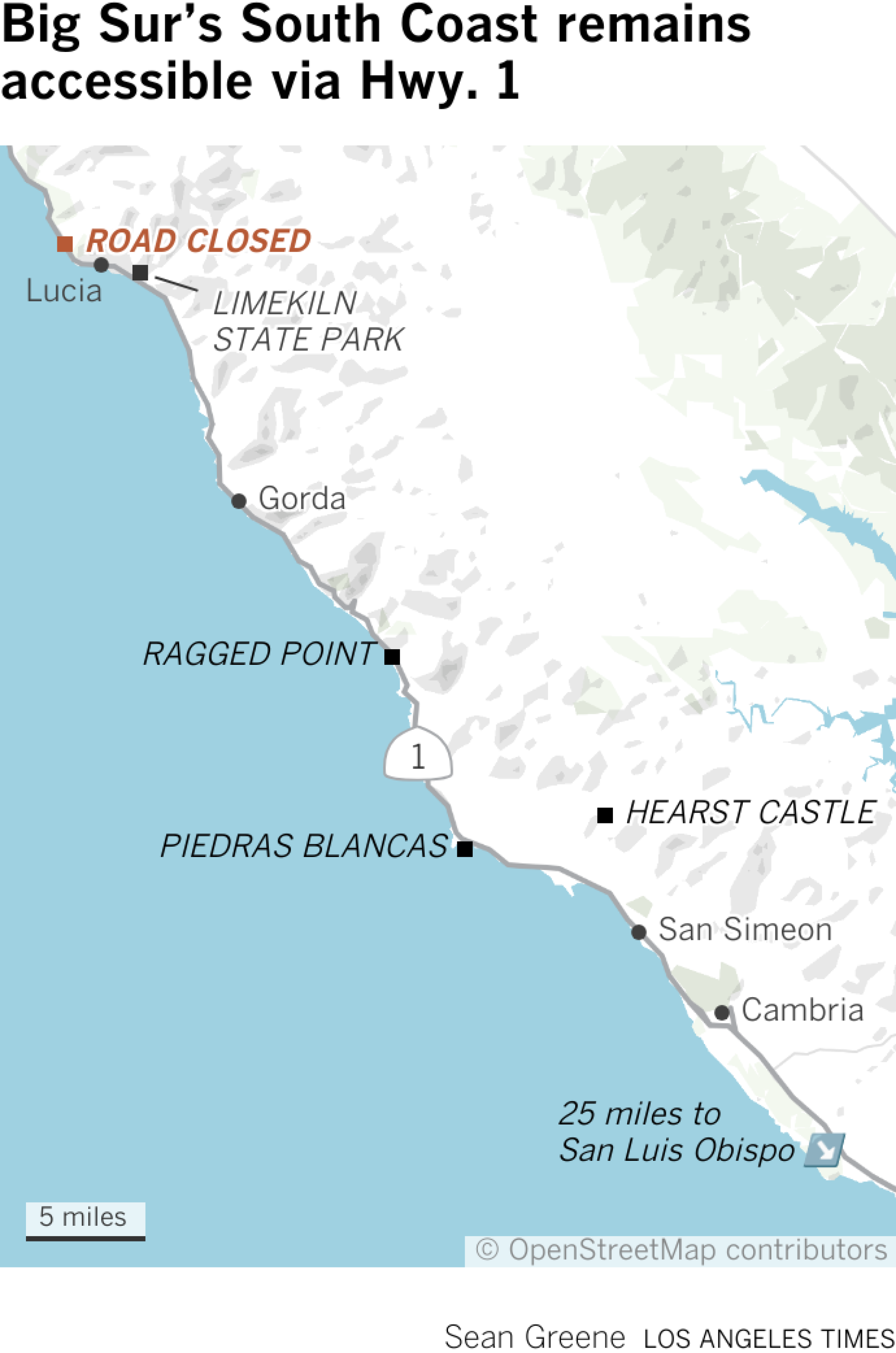
Map shows locations along Hwy. 1 on the Central Coast: towns Lucia, Gorda, San Simeon and Cambria; and attractions/landmarks such as Limekiln State Park, Ragged Point and Piedras Blancas.

That means the 44-mile stretch from San Simeon to Lucia will likely be lonely for at least six more months. Travelers from the near north (Carmel, for instance) will need to detour inland on U.S. 101. Meanwhile, many Canadian travelers (usually eager explorers of California) are boycotting the U.S. altogether over President Trump’s tariff policies and quips about taking over their country.

And so, for those of us in Southern California, the coming months are a chance to drive, hike or cycle in near solitude among tall trees, steep slopes and sea stacks. The weather is cooler and wetter. But over the three October days I spent up there, the highway was quieter than I’ve seen in 40-plus years of driving the coast.

Moreover, those who make the trip will be supporting embattled local businesses, which remain open, some with reduced prices. Fall rates at the Ragged Point Inn, 15 miles north of Hearst Castle, for example, start at about $149 nightly — $100 less than when the road was open.

“It’s kind of perfect,” said Claudia Tyler of Santa Barbara, on her way from Salmon Creek Falls to two nights of camping at Plaskett Creek in Los Padres National Forest.

“I am sorry for the businesses…,” Tyler said, “but it’s good for the traveler.”

Further north, David Sirgany, 64, of Morro Bay, was getting ready to surf at Sand Dollar Beach, thinking about coastal erosion, climate change and this moment in history.

“To me,” he said, “it feels like the end of a time that will never be again.”
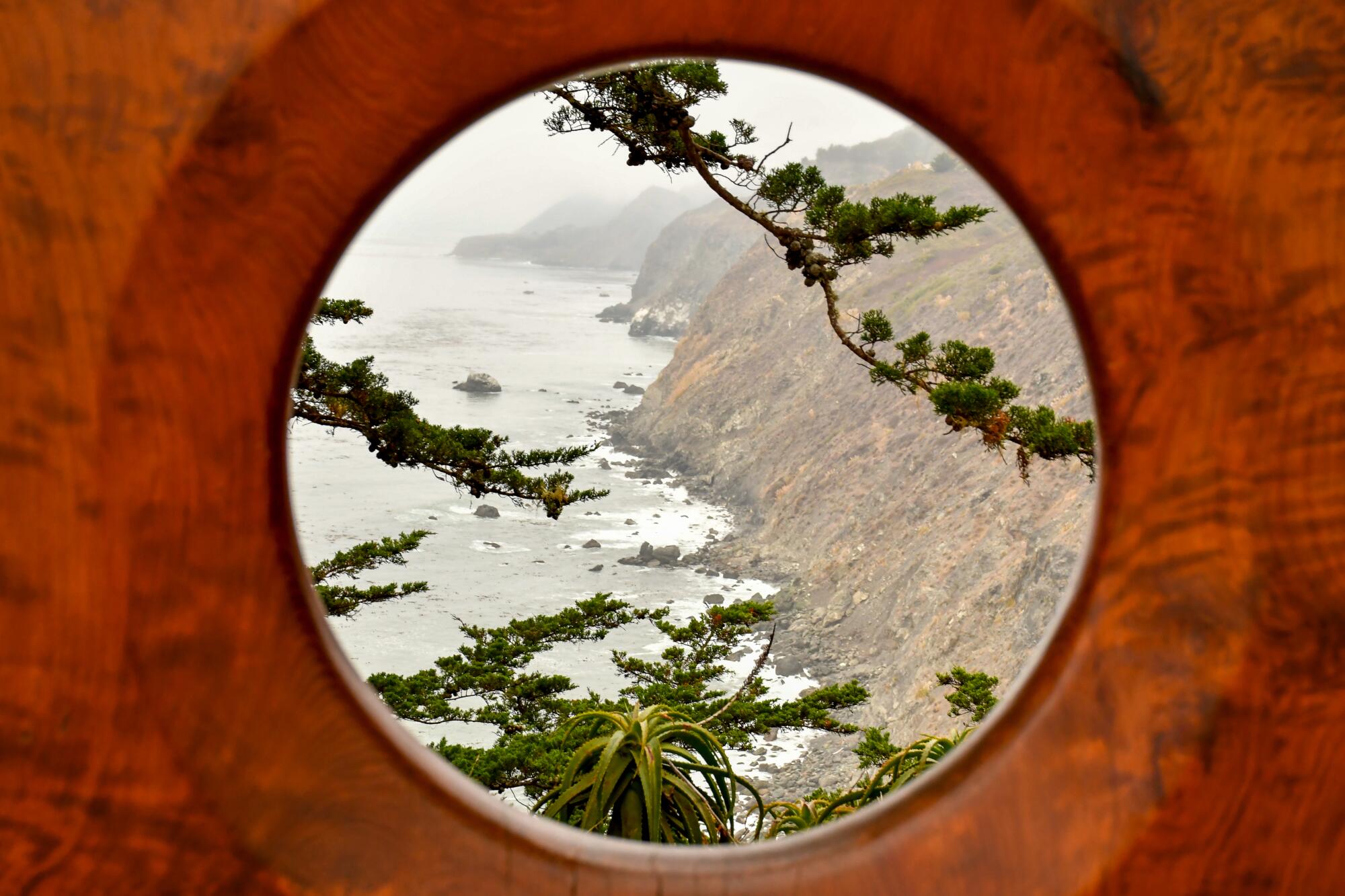
The Ragged Point Inn stands at the southern end of Big Sur.

The Ragged Point Inn stands at the southern end of Big Sur.

The closed area, known as Regent’s Slide, begins about 26 miles north of Ragged Point, toward the south end of Big Sur, and covers 6.8 miles. Thus, you’d need to detour inland via U.S. 101 to reach most of Big Sur’s best-known attractions, including the Bixby Creek Bridge, Pfeiffer Beach, Nepenthe restaurant, Deetjen’s Big Sur Inn, McWay Falls and Esalen Institute.

But there’s plenty to explore on the stretch from San Simeon north to the roadblock at Lucia (milepost 25.3). Just be careful of the $8.79-per-gallon gas at the Gorda Springs Resort. (At $6.99, the Ragged Point gas station isn’t quite so high.)
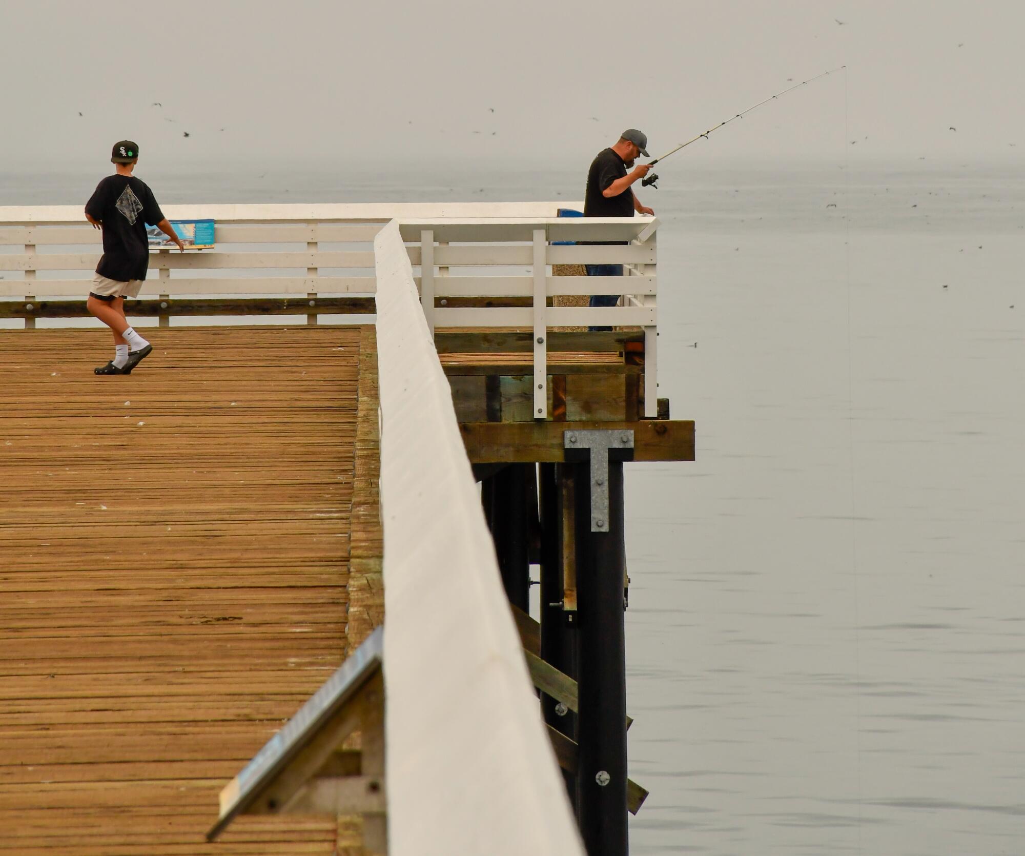
San Simeon Bay Pier at William Randolph Hearst Memorial Beach.

San Simeon Bay Pier at William Randolph Hearst Memorial Beach.

Here, from south to north, are several spots to explore from San Simeon to Lucia. Be sure to double-check the weather and highway status before you head out.

See Hearst’s castle. Or just one of his zebras.

I’ve been hoping to see some of the Hearst zebras in the hills of San Simeon for years, and this time I finally did — a single zebra, surrounded by cows in a pasture beneath distant Hearst Castle.

That was enough to make my brief stop at the castle visitor center (which has a restaurant, historical displays and shop) well worth it. Other travelers, however, might want to actually take a tour ($35 per adult and up) of the 165-room Hearst compound (which is officially known as Hearst San Simeon State Historical Monument).

The state park system’s visitor tallies from June through August show that 2025 was slightly slower than 2024, which was slightly slower than 2023.

Perhaps with that in mind, the castle last fall added “Art Under the Moonlight” tours, which continue this autumn on select Friday and Saturday nights through Nov. 16. The castle also decorates for the holidays.

If you’re spending the night, the Cavalier Oceanfront Resort has 90 rooms (for as little as $169) and firepits overlooking the sea.
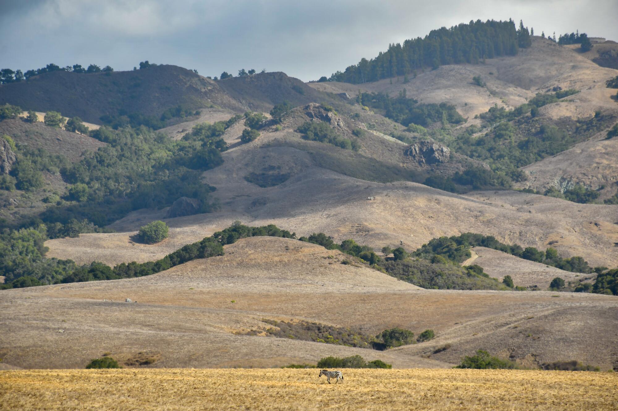
A zebra, part of the Hearst Castle animal collection, is seen from the visitor center off Highway 1 in San Simeon.

A zebra, part of the Hearst Castle animal collection, is seen from the visitor center off Highway 1 in San Simeon.

San Simeon Bay Pier or hike San Simeon Point Trail

My southernmost hike was at the San Simeon Bay Pier. From the parking lot there, walk north on the beach and follow a path up into a eucalyptus grove. That puts you on the 2.5-mile round-trip San Simeon Point Trail (owned by Hearst Corp. but open to the public.)

At first, the route is uneventful and surrounded by imported eucalyptus (now being thinned) and pines. But there’s a payoff waiting at the point, where tides lap on a little sand beach, waves crash on dramatic black rocks and pelicans perch on sea stacks. Look back and you see the beach, the pier and the hills of the central coast sprawling beyond them.
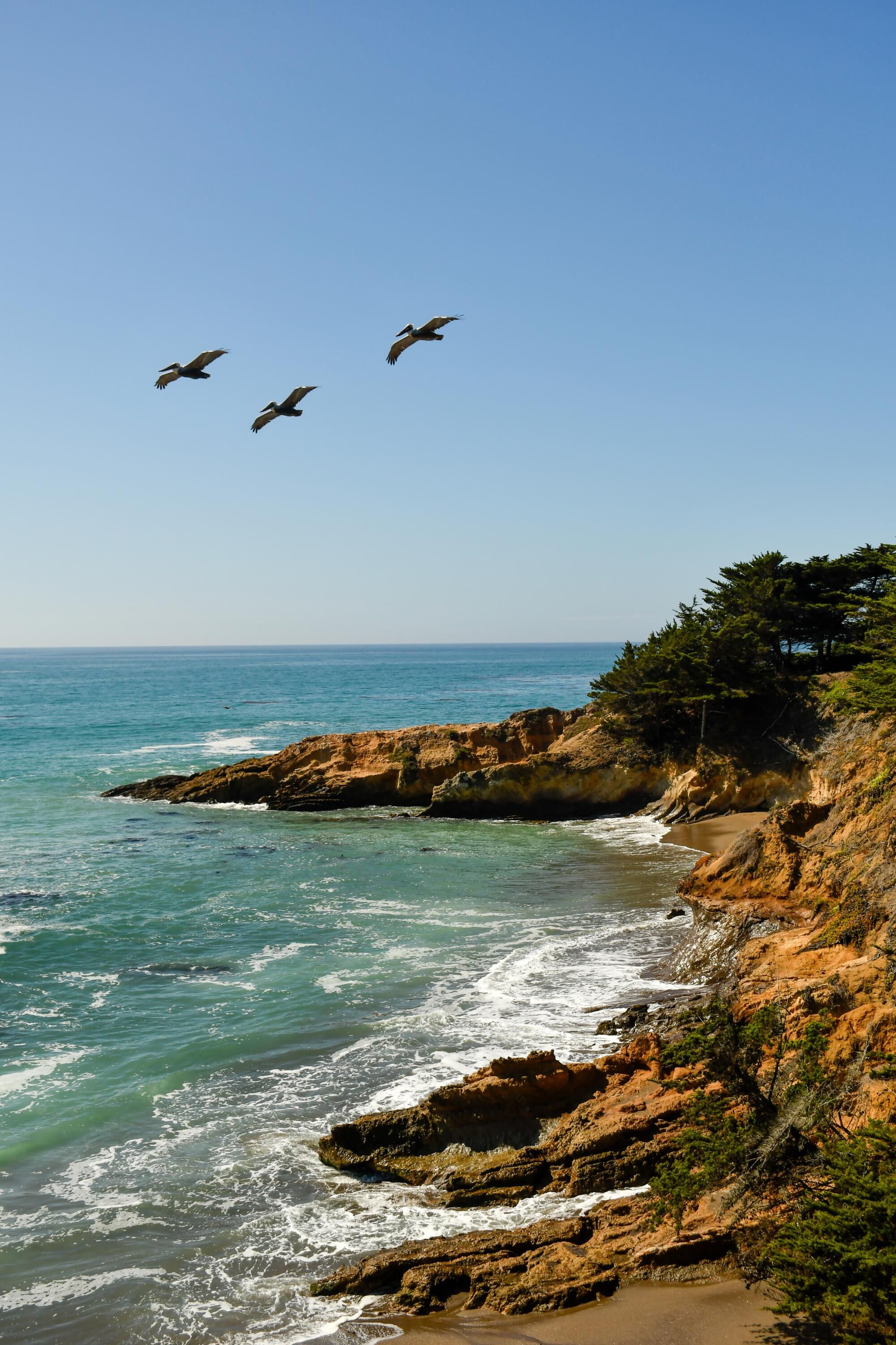
San Simeon Point Trail.

Then, if you’re as hungry as I was, you rapidly retrace steps and head to the Seaside Foods deli counter in Sebastian’s General Store, a block from the pier. (I recommend the Coastal Cowboy tri-tip sandwich, $21. But you could also take your meal across the street to the Hearst Ranch Winery tasting room.)

Find the Piedras Blancas elephant seal viewing area, then go beyond it

California’s coast is a catalog of uncertainties, from rising tides and crumbling cliffs to private landowners discouraging public access. But we can count on the elephant seals of Piedras Blancas.
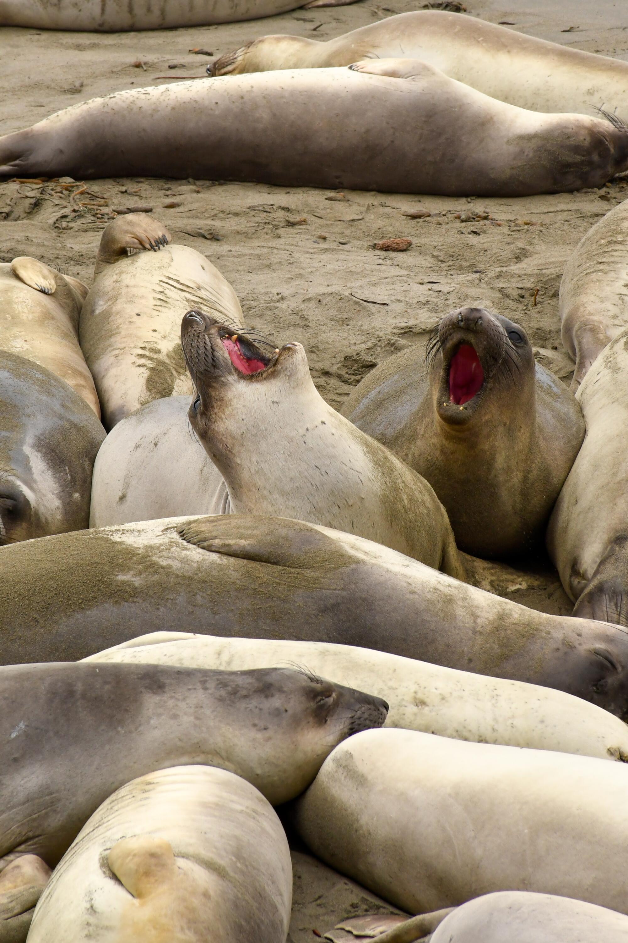
Elephant seals gather at Piedras Blancas, north of San Simeon.

Elephant seals gather at Piedras Blancas, north of San Simeon.

Once you pull off Highway 1 into the observation area parking lot, no matter the time of year, you’re likely to see at least a few hulking sea creatures flopped on the sand and skirmishing for position.

Because it’s a great spectacle and it’s free, there are usually dozens of spectators along the shore. But most of those spectactors don’t bother to follow the boardwalk north and continue on the Boucher Trail, a 1.9-mile path along the bluff tops and across a meadow, leading to striking views of sea stacks and Piedras Blancas Light Station.
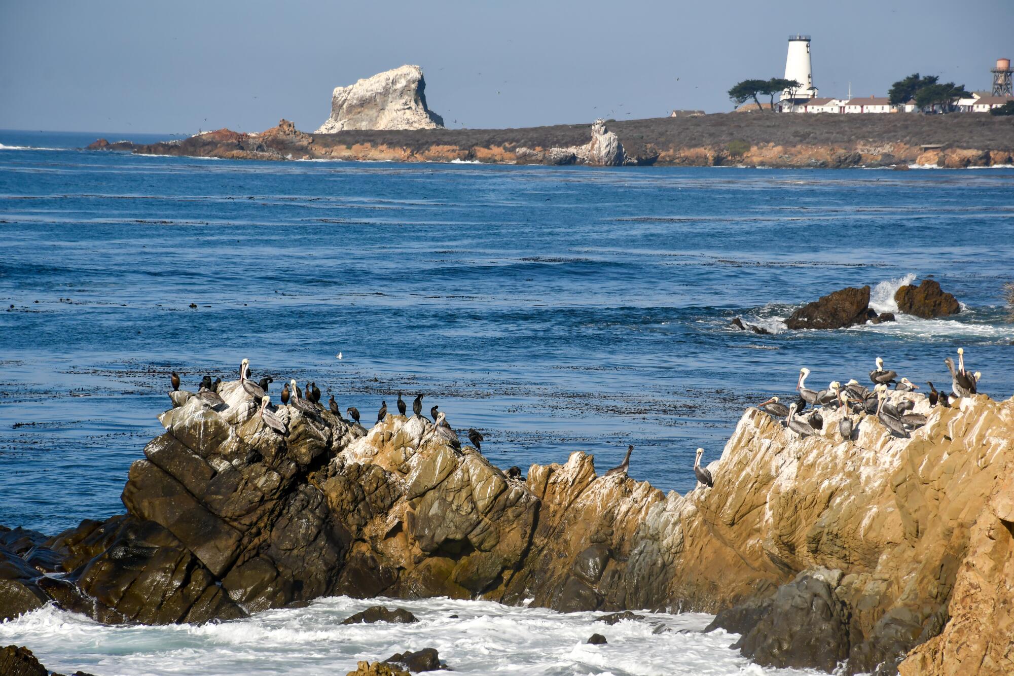
Along Boucher Trail, just north of the elephant seal viewing area at Piedras Blancas.

Along Boucher Trail, just north of the elephant seal viewing area at Piedras Blancas.

(BTW: Visitors need an advance reservation to tour the Piedras Blancas Light Station. At press time, all tours were canceled because of the federal government shutdown.)

At Ragged Point, that Big Sur vibe kicks in

About 10 miles beyond the elephant seals, the raw, horizontal coastal landscape morphs into a more vertical scene and the highway begins to climb and twist.

Right about here, just after San Carpoforo Creek, is where you find the Ragged Point Inn, a handy place to stop for an hour or an evening. It has 39 rooms, flat space for kids to run around, cliff-top views, a restaurant, gift shop, gas station and a snack bar that’s been closed since the highway has been blocked.
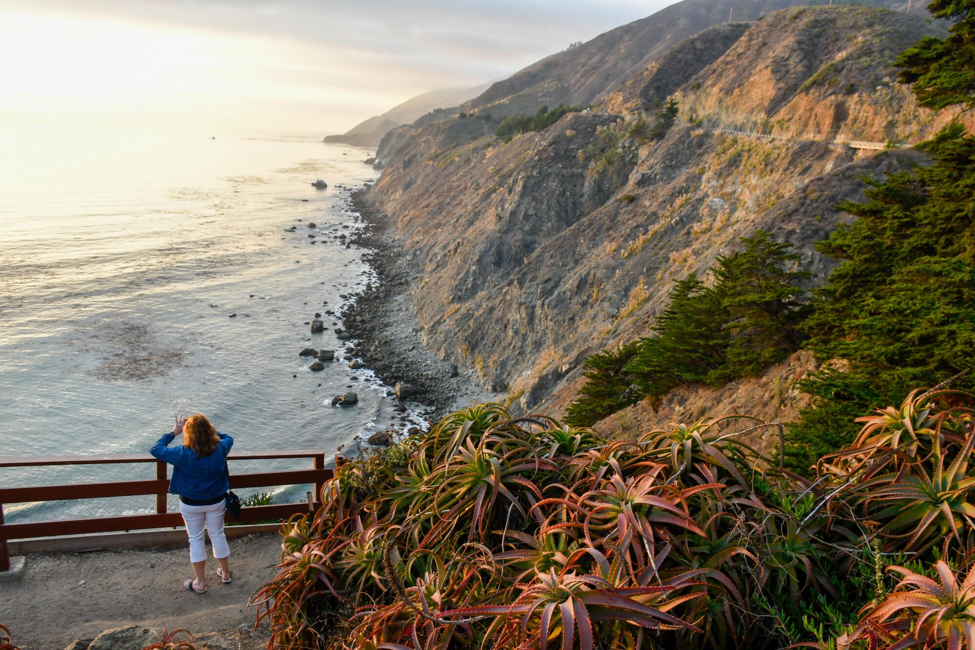
Ragged Point Inn.

Right now, this stretch of the highway “is a great place to cycle,” said Diane Ramey, whose family owns the inn. “I wouldn’t do it at a normal time. But now the roads are uncrowded enough.”

To recover from the “frightening” drop in business when the road first closed, the inn has put more emphasis on Sunday brunch, the gift shop and live music on summer weekends, Ramey said.

At Salmon Creek Falls, roaring water meets tumbled rocks

At the Salmon Falls trailhead, 3.6 miles north of Ragged Point, there’s room for about 10 cars in the parking area on the shoulder of the highway.

When the highway is open, those spots are often all full. Not now. And it’s only about 0.3 of a mile to the base of the 120-foot falls, where there’s plenty of shade for the weary and boulder-scrambling for those who are bold. In the hour I spent scrambling and resting, I encountered just two couples and one family, all enjoying the uncrowded scene.
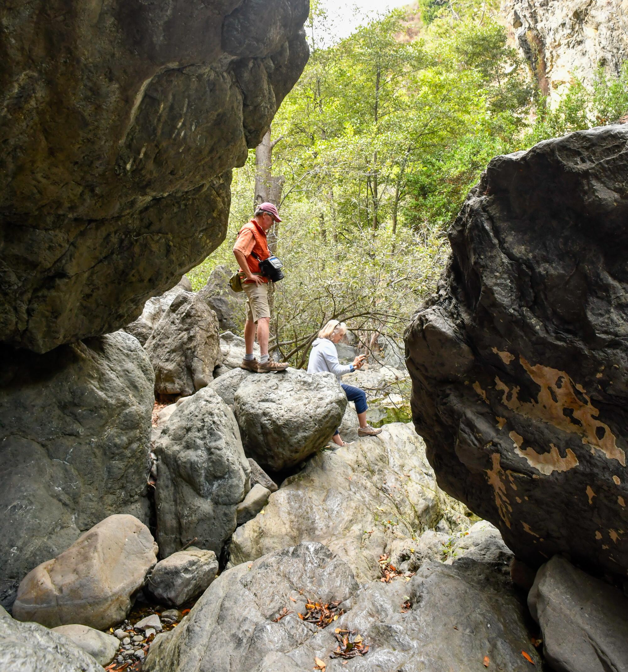
Salmon Falls.

If you want a longer, more challenging hike, the falls trailhead also leads to the Salmon Creek Trail, a 6.6-mile out-and-back journey through pines, oaks and laurels that includes — gulp — 1,896 feet of elevation gain.

The yurts and quirks of Treebones Resort

Treebones, about 14 miles north of Ragged Point and 2 miles north of the rustic, sleepy Gorda Springs Resort, is an exercise in style and sustainability, producing its own power and drawing water from its own aquifer.
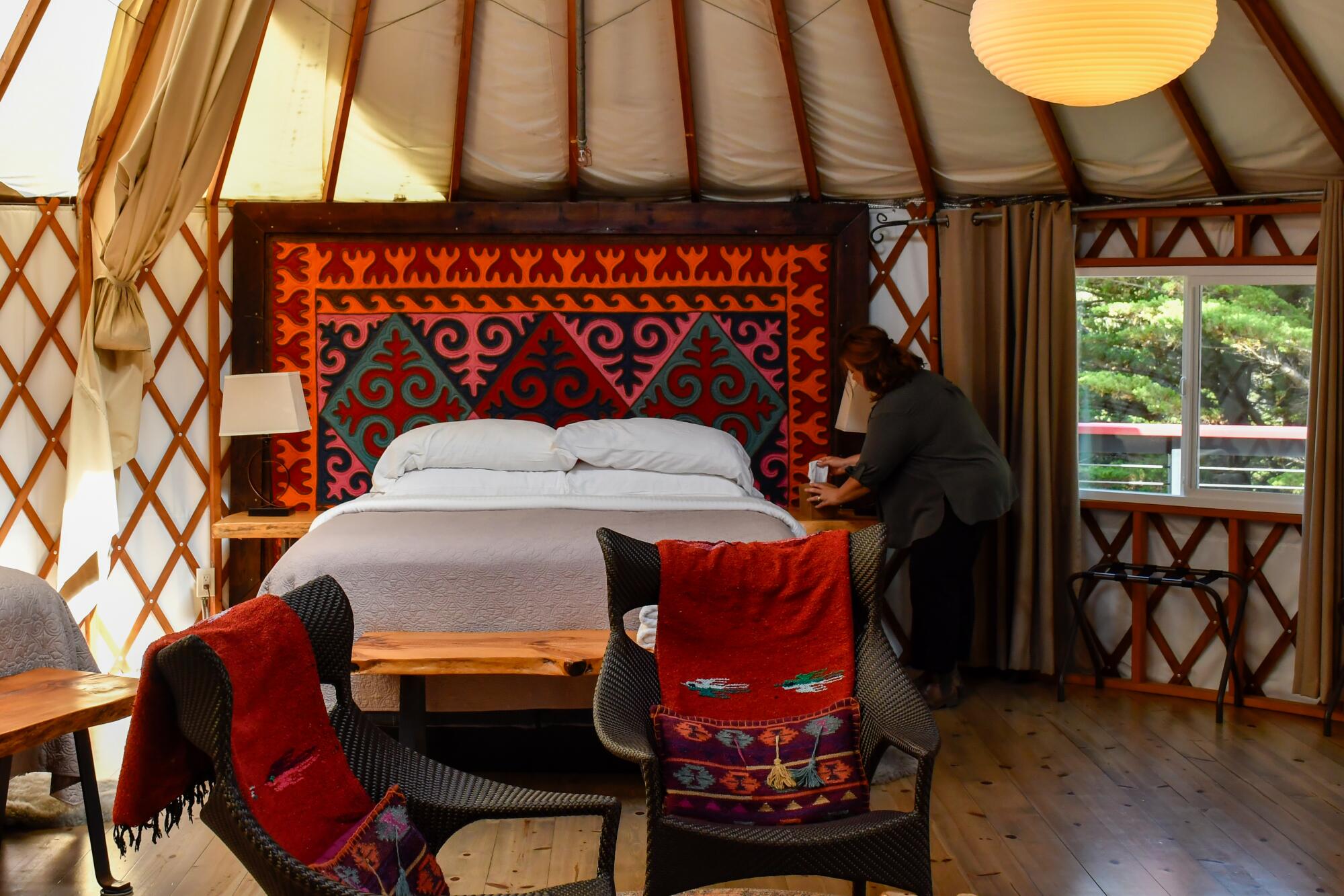
Treebones Resort, just off Highway 1 in the South Coast area of Big Sur.

Treebones Resort, just off Highway 1 in the South Coast area of Big Sur.

Born as a family business in 2004, Treebones has 19 off-the-grid units, mostly yurts, whose rounded interiors are surprisingly spacious. Its Lodge restaurant offers chef’s-choice four-course dinners ($95 each) and a sushi bar.

If you book a yurt (they begin at $385), you’ll find your headboard is a felted wood rug from Kyrgyzstan (where yurts go back at least 2,500 years). The resort also has five campsites ($135 nightly, advance reservation required) that come with breakfast, hot showers and pool access.
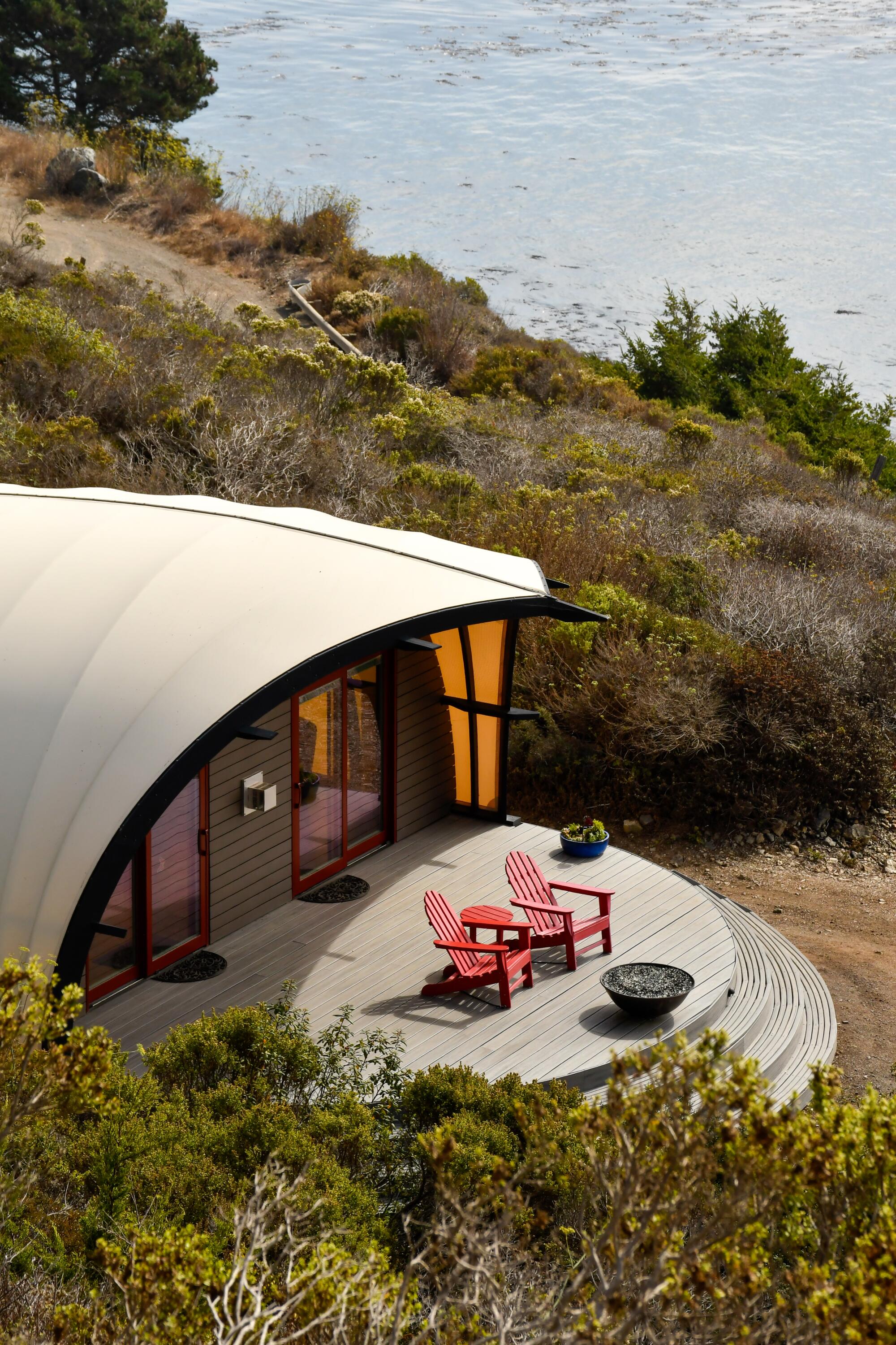
A deck at Treebones Resort.

A deck at Treebones Resort.

“For the last 20 years, we were basically 100% occupied from April through October,” assistant general manager Megan Handy said, leading me on a tour. Since the closure, “we’ve stayed booked on the weekends, but we’ve seen at least a 40% decline midweek.”

Once you’re north of Treebones, beach and trail possibilities seem to multiply.
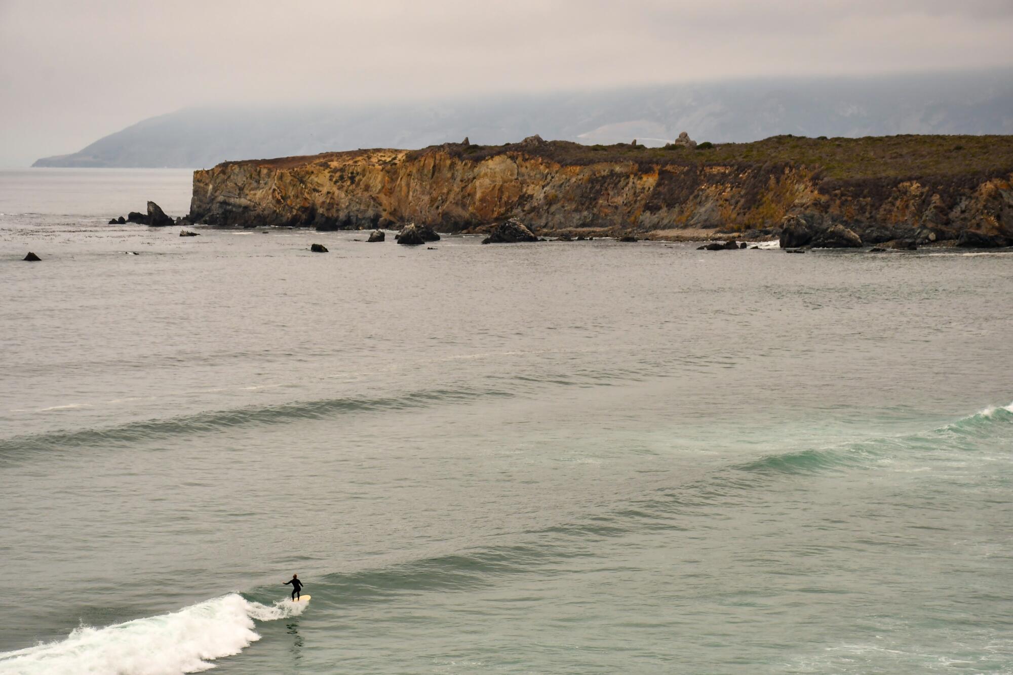
Sand Dollar Beach.

Stand by the edge (but not too close) on the Pacific Valley Bluff Trail

Several people told me I shouldn’t miss the Pacific Valley Bluff Trail, a flat route that begins just north of Sand Dollar Beach. It runs about 1.6 miles between the roadside and the bluffs over the Pacific. Here you’ll see sea stacks in every shape, along with a dramatic, solitary tree to the north. In about 45 minutes of walking amid a land’s end panorama, I never saw another soul. Plenty of cow patties, though, and a few patches of poison oak, which turns up often near Big Sur trails.

A little farther north, I did run into four people walking the beach at Mill Creek Picnic Area. I found even more at Kirk Creek Campground, which was booked solid because it has some of the best ocean-view campsites in the area and it’s on the ocean side of the highway.
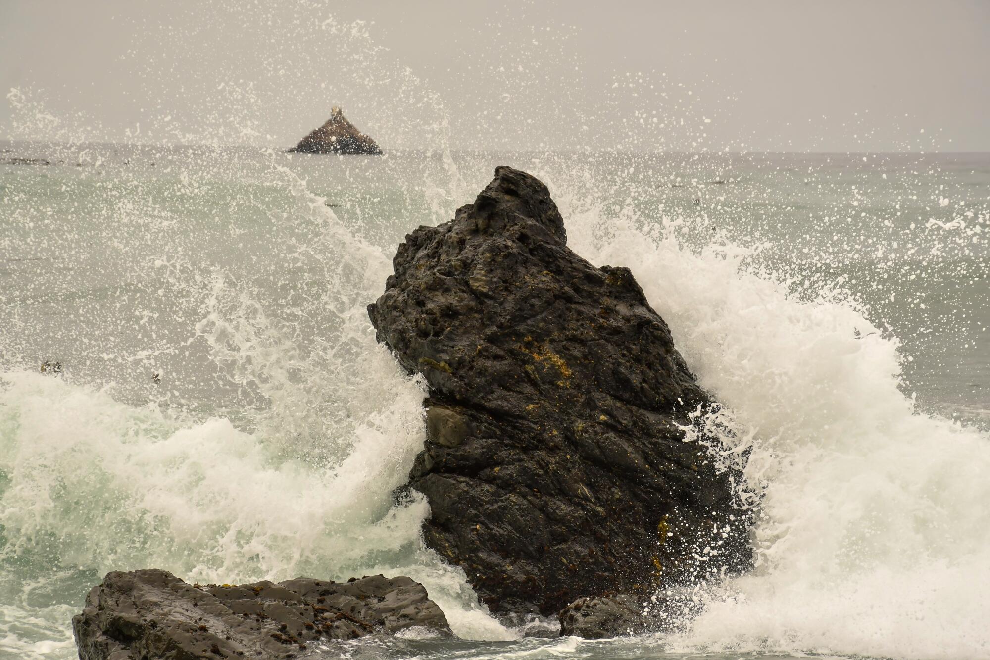
Waves crash near Sand Dollar Beach.

Waves crash near Sand Dollar Beach.

Big trees and a meandering creek at Limekiln State Park

Limekiln State Park is one California’s youngest state parks, having been set aside in the 1990s. But its occupants, especially the redwoods, have been around much longer.

And now, after park closures over storm damage and infrastructure issues and a reopening early this year, we have a chance to enjoy the place again. Or at least part of it. The park’s campground, Hare Creek Trail and Falls Trail remain closed.

But there’s still plenty of opportunity to check out the rare overlap of species from northern and southern California. As the Save the Redwoods League notes, “You can’t find both yucca and coast redwoods in very many parks.”

The park is about 4.4 miles south of the Highway 1 closure. Entrance is $10 per vehicle. I savored the 1.5-mile out-and-back Limekiln Trail, which is one of the best ways to see redwoods in the area. And once again, no fellow hikers.
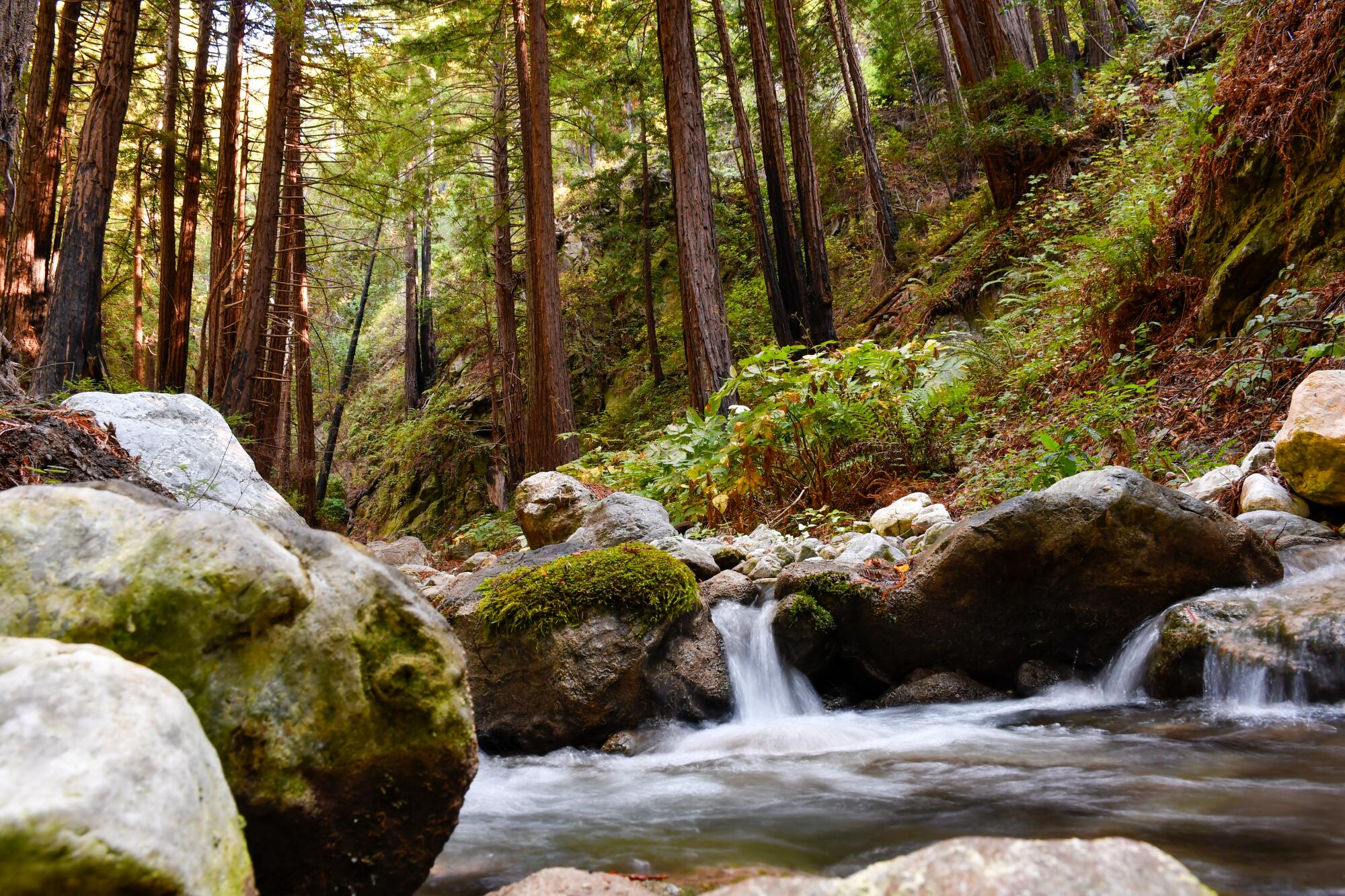
Limekiln State Park.

Highway still too busy for you? How about an isolated lodge or a silent monastery?

Just south of the highway closure, the rustic, isolated Lucia Lodge and the New Camaldoli Hermitage, a Benedictine monastery, remain open for overnight guests.

But not everyone knows this. Unless somebody at Google HQ has just made a fix, Google Maps will tell you incorrectly that the hermitage and lodge are beyond the road closure. Nope. They’re both on the south side of the road closure, accessible to northbound traffic. And they’re both really quiet.

“People come here for silent, self-guided retreats,” said Katee Armstrong, guest ministry specialist at New Camaldoli Hermitage. Its accommodations, high on the slopes above the highway, include nine single-occupancy rooms and five cottages with kitchenettes ($145 nightly and up).

Meanwhile, on the ocean side of the highway, the Lucia Lodge’s 10 very basic units are visible from the road. Four of them are cabins that go back to the 1930s, when Highway 1 was new.

Some nights, there are only one or two guests, and those guests typically see no hotel employees, because there’s no lobby and the staff is down to a skeleton crew. (The lodge’s restaurant and lobby burned down in 2021.) The nearest restaurant is at Treebones, about 10 miles south.

“We have to have a conversation with every guest who books with us,” said Jessie McKnight, the lodge reservationist. Many “end up canceling once they understand the situation,” she said. “You’re kind of on your own.”

Ad yet, she added, “it’s so rare to experience Big Sur like this. Once the road opens, I think it’s going to be right back to being a zoo.”
The road to Ragged Point Inn.
The road to Ragged Point Inn.

Source link

Road trips with your partner are invaluable and can test your marriage

My husband and I spent much of the weekend driving from Los Angeles to Petaluma, and back, to attend a wedding. The trip began, as our car trips inevitably do, with my husband asking me to find the best route via Apple Maps and then arguing with every direction the app offered.

Out loud, as if the app’s “voice” could hear him.

As in “What? That makes no sense. Why take the 118 when we can just keep going and pick up the 5 in a few miles?” or “I knew we should have taken my shortcut back there. Look, now we’re just sitting in traffic. I thought these apps were supposed to help you avoid traffic.”

If, during these early explosions, I am sufficiently caffeinated, I calmly suggest that the traffic on alternate routes is probably much worse. If I am not, I simply snap that he was the one who asked to use Maps in the first place and if he doesn’t like it, he should just take whatever route he wants like he always does anyway.

We have been married for a very long time.

Long enough, in fact, for me to remember a time when the voice he would argue with was mine, as I bent over the Thomas Guide or some impossibly large map and we exchanged, in heated tones, our deep and personal feelings for one route or another. (He, for example, thinks the 405 is just another freeway while I know it is a shimmering sliver of Hell designed by Satan to suck the life out of unwary motorists.)

After 30 years of road travel together, I know that any trip of more than 10 miles will be filled with either exasperation over roadwork delays or complaints about how “they really need to fix this road” and that there is no point in arguing that local government simply does not have the organizational wherewithal, never mind the motivation, to “time the lights” in such a way to intentionally make his life more difficult. (But if L.A. city or county is looking for someone to fix their traffic lights, Richard is available.)

As we headed toward the wedding, I found myself hoping that the couple we would be celebrating had spent enough time in the car together. Any long-term personal relationship requires the acknowledgment and acceptance of certain things about your partner. In L.A. especially, that means being able to live with the way they drive, even when … no, especially when, this seems at odds with every other facet of their nature.

My husband is a rational man who believes in the laws of science. Until he enters a car and his notion of time and space become defined by movement — any “shortcut” that allows the car to remain in motion is better than sitting in traffic, even if it makes the trip much longer in minutes and miles.

He is also notably sweet and sympathetic, always willing to think the best of his fellow humans. Except from behind the windshield, where he views the world as teeming with schemers and brutes, acting on all manner of Machiavellian impulses. If Richard designed a driving app, it would be called “This Sonuvabitch.”

As in “this sonuvabitch knows I want to get over and keeps creeping up so I can’t.” Or “this sonuvabitch is mad because I passed him and now he’s riding my tail.”

Traffic in L.A. is quite literally maddening and I too am guilty of loudly questioning the sanity of that guy in the blue Honda who thinks he can make a left on La Cienega at rush hour or the woman who has stopped traffic in an effort to parallel park in a space that anyone with eyes can see is too small for her freaking Bronco. But I never take their choices personally.

Richard takes it all very personally, offering a steady stream of criticism and muttered instructions — ”that’s it, you can do it, just turn the wheel, it’s not difficult” — to any driver not performing up to his standards.

Neither conversation nor music provides much of a distraction — he will talk right over his beloved Aaron Copland, never mind me. Even the suggestion that he put his ability to conjure such vividly precise character defects and psychological motivations to better use in, say, fiction writing, has been to no avail.

He is, I hasten to add, a good and safe driver, aggressive only rhetorically. And so, as one must do in marriage, I have sought the serenity to accept the things I cannot change. As we made our expletive-fueled way up the 5, I silently soothed myself with the knowledge that in a couple of hours, we’d need to take a restroom break and then I would slide into the driver’s seat and stay there until we arrived. Since our rule is that the driver controls the audio, I had queued up “I, Claudius” read by Derek Jacobi on Audible.

I have also been married long enough to know that the one thing my former-theater critic husband won’t disrupt is a masterful performance.

Not so Maps, which, as we neared San José, began chiming in with a quite complicated alternate route, designed, I assumed, to avoid freeway traffic. Richard was not at all pleased by either the interruptions or the route, and it was frankly hilarious to listen to him vent about precisely the sort of shortcut he himself is known for.

Indeed, I found myself feeling a personal bond with the calm and implacable voice guiding our progress even as my spouse spluttered and argued. Not only was she a third-party recipient of road-trip frustration, the voice of Maps seemed to take on the kind of objective helpfulness of a good therapist.

She is simply not interested in the “you always,” “I never” emotional quagmires a gridlocked freeway or rerouting decision can churn up. When I missed a turn, she didn’t care at all when my husband asked if whoever programmed Maps had ever actually driven a car and if they were so smart, could they not see that truck that wouldn’t let us get over?

She just continued to suggest that we “proceed to the route.”

Being the proud participant in a decades-long relationship, which, despite its many compromises and workarounds, remains solid and loving, I, of course, had been wondering what sort of advice I might, if only in my imagination, offer the soon-to-be-newlywed couple.

And here was Maps doing it for me.

Marriage is like a road trip; no matter how much you love the other person in the car, if it lasts long enough, you will drive each other a little nuts. My husband’s explosive commentary sometimes amuses me and sometimes wears me down. But at this point, if he didn’t complain about the timing of the lights or “this sonuvabitch who doesn’t know you can make a right on red,” I would worry that he was having a stroke.

Among the glories of the journey and the intimacy of the conversation, there will always be missed turns, ill-fated routes and arguments over how to cope with the forces that surround you. But if you choose to stay in the car, then the only real option is to keep moving forward.

Or as Maps would say, proceed to the route.

Source link

Dodgers bullpen melts down as road trip ends with loss to Guardians

The Dodgers got five good innings out of Clayton Kershaw on Wednesday. Then they let it go to waste in a five-run eighth inning.

Despite leading most of the day at Progressive Field, seeking to end their East Coast road trip with a three-game sweep against the Cleveland Guardians, the Dodgers instead lost 7-4 after an eighth-inning meltdown.

It was three ground ball singles, one walk to load the bases and one mighty Angel Martínez swing that changed the game.

Leading 4-2 entering the eighth, Dodgers left-hander Tanner Scott took the mound for his second inning of work, manager Dave Roberts asking for an up-and-down outing out of his recently up-and-down closer.

Scott’s appearance had started well, striking out Gavirel Arias to escape a jam in the seventh inning.

But, in what was charged as already his fifth blown save of the season, he failed to limit damage as a threat began to brew.

Jhonkensy Noel led off the frame with a ground ball up the middle, after second baseman Kiké Hernández got to it in the hole but had no chance to make a throw. Will Wilson followed that with a spinning ball up the third base line, its awkward hop off the edge of the infield grass tripping up Max Muncy for another infield single.

Scott only hurt his own cause from there, walking Daniel Schneemann in a left-on-left matchup to load the bases.

And though he fanned Austin Hedges for the first out of the inning, Nolan Jones hit a one-out bouncer that found a hole through the left side of a shifted infield. Two runs came around to score. A lead the Dodgers had held since the fourth inning had suddenly evaporated.

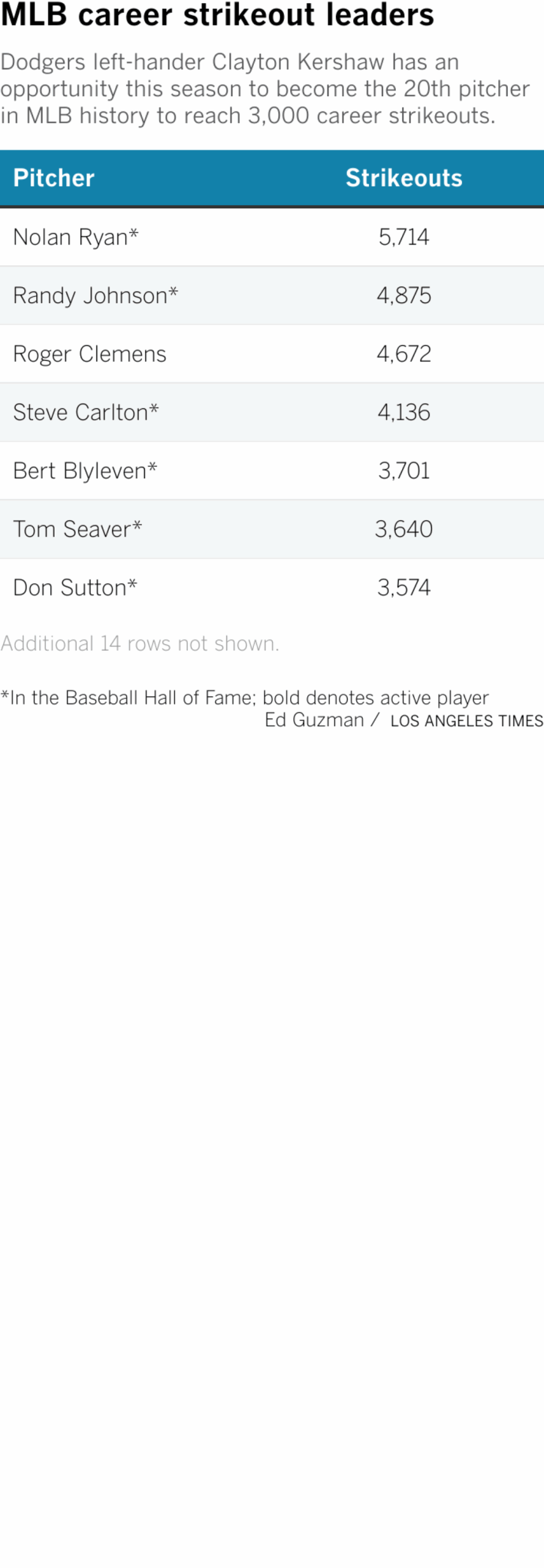
A chart examining the strikeout leaders in MLB history and where Clayton Kershaw stands.

The final blow came in the next at-bat, when left-hander Alex Vesia entered the game and quickly fell behind 2-and-0 to Martínez. Vesia tried to get back in the count with a fastball up in the zone. Martínez instead delivered a knockout blow, belting a three-run homer to left to complete the Guardians’ five-run rally.

The ending meant that Kershaw, who gave up just one run in five innings despite generating only three strikeouts, was left with a no-decision — and that the Dodgers had to settle for only a 3-3 record on this New York-Cleveland road trip, stumbling to another frustrating loss during a stretch of the season that has recently been full of them.

Source link

Why the Dodgers are using two planes on road trips this year

In the interest of doing things differently last October, the Dodgers made a subtle, but profound, change in their travel plans.

In previous postseasons — many of which ended with disappointing early eliminations — the Dodgers would use one wide-body plane to shuttle players, coaches, executives, staff, broadcasters and other members of their bloated playoff traveling party from city to city.

Last year, they opted for a different flight pattern.

Players took one plane, as part of a larger effort to promote a sense of togetherness in pursuit of a World Series title.

Everyone else, meanwhile, flew on a second, separate chartered commercial jet.

“I think it’s just [a way for us to make sure] more of the time we spend is together,” first baseman Freddie Freeman said during last year’s postseason. “Making sure we stayed together as a group.”

Given the results, the Dodgers decided to keep the change in place for this season.

What started as a one-month experiment then, has become a permanent routine for the defending champions now.

This year, in a significant shift to the way they travel, the Dodgers are using two planes on a full-time basis for their regular-season road trips: One for players, just like they did last October; and another for everyone else, from manager Dave Roberts and the rest of his coaching staff to the dozens of other team personnel that make up each trip.

“It was driven by them,” Roberts said of the players, noting their interest in continuing the two-plane itinerary this year. “And we facilitated it.”

“It’s reimagining team travel,” added Scott Akasaki, who as the Dodgers’ senior director of travel has overseen the transition. “It’ll be interesting to see what the positive things that come out of it are.”

Indeed, as club officials looked ahead to their 2025 title defense this winter, they quickly warmed to the idea of making the two-plane system permanent.

Already, they had bought into the positive impacts it had on team chemistry during the playoffs, believing it to be a contributing factor to the heightened level of camaraderie players cited as a driving force behind their 2024 championship.

But as they mapped out ways to ease the burdens of a grueling 162-game season, they recognized other logistical benefits that could result from the added travel investment.

“Our ownership was incredibly supportive of the idea,” general manager Brandon Gomes said. “And yeah, it seems like it’s gone well so far.”

For starters, players now have more comfortable seating arrangements on flights, able to spread out on an aircraft that includes only a handful of additional clubhouse support staff.

“It’s providing an environment where our players are more apt to get rest and recovery, with just less people on the plane and more room to move around,” Akasaki said.

And after the team experienced several lengthy travel-day delays last year because of mechanical problems with their charter, they now have a “fail-safe” contingency plan, as Gomes described it; always having a second plane available to transport team members to their next city as scheduled.

“In theory, the players and critical staff can hop on the working plane and go,” Akasaki echoed, “while the remaining folks stay behind until the mechanical problem gets resolved.”

Four road trips into this year, however, no trickle-down effect has been as lauded as the changes the Dodgers have made to their actual travel schedule.

In the days of traditional single-plane travel, the Dodgers would typically wait to fly out of Los Angeles if they had an off day between the end of a homestand and the start of a road trip. It meant one extra night at home, but a later arrival into cities on the eve of an away series.

“When you’re spending your off day on the plane,” veteran third baseman Max Muncy said, “you don’t ever feel like you’re as recovered.”

The Dodgers' Max Muncy takes batting practice before a game against the Pirates at Dodger Stadium last month.
Using two planes for road trips has allowed the Dodgers players to leave right after the final game of a homestand, which so far this season has been followed by an off day. “When you’re spending your off day on the plane,” veteran third baseman Max Muncy said, “you don’t ever feel like you’re as recovered.”

(Gina Ferazzi / Los Angeles Times)

With the benefit of a second plane, the Dodgers can do things differently now.

Though each of the team’s first four homestands this year have been followed by an open date, the players’ plane has departed immediately after all four getaway-day games, getting them into road cities the same night (or, in the case of Wednesday’s flight to New York this week, early the next morning) before the rest of the traveling party arrives the following afternoon.

“I think it’s better,” Freeman said. “It gives us actually a whole day off.”

“It’s nice to just have the off day [without having to fly],” Muncy added. “You’re tired on the off day, but then you can get a full night’s sleep to rest and recover. That felt pretty good.”

Sometimes, that extra day affords players with rare additional personal time — giving someone like Muncy, a Dallas-area native, a full afternoon to see family before last month’s Easter weekend series in Texas.

But even for other guys, Muncy added, “it was, let me go lay out by the pool, or let me go grab some lunch somewhere, and then we’ll go get a nice dinner. It just gives you the whole day to kind of recover. I think it’ll be a better change for us.”

Accounting for a second plane, of course, does add complexities to the planning of each road trip. The truckloads of equipment the Dodgers travel with has to be specifically sorted and loaded onto the correct flight. The team has to coordinate between two airline partners, chartering a Boeing 757 from Delta and a Boeing 737-800 from United, to handle travel parties sometimes upwards of 100 in all. Akasaki now even has a bigger team of people who help with the planning process, too.

“From Andrew [Friedman, president of baseball operations] on down, it was like, ‘Hey, this is a big thing, and it’s a lot for one person to handle,” Akasaki said. “So [they asked], ‘What do you need to keep this all organized?’ That’s been very helpful.”

The team also had to account for potential other negatives. There were considerations made over the environmental impact of using a second plane, according to one person involved in the process but not authorized to speak publicly. There were more simple day-to-day changes to the rhythm of the team’s season as well.

“Like, you can’t have that organic conversation in the back of the plane between a staff member and a player like you used to,” Akasaki noted.

But, in the end, the pros outweighed the cons.

“You can still have that [conversation] in the clubhouse,” Akasaki noted.

Plus, for an organization that has long tried to maximize its monstrous financial resources to become a premier destination for star talent in baseball, being able to pitch prospective free agents on the luxury of using two planes certainly “doesn’t hurt” either, Gomes quipped.

With the Dodgers’ new travel system believed to be unique among MLB clubs, Roberts noted that “there’s a lot of other teams already asking about the two planes.”

And to this point, players said, the reviews have been positive.

“It’s still early,” Muncy noted. “I’ve only ever done it the one way since I’ve been here, so I don’t know what the other way is like” over the course of a full season.

But, Freeman joked with a grin, “I haven’t heard one complaint about it.”

Source link