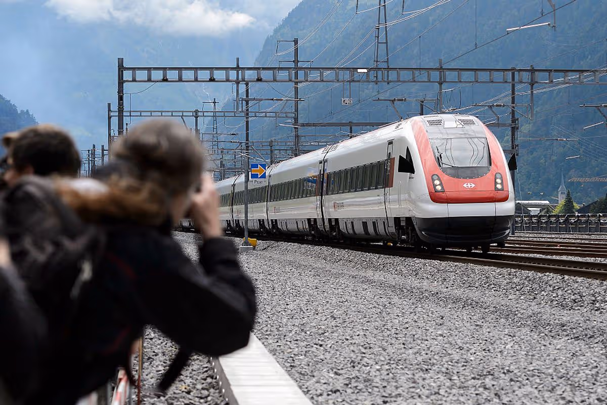
The high-speed rail tunnel extends as far down the mountains as some of the deepest mines on the planet
One of the first trains that crossed the world’s longest rail tunnel(Image: FABRICE COFFRINI/AFP via Getty Images)
Nothing stands in the way quite like Europe’s highest and most extensive mountain range. With France on one end and Austria the other, the Alps sprawl 1,200km across eight countries in a massive crescent shape.
Historically, Alpine crossings were perilous journeys taken on foot or mule. For as long as people have been in Europe, they have sought to cross this mountain range so vital for travel, trade and war.
The Romans fought battles to control routes through the Alps. Historic figures, including Hannibal — with elephants in tow — then later Napoleon, led armies over the mountains to gain a strategic wartime advantage.
They’d have wished for something like the Gotthard Base Tunnel, a corridor between northern and southern Europe that opened in 2016. At the cost of about £11.5bn, it is the longest and deepest tunnel ever built.
It’s a crucial link for travel as well as the transport of goods across Europe. Used by freight and passenger trains, it cuts travel time from Basel to Zurich and Milan to Lugano by up to an hour.
The Gotthard tunnel extends 57km — a 20 minute journey underneath the majestic Alps that loom above. Remarkably, its depth of 2.3km is comparable to some of the deepest mines in the planet.
Trains are able to zip through at a maximum speed of 155mph due to their clever design.
Where older tunnels spiral their way up the mountains, the Gotthard is completely flat. It’s the first flat route through the Alps or any other mountain range.
As the world’s longest tunnel, it bypasses the Channel Tunnel running between England and France by 7km.
It beat out the previous world record holder, Japan’s Seikan rail tunnel, by 3km. The Seikan tunnel connects the country’s two largest islands, Honshu and Hokkaido.
The tunnel was created to replace the first Gotthardbahn rail tunnel, an engineering marvel of its time that was completed in 1882.
Plans for its replacement began a century later in the 1980s. It was an ambitious and arduous project that took 17 years to build.
With 35 miles of mountain pressing down on the route, one of the critical challenges was how to prevent the tunnel from collapsing in on itself. Fortunately, reinforced steel rings spanning the tunnel support the weight of the mountain above.
The project required the use of a massive drill the length of four football fields. At 410m long and 10m wide, it carved through 40m of mountain a day.
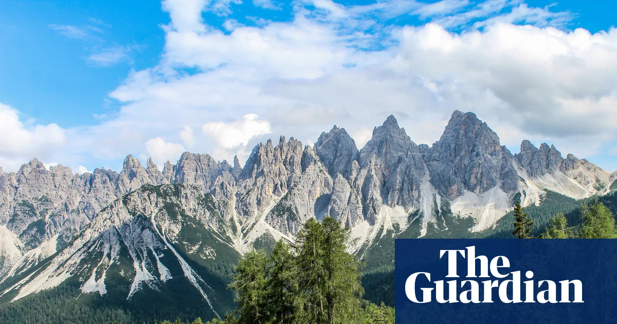
The “forgotten” Dolomites lie to the east, far from the crowds of the Tre Cime di Lavaredo and Val Gardena. Belluno is the main gateway, two hours north of Venice by train or a drive up the A27. From here, the upper Piave valley leads into the quieter Friulian mountains. The land rises gently, opening into pasture, then stone lifting into spires above the meadows.
Traditional local councils, the Regole di Comunità, still manage the land and forests collectively here, sustaining artisans and alpine farmers in scattered hamlets shaped by shared work and resilience. Pastìn (a minced, seasoned blend of pork and beef), malga cheeses and polenta, once staples for long days in the mountains, are still shared over grappa at the end of the day. Beyond the hamlets, paths lead towards Monte Pelmo or drift into the beech woods of Cansiglio, where deer call at dusk. It’s a fine place to experience mountain culture, and these are some of my favourite places.
Alpine lakes and pools
Lago di Calaita is beneath the Pale di San Martino peaks. Photograph: Denis Perilli
The Val del Mis lies west of Belluno, where the narrow SP2 road follows the shore of Lago del Mis. The lake is worth half a day on its own – paddle north by canoe or kayak towards the Cascata della Soffia waterfall, or explore the side gorge of Falcina, where you can swim in still, deep pools of crystalline water under the Passerella del Peron suspension bridge, just off the SR203 past Ponte Mas. Alternatively, from the car park at the northern end of the lake, it’s a 10-minute walk to the Cadini del Brenton – a series of turquoise pools carved into white rock cascading from one basin to the next, some more than four metres deep. A wooden bridge trail leads between them, but bathing here is forbidden.
From the Val del Mis, head north-west towards San Martino di Castrozza, then south through Fiera di Primiero, following signs for the Val Vanoi on the SP79, then climb the road to the spectacular Lago di Calaita, at an altitude of 1,621 metres beneath the ramparts of the Pale di San Martino. At dawn, the rock above is grey; by sunset, the whole massif turns gold. Open meadows line the shore, and Rifugio Miralago serves canederli (bread dumplings) and polenta with tosèla di primiero, the local cheese. In winter, the lake freezes, and the meadows are used for snowshoeing. A two-hour uphill walk leads to the darker Lago Pisorno, said to be haunted.
Mountain viewpoints
From Monte Penna there are spectacular views of Monte Pelmo. Photograph: Denis Perilli
Head for Agordino – the group of valleys along the Cordevole river, south of Cortina d’Ampezzo – for the highest viewpoints. You’ll experience the same massive Dolomite walls but without the crowds. Park near Rifugio Staulanza and take CAI trail 472. In a couple of hours, climbing gently through sparse larch and open grass, you’ll reach the slopes of Monte Penna and look straight at Monte Pelmo’s immense north-west wall – sheer pale rock rising from the valley floor. You’re standing on gentle grass; across the valley, the mountain is vertical stone. The central basin – the Trono di Dio (Throne of God) – is visible in full. To the west is the jagged profile of Monte Civetta.
For a closer look at Civetta, take the old mule track from the hamlet of Piaia, through woods dotted with tabià, the traditional wooden barns used for storing hay at altitude. After a two-hour climb, the trail opens on to the broad pasture of Sasso Bianco, looking directly at Civetta’s sheer face. Note that the road to Piaia is very narrow; parking at the end is limited.
To the south-east, the Alpago basin opens out. From the small Malga Pian Grant farm, the Costa Schienon ridge leads to the rocky peak of Cima delle Vacche at 2,058 metres. It makes for a fine full day’s hike, with the view widening at every step – Lago di Santa Croce shimmers below, and the Dolomites tower beyond.
Farther north, the Campanile di Val Montanaia rises some 300 metres from the floor of its glacial valley. The walk from Rifugio Pordenone takes about three hours over scree and is suited to experienced hikers. The Perugini bivouac beneath the spire offers overnight accommodation – when climbers reach the summit during the day, they ring a small bell, which peals across the valley below.
Restaurants
Outdoor dining at Agriturismo Bon Tajer near Lentia. Photograph: Alberto Bogo
The isolation that once made these valleys hard to reach has also kept their culinary customs intact. Near Lentia in the Valbelluna, Agriturismo Bon Tajer has hundreds of hand-painted wooden plates and chopping boards hanging from the ceilings and walls. Four generations of farmers have run the kitchen where the dishes are made with local herbs and valley produce – egg custards arrive cooked in their own shells, starters come on beds of moss with foraged flowers. Finish with the farm’s own idromele, a fermented honey drink. The mountains glow purple at sunset from the terrace. It’s a 30-minute drive up from Belluno.
Higher up, above Feltre, Malga Campon sits on the summit plateau of Monte Avena. It’s a stone-and-wood hut surrounded by cattle, horses and donkeys grazing freely, with views across the Vette Feltrine peaks, the Lagorai chain and the Monte Grappa massif. In early spring, the meadows fill with white and purple crocuses. The food is homemade – thick slices of bread with pastìn and malga cheese, best eaten under a tree with the animals grazing nearby. Malga Campon is also a starting point for hikes across the plateau. It’s a 30-minute drive from Feltre.
Rifugios and farm stays
The cosy, remote Bivacco dei Loff. Photograph: Denis Perilli
In the north of the region, above Domegge di Cadore, the road ends at Rifugio Padova. But hike on up through the woods and meadows surrounding the Casera Vedorcia dairy under the jagged limestone peaks of Spalti di Toro, to Rifugio Tita Barba di Pieve(open June-Sept but book ahead, €50-80 a night including dinner), a gorgeous alpine log cabin. The hike takes about two and a half hours on the CAI 342 and 352 trails, but the rifugio serves delicious meals and has comfy beds. From the nearby viewpoint on Monte Vedorcia, the panorama stretches over the Centro Cadore lake to the Antelao and Marmarole peaks.
For something even wilder, Bivacco dei Loff, which perches beneath the cliff of Crodón del Gevero, is a cosy stone bothy with a fireplace, a loft for sleeping and a table at the window overlooking the Valle del Rujo – on clear days, the view reaches the Venetian lagoon. Below, the Via dell’Acqua follows the stream past ruined mills and washhouses down to Cison di Valmarino. It’s about a 90-minute hike from Passo San Boldo on trail 991. You can’t book and it’s free to stay, so bring a tent in the event it’s full.
In the far eastern edges of the region, the Cansiglio plateau rises into a forested tableland. Agriturismo Filippon is just a 30-minute drive from the A27, hidden in an alpine meadow ringed by fir and beech. Mountain cattle graze the clearing and wild deer also visit. Meals are prepared with farm-fresh goods and there is a barrel sauna and open-air bathtub. The old Gran Bosco de Reme di San Marco, where Venice once sourced timber for boats’ oars, beckons above, and you could walk for days here, lost in mountain air.