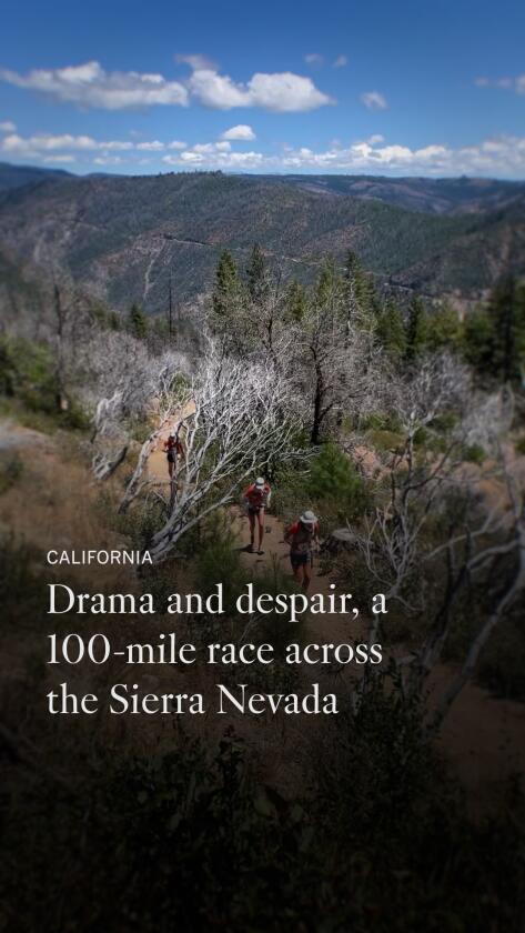
This silent disco 🪩 hike is a new way to experience Griffith Park
It’s a Tuesday evening, just before sunset, and I am in a meadow thrashing an air guitar with a dozen strangers in Griffith Park.
We take the lyrics to Prince’s “Let’s Go Crazy” literally as we gyrate and bend to the song’s iconic guitar solo, which lasts almost 45 seconds. Huffing and puffing, we leave the meadow, laughing together at the beautiful end of the hourlong “silent disco” hike we completed along one of the park’s dirt trails.
I stay for an extra 45 minutes, talking to two other dancers whom I hope become future friends — and that we all dance together again soon.
That night, I participated in Dance Quest’s silent disco hike, a new way to experience Griffith Park where participants shimmy and shake on a trail alongside L.A. improviser and comedian Kristen Smith.
For a suggested donation of up to $25 — Smith emphasizes that no one will be turned away for lack of funds — participants don headphones and hike as they listen to a playlist that Smith has curated. That Tuesday night’s playlist included Donna Summer, Madonna and Carly Rae Jepsen (whom Smith unapologetically stans).
Smith plans to host at least two night hikes a month, but will schedule more if those events sell out. She’s taking a brief pause, though, because her wife gave birth to their second child last Thursday.

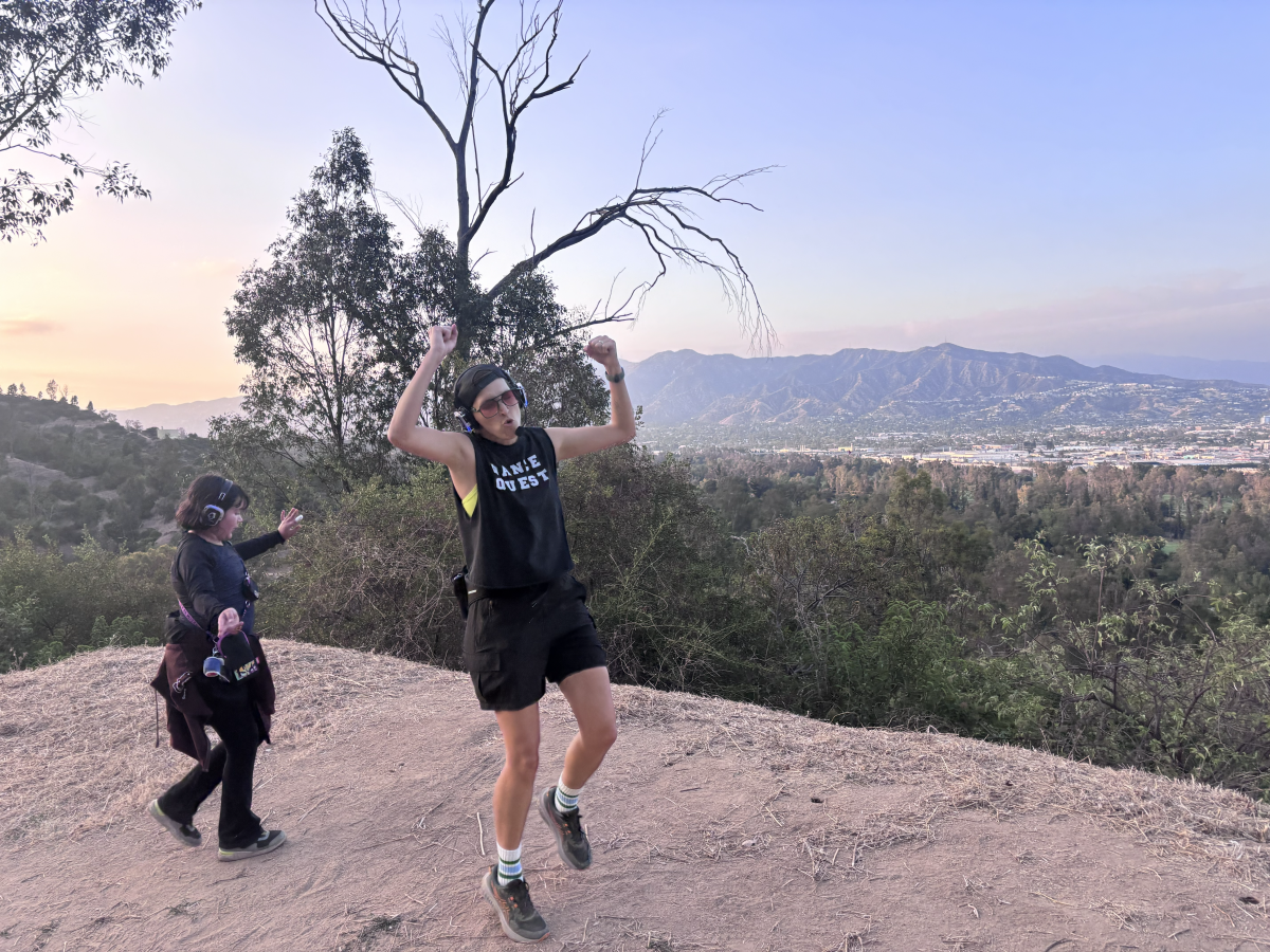
Dance Quest leader Kristen Smith pumps her fists in the air on an overlook along a trail in Griffith Park.
(Jaclyn Cosgrove / Los Angeles Times)
I’m kind of an experiential purist when it comes to hiking — never headphones, never music. I love putting my phone away and just being there with the trees and bees. I couldn’t help but wonder: Would this silent disco ruin or enhance the outdoors experience?
I was pleasantly surprised by the answer, but I think it largely depends on who leads the dancing.
Smith, a tribal member of the Chickasaw Nation who identifies as two spirit and uses she/they pronouns, said they were inspired to start Dance Quest while on a trip to Scotland in 2024 to celebrate their mother’s 70th birthday.

Kristen Smith of Dance Quest leads hikers on a silent disco trek through Griffith Park.
(Jaclyn Cosgrove / Los Angeles Times)
While out and about, Smith and her mom spotted Guru Dudu, a character created by Melbourne-based performer David Naylor, leading a silent disco through the streets of Edinburgh.
“That looks fun,” Smith’s mom said.
They both signed up for a tour, led by Dudu, who wore a purple sequin jumpsuit.
“We danced through the very crowded streets of Edinburgh, and it was the most fun I’d had in such a long time,” Smith said.

L.A. artist Heidi Neilson, center, dances alongside other silent disco hikers in Griffith Park.
(Jaclyn Cosgrove / Los Angeles Times)
Smith, who’d spent years performing on stages throughout L.A., had been stuck inside and away from people for much of the COVID-19 pandemic.
In summer 2021, just as vaccines were becoming available and it was becoming safer to gather with groups indoors, Smith was diagnosed with follicular lymphoma, a type of non-Hodgkin lymphoma.
Smith’s summer was soon full of surgeries and tests until they started chemotherapy that September, receiving a dose every three weeks until early 2022, when their doctors switched Smith to chemotherapy every three months.
Smith’s treatment was going well, but that didn’t mean an immediate return to normalcy was on the horizon. Her doctors said Smith and her family needed to assume Smith’s COVID-19 vaccine didn’t give her immunity to the virus.
As Smith watched her friends return to a semblance of their pre-pandemic lives, she worked inside at her Nickelodeon job, grateful for health insurance and employment in the entertainment industry, but missed the joy and connection that comes with performing.

Kristen Smith of Dance Quest is surrounded by silent disco dancers in Griffith Park.
(Jaclyn Cosgrove / Los Angeles Times)
Smith kept wondering how they could find a way to remain active and connect with others. Plus, being outside remains the safest option for Smith to be around people, as the type of cancer they have is not considered curable and is managed like a chronic illness.
“I know that one of the things that I offer to the world is joy and sparkly effervescence,” Smith said. “I was like, ‘What can I do to be my own boss, is something that’s of service to people in this time of darkness and is also good for me as well?’”
During the silent disco in Edinburgh, Smith realized as they danced alongside others that they felt like they were performing and letting go in a way they hadn’t been able to do in a long time. “When we finished, I was like, ‘I can do this,’” Smith said.
Smith told their mentor at Nickelodeon about their idea to start Dance Quest and they immediately encouraged them to give it a shot. Smith bought the equipment the next week and launched Dance Quest, her company that hosts the silent disco hikes, earlier this year. After doing a test run with friends and family, they started hosting events in the park.
When I arrived to the silent disco, I quickly met my fellow dancers, a welcoming group of people ages 5 and older. I liked that I could adjust the volume on my headphones rather than listen to music all at the same volume.

Holly Gray, an L.A. event planner, throws her arms in the air alongside other dancers in Griffith Park.
(Jaclyn Cosgrove / Los Angeles Times)
We took a wide dirt path in the park that’s not as popular as other routes, which allowed us to spread out and really do whatever we wanted. I quickly realized this was primarily going to be a lot of frolicking to a good beat, which was exactly what I wanted.
Along the way, Smith pointed out invasive plants like black mustard and native plants and animals that live in the park. Whenever a hiker headed our way, we made a tunnel of “spirit fingers” for them to pass through, which I detected 95% of people actually enjoyed. In today’s fast-paced and often negatively focused world, it’s kind of nice to turn a corner and find strangers cheering for you.
Smith, who taught improv to children, teenagers and business professionals, will not force participants to dance. That isn’t the purpose of Dance Quest.

Kristen Smith of Dance Quest, center, leads two children along a dirt path in Griffith Park.
(Jaclyn Cosgrove / Los Angeles Times)
Rather, it’s to find joy with others and escape the harsh political environment that queer and BIPOC people face on a daily basis.
“When you put on the headphones, you forget how you look, and hopefully I provide a no-pressure environment where, however your body tells you to move, you move that way,” Smith said. “And there’s strength in numbers with the silent disco.”

3 things to do

Families play volleyball at an L.A. County overnight camping event at a local park.
(Los Angeles County Department of Parks and Recreation)
1. Camp with family and friends around L.A.
Los Angeles County Parks and Recreation will host family campouts on weekends in July and August at five of its parks. That includes campouts at Castaic Lake Recreation Area at 6 p.m. Friday; Frank G. Bonelli Regional Park in San Dimas at 6 p.m. Friday; Kenneth Hahn State Recreation Area at 6 p.m. July 17; and 6 p.m. July 24 at Santa Fe Dam Recreation Area. Those parks, along with Whittier Narrows Recreation Area, will host additional family campouts in August. General admission is $15. Children age 13 and younger are free. To register, visit anc.apm.activecommunities.com.
2. Clear out streambeds in L.A.
Friends of Griffith Park needs volunteers from 8:30 to 11 a.m. Saturday in the park’s Fern Dell hiking area. Participants will clean streambeds and trails, yanking weeds and restoring habitat. Learn more at friendsofgriffithpark.org.
3. Kayak the L.A. River near Van Nuys
L.A. River Expeditions will host a two-hour kayak tour at multiple times Saturday through the Sepulveda Basin, a lush area of the Los Angeles River. Paddlers will move through the tree-lined, mud-packed riverbanks, observing local fish and birds. Trips are at 9 a.m., 12:30 p.m. and 3:30 p.m. Tickets are $53.74. Register at eventbrite.com.

The must-read

Mary Saba Tehran takes part in a Mindful Archery class at the Woodley Park Archery Range in Van Nuys.
(Eric Thayer / Los Angeles Times)
Times staff writer Deborah Vankin recently learned via a bow and arrow the importance and freedom that can come with literally letting go. Vankin wrote about her experiencing at Mindful Archery, a course led by spiritual counselor and archer Angie Fadel at Woodley Park Archery Range in Van Nuys. Fadel said her goal is to help female and BIPOC participants release something holding them back or take aim at a goal. “An archery range can be a very white, male-dominated space,” she said. “And the stance, with a bow and arrow in your hand, shooting — it’s very male. And [men] don’t have any problem, most of the time, taking up space. So it is a practice to remind ourselves, as a queer woman, a trans person, nonbinary person, anybody that’s kind of othered in our society, to be able to take up space. To adopt a power stance and be, like, ‘I’m allowed to be here.’”
Happy adventuring,

P.S.
Great news! State lawmakers have selected the California State Library park pass to receive ongoing funding in future budget cycles. Previously, lawmakers had to approve funding every year for the program to be added into the state’s budget, according to the California State Parks Foundation. This development means Californians will be able to check out a state parks pass for free at their local library for the foreseeable future, unless a governor or the Legislature announces otherwise. In L.A. County, participating parks include the Antelope Valley California Poppy Reserve, Leo Carrillo State Park, L.A. State Historic Park and Malibu Creek State Park. You can find out which library near you offers the pass by visiting this interactive map. Have fun out there!
For more insider tips on Southern California’s beaches, trails and parks, check out past editions of The Wild. And to view this newsletter in your browser, click here.