This peaceful South Lakes village offers a quieter alternative with River Brathay access, kayaking, Loughrigg walks, and family activities
Isobel Pankhurst Audience Writer
03:11, 08 Mar 2026
This little-known village is something of a hidden gem(Image: ALBAimagery via Getty Images)
Millions flock to the Lake District annually seeking respite from the chaos of daily life. Yet, countless holidaymakers gravitate towards the crowded hotspots of Windermere, Kendal, and Ambleside, which means their walks may prove less tranquil than anticipated, whilst they overlook some of the more hidden corners that the national park boasts.
One such secret treasure nestled in the South Lakes region is Clappersgate, a tranquil village situated on the fringes of Ambleside. Jerry Rebbeck, a regional specialist at Wheelwrights Holiday Cottages, has championed the settlement’s appeal, suggesting it as an ideal base for those exploring the vicinity.
He said: “Clappersgate has great access to the River Brathay, making it a great spot for adventurous visitors who want to paddleboard or kayak towards Waterhead or further onto Windermere.
“If you are not the adventurous type, you can enjoy the majestic riverside setting, taking in the views with a tipple of your choice or a book in a more secluded area.”
For those who prefer rambling, there are excellent routes directly from Clappersgate leading up to the Loughrigg Circular, which offers stunning panoramas across Windermere, and serves as an ideal lower-altitude trek when weather obscures the loftier peaks.
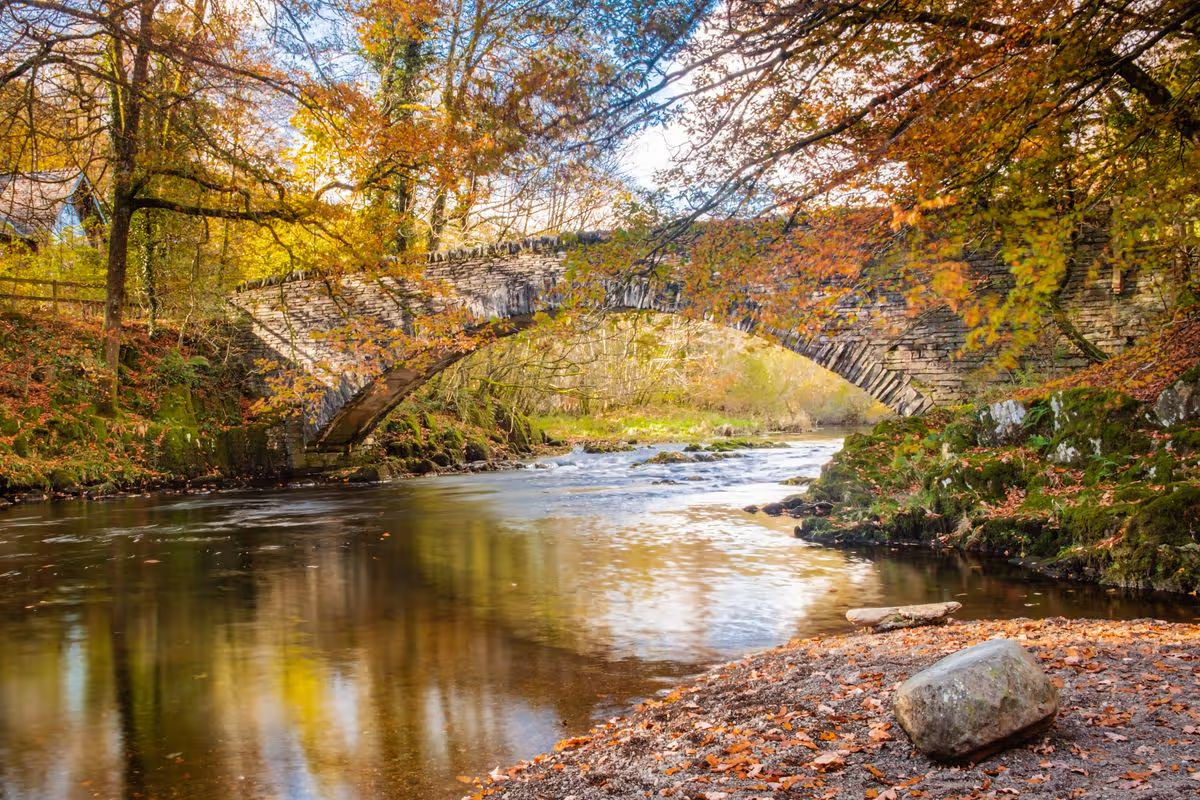
Despite being a compact settlement, Clappersgate brims with heritage, boasting numerous period buildings, including the remarkable Clappersgate Bridge.
The Grade II listed bridge, dating back to the 17th century, is a favourite spot for walkers in the area, owing to its views over the river and surrounding greenery.
Jerry added: “Clappersgate also has convenient access to nearby indoor activities, making it a brilliant place for families to stay in case of those unexpected rainy days, including the Lake District Aquarium and a neo-gothic Wray Castle.
“There are lovely historic houses and holiday cottages in Clappersgate for those wishing to stay in the area.
“The village is tucked away from the crowds, yet within easy reach of numerous landmarks and boasts stunning scenery – offering the perfect balance between relaxation and exploring the Lakes.”
The stunning sister villages offer an idyllic escape for anyone looking to avoid the Lake District crowds – without compromising on scenery, wildlife or history.
They’re home to some of the ‘finest views in the country’(Image: Getty Images/iStockphoto)
Whilst the Lake District remains a beloved choice amongst British holidaymakers, it becomes swamped with visitor numbers during the UK’s beautiful summer season, frequently leading to extortionate costs for lodging, meals and beverages.
For those still wanting to experience a Lake District-style getaway as warmer weather returns – without breaking the bank and whilst steering clear of the crowds, naturally – we’ve discovered the ideal option for you.
Two delightful neighbouring villages straddling the Lancashire-Cumbria boundary tick all the boxes, offering remarkable wildlife, stunning vistas and superb lakeside rambles. These historic settlements are tucked away along Morecambe Bay’s shoreline within an area classified as a National Landscape (the smallest of the lot), thanks to their flourishing natural variety and abundant plant and animal life.
In fact, they appeared in The Sunday Times’ Best Places to Live Guide in 2021, with judges commenting: “These twin villages on the Kent estuary have some of the finest views in the country as well as an energetic, kind-hearted community.”
The settlements of Arnside and Silverdale create a distinctive corner of North-West England’s countryside, teeming with uncommon and beautiful wildlife, reports Lancs Live.
Best Lancashire holiday cottage deals
This article contains affiliate links, we will receive a commission on any sales we generate from it. Learn more
Lancashire is known for its wide open skies, stunning landscapes and lively coastal resorts. Sykes Cottages has a wide range of self catering accommodation across the county from £42 a night.
Positioned on Morecambe Bay’s coastline, Arnside is an enchanting village located within Cumbrian territory with a vibrant community spirit. The settlement’s Victorian seafront and sweeping railway viaduct spanning the Kent estuary stand as two of its most notable landmarks.
Silverdale, meanwhile, is the Lancashire component of this duo, boasting charming whitewashed properties, abundant historical landmarks, and spectacular wooded trails leading to magnificent views of the Bay.
One of Britain’s largest ever ‘Viking Hoard’ was unearthed near Silverdale, thought to date back to 900 AD.
The Arnside and Silverdale Area of Outstanding Natural Beauty (AONB) spans just 75 square kilometres – yet it’s more abundant in terms of heritage and biodiversity than most other locations across the UK.
Things to do in Arnside and Silverdale
Limestone grasslands, coastal rock and salt marshes and verdant woodlands surrounded by low-lying limestone hills make this protected region the ideal breeding ground for marshland birds and rare butterflies.
A visit to RSPB Leighton Moss and Morecambe Bay Nature Reserve in Silverdale provides perfect opportunities to explore the area’s rich biodiversity, particularly its distinctive birdlife.
Leighton Moss hosts the North-West’s largest reed bed, drawing over 100 species of birds throughout the year, including the rare marsh harriers, bearded tits, and bitterns.
Furthermore, otters can frequently be seen playing at dusk in the beautiful meres of Leighton Moss, which also function as a breeding ground for these mammals.
A trek to Arnside Knott should certainly be on the agenda, with the popular hill and its magnificent summit viewpoint offering panoramic vistas of the Irish Sea surrounding Morecambe Bay, the Lake District fells, and the Kent estuary. Arnside Knott is regarded as the finest location in the entire UK for spotting rare butterflies, particularly during June and July, with uncommon species such as the high brown fritillary and the Scotch argus discovered there.
The Arnside Knot Circular Walk proves popular amongst walkers.
Close to Beetham, The Fairy Steps are a children’s favourite, whilst Gait Barrows National Nature Reserve near Carnforth serves as an excellent destination to experience limestone pavement.
The Elizabethan manor, Levens Hall, features an exceptional yew topiary garden and shouldn’t be overlooked, whilst the Giant’s Seat at Jenny Brown’s Point near Silverdale offers the ideal vantage point to absorb the spectacular views.
Leighton Hall, the historic residence of the Gillow family, represents another essential attraction near Silverdale. The family continues to reside there throughout the year and its highlights include the “famous collection of Gillow furniture and objets d’art, the gardens, and woodland walk”.
The award-winning Grade II Listed Building showcases impressive architecture and offers visitors (particularly history enthusiasts) an opportunity to explore and uncover the captivating history of this ancient Lancashire family.
Arnside Tower, also referred to as Pele Tower, is a late-medieval tower house constructed during the latter half of the 15th century. Built from limestone rubble, the tower originally stood five storeys tall but suffered a devastating fire in 1602.
Following restoration work, the structure remained operational and today its surviving features offer a fascinating destination for history enthusiasts.
Whilst visiting Arnside, some excellent dining and drinking establishments include: The Albion, Ye Olde Fighting Cocks, JJ Crossfield’s Cafe and Bar Arnside and The Old Bakehouse Arnside. In Silverdale, visitors can visit The Woodlands Hotel, The Royal Silverdale, and The Wolfhouse for an enjoyable experience.
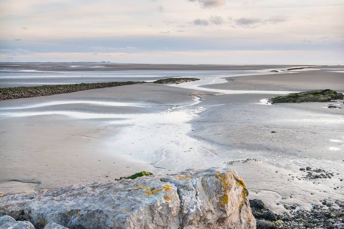
It would be an oversight not to mention the breathtaking Silverdale Cove in this compilation of essential Silverdale and Arnside attractions.
Silverdale Cove is a gradually descending, stony inlet scattered with areas of sand and shingle. Surrounded by historic woodland and imposing limestone cliffs, the whole location possesses a distinctly untamed and unspoilt character.
Visitors should be aware that the bay is notorious for its rapidly changing tides and soft mud, so caution and vigilance are essential whilst exploring.
The cove is primarily suited for walking and observing the local wildlife rather than engaging in traditional seaside pursuits like swimming and snorkelling.
Stunningly picturesque coastal routes and forested pathways link Silverdale Cove to other natural landmarks in the vicinity such as Jenny Brown’s Point and Arnside Knott, and the sunsets are reportedly spectacular.
Ensure our latest headlines always appear at the top of your Google Search by making us a Preferred Source. Click here to activate or add us as your Preferred Source in your Google search settings.
The routine of gently but skillfully pushing wooden canoes into the water body at the shores of Kainji Lake each dawn has been part of the lives of generations of fishermen in North-central Nigeria.
The lake was not always calm – vigorously exhaling and flooding the banks, then intermittently receding – but was inevitably connected to the lives that many communities have held firmly to across Kebbi, Niger, and Kwara states.
Today, that ancestral connection between the communities and the lake is evaporating rapidly. And it is not merely ecological. In some villages where government presence is absent, and terrorists have assumed authority, fishermen now wait for permission from non-state actors before casting their nets. In other areas within the Kainji region, they pay informal levies to armed groups operating from the forests. For decades, Nigeria’s national parks were imagined as spaces apart: buffers of nature against human pressure and political failure. Sambisa Forest shattered that illusion long ago when the Boko Haram terror group took control of it, transforming from a conservation zone into the most notorious symbol of jihadist insurgency in the country. Now, further west, a quieter but no less consequential transformation is unfolding.
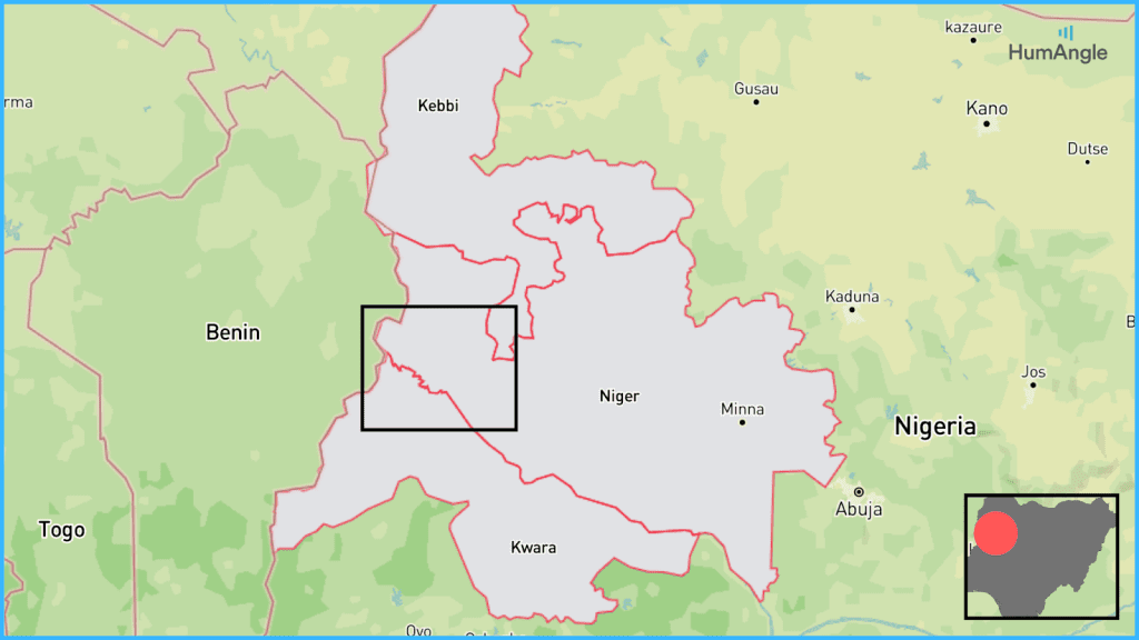
The Kainji Lake National Park (KLNP), sprawling across three states and bordering Benin, has slipped from a wildlife sanctuary into a strategic corridor where poverty, climate stress, criminal enterprises, violence, jihadist ideology, and Sahelian militancy intersect.
Kainji Lake National Park spans three states in Nigeria’s northern region and borders two countries. Map illustration: Mansir Muhammed/HumAngle.
A corridor
Security analysts increasingly describe Sambisa as a “fortress-base” model of insurgency: entrenched, ideological, territorially assertive. Kainji Lake fits a different and more elusive pattern—a “corridor-node” model.
Here, armed actors do not raise flags or announce governance structures. They pass through, networking, training, recruiting, and trading, before vanishing. The park links Nigeria’s troubled North West to the Middle Belt and, increasingly, to the destabilised Sahel. It connects Kebbi to Benin Republic’s Alibori and Atacora regions, Niger State to Niger Republic’s Tillabéri zone, and local grievances to transnational jihadist ambitions.
This distinction matters. Sambisa attracted relentless military pressure for more than a decade because it became a visible symbol of territorial breach. Kainji Lake did not. It appeared peripheral, quiet, manageable. In that absence of sustained attention, the park matured into something arguably more dangerous: a fluid connector for multiple armed actors rather than a single-group stronghold.
Communities along the lake, from Yauri and Ngaski in Kebbi to Borgu in Niger State and Kaiama in Kwara, depend on a fragile interweaving of fishing, floodplain farming, pastoralism, and cross-border trade. Fishing sustains thousands of households. Smoked and dried fish move through informal networks to Ilorin, Ibadan, southern Niger, and beyond. Seasonal farming follows the lake’s unpredictable pulse: millet, sorghum, maize, rice, and cowpea are cultivated on land that appears and disappears with the water’s rise and fall.
Fishing sustains thousands of households. Map illustration: Mansir Muhammed/HumAngle
Pastoralism runs through it all. Herders move cattle along routes that long predate colonial borders, grazing across Nigeria, Benin Republic, and Niger Republic as if the lines on maps were suggestions rather than laws. Weekly markets in Bagudo, Wawa, Babana, Kaiama, and Borgu draw traders from Benin’s north and Niger’s Tillabéri. Grain, livestock, fuel, kola nuts, dried fish, and cloth circulate through these hubs. Some of it is smuggling.
These networks matter because armed groups do not need to invent new pathways. They insert themselves into existing ones. The same tracks used by herders and traders now carry militants, arms couriers, recruiters, and ideological emissaries.
Climate stress as an accelerant
Climate change has exacerbated existing security vulnerabilities around Kainji Lake.
Erratic rainfall patterns and fluctuating water levels have made fishing yields unpredictable. Floodplains that once reliably supported seasonal farming now vanish early or arrive late. Pasture availability shifts without warning, intensifying competition between herders and farmers. Each shock further compresses livelihoods, forcing households to adapt through debt, migration, or risk-taking.
In this environment, armed groups offer something deceptively valuable: predictability. Access to grazing land. Protection from rivals. Permission to fish or farm. Even informal dispute resolution. Where the state provides uncertainty – sporadic enforcement, unclear rules, delayed response – armed actors provide immediate answers, enforced by violence if necessary.
Climate stress, in this sense, is not just an environmental issue but a governance crisis multiplier.
Fieldwork conducted by HumAngle across several local government areas in Kebbi, Niger, and Kwara states identified at least five active extremist factions operating within and around the park. These include the Mahmudawa (Mahmuda faction), Lakurawa, elements of Ansaru and Jama’atu Ahlis Sunna Lidda’awati wal-Jihad (JAS) led by Sadiku and Umar Taraba, and a newly emerged cell linked to Jama’at Nusrat al-Islam wal-Muslimin.
The groups do not operate in isolation. Many originate from northwest Nigeria and southern Niger, with local cover, as they undertake terror attacks in distant locations and return to their various hideouts within the region. What has emerged is a hybrid threat ecosystem where ideology, criminality, climate stress, and grievance reinforce one another.
Brokers, enforcers, and ideologues
The Mahmudawa illustrate the new logic of this ecosystem. Despite sustained air and ground operations by the Federal Government between September and December 2025, the group remains influential. Fragmented into smaller camps, some closer to the Benin border, they act as brokers linking criminal networks of jihadist actors. They facilitate training, arms movement, ransom negotiations and sanctuary for fighters arriving from outside the region.
Official claims regarding the arrest of their leader, Malam Mahmuda, remain unconfirmed in border communities, where continued attacks and coordinated leadership are still attributed to the group.
If the Mahmudawa are brokers, the Lakurawa are enforcers. With an estimated 300 fighters, they have become one of the most active jihadist–terrorist hybrids affecting Kebbi’s border communities. Operating from within and around KLNP, they routinely launch incursions into Bagudo and Suru LGAs, combining attacks on military targets with ideological messaging aimed at delegitimising the Nigerian state.
Their leadership shows signs of Sahelian exposure. Their fighters are drawn from local nomadic tribal networks and northwest terrorist pools. Kebbi, long considered peripheral, is now firmly part of the frontline.
Get our in-depth, creative coverage of conflict and development delivered to you every weekend.
Subscribe now to our newsletter!
The relocation of Sadiku and Umar Taraba, both veteran jihadist operatives, to the Kainji axis in 2024 marked a shift. Their presence injected technical expertise into a space previously dominated by loosely organised armed groups.
IED knowledge, structured training, and a sharper focus on high-value targets followed. Collaboration with criminal terrorist groups deepened. The abduction of foreign nationals near Bode Sa’adu illustrated this fusion starkly: JAS elements, Mahmudawa fighters, and allied terrorists executing a single operation where ideology and profit were indistinguishable.
JNIM’s shadow on the lake
The most alarming development emerged in late November 2025: the appearance of a group believed to be affiliated with JNIM along the Kebbi–Benin border corridor.
Witnesses describe predominantly foreign fighters, many believed to be Tuareg, moving at night in disciplined formations, wearing military-style uniforms with turbans on their heads, and engaging communities with a calculated restraint unfamiliar to local armed groups. So far, they have avoided major attacks.
That restraint is likely strategic.
Their presence suggests Kainji Lake could become a staging ground for Sahelian expansion into northwestern Nigeria — a shift that would fundamentally alter the region’s security calculus. Unlike local groups, JNIM brings external financing, battlefield experience, and a long-term vision.
Communities adapting under pressure
Communities in the lake basin are not passive observers. They are recalibrating in real time. Some negotiate access quietly to avoid displacement. Others maintain layered loyalties, sharing information selectively as a survival strategy. Vigilante groups that once patrolled forest edges retreat under sustained pressure. Traditional rulers face coercion or marginalisation. In certain settlements, schools and community buildings are repurposed by armed actors for operational use.
Access to fishing grounds, farmlands, and trade routes increasingly depends on permissions issued by commanders operating from forest camps rather than on decisions by local councils or chiefs. Authority has shifted, not through formal declaration, but through incremental control of movement and livelihoods.
How conservation and governance hollowed the ground
The transformation of Kainji Lake into a security corridor is as much the product of ideology as it is the cumulative outcome of governance failure layered over decades.
The creation of Kainji Lake National Park in 1976 displaced communities and restricted access to land and water without meaningfully integrating residents into conservation planning. Fishing zones were closed, grazing was curtailed, and farming was criminalised in places where alternatives did not exist. Promised livelihoods rarely materialised.
Park rangers – tasked with enforcing vast conservation boundaries – were underpaid, poorly equipped, and often absent. Their presence, when felt, was frequently punitive rather than protective.
Local governments in Bagudo, Suru, Kaiama, Borgu, and Ngaski remain chronically weak.
When armed violence escalated across the northwestern region, security deployments focused on Zamfara, Katsina, and parts of Niger State. Kebbi’s borderlands were treated as peripheral, stable, and low-risk. That assumption proved costly.
Border governance failed as well. Coordination with Benin and the Niger Republics remains distant, reactive, and politicised. Joint patrols are rare. Intelligence sharing is uneven. Communities know this. Armed actors understand it better.
Armed groups arrived first as guests, then as protectors, and finally as power brokers, filling gaps the state created—sometimes violently, sometimes persuasively.
Poverty caused by the absence of authority
In the absence of legitmate sate authority, people seek alternative systems of order. Armed groups exploit this vacuum expertly. They tax, regulate, punish, and reward. In some communities, the question is no longer whether armed groups are legitimate, but whether they are avoidable. Increasingly, they are not.
The Kainji axis experienced seven major attacks between 2025 and Feb. 2026: The Nov. 2025 abduction of 303–315 students from St. Mary’s School in Papiri (Niger State); the market raid in Kasuwan Daji that claimed the lives of about 30-42 people on Jan. 3, 2026; the Jan. 23 park ambush killing six; the Feb. 1 raids in Agwara and Mashegu (dynamiting a police station and church), and the Feb. 4 massacre in Kaiama. Map illustration: Mansir Muhammed/HumAngle.
Once a symbol of Nigeria’s conservation ambition, KLNP has become a largely ungoverned hub exploited by a mix of violent actors: jihadist cells, armed terrorist factions, and transnational militants with roots beyond Nigeria’s borders.
From the northwest’s perspective – particularly Kebbi State – the park functions as a rear operational hub. Armed groups operating in border local governments use it for recruitment, logistics, training, and cross-border movement into the Benin Republic. Its sheer size, rugged terrain, and weak oversight enable a dangerous convergence: criminal armed groups blending with jihadism.
This shift carries national implications
Kainji’s forests and waterways provide mobility, with the lake economy providing revenue streams and border proximity offering escape and reinforcement routes.
While Sambisa became synonymous with territorial insurgency, Kainji signals the maturation of a corridor-based conflict economythat binds Nigeria’s northwest to wider Sahelian instability through forest reserves and lake communities.
When conservation spaces double as conflict connectors, the impact extends beyond biodiversity loss. Human buffers weaken first as communities negotiate survival under parallel authorities. Ecological buffers follow as enforcement fractures and resource exploitation become embedded in armed group financing.
Communities adapt under the rule of local armed terror groups in the absence of state and local government authorities. Density map of settlements in the Kainji axis where terrorists control.
The lake basin lies close to Kainji dam, a critical energy infrastructure, touches sensitive international borders, and anchors trade and livelihood systems that extend deep into the country’s interior.
In 2026, the geographic corridor surrounding the lake and its forest reserves recorded some of the highest levels of mass killings and large-scale abductions in Nigeria. Armed groups operate with increasing confidence, widening their reach across rural settlements and mobility routes connecting Niger State to Kebbi, Zamfara, and beyond toward the Sahelian belt.
The warning signs are not limited to a single park
In April 2025, the Conservator-General of Nigeria’s National Park Service, Ibrahim Musa Goni, told HumAngle that six national parks across the country were overrun by terrorists. Two years earlier, the federal government had created 10 additional parks to prevent further takeovers. However, only four of those new parks are currently operational. In addition to the seven existing parks, only eleven national parks are currently functioning nationwide.
Even where reclamation has occurred, the process is complex. The Conservator General pointed to Kaduna State as an example, describing what he termed a “mutual understanding” between authorities and armed groups.
“They have agreed to resolve their issues,” he said. “[As a result], most of the forest and game reserves, and even the national park in Kaduna State, have today been freed of banditry.” This, he argued, has brought “relative peace” and enabled forest and game guards, including officers in Birnin Gwari, to resume operations.
The National Park Service has also redefined its institutional posture. “The government classified the National Park Service as a paramilitary organisation,” Goni explained. “And as a paramilitary organisation, the act provides that we can bear arms.” Rangers affiliated with the Service have received training from the United Nations Office on Drugs and Crime to address wildlife crime and respond to terror-related takeovers. According to Goni, this training has strengthened Nigeria’s capacity to confront forest-based criminality linked to armed groups and insurgents.
The approach is not solely security-driven. The Service engages surrounding communities through alternative livelihood programmes, skills training, and starter packs intended to reduce dependence on park resources. “This has, in a great deal, diverted the attention of most of them from the resources of the national parks,” Goni said, adding that it has helped contain hunting and wildlife trafficking.
Yet resource limitations remain significant. “Apart from managing wild animal resources and the plants, we also have to manage the human population,” he acknowledged, noting that the Service cannot meet the needs of every community bordering the parks.