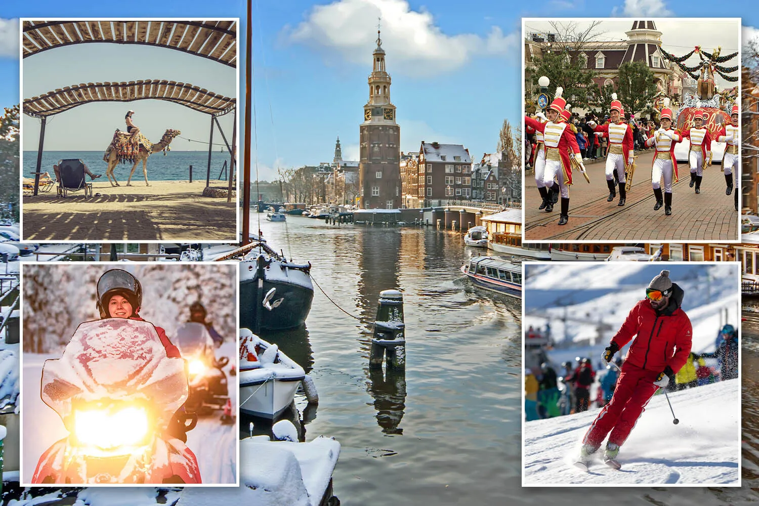
IT MAY be sizzling at the moment – but set your sights on winter breaks to bag some real value.
Now is the best time to book a Christmas getaway, says Sophie Swietochowski, with prices as low as they go for the next few weeks. You can try out these top deals . . .
Sign up for the Travel newsletter
Thank you!
WINTER SUN IN EGYPT
You’ll be waited on hand and foot if you head to Hurghada this ChristmasCredit: Getty
THOSE wanting to spend Christmas on the beach in luxury lodgings should set their sights on Hurghada.
It’s around a five-hour flight, temperatures will reach 23C and you’ll be waited on hand and foot.
You can score a cracking deal with easyJet if you book before July 21, using the code FOOTBALL26.
There’s £100 off a seven-night B&B getaway to the 4H Cook’s Club El Gouna with a new price from £876pp based on two sharing and including flights from Bristol on December 19.
The Suomo resort will take your breath away with its thick woodland coated in fresh snow,Credit: supplied
IF bucket list is what you’re after, that’s what you’ll get when you whisk the kids off to Finnish Lapland.
Who wouldn’t dream of seeing Santa Claus on Christmas Day?
The Suomo resort will take your breath away, with its thick woodland coated in fresh snow, and cosy wooden lodges where you can hunker down with some wine or a board game around a roaring fireplace.
Along with feeding the reindeer, little ones will get to join the elves filtering through letters and go husky sledding or tobogganing, all while wrapped in their snowsuit and boots — free for all guests.
The four-night package costs from £1,890pp based on a family of four sharing and includes all of the experiences mentioned above, plus flights from Stansted on December 23.
You’ll stay in the Scandi-decorated Arctic Circle Hotel with all meals included and a meeting and gift from Santa.
The price includes four days’ worth of park tickets for the whole familyCredit: Alamy
DISNEY doesn’t come cheap, no matter what time of year you visit, but if you book now you can bag seriously good deals over Christmas.
Disney Enchanted Christmas brings the magic from November 7 to January 6 and this season, for the first time, the joy will spread beyond Disneyland Park as you celebrate in Arendelle style in World Of Frozen.
Queen Anna, Elsa ,Olaf and friends, will welcome guests into the Kingdom of Arendelle at Disney Adventure World, plus there are carol singalongs and character meet-and-greets.
Three nights’ room-only in Disney’s Santa Fe hotel is from £745.96pp based on a family of four sharing, flying from Heathrow on December 23.
This price includes four days’ worth of park tickets for the whole family.
The Christmas markets will be in full force in the lead-up to the big dayCredit: Getty
SOME cities simply come alive in winter — and Amsterdam is undoubtedly one of those.
The frosted canals of the Netherlands city are lit up by old-fashioned lampposts and pokey cafes serve up piping- hot mugs of Choco- mel spiked with rum to give it some extra warmth.
The Christmas markets will be in full force in the lead-up to the big day.
But these are not your stereotypical tat stalls — everything here if authentically Dutch.
Don’t forget to sample the oliebollen — warm doughballs dunked in powdery icing sugar.
Check in at the 4H Leonardo Museumhotel Amsterdam City Centre which is slap-bang in the heart of the action.
Four nights’ room-only costs from £485pp based on two people sharing and including flights from Liverpool on December 23.
These pistes are often praised for their world-class ski schools that exceed many others in EuropeCredit: Getty
Few scenes are more spectacular at Christmas time than those from the top of a snow-drenched ski slope, the sun reflecting off the mountain-scape.
Crystal Ski has some great deals at the moment, including this one to Andorra. The resort of Grandvalira is perfect for both pros and beginners, with one of the largest ski domains in Europe, home to a whopping 215 km of interconnected slopes, meaning there’s great variety.
These pistes are often praised for their world-class ski schools that exceed many others in Europe, plus it’s a little more affordable than the Alps.
Seven nights’ half board at the 4* Residence Pas de la Casa Alaska is from £825pp based on two people sharing including flights from Gatwick on December 20.
For the first time in 48 years, Japan has changed its visa fee, rising by a staggering five times for foreign nationals, who will need to pay an extra £55 when visiting
Japan has increased its visa fees for tourists(Image: Getty Images)
Japan has dramatically hiked its visa fees for tourists, with the cost of entry now a whopping five times higher.
From Wednesday, 1 July, many foreign nationals travelling to the country home to Mount Fuji will be required to pay 15,000 yen (£69.99) for a single-entry visa, a sharp rise from the previous 3,000 yen (£14). Meanwhile, multi-entry visas will now set travellers back 30,000 yen (£139.98), jumping up from 6,000 yen (£28).
This represents a staggering fivefold increase, meaning visitors will fork out an additional £55.99 for a single trip, or £111.98 for a multi-entry visa. Remarkably, this marks the first time Japan has raised its visa fees since 1978 — a full 48 years ago.
Foreign Minister Toshimitsu Motegi said the changes were made to “reflect inflation and exchange rate fluctuations”. He added: “We do not anticipate that it will have an immediate impact on inbound tourism.”
The updated visa fees will apply to all applications submitted on or after 1 July, 2026, as the nation continues to experience a surge in visitor numbers. Last year alone, Japan welcomed a remarkable 42.7 million international tourists, with iconic destinations such as Tokyo, Kyoto and Osaka remaining amongst the most sought-after, reports the Express.
The good news for Brits is that Japan has reciprocal visa exemption arrangements with 74 countries and regions, allowing citizens to enter for short-term stays without a visa. UK passport can stay for 90 days visa-free.
Japan’s new visa charge places it among the pricier destinations to enter globally. Other nations with steep tourist visa costs include the UK, where a standard visitor visa costs £135, and Ghana, where travellers from non-African nations pay $260.
Some countries levy per-night charges, with Bhutan ranking among the most expensive. A daily sustainable development levy of $100 is imposed per adult.
The Foreign, Commonwealth & Development Office (FCDO) advises that Brits travelling to Japan must make sure their passport remains valid for the duration of their visit. The FCDO states on its travel advice page: “No additional period of validity is required. You need a blank page for your visa stamp.”
In guidance on obtaining a visit, the Foreign Office adds: “You can get a visa on arrival in Japan for tourism or business for up to 90 days. You do not need to apply before you travel. If you need a multiple-entry visa, you must ask the immigration officials when you arrive. If you want to stay longer, you can apply at your nearest immigration office for an extension for another 90 days. Your passport must be valid for the period of the extension.”
The FCDO adds: “For long-term stays or to work or study, you must meet the Japanese government’s entry requirements. Check which type of visa you need. It is illegal to work in Japan without the correct visa, no matter how informal or temporary the work.
“If you overstay your permission to remain in Japan, you risk arrest, detention and a heavy fine. For residency information, see the Japanese Immigration Services Agency website and read about living in Japan.”
While there is no advice against travelling to Japan, the FCDO has warned about “global travel impacts due to escalation in the Middle East.” They stated: “Escalation in the Middle East has caused widespread travel disruption, including airspace closures, delayed and cancelled flights.
“Your travel plans may be affected, even if your destination is not in the Middle East. Before you travel:
Check travel advice for any countries or territories you are transiting through
Check for the latest updates from your airline or tour operator
Review your travel insurance policy for coverage
Monitor local and international media for the latest information and sign up for travel advice email alerts.”
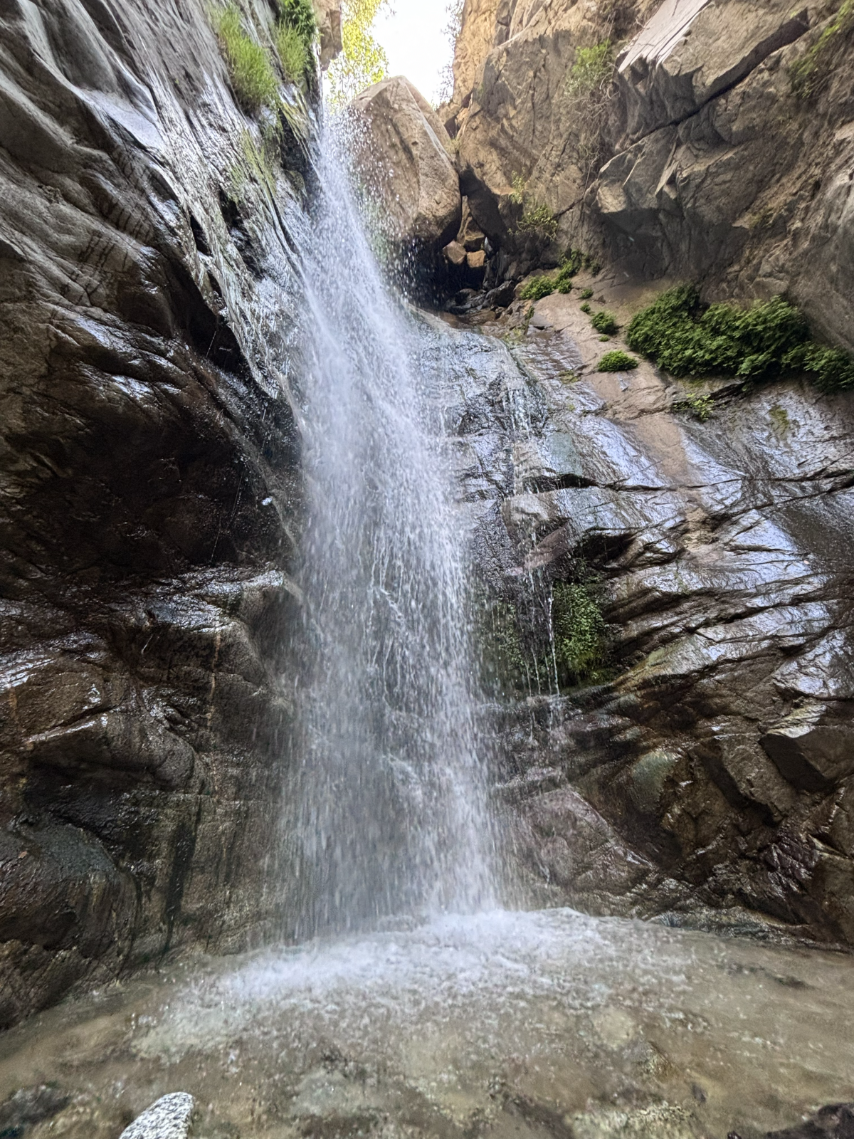
I was alone in the forest in my favorite place for the first time in years, so I did the only logical next right thing. I lay down.
There I was, sprawled next to Millard Canyon Falls, listening as the water roaring down the cliff and cool air whooshed past my face. I gained a new perspective when I gazed at an upside-down waterfall. What’s the point of hiking if we don’t play around?
In today’s edition of The Wild, our weekly outdoors newsletter, I provide you with three great hikes where rivers and waterfalls are still flowing. It’s essential information as we head into summer and temperatures start to rise.
You are reading The Wild newsletter
Sign up to get expert tips on the best of Southern California’s beaches, trails, parks, deserts, forests and mountains in your inbox every Thursday
By continuing, you agree to our Terms of Service, which include arbitration and a class action waiver. You agree that we and our third-party vendors may collect and use your information, including through cookies, pixels and similar technologies, for the purposes set forth in our Privacy Policy such as personalizing your experience and ads.
If you were to force me to choose my favorite hike, I would stubbornly refuse to pick just one, but my list would include these three.
That’s why I really want to urge you, my dear Wild reader, to treat these places with the reverence they deserve. That includes:
Refreshing your memory on the seven “Leave No Trace” principles.
Packing a small trash bag in which you can store empty food wrappers, toilet paper and garbage you spot along the way.
Observing wildlife from a distance, including California newts, which you shouldn’t pick up because it’s rude and, more important, because they can secrete a neurotoxin through their skin that can be lethal to humans.
OK, let’s talk about where your next favorite hike will be!
Millard Canyon Falls in Angeles National Forest.
(Jaclyn Cosgrove / Los Angeles Times)
1. Millard Canyon Falls
Distance: 3.3 to 4.3 miles (see below) Elevation gained: About 900 to 1,100 feet Difficulty: Moderate Dogs allowed? Yes Accessible alternative: Paved segment of Gabrielino Trail from Windsor Boulevard
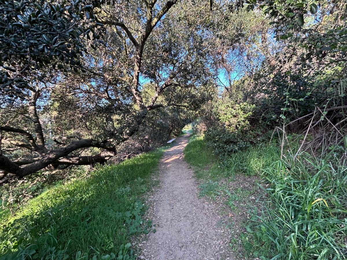
This 3.3- to 4.3-mile hike to Millard Canyon Falls will take you through lush hillsides and beneath the shade of coast live oaks and bigleaf maples as you walk alongside, and sometimes through, Millard Creek. Your journey ends at Millard Canyon Falls, a gorgeous 50(ish)-foot waterfall that gushes past massive boulders perched at the top of the cascade.
This hike is usually much shorter (about 1.5 miles), but a road closure in place since the Eaton fire lengthened it. I will explain more about the closure later. It is important to note, though, that Chaney Trail is the name of the roadway and an actual trail, both of which you’ll take on this hike.
To begin your hike, you can either parallel park nearNuccio’s Nurseries, taking care to obey all parking signage, or if those spots are all taken, park nearby and order a rideshare to drop you at the trailhead. I had cell reception with Verizon here, so it should be possible to order a ride back to your vehicle.
Millard Creek in Angeles National Forest.
(Jaclyn Cosgrove / Los Angeles Times)
From here, you have two options for reaching the Millard Canyon Falls trailhead.
1. Follow Chaney Trail road for about 1.66 miles to the Millard Canyon Falls trailhead. This route will be exposed, so you’ll need to start early if you choose this option.
2. Walk about half a third of a mile north from Nuccio’s, and then, near a bend in the road, you’ll take the Chaney Trail, a winding dirt path that I was delighted to find is in great shape. (Shout out to Restoration Legacy Crew, a volunteer trail maintenance group, for its amazing work in the Millard Canyon area!)
That trail is a bit overgrown in a few spots, so you’ll want to wear pants (or take the road). Additionally, make sure to lightly stomp before heading into overgrown areas, as this helps alert any snakes snoozing in the shade of your presence.
The view from the ground looking up at Millard Canyon Falls.
(Jaclyn Cosgrove / Los Angeles Times)
You’ll take Chaney Trail for about half a mile, pausing to catch your breath and take in the increasingly great views of the San Gabriel Valley. You will next cross over Mt. Lowe Motorway to take the Sunset Ridge Trail down. (See map for greater detail.)
You will boogie down a few switchbacks for 0.7 miles, enjoying shade provided by bay laurels and sumac trees, listening to the sweet songs of canyon wrens and spotted towhees. (That’s who was singing to me, anyway!)
You will reach the Millard Canyon campground, which is closed for overnight camping but does feature a few nice picnic tables shaded by massive coast live oaks. With the creek flowing nearby, I wouldn’t blame you if you stopped and had a little snack here.
Millard Campground in Angeles National Forest. It is closed because of damage from the Eaton fire.
(Jaclyn Cosgrove / Los Angeles Times)
That said, you have finally made it to the Millard Canyon Falls trailhead! Just northwest of the campground, you’ll find a little arrow pointing you northward onto the trail. From here, you will gain minimal elevation, and can actually just frolic. It is about half a mile to the waterfall.
As I mentioned, this trail is usually shorter and easier to access, as there’s a large parking lot near the trailhead and more parking along the roadway.
The roadway Chaney Trail was slated to reopen at the end of April. I frequently checked Los Angeles County Public Works’ road closure website, as I had planned to write about Millard Canyon once the road reopened. But when I checked the website, I saw that the reopening had been moved to the end of August. Huh?
I asked the public information officers at county Public Works about it and was told: “We are currently coordinating with our on-call emergency contractor to complete guardrail repairs on Chaney Trail, just north of the gate. Construction is anticipated to begin in July and be completed by the end of August, weather and field conditions permitting.”
Clockwise from top left: prickly phlox, golden yarrow, cliff aster and a type of larkspur. Center: A little bird on a dried out plant.
(Jaclyn Cosgrove / Los Angeles Times)
I passed a shiny new guardrail just north of the gate when I was hiking there earlier this week. I asked the agency whether there was some other guard rail missing. No, my friends. “The community raised concerns about the roadway narrowing included in this project, and we will be reconstructing the guardrail to address those concerns,” a spokesperson told me via email.
And now ends the saga of the Chaney Trail guardrail.
As for Millard Canyon, I will admit, it quite possibly is my favorite frontcountry natural areas. I was reminded of this fact when I visited this week. Although the road closure adds some steep mileage to reach the canyon, it’s worth it to me. I will be back. I hope to see you there!
The Fish Canyon Narrows near Castaic.
(Jaclyn Cosgrove / Los Angeles Times)
2. Fish Canyon to Fish Canyon Narrows
Distance: About 5.5 miles Elevation gained: About 400 feet Difficulty: Moderate Dogs allowed? Yes Accessible alternative:San Francisquito Creek Trail
To reach the Fish Canyon Narrows, you will take the Fish Canyon Trail (called Forest Route 6N32 or the Warm Springs Fish Canyon Truck Trail on some maps) on a 5.5(ish)-mile out-and-back journey. You will ascend into narrowing walls of sandstone, granite and conglomerate. A healthy stream flows throughout the canyon, giving you ample opportunity to cool off or have a picnic in a naturally occurring sound bath (which, when you’re lucky, will include a tree frog).
A quick note: This is the most rugged (read: least curated) of the three adventures mentioned in this list. There is no trail signage, and you’re in a less popular corner of Angeles National Forest. You might be entirely alone, especially if you hike this on a weekday. You should plan accordingly. Or skip it if I’ve already freaked you out. (I do this out of love!)
To begin, you’ll park on the road’s shoulder, and head east through a gate. Follow the roadway north and then south as it curves toward a dirt path. Follow the exposed dirt path northeast. You’ll trudge through multiple water crossings and be blessed with the occasional shade of sycamore trees.
The narrows are often cooler than the rest of the area. The first portion of this hike has little to no shade, so make sure to wear plenty of sun protection.
And if you leave the trail but aren’t ready to go home, head over to the swim beach at Castaic Lake. And if you’re not tired, there’s always the Cali Splash Park, a massive inflatable floating park. That’s a full day of adventure!
A hiker lies near the creek along the Icehouse Canyon Trail.
(Brian van der Brug / Los Angeles Times)
3. Icehouse Canyon Trail to Icehouse Saddle
Distance: Around 7 miles Elevation gained: 2,600 feet Difficulty: Challenging Dogs allowed? Yes Accessible alternative:West Fork National Scenic Bikeway
Icehouse Canyon Trail to Icehouse Saddle is a 7(ish)-mile trek that runs mostly parallel to the gorgeous and crystal clear Icehouse Creek, which often features several short waterfalls as the water rockets down the mountainside.
As they trek through the canyon shaded by bigleaf maple, California incense-cedar and bigcone Douglas-fir, hikers might spot wildflowers including orange-yellow western wallflowers, light purple Grinnell’s Beardtongue and red western columbine.
Icehouse Canyon is popular on weekends and is best visited on a weekday if you can swing it. You’ll need either a $5 Adventure Pass, an annual America the Beautiful pass or other federal public lands pass to park.
To begin your hike, you’ll park at or near the trailhead — in the parking lot if it’s your lucky day. Otherwise, you’ll park along the roadside, taking good care to read signage and not block anyone’s driveway. Once while walking to the trailhead, I was greeted by a local dog whose collar informed me that he was allowed to meander about and knew how to get back home. I love small mountain towns.
After you park — and remember to display your pass, as forest service workers do ticket vehicles without them — you’ll head east to the trailhead.
A visitor cools down in the creek at Icehouse Canyon.
(Jaclyn Cosgrove / Los Angeles Times)
Immediately upon entering the canyon, you’ll be greeted with stunning beauty. Try not to become too distracted by the pools of water surrounded by large boulders. (No one will know if you skip the hike and just take a dip.)
About a mile into your hike, you’ll come to a crossroad where the Chapman Trail and Icehouse Canyon Trail intersect. Continue east on the Icehouse Canyon Trail. A mile farther, you’ll start the switchback portion of the trail, where you’ll gain about 1,200 feet in 1.5 miles. It’s a beautiful suffer fest.
Icehouse Saddle will offer you incredible views of the San Gabriel Mountains and Mojave Desert. You’ll likely meet other hikers here who are planning to continue their journeys to one of several peaks reachable from the saddle, including to popular spots like Cucamonga and Ontario peaks.
Hikers meander past boulders and large pine trees.
(Brian van der Brug / Los Angeles Times)
It can be quite windy at Icehouse Saddle, so if you’re planning to have your lunch here (which I’ve done many times), consider packing a windbreaker.
The Times has been writing about hiking in Icehouse Canyon for more than 100 years, as city dwellers have long been drawn to its beauty. A July 1926 article about Icehouse Canyon started with a headline declaring, “Here’s a nice cool trip” in all caps.
“It is a trip which one will want to take more than once when its lure has gotten into the blood,” an unnamed Times journalist wrote.
May we all be so lucky to return again and again.
3 things to do
Docent Susan Hopkins leads a Pride Month hike during a previous year’s celebrations.
(L.A. County Department of Parks and Recreation)
1. Celebrate Pride across L.A. County The L.A. County Department of Parks and Recreation will host several events celebrating LGBTQ+ Pride throughout June. Almost 60 county parks are hosting events, including from 5 to 7 p.m. Thursday at Dalton Park in Azusa; from 5 to 7 p.m. Thursday at Dr. Richard H. Rioux Park in Stevenson Ranch; and from noon to 2 p.m. Saturday at Crescenta Valley Community Regional Park in La Crescenta. For a list of all events, visit parks.lacounty.gov.
2. Walk for peace in L.A. Los Angeles meditation nonprofit InsightLA will lead a free 12-mile Walk for Peace from 9 a.m. to 3 p.m. Saturday. The walk will start at Hollywood Forever Cemetery and end with community picnic at Tongva Park in Santa Monica. Register at insightla.org.
3. Repair trails in remote forest near L.A. The Lowelifes Respectable Citizens’ Club, a volunteer trail maintenance group, needs volunteers on Saturday and Sunday to help restore an overgrown segment of the Gabrielino Trail in Angeles National Forest. Volunteers will either ride gravel bikes down a 5.5-mile dirt road or hike in. Previous trail work experience not required. Register by emailing trailwork@lowelifesrcc.org.
The must-read
The aedes aegypti mosquito, called the “yellow fever mosquito,” is well-known for spreading nasty illnesses like its namesake and dengue fever.
(Sameer Neamah Mahdi / Associated Press)
Here’s a sentence I didn’t expect to write this year (or ever): Google would like to release up to 64 million sterilized male mosquitoes in California and Florida to help combat mosquito-borne illnesses such dengue, Zika, chikungunya and yellow fever. “Google says it can harness technology to optimize a concept that’s been around for decades, but hasn’t worked at a large enough scale with mosquitoes to rein in disease,” Times staff writer Lila Seidman reported. The project is called Debug —although Google could have gone with WiFly.
I’ll see myself out.
Happy adventuring,
P.S.
You’re sitting there thinking about your weekend, wondering, “Is there anywhere I could go dressed as a shark?” Why, yes, there is! The Cabrillo Marine Aquarium and Cosplay for Science will co-host the Science Entertainment Aquarium Convention from 9 a.m. to 4 p.m. Saturday at the aquarium (3720 Stephen M. White Drive in San Pedro). SeaCon 2026 will feature a beach cleanup, a fictional marine biology panel and a cosplay contest, along with much more. Learn more at the aquarium’s Instagram page. Have a jaw-some time!
For more insider tips on Southern California’s beaches, trails and parks, check out past editions of The Wild. And to view this newsletter in your browser, click here.
Now, the fee change is being criticised, with passengers and drivers calling it “disgusting” and “mad”.
Meanwhile, taxi operators are being forced to warn customers that the charge will be part of their cab bill when rides are booked.
Mark Streeter, boss of Norwich’s Courtesy Taxis, told Norwich Evening News: “The main annoyance from our side is that we tell customers it’s an extra £5 or so, and now it’s gone up with no warning. So either the customer or the driver has to pay more than expected.”
Norwich Airport has responded to explain that the drop-off fee increase is a result of growing business costs and worsening energy prices.
A spokesperson for Norwich Airport told The Sun: “We understand that no one welcomes increased charges. But our airport group is facing sharp rises in costs, including a tripling of business rates, higher employment costs such as National Insurance and rising energy costs.”
Admitting that there is no choice but to rely on the public to absorb some of the growing costs, the spokesperson added: “At the same time, we continue to invest millions of pounds in maintaining the airport infrastructure needed to provide an essential public service in our regions.
“We cannot keep absorbing these increased costs without passing some of the additional burden on to our customers.”
Norwich’s change in drop-off policy comes alongside Stansted Airport‘s similar changes.
The London airport took its 15-minute express drop-off charge from £7 to £10 in March, with stays of up to 30 minutes now costing £28 instead of £25.
Meanwhile, London Gatwick‘s fee for a 10-minute drop-off now costs £10, up £5 from when it was first introduced in 2021.
Seemingly at every single turn, a hiker blazed past me, ignoring any semblance of trail etiquette.
A house party near the mouth of the canyon blared music that reverberated throughout the hillsides, blocking any chance to hear birdsong. Although I’m nonbinary, I felt my gender rapidly evolving into grumpy old man.
“The privilege of living here,” I grumbled to myself. “Never hiking on Memorial Day ever again.”
Then, I realized just how much my own attitude was ruining what could otherwise be a beautiful day outdoors. I paused, took a few deep breaths and made myself look at the flowers, take in the smile of a passing hiker, and say a few things I felt grateful for. This gentle reframing saved the day.
You are reading The Wild newsletter
Sign up to get expert tips on the best of Southern California’s beaches, trails, parks, deserts, forests and mountains in your inbox every Thursday
By continuing, you agree to our Terms of Service, which include arbitration and a class action waiver. You agree that we and our third-party vendors may collect and use your information, including through cookies, pixels and similar technologies, for the purposes set forth in our Privacy Policy such as personalizing your experience and ads.
It was my first time hiking around Santa Ynez Canyon, and I laughed at myself for expecting serenity on Memorial Day, when seemingly half of L.A. heads to the beach and mountains for a quick escape. I had high expectations for the canyon’s Los Leones Trail. Several friends and colleagues had told me how beautiful it was. But those expectations were what put me in such a bad head space at the start of my hike.
I share this experience because I want to remind us all how lucky we are to live in a place where we can hike near the Pacific Ocean and then go swim and bounce in its waves.
In this edition of The Wild, our weekly outdoors newsletter, I will share three great hikes near some of the best (and cleanest!) beaches in Los Angeles County.
I chose trails near beaches that made our “15 best beaches in L.A. County” list this year, including two that feature tide pools. (Don’t know what a tide pool is? Check out my guide on how to explore them!)
A few quick things to remember:
Plan for hotter temperatures as summer creeps up: 🥵 Make sure to pack more water than you typically need, especially on hikes with minimal shade.
Bring your sun protection: Lately, I’ve been using my hiking umbrella that I reviewed for last year’s holiday gift guide. Its silver top deflects heat while its black underside traps harmful UV rays.
Leave no trace: Please refresh your memory of the seven “Leave No Trace” principles, including being mindful of how loud you’re talking and not playing music audibly from your phone or a speaker.
Tell someone where you’re going: Complete this form (or something like it) and leave a copy with a friend or family member, and another on your car’s dash. This will better ensure rescuers can find you, should an emergency occur.
OK, now that we’ve covered some essential safety measures, let’s dive into this week’s hikes. Soon, you could gaze upon a stretch of coastline from one of these hikes, only to go swimming later in the day at the same spot!
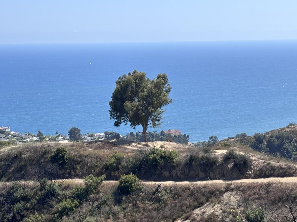
A popular lookout spot near the Los Leones Trail in the Santa Monica Mountains.
(Jaclyn Cosgrove / Los Angeles Times)
1. Los Leones Trail to Parker Mesa Overlook
Distance: About 7.4 miles out and back Elevation gain: About 1,500 feet Difficulty: Moderately challenging Dogs allowed? No Accessible alternative: Will Rogers State Park’s Inspiration Loop Trail Beach to visit nearby: Will Rogers State Beach at Temescal Canyon
This 7.4-mile out-and-back journey in the Santa Monica Mountains starts with taking the Los Leones Trail about 1.3 miles up before joining with East Topanga Fire Road for a steep 2.4-mile trek to the Parker Mesa Overlook.
To begin your hike, you’ll park in or around the Los Leones trailhead near Topanga State Park. Hopefully, you’ll snag a spot in the small lot near the trailhead. This reporter did not get that lucky, but I did find there was plenty of street parking, although it adds a little mileage to the trip.
There are flush toilets and water fountains near the trailhead, which always feels like a luxury. And even just from the restrooms, you can already see the deep blue ocean, a visual hint of what’s to come.
A large swath of the L.A. County coastline is visible from the East Topanga Fire Road.
(Jaclyn Cosgrove / Los Angeles Times)
You’ll find the trailhead marked by a wood and rock archway with a “Los Leones Canyon” sign. From here, you’ll hike north along steep rocky stretches. Poles and shoes with good traction are essential. I saw multiple hikers fall without them.
Immediately upon entering, it’s easy to see where last year’s Palisades fire charred several trees along the hillside. There is a little bit of mustard popping up, but it’s not overtaking the California sagebrush and other native plants just yet. I was pleased to see wildflowers still blooming in this canyon, including bush monkey flower, cardinal catchfly and just a bit of canyon sunflower. There were also several sumac and Southern California black walnut trees.
Watch out for roots and rocks along the Los Leones Trail, as I noticed several that could easily catch the feet of tired hikers headed down.
From left: Douglas nightshade, bush monkey flower, and canyon sunflower.
(Jaclyn Cosgrove / Los Angeles Times)
As mentioned, there was a loud house party at one of the houses down the canyon. Once I turned a corner about half a mile in, I could finally hear nature’s music over the All-American Rejects.
At just under 1.3 miles, you’ll find the Los Leones Trail meeting with East Topanga Fire Road (called the Paseo Miramar Trail on some maps). There’s an optional side quest here where you can take the fire road south to an overlook spot with a tree prominent on its bare hilltop.
Otherwise, you’ll take the East Topanga Fire Road northwest for about 1.8 miles before turning south to walk just over half a mile to the Parker Mesa Overlook. Along the way, you’ll find several spots to pause and take in the views.
To the east, you will see the wood frames of dozens of houses being rebuilt after the Palisades fire. It offers a sobering perspective on the long journey to getting one’s house back after wildfire.
I could also see downtown L.A., the Santa Monica Pier, the Palos Verdes Peninsula, sailboats and maybe some dolphins. (If you want to learn how to spot whales and dolphins from the trail, check out my tips on how to do just that!)
As hikers ascend the East Topanga Fire Road, the views of the Pacific Ocean grow only more expansive and panoramic.
(Jaclyn Cosgrove / Los Angeles Times)
As I left the trail, I noticed the house party had ended, as had my bad mood.
The short trails around White Point Preserve meander through coastal prairie and coast sage scrub.
(Jaclyn Cosgrove / Los Angeles Times)
2. Vista Trail & Grasslands Loop Trail
Distance: From 1.6 to 2.2 miles Elevation gain: About 250 feet Difficulty: Easy, but does include hills Dogs allowed? Yes, but not on beach Accessible alternative: Paths around the White Point Nature Education Center and some portions of the Grassland Loop Beach to visit nearby: White Point/Royal Palms Beach
This gentle 1.6-mile trek through White Point Nature Preserve in San Pedro combines two trails: Grasslands Loop Trail (0.8 miles) and the Vista Trail (0.8 miles). You’ll experience a coastal prairie, a rare habitat that used to cover an estimated 36 square miles, “extending north-south from the crest of the Ballona Bluffs to Palos Verdes and inland from the lee of the El Segundo sand dunes for three to six miles,” according to research compiled by the Urban Wildlands Group.
The White Point Nature Preserve, a 102-acre expanse, also houses a nature education center that’s open weekends from 10 a.m. to 3:30 p.m. The preserve’s trails are open daily from dawn to dusk.
Maggie May, canine hiking companion of Wild writer Jaclyn Cosgrove, trots along the trail past native plants in the White Point Preserve.
(Jaclyn Cosgrove / Los Angeles Times)
The preserve was previously owned by the U.S. military and was a Nike missile site, a Cold War-era missile defense system. The Palos Verdes Peninsula Land Conservancy now manages the L.A. city-owned property, regularly hosting volunteer opportunities to continue the conservancy’s efforts to restore the preserve’s native plant system that was destroyed by human activities.
After your hike, you can head just west of the preserve to White Point/Royal Palms Beach, which Times contributor Jenna Belhumeur wrote in our beach guide offers “some of the most diverse tide pools in Southern California.”
To begin your hike, you’ll park either in a large dirt lot at the preserve or along the street. Then, it’s choose your own adventure. If you’d like to do both loops (see map), you could head west from the parking lot, briefly walking on the Grassland Loop before joining the Vista Trail. Take the Vista Trail clockwise as it wraps around the preserve.
Catalina Island is often visible from White Point Preserve.
(Jaclyn Cosgrove / Los Angeles Times)
At the top of Vista Trail, the conservancy notes that: “Catalina Island is often visible less than 20 miles away. On the northeast portion of the trail are two gun emplacements built in 1942 as part of the US coastal defense system, each housing a 16-inch gun.” It was a clear enough day when I hiked the trail that I thought I saw a dolphin jump in the nearby water!
You can head from the Vista Trail and join back up with the Grasslands Trail to take its full loop around, too. There is also a nice path around the nature center with several educational signs about the local culture, flora and fauna.
The White Point Nature Education Center in San Pedro.
(Jaclyn Cosgrove / Los Angeles Times)
I visited the preserve on a weekday and found it to be somewhat meditative, especially when I realized there was a labyrinth near the nature center. The loudest sound was the crunching of my feet as I headed down the path, my trusted hiking dog Maggie May at my side.
The Nicholas Flat Trail in the Santa Monica Mountains, as seen last May.
(Jaclyn Cosgrove / Los Angeles Times)
3. The Willow Creek Trail to Nicholas Flat Loop
Distance: 1.8 miles (with an option to extend) Elevation gain: About 575 feet (more if you extend) Difficulty: Moderate Dogs allowed? No Accessible alternative: Nicholas Flat ADA Trail Beach to visit nearby: Leo Carrillo State Beach
The Willow Creek Trail to Nicholas Flat Loop is a 1.8-mile jaunt through coastal sage scrub at Leo Carrillo State Park that quickly rewards hikers with breathtaking ocean views.
You start near the park’s campground and take the Willow Creek Trail about 0.7 miles northeast before it jags to the west. There, you will find a sign for an ocean vista lookout point, which I recommend as long as body and spirit allow. It’s steep but does provide panoramic views of the mountains and coastline.
From here, you can either take the Nicholas Flat Trail back down to the parking lot, or you can continue on another section of the Nicholas Flat trail that takes you north and eventually to a quaint stock pond in the Nicholas Flat Natural Preserve.
The hike to the stock pond is about 2.3 miles with about 1,100 feet of elevation gained. Round trip, it will add up to 4.6 miles to your hike, depending on whether you incorporate other trails in the preserve into your hike. I’ve found this stretch of the hike to be uncrowded and serene, albeit challenging on the way up.
What I love about this hike is, it’s a buffet serving up some of the best features of the Santa Monica Mountains hikes: great views of the ocean, gorgeous wildflowers and lots of lizards and birds skirting here and there along the trail.
Over the past two weeks, users on iNaturalist have documented golden yarrow, cliff aster, Blochman’s dudleya, Plummer’s mariposa lily and other native plants still with blooms. You might be able to catch wildflowers, too, if you hike it soon!
3 things to do
Volunteers are needed to help at one of the native plant nurseries that the Santa Monica Mountains Fund manages.
(Christina Jimenez, SAMO Fund)
1. Free plants of weeds in Thousand Oaks The Santa Monica Mountains Fund needs volunteers from 9 a.m. to 2 p.m. Saturday at its Rancho Sierra Vista nursery to process cuttings, transplant seeds and tend to more than 50,000 plants being grown for local restoration. Volunteers who give at least two hours of their time will be thanked with three native plants. Participants should wear outdoor working attire and bring a reusable water bottle and sun protection. Register at eventbrite.com.
2. Learn about mobility justice in L.A. BikeLA, Los Angeles Walks and the Willowbrook Inclusion Network will host a soft launch gathering of a new community space from 3 to 5 p.m. Sunday at the Willowbrook/Rosa Parks Station. Guests can visit local vendors, including artists and small businesses, and see a portrait exhibit honoring mobility justice leaders. Learn more at the groups’ Instagram pages.
3. Celebrate the planet in Santa Ana OC Habitats, a Santa Ana-based conservation nonprofit, will host the “Earth for Everyone” festival from 12:30 to 3:30 p.m. Saturday at 1505 E. 17th Street in Santa Ana. Several local groups, including Bolsa Chica Conservancy, California Native Plants Society’s Orange County chapter and Orange County Coastkeeper, will be in attendance. Guests can play games, listen to live music, win prizes and more. Register at eventbrite.com.
The must-read
A view of the “Texas Dip” on Borrego Springs Road, near where San Diego Gas and Electric has proposed running miles of high voltage power lines and structures through a long stretch of the Anza-Borrego State Park.
(Robert Gauthier/Los Angeles Times)
One of my favorite sounds while I’m out hiking is the strange, discomforting buzz that comes from large transmission towers often found in our mountains. Just kidding! That’s one of many reasons that environmentalists are puzzled as to why San Diego Gas & Electric has proposed a 140-mile transmission line that would cut right through Anza-Borrego Desert State Park — again. As Times staff writer Hayley Smith reported, experts say the project would disrupt habitat for the park’s 1,500 plant and animal species, including bighorn sheep who already face the U.S. border wall as a migratory barrier. In 2008, a project was proposed along a similar route through the park, “but it was rejected by the California Public Utilities Commission as ‘environmentally unacceptable and infeasible’ because it would result in more than 50 significant and unavoidable impacts to the park,’” Smith wrote. It remains unclear what, if anything, has changed since then.
Happy adventuring,
P.S.
The Santa Rosa Island Fire has been devastating for many of us in the outdoors community to witness. The fire started May 15 and burned more than 18,000 acres of the island’s southeastern end. Santa Rosa is the second largest island in California at about 53,000 acres. It is a special place for many reasons, including its Torrey pines, island foxes, lizards, spotted skunks and several rare birds. Do you have any memories from hiking or camping on Santa Rosa Island that you’d like to share? Please either reply to this newsletter if you received it in your inbox, or if reading from the Times website, email me at jaclyn.cosgrove@latimes.com. We might use your responses in an upcoming article or newsletter. Thank you for sharing what makes this place special!
For more insider tips on Southern California’s beaches, trails and parks, check out past editions of The Wild. And to view this newsletter in your browser, click here.
Despite U.S. President Donald Trump’s public expectations that incoming Federal Reserve Chair Kevin Warsh will cut interest rates, one investment expert believes the central bank may actually be forced to move in the opposite direction.
I excitedly followed my uncle down the narrow dirt path along Wildhorse Creek, a canopy of oaks, maples and other deciduous trees above us.
“What’s this?” I asked, picking up a stick that looked like it’d gotten into a fight with a wood chipper.
“That’s a beaver stick,” my Uncle Dale told me, explaining that one of the cute rodents had chewed on it, probably in the midst of making a dam along the river.
“Can I keep it?” I asked, a little in awe that I could hold such a magical thing.
We were trekking along a trail that my uncle had created on my family’s land in Oklahoma. For years, the stick was in my childhood bedroom, a memento from my earliest hiking memory.
You are reading The Wild newsletter
Sign up to get expert tips on the best of Southern California’s beaches, trails, parks, deserts, forests and mountains in your inbox every Thursday
By continuing, you agree to our Terms of Service, which include arbitration and a class action waiver. You agree that we and our third-party vendors may collect and use your information, including through cookies, pixels and similar technologies, for the purposes set forth in our Privacy Policy such as personalizing your experience and ads.
Spending time hiking with my uncle helped me fall in love with the outdoors, and I hope this week’s edition of The Wild, The Times’ weekly outdoors newsletter, helps you make memorable moments with the kids in your life too.
I chose three hikes for children of all ages, including for us kids at heart. The trails are all either easy or some level of moderate. They don’t require technical skills, but curiosity, sunscreen and a reusable water bottle are all encouraged. They each feature a mix of native plants and trees and offer opportunities to see a range of wildlife.
I chose trailheads where parking isn’t too challenging (at least, I hope it isn’t). There are restrooms at two out of the three trails. You’ll want to pack snacks and water, as two of the three hikes don’t have water refill stations available.
Logistics done, let’s dive into the hikes!
The Park to Playa Trail offers panoramic views of L.A. County, including views of the Pacific Ocean and San Gabriel Mountains.
(Jaclyn Cosgrove / Los Angeles Times)
1. Park to Playa Trail to Baldwin Hills Scenic Overlook
Distance: 2.6 miles Elevation gain: 304 feet Difficulty: Easy Dogs allowed? Limited (see below) Accessible alternative: Gwen Moore Lake path at Kenneth Hahn State Recreation Area
The Park to Playa Trail is a 13-mile regional trek that starts near Leimert Park and takes hikers all the way to the Pacific Ocean. It’s also fun to break into small adventures, like the one I outline below.
You can take Park to Playa from Culver City up to the Baldwin Hills Scenic Overlook, a fun day for adults and kids (and teenagers who enjoy taking selfies with great views). If visiting Friday through Sunday, you and your kids can pop into the Baldwin Hills Scenic Overlook Visitor Center, which offers educational exhibits, maps and more.
Although Culver City Park allows dogs, canines aren’t allowed on trails in Baldwin Hills Scenic Overlook, so you and Fluffy would need to use roads or sidewalks once you enter state parkland.
To begin your hike, park in or near this Culver City Park lot. The lot offers two-hour parking. If you’d like to stay longer, you can pay to park in the 10-hour parking along the street. Either way, you’ll follow the Park to Playa Trail signs northeast out of the lot.
A wood bridge trail leads hikers to great views of L.A.
(Jaclyn Cosgrove / Los Angeles Times)
You’ll take a well-built wood bridge trail that’s shaded by several large oak and other trees. At the top of the bridge, you’ll arrive at a small picnic area with a public art piece that’s also an equatorial sundial. You’ll get your first glimpse here at the views you can expect the higher you climb.
Head north, either taking the short stairs or ramp, to then hike east past green sports fields. You’ll follow the Park to Playa Trail around a field before entering Baldwin Hills Scenic Overlook via a charming metal archway.
From here, the dirt path widens, and you’ll start to notice more native plants such as California brittlebush and a variety of sages (which offer a fun sensory experience when you pause to give them a sniff).
The Park to Playa Trail passes through the Baldwin Hills Scenic Overlook area.
(Jaclyn Cosgrove / Los Angeles Times)
Just under a mile in, you’ll reach your first large overlook. Look east toward the Hollywood Hills, and you can likely spot the Hollywood sign and Griffith Observatory. I paused here to watch a red-tailed hawk dip and fly above the city below.
Follow Park to Playa as it winds around, turning left (east) onto a separate trail that will take you up to the main overlook. You’ll soon pass the famous Culver City Stairs, which you could take the rest of the way up to the overlook, or follow the gentler dirt path before you. The path will head southeast before leading you to the overlook where it’s mandatory to pause and take it all in: the ocean, the mountains, the views of why we live here.
From the overlook, you can take the path south to the visitor center, where you’ll also find flush toilets and water fountains. You have the option to turn back around and head down with your crew to where you parked — or continue onward on Park to Playa, which if you feel adventurous, you could take to Kenneth Hahn State Recreation Area.
The Antonovich Trail runs alongside Walnut Creek in San Dimas.
(Jaclyn Cosgrove / Los Angeles Times)
2. Antonovich Trail
Distance: 7.8 miles out and back Elevation gained: 385 feet Difficulty: On the easier end of moderate Dogs allowed? Yes Accessible alternative: The Antonovich Trail, but instead of entering the trail off San Dimas Avenue, where you must navigate a steep hill, start the trail from this parking area; the trail is not paved, but it is mostly flat if you head in the westerly direction from the parking lot.
The Antonovich Trail is a 7.8-mile out-and-back trail that follows gently flowing Walnut Creek, shaded by canopies of coast live oak, fig and Southern California black walnut. Besides a steep descent from the parking lot into the canyon, the route is mostly flat.
Unfortunately, there’s no easy restroom access along the trail. If that’s a deal-breaker, then I’d recommend the Placerita Canyon and Waterfall Trail, which I wrote about here, if you’d like to hike in a similarly shaded canyon vibes. You’ll park near the Placerita Canyon Nature Center, which I’d highly recommend visiting for its educational exhibits and animal ambassadors. It has flush toilets and water fountains.
As shown on this map, there are multiple places to start the Antonovich Trail. If starting it from the lot off San Dimas Avenue, you will navigate an exposed, steep dirt path down into the canyon. As you descend, take in the views of the San Gabriel Mountains.
The trail is popular with horse riders and locals who enjoy bringing their dogs to frolic in the cool creek waters. Keep a keen eye out for birds commonly spotted here, including black phoebe, acorn woodpeckers and hawks. Also watch out for poison oak.
The path splits off into multiple unofficial trails, so keep an eye on your hiking app or map as you scurry along. The first time I hiked this trail, I was diverted from the main route a few times, including once when, to my delight, my detour brought me to a tire swing (which I tested out, flying over a nearby sparkling pool of water).
The trail appears to just abruptly end, but it actually connects to a larger local trail network.
The Devil’s Chair Trail in Devil’s Punchbowl Natural Area leads to an incredible overlook point on a small boulder.
(Jaclyn Cosgrove / Los Angeles Times)
3. The Devil’s Chair Trail
Distance: 7.4 miles Elevation gain: About 1,500 feet Difficulty: Moderate Dogs allowed? Yes Accessible alternative: Prime Desert Woodland Preserve walking trail in Lancaster
The Devil’s Chair Trail is a 7.4-mile out-and-back hike that takes visitors through ancient sandstone formations of every imaginable shape and size. It’s a great all-day adventure for adults, teenagers and older kids.
About an hour-and-a-half drive from L.A. near Pearblossom, the hike starts in the Devil’s Punchbowl Natural Area, a 1,310-acre L.A. County park with massive sandstone rock formations and a healthy desert landscape of juniper and Joshua trees, along with native wildlife, including bighorn sheep.
Upon arriving in the large parking lot, you’ll find vault toilets and a visitor check-in area. The nature center is a great stop with live snakes, bugs and other crawly creepers inside. The rosy boa and tarantula are among my favorites to view.
The Devil’s Chair Trail was previously closed because of storm damage, but reopened about two weeks ago, thanks to the diligent work of county staff.
Its trailhead is in the southeast corner of the parking lot. The first mile of this hike is arguably the hardest part because you gain 500 feet in just under a mile.
After catching your breath, you’ll turn left (or east), cross a seasonal creek and hike for just over 2½ miles on a gentle path.
As you hike along the trail, you’ll likely spot chipmunks and gray squirrels. I frequently hear a variety of birds when I hike in the park, including hawks, ravens, white-crowned sparrows and dark-eyed juncos (which are very cute).
You also get incredible views of the desert below and mountains in the distance, including nearby Table Mountain in Angeles National Forest and the Tehachapi Mountains in Kern County.
To reach the trail’s namesake, you will walk down a narrow fenced path to a small boulder, surrounded by a short fence, that overlooks the valley below. This is the aforementioned devil’s chair. It’s a great spot to take a family selfie, share snacks and reminisce. And if you’re lucky, you might spot bighorn sheep in the valley below.
***
Regardless of how you spend time in the outdoors, with your immediate or chosen family, I hope you make great memories on our public lands.
3 things to do
A guest at Clockshop’s Kite Festival flies a large octopus kite at L.A. State Historic Park.
(Gina Clyne / Gina Clyne Photography)
1. Fly a kite with friends in Chinatown Clockshop’s Kite Festival, an annual free celebration, is scheduled from 2 to 6 p.m. Saturday at L.A. State Historic Park. Visitors can attend free art and kite-making workshops, compete in a kite competition and dance to local music. This year, The Times collaborated with Clockshop to publish a newspaper kite design. We will have a booth where you can get a copy of our newspaper kite design while supplies last. RSVP and donate at clockshop.org.
2. Yank weeds in Northeast L.A. The Ascot Hills Green Team and local hiking group We Explore Earth will host a volunteer day from 8 to 10:30 a.m. Saturday at Ascot Hills Park. Participants will yank out castor bean and black mustard, two invasive species that turn into serious fire hazards when they dry out. Closed-toe shoes, long pants and a reusable water bottle are recommended. Register at eventbrite.com.
3. Restore the land in Santa Clarita TreePeople, an L.A. climate resilience nonprofit, will co-host a volunteer restoration day with CalFire from 8 a.m. to noon Saturday in San Francisquito Canyon in Santa Clarita. Volunteers will remove invasive weeds and water native plants over uneven ground. Register at treepeople.org.
The must-read
(Photo illustration by Jim Cooke / Los Angeles Times; source photo / Getty Images)
Cute animal videos are a huge part of what makes the online world go round, including a recent viral video where Big Bear’s bald eagle Shadow appears to give his famous mate Jackie a nice massage. Too bad it was fake. Times staff writer Lila Seidman wrote that deepfake wildlife videos are taking over social media, prompting much concern from animal experts. “Far from benign, some experts say the videos can skew how people view and even interact with wildlife — potentially leading to perilous encounters,” Seidman wrote. “They may also undermine viewers’ growing desire to tune into nature to escape the frenetic rhythms of daily life.”
Happy adventuring,
P.S.
Any hiker who has driven into Angeles National Forest has undoubtedly forgotten to buy a $5 day pass or mistakenly left their annual pass at home. Good news, forgetful ones! Angeles National Forest installed an automated day pass dispenser at the pull-off at the intersection of Angeles Crest Highway and Angeles Forest Highway. The lot previously housed the Clear Creek information center and sits just west of the entrance to Switzer Picnic Area. The machine only takes cards. Better to stop and grab a pass than risk a ticket!
For more insider tips on Southern California’s beaches, trails and parks, check out past editions of The Wild. And to view this newsletter in your browser, click here.
Correction: A previous version of the April 30 edition of The Wild instructed readers to take Griffith Avenue outside the Audubon Center at Debs Park. The street’s name is Griffin Avenue.
With the economy under wide-reaching sanctions, the Venezuelan government has favored non-wage bonuses in recent years despite criticism from trade unions. (AFP)
Caracas, May 1, 2026 (venezuelanalysis.com) – Venezuelan Acting President Delcy Rodríguez announced on Thursday an increase in the so-called “integral minimum income” to the equivalent of US $240 per month for public sector workers.
At a public rally in Caracas, Rodríguez stated that the private sector was also urged to establish employees’ incomes at $240 per month or more. The amounts are set in US dollars but paid in bolívares at the day’s official exchange rate set by the Central Bank.
The latest adjustment involved an increase of the “economic war bonus” from $150 to $200 a month, alongside a $40 monthly food bonus. Venezuela’s monthly minimum wage has remained frozen at 130 bolívares, roughly $0.27 at the present exchange rate, since the last increase in March 2022.
The economic war bonus for pensioners was raised from $58 to $70 a month, and for public sector retirees from $130 to $168. The acting president further introduced a new, one-time “professional and academic recognition” bonus, ranging between $60 and $120, aimed at strategic sectors such as security, education, and healthcare. She also urged labor inspectorates to address workers’ demands regarding employment conditions.
The acting president described the latest income hike as “the most significant increase in recent years,” while acknowledging that it remains insufficient in the face of rising living costs. The announcement also included a commitment to develop a special plan to improve conditions for elders in the medium term.
“When I see workers protesting, I tell them ‘you are right!’” Rodríguez stated. “We want to recover wages, and this is a first step to protect the workers’ purchasing power.” In the lead-up to May 1, the Venezuelan leader had argued that salary adjustments must be “responsible” in order not to trigger inflation.
Rodríguez emphasized that the latest bonus adjustments, while maintaining the minimum wage freeze, were agreed upon in discussions between government representatives, trade unions, and business sector associations.
The tripartite negotiations are also advancing in a proposal to reform Venezuela’s Labor Law. On Thursday night, Labor Minister Carlos Castillo confirmed that a labor reform is being evaluated.
“We are discussing it,” he said in an interview with state broadcaster VTV. “It has to come out of the negotiating table and generate consensus.”
The labor reform plans, as well as the continued bonus-over-wage policies, have drawn fierce criticism from trade unions. Center-right, right-wing, and left-wing labor organizations staged a number of rallies in multiple states on May 1st.
Organizations such as the Central University of Venezuela Professors Association (APUCV) rejected the bonus increase, arguing that it deepens the “de-waging” of salaries and undermines labor rights.
“Continuing the policy of replacing wages with income is another severe blow against the university. It disregards merit, experience, and hierarchy. It also destroys collective bargaining agreements and the institutions responsible for social security,” the group said in a statement.
In recent months, labor protests have intensified in sectors such as education, healthcare, and public services. Workers have demanded that any wage increase be fully incorporated into base salaries rather than delivered through discretionary bonuses, noting that Venezuela’s Constitution mandates at least one annual adjustment to the legal minimum wage. Unions have likewise demanded the repeal of statutes such as the 2792 Memorandum that suspended several collective bargaining rights.
These sectors have also voiced opposition to business-backed proposals to reform the Organic Labor Law (LOTTT) in ways that could reduce benefits and social security contributions. Fedecámaras and other private sector associations have demanded reforms that cheapen labor costs for employers and increase flexibility for dismissals.
Venezuela’s landmark 2012 Labor Law, one of the last major legislative projects of former President Hugo Chávez, prohibits unjustified dismissal and outsourcing, establishes one of the longest maternity leaves globally, guarantees the right to work for women and people with disabilities, and extends pension rights to all workers, including full-time homemakers and the self-employed.
The latest bonus adjustment was announced during the closing rally of the “Great Pilgrimage for a Free and Peaceful Venezuela,” a series of mobilizations across the country calling for an end to wide-reaching US sanctions imposed on the country.
The measures followed a string of recent oil agreements with transnational corporations and optimistic forecasts regarding the Venezuelan economy. However, since January, the Trump administration has imposed control over the Caribbean nation’s oil export revenues, with the disbursement amounts and timings left at US officials’ discretion.
SUNDAY may be a day of rest in Europe, but that’s not the case for Puerto Rico.
The shops were shut, but the city of Ponce was very much awake.
Sign up for the Travel newsletter
Thank you!
St Thomas, one of the US Virgin Islands, where you can snorkel in the crystal-clear water of Magens BayCredit: GettyIn the city of Ponce men play a leisurely game of dominoes in the main squareCredit: Jenny GreenPonce is an Art Deco delightCredit: Getty
As I wandered the streets, locals cruised past in their vintage cars, music blasted from lively bars and groups of youngsters burst into spontaneous dance on the streets.
In the main square, families strolled past colourful murals and beautiful yet crumbling Art Deco buildings, while old men put the world to rights over a leisurely game of dominoes in the main square.
Ponce (pronounced Pon-say) was the last stop on my Tropical Isles cruise onboard the recently refurbished Marella Discovery.
It’s a new port for Marella so, like Christopher Columbus — who discovered the Caribbean island of Puerto Rico back in 1493 — I was excited to be one of the first people to explore.
Week-long sailings start and finish in La Romana, in the Dominican Republic, calling at the nearby nature reserve of Isla Catalina, the Puerto Rican capital of San Juan and the US Virgin Islands of St Thomas and St Croix.
Now I’ve been lucky enough to visit the Caribbean a few times before, but I was still surprised by how green these islands were.
The Marella DiscoveryCredit: SuppliedPuerto Rico’s El Yunque National ForestCredit: GettyDominican Republic’s Isla CatalinaCredit: Supplied
And while this itinerary gave me plenty of opportunity to sunbathe on white-sand beaches and sample local rum (I recommend Ron del Barrilito), I was still able to go hiking in the rainforest and kayak through beautiful coves.
Staying active is something I would definitely recommend on a Marella cruise — not just because you’ll miss out on amazing experiences if you don’t, but because you’ll need to burn off all the extra calories you’re bound to consume on board.
With nine restaurants and seven bars spread over 11 decks, you certainly won’t go hungry or thirsty — especially as Marella cruises are all-inclusive as standard.
This means your flights, cabin, transfers to and from the ship, drinks, food and entertainment are all included in the price.
Even your bags go straight from your home airport to your cabin door so you don’t have to worry about collecting them from a carousel or lugging them around.
Compared to other cruise ships, Marella Discovery is quite small, accommodating up to 1,800 passengers.
It’s really set up for British tourists, though, with Yorkshire Tea on tap and dishes such as steak and ale pie readily available in the excellent Islands buffet.
Passengers can find their way out of an escape room on the shipCredit: SuppliedJenny pictured at Magens BayCredit: Jenny GreenCatch a West End style-show at the Broadway Show LoungeCredit: Unknown
Entertainment-wise, passengers can find their way out of an escape room, play a round of mini-golf or enjoy a musical afternoon tea. Plus there are West End-style shows, quizzes and gameshows galore.
For better-quality booze and speciality coffees, you can upgrade to a Premium All Inclusive package, while speciality restaurants, including the Surf & Turf Steakhouse and Sushi Bar, come at an extra charge.
But be sure to leave room for some traditional Caribbean delicacies when you leave the ship. At Café Manolin, in San Juan, I joined locals queuing to tuck into giant plates of mofongo, a much-loved Puerto Rican dish of fried green plantain stuffed with meat or veggies.
Coffee is also big business here — and almost as popular as rapper Bad Bunny, who hails from the island.
Many coffee plantations welcome visitors to sample their wares but I got my caffeine fix at Hacienda Jacana, in the mountainous region of Adjuntas, where owner Jonathan and his ex-cop father proudly showed off their farm while explaining details of the coffee-making process.
I was buzzing after a few cups of their delicious Latitude 18° coffee — but it couldn’t possibly compare to the buzz I got in St Thomas after snorkelling with a group of green turtles in the crystal-clear water of Magens Bay.
Granted, I had to keep reminding myself that I wouldn’t die if I tried to breathe normally underwater, but I forgot all about breathing when a metre-long turtle paddled right past my face. Just wow.
As an animal lover, and a keen traveller missing my two dogs back home, I was also thrilled to stumble across the Ruff Night — Hair Of The Dog Bar in St Croix (pronounced Croy), just steps from where Marella Discovery docked in Frederiksted.
The lively bar, in the courtyard of the Victoria House Inn, is run by volunteers from the Ruff Start STX animal charity who love nothing more than mixing super-strong cocktails and bringing in puppies for punters to cuddle.
And if that’s not reason enough to visit, all money raised from the bar goes directly to local dogs in need, so go armed with plenty of cash in your pocket!
I’d certainly worked up a thirst after a morning kayaking in the nearby Salt River Bay, and I enjoyed getting back to nature there almost as much as I did at El Yunque National Forest — the jewel in the crown of Puerto Rico.
The 28,000-acre site is the only tropical rainforest in the US and it has more than 100 miles of walking trails just waiting to be explored. With enormous trees providing canopies of greenery and exotic birds and frogs creating a cacophony of noise, it was just how I imagined a rainforest to be.
While mosquitoes are rife here after dark, I managed to avoid being savaged by the pesky wee beasties during the daytime.
One thing was for sure, though — I had definitely been bitten by the Caribbean cruise bug.
GO: TROPICAL ISLES CRUISE
SAILING THERE: A seven-night Tropical Isles round-trip on board Marella Discovery is from £1,573pp, departing from La Romana, Dominican Republic.
Price is based on two adults sharing a Deck 2/3 inside cabin on an all-inclusive basis and includes flights from Gatwick on November 24, 20kg of luggage per person, transfers, tips and service charges.
I’ve come to resent the frenzy around superblooms.
You are reading The Wild newsletter
Sign up to get expert tips on the best of Southern California’s beaches, trails, parks, deserts, forests and mountains in your inbox every Thursday
By continuing, you agree to our Terms of Service, which include arbitration and a class action waiver. You agree that we and our third-party vendors may collect and use your information, including through cookies, pixels and similar technologies, for the purposes set forth in our Privacy Policy such as personalizing your experience and ads.
Not because I don’t love seeing our hillsides blanketed with nature’s bounty, but because it misses the point that every wildflower that bursts out of the ground is its own sort of miracle. Have you ever slowed down on the trail just to stare at an individual California poppy and considered how in the world a seed that’s a fraction of an inch (1/20 to be exact-ish) became this bright orange delicate thing before you?
For me, each wildflower I spot on the trail is an opportunity to practice gratitude. I hope I can persuade you to consider the same.
With that same energy, I’d like to teach you how I find wildflowers and other plants I love, both as a hiker and outdoors journalist. Here is what I consider as I’m searching for the best spring hikes.
A large oak tree provides shade over a trail in Franklin Canyon Park.
(Jaclyn Cosgrove / Los Angeles Times)
1. Learn the landscapes
L.A. County is home to a multitude of diverse plant habitats, with each offering its own range of wildflowers, shrubs, trees and more. And often, these landscapes can be interspersed among each other.
Hikers around L.A. commonly encounter plant habitats and ecosystems that include:
Coastal sage scrub: Found at lower elevations (generally below 3,000 feet), this fire-adapted plant community often includes bright yellow bush sunflower, sticky monkey flower (orange blooms), deerweed (orange and yellow blooms) and fragrant California sagebrush and black sage, which features white and bluish blooms; this is a great plant habitat to hike when you want to really stop and smell things.
Chaparral: Often said to be the most extensive vegetation type in California, chaparral is found throughout Southern California’s mountain ranges up to about 5,000 feet, although it does grow higher; chaparral is a “continuous cover of low-growing shrubs creating a mosaic in shades of green,” according to research by the U.S. Forest Service; common flowering plants found in chaparral include woolly bluecurls, chamise (white flowers), ceanothus (shrubs with fragrant purple, white and sometimes pink blooms) and manzanitas.
Oak woodlands: A plant habitat often found in low- to mid-elevations (generally below 5,000 feet) in foothills and valleys, this ecosystem is “officially defined as an oak stand in which at least 10% of the land is covered by oaks and other species, mostly hardwoods,” writes author Kate Marianchild in “Secrets of the Oak Woodlands”; wildflowers that often grow here include California buttercup (yellow blooms), Collinsia heterophylla (purple and white blooms), hummingbird sage (super cool plant with magenta flowers) and more.
Several coast live oaks, including this one with a swing, live along the Gabrielino Trail, left. Top right, there are several native plants and wildflowers along the Gabrielino Trail, including golden yarrow. Bottom right, Bush monkey flower, sometimes called sticky monkey flower, is a native shrub found along the Gabrielino Trail.
(Jaclyn Cosgrove / Los Angeles Times)
Riparian habitats: This is the term used to describe the lush landscape found around rivers, creeks and in moisture-rich canyons and includes riparian woodlands; it is less defined by elevation and more so is used to describe the life found around water. Wildflowers and plants that bloom include western columbine, scarlet monkey flower and miner’s lettuce (white and pale pink blooms). You can often also find California bay laurels, which have a zesty pungent smell (that not everyone loves).
Where to see it: Essentially anywhere along the 28.8-mile Gabrielino Trail, which runs parallel in several sections to the San Gabriel River and Arroyo Seco.
The snow plant (sarcodes sanguinea Torr.) is starting to come up around pine trees at the Chilao Picnic Area in the Angeles National Forest. It grows in the spring, after snow has melted, has no chlorophyll and gets its nutrition from fungi growing on conifer roots in the soil.
(Raul Roa / Los Angeles Times)
2. Go higher for late-season blooms
Thanks to our proximity to the San Gabriel Mountains, the wildflower season often extends into late spring and early summer.
In Angeles National Forest, you can easily hike above 5,000 feet and even farther into the sub-alpine regions where you’ll find mixed conifer forests and a range of wildflowers and other interesting plants. One of my favorites to spot is the snow plant, a funky red parasitic plant that “derives sustenance and nutrients from mycorrhizal fungi that attach to roots of trees,” according to the California Native Plant Society. Other blooms you might spot include various types of lupine, pumice alpine gold and some types of paintbrushes.
Grape soda lupine grows in Angeles National Forest, including here along the Cooper Canyon trail.
(Jaclyn Cosgrove / Los Angeles Times)
3. Determine whether an area has burned in recent years
Many of the most beloved areas of the Santa Monica and San Gabriel mountains have burned in recent years. The immediate aftermath is devastating to witness: blackened hillsides with shrubs and trees burned down to nubs and stumps.
But, as the ecosystem starts to heal, several wildflowers known as “fire followers” will start popping up.
“Often boasting beautiful blooms, some germinate only when their seeds are exposed to heat, while others take advantage of the charred, mineral-rich soil left behind, helping to secure the land and reduce erosion,” according to TreePeople.
I’ve found this to be true in areas that burned in the 2020 Bobcat fire, where trails burst with blooms from several types of lupine (including grape-soda lupine, my personal favorite), phacelias, including large flowered phacelia and caterpillar phacelia, and withered snapdragon.
California poppies bloom next to the California State Route 138 near the Antelope Valley California Poppy Reserve State Natural Reserve on March 12. The state’s wildflowers typically bloom from mid-March through April.
(Kayla Bartkowski / Los Angeles Times)
4. Check the data and help others do the same
Before heading out, I often head to iNaturalist, a citizen science app where users submit photos of animals, plants and other living organisms they observe. I will usually look at what other users have submitted in recent weeks. And on every hike, I typically submit at least 20 observations of wildflowers, lizards and trees I noticed. (As of today, I’ve submitted 675 observations of 341 species, including eight California poppy observations and seven black bear observations, which are really just photos of scat.)
To use iNaturalist, you can either visit its desktop site or use the app, which is available for iPhone and Android. You can easily search specific plants — although rare and endangered specimens will have their locations hidden — to discern whether any have been spotted along the trail you’re headed to. This is one of the ways I discovered an abundant showing of wildflowers in Towsley Canyon and in the Santa Monica Mountains, which hopefully is still there thanks to the recent rainfall.
As you can tell, there is much to learn about the diverse landscapes covering Southern California. I hope this newsletter prompts you to learn even more as you venture out there.
May your adventures lead you to a day full of springtime color and a deep sense of gratitude for whatever you find!
3 things to do
Violet Tiul, 12, removes invasive mustard weed at Friends of the Los Angeles River’s Habitat Restoration & Earth Month Celebration at the Sepulveda Basin Wildlife Preserve in Los Angeles on May 24, 2025.
(Carlin Stiehl / Los Angeles Times)
1. Celebrate Earth Month at the L.A. River Friends of the L.A. River needs volunteers from 8 to 11 a.m. Saturday at the Sepulveda Basin for its Earth Month habitat restoration day. Other local groups at the event will include the California Native Plant Society and the L.A. and San Fernando Valley chapters of the Audubon Society. Volunteers will yank weeds and install native plants and be rewarded with guided nature walks around the native reserve. Binoculars will be provided. Learn more at support.folar.org.
2. Explore the night sky in Joshua Tree The Mojave Desert Land Trust will host an interactive evening exploring the night skies from 7 to 10 p.m. Friday at its headquarters in Joshua Tree. Interns from the trust’s Women In Science Discovering Our Mojave (or WISDOM) will share their research findings, and afterward, guests will be treated to s’mores and a night sky viewing with a National Park Service ranger. Learn more and register at mdlt.org.
3. Hike with bats and more in Calabasas Malibu Creek State Park will host a guided night hike from 7:30 to 9 p.m. in Calabasas. Guests will learn about nocturnal animals as they hike about three miles round trip. Register at eventbrite.com.
The must-read
Carrizo Plain National Monument in San Luis Obispo County.
(Christopher Reynolds / Los Angeles Times)
If you’re feeling up for a road trip, may I suggest heading to the Carrizo Plain National Monument? Times staff writer Christopher Reynolds outlined how, even though we are past its peak wildflower season, the monument is still a gorgeous display of springtime blooms. “By the time my wife and I arrived in the first days of April, the flowers were past their peak, but the hills were still green and many meadows popped with yellow, purple and blue,” Reynolds wrote. “If I’m reading my wildflowers handbook right, these were tidy tips, Goldfields, Owl’s Clover, thistle sage, Valley Larkspur, coreopsis, phacelia and hillside daisies.”
We are so lucky to live among such rich biodiversity!
Happy adventuring,
P.S.
Would you like to meet me IRL? I am hosting “L.A. Hiking 101” at 1:45 p.m. Sunday at Mudd Hall 203 during the L.A. Times’ Festival of Books at USC. The festival is free to attend, as are several of the panels, mine included. I will share how to find some of the best hikes around L.A., what I’ve learned writing about our local wildlands and, as a fun show-and-tell, what I carry in my pack when I’m out on a day hike. Space is limited, so grab your ticket now for my talk. I am eager to hear what questions you have. See you there!
For more insider tips on Southern California’s beaches, trails and parks, check out past editions of The Wild. And to view this newsletter in your browser, click here.