Coachella 2026: Violent winds disrupt festival, campgrounds
Strong winds disrupted the Coachella Valley Music and Arts Festival on Friday night and the forecast calls for more gusts throughout the weekend.
Windy conditions are not unusual to the festival, which attracts roughly 125,000 attendees to the Empire Polo Club each of its weekends, but it’s rare to see the weather cause performances to be canceled.
On Friday night, EDM artist Anyma canceled his much-anticipated performance set for just before midnight on the festival’s biggest stage due to the weather.
“Due to strong wind conditions affecting Anyma’s stage build, he is unable to perform. Coachella & Anyma have made this decision together with your safety as the priority,” the fest wrote in a message on its app just after midnight on Saturday morning.
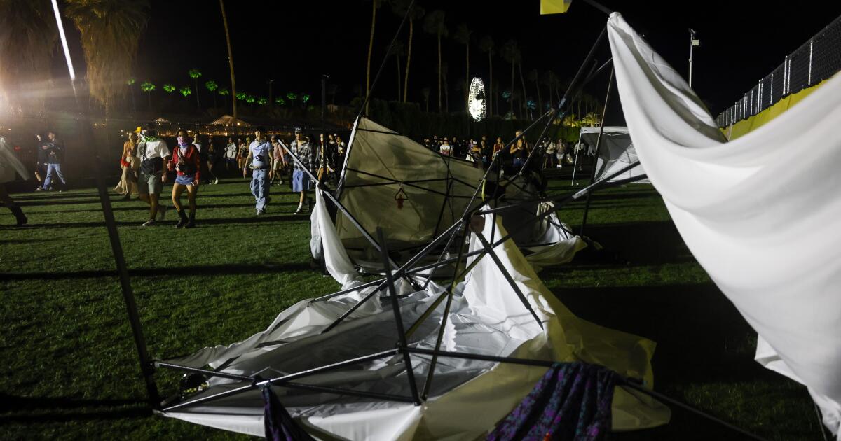
On Friday night, there were social media reports that showed that the Do Lab — a stage on the southern side of the festival grounds, which includes shade structures with colorful bolts of fabric — was closed for the night with yellow caution tape around the area and that a speaker may have fallen to the ground.
Festival promoter Goldenvoice and the organizers of the Do Lab stage did not provide comment at the time of publication.
The wind wreaked havoc in the campsite as well, blowing tents and canopies over.
“It was definitely pretty impactful last night. The wind reports in the area saw gusts up to 35 to 40 mph yesterday during late afternoon,” said Isaac Longley, a meteorologist with AccuWeather. “Unfortunately, that was when there were a lot of performers on the main stages, and a pretty impactful situation with the tents at Coachella.”
According to the online forecast for the weekend from the National Oceanic and Atmospheric Administration, temperatures in Indio were expected to reach 86 degrees on Saturday with 5- to 10-mph winds in the afternoon and a low of 56 degrees with the winds increasing to 15 to 20 mph and changing direction after midnight. Gusts were expected to be up to 30 mph later into the evening.
“As we head into Saturday afternoon and evening, we expect pretty similar conditions to [Friday] and for winds to pick up,” Longley said. “I would definitely consider staking my tent down.”
Sunday’s forecast was cooler, with a high of 79 and winds of 10 to 20 mph in the day. The expected low is 53 with winds expected at 15 mph with gusts of up to 30 mph.
There’s also an air quality alert for the windblown dust through 5 a.m. Sunday.