Weather & Climate

Hungary sinks barges into Danube River to stave off energy crisis

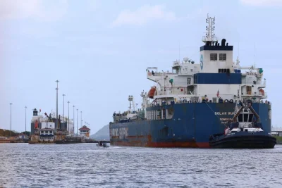
Workers in Hungary are sinking two 260-foot barges into the Danube River to raise waters levels. Photo courtesy of Prime Minister Peter Magyar’s Office/X

Aug. 15 (UPI) — Hungarian working crews are sinking two barges into the Danube River in an attempt to raise water levels and stave off an energy crisis, the prime minister said on Saturday.

Water levels of the 1,800-mile river have fallen to record lows amid a months-long drought across Europe.

To raise the waters, crews are sinking two 260-foot barges into the Danube River.

Hungary’s only nuclear power plant, Paks, depends on water from the river to cool down its reactors.

Prime Minister Peter Magyar said current water levels on Saturday were 48 inches lower than usual, and could fall a further 4 inches by Monday.

If it falls that low, he added, the power plant would have to shut down one of its last two functioning turbines.

“Water management experts are continuously monitoring the water level, water velocity, and riverbed condition using a measuring vessel and installed measuring devices,” Magyar said in a statement on X.

The plant is responsible for generating half the electricity needed by the country’s 10 million people.

Source link

British PM bans sales of BBQs, deploys military in wildfire fight

An aerial view taken with a drone shows smoke rising from wildfires near Dunwich Heath in Suffolk, Britain, on July 31. British Prime Minister Andy Burnham on Friday banned the sale of disposable barbeques and took other emergency measures to combat wildfires triggered by heatwaves and a lack of rain. File Photo by Tolga Akmen/EPA

Aug. 14 (UPI) — British Prime Minister Andy Burnham imposed a temporary ban on the sale of disposable barbecues and deployed military personnel on Friday in a battle against widespread wildfires across the country.

Speaking from the hard-hit West Midlands of England, Burnham said the measures were made necessary by continuing waves of hot weather and extreme drought.

“We cannot accept this as the new normal,” he said in a video address while recounting how fires the region “have destroyed homes, forced people to evacuate and left firefighters injured while protecting others.”

Much of England and Wales remains in a deep drought and is facing another period of extreme heat a day after the Met Office reported temperatures reaching 100.6 degrees in London for the fifth-hottest day on record in the nation’s history, the British leader noted.

“Farmers are watching crops fail and firefighters have faced hundreds of wildfires in a matter of weeks,” he said. “This is what climate change looks like here and now.”

The prime minister said the barbeque ban, emergency funding for fire and rescue services and deploying military support were decided during a meeting of COBRA, the government’s emergency response committee, earlier this week.

But, he added, “we also have to tackle the causes of climate change and make Britain more resilient to the extreme weather we’re already experiencing. We shouldn’t just accept this as inevitable and I don’t.”

The British government has already announced plans to support the development of nine new water reservoirs and improve resilience to future droughts, floods and extreme weather, as well as a investment of nearly $135 million million “to strengthen the country’s response to wildfires and extreme weather.”

Thursday’s extreme temperatures meant Britain this year has already seen the most number of days reaching or exceeding 97 degrees (four days) and 98 degrees (three days), as well as equaling 2022 for seeing two days of 100 degrees.

As the weekend began, forecasters predicted a gradual cooling from north to south across the country but with much-needed rainfall remaining scarce.

“A front moving south eastwards across the U.K. on Monday and Tuesday could bring northern areas some rain but amounts of rain in the south will be small at most and the majority will fall over Northern Ireland and Scotland,” Steven Keates of the Met Office said in a release.

“The next meaningful rain forecast for these very dry areas could be towards the end of next week as an area of low pressure influences our weather from the southwest.”

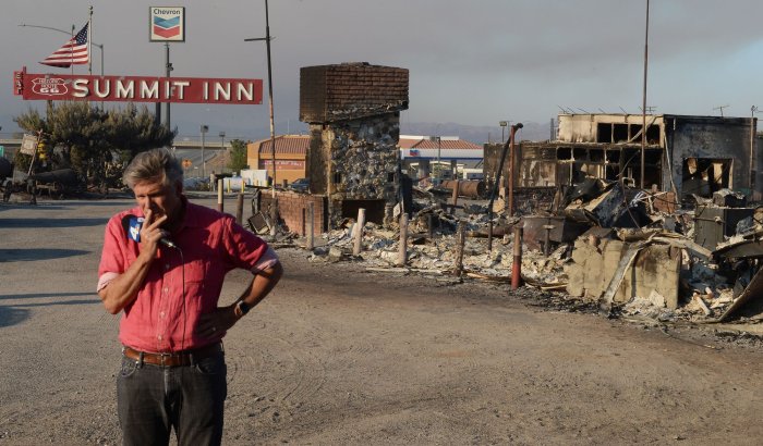
Among the structures lost to the explosive Blue Cut Fire is the historic Summit Inn on Route 66. Finding it had none of his music, Elvis reportedly kicked the jukebox here and left without eating. Having recently changed ownership, it now lies in ruins as the massive wildfire grows into a major problem, triggering a state of emergency and forced evacuations of more than 80,000 people near Cajon Pass, California on Aug. 17, 2016. The Blue Cut Fire began early Tuesday in the San Bernardino National Forest and quickly grew to more than 25,000 acres in about 24 hours. Photo by Jim Ruymen/UPI | License Photo

Source link

First 10 days of August rank as hottest on record in South Korea

People cool off in a swimming pool at Ttukseom Hangang Park in Seoul on Saturday. The first 10 days of August were the hottest on record in South Korea. Photo by Yonhap

South Korea saw a record hot summer this year with the nationwide average temperature, excluding Jeju Island, coming to 29.1 C in the first 10 days of August, the highest on record, the state weather service said Tuesday.

The reading is on par with the 10-day average of August 2018, making it the hottest first 10-day period of August in 53 years since 1973, when the weather observation network was expanded nationwide, according to the Korea Meteorological Administration (KMA).

The average daily maximum temperature in the first 10 days of this month was 34.4 C, the second highest after 34.7 C recorded in 2018, the KMA said.

The average daily minimum temperature, which is an indicator of night heat, was 24.8 C for the same period, the third highest on record following 25 C in 2022 and 24.9 C in 2018.

The highest temperature recorded during the 10-day period was 42.5 C observed in the southeastern city of Yangsan at 1:26 p.m. on Aug. 2. It was also the highest temperature recorded in the country since 1904, when modern meteorological observations began, according to the KMA.

In total, the daily maximum temperature exceeded 40 C at 32 locations nationwide in the first 10 days of this month, the KMA noted.

Copyright (c) Yonhap News Agency prohibits its content from being redistributed or reprinted without consent, and forbids the content from being learned and used by artificial intelligence systems.

Source link

Typhoon Dolphin makes landfall in China, hundreds of flights canceled

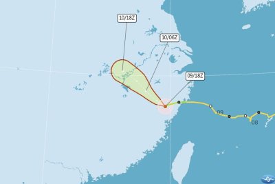
The projected path of Typhoon Dolphin is shown through eastern China after making landfall Sunday in Zhejiang Province. The storm is producing torrential rainfall in the region, official media says. Graphic courtesy Taiwan Central Weather Administration

Aug. 9 (UPI) — Typhoon Dolphin roared into eastern China Sunday at Force 13 speeds of 85 miles per hour, producing extreme downpours and prompting the cancelation of hundreds of flights, official media reported.

Dolphin made two landings in densely populated eastern China, with the first coming at 5:30 p.m. local time at Yuhuan in Taizhou City, Zhejiang Province, according to the official Xinhua news agency.

The second landfall came at Yueqing City in Zhejiang a bit more than an hour later.

China’s National Meteorological Center issued alerts to local authorities in the region to be guard on against extreme downpours.

Forecasters warned that heavy to torrential rain is expected until Tuesday in most parts of Zhejiang, Shanghai, Jiangsu, Anhui and northern and central-eastern Hubei provinces.

Some local rain totals could reach as high as 12.5 inches in eastern Zhejiang and the mountainous regions of southern Anhui, they predicted, with as much as 3.1 inches falling in as little as an hour.

Meanwhile, 388 inbound and outbound flights were canceled Sunday at Hangzhou Xiaoshan International Airport in Hangzhou City, the capital of Zhejiang Province.

Typhoon Dolphin is expected to weaken into a tropical storm as it moves northwestward through Zhejiang, Taiwan’s Central Weather Administration said Sunday.

The storm passed north of the island but its wake prompted sea warnings in the area as maritime officials announced the suspension of sea traffic on Monday.

Despite dodging a direct hit, Dolphin produced strong winds and heavy rains in northern Taiwan, causing scattered damage, the Central News Agency reported.

Six people were injured and hundreds of incidents of fallen trees were reported in Taipei as a result of the typhoon.

Source link

Hungary faces energy crisis as Danube River dries to record lows

The dried banks of the Danube River are exposed due to the record low water level caused by extreme heat and drought in Budapest, Hungary. Photo by Zsolt Szigetvary/EPA

Aug. 5 (UPI) — Hungary is facing an energy crisis as the Danube River, which cools the nation’s largest power plant, dries to record lows.

Water levels of the 1,800-mile river, which flows through 10 countries in Europe, has fallen amid a three-month drought across the continent.

The Danube is an integral component in the running of Paks, Hungary’s only nuclear power plant, as it flows into the reactor and cools it down.

Three of the plant’s four reactors were not in operation on Wednesday, while the fourth is operating at 50% power, CBS News reported.

The plant is responsible for generating half the electricity needed by the country’s 10 million people.

“Several factors will determine whether Hungary’s most important power plant can avoid a complete shutdown in the coming days,” said Hungarian Prime Minister Peter Magyar, CBS News reported.

“There are a few critical days left — today and tomorrow are certainly that,” Magyar added, according to the outlet. “I ask everyone to continue the national unity that has developed in the country. Let’s do what our country demands.”

But the drying of the Danube has brought a silver lining for some. Residents and researchers have marveled at several discoveries that have emerged as water levels drop.

In Serbia, researchers have found some 200 boats that had been hidden deep in the Danube, including World War II-era Nazi warships, Smithsonian magazine reported.

A ship that likely sank in 1937 was exposed in Croatia.

And in Bulgaria, residents discovered the remains of a woolly mammoth.

Source link

Flash flooding warning issued for New York City

Aug. 3 (UPI) — A flash flooding alert has been issued for New York City and parts of Long Island through Monday evening.

The National Weather Service warns that heavy storms battering the area could reach as much as 2 inches per hour throughout all of the city’s boroughs and Nassau County.

“Excessive runoff may result in flooding of rivers, creeks, streams, and other low-lying and flood-prone locations,” the NWS warning said.

Heavy rain and scattered thunderstorms are expected to ease by Monday evening.

“Summer storms can arrive with little warning, bringing flash flooding, downed tree limbs and dangerous lightning,” Mayor Zohran Mamdani said in a statement.

“I urge every New Yorker to stay alert, take these storms seriously and head indoors when conditions become unsafe,” the mayor continued. “The best way to protect yourself and your loved ones is to stay informed.”

City officials recommend New Yorkers allow extra travel time and avoid driving through flooded streets, as even shallow water can stall vehicles.

Source link

Thousands under evacuation orders as Pacific Northwest wildfires rage

Dangerous wildfires are spreading across the Pacific Northwest, forcing thousands of people to evacuate their homes in parts of Washington state and Oregon. Photo Courtesy Washington Department of Natural Resources.

Aug. 2 (UPI) — Thousands of people were ordered to evacuate their homes across the Pacific Northwest on Saturday, as dangerous wildfires spread in parts of Washington state and Oregon.

Three major wildfires are burning around Spokane, the largest of which had burned more than 3,500 acres by Sunday morning, NPR reported.

“I was sitting near an elementary school and saw a wall of flames east of the school and just a cascade of black smoke and a wall of flames coming toward me,” Alexandra Duggan, who lives in the area, told NPR.

More than 5,000 structures are threatened by the fires, which have knocked out power from ore than 13,000 homes, CNN reported.

Gov. Bob Ferguson of Washington declared a state of emergency, saying, “Our record-setting drought and high winds are creating dangerous conditions across the state.”

“If you are in the area, please continue to be vigilant and follow directions of emergency personnel,” Ferguson said in a statement on X.

In Oregon, wildfires have burned more than 1.8 million acres this season, OPB reported.

On Saturday, more than 25,000 Oregonians were under evacuation orders in central and southeastern Oregon.

One of the blazes, east of Mount Hood, had already burned some 23,000 acres by Saturday morning and remained at 0% containment.

“The reason we’re seeing these conditions… is that things are really dry,” said Matt Callihan, a lead meteorologist for the National Weather Service, to OPB. “We haven’t seen rain in a long time. It’s been hot, so that’s allowed fuels to cure pretty well.”

Source link

Authorities in France, Spain allow some wildfire evacuees to return

A handout photo made available by the Fire and Rescue Departmental Service 33 shows firefighters crew battling a fire near Le Porge, in southwestern France on Wednesday as a wildfire rages through the forest in Gironde. Photo by EPA

July 30 (UPI) — Tens of thousands of residents in Spain and France are returning home Thursday after being evacuated from wildfires that have torn through Europe.

Firefighters have contained wildfires near Madrid in Spain and in France’s Bordeaux region for the moment. However, authorities in both countries warn that there is still work to be done while Europe withstands conditions that are conducive to the fires spreading again.

Spanish Prime Minister Pedro Sánchez said Wednesday that firefighters were making progress, focusing on hot spots to prevent the fires from regaining momentum. Authorities later began lifting some evacuation orders.

France lifted evacuation orders for about 84,000 residents in the southwest region of the country Thursday. In total, about two-thirds of evacuees have been given the go-ahead to return to their homes.

While progress is being made in the fight, the heatwave in Europe continues. It has been one of Europe’s hottest summers ever recorded. Fires are still raging from Spain to Turkey. Northern Africa has also been battling wildfires for more than a week.

France is bracing for weather conditions Thursday that Sophie Brocas, prefect of the French department of Gironde, has called “unfavorable.” High winds, falling humidity and a chance of thunderstorms have increased the chances of renewed intensity.

Bordeaux received some rainfall Thursday.

In Spain and France alone, more than 300,000 acres have burned.

Source link

Seoul warns North Korean landmines may have washed across border

Seoul’s military warned Thursday that North Korean landmines in the DMZ may have washed across the border after heavy rainfall. In this photo, water from the Imjin River is released from Gunnam Dam on Tuesday. Photo by Yonhap

SEOUL, July 23 (UPI) — South Korea’s Joint Chiefs of Staff on Thursday warned that landmines laid by North Korea in the Demilitarized Zone may have been washed into the South after recent heavy rainfall.

“There is a very high possibility that these washed-away landmines could flow into our territory via the rivers shared between the two Koreas, and an explosion of these landmines could cause significant damage,” JCS spokesman Capt. Jang Do-young said during a regular press briefing.

Jang urged the public to be cautious when near inter-Korean rivers and to report any suspected landmine to police or a nearby military unit.

The alert comes days after South Korean authorities issued a flood warning for the Imjin River following heavy downpours and North Korea’s release of water from a dam without advance notice.

Seoul’s Ministry of Climate, Energy and Environment said Monday that satellite imagery confirmed water had been released from North Korea’s Hwanggang Dam on the upper reaches of the Imjin River.

A Unification Ministry official on Tuesday said joint responses to natural disasters should be treated as humanitarian matters.

“Responsible cooperation between the two sides is necessary,” the official told reporters.

An unannounced discharge from Hwanggang Dam in September 2009 caused flooding that killed six South Koreans. The following month, North Korea agreed to provide advance notice before future releases. Pyongyang sent notifications on a handful of occasions in 2010 and 2013 but has not done so since.

North Korea released water from the dam several times during last year’s monsoon season, prompting the Unification Ministry to publicly urge Pyongyang to provide advance notice. A ministry spokeswoman said the appeal served as a form of “indirect communication” because Pyongyang had cut off inter-Korean communication channels in April 2023.

Thursday’s warning also comes as Pyongyang continues an extended campaign to fortify the border and harden its military posture toward South Korea, including laying large numbers of landmines inside the DMZ.

North Korean leader Kim Jong Un declared the South a “hostile state” and scrapped an inter-Korean military agreement in late 2023.

Beginning in April 2024, Pyongyang ramped up activity along the DMZ by clearing land, laying mines, reinforcing tactical roads and installing anti-tank barriers near the Military Demarcation Line.

South Korean military officials have said North Korea increased the number of troops assigned to the work from roughly 1,000 last year to about 5,000 this year.

Seoul’s Defense Ministry last month described the activity as a violation of the armistice agreement that halted fighting in the 1950-53 Korean War, an assessment later contradicted by the U.S.-led United Nations Command.

Source link

Tropical Storm Bertha nearing southern Louisiana coast

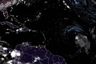
Tropical Storm Bertha was moving a little south of west over southeastern Louisiana as of Wednesday night. Image courtesy of NOAA.

July 23 (UPI) — Tropical Storm Bertha was nearing southern coast of Louisiana late Wednesday, hours after it made landfall over the state, according to forecasters.

The center of the storm was about 75 miles southwest of New Orleans and about 135 miles east-southeast of Lake Charles, La., the National Hurricane Center said in its 10 p.m. CDT update. The storm was traveling west at 12 mph and had maximum sustained winds of 45 mph, marking no change in strength or direction.

There was a tropical storm warning in effect from the Alabama-Mississippi border to Sargent, Texas, and metropolitan New Orleans and Lake Pontchartrain.

The NHC said a faster westward or west-southwestward track is expected for Bertha over the next day or so.

“On the forecast track, the center of Bertha will move near or along the Louisiana and upper Texas coasts through Thursday afternoon, and then move farther inland into Texas Thursday evening and Thursday night,” the NHC said.

Little change in strength in the storm is expected over the next day or so. Bertha is expected to maintain tropical storm intensity until it reaches the upper Texas coast on Thursday. It’s expected to dissipate inland over Texas by Thursday night or Friday.

Bertha, which formed Monday night, is expected to produce total rainfall amounts of 1 to 4 inches with isolated higher totals through Thursday along the central Gulf Coast from western Florida into southern Louisiana. This could produce isolated flash flooding, especially in urban areas, the NHC said.

Surf conditions caused by Bertha will continue spreading west along the northern Gulf Coast, with swells likely to cause life-threatening surf and rip current conditions

Source link

Tropical Storm Bertha moving over southeast Louisiana

Tropical Storm Bertha was moving a little south of west over southeastern Louisiana as of Wednesday evening. Image courtesy of NOAA.

July 22 (UPI) — Tropical Storm Bertha moved somewhat westward over southeast Louisiana on Wednesday evening, hours after it made landfall over the state.

The center of the storm was about 40 miles southwest of New Orleans and about 165 miles east-southeast of Lake Charles, La., the National Hurricane Center said in its 7 p.m. CDT update. The storm was traveling west at 7 mph and had maximum sustained winds of 45 mph, marking no change in strength or direction.

There was a tropical storm warning in effect from the Alabama/Florida line west to Cameron, La., metropolitan New Orleans and Lake Pontchartrain. A tropical storm watch was in place from west of Cameron, La., to Sargent, Texas and Lake Maurepas.

The NHC said a faster westward or west-southwestward track is expected for Bertha over the next day or so.

“On the forecast track, the center of Bertha will move near or along the Louisiana and upper Texas coasts through Thursday, and then move farther inland into Texas Thursday night,” the NHC said.

Little change in strength in the storm is expected over the next day or so. Bertha is expected to maintain tropical storm intensity until it reaches the upper Texas coast on Thursday. It’s expected to dissipate inland over Texas by Thursday night or Friday.

Bertha, which formed Monday night, is expected to produce total rainfall amounts of 1 to 4 inches with isolated higher totals through Thursday along the central Gulf Coast from western Florida into southern Louisiana. This could produce isolated flash flooding, especially in urban areas, the NHC said.

Surf conditions caused by Bertha will continue spreading west along the northern Gulf Coast, with swells likely to cause life-threatening surf and rip current conditions

Source link

Conditions from Tropical Storm Bertha to continue spreading across northern Gulf Coast

Tropical Storm Bertha, which formed Monday, continued to move along the Gulf Coast on Tuesday. Image courtesy of NOAA

July 21 (UPI) — Conditions from Tropical Storm Bertha will continue to spread into Wednesday across parts of the north Gulf Coast, the National Hurricane Center said. Tropical storm conditions are possible in Louisiana by late Wednesday.

The storm, which isn’t expected to become a hurricane before fizzling out, formed Monday night.

The epicenter of the storm was located about 120 miles west-southwest of Panama City, Fla., and 105 miles south-southeast of Mobile, Ala., the NHC said in its 7 p.m. CDT update. The storm was traveling west at 6 mph and had maximum sustained winds of 60 mph.

Winds must reach at least 74 mph for a storm to be considered a hurricane.

There was a tropical storm warning in effect from the Bay/Gulf County line in Florida west to Morgan City, La., metropolitan New Orleans and Lake Pontchartrain. A tropical storm watch was in place from Morgan City, La., west to Cameron, La., and Lake Maurepas. This marked no change from the 4 p.m. CDT update.

“Little change is strength is expected tonight, and gradual weakening is forecast Wednesday through Friday,” the NHC said.

Bertha is expected to produce total rainfall amounts of 2 to 4 inches with isolated higher totals through Thursday along the central Gulf Coast from western Florida into southern Louisiana. This could produce isolated flash flooding, especially in urban areas, the NHC said.

Surf conditions caused by Bertha will continue spreading west along the northern Gulf Coast, with swells likely to cause life-threatening surf and rip current conditions.

Source link

Thick, hazardous wildfire smoke spreads from Great Lakes to East Coast

July 16 (UPI) — Thick smoke from Canadian wildfires poured into northeastern quarter of the United States on Thursday after similarly darkening skies across and prompting health warnings across much of the Great Lakes region.

Dangerous levels of smoke were noted across Canada and the northeastern and midwestern United States, sparking memories of the historically severe wildfire smoke outbreak in 2023.

Entire states including New York, New Jersey, Connecticut, Delaware, Massachusetts, Michigan, New Hampshire, Ohio, Pennsylvania, Rhode Island and Wisconsin were under air quality alerts.

By early Thursday, Minneapolis, Duluth, Minn., and Detroit were among the most heavily impacted areas of the country.

Very heavy smoke from large wildfires in northern Minnesota and northwestern Ontario spread over Minnesota from late Wednesday into Thursday morning, the Minnesota Pollution Control Agency reported.

Hourly observations of smoke concentrations broke records for the Twin Cities on both days, the agency said.

In Detroit, businesses and attractions closed due to poor air quality.

A planned concert by rocker John Mellencamp at Pine Knob Music Theatre in Clarkston, Mich., was canceled while some workers inside Ford Motor‘s Michigan Assembly plant in Wayne, Mich., were hospitalized amid the smoky haze and intense heat, the Detroit Free Press reported.

Michigan’s statewide air quality alert was extended through Friday before cooler weather was expected to move the smoky pall out of the Great Lakes region.

In Chicago, the city closed all of its public beaches and outdoor pools, while Milwaukee recorded the worst air quality in its history — a record-breaking Air Quality Index measured at over 600, according to the Milwaukee Journal.

Further east, smoke from the Canadian wildfires enveloped New York City, prompting Mayor Zohran Mamdani to urge residents to “take precautions to stay cool and out of harm’s way” while dealing with both the smoke and high temperatures.

“In our city, we pride ourselves on being resilient,” the mayor told reporters early Thursday. “Today is not a day to say, ‘In spite of the air quality, I’m going to do everything I was going to do yesterday.’ This is very serious. We are reaching into a level of air quality that is dangerous for every single New Yorker.”

Smoke from fires in Northern California lowers visability of the Bay Bridge and San Francico as viewed from Yerba Buena Island on October 2. Photo by Terry Schmitt/UPI | License Photo

Source link

Chile declares emergency as extreme weather threatens country

A backhoe removes earth as a preventative measure to reduce overflows and flooding in the Ramon Ravine in Santiago, Chile, on Tuesday Chile declared a preventive state of emergency across 10 of its 16 administrative regions as authorities warned that an exceptionally severe weather system. Photo by Elvis Gonzalez/EPA

SANTIAGO, Chile, July 16 (UPI) — Chile declared a preventive state of emergency across 10 of its 16 administrative regions as authorities warned that an exceptionally severe weather system linked to El Niño could bring life-threatening conditions, widespread flooding and significant property damage.

President José Antonio Kast’s government issued the emergency declaration ahead of a powerful frontal system expected to trigger flooding, overflowing rivers and landslides in the Andes foothills.

Chile’s Meteorological Directorate forecast that the system, which already has reached the country’s southern regions, will persist for five consecutive days, bringing heavy rainfall, strong winds, snowfall in the Andean foothills and hazardous coastal conditions.

Central and southern Chile are expected to face three consecutive frontal systems, including a Category 5 atmospheric river, the highest level on the scale used to measure these corridors of concentrated atmospheric moisture. In response to the multi-hazard event, authorities issued the country’s highest meteorological alert.

Meteorologists warned that Santiago alone could receive between 4 and 6 inches of rain during the event, more than half the precipitation the capital typically receives from four to six major winter storms.

According to records from Santiago’s main weather station, the city averages 11.27 inches of precipitation annually. The approaching system could deliver between 35% and 52% of the city’s average yearly rainfall within just a few days.

Metropolitan Gov. Claudio Orrego said the situation could become even more challenging because the region has experienced an unusually dry year.

“The metro area is expected to get [5.5 to 8 inches] of rain over four days, with winds reaching about [45 mph], and the freezing level has climbed above [11,500 feet]. That adds up to a difficult situation for the region. We expect the power companies to respond appropriately to what’s coming,” Orrego said.

Chile’s National Geology and Mining Service, known as Sernageomin, warned of a high probability of mudslides, landslides, rockfalls and flooding.

Kast said the Armed Forces had been placed on preventive standby to strengthen the government’s emergency response capabilities.

“The Armed Forces have ordered their personnel into preventive readiness so they will be available if a response is required,” Kast told Radio BioBio.

As an additional precaution, authorities suspended classes at preschools and schools in the affected areas.

Officials also urged residents to prepare for possible disruptions to essential services, including drinking water and electricity. One of the government’s main concerns is the resilience of the power grid after severe storms in August 2024.

During that event, wind gusts exceeding 74 mph damaged critical infrastructure, leaving more than 80,000 households without electricity for as long as six days.

Carolina Martínez, director of the Coastal Observatory at the Pontifical Catholic University of Chile, warned that the storm’s effects could continue even after rainfall subsides.

“We should not only be concerned about the rain, but also about the behavior of the ocean, the response of beaches, unstable coastal cliffs, hillsides reacting to higher river flows at river mouths and intense or concentrated rainfall,” she said.

Martínez said the storm could cause localized flooding, shoreline changes, wave overtopping, increased pressure on wetlands and river mouths, along with sinkhole risks in the most vulnerable areas.

The preventive state of emergency will remain in effect through Tuesday.

Source link

Heat waves in England and Wales caused thousands of additional deaths

Exceptionally hot weather in May and June was responsible for the heat-related deaths of at least 2,700 people in England and Wales, according to British research out Monday. File photo by Facundo Arrizabalaga/EPA-EFE

July 13 (UPI) — Exceptionally hot weather in May and June was responsible for the heat-related deaths of at least 2,700 people in England and Wales, according to British research out Monday that found that human-caused climate change was a significant factor.

Temperature records for both months fell during heat waves May 21-29 and June 18-28, with the bulk of the fatalities — 2,200 — in June when the temperature rose to as high as 99.9 degrees Fahrenheit compared with average daytime highs of 68 degrees Fahrenheit, the Met Office said in a news release.

Researchers from Imperial College London, the London School of Hygiene & Tropical Medicine and the Met Office modeled excess deaths — those over and above normal levels — during both heat waves using historical mortality records and established peer-reviewed methods.

Notably, almost 6 in 10 of fatalities during the May heat wave were attributed to additional heat contributed by human-caused climate change, compared with a little less than 4 in 10 during the heat wave in June, which was hotter and lasted longer.

The scientists said daytime maximum temperatures approximately 7 degrees Fahrenheit higher than they would have been without human-induced climate change had fueled temperatures that would have otherwise been far less likely to occur — making the heat waves far more hazardous to human health.

“We all love the sun, but people need to be aware that we are now seeing dangerous climate-change-fueled heat that is claiming lives, disrupting schools and hospitals and shutting down transport and infrastructure,” said Dr. Clair Barnes, Research Associate in Extreme Weather and Climate Change at Imperial College London.

“It’s time we woke up to the fact that we now live in a country with dangerously hot summers. To protect people during future extremes, we must urgently adapt to the reality of the climate we now have, and double down on global efforts to reach net zero emissions to stop this from getting worse,” she said.

Dr. Malcolm Mistry, Assistant Professor in Climate and Geo-spatial Modelling at the London School of Hygiene & Tropical Medicine, expressed concern that only a few weeks into summer England and Wales had already experienced two record-breaking heat waves.

He warned that with spikes of extreme hot weather more frequent and more intense due to human activity, summer heat waves were “rapidly evolving into a major health risk for people in the United Kingdom.”

Mistry said it was critical that changes to homes, workplaces and critical infrastructure to cope with extreme heat kept ahead of rising health risks in order to protect the elderly, children, babies and other vulnerable groups.

The Met Office said 2026 has been exceptional with the two heat waves topping records that had stood since May 1944 and June 1976.

“For the time of year these events were extreme, even in our warmer climate,” said Climate Attribution Manager, Dr. Mark McCarthy.

The climate division of the U.K. Health Security Agency said that with periods of heat likely to become more intense, longer and more frequent as the world continued to warm, the study showed the “scale of risk associated with extreme heat and the growing threat climate change poses to our wellbeing.”

Continental Europe has also been in the grip of a more or less continuous heat wave since May that has placed health systems under huge pressure, triggered deadly wildfires that have burned through tens of thousands of hectares of woodland and scrubland, crippled power grids and forced schools to close.

The World Health Organization said Sunday that 1,300 excess deaths reported across Europe since June 21 were linked to the high temperatures.

Director-General Tedros Adhanom Ghebreyesus said Europe was warming twice as fast as the rest of the world with 150 million people suffering the negative impacts of the extreme heat.

France’s Health Ministry said Sunday that there were 1,000 extra deaths between Wednesday and Saturday alone, compared with previous months.

Source link

Dangerous heat dome spreads from west to east across middle of U.S.

July 12 (UPI) — A major heat dome expanded from the interior West into the Upper Midwest on Sunday on its way to smothering the East later this week, forecasters said.

The heat in the East is expected to be shorter and less intense than the early July heat wave, but parts of the West are coming within a few degrees of all-time record highs.

Dangerous heat is also gripping even the Desert Southwest, where communities are used to extreme temperatures. The pattern will raise the risk of heat exhaustion, heatstroke and heat-related deaths.

Motorists are urged to carry plenty of water with them in the event of a breakdown.

Temperatures climbed well above 100 degrees Fahrenheit across much of the Great Basin, the Cascades and Sierras east to the western Rockies, eastern Washington, eastern Oregon, Nevada, Idaho, Utah, western Colorado and northern Arizona this weekend.

The building heat dome has already pushed season-high temperatures into the 110s in Phoenix, Las Vegas and Palm Springs, Calif.

The heat expanded north this weekend, bringing highs of 106 in Salt Lake City, 107 in Bismarck, N.D., and 110 in Billings, Mont. Those temperatures are 10-25 degrees above historical averages during what is typically the hottest part of the year.

As the heat shifts east into the north-central United States early this week, some daily record highs will be challenged. As the hot air spreads east of the Rockies into more humid air, AccuWeather RealFeel Temperatures will run as much as 10-15 degrees higher than the actual air temperature.

While the North American monsoon will begin to temper the heat across parts of the West with increasing clouds and thunderstorms, multiple days of 90-degree heat are forecast across the Midwest, including Minneapolis, Chicago, Detroit and Cleveland.

Minneapolis and Chicago can expect at least four consecutive days with highs at or above 90.

“Temperatures will peak in the mid- to upper 90s in the Interstate 95 cities of the mid-Atlantic and New England during the heat surge this week,” AccuWeather Vice President of Forecast Operations Dan DePodwin said. “While high temperatures will still create dangerous conditions, the heat will be somewhat less intense and shorter-lived than the early July heat wave.”

Humidity levels with the heat in the Midwest and Northeast this week will be significantly lower when compared to the week of Independence Day.

Source link

One dead, hundreds rescued in devastating Missouri flooding

July 11 (UPI) — One person was found dead and hundreds evacuated in Missouri after an intense day of flash flooding across the state, authorities said Saturday.

More than 350 people were rescued in Iron, Reynolds and Crawford counties on Friday as floodwaters rapidly took over the area.

Officials said 250 of those were staff and children at Camp Taum Sauk, all of whom were safely evacuated. Another 100 were water rescues.

“It was very harrowing,” Jennifer Box, mother of of two you boys at the camp, told The New York Times. “We knew they were safe, but we didn’t know how to get to them, and that’s kind of your worst nightmare.”

One Crawford County woman, Faith Gregory, was found dead a mile downstream from her home in Huzzah Creek, officials said.

Authorities said Gregory was swept away after part of her home collapsed in the floodwaters.

“It’s definitely not the outcome we were hoping for, but it’s a tragic reminder of how strong Mother Nature can be and how forceful it can be,” Missouri State Highway Patrol Sergeant Eddie Young told FOX Weather.

The region was battered by more than 12 inches of rain, leaving many area residents remained strained throughout Saturday.

“But they’re OK,” spokeswoman Kate Moore, of Missouri Region C, told ABC News. “They’re just stranded because the roads are washed away. We have a lot of damage — the trees, buildings, a lot of things have gone and ripped the roads away.”

Olympic canoeist David Hearn departs the Moultrie Courthouse after pleading not guilty to damaging the Lincoln Memorial Reflecting Pool on Thursday. Hearn was indicted on July 2 on one count of destruction of property of more than $1,000 for allegedly damaging the Reflecting Pool, carrying a maximum penalty of 10 years in prison if convicted. Photo by Bonnie Cash/UPI | License Photo

Source link

Amazon rainforest deforestation hits lowest level in more than a decade

Deforestation in parts of the Amazon rainforest in Brazil declined to its lowest levels in more than a decade, a good sign for what scientists call one of the world’s most important climate regulators. File Photo by Antonio Lacerda/EPA

July 11 (UPI) — Deforestation of Brazil’s Amazon rainforest has fallen to its lowest levels in more than a decade, officials said this week.

Satellite surveys show a 37% decrease in the number of trees felled in the world’s largest rainforest in the past year compared to the previous one, according to the National Space Research Institute (INPE).

This is the lowest level of Amazon deforestation since 2014, data published on Friday shows.

“It’s a solid result, stemming from government actions to protect the forest and combat environmental crime,” said executive secretary Márcio Astrini, of the Brazilian environmental collective Observatório do Clima.

“The figures are excellent and deserve to be celebrated,” Astrini told G1.

The Amazon rainforest is one of the world’s most important climate regulators, scientists and experts have said.

Deforestation of the Amazon in Brazil reached a 15-year high in 2021 under former President Jair Bolsonaro, whose government cut environmental protections and enforcement of conservation laws.

Brazil’s current president, Luiz Inácio Lula da Silva, has vowed to eradicate illegal deforestation by 2030.

“It is a commitment — otherwise, I will have failed,” Lula told reporters during an event in Belém do Pará, a city known as the metropolis of the Amazon.

Olympic canoeist David Hearn departs the Moultrie Courthouse after pleading not guilty to damaging the Lincoln Memorial Reflecting Pool on Thursday. Hearn was indicted on July 2 on one count of destruction of property of more than $1,000 for allegedly damaging the Reflecting Pool, carrying a maximum penalty of 10 years in prison if convicted. Photo by Bonnie Cash/UPI | License Photo

Source link

Typhoon Bavi moves off the Philippines toward Taiwan, Japan, China

Typhoon Bavi was moving off the Philippines on Friday after pouring rain caused landslides linked to at least 15 deaths, and now has its sights set on Japan, Taiwan and China. Photo courtesy Joint Typhoon Warning Center/Naval Meteorology and Oceanography Command/U.S. Navy

July 10 (UPI) — Typhoon Bavi weakened as it moved off the Philippines on Friday but was expected to bring heavy rain to Taiwan and parts of Japan before it makes landfall in China.

Bavi, which was called Inday in the Philippines, killed at least 15 people after heavy rains caused flash floods and landslides in several villages and cities, and affected tens of thousands of people there, The BBC and The Philippine Star reported.

The typhoon on Friday brought storm surge and rain to Okinawa, Japan, and was expected Saturday to pound the north and east sides of Taiwan, potentially bringing nearly 40 inches of rain in some areas.

Once past Taiwan, the storm could make two landfalls in China, part of which is still recovering after Typhoon Maysak earlier this week.

Maysak’s havoc is linked to at least 39 deaths, though searches were underway for people reported missing.

Hundreds of flights in Japan, including Okinawa and the Sakishima Islands, were canceled on Friday and Saturday as residents braced for Bavi’s pounding rain.

Forecasters in China warned of two potential landfalls as it moves toward the north, noting that Bavi’s size — at it’s widest point, the typhoon is as wide as France — means that both its remnants and outer rain bands are likely to affect a huge swath of people and property.

Source link

EPA proposes rollback of heavy duty diesel truck emissions regulation

July 9 (UPI) — The Trump administration on Thursday proposed to roll back a Biden-era rule on emissions from heavy duty diesel trucks because it is “unworkable.”

The Environmental Protection Agency proposed lowering requirements for heavy truck emissions systems because of issues with the technology for new trucks and penalties for older vehicles that do not measure up, the agency said in a press release.

The change is expected by the administration to save up to $6,000 per new truck and could help save truckers roughly $12 billion, Fox News and The Hill reported.

The change will shorten government requirements for engine warranties to 100,000 miles, from 450,000 miles, and will delay a requirement that trucks meet emissions standards for their first 650,000 miles — an increase from the first 435,000 miles — for three years.

“This proposal to eliminate engine deratements and reform the Biden-era … requirements will lower costs, increase safety and keep our nation’s food supply moving,” Secretary of Agriculture Brooke Rollins said in the release.

The Biden administration rule was aimed at strengthening rules about nitrogen oxide emissions by improving maintenance and repair requirements over a longer period of time.

Critics have said that the new rule will weaken clean air protections and potentially affect Americans’ health, but the administration has countered that lowering business and consumer costs are an essential focus and that environmental concerns are overblown.

Source link

3 kids dead after Wisconsin boat capsizes in storm

July 4 (UPI) — Three children were killed Friday when a severe storm capsized a boat in Wisconsin, police said.

The privately owned, recreational motorboat had six adults and four children aboard on Geneva Lake, and all children were wearing life jackets.

When a storm hit, the boaters tried to find their way to safety but were overwhelmed by high winds and waves. The boat capsized and later sank.

Rescuers were able to quickly help the adults and one child out of the water, but three were still missing. After an intensive search, they found all three. Rescuers took lifesaving measures on the scene and on the way to a hospital, but all three children were pronounced dead.

“Our hearts and prayers go out to the families of those, not only of those people, but the people who were injured as a result of the storm. We know that there were many injuries, people transported to local hospitals and diversion from the hospitals because of the number of injuries,” Walworth County, Wisc., Undersheriff Tom Hausner said.

The storm hit at about 12:10 p.m., and 911 calls began coming in around the same time, Hausner said.

A source told CBS News Chicago that the three victims are believed to be younger than 13.

The deaths are under investigation by the Geneva Lake Law Enforcement Agency and the Wisconsin Department of Natural Resources.

A squall line of storms moved into northern Illinois and southern Wisconsin Friday morning and early afternoon, with wind gusts of up to 60 mph, The New York Times reported. Nearly 514,000 homes and businesses in Michigan, Illinois and Wisconsin were without power Friday night.

News anchors are seen outside the Supreme Court of the United States as the court releases their final opinions before summer recess on Tuesday. The court upheld birthright citizenship and also state laws banning transgender women and girls from playing on school athletic teams. Photo by Bonnie Cash/UPI | License Photo

Source link

Northeast braces for dangerous heat wave as holiday approaches

A child eats a snow cone Monday at the Great American State Fair on the National Mall in Washington. As the nation moves into the holiday weekend, a record-setting heat wave has settled over parts of the Northeast, including Washington. Photo by Bonnie Cash/UPI | License Photo

July 2 (UPI) — As the United States heads into a milestone July 4 holiday this weekend, parts of the Northeast are preparing for hazardous levels of heat and humidity, with a heat index of more than 110 possible in some places.

“‘It’s summer, it’s hot,’ ” the National Weather Service posted on social media this week. “We hear ya, but this is no ordinary heat.”

The NWS said the weekend could include “widespread highs within the mid-90s to low-to-mid-100s.”

“Numerous daily temperature records are possible, while warm overnight lows in the 70s and 80s will provide little relief,” the NWS said.

Major to extreme heat risk conditions will prevail across the Midwest — where temperatures soared mid-week — into the East Coast, with the “extreme” zone centered around portions of the Northeast including New York City, Washington and Philadelphia. About 160 million people are in this zone.

“Extreme” heat conditions are defined by the weather service as “rare and/or long-duration heat with little to no overnight relief.”

The heat index, which combines temperature and humidity readings to show how hot it feels out, could reach 110 to 115. High humidity compounds the health risks from high temperatures, as it prevents sweat from evaporating efficiently, CNN reported.

This comes as the United States prepares for milestone 250th anniversary Independence Day celebrations Saturday. The weekend marks one of the busiest travel and outdoor-activity times of the year, but many local officials have urged people to stay inside in air-conditioning and to check on neighbors, The New York Times reported.

Many cities and smaller municipalities are opening cooling centers and adapting holiday plans. The federal Department of Energy declared an emergency and directed the PJM Interconnections electrical grid in the Mid-Atlantic region to “take action” to avoid power outages, ABC News reported.

“It’s really going to strain the grid,” Ramanan Krishnamoorti, vice president of energy and innovation at the University of Houston, said to ABC News. “I think we’re going to see peak demand that is going to be a record across different geographical areas.”

The heat wave originates from a heat dome, an area of high pressure that holds hot air in place. Europe has also been dealing with a record heat wave recently.


Source link