Trump weakens fuel economy standards, rolling back climate change fight
WASHINGTON — The Trump administration on Tuesday weakened one of the nation’s most aggressive efforts to combat climate change, releasing new fuel efficiency standards for cars and trucks that handed a victory to the oil and gas industry.
The new rule, from the Environmental Protection Agency and Transportation Department, will almost immediately be plunged into litigation as environmental groups and states with stricter standards, led by California, plan to challenge it.
“We intend to make sure the backsliding doesn’t reach California’s doorstep,” California Atty. Gen. Xavier Becerra said Tuesday in announcing the state’s plan to go to court to defend its tougher standards.
If the administration’s policy survives those fights, it would spare automakers from having to meet ambitious gas mileage and emissions requirements put in place in 2012 under President Obama. It is among the biggest steps the administration has taken to reverse an existing environmental policy.
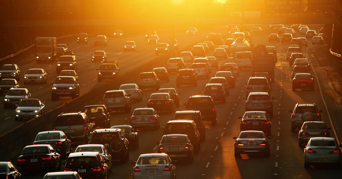
The final rule is a dialed-down version of the one the administration originally planned. Instead of proposing zero improvements in fuel efficiency in coming years, it would require automakers to increase fuel economy across their fleets by 1.5% a year, with a goal of achieving an average of about 40 miles per gallon by 2026. That’s still a major departure from current rules, which mandate annual increases of 5%, reaching an average of 54 mpg by 2025.
Nearly 900 million more tons of carbon dioxide are expected to be released under the new rule than under the Obama-era standards, a result of less efficient cars burning an additional 78 billion gallons of fuel.
“We are delivering on President Trump’s promise to correct the current fuel economy and greenhouse gas emissions standards,” EPA Administrator Andrew Wheeler said in a statement. The administration’s plan, he said, “strikes the right regulatory balance that protects our environment and sets reasonable targets for the auto industry.”
Environmentalists and public health advocates said the change would likely contribute to thousands of premature deaths and asthma attacks. They criticized the decision to make the new standards final in the midst of a global pandemic, arguing that the rollback would damage public health at a time when thousands of people are gravely ill and the nation’s economy is in tatters.
But after repeatedly postponing the release of the new rule as it scrambled to justify the change, the administration faced deadlines that may have forced its hand.
For one, the longer the government delayed the new rule, the less effect it would have. Although Trump had initially announced that the new standards would affect vehicles in model year 2020, those cars were built under the Obama-era stringent fuel efficiency standards and are already on the road.
Unless the administration finalized its rollback by April 1, it was in danger of missing the deadline to apply the new standards to the 2022 model year.
Additionally, under the Congressional Review Act, new rules issued after May 19 could be invalidated by the next Congress.
The new standards will apply nationwide. Although California has historically set its own tougher car pollution rules, the Trump administration last year moved to strip the state of that authority. California and many of the other states that have adopted its clean-car standards have sued the administration over this change, and that issue likely won’t be resolved until next year at the earliest.
Just hours after the administration unveiled the final rule Tuesday, Mary Nichols, chairwoman of the California Air Resources Board, disclosed that Volvo was in talks with the state to reach a voluntary emissions agreement. Four other automakers — Ford, Honda, Volkswagen and BMW — have already made a deal with the state that would preserve emissions standards that are not as tough as the Obama standards, but are significantly more ambitious than Trump’s proposal.
The change in fuel-economy standards has been in development since the early days of the administration, when two lobbying groups representing automakers asked then-EPA Administrator Scott Pruitt to relax the Obama-era standards.
The administration’s original proposal would have frozen fuel-economy standards at this year’s levels. That met a furious response from officials in California and several other states as well as unexpected resistance from some auto companies, which worried the administration was going overboard and dragging them into years of court battles with states.
Karl Brauer, an analyst for the research firm Cox Automotive, said that Trump’s rule had put automakers in an impossible position. If they opposed the rollback, their investors would be unhappy. If they endorsed it, they would be branded as anti-environment.
The rollback will likely make it easier to sell cars by making them cheaper, he said, but automakers are concerned it may not survive legal scrutiny or the next election.
“I think automakers will feel a lot of uncertainty until Nov. 3,” Brauer said.
“The auto industry has consistently called for year-over-year increases in fuel efficiency,” said John Bozzella, president of the Alliance for Automotive Innovation, a trade group that lobbies on behalf of the world’s largest car companies. “Looking to the future, we need policies that support a customer-friendly shift toward these electrified and other highly efficient technologies.”
Trump has boasted that his plan would save lives, improve the economy and lower the cost of new cars.
In a phone call with reporters on Tuesday, senior EPA and National Highway Traffic Safety Administration officials said their analysis showed that lowering the cost of a new car would allow more Americans to replace aging vehicles with newer, safer ones. That turnover in the nation’s fleet would prevent more than 3,300 traffic fatalities, according to the government’s projections, as well as 46,000 post-crash injuries.
They also emphasized the rollback’s estimated cost savings for automakers — as much as $100 billion over the lifetime of the vehicles built under the new rule.
But while administration officials said the change would help drivers and the environment, the government’s analysis was not as optimistic.
Its estimates showed that while loosening fuel-economy standards could shave about $1,000 off the price of a new car, drivers would have to buy more gas than they would have under the current rule.
David Friedman, vice president of advocacy for Consumer Reports, said his group’s projections show that each vehicle sold under the Trump rule will cost its owner on average $2,100 more, even if gas prices continue to fall.
Automakers and their suppliers could also suffer. The government’s analysis shows that American car companies could experience a loss of thousands of jobs by making dirtier cars that would be locked out of many overseas markets.
The change is also expected to result in significantly more greenhouse gas emissions, which trap the sun’s heat, worsening the effects of climate change. Hotter temperatures contribute to more smog, which can damage the lungs and cause other serious health problems.
“Of all the bad things President Trump has done to the environment, this is the worst,” said Dan Becker, head of the Safe Climate Campaign, a Washington-based consumer advocacy group. “He is rolling back the biggest single step any nation has taken to fight global warming, cut oil use and save money at the pump.”
In a February report to Wheeler, the agency’s science advisory board warned that the technical analysis underpinning the government’s draft proposal was so flawed that it had possibly led the EPA to the wrong conclusion.
“In other words,” the board wrote, “the standards in the 2012 rule might provide a better outcome for society than the proposed revision.”
Phillips reported from Washington and Mitchell from Los Angeles.