griffith park

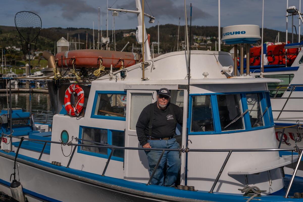
‘Jaws’ was wrong. Great white sharks are not mindless killers

Duhhhh-nuh. Duhh-nuh. …

Friday marks 50 years since the 1975 film “Jaws” from Steven Spielberg introduced audiences to that infamous John Williams movie score — and the fear that they should clearly feel over the great white shark lurking just beneath their feet, waiting to chomp down on their dangling legs as they enjoy a day at the beach.

Except, over the past six decades, marine biologists like Chris Lowe at the Shark Lab at Cal State Long Beach have found that great white sharks and their selachian counterparts not only don’t want to eat humans but also would like to avoid us if at all possible.

“Believe it or not, a lot of the times they’re big babies. They’re big scaredy-cats,” Lowe told me.

Newsletter

You are reading The Wild newsletter

Sign up to get expert tips on the best of Southern California’s beaches, trails, parks, deserts, forests and mountains in your inbox every Thursday

You may occasionally receive promotional content from the Los Angeles Times.

As part of the series I’ve completed over the last year in The Wild, exploring how to react should you see a potentially dangerous animal on the trail, I spoke to Lowe, who has studied sharks for the past 35 years, about how you should react if you see a great white shark in the wild.

Lowe said that unlike 50 years ago when “Jaws” was filmed — where sharks’ populations were so low that even the “Jaws” filmmakers could barely find a shark in the ocean to record — the great white shark population has bounced back thanks to conservation efforts.

“Sharks are probably swimming by people way more often than they would ever imagine — they just don’t know they’re there,” Lowe said. “I think your chances of seeing a shark, any shark — a white shark, a leopard shark, a bull shark, a tiger shark, no matter where you go — is actually getting much better.”

Shark Lab student assistant shows Junior Lifeguards a white shark jaw while giving a shark education presentation.

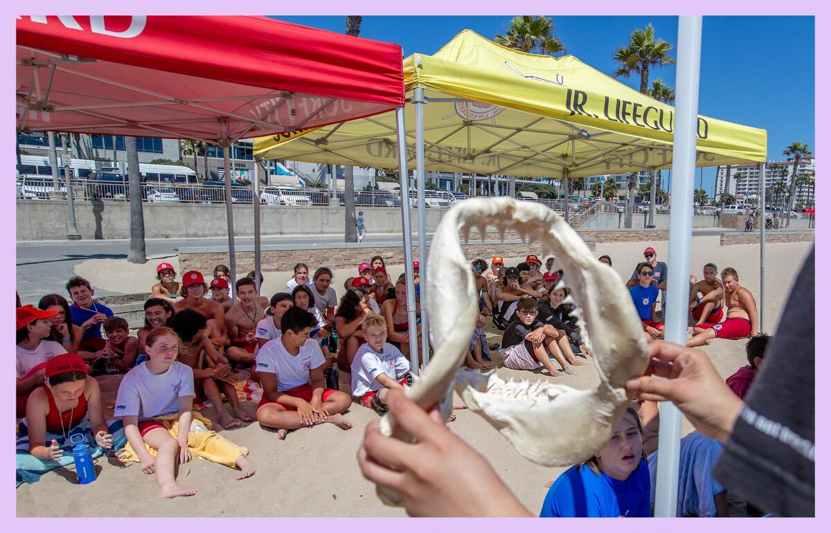
Cal State Long Beach Shark Lab student assistant Julianne Santos shows Huntington Beach junior lifeguards a white shark jaw during a July 2023 presentation.

(Allen J. Schaben / Los Angeles Times)

Please note that my conversation with Lowe focused on how a beachgoer should react if they see a great white shark off the coast of a Southern California beach, and I primarily asked him for tips for folks swimming or snorkeling. The Shark Lab has a great short guide for surfers, and there is other guidance available for spearfishers.

All right, no need for a bigger boat. Let’s dive in.

1. Observe the shark’s behavior

You’re swimming in the ocean, perhaps snorkeling, and you see a great white shark swimming about 20 feet from you. First, “take a deep breath and go, ‘Wow, that’s so cool,’” Lowe said.

Next, observe what the shark is doing. Is it relaxed? Has it spotted you yet?

Lowe said that oftentimes, you will see a shark because the animal wanted you to or allowed you to see it. The majority of human-shark encounters in Southern California occur without the human ever knowing it happened.

“We see it all the time from our drones — they’ll come up behind people, and in fact get what I would consider uncomfortably close to people, and then it’s almost like [they think,] ‘OK, that’s not what I thought it was,’ and then they just turn and take off,” he said.

I asked what uncomfortably close means, thinking 15 feet, 10 feet. “Three feet,” Lowe told me.

2. Keep your eye on the shark

“Let the shark know you see it,” Lowe said. “As the shark is swimming around you, you should pivot to always face the shark. That is part of this body communication that all animals use. If you’re ever threatened, do you ever turn your back on the threat?” (No.)

Move calmly and naturally as you float in the water. Do not throw anything at the shark or jerk around.

Most often, this is where the encounter ends, Lowe said. If the shark doesn’t feel threatened, you’ll observe the shark until it leaves the vicinity, and then you can alert a lifeguard of what you saw.

3. If you suddenly lose track of the shark, look behind you

You might have (even accidentally) startled the shark by moving too quickly.

When Lowe and his students go out into the ocean to tag sharks, they will pull up next to a shark and start recording it with a camera and taking other measurements. But if they startle it or if the shark feels threatened, the shark almost always loops around and tries to get behind the boat. It’ll do the same if you scare it.

People mistake this as the shark stalking them. “Actually, no,” Lowe said. “That’s how it’s investigating you safely. People forget these animals are just as much worried about their safety as we are [worried about ours].”

Overhead of paddleboarder paddling a few feet from a shark.

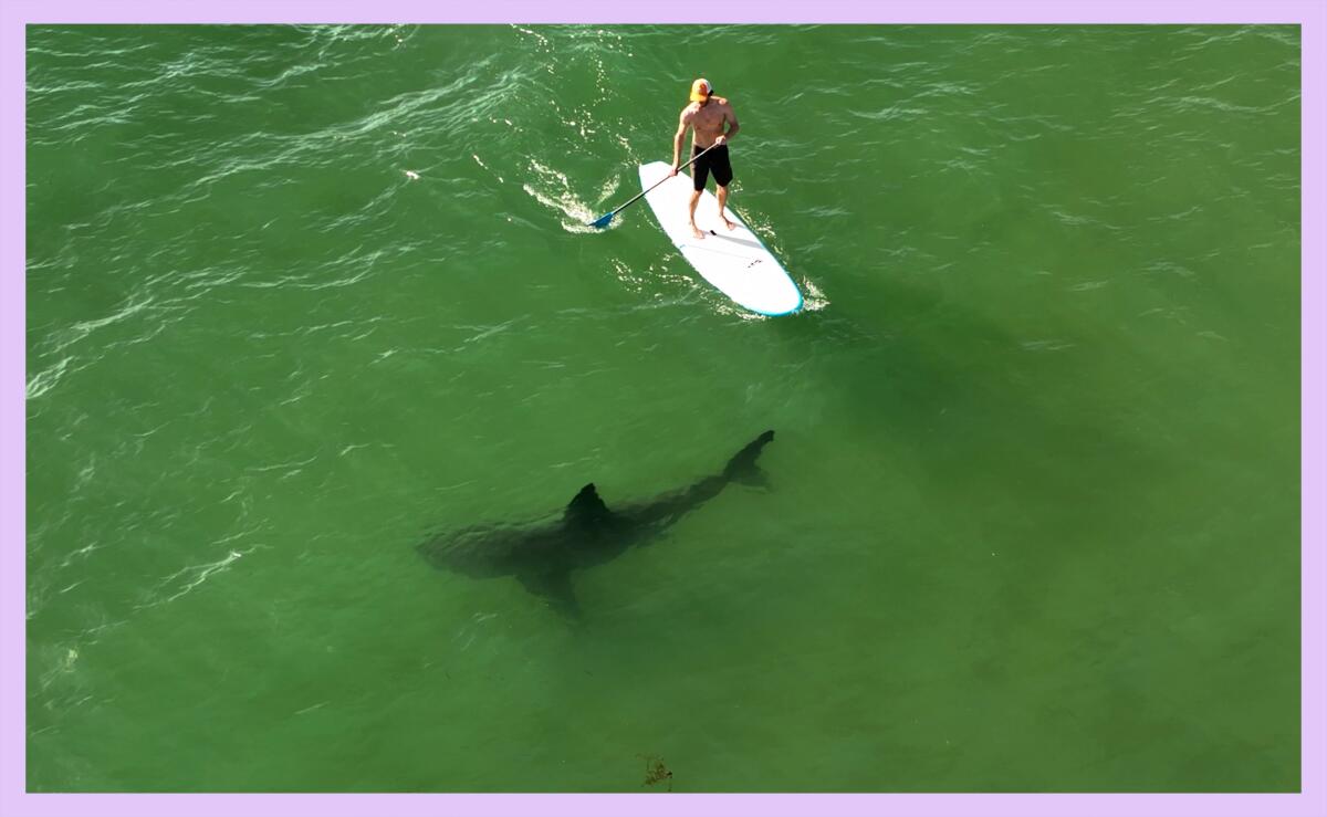
Researchers with the Shark Lab at the Cal State Long Beach have found that sharks and humans swim together at some California beaches more often than previously thought.

(Carlos Gauna / Cal State Long Beach)

4. Keep your distance as you keep watching the shark

If a shark feels threatened, it will arch its back and drop its fins and start an exaggerated slow-motion swimming behavior, Lowe said. “They will open their mouths, they’ll bear their teeth,” similar to an angry cat, he said.

You should, if you haven’t already, start to back away slowly from the shark, maintaining eye contact. Unlike the movies when people thrash out of the water, you want to backpedal at a normal speed. Remember, this animal is likely scared too.

Do not move toward the shark. “If you chase that shark, if you pursue it, it will break out of that behavior, and it will rush in and bite. And then it will take off,” Lowe said. “That’s a defensive response.”

5. If the shark gets in your space, bop it on the nose

Hopefully your encounter has ended by now, as this next tip is for exceedingly rare instances when a shark is getting in your space.

If you’ve been backing away from the shark, and it keeps coming toward you, getting within arm’s length, give it a “good pop to the nose,” Lowe said.

“The animal has to know you’ll defend yourself,” he said.

How hard should you strike its nose? “It’s not a little flick, it’s not a hand wave,” Lowe said. “You want the animal to know you will defend yourself because, in many cases, they are just as afraid of getting hurt as you are. A little bop on the nose quite often is enough to stop that from happening, and of course, you keep backing up. That’s the best you can do in those circumstances.”

6. If attacked, fight back with all you’ve got

If the shark bites you, you should punch it in the nostrils, eyes and gills. “There are pretty good eyewitness accounts of people fighting back, and that making a difference and then getting the shark to release. And in some cases, they don’t even see the shark after that,” Lowe said.

Most sharks bite once and leave.

Like other apex predators in California, sharks have in rare instances attacked and, in even rarer instances, killed people.

In the past 75 years, there have been about 223 shark incidents in California, with “incident” defined as a documented encounter where a shark touched a person or their surfboard, paddleboard, kayak, etc., according to the California Department of Fish and Wildlife.

Of that, at least 195 of the incidents involved white sharks. None of the 16 fatal shark incidents in California occurred in L.A. County.

These numbers feel even lower when you consider that millions of people visit California’s beaches every year.

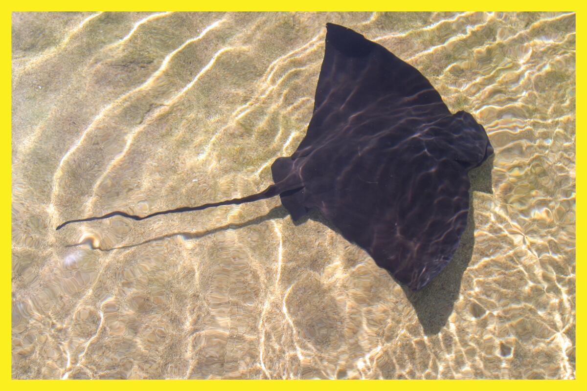
Even with the large number of white sharks present along Southern California beaches, swimming and recreating along the coastline remains a largely safe activity, Lowe said. (In terms of risks, you’re much more likely to step on a stingray.)

I hope you will never need these tips and instead have great experiences this summer on our beautiful beaches.

I have to admit that, as someone who grew up in the landlocked state of Oklahoma, I came into this conversation with a lot of fear. It doesn’t help that my wife watches the Discovery Channel’s Shark Week every year. But after talking to Lowe, I feel about sharks like I do about bears and mountain lions. They live here too, and when we visit their homes, we could see them. More often than not, they mean us no harm and want to be left alone to live their lives — just like we do ours.

“People need to stop thinking of these animals as nothing more than these mindless animals,” Lowe said. “They are more like us than [people] think. If somebody was invading your personal spaces, you should defend yourself. You will defend yourself, whether you do it innately or not. The animals will do the same. If they feel threatened, they will protect themselves.”

A wiggly line break

3 things to do

Note: Out of concern for the safety of community members who could be targeted in ICE raids, multiple outdoors events have been postponed this week. Please check before heading out to make sure the activity you’re attending is still happening.

Hikers walking down path under arc of trees.

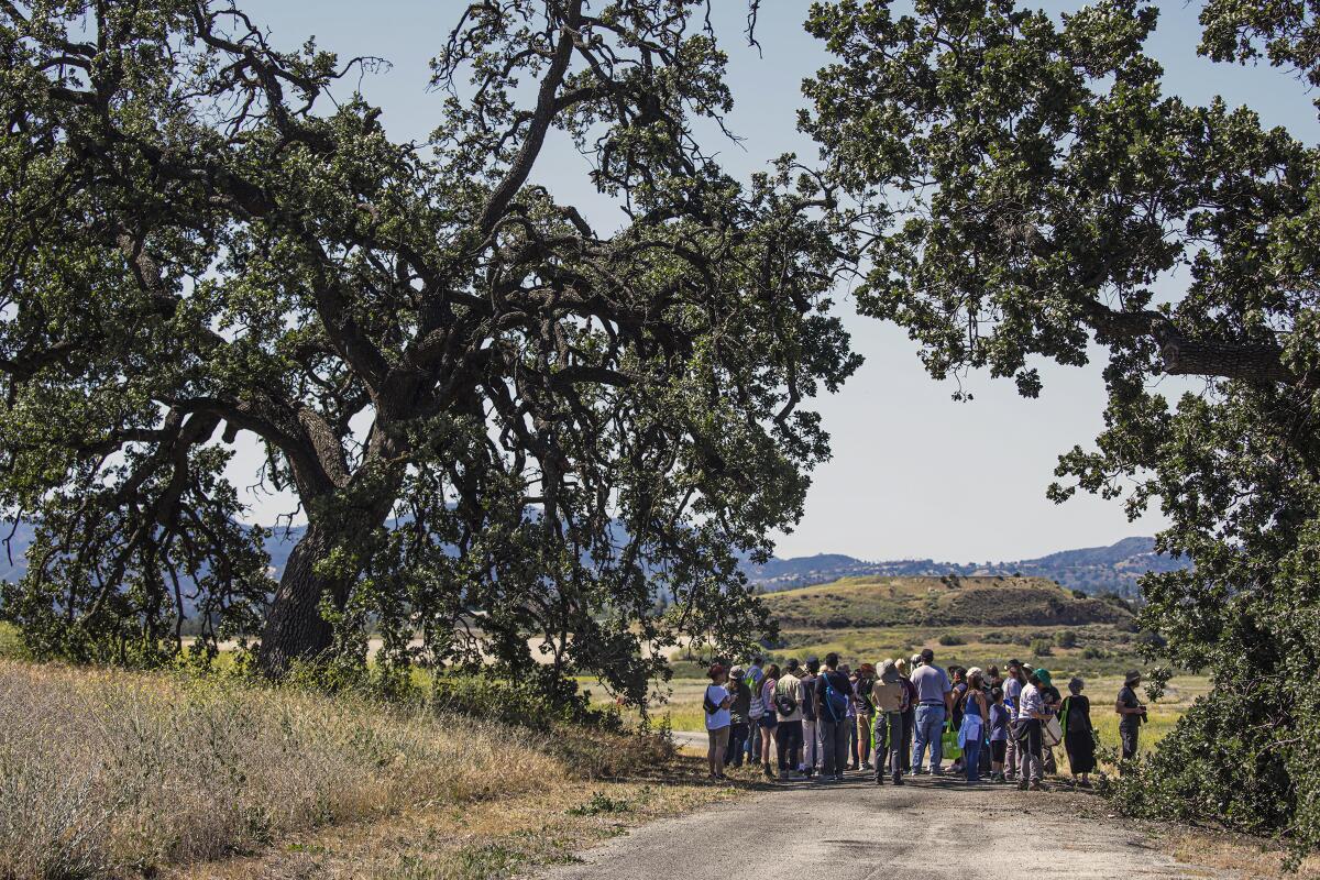
Visitors take a guided nature hike during an open house at the Chatsworth Nature Preserve by the Los Angeles Department of Water and Power in celebration of Earth Day on April 23, 2022.

(Irfan Khan / Los Angeles Times)

1. Hike on the longest day of the year in Chatsworth
The Chatsworth Nature Preserve will host a summer solstice event from 9 a.m. to 1 p.m. Saturday featuring guided hikes, storytelling, live animal exhibits and more. Guests should wear hats and comfy shoes and they should bring refillable water bottles and sunscreen. Dogs are not allowed. Visitors should enter through the Valley Circle Boulevard gate, west of Plummer Street. Learn more at ladwp.com.

2. Tend to trees near Malibu
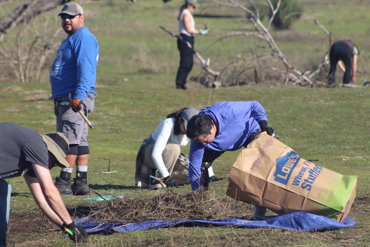
The Resource Conservation District of the Santa Monica Mountains needs volunteers from 9 a.m. to noon Saturday to care for newly planted oak trees in Nicholas Flat in Leo Carrillo State Park. Participants will water, weed and mulch around newly planted trees and possibly plant acorns to replace trees that died. Volunteers will also collect data for a reforestation project. Volunteers should wear comfortable clothing and durable shoes. Register at eventbrite.com.

3. Celebrate inclusivity and nature in San Dimas
L.A. County Parks and Recreation will host Pride Outside at 5 p.m. Friday at the San Dimas Canyon Nature Center (1628 N. Sycamore Canyon Road in San Dimas). The event will include a hike alongside representatives from Pomona Valley Pride, which is partnering with the county for the event. Learn more at the park’s Instagram page.

A wiggly line break

The must-read

A view of the Chuckwalla Mountains.

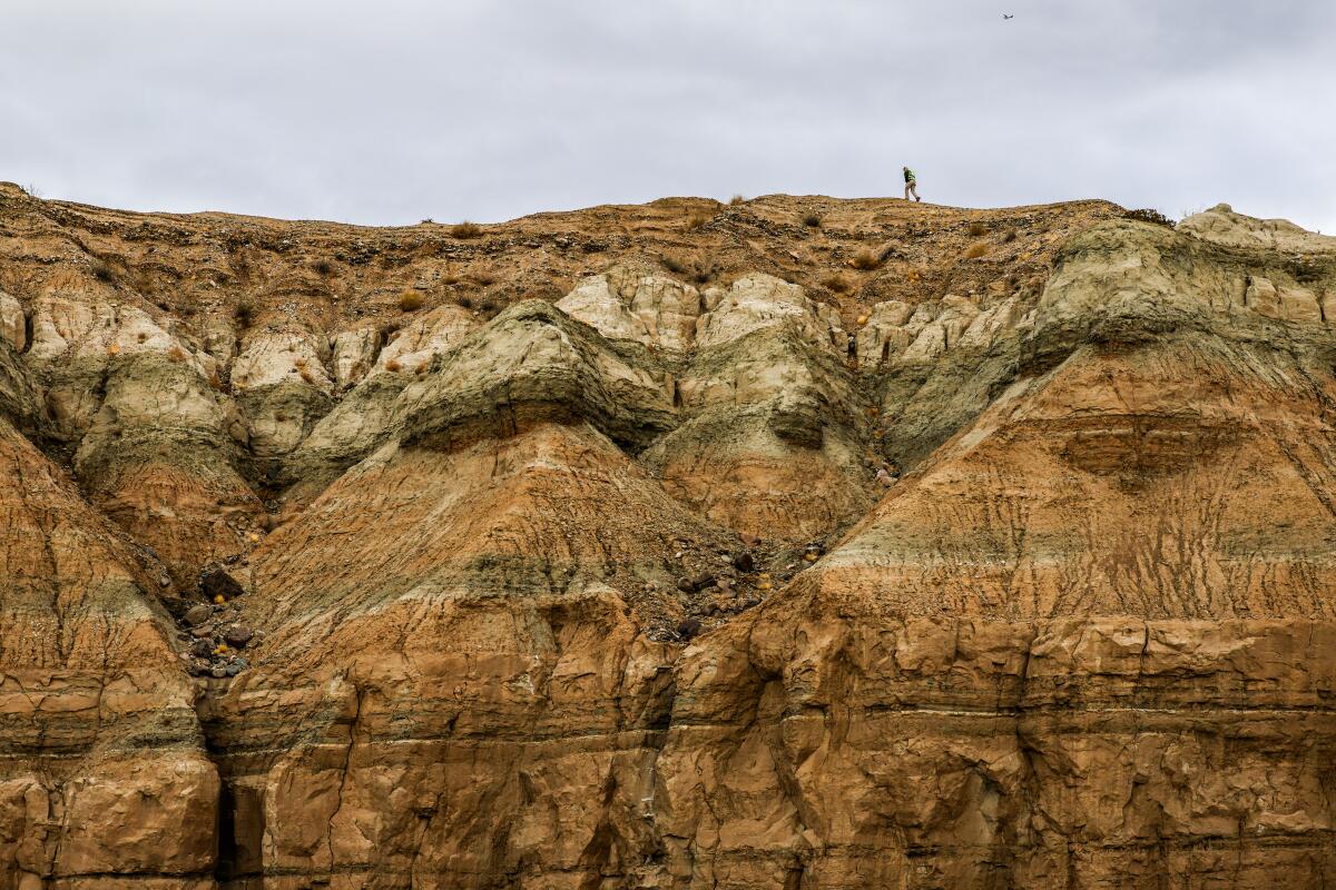
A view of the Chuckwalla Mountains. President Biden established Chuckwalla National Monument shortly before leaving office, protecting over 600,000 acres of public lands in the California desert.

(Robert Gauthier / Los Angeles Times)

The Chuckwalla National Monument, a 624,000-acre desert landscape next to Joshua Tree National Park, faces an increased threat of losing its federal monument status after a recent ruling from the Department of Justice. Times staff writer Lila Seidman reports that a May 27 legal opinion by President Trump’s DOJ overturns a more than 80-year-old Justice Department determination that presidents can’t revoke national monuments created by their predecessors under the Antiquities Act. This opens a wide window for Trump to dismantle Chuckwalla and the Sáttítla Highlands near the Oregon border, which President Biden established as national monuments shortly before leaving office. “Whether presidents have the authority to alter monuments is hotly contested,” Seidman wrote. “Litigation challenging Trump’s previous monument reductions was still pending when Biden reversed them and the matter was never settled.” We’ll keep you posted on what happens next.

Happy adventuring,

Jaclyn Cosgrove's signature

P.S.

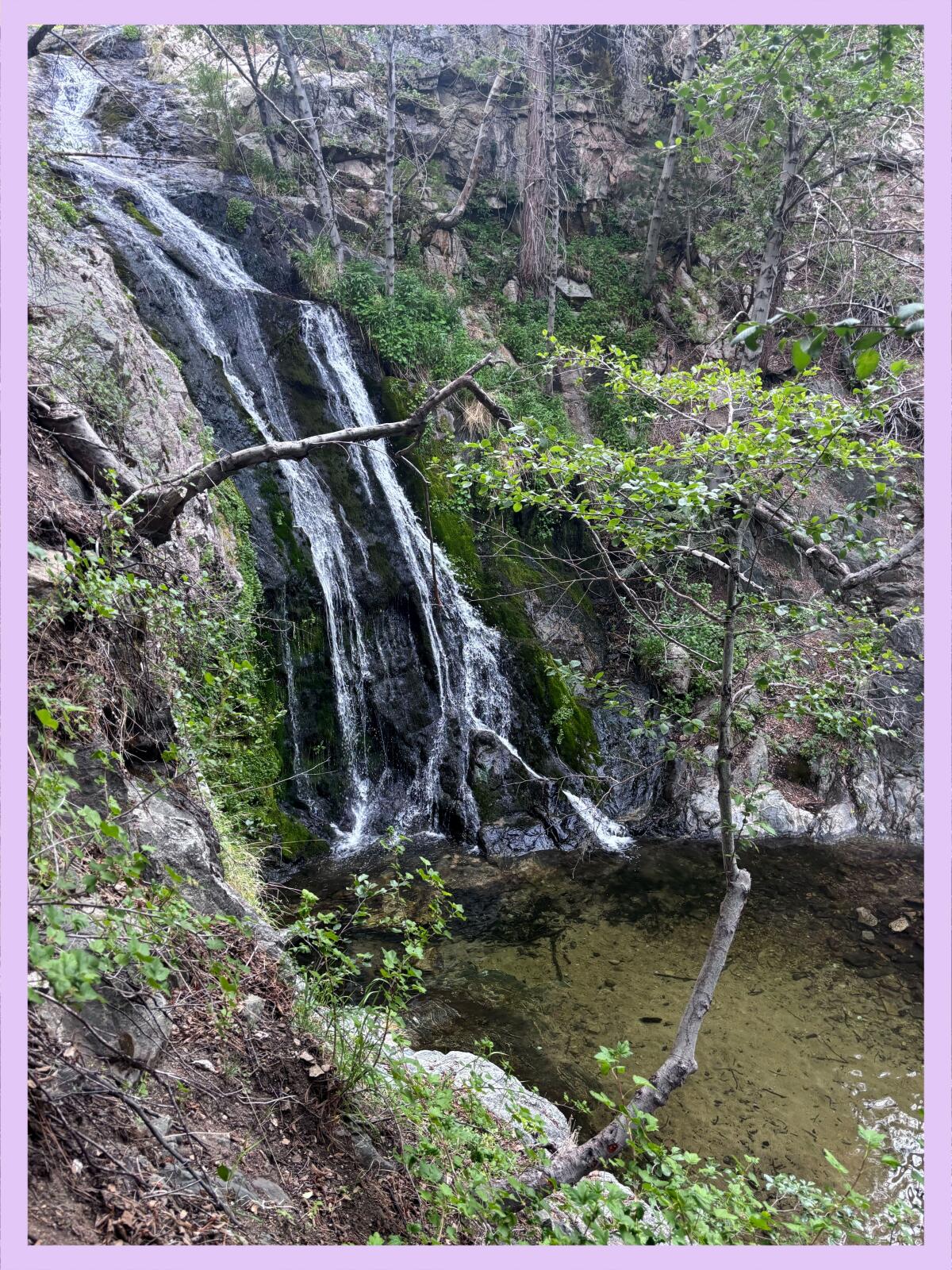
The Mountains Recreation and Conservation Authority, which manages more than 75,000 acres of public land around L.A. County, announced this week that it is reopening multiple hiking areas closed in response to the Palisades fire. This includes the popular Escondido Canyon Park & Falls, which I’m eager to see, and San Vicente Mountain Park. A few Wilders, who recently emailed me regarding trail closures, will be happy to hear Westridge-Canyonback Wilderness Park and Mandeville Canyon are reopening too. You can read more about other recent trail reopenings here.

For more insider tips on Southern California’s beaches, trails and parks, check out past editions of The Wild. And to view this newsletter in your browser, click here.


Source link

This California hike features massive waterfalls and swimming holes

Whenever I’m feeling stressed out, heartbroken or scared over the state of our nation, the one place where I can find solace, however fleeting, is in the outdoors.

I’ve taken several mental vacations this past week back to the most beautiful hike I’ve ever traversed in California. I can close my eyes and feel the sun on my skin as I sit next to a massive waterfall, its roar filling my ears as my face turns misty from its blast. I’d like to take you there with me now and explain how, when and why you must go too.

Newsletter

You are reading The Wild newsletter

Sign up to get expert tips on the best of Southern California’s beaches, trails, parks, deserts, forests and mountains in your inbox every Thursday

You may occasionally receive promotional content from the Los Angeles Times.

In mid-May, I traveled three hours north of Sacramento to the Trinity Alps Wilderness so I could write a guide on how to explore the region. You’ll find everything you need to start planning your trip.

The Trinity Alps are about 540,000 acres, which is about 100,000 acres larger than the San Gabriel Mountains National Monument, and they feature massive waterfalls, crystal-clear rivers and creeks, and dozens of turquoise alpine lakes.

The Canyon Creek trail is the most popular in the Trinities, and for good reason, as it has each of those things.

Backpackers often take the path 8.5 miles to the Boulder Creek lakes or nine miles to the Canyon Creek Lakes. (Note: If you’d like to backpack the trail, please visit the Weaverville Ranger Station beforehand to gain clarity on where you should camp, as there are certain areas that have been damaged by overuse and should be avoided.)

Blue-green water flowing through the woods.

The blue-green water of Canyon Creek.

(Jaclyn Cosgrove / Los Angeles Times)

I took a 16-mile, round-trip day hike, ending my journey at the upper falls, but you certainly don’t have to go that far to see tremendous beauty here, as seemingly every mile traveled offers a new delight.

To reach the trailhead, you’ll take California 299 to Canyon Creek Road, a narrow two-lane thoroughfare that includes two one-lane bridges. You’ll pass through a rural community where signs request you to kindly watch your speed. It’s a good idea regardless of where you’re driving in the Trinity Alps, as deer are easy to spot on the highway (including eating in the middle of the road, which I couldn’t figure out).

You’ll need to arrive early if hiking the Canyon Creek trail on a weekend, as the parking lot can fill up. I went pre-season and had one of three vehicles in the large lot.

Dirt trail through wooded area.

The first mile of the Canyon Creek trail is a gentle narrow dirt path.

(Jaclyn Cosgrove / Los Angeles Times)

From the trailhead, you’ll hike past an information board — during my visit, the forest service staff was warning of two food-motivated bears — and then past a large wooden Trinity Alps sign, a good selfie spot.

From here, you’ll start down a narrow mostly flat dirt path shaded by massive conifers and bigleaf maples. The path runs parallel to its namesake channel and includes several water crossings of varying sizes, so plan accordingly (i.e. pack extra socks!).

I visited before the Trinity Alps season starts, as it typically runs from June to October, but still noticed several flowering plants in this first mile of my hike, including western starflower, baldhip rose, longtube iris and some type of inside-out flower.

Various flowers growing along trail.

Cliff maids (lewisia cotyledon), spreading phlox and a paintbrush flower grow along the Canyon Creek trail.

(Jaclyn Cosgrove / Los Angeles Times)

About a mile in, you’ll come to your first major water crossing. On my way back, I did a great job letting the river’s current ram my toes into a boulder, so please take good care as you cross. This is a great turn-around spot if you’re hiking with little kids, as it has a few spots where you can splash around without getting pummeled by the river, along with rocks covered in bright green moss.

A look up at tall conifer trees.

Massive conifers grow throughout the Canyon Creek area.

(Jaclyn Cosgrove / Los Angeles Times)

After the crossing, the trail started to remind me a bit of the Switzer Falls hike or the Valley Forge area of the Gabrielino trail, but with way more water and much taller trees. I spotted several deer tracks, and maybe smelled bear urine. I loved seeing the large white blooms of the dogwood trees.

White flower bloom coming off of a dogwood tree across the path.

The white bloom of a dogwood tree.

(Jaclyn Cosgrove / Los Angeles Times)

About three miles in, I reached a fork in the trail where I headed down to the Sinks for a short side trip. This area has nice, clear pools where you can take a dip, relax and explore.

It is another great turn-around spot, as you could easily spend the day lounging in the river, napping in a hammock and enjoying the sound of native birds and the river around you. I was almost pulled by the river siren’s call to just stay there. But I really wanted to see all three waterfalls!

A creek with trees and rocks on either side.

The Sinks is an area just off the Canyon Creek trail that offers calmer areas to swim and spend the day.

(Jaclyn Cosgrove / Los Angeles Times)

Shortly after leaving the Sinks, I walked over a landslide. Alone, happily bored and a big Fleetwood Mac fan, I did sing as I crossed over it (but I did not see my reflection in the snow-covered hills). I later spoke to a forest service worker who said these obstacles were being cleared. So fingers crossed the landslide won’t be there when you arrive.

Dendroalsia moss growing on a tree near the Canyon Creek trail.

Dendroalsia moss growing on a tree near the Canyon Creek trail.

(Jaclyn Cosgrove / Los Angeles Times)

This segment of the trail felt like it was teeming with life. Several rocks I passed had dens beneath them for snakes, frogs and other creatures. The trees had holes where woodpeckers had or will store food. Also, several conifers had bark covered in furry moss. I am always reminded when in nature about our interconnections and how we can all support each other.

Soon, I ascended from the forested area onto a rockier part of the trail where I had clear views of the jagged canyon walls. You’re at just over 4,000 feet while the tops of the canyon walls are easily more than 2,000 feet higher in elevation. Also, this is a sunnier portion of the trail, so you’ll want to make sure to reapply sunscreen.

As you hike, I hope you’ll spot even more wildflowers than I did! I passed by large boulders covered in moss and bright pops of spring color, including a yellow small-leaved monkey flower, light purple spreading phlox, red paintbrushes and pink cliff maids.

I could hear Canyon Creek Falls, or the lower falls, long before I arrived, calling to me like a music festival starring Mother Nature. And then, four miles in, I screamed in delight and briefly wondered if I’d somehow made it to the upper falls because of the size of the cascade before me. I stood in awe of the wide multi-story waterfall, watching hundreds of gallons of water rush over boulders into a deep turquoise plunge pool.

You’ll notice several jagged peaks like this one as you hike along Canyon Creek.

You’ll notice several jagged peaks like this one as you hike along Canyon Creek.

(Jaclyn Cosgrove / Los Angeles Times)

I talked to three backpackers from Northern California, one of whom was celebrating a birthday, as they debated where they’d camp. I saw a total of eight people all day.

Short falls off rocks.

The Canyon Creek Falls, or the lower falls, are reachable via an eight-mile round-trip hike.

(Jaclyn Cosgrove / Los Angeles Times)

As I gained elevation, I reentered another forested area with boulders at least 12 feet tall. About 4.5 miles in, you’ll pass by Upper Canyon Creek Meadow. Part of it appeared to be part wetlands, part meadow, looking like an ideal place for fish to hide if they can make it there. There was a substantial amount of bear scat in this area, so on the way back when I spotted a small cave nearby, I snapped a quick photo and skedaddled.

The trail was harder to find five miles in. I ended up off-trail multiple times, but it was usually easy to see where I’d gone wrong. Please download a map before heading out so you can check your outdoors app. And, yes, carry a paper map too just in case.

A meadow with peaks behind.

A meadow off the Canyon Creek trail.

(Jaclyn Cosgrove / Los Angeles Times)

At six miles in, you’ll find yourself standing mouth agape at the middle falls. This website claims this waterfall, which is easily more than 100 feet high, is “great for whitewater enjoyment.” This sounds terrifying to me, but I’m not going to yuck anyone’s yeehaw. There is a short trail (about 400 feet) you can take to the base of the middle falls. Please use caution as it’s crumbly and a bit technical.

I did not spend too much time here because, as mentioned, I had tunnel vision for the upper falls. But stopping here would provide you with a splendid 12-mile, round-trip hike where you would get to see two massive waterfalls, an absolutely stunning river with several pools, the Sinks, mountain views and wildflowers (and probably deer because they’re everywhere in the Trinity Alps).

A river flows through wooded area near small pools of water.

A river flows near the Sinks, an area just off the Canyon Creek trail.

(Jaclyn Cosgrove / Los Angeles Times)

But if you want to keep going, a striking reward remains about a mile ahead. I knew I was getting tired, so I ate my favorite trail gummies and other snacks and headed past ancient trees and over rocky steps, reminding myself how lucky I was to be on the clock in the woods.

Near a large rock that resembled the Mandalorian’s helmet, I checked my map and found I’d almost made it. When I took my final turn, I could see rushing water past a stand of trees. I forged ahead and found myself standing (alone!) before 10 short cascades rushing over various sized boulders. I thought this was the upper falls, and I was impressed.

Falls cascading down multiple levels of rocks.

The upper falls at Canyon Creek start via a series of cascades before descending hundreds of feet down the mountain.

(Jaclyn Cosgrove / Los Angeles Times)

But I heard a loud roar of water and I couldn’t help myself. I carefully traveled around the rocky area and realized that those waterfalls were only the upper portion of the upper falls. The water continued racing down the mountain. In total, the upper falls are easily hundreds of feet.

Large falls over multiple layers of boulders.

The upper falls of Canyon Creek is a series of cascades that collectively fall more than 100 feet down the mountain.

(Jaclyn Cosgrove / Los Angeles Times)

I sat near the waterfall, enjoying what tasted like the best peanut butter and jelly sandwich I’d ever had, given the scenery and the journey I’d made to get there. I briefly toyed with the idea of hiking the additional 1.5 miles to the Canyon Creek Lakes, pulled by the allure of the larger of the two, which spans 25 acres and reaches a depth of 86 feet. But I knew that was foolish. I wanted to get back to my car before nightfall. And after falling deeply in love with the landscape, I know I will return to the Trinity Alps (hopefully many times).

On the hike back, I had to go slightly off trail through dense weeds to avoid some stagnant water pooled on the trail, which I’d already done once. This time, though, as I lifted my foot, one of the springy plants shot back up and slapped me right in the middle of my face. Stunned, I wondered whether my lip was bleeding. It felt a bit karmic, like the universe saying, “Hey, watch it!” I hope you’re laughing as much as I was.

It was impossible to bring my mood down after hiking in one of the most beautiful places in California and arguably the West.

A wiggly line break

3 things to do

A lone hiker takes in sweeping views of the Santa Monica Mountains.

A lone hiker takes in sweeping views of the Santa Monica Mountains at Eagle Rock along the Backbone Trail in Topanga State Park.

(Brian van der Brug / Los Angeles Times)

1. Celebrate California State Parks Week across L.A.
State parks across L.A. County (and California) are hosting events through Sunday to celebrate California State Parks Week. At Topanga State Park, the Santa Monica Mountains Task Force of the Sierra Club will host an introductory trail maintenance course from 8:30 a.m. to 12:30 p.m. Saturday. At Santa Susana Pass State Historic Park, visitors can attend a morning mindfulness hike from 9 to 11 a.m. or an evening hike from 5 to 7 p.m., both on Saturday. Find events near you at castateparksweek.org.

2. Sashay down the trail in Glendale
A group of local nonprofits will host Pride Outside: San Gay-briel Mountains from 5 to 8 p.m. Saturday at Deukmejian Wilderness Park in Glendale. Organizers will offer a one-mile hike at 5 and 7 p.m. to prevent overcrowding on the trail. In between, the group will hear from local organizations and watch drag performances. Register at eventbrite.com.

3. Cut the mustard in La Crescenta
The Arroyos & Foothills Conservancy needs volunteers from 8 to 10 a.m. Saturday at its Rosemont Preserve in La Crescenta. Participants will yank invasives like black mustard, water newly planted native plants and perform trail maintenance. Volunteers are welcome to bring shovels, spades, loppers, hatchets and clippers. Other tools will be provided. Register at arroyosfoothills.org.

A wiggly line break

The must-read

A man standing on a blue and white boat.

William “Captain Smitty” Smith at Pillar Point Harbor in Half Moon Bay.

(Loren Elliott / Los Angeles Times)

This past weekend, Californians were allowed to fish in the ocean for Chinook salmon, the first time the state allowed recreational fishing of the species since 2022. Times reporter Ian James spoke to William “Captain Smitty” Smith, who was busy preparing his charter fishing boat Riptide at Pillar Point Harbor in Half Moon Bay. Smith said the moment news broke in April that the state would allow a limited amount of fishing of Chinook salmon in the ocean, his regulars called and his boat was booked up. His plan was to take out 18 people both days. California Department of Fish and Wildlife is allowing up to 7,000 of the fish to be caught. If that quota wasn’t met this past weekend, then salmon fishing will be allowed until the limit is reached, likely on July 5-6, July 31-Aug. 3 and Aug. 25-31. Given the progress the state has made on improving the salmon’s environment (although climate change has more than made it challenging), Smith told James that he’s hopeful about what the future holds. “I want there to be a fishery for my grandson,” said Smith, who has worked in the charter boat industry for 50 years. “I want him to be able to experience the thrill of catching a fish in the ocean.”

Happy adventuring,

Jaclyn Cosgrove's signature

P.S.

L.A. County Parks and Recreation is hosting family campouts through the summer, including this month where participants can learn about fishing in our local lakes at four county parks. At Kenneth Hahn State Recreation Area, campers can participate in a night hike, and at Castaic Lake Recreation Area, kayaks will be available. Each event is $15 per person. Children 13 and younger are free. Register at bit.ly/OvernightCamping.

For more insider tips on Southern California’s beaches, trails and parks, check out past editions of The Wild. And to view this newsletter in your browser, click here.


Source link

3 campgrounds near L.A. where you can start the morning with a hike

Even though I’m technically a “professional” hiker, I do not excel at arriving to trailheads early.

Unless I’m camping.

Camping removes all distractions and simplifies my morning. Wake up. Boil water for coffee on the butane stove. Sit. Listen to the birds. Leave for a hike after two precious cups of java.

I also go to bed much earlier. I’m not binging shows like Netflix’s “The Diplomat” with my wife or as interested in playing 17 rounds of Solitaire on my phone as a means to lull me to sleep. I simply lie down in the darkness, sleepy from an adventurous day and hot meal, and quickly fall asleep. Perhaps the version of myself I am while camping is something I should try to carry with me.

Newsletter

You are reading The Wild newsletter

Sign up to get expert tips on the best of Southern California’s beaches, trails, parks, deserts, forests and mountains in your inbox every Thursday

You may occasionally receive promotional content from the Los Angeles Times.

I know we’re all thinking about how we can squeeze every ounce of delight out of the summer. I’ve been daydreaming about campgrounds, including the three below.

These three spots will allow you to get up, make your coffee and get to the trailhead early (if you want to).

Trail with blackened trees both standing and laying on the ground.

You’ll notice several blackened trees on the Burkhart trail that were burned in the 2020 Bobcat fire.

(Jaclyn Cosgrove / Los Angeles Times)

Buckhorn Campground

About an hour’s drive from L.A., Buckhorn is a 38-site, first-come, first-served campground shaded by large incense cedars and pine trees. It is $20 per night, payable by cash or check. It is situated along a creek just off California State Route 2 in Angeles National Forest.

The campground sits at around 6,500-feet elevation, providing a shady respite in the hottest summer months. Each camp site includes a picnic table, a fire ring and bear box, which you should use. It is a popular spot, so plan your arrival times accordingly. (Arriving before noon on a Friday should secure you a spot on a non-holiday weekend.)

A 25-foot waterfall falls gently down a mossy hill

Cooper Canyon Falls cascades down the hillside near the Burkhart Trail.

(Jaclyn Cosgrove / Los Angeles Times)

Waking up at Buckhorn, you’ll be a quick walk from the Burkhart Trail, an 11.3-mile point-to-point segment of the High Desert National Recreation Trail that ends at the Devil’s Punchbowl Natural Area. Most hikers take the Burkhart Trail 1.5 miles from its trailhead to Cooper Canyon falls, which descends about 30 feet into a refreshingly cold pool. On one camping trip, my friend Hannah and I plunged into the water together, screaming on our way up to the surface. Once the shock subsided, it felt great.

Other trails near the Buckhorn Campground include the Pacific Crest Trail, which you can take as far as you’d like, or the 53-mile Silver Moccasin National Recreation Trail. The trailhead for Mt. Waterman, which dedicated Wild readers will know is one of my faves, is across the street from Buckhorn.

Grinnell's beardtongue, red columbine, grape soda lupine and sanddune wallflower on the Burkhart Trail.

Grinnell’s beardtongue, red columbine, grape soda lupine and sanddune wallflower on the Burkhart Trail.

(Jaclyn Cosgrove / Los Angeles Times)

Chilao Campground

Chilao is an 84-site, first-come, first-served campground in Angeles National Forest. It is $20 per night, payable by cash or check. The campground features large boulders, sweeping views and, like the other two campgrounds listed, tall trees. You’ll need to bring your own water. Potable water is often available, but per the forest service, isn’t turned on right now.

Tree-shaded campsites and campsites with views of the surrounding mountains.

1. One of the many shaded campsites at Chilao campground. 2. Some of the campsites at Chilao campground offer sweeping views of the surrounding mountains.

(Jaclyn Cosgrove / Los Angeles Times)

Chilao is one of my happy places. A cool breeze is blowing through my window right now, making it easy to close my eyes and remember lying in a hammock at my campsite here, looking up at the pine trees as I debated whether I would keep reading my book or take a nap.

From Chilao, you can take a portion of the Silver Moccasin Trail and some fire roads to Mt. Hillyer, a fun little spot with large boulders to scramble over. Another option is to take the Silver Moccasin Trail to other segments of the forest, including a 6.6-mile hike to the Vetter Mountain fire lookout, where you can be inducted into the Ancient and Honorable Order of the Squirrels.

A pile of boulders at Mt. Hillyer.

The boulders at Mt. Hillyer.

(Jaclyn Cosgrove / Los Angeles Times)

Manker Flat Campground

Hikers head up the rocky path of Devil’s Backbone Trail in their quest to reach Mt. Baldy.

Hikers head up the Devil’s Backbone Trail in their quest to reach Mt. Baldy.

(Jaclyn Cosgrove / Los Angeles Times)

Manker Flat is a 21-site, first-come, first-served campground at 6,000-feet elevation near Mt. Baldy. It is $14 per night, payable by cash or check. Shaded by tall evergreens, each site has a picnic table and fire ring. The campground has vault toilets. Potable water isn’t presently available. Bears are known to frequent this campground, so plan accordingly.

Manker Flats will likely be my next trip, as I’ve been lusting over a trip up to Mt. Baldy since the route reopened. I envision hiking about 3.4 miles from my campsite up to Top of the Notch, having a quick bite and continuing the arduous but rewarding journey to the Mt. Baldy summit.

And instead of having to drive back home, I could simply arrive back at my tent, cook my dinner over a campfire and crash in my tent, looking up at the twinkling stars. That sounds like living!

View of the sunset through silhouetted trees from the trail to Mt. Baldy.

The sunset from the trail to Mt. Baldy.

(Jaclyn Cosgrove / Los Angeles Times)

A wiggly line break

3 things to do

Grassy wetland field in the southern Los Cerritos Wetlands.

The southern Los Cerritos Wetlands.

(Jason Lustig)

1. Walk among raptors in Los Cerritos
The Los Cerritos Wetlands Land Trust will host a free guided nature walk through the southern Los Cerritos Wetlands from 8 to 10 a.m. Saturday. Ecologists will teach walkers about raptor habitat in the area and native people who lived in the area and their role in recent restoration efforts. Guests must wear close-toed shoes. A $5 donation is requested for those who are able to give. Register at eventbrite.com.

2. Yank invasive plants in Griffith Park
Friends of Griffith Park will host a trail maintenance day from 8:30 to 11 a.m. Saturday. The group will meet at the merry-go-round parking lot and then head to catch basins at the bottom of Fern Canyon where they’ll remove mustard, castor and other invasive plants. Volunteers should wear close-toed shoes or boots, long pants and sleeves, and bring a reusable water bottle, sunscreen and a hat. The organization will provide tools and water. Learn more and sign the waiver at friendsofgriffithpark.org.

3. Take a Dam good ride in El Monte
ActiveSGV will host a 20-mile bike ride from 8 a.m. to noon Saturday exploring the hidden gems of the Santa Fe Dam. This ride will start and finish at the Jeff Seymour Family Center (10900 Mulhall St., El Monte) and include both city streets and bike paths. Riders will learn about the Emerald Necklace network, a 17-mile series of parks, greenways and trails. Participants can register to ride an e-bike for free. Register at eventbrite.com.

A wiggly line break

The must-read

A wolf from the Beyem Seyo pack is released in a valley field.

A recently collared wolf from the Beyem Seyo pack is released close to where she was captured by a helicopter team.

(Malia Byrtus / California Wolf Project/UC Berkeley)

One of the most remarkable things I’ve seen in the outdoors is a black wolf crossing a meadow in Yellowstone National Park and then leaping several feet in barely a second at a deer that likely became its next meal. It’s a sight that hikers in Northern California increasingly have the chance to see, as the state now has a confirmed 10 wolf packs. Times staff writer Lila Seidman talked to experts who said there could be more than 70 wolves in California now. This is cause for celebration in conservation circles. But the resurgence of wolves in California, hunted to extinction about 100 years ago, has led to an increasing number of the canines killing cattle instead of the deer and elk that state wildlife officials expected them to eat. Killing wolves is a crime, but Sierra County Dist. Atty. Sandra Groven recently told Times staff writer Jack Dolan that she would not prosecute a rancher who kills a wolf caught preying on cattle. “What are they supposed to do? Run up and wave their arms and say, ‘Go away’?” Groven said. But Axel Hunnicutt, the gray wolf coordinator at the California Department of Fish and Wildlife, cautions that the recovery of California’s wolf population is only occurring because they’re protected. “On the flip side, it would not take very much to completely topple these 10 packs,” Hunnicutt said.

Happy adventuring,

Jaclyn Cosgrove's signature

P.S.

If you’re concerned about the future of trails in the Santa Monica Mountains, consider attending the Santa Monica Mountains Fund’s event from 5 to 7 p.m. this Saturday at the Anthony C. Beilenson Interagency Visitor Center in Calabasas. Money from your $50 ticket will be spent on the fund’s “Trails Forever” campaign aimed at restoring and protecting hikes throughout the Santa Monicas. It’s great food for a great cause!

For more insider tips on Southern California’s beaches, trails and parks, check out past editions of The Wild. And to view this newsletter in your browser, click here.

Source link

How trails are recovering from the Eaton and Palisades fires

Eaton Canyon and adjacent federal land that burned in the January wildfires in L.A. County will remain closed through 2026 and maybe longer given the extensive damage caused by the Eaton fire and subsequent flooding, county officials said during a recent news conference.

One of the most popular hiking areas in L.A. County, Eaton Canyon previously saw a million visitors per year. Officials said they’ve seen a spate of trespassers in the park since the fire, including one hiker who tried to reach Echo Mountain only to get lost and require rescue. Officials are pleading with the public to stay out of the area and let the land heal.

A person speaks during a news conference with other officials in the background near a fence.

Karen Mateer, vice president of the Eaton Canyon Nature Center Associates, speaks during a news conference last week in which officials asked the public to stay out of the Eaton fire burn scar to let the land heal.

(Jaclyn Cosgrove / Los Angeles Times)

“With apologies to James Taylor, we’ve seen fire and we’ve seen rain, and I’ll tell you what, we’ve also seen a fair amount of air in the form of wind coming through the canyon,” said Karen Mateer, vice president of the Eaton Canyon Nature Center Associates. “Those are three of the basic elements of nature, and now we really need to focus on the fourth, the earth.”

Although it will take time for the land most damaged by the L.A. fires to heal, there are some areas of the burn scars that have recently reopened or will reopen soon.

Newsletter

You are reading The Wild newsletter

Sign up to get expert tips on the best of Southern California’s beaches, trails, parks, deserts, forests and mountains in your inbox every Thursday

You may occasionally receive promotional content from the Los Angeles Times.

Here is the latest information on trails in three recent burn zones.

Eaton fire

The Eaton fire killed much of the plant life in Eaton Canyon, leaving the soil unstable. As such, boulders and burned trees can fall at any moment.

Norma Edith García-Gonzalez, director of L.A. County Parks and Recreation, said on one of her first visits to the canyon after the fire, a tree fell five feet in front of her. All hikers should heed the warnings to stay out, she said. Additionally, those who trespass could face substantial fines if caught.

For those wanting to see a waterfall like the gorgeous cascade that plummets down the mountain at Eaton Canyon, I’d recommend checking out the popular Switzer Falls. It was closed immediately following the Eaton fire, and there was some confusion about whether the trail had reopened. At last week’s news conference, Justin Seastrand, forest recreation manager at Angeles National Forest, confirmed it is open! However, the nearby Bear Canyon Trail Camp and the trail leading to it remain closed.

The burned hillsides around Eaton Canyon in the San Gabriel Mountains.

The burned hillsides around Eaton Canyon in the San Gabriel Mountains.

(Jaclyn Cosgrove / Los Angeles Times)

A similar and beautiful trail, Millard Canyon, which also features a waterfall, will likely remain closed through 2026, as its restroom burned in the fire, Seastrand said.

Henninger Flats, a popular hiking destination north of Eaton Canyon, suffered even more serious damage, said Kim Bosell with L.A. County Parks. The old museum, propagation areas and restrooms are gone, and workers will need to remove that debris before the area is safe for hikers to access, Bosell said.

Before the fire, officials had planned to add Henninger Flats to the Eaton Canyon natural area, she said. “Unfortunately the fire took it before we could follow through with those plans, but what the future holds for it, we don’t know right now,” Bosell said.

Bridge fire

Last September, the Bridge fire burned almost 55,000 acres, including 25 trails on federal land.

The popular Bridge to Nowhere hike was near where the fire started and will remain closed for the foreseeable future, Seastrand told me, because the rivers and creeks in the area were seriously damaged during the fire and subsequent flooding. It’ll take tremendous manpower (and money) to bring it back online.

But, the good news is, the U.S. Forest Service revised the Bridge fire closure order last week to reopen two popular routes to Mt. Baldy, the Baldy Bowl Trail (Ski Hut) and Devil’s Backbone Trail. Bear Canyon, sometimes referred to as Old Mt. Baldy Trail, remains closed.

This reopening is more than a little bit exciting, considering the closure of these two trails was probably one of the least popular decisions that Angeles National Forest officials have made in a hot minute.

That said, you might notice these trails and others in the Mt. Baldy area, like Icehouse Canyon, are listed as closed on the forest service’s website when they’re actually open.

That’s, in part, because the U.S. Forest Service recently updated several forest websites and in doing so broke the links for several trails and campgrounds. The update rolled out about the same time that the federal government fired thousands of forest service workers. So, needless to say, it might be a minute before the website reflects reality. In the meantime, check the closure order if you have a question about what’s open. (You’re also welcome to email your local outdoors reporter!)

Palisades fire

In the coming weeks, hikers will be able to return to a handful of popular trails in and around the Palisades burn scar.

I spoke to Richard Fink, district superintendent for the Angeles District of California State Parks, who told me that some parkland and trails are closed not because of fire damage, but because they’re being used by state and federal officials in the recovery effort in the aftermath of the Palisades fire.

That list includes Will Rogers State Park, where Fink told me that the park was severely burned, but the trails are in great shape.

“We could open the trails at Will Rogers tomorrow if the rest of the park would be open,” Fink said. “There are actually a lot of trails that [the fire] really didn’t have any impact [on], and also due to our parks being closed, we’ve been able to perform a lot of the work already.”

An area of Topanga State Park near Eagle Springs Fire Road that did not burn in the recent Palisades fire.

An area of Topanga State Park near Eagle Springs Fire Road that did not burn in the recent Palisades fire.

(Jaclyn Cosgrove / Los Angeles Times)

Parts of Topanga State Park were used by the U.S. Environmental Protection Agency for hazardous debris removal, and L.A. County Department of Water and Power is using part of the park to rebuild the power grid in the Palisades. Once those efforts are finished later this year, that region of the park should be able to reopen, officials said.

“The state park priority for parts of Topanga and parts of Will Rogers State Historic Park are first and foremost to help the recovery and then to eventually get them open to the public,” Fink told me.

The southern part of Topanga State Park suffered the worst damage in the Palisades fire and will remain closed for “a while,” in particular the area around the Topanga Ranch Motel, which was “completely destroyed,” Fink said.

There are trails that may take years to recover or may no longer be accessible to the public moving forward, he said.

The Palisades fire burned several acres through Topanga State Park where structures and popular hiking trails were destroyed.

The Palisades fire burned several acres through Topanga State Park, especially in the southern end of the park where structures were destroyed, as well as popular hiking trails.

(Jaclyn Cosgrove / Los Angeles Times)

The popular Los Leones Trail will remain closed, although it suffered minimal damage and was one of the first trails the state parks crew worked on in early March. Crews cleared burned vegetation, removed landslides and widened the trail. It’s in good structural shape, officials said, but will remain closed because the neighborhood near the trailhead remains closed to the public. Once the neighborhood reopens, a crew will need to remove plants that have grown in the path thanks to a lack of foot traffic.

But, dear Wilder, I do have some good news for you.

On Saturday, I hiked with Rachel Glegg, volunteer coordinator with the Santa Monica Mountains Task Force, who took me around Topanga State Park to see the trail work that the Sierra Club Angeles Chapter’s trail crew, state park workers and other volunteers have completed.

Thanks to those efforts, Glegg said, officials aim to open the following trails in the next few weeks:

  • East Topanga Fire Road from Trippet Ranch to Parker Mesa, although anything beyond the Parker Mesa junction will likely remain closed to keep the public away from neighborhoods burned in the fire
  • Eagle Rock Fire Road, Eagle Springs Fire Road and Fire Road #30 to the Hub Junction in Topanga State Park
  • The Garapito Trail in Topanga State Park, which Glegg’s crew is still working on, but is close to repairing fully
Several phacelia grandiflora plants are growing along a burned section of the Garapito Trail.

Several phacelia grandiflora plants are growing along a burned section of the Garapito Trail.

(Jaclyn Cosgrove / Los Angeles Times)

On my trip with Glegg, I just kept saying, “This is so beautiful,” as I took in the views of the surrounding city and ocean. We spotted loads of wildflowers, including phacelia grandiflora and a small patch of California poppies. Like you, I am eager to return and make more memories in this beautiful, resilient landscape.

A wiggly line break

3 things to do

Child jumping in the play area of a park.

A child plays at a previous migration celebration hosted by the Friends of Ballona Wetlands.

(Friends of Ballona Wetlands)

1. Get up close with birds in Playa Vista
Friends of Ballona Wetlands will host its annual migration celebration from 10 a.m. to 2 p.m. Saturday at Ballona Discovery Park. Raptors will be present for visitors to see and learn about up close. Guests can also enjoy music, purchase native plants and partake in a scavenger hunt, along with tours of the freshwater marsh. Learn more at ballonafriends.org.

2. Celebrate National Bike Month in L.A.
People for Mobility Justice will host a community bike ride from 8:30 a.m. to noon Saturday, starting at Ted Watkins Memorial Park. As part of this celebration of National Bike Month, riders will travel through the Florence-Firestone area, learning about bike safety and local resources. Participants should bring water, along with their bike and helmet. Register at eventbrite.com.

3. Prance down open streets in Glendale
The city of Glendale will close 1.3 miles of Glendale Avenue from 10 a.m. to 4 p.m. Saturday for its first car-free open streets event. Let’s Go Glendale will feature live music (including a strolling mariachi) and other arts and culture programming. Visitors can walk, run, bike or take the route in any other preferred people-powered way. Learn more at glendaleca.gov.

A wiggly line break

The must-read

A female black bear and her cub in South Lake Tahoe

A female black bear and her cub scour a South Lake Tahoe neighborhood in search of food.

(Corey Arnold / For The Times)

It’s rare to see a black bear in the wild, and it’s even rarer for someone to be hurt by one, much less killed. That’s why it was so startling when news broke of the death of Patrice Miller, 71, who, a coroner’s report found, was killed by a black bear in her home. Times reporters Jessica Garrison and Lila Seidman wrote in their recent story that questions — and even disbelief — still exists around how Miller died. “We don’t believe the bear did it,” said Ann Bryant, executive director of the Bear League in the Tahoe Basin. “And I will go on record as saying that.” The bear in question has been killed. What remains is an intense debate over how California should manage its population of an estimated 65,405 black bears, especially those found lumbering around mountain towns.

Happy adventuring,

Jaclyn Cosgrove's signature

P.S.

The U.S. Forest Service is taking public comment through Monday on its proposal to log trees and clear chaparral across 90,700 acres in Los Padres National Forest, which sits north of L.A. County and features gorgeous landscapes. “But this plan falls short and threatens habitat in many areas,” according to advocacy nonprofit ForestWatch. “The project emphasizes vegetation removal in remote areas — places that pose little threat to public safety but are rich in biodiversity, cultural value and recreational importance. The plan also allows for commercial logging, and it overlaps with roadless areas and endangered species critical habitat.” You can learn more at the organization’s website, where you can submit your comment as well. You can also submit your comment on this federal website.

For more insider tips on Southern California’s beaches, trails and parks, check out past editions of The Wild. And to view this newsletter in your browser, click here.

Source link

What to do if you get stung by a stingray in the ocean

Last year, I started teaching you, dear Wilder, what to do if you see an animal on the trail who could possibly hurt you. We’ve learned a lot together!

I explained the importance of observing a bear’s behavior to determine your best course of action. Same goes for coyotes. I also taught you that, if you actually see a mountain lion, you want to make so much noise they think, “‘What the hell is that?’” and leave.

We learned how you should not throw rocks at rattlesnakes to get them to move off trail, but it is sometimes OK to give them a little nudge with a long stick or hiking pole. (Read: sometimes.)

I hope, like me, you feel safer and more prepared should you encounter one of these critters in the woods. Now, I want to instruct you on the importance of dancing at the beach. Yes, it’s for your safety. It’s a specific type of boogie known as the “stingray shuffle.”

Newsletter

You are reading The Wild newsletter

Sign up to get expert tips on the best of Southern California’s beaches, trails, parks, deserts, forests and mountains in your inbox every Thursday

You may occasionally receive promotional content from the Los Angeles Times.

Stingrays live all over the world, including right here along the coastline of Southern California. Round stingrays, a sand-colored little cutie, are the most common of this cartilaginous fish group to be found around our beaches, and thus, the one you are most likely to step on.

That’s in part because they don’t want to be seen. Round rays are usually less than a foot long and often “cover themselves with mud or sand, leaving only the eyes and spiracles exposed,” according to the Aquarium of the Pacific, “an excellent camouflage technique.”

It’s less likely that you’ll see a bat ray in shallow water. If lucky, you might spot one of those swimming near a local pier.

Although data on the number of stings in L.A. County were not readily available, the experts I spoke to agreed that it’s common enough that you need to be prepared when you visit the beach. I’d usually end with “Let’s dive in!” to be cheeky, but that directly contradicts the advice below. Puns aside, here are five tips to avoid a painful stingray encounter at the beach.

1. Shuffle your feet as you enter the water

Rather than stepping into the ocean, you should shuffle your feet as you enter the water. This is the aforementioned “stingray shuffle,” where you kick up sand, hopefully causing enough of a commotion that it will prompt any rays in the area to swim into deeper water.

“Their first line of defense is to swim away,” said Sara Lesser, education supervisor at the Aquarium of the Pacific in Long Beach. “That stinger is the last thing they want to use, and they are pretty fast swimmers. If they get spooked, the first thing they’re going to do is try to get away from whatever spooked them.”

A bat ray in the water.

A bat ray, a species commonly found along the coast line from Oregon to the Gulf of California.

(Aquarium of the Pacific)

2. Don’t touch rays in the wild

At the aquarium, you can touch rays in a controlled setting around trained staffers. Out in the open ocean, don’t touch any animal, even if you perceive it to be gentle. Rays are wild animals too, and even if you’re out snorkeling, just watch it go by.

“They don’t have any interest or want to interact with us,” Lesser told me. “Snorkeling with them is a great way to see them, but make sure, like with all animals, [you] give them their space and distance. You’re entering their home. Be a quiet observer of them and their habitat.”

3. Be aware of your continued risk of being stung

Stingrays can be found anywhere along the ocean bottom, but you should especially use caution when walking along a nice flat seabed on a calm day when the water is shallow and warm.

“If you kick up enough sand, and you’re around enough people, the stingrays are going to get away from you,” said Pono Barnes, a spokesperson for the ocean lifeguard division of the L.A. County Fire Department. “They’re not going to wait until you get a foot away to swim away. If you’re shuffling around, and relatively in the same spot while you’re enjoying the water, the stingrays are going to clear out and move down the beach where it’s calm.”

Barnes said you don’t have to constantly shuffle your feet, but if you’re the only person out on a sand bar, it’s good to shuffle as you move around. Another option: swim.

Barnes has never been stung and attributes that to swimming to travel through the ocean. “They’re going to stay on the bottom. They’re not going to come up to sting you,” he said.

4. If stung, don’t pee on it

“I would not recommend that, that would not alleviate your pain,” Barnes said.

Given the myth around peeing on a jellyfish’s sting to alleviate pain, I had to ask. Not only does urine not help remove venom from a ray’s barb, it also should not be used to treat a jellyfish sting. Truly, the more you know!

5. Seek actual medical aid

Generally, being stung by a small round ray will feel like you’ve stepped on a piece of glass. That sensation will go away momentarily, only to be replaced by a throbbing pain that will vary in intensity depending on how much venom you received from the ray’s barb.

“I’ve seen linebacker-sized guys that are completely inconsolable, can’t talk because they’re writhing in pain, and then I’ve seen little kids that are totally fine that got stung,” Barnes said. “It really depends on how much venom gets delivered at the time you got stung.”

You should head, hopefully pee-free, to the nearest lifeguard stand.

The lifeguards will assess your injury, make sure the barb isn’t still in your foot and then wash the wound out.

Then, they will place your foot inside a Mylar-type bag where they’ll add the hottest water you can stand to kill the venom.

“What that hot water does is, it essentially cooks off that venom and the protein in the venom, and once that breaks down, the pain goes away,” Barnes said.

(Fun fact: Every morning, lifeguards collect scalding hot water and keep it in insulated containers in case a beachgoer suffers a sting. They’re always prepared for this to happen!)

It can take a few hours for the pain to subside.

“It’ll feel like you’re getting better and that you can take your foot out of the water, and then as soon as you take your foot out of that hot water, you’ll feel that pain start to come back,” Barnes said. “Typically, it’s the end of your beach day.”

The lifeguards will take you to the end of the beach, where your driver will take you home. Lifeguards can even help your driver plan the route home to include the nearest coffee shop or convenience store where you could get a refill on hot water, depending on how far you’re going.

Most people don’t have any other issues once the venom is cooked off. Those who do develop an infection should go to an urgent care and inform the physician they were stung by a stingray, as there are specific antibiotics more effective for marine-related injuries.

I hope you don’t have to ever use this advice. If you do, may your pain be minimal and aid be rendered swiftly!

A wiggly line break

3 things to do

People standing and bending over cleaning up a field.

Volunteers work to restore habitat at a Friends of the L.A. River event.

(Friends of the L.A. River)

1. Clean up habitat down by the L.A. River
Volunteers are needed from 8 to 11 a.m. Saturday at the Sepulveda Basin Wildlife Reserve for Friends of the L.A. River’s habitat restoration day and Earth Month celebration, postponed because of rain last month. Participants will restore native habitat in the reserve, yanking invasive plants and making seed balls. Local organizations, including the California Native Plant Society and San Fernando Valley Audubon Society, will teach volunteers about local flora and fauna. Learn more and register at folar.org.

2. Glean native plant knowledge in Glendale
Officials from Glendale’s Office of Sustainability will lead a 2.8-mile hike at 10 a.m. Saturday through the Catalina Verdugo Trail, where they will teach hikers about native plants such as laurel sumac, sycamores and sages along the path. This lightly moderate path meanders around the Glendale Sports Complex in the San Rafael Hills. It is lush, and as such, long shirts and pants are recommended. Guests should also bring water and sun protection. Register at laworks.com.

3. Meet new plants at the L.A. River
Herb Club L.A. will host a walk at 5 p.m. Sunday around the L.A. River, where guides will teach guests about native plants and their medicinal, ecological and cultural significance. Afterward, guests will be invited to imbibe kefir water while sketching plants and adding to their field guides. Art supplies will be provided, but guests are welcome to bring existing pieces to work on. Tickets range from $23.18 to $33.85, with participants encouraged to pay what they can. Register at eventbrite.com.

A wiggly line break

The must-read

An illustration of a hiker enjoying the mountainous view.

(Marie Doazan / For The Times)

The Sierras offer ample opportunity to backpack to alpine lakes and high peaks, where you’ll have much of the trail to yourself. But it isn’t always doable to drive a few hours north for a backpacking trip. That’s why I put together this helpful guide on how to backpack in our own backyard! There are around 20 backpacking sites around L.A. County, and I chose the best ones to check out this summer. Everything on my list is open. The roads to reach them are paved, and the trails to reach each site are generally well-maintained. I am looking forward to revisiting several spots on my list, including Valley Forge, where the stars will be bright, and the frogs hopefully loud.

Happy adventuring,

Jaclyn Cosgrove's signature

P.S.

Good news! This past weekend, a volunteer at Project Monarch L.A. spotted the first butterfly chrysalis that the group has seen in its three years of restoring habitat for the at-risk winged wonder. Since 2023, the project’s volunteers have spent hundreds of hours planting milkweed and native pollinating plants and taken other steps to help Los Angeles State Historic Park near Chinatown be a place where monarchs can reproduce and thrive. In the coming days, the little green chrysalis will hopefully transform into an orange-and-black beauty!

For more insider tips on Southern California’s beaches, trails and parks, check out past editions of The Wild. And to view this newsletter in your browser, click here.


Source link

A coastal L.A. hike with views, wildflowers and a path to the beach

Whenever friends or family visiting L.A. ask to go spend a day swimming in the ocean, I always take them to Leo Carrillo State Beach.

Unlike Santa Monica or Venice beaches, Leo Carrillo is not crowded. Parking is usually easy. And it’s a great place to swim and explore, with its tide pools where you can spot a starfish and scramble on its huge rocks (I may have had a goofy photo shoot or two with my friends there).

But until recently, I did not know that the adjoining Leo Carrillo State Park was home to a magnificent series of hiking trails where, when connected, provide you with a seven-mile trek with striking ocean views, wildflowers and birdsong. The halfway point is a pond and wetlands area where you can spot waterfowl and, if you’re lucky, listen to frogs! This is now the hike I take friends on when they want to both hike and have a beach day. I recommend you do the same.

Along with striking views of the Pacific Ocean, the Nicholas Flat Trail includes great vantage points of local peaks.

Along with striking views of the Pacific Ocean, the Nicholas Flat Trail includes great vantage points of local peaks.

(Jaclyn Cosgrove / Los Angeles Times)

Newsletter

You are reading The Wild newsletter

Sign up to get expert tips on the best of Southern California’s beaches, trails, parks, deserts, forests and mountains in your inbox every Thursday

You may occasionally receive promotional content from the Los Angeles Times.

The hike that I took through Leo Carrillo State Park — which I would gauge as mostly moderate with a few short but hard stretches — connects a few different trails, and I will explain how you can even just do portions of it and still have a great time before heading over to the beach.

To begin, you’ll park at Leo Carrillo State Park. An all-day pass is $12, payable to the ranger at the gate or via the machine in the parking lot. Once parked, you’ll head northeast to the trailhead. You’ll quickly come to a crossroads. Take the Willow Creek Trail east to officially start your hike.

A western fence lizard perches on a hillside.

A western fence lizard perches on a hillside.

(Jaclyn Cosgrove / Los Angeles Times)

You’ll gain about 575 feet in a mile as you traverse the Willow Creek Trail. I took breaks along the way to gaze at the ocean, watching surfers bobbing on their boards and a kite surfer trying to gain traction. I spotted coast paintbrush and California brittlebush, a flowering shrub that features yellow daisy-like flowers, on the path, along with several lizards.

A mile in, you’ll come to a junction in the trail where you have three-ish options. You can continue west to a branch of the Nicholas Flat Trail that will take you a mile back down to the parking lot. You can head south onto ocean vista lookout point (which, though steep, I highly recommend). Or you can turn north onto another branch of the Nicholas Flat Trail.

Leo Carrillo State Beach is easy to spot from high points along the Nicholas Flat Trail.

Leo Carrillo State Beach is easy to spot from high points along the Nicholas Flat Trail.

(Jaclyn Cosgrove / Los Angeles Times)

I did a combination, hiking 235 feet up the lookout path, where I had one of those “Wow, I get to live here” moments. The ocean was varying shades of blue, from turquoise to cerulean to cobalt. I could clearly see in all directions, including about eight miles to the east to Point Dume. I was, once again, amazed to be alone in a beautiful place in a county of 10 million people.

Once I finished at this awe-inspiring point, I headed north onto the Nicholas Flat Trail, taking it about 2.3 miles — and about 1,100 feet up 🥵 — through laurel sumac and other coast sage scrub vegetation into the Nicholas Flat Natural Preserve. Along the way, I observed loads of deerweed covered in its orange and yellow flowers along with scarlet bugler (which I spotted hummingbirds feeding on during my way back), Coulter’s lupine and small patches of California poppies.

California poppies growing amid invasive weeds, Coulter's lupine and Longleaf bush lupine in Leo Carrillo State Park.

California poppies growing amid invasive weeds, Coulter’s lupine and Longleaf bush lupine in Leo Carrillo State Park.

(Jaclyn Cosgrove / Los Angeles Times)

If you need to catch your breath but don’t want to share that fact with your friends, just yell “Look at that view!” which is relevant for the hardest parts of the first stretch of this path, as the ocean grows only more beautiful and expansive as you climb.

About 2.5 miles in, you will see a path on your right that heads south. I’d skip this. It is a lookout point, but is washed out and looked sketchy to me. Instead, continue east-ish for another mile, and you’ll reach the charming little Nicholas Pond.

This is a great spot to sit, have a snack and observe the waterfowl and other birds, like red-winged blackbirds, song sparrows and lesser goldfinches (which are only lesser in their names). As I sat there eating my Trader Joe’s veggie sushi, I imagined decades ago when cattle probably drank from the pond, given a portion of the preserve resembles pasture and not native coastal sage scrub, and thus appears to have been used for ranching.

The Nicholas Pond in Nicholas Flat Natural Preserve near western Malibu.

The Nicholas Pond in Nicholas Flat Natural Preserve near western Malibu.

(Jaclyn Cosgrove / Los Angeles Times)

I continued north and then west on the Nicholas Flat Trail through the preserve. You could also turn around at the pond and head back the way you came.

The walk through the preserve featured views of the pasture and some shade from large oak trees, but it didn’t delight me the same as the rest of the hike. Additionally, just before finishing this leg of my hike, I noticed a steep, washed out hill and thought, “Please don’t let that be the trail.” Dear Wilder, it was. There was a nice view once I cursed my way up, but I give you permission to, again, just turn around at the pond.

The Nicholas Flat Trail is steep in spots but worth it for the views.

The Nicholas Flat Trail is steep in spots but worth it for the views.

(Jaclyn Cosgrove / Los Angeles Times)

At six miles in, or when you have only a mile left, you’ll return to the junction with the ocean vista lookout point. Instead of taking the Willow Creek Trail back the way I came, I took a right (northwest-ish) onto the last bit of the Nicholas Flat Trail. This trail also offered tremendous views and had patches covered in brittlebush with its yellow blooms.

I hiked this trail on a Thursday and did not see another human for the first six miles. It was just me, the western fence lizards, California quail and one very shy skinny silver striped snake who, upon hearing my footsteps, bolted into the bushes.

If you start this hike early enough in the day, you can simply trek back to your car and change into your swimsuit for an afternoon at the beach. And if the tide is out, you might also be able to walk around the tide pools. In the same day, you can hang out with both lizards and starfish, and when lucky, even spy an endangered bumblebee on the trail and an octopus on the beach. Please, go have yourself a remarkable Southern California day!

As the sun sets, golden light blankets the hillsides in Leo Carrillo State Park.

As the sun sets, golden light blankets the hillsides in Leo Carrillo State Park.

(Jaclyn Cosgrove / Los Angeles Times)

A wiggly line break

3 things to do

Cyclists ride along the route of CicLAmini—Wilmington, hosted in 2024.

1. Pedal your heart out in Pico Union
CicLAvia will host its 60th open streets event, CicLAmini—Pico Union, from 10 a.m. to 3 p.m. Sunday in Pico Union along Pico Boulevard between Normandie and Union Avenues. Guests are invited to travel the 1.4-mile pop-up park through their favorite people-powered mode of transport, whether that’s walking, jogging, biking, skating or shimmying. The route will feature booths from nonprofit organizations and photo opportunities and food. CicLAvia, a nonprofit whose events are always free, invites participants to show up anywhere along the route during the event to take the time to explore one of L.A.’s most historic neighborhoods. Learn more at ciclavia.org.

2. Observe waterfowl and more in Castaic
An instructor-led bird walk and talk will be hosted from 8 to 10 a.m. Sunday at Castaic Lake. Guests should bring binoculars, sun protection and water, and wear comfy shoes for this relaxing stroll along paved pathways, sand and grass. Participants should meet at parking lot No. 4 and check in at the office. Register for free to this L.A. County site.

3. Fly a kite at Los Angeles State Historic Park
Clockshop, an L.A. arts and culture nonprofit, will host its fifth Community & Unity People’s Kite Festival from 2 to 6 p.m. Saturday at Los Angeles State Historic Park. This free event will feature free arts workshops, live music and booths from local community organizations. There will be a kite competition where contestants will fly their handmade kite, to be judged by kite masters. A $5 donation to Clockshop is requested but not required. Register at clockshop.org.

A wiggly line break

The must-read

A western fence lizard, also known as a blue belly.

A western fence lizard, also known as a blue belly.

(James Maughn)

Anyone who has hiked for three minutes in L.A. has spotted a western fence lizard. They’re seemingly everywhere, scampering up a hillside, along the trail or on a rock. Turns out, Californians love documenting these little guys. Sean Greene, an assistant data and graphics editor at The Times, analyzed data from the citizen science app iNaturalist and found more than 130,000 verified identifications of the fence lizard in California. That’s way more than the number of poppies observed (almost 47,000) and red-tailed hawk (almost 76,500), two common and beloved things found in Southern California. “Outside California, iNaturalist users focus on other things,” Sean wrote. “Oregonians enjoy snapping pictures of ponderosa pines. In Washington, it’s mallards — the most commonly observed species worldwide. Nevadans have a thing for creosote bushes.” Biologist Giovanni Rapacciuolo told Sean that the fence lizard’s population on iNaturalist almost certainly comes down to “what human beings think is cool.” Like a large sunbathing lizard. As an added bonus, the piece features a video of a lizard doing push-ups, one of my favorite natural phenomenons to observe while hiking. So swole!

Happy adventuring,

Jaclyn Cosgrove's signature

P.S.

As we head into summer, the kind folks at Anza-Borrego Desert State Park remind us to check the ground temperature when hiking with pets. I often bring my dog, Maggie May, with me on trails. In the summer, I take the back of my hand and leave it on the ground for five seconds. If it’s too hot for me, it’s too hot for Maggie. If so, we just go find a swimming hole in the shade that we can both enjoy!

For more insider tips on Southern California’s beaches, trails and parks, check out past editions of The Wild. And to view this newsletter in your browser, click here.


Source link