The popular Canary Islands holiday destination recorded 84 earthquakes over the weekend near Mount Teide, with officials starting work on a contingency plan in case of an eruption

Tenerife reported 84 earthquakes at the weekend(Image: Getty)
Tenerife experienced 84 earthquakes over the weekend, prompting officials to initiate a “plan for disaster”. The National Geographic Institute (IGN) reported that the tremors were detected in the western part of Las Canadas on the island.
Approximately 59 of these seismic events were accurately located, which they claim occurred around Mount Teide. The most notable activity consisted of two low-frequency pulses around the Canary Island.
One happened between 1.30am and 5.30am on Saturday, with the second recorded between 7.30am and 10.30am on Sunday. It’s believed they both occurred at depths of roughly eight and 21km below Las Canadas, each registering low magnitudes.
However, the IGN has stated that these figures are provisional and could potentially rise. It stresses that this type of activity does not indicate an increased risk of a volcanic eruption in the forthcoming weeks or months, according to Canarias7.
This follows reports that the Santa Cruz de Tenerife Council has begun preparations on a contingency plan in the event of an eruption. Mount Teide, Spain’s tallest peak, last erupted in 1909, reports the Express.
A specialised technical department has now been set up to devise an action plan should it erupt again. The plan aims to bolster the city’s readiness and ensure it can provide shelter and essential services.
It’s believed the city could presently manage a “moderate emergency” but there are concerns a major eruption could pose more significant challenges. Santa Cruz Mayor Jose Manuel Bermudez stated: “We don’t know how it will happen, how it will develop, or when it might occur.
“But scientists have indicated that current volcanic developments on the island are not something normal.”
The IGN monitors seismic activity in Spain through a network of over 100 stations, equipment and sampling points which are deployed throughout Tenerife. This enables continuous surveillance.
Scientists can therefore conduct real-time monitoring to detect potential changes in seismic activity, ground deformations, or geochemistry. Tenerife, the largest of Spain’s Canary Islands, is encircled by volcanic activity.
Whilst the mayor has expressed concerns about preparedness to handle an eruption, the president of the island’s governing council, the Cabildo of Tenerife, Rosa Davila, has previously dismissed speculation.
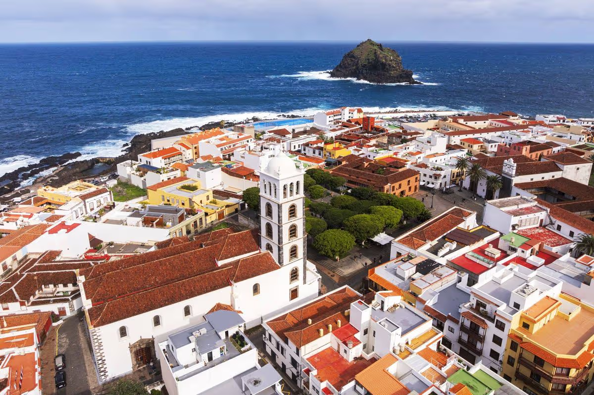
Teide’s 1909 eruption resulted in “minor damage” on the island. Yet an earlier eruption in 1706 is reported to have destroyed a town along with Tenerife’s main port of Garachico.
“A month and a half ago this activity would not have attracted much attention,” a spokesperson for the local National Geographic Institute said. “However, given the current context we will continue to monitor the situation closely in case anything changes.”