North Carolina’s electoral future may hinge on rural Black voters who feel ignored by Democrats
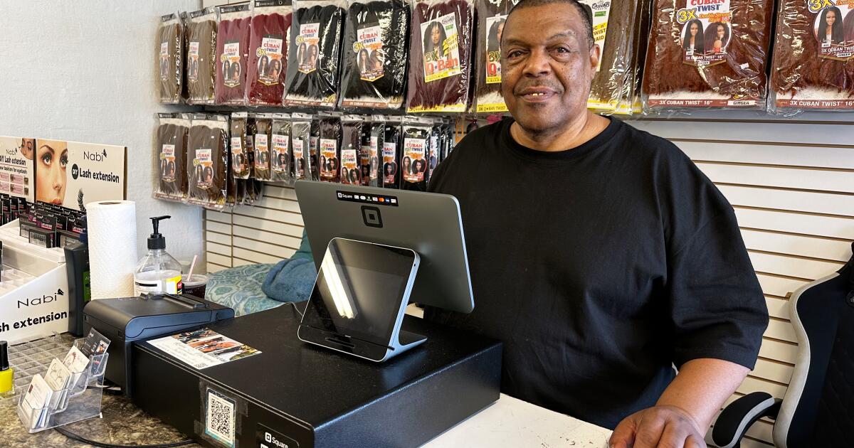
NASHVILLE, N.C. — Ricky Brinkley has lived in rural North Carolina nearly all of his 65 years, and he likes it “out in the county,” past the street lights and bustle of the small towns that carpet the landscape.
But the former truck driver can feel left out when elections roll around in this battleground state.
“People don’t come out like they should and ask you how you feel about things,” Brinkley said while he manned the counter at his daughter’s beauty supply store down the street from the Nashville courthouse. “You want somebody to vote, but you don’t want to do nothing to get the vote. No, it don’t work that way.”
Brinkley is among the rural Black residents who Democrats have often failed to mobilize as they try to dent Republican advantages here. It’s an urgent demographic puzzle for the party, which is normally strong with Black voters but tends to fall short in rural areas.
Success could help former Gov. Roy Cooper win a hotly contested U.S. Senate race this year and tilt the balance of power in Washington. It could also reshape presidential elections, providing Democrats with a wider path to the White House.
“People want to look at the word ‘rural’ in North Carolina and equate it to the word ‘white,’” said state party chair Anderson Clayton, a 28-year-old who won her job three years ago promising to expand the party beyond cities. “In my vision of a Democratic Party, when you talk about reaching out to rural voters, you are talking about rural Black voters.”
The Rev. James Gailliard, a former state lawmaker who leads a large Black congregation in Rocky Mount, put it even more bluntly.
“You don’t win this state in Durham,” Gailliard said. “You win it in the east.”
It’s about more than Cooper’s Senate bid
North Carolina is known for the university-heavy Research Triangle that includes Durham, Raleigh and Chapel Hill, along with Charlotte’s banking hub. But it also includes large swaths of small towns and rural areas where Democrats have lost ground in recent decades.
That’s not just because of white voters realigning with Republicans. It’s also because Black voters who lean Democratic don’t vote as often as their urban counterparts. Those rural Black voters are concentrated east of the triangle, extending along winding state highways through small towns, flatlands and farmland toward the Atlantic coastline.
Cooper, 68, won two terms as governor and four terms as state attorney general. However, Republicans control the state courts and the legislature, and they’ve redrawn the congressional map to expand their advantage in the U.S. House. Donald Trump carried the state for Republicans all three times he ran for the White House.
A native of rural Nash County, Cooper already in recent months held roundtable sessions with Black farmers, business owners and civic leaders in eastern North Carolina, along with students from North Carolina A&T University, a historically Black school that draws students from across the state. His campaign promises a statewide organizing effort before November.
Gailliard wants a more intentional effort
But Gailliard wants more.
The founding pastor at Word Tabernacle Church, Gailliard was among the Black state lawmakers who lost seats after Republican-led redistricting. He said regaining ground will require neighborhood-level organizing and investment from national Democrats, something he struggled to get from Kamala Harris’ 2024 presidential campaign.
“I couldn’t get any traction,” Gailliard recalled. “I begged them to bring her to Rocky Mount. I said, ‘Listen, Rocky Mount is the gateway to the East. If we crack Rocky Mount, we’ve cracked the East.’ Could not convince them to come. Two weeks later, guess who’s in Rocky Mount? Donald Trump.”
The Harris campaign sent former President Bill Clinton to the area instead.
Gailliard said Cooper needs people like him to get elected.
“Roy is a great friend, and I’m gonna run my butt off to help him in every way, but I’m not banking on his coattails,” Gailliard said. “I’m going to do the opposite. I’m going to grow coattails for him.”
The state party tries to fill gaps
Clayton, the state party chair, said the national party and its donors haven’t prioritized North Carolina early enough in recent cycles.
She said she’s relied mostly on local money to finance 25 full-time staffers, more than three times what the state party had heading into the 2022 midterms.
Bertie County Democratic chairwoman Camille Taylor, whose hometown of Powellsville has fewer than 200 residents, said she’s felt the shift.
She speaks regularly with a field organizer in nearby Greenville, the city closest to the northeastern counties with large proportions of Black residents. But she said it’s especially difficult to persuade rural voters to care about voting beyond the presidency, even though she tells them “these are the races and the people that you’re going to interact with more.”
Democrats have recruited candidates in all 170 legislative districts — two are Democratic-aligned independents — and every U.S. House district. State Supreme Court Justice Anita Earls, a noted civil rights attorney and Black woman, is running statewide for reelection.
Gailliard said he’s identified a few hundred nonprofits, neighborhood associations and other groups that can do issue-orientated work in his district as the election approaches. He wants to match each of them to specific precincts, routing money for them to reach voters and persuade them to vote.
He wants volunteers to get training from Democratic and left-leaning organizations rather than have the outsiders themselves knocking on rural Black voters’ doors.
“We can’t have 21-year-old recent college graduates from Utah knocking doors at $22 an hour in the hood,” Gailliard said. “That just does not work. They’re not a trusted messenger.”
Marginal voting changes add up
About 2 in 10 North Carolina voters in the 2024 and 2020 presidential elections were Black, according to AP VoteCast, as well as in the 2022 Senate election.
Roughly 4 in 10 Black voters in North Carolina’s last presidential election said they live in small towns or rural communities, similar to the share who said they live in the suburbs. Only about one-quarter reported living in urban areas.
Small shifts in persuasion matter, particularly when races are close. In 2008, Barack Obama became the last Democratic presidential candidate to win North Carolina, by a margin of just 14,000 votes out of 4.3 million votes cast.
Voter turnout between the 2020 and 2024 elections declined more in North Carolina counties that have larger Black populations.
Counties where Black voters make up about 30% to 40% of the electorate saw the biggest drop, with turnout falling by more than 3 percentage points. Counties with smaller Black populations saw more modest declines of about 1 percentage point. Overall, turnout remains higher in counties with fewer Black voters.
An old Cooper schoolmate just wants to be asked
Gailliard said Democrats cannot underestimate how much it means for someone to simply get asked for their vote.
“Black and rural voters are not transactional,” he said. “They are relational.”
Back in Nashville at the beauty supply store, Brinkley agreed.
“You get to be a big wheel, and you can forget where you came from,” Brinkley said. “I ain’t gonna say Roy forgot. He’s a hometown guy, so to speak, but I don’t expect to see him out here walking.”
Brinkley made it clear that if he votes, it would be for Cooper and other Democrats — but only if he votes.
“I could. I could. I may vote,” he said. “There’s just so much going on.”
Barrow and Sweedler write for the Associated Press. Sweedler reported from Washington. AP journalist Linley Sanders in Washington contributed to this report.