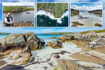
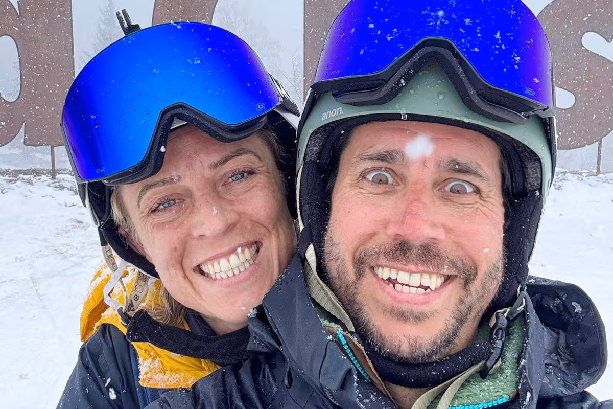
Alps

Pretty town surrounded by waterfalls and mountains feels like being in the Alps

Betws-y-Coed in north Wales is a beautiful town surrounded by craggy mountains, peaceful lakes, and lush woodlands – making it an ideal spot for an autumn break

The arrival of roads and railways was a game changer for Betws
This pretty town is the perfect place for an autumn getaway(Image: Joe Daniel Price)

As autumn slowly makes its arrival, those planning to have a seasonal getaway may want to look towards Wales. With autumn’s fresh air, the crackling leaves beneath your feet, Wales’s stunning landscapes transform into a brilliant tapestry of reds, oranges, and golds.

The country is home to countless autumnal destinations where you can marvel at spectacular foliage, enjoy steaming hot chocolates in welcoming cafés, and explore independent shops for seasonal delights. One picturesque town is Betws-y-Coed, with its distinctive alpine atmosphere and delightful stone structures and bridges.

Regarded as the entrance to Eryri National Park (Snowdonia), its name translates to “prayerhouse-in-the-woods” and is believed to derive from the 14th-century St. Michael’s Church, where ancient yew trees have flourished for over 500 years.

For generations, St. Michael’s Church served as Betws-y-Coed’s vital centre until the settlement expanded, and, in 1873, St. Mary’s Church arrived with its impressive scale to assume control. Both places of worship and the railway terminus, constructed in 1869, were crafted by Owen Gethin Jones – quite the regional icon.

Betws-y-Coed is a small village in the heart of the Eryri national park
Betws-y-Coed is a small village in the heart of the Eryri national park(Image: Getty Images)

The introduction of transport links and rail connections proved transformative for Betws, drawing artists, poets, and authors to the region, captivated by the invigorating atmosphere and woodland panoramas. It wasn’t long before Betws-y-Coed established itself as Britain’s inaugural artists’ settlement, where artistic expression flourished.

By the Victorian era, this quaint village had transformed into a posh tourist hotspot for affluent visitors seeking wellness and relaxation.

Hotels began to pop up, offering horse-drawn tours to showcase Betws’ stunning beauty. Fast forward to the 1930s, steam trains started transporting factory workers from Lancashire to Betws-y-Coed for a much-needed break from urban life.

The Trefriw Spa became a massive attraction, drawing in crowds of visitors. Paddle steamers even moored at Trefriw Quay, adding to the village’s allure, until the outbreak of World War II sadly brought everything to a standstill in 1939.

Today, Betws is at the centre of all the action in Eryri, with a plethora of nearby activities including waterfall walks, canyoning, hiking, and ziplining.

Gwydir Forest Park practically envelops Betws-y-Coed, offering a magical blend of tranquil mountain lakes, woodland paths and frothing waterfalls cascading through the wild Welsh landscape.

AUTUMN Afon Llugwy in Betws y Coed. Image: North Wales Live/David Powell
Afon Llugwy in Betws y Coed(Image: North Wales Live/David Powell)

Several trails are located in this area, so download the handy AllTrails app to find your preferred route and enjoy the dazzling foliage as you trek along.

Embark on the two-mile-long Swallow Falls walk to see the cascading falls. This often muddy trail meanders through woodland to a viewpoint over the waterfall – you get a fantastic view from this side of the river, so don’t forget your camera.

For adrenaline junkies, Zip World is a family-friendly adventure hub nestled inside a beautiful woodland that looks absolutely stunning in autumn.

Fancy a thrilling woodland adventure? You can jump on the UK’s only alpine coaster and whizz through the trees at 25mph right here. The rugged glacial valleys and craggy canyons around Betws-y-Coed are perfect for bracing water adventures.

For those seeking an adrenaline kick, canyoning and gorge walking are a must. With Seren Ventures, you can scramble through river-filled canyons, abseil down cliffs, and even zipline across rivers.

Betws-y-Coed isn’t just about outdoor pursuits; it’s also home to charming Victorian architecture and Swallow Falls at Ty’n Llwyn – often dubbed North Wales’ most picturesque spot, with a backdrop that could easily double as a film set.

If you don't fancy an epic hike to a waterfall spot, there is a beautiful waterfall near Betws-y-Coed that doesn't require a three-hour trek to reach it.
If you don’t fancy an epic hike to a waterfall spot, there is a beautiful waterfall near Betws-y-Coed that doesn’t require a three-hour trek to reach it(Image: Portia Jones)

But it’s not just the scenery that’s captivating; the falls are steeped in local folklore, adding an extra layer of charm to this already enchanting place.

Here, the River Conwy meets three tributaries – the Llugwy, Lledr, and Machno – flowing in from the west, creating a dramatic mix of waterfalls, rapids, and deep, mysterious pools. The natural beauty is absolutely spellbinding.

Rhaeadr Ewynnol (Swallow Falls) are just a 15-minute drive from Betws, and you can park at the Ty’n Llwyn car park in Gwydir Forest Park, which is a starting point for a walking trail to the falls.

Alternatively, parking is available in the nearby lay-by on the A5. You can also take the regular Snowdon Sherpa S1 (Betws-y-Coed to Caernarfon) and T10 (Betws-y-Coed to Bangor) bus services.

Once you get there, you’ll encounter a coin or card-operated turnstile to gain access to the viewing area for the falls. For just £2 per person, you can enter the viewing areas, which are only a short stroll from the turnstiles.

The sound of the falls will likely reach your ears before the sight does, as the thunderous noise of the white water cascading over the rocks pierces the tranquil woodland.

AUTUMN A bridge by The Ugly House near Betws y Coed. Image: North Wales Live/David Powell
It’s super dreamy in autumn(Image: North Wales Live/David Powell)

You can admire the falls from timber boardwalks and a footbridge, with platform access in a gently steep gorge. There’s no need for an extensive hike; simply amble to the platforms and start capturing some stunning fall photos.

The falls are made up of multiple cascades, adding up to approximately 42 m (138 ft) in height, tumbling over a stepped rocky platform and hold the title of the highest continuous waterfall in Wales.

It’s one of the most accessible and picturesque falls in Wales and is definitely worth a visit this autumn.

Worked up a hunger after all that waterfall gazing? Make your way to the newly revamped Swallow Falls Hotel just across the road. This delightful old inn has been a welcoming spot for travellers and locals for over 150 years, and now, following a swanky multi-million-pound refurbishment, it’s looking better than ever.

Expect cosy pub vibes, comfortable rooms, and relaxed food and drink served all day, every day. It’s the ideal place to recharge with a pint and a pub lunch.

Back in the village, there are plenty of dining and drinking choices. For authentic excellent pizza, Hangin’ Pizzeria is a brilliant choice for traditional Italian pizzas topped with inventive ingredients.

It's one of the most accessible and beautiful falls in Wales and is well worth a visit this autumn
It’s one of the most accessible and beautiful falls in Wales and is well worth a visit this autumn(Image: Portia Jones)

Dog-friendly Y Stablau is a delightful venue for local ales, hearty portions crafted with Welsh ingredients, and a selection of bespoke cocktails. It’s ideal for relaxing after a big day of hiking or canyoning.

Upmarket B&B Olif boasts an onsite tapas bar that combines Spanish tapas and traditional Welsh fare to deliver a cracking menu of small plates packed with locally sourced Welsh produce.

The beloved Alpine Coffee Shop is a favourite destination for coffee and homemade cakes in a charming atmosphere. Bonus points: they’ve even got a “sausages for dogs,” loyalty card so your pooch can enjoy a cheeky treat.

If you fancy a brief drive (roughly 20 minutes from Betws-y-Coed), The Old Stag in Llangernyw is essential. This traditional country pub is a properly welcoming venue and nestles beneath a 4,500 year old yew tree.

Constructed in 1640 as a farm, it’s now packed with quirky treasures from centuries past. There’s nothing quite like settling into one of its comfortable seats beside a crackling fire with a delicious Welsh ale.

There’s simply too much to experience in beautiful Betws-y-Coed to squeeze into just one day, so why not stay around for a while?

Revamped Swallow Falls Inn at Betws-y-Coed
Revamped Swallow Falls Inn at Betws-y-Coed (Image: Swallow Falls Inn)

After all, you’ll need time to discover everything this stunning village provides, and trust me, it’s worth it. For a charming, rustic stay, consider the Tŷ Gwyn Hotel, a centuries-old coaching inn complete with beamed ceilings and stunning bedrooms.

If you’re after a more tranquil setting, Pengwern Country House is just a mile out of town. Constructed from beautiful Welsh stone and slate, it offers breathtaking views over the lush Lledr Valley.

For those who prefer their accommodation with a bit more excitement, Pont-y-Pair Inn is the place to be. This family-run, traditional inn boasts 10 luxury en-suite bedrooms and is surrounded by endless hiking and biking trails.

The inn also hosts a variety of entertaining events, from karaoke to live music, perfect for a lively evening after a day filled with autumn adventures.

Source link

‘It feels as though the mountains are ours alone’: family-friendly hiking in the French Alps | France holidays

‘This is probably the wildest place in the whole of the Vallée des Belleville,” says Roland, our guide, sweeping one arm across a bank of saw-toothed peaks as though conducting a great, brawny orchestra. My husband, two sons and I are midway through a four-day stretch of the Grand Tour de Tarentaise hiking trail in the French Alps, and we’ve stopped near the top of Varlossière, a roadless side valley among a great arc of mountains that runs to the west of the ski resorts of Val Thorens, Les Menuires and Saint-Martin-de-Belleville. Hiking up here from Gittamelon, a rustic, summer-only mountain refuge in the neighbouring Vallée des Encombres, we’ve paused to exhale breath, and to inhale the primeval views.

Map for Rhiannon piece in France

High peaks loom either side of us, their shocking green flanks underscored by an elegantly designed bothy and its shepherd-dwelling twin, and we can hear the rush of water far below. It’s midmorning but the moon is low and large in a cloudless sky, adding to the otherworldly scene. Climbing higher, an eagle flies past almost at eye level, no more than six metres away. Though we meet three other hikers on the other side of the Col du Bonnet du Prêtre, the 2,461-metre (8,074ft) pass that leads from Varlossière to the Nant Brun valley – and detect from sheep bells that at least two shepherds must be somewhere among the great folds of these hills – it feels as though the landscape is ours alone.

That may not be the case for long. Soaring temperatures across Europe this summer have fuelled a rush to the mountains, social media funnelling many visitors to the same honeypots and creating infrastructure pressure points; in Italy some farmers in the Dolomites have resorted to installing turnstiles and charging tourists €5 to pass, incensed at having their meadows trampled.

Navigating these challenges is no easy task for Europe’s mountain resorts, which are increasingly encouraging summer tourism as the climate crisis signals a limited lifespan for ski tourism. One of the biggest issues is that many of these new summer visitors are first-timers, unfamiliar with the mores of mountain adventuring: treading gently on the environment, respecting local countryside codes, wearing suitable kit, knowing how to read a map rather than an app (we had no wifi or phone signal for two days of our hike), and packing enough food and water. In France, call-outs to mountain rescue services by inexperienced hikers have risen so sharply that workers now trawl social media looking for potential disaster hotspots in advance.

The writer and her sons walking above Lac de Lou. Photograph: Richard Hammond

In an attempt to tackle these issues, the Vallée des Belleville tourist office has introduced a range of summer initiatives to support new hikers, from kids’ mountain skills activity days to free wildlife talks and events. Lower-level footpaths and bike trails for children, pushchair-users and visitors with reduced mobility makes it safer for those groups to access the mountains, and easier for local communities to manage the larger numbers that tend to make use of them. And while challenging marked trails through more remote corners of the mountains are fairly easy to follow, visitors are encouraged to hire a guide (something we are glad of at Col du Bonnet du Prêtre, when Roland tracks down the shepherd owner of an aggressive dog and persuades him to move away from the trail).

It is at our accommodation each night, in mountain refuges, that we really see support for new hikers in action, though. Several have been designed specifically with families and first-timers in mind, including Refuge Plan Lombardie, where we end our 12-mile (19km) hike from Gittamelon.

We are not first-timers, but staying here is a good opportunity to remind ourselves of the rules of refuge culture, and for the boys to hang out with other children. Though we hike in, it’s possible to park about 20 minutes’ away and walk from there, something several guests with preschoolers have done, grateful for the treasure hunt-style sculpture trail the refuge has installed along the route to entice younger visitors uphill.

Though we have seen less than a handful of hikers during the day, we find Refuge Plan Lombardie as packed as a marmot’s burrow. Approaching it in the soft glow of the afternoon, earlier arrivals have already nabbed the terrace’s deckchairs with a view. Instead, we collect beers and lemonades and find a free bench to enjoy them before swapping our boots for the refuge’s borrowed Crocs, and finding our allocated bunk beds.

Refuges like this are more than just places to sleep. Full of city folk temporarily escaping to higher ground, they’re the human equivalent of a centuries-old rhythm of transhumance, where families bring sheep and cows up to the high pastures for the summer months. At dinner, we share a table with a mother from Chambéry who has brought her four-year-old son for his first visit to a refuge. “My friend gave me a list of the most family-friendly ones and I’ve decided to start a new tradition of visiting one every year with my son. I want him to love them as much as I do,” she told us between bites of a Savoyard blueberry version of Eton mess.

The previous evening, in cosy Gittamelon refuge, we’d shared similar tales, and a dorm, with three generations of a Belgian family who were following the same trail as us but in the opposite direction. And the evening before that, we’d followed suit with other families, playing cards at Refuge du Lac du Lou, a modern, child-friendly refuge just 90 minutes’ hike above the resort of Les Menuires.

Walking from the cosy Gitamelon refuge. Photograph: Richard Hammond

Between Lac du Lou and Gittamelon we’d hiked with Estelle Roy-Berthaud from Les Menuires tourist office, following the trail through harebells, cotton grass, neon-coloured lichens and, much to the boys’ delight, thickets of wild blueberries. Stopping for lunch with Mont Blanc spearing the horizon in the distance, I ask her how the valley is managing increasing summer numbers.

“Summer tourism is a relatively new concept here, so we are not seeing the overtourism issues experienced by more well-known summer destinations in the Alps,” she says. “We’re also protected by not having too many places to stay. In winter, we have around 27,000 beds, but in summer this reduces to just 8,000, so this naturally restricts the number of people in the valley.”

Further along the trail, at Plan Lombardie, I wake in the night and slip out of one of those beds. Outside, the sky is luminous with stars, while the peaks and folds of the land are now entirely black beyond the winking of a distant light – a shepherd’s stove, perhaps, or the torch of a camper. The Belleville valley still feels wonderfully wild tonight.

Transport from London to Chambéry was provided by Flixbus; return fares from £89pp. Half-board accommodation at Refuge du Lac du Lou from €39 children/€69 adults, Refuge Gittamelon €46pp, and at Refuge Plan Lombardie from €32 children and €52 adults. Hiking guides from €25 for a half-day (guides-belleville.com). More information at lesmenuires.com

Source link

Beautiful town dubbed ‘Venice of the Alps’ Brits are just discovering

This Alpine gem of Annecy has become increasingly popular with Brits over the last few years, coming to ski in winter, have fun on the lake, and soak up its European elegance and history in the warmer months

It’s been dubbed ‘the Venice of the Alps’ and is home to Europe’s cleanest freshwater lake. And the French town of Annecy definitely lives up to the hype.

This Alpine gem has become increasingly popular with Brits over the last few years, coming to ski in winter, have fun on the lake, and soak up its European elegance and history in the warmer months.

It’s easy to see why it’s such a hit. With its charming medieval old town, amazing food culture (it’s home to eight Michelin-starred restaurants), brilliant sports facilities, and great transport links (Geneva Airport is 40–60 minutes away, Lyon just over an hour), Annecy really does have it all.

Here’s our guide to 24 hours in and around the famous lake.

READ MORE: ‘This mad holiday activity combines near-death experiences with cheese and wine’READ MORE: Breathtaking French city that’s a dupe for Venice but without all the crowds

A view of the river in Annecy
The town is known as the Venice of the Alps(Image: BPO)

Try your hand at water sports

Lake Annecy really is the jewel in the crown of this gorgeous region. Framed by snow-frosted mountains and with sparkling aquamarine waters and accessible beaches, it’s a magnet for visitors and locals alike. Officially the cleanest lake in Europe, it’s large enough to accommodate lots of people without ever seeming crowded, and there are lots of water sports centres dotted around its edges.

We went to Doussard, a quieter corner of the lake, to try our hand at kayaking (safe and fun) and paddleboarding (also fun but harder than it looks). Parasailing and swimming – the water was a balmy 18 degrees when I visited – are other great options, and cyclists are well-catered for here, so hiring a bike and hitting some of the 40km of lakeside trails is a great way to enjoy the seemingly endless views. There are coffee huts providing refreshment stops along the trails – very civilised!

Chill like a local with a picnic in the lakeside park

Annecy is packed with great places to eat, but if you’re on a budget, a park picnic is a fab way to live like a local and soak up some rays. Residents flock to Les Marquisats, the beach closest to the old town, after work, so grab a bottle of rosé and join the party.

Saint Jorioz is another well-equipped option. With lots of shaded areas, a diving board, volleyball and pétanque courts, it’s perfect for families. It gets busy here in high summer, so head there early to avoid the crowds. There are plenty of beaches to choose from, so you won’t feel shortchanged.

A general view taken on February 10, 2011 eastern France, shows the lake and the city of Annecy.
The lake is one of the freshest and cleanest in Europe(Image: AFP/Getty Images)

Say Je T’Aime at the Pont des Amours

So it’s not an altogether original idea, but it is a cute one – and who can resist a romantic iron bridge, especially when it comes with killer views? The Pont des Amours has become a spot where lovers add their lock and these days, snap some Insta-perfect shots.

It’s a great spot for lake-gazing too. Legend has it that if you’re single, you’ll fall in love with the first person you see as you cross. You’ve been warned…

Embrace your inner foodie with artisan eats and Michelin-starred dining

The food is amazing here – with a strong emphasis on Alpine cuisine and cheese. But alongside traditional favourites like reblochon cheese (the best I’ve ever tasted), gratin, raclette, and croziflette, there are plenty of contemporary menus to choose from, and a new gourmet hall opens later this year.

If you’re feeling spenny, check out some of the town’s Michelin-starred establishments. For classic Annecy fare, Le Freti offers huge main dishes for less than 20 Euros, while La Cuillère à Omble is unbeatable for fresh seafood, veggie delights, and stunning lakeside vistas.

I tried local aperitif Génépi too. Made from a sage-like herb and 40% proof, it’s not for the faint-hearted but tasted fresh and sweet.

Claire by the lake
Claire went to see what all of the fuss was about(Image: DAILY MIRROR)

Sample the ice cream

This town loves its ice cream – and at last count, there were at least ten parlours to choose from. Most of the best places are in the old town; head to Rue Sainte-Claire, where Le Palais des Glaces, Chez Poustache, Glacier Perrière, or Glacier des Alpes all come highly recommended.

Or you can take your pick or buy from one of the many street vendors – lots of these have been plying their trade for generations. Top tip – keep an eye out for ice cream that looks too bright in colour; it’s probably had lots of artificial dyes added. Opt for paler versions to enjoy higher quality, artisan scoops.

Take to the boats

There are boats galore here, so it’s worth trying out at least one during your stay. Channel your inner James Bond or dial up the romance with a luxurious wooden gondola, charter a sailing boat, or just hire a pedalo for an hour.

To see the lake up close and find out more about the people who live and work on its shores, a guided boat ride is a must. Crossing the aquamarine water on a sunny day is an experience I’ll never forget – views to die for and lots of opportunities for bagging great souvenir photos.

The Compagnie des Bateaux d’Annecy offers an hour round trip for under 20 Euros – or upgrade to a restaurant experience for Euros 69.

Discover medieval and modern

Take a guided tour of Vieille Ville – the old town – and find out more about how the town was formed, its resistance role in World War II, and how modern residents live today.

If you’re on foot, head up one of the pretty, steep cobbled streets for a breathtaking 360° view of the town and lake and enjoy spotting the many carved trout figures added to churches and older buildings – a symbol of civic pride.

Convertible bus tours offer a more laid-back way to see the sights in style.

Book it

OVO Network offers seven nights at Chalet Bleu Infini in La Clusaz, in the Annecy Mountains region.

Source link

Alpine adventures: fairytale hiking in the hidden French Alps | France holidays

The baguette was fresh from the boulangerie that morning, a perfect fusion of airy lightness and crackled crust. The cheese – a nutty, golden gruyère – we’d bought from Pierre: we hadn’t expected to hike past a human, let alone a fromagerie, in the teeny hillside hamlet of Rouet, and it had taken a while to rouse the cheesemaker from within his thick farmhouse walls. But thankfully we’d persevered. Because now we were resting in a valley of pine and pasture with the finest sandwich we’d ever eaten. Just two ingredients. Three, if you counted the mountain air.

Map for Queyras

As lunches go, it was deliciously simple. But then, so was this trip, plainly called “Hiking in the French Alps” on the website. The name had struck me as so unimaginative I was perversely intrigued; now it seemed that Macs Adventure – organisers of this self-guided walk in the Queyras region – were just being admirably to the point.

Yes, Queyras. I hadn’t heard of it either. Bordered to the north and east by Italy, barricaded by a phalanx of 3,000-metre peaks, this regional natural park might be the least-discovered – and the Frenchest – corner of the Alps. Queyras only really entered the national consciousness in 1957, after disastrous floods made it briefly headline news. Tourism filtered in. But it remains little known to outsiders, and centuries of undisturbed agriculture and isolation mean its rural character has been preserved.

Ceillac, the gateway to Queyras natural park. Photograph: Sarah Baxter

Even now Queyras takes some effort to reach. Either you take the narrow, hair-pinning road through the gorges of the Guil River from Guillestre. Or you drive over the 2,361-metre Col d’Izoard (from Briançon) or the 2,744-metre Col Agnel (from Italy), both of which periodically test the thighs of Tour de France riders, and both of which close over winter, all but cutting Queyras off from the rest of the world.

Making the most of Macs Adventure’s collaboration with the no-fly specialists Byway, my husband and I travelled as close as we could by train. We overnighted in Paris, whizzed down to south-east France, then chugged more slowly towards Montdauphin-Guillestre, where a Vauban hilltop fort surveils a strategic meeting of valleys. Finally, we boarded the end-of-day school bus, joining children inured to the spectacular views to squeeze up the valley to Ceillac, gateway to the natural park.

The plan from here was to spend six days hiking a circular route that promised big, satisfying climbs but no technical terrain (and no shared dorms or privation). Covering up to 12 miles each day – and walking for an average of six hours – we’d use parts of the GR58 (the grande randonnée that circuits Queyras) as well as other trails to roam between traditional villages. We’d eat cheese, gaze over lakes and mountains, and generally revel in a region that, reputedly, has 300 days of sunshine a year and as many species of flowers as it does people (about 2,500 of both).

On day one this meant walking from Ceillac to Saint-Véran, over the Col des Estronques (2,651 metres). It was a fine start, under blue September skies – we’d come at the end of the hiking season (the trip runs June to mid-September), when crocuses still fleck the meadows and houseleeks hang on higher up, but the bilberry bushes are beginning to blaze in fall-fiery colours and there’s a sense of change in the air.

‘The highest village in Europe’, apparently … Saint-Véran. Photograph: Jo Skeats/Macs Adventure

We joined a light stream of other walkers, progressing up the valley via lonely farmsteads and meadows bouncing with crickets. Noisy choughs and a boisterous breeze welcomed us to the pass itself; 100 vertical metres more took us to the lookout of Tête de Jacquette, where we felt like monarchs of this mountain realm. These may not have been the very biggest Alps – few peaks sported any snow – but they rippled every which way, great waves of limestone, dolomite, gabbro and schist.

From the col we dropped down through arolla pine and larch to Saint-Véran. At 2,042 metres, it claims to be the highest village in Europe. It’s also a snapshot of Alpine life before the modern world seeped in. The oldest house, built in traditional Saint-Véran style, dates to 1641 and is now the Soum Museum; the ground floor, with its half-metre-thick stone walls, is where animals and families would sleep together for warmth. The upper floors, built from tree trunks, were used to keep hay, barley and rye; the grains were made into coarse loaves that would last all winter, baked in the communal oven.

That enormous village oven is still fired up a few times a year, for festivals. But I was pleased to be fed at Hotel le Grand Tétras (“Capercaillie”) instead. Here, we feasted on gratin d’oreilles d’âne (literally “donkey’s ears”, actually a delicious spinach lasagne) and stayed in a simple room with a five-star view to the opposite peaks.

skip past newsletter promotion

‘A five-star view’ … at Hotel le Grand Tétras, Saint-Véran. Photograph: Sarah Baxter

After this, our days settled into a familiar pattern. We’d set off after breakfast to buy picnic supplies. We’d hike up through butterfly-wafted green. We’d cross a pass, go by a lake or reach a panoramic ridge. Then we’d descend through forest or towards an icy river. By evening we’d be ensconced in a pretty village, drinking reasonably priced wine, with a multicourse meal or an indulgent fondue. The air was always fresh, the trails always joyful, the crowds largely thin.

“It’s busy here mid-July to mid-September,” said Christophe Delhaise Ramond, the owner of a gîte in Abriès where we stayed one night, as he poured us mélèze (larch) liqueurs while we pored over maps. Then he reconsidered: “But there are only around 2,000 tourist beds in the park, so it’s never that bad.”

A très français pitstop in Queyras park. Photograph: Sarah Baxter

It’s thanks to Christophe that we made a slight detour the following day. As planned, we climbed up to 2,583-metre Lac Grand Laus, a lake so brilliantly blue-green it seemed a bit of the Mediterranean had got lost in the mountains. It was spectacular, but as crowded as we’d seen anywhere in Queyras. So, on Christophe’s suggestion, we continued to climb, steeply, up to the Col du Petit Malrif, where tenacious flowers popped through the rocks and the views were immense, reaching to snow-licked peaks.

From here, we looped back, via two smaller, but no less Mediterranean, tarns, where there were no other people. At the second we flopped down in the cotton grass and chewed baguettes stuffed with bleu de queyras. We stayed there long after the baguettes were gone, listening to the water burbling in the wind. Finally, we headed on, descending via a rocky cleft. Soon we emerged on a track so swirled by puffs of silken thistledown it was as if we were hiking in Fairyland. But no, we were still just hiking in the French Alps – albeit a particularly magical bit.

The trip was provided by Macs Adventure and Byway,; the seven-night self-guided Hiking in the French Alps trip costs from £1,150pp half-board. Transport was provided by Byway, which can book return trains from London to Montdauphin-Guillestre, plus a night in Paris in each direction, from £734pp

Source link

Light at the end of the tunnels: classic rail routes through the Alps reopen | Rail travel

The planning of main rail routes through the Alps was shaped by national ambition and rivalries. The opening of Austria’s Semmering railway in 1854, the Mont Cenis route (also known as Fréjus) between France and Italy in 1871 and Switzerland’s Gotthard tunnel in 1882 defined the broad contours of Alpine railway geography in the late 19th century. But Habsburg planners were keen to secure better links with Adriatic ports, so in 1901 they sketched out a bold plan for the Neue Alpenbahnen (new Alpine railways), of which Austria’s Tauern railway was the most important. It opened in 1909. When it closed for rebuilding in November 2024, it was a sharp reminder of how much passengers and freight rely on a handful of key Alpine rail routes. Lose one key Alpine link and the effects of that closure are felt across Europe.

Emperor Franz Joseph of Austria at the inauguration of the Tauern electrified mountain line in 1909. Photograph: Photo 12/Photo12/Universal Images Group/Getty Images

The last couple of years have been tough for Alpine rail operators. Landslides, floods and derailment have played havoc on the lines. So three cheers for the more recent good news stories. The important Mont Cenis route reopened this spring, having been shut after a landslide in August 2023 (though there was a wobble last week when another landslide briefly interrupted services). That closure necessitated the cancellation of all high-speed trains between France and Italy. These links have now been restored, allowing travellers this summer to speed from Paris to Turin in just 5hrs 40mins, or from Lyon to Milan in under five hours.

New services on classic railways

Other major Alpine routes welcomed new long-distance trains this summer. On the Brenner route from Austria into Italy, a new seasonal Railjet service now runs from Munich right through to the Adriatic port of Ancona. Since late June, the famous Semmering railway has seen new direct trains from Warsaw to Rijeka which slip by dead of night through the Austrian Alps – 20 hours from the Polish capital to the Croatian coast. Last month also saw the celebrated Gotthard route hosting a new daytime train from Zürich to Pisa, an eight-hour journey that takes in not merely the Alps but also some glorious Ligurian coastal scenery along the way.

The Adriatic port of Ancona, Italy, where tourists can disembark courtesy of a new rail service from Munich. Photograph: Westend61/Getty Images

But the best is yet to come. The Tauern railway will reopen on 14 July. The return of this major rail axis through the Austrian Alps has had a transformative effect on European rail timetables, as many key trans-Alpine train services are restored. Overnight services from Stuttgart and Salzburg to Venice, suspended since last year with the Tauern closure, return from 14 July. So does the Nightjet from Munich to Rome.

It is remarkable how the loss of one key rail link can reshape European geography. During the Tauern closure, journeys from Switzerland and southern Germany to Slovenia have been slower. Within Austria, Salzburg and Carinthia will be happily reconnected with the reopening of the railway. Trains will again glide from Salzburg to the lovely Carinthian city of Villach in just 2hrs 32mins, from where there are good onward connections to Slovenia and Italy.

The Austrian Alps overlooking the Carinthian city of Villach. Photograph: Ewa Olek/Getty Images

The Tauern railway is an old-style main line carrying a mixture of freight and passenger services. It was never designed for high speed and the scenery is too good to rush. So the fact that even the fastest trains average under 50mph is a blessing.

Salzburg to Villach

The debut southbound passenger train through the restored Tauern tunnel is an Intercity scheduled to leave Salzburg at 06.12 on 14 July. And here’s hoping for good (but not too hot) weather on that Monday, as the Tauern railway is at its best on a sunny summer morning. The railway cuts up the Salzach valley from Salzburg, the scenery initially revealing little of the drama that lies ahead. It is only beyond Schwarzach that the hills close in and the railway presses south, with the great wall of the Tauern Alps ahead. The last stop before the Tauern tunnel is Bad Gastein, a remarkable Habsburg-era spa town with belle epoque charm. It is a great spot to break the journey and enjoy the mountain air, or the town’s radon-rich spa tradition.

‘A great spot to break the journey’ … the Habsburg-era spa town of Bad Gastein. Photograph: Westend61/Getty Images

Continuing beyond Bad Gastein, the railway plunges into the Tauern tunnel. This is one of the shortest of the great Alpine rail tunnels and there is just seven minutes of darkness before the train emerges into Carinthian sunshine, with the landscape now hinting at a more southern demeanour. I love this stretch, as the railway drops down towards the Möll valley, following the latter down towards the River Drau, which is crossed just after stopping at Spittal. After bridging the Drau, sit on the right for great views of the river, as the railway parallels it downstream to Villach.

Here the Drau is just in its infancy; but further down its long course it becomes the Drava and flows east to join the Danube, on the border between Croatia and Serbia. It is a river which has shaped European history, just as the Tauern railway has shaped travel patterns through the Alps.

The construction site for a high-speed line between Lyon and Turin, in Avrieux, France in 2023. Photograph: Marco Bertorello/AFP/Getty Images

Björn Bender, CEO of Rail Europe, captures the huge sense of relief across the wider European rail industry when he says: “The Tauern tunnel reopening is so important, as it’s a key route for trains from Bavaria to Slovenia. It is also used by travellers heading through the Alps to north-east Italy. The Austrian province of Carinthia becomes so much more accessible again. And the Tauern reopening on 14 July is just the prelude of more good things to come. In December the new Koralm tunnel opens, cutting journey times between Vienna and Klagenfurt, the provincial capital of Carinthia.”

Tickets from Salzburg to Villach via the Tauern railway cost from £9 one way (increasing to £13.50 or £18 once £9 tickets are sold out) from Rail Europe. This is a discounted Sparschiene ticket, which needs to be booked in advance.

Nicky Gardner is co-author of Europe by Rail: The Definitive Guide (18th edition, Hidden Europe, £20.99) available from the Guardian Bookshop

Source link

The Trinity Alps Wilderness might be California’s best-kept secret

p]:text-cms-story-body-color-text clearfix”>

A large body of water surrounded by trees.

Trinity Lake, at its fullest, has 145 miles of shoreline and is 2.5 million acre-feet of water. It is an artificial lake formed by the creation of the Trinity Dam, a massive earth-filled dam, in the 1960s.

(Jaclyn Cosgrove / Los Angeles Times)

The Trinity Alps is home to several campgrounds, resorts and limitless backcountry camping spots. There are several campgrounds around Trinity Lake, including Hayward Flat, Jackass Springs and Bushytail, which has showers. Rental cabins and resorts (and also a Buddhist retreat center where you can rent various accommodations) are scattered throughout the Trinity Alps for those wanting to sleep in something beyond a nylon-walled tent.

Here are some of the campgrounds that hikers should consider when planning a trip to the Trinities.

Big Flat Campground

Remote and deeper in the Trinities than others on this list, the Big Flat campground in Klamath National Forest has nine first-come, first-served campsites just off the South Fork of the Salmon River. It is farther north than other sites on this list, nearest to the Coffee Creek community where there’s a general store that sells cold beer and sandwiches.

Hikers camping here will have several trails to choose from, including arduous but rewarding treks to Caribou Lakes, the Yellow Rose Mine or Ward Lake. The site sits at about 5,000 feet and is typically closed until later in the summer when snow in the area has melted enough for the campground to be safely accessed. It is best to call or check in person at the ranger station to ensure your vehicle is suitable to make the drive on Coffee Creek Road.

Bridge Camp Campground

A dirt road with tall trees on each side leading to couple of tents.

Bridge Camp has 10 campsites, each with picnic tables and fire rings.

(Jaclyn Cosgrove / Los Angeles Times)

Bridge Camp is a 10-site first-come, first-served campground situated along the Stuart Fork, a tributary of the Trinity River, in Shasta-Trinity National Forest. Situated about 17 miles north of Weaverville, the campground has potable water available from Memorial Day to Oct. 31.

To reach the campground, you’ll drive through the charming Trinity Alps Resort, which rents out rustic red cabins named after California counties, and onto a narrow gravel road. Use extreme caution on this final stretch of your journey as the southern edge of the roadway has a steep drop-off that plunges down to the Stuart Fork.

The campground is an arboreous escape shaded by massive old trees and, under safe conditions, guests can enjoy a cool dip in Stuart Fork’s clear waters.

Backpackers will often stay a night here because it shares its location with the Stuart Fork Trailhead, where they can start a multi-day trip to Emerald and Sapphire Lakes, which are 14 and 15 miles away, respectively. This trip to reach the 21-acre Emerald Lake (at a depth of 68 feet) and 43-acre Sapphire Lake (at 200 feet deep) is one of the most popular among backpackers in the Trinities. The Stuart Fork trail also makes for great day hiking regardless of how far you go.

As a bonus, Trinity Alps Resort, only two miles from the campground, has a general store that’s open to the public and features an ice cream counter and a restaurant, Bear’s Breath Bar & Grill, that advertises a “world famous” spaghetti buffet — just in case you forget your can opener and need an easy spot for dinner.

Mary Smith Campground

Mary Smith, a 17-site campground on Lewiston Lake shoreline, treats guests with one thing none of the other sites on this list provide: glamping. Six of its campsites, each available to reserve through recreation.gov, offer yurts including queen beds with linens, down comforters and pillows, along with two nightstands and an oversized rug. Outside the yurts, guests will find armchairs, a coffee table, fire pit and picnic table. Not a bad place to rest after hiking and swimming all day!

The campground, shaded by large pine and other trees, has flush and vault toilets and drinking water. Guests can marvel at great views of the lakes and wildflowers that blanket the area through the summer. It’s a great spot to camp for anyone wanting to kayak or canoe, as the lake has a 10-mph speed limit for watercraft.

Ripstein Campground

A picnic table in the wilderness.

The Ripstein campground has 10 sites for tent camping near the popular Canyon Creek trailhead.

(Jaclyn Cosgrove / Los Angeles Times)

Ripstein is a 10-site first-come, first-served campground in Shasta-Trinity National Forest that’s shaded by tall trees with a natural soundscape of nearby Canyon Creek. It has multiple roomy campsites, including a few next to the river that deliver pristine views and privacy.

The popular Canyon Creek Trailhead is just under a mile away, and a popular swim area is close too. Nearby parking areas can fill up on weekends so it’s best to arrive early to the trailhead or walk from your campground. Backpackers use this campground as a quick stopover before heading out.

Although Ripstein doesn’t have potable water or flush toilets, it boasts a landscape so vibrant and green, it feels like walking into a fairy tale. For those campers willing to rough it a bit, it’s an A-plus choice.

Source link