Details are still emerging about the U.S. operation to capture Venezuelan dictator Nicolas Maduro, an effort known as Absolute Resolve. We now have access to satellite imagery that provides an intriguing look at some of the key targets that were struck by the U.S. military during the operation, which are also indicative of the precision of the weapons employed.
You can catch up with our previous rolling coverage of the operation here.
At this point, we do not know for sure where Maduro and his wife were taken from. One very strong possibility is the major military complex at Fuerte Tiuna, in the Venezuelan capital, Caracas. This is widely reported to accommodate a Maduro compound, and Venezuelan ruling party leader Nahum Fernández told The Associated Press that Maduro and his wife were there when they were captured. U.S. President Trump said the couple was in “a house that was more like a fortress,” which would also fit the description. Certainly, there were U.S. airstrikes concentrated at Fuerte Tiuna, as seen in the satellite imagery that follows in this article.
In terms of the platforms that carried out airstrikes, the Pentagon has confirmed that assets involved included F-22s, F-35s, F/A-18s, EA-18s, and B-1 bombers, as well as numerous drones, any of which could have been delivering munitions. Meanwhile, helicopters of the U.S. Army’s 160th Special Operations Aviation Regiment spearheaded the operation to capture Maduro. It appears that a Night Stalker MH-60 and possibly more rotorcraft may have touched down at or near Fuerte Tiuna.
In our early reporting, we looked at just some of the peculiar fortified locations on the base grounds at Fuerte Tiuna.
This military installation is a known center of gravity for the Venezuelan military, and it has some unique features, including bunkers/tunnels built into the side of the mountain it butts up against. Three examples of the unusual constructions at Fuerte Tiuna are seen in the images immediately below that were taken over the years, long before the operation:
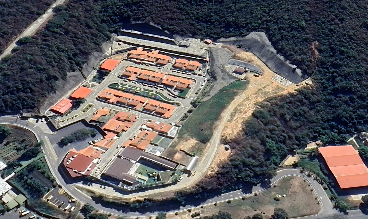
The view of Fuerte Tiuna dated December 22, seen below, shows the site as it looked before the raid:
In the satellite image below, dated January 3, we see the aftermath of the U.S. operation at Fuerte Tiuna, in particular, toward the top of the picture, where U.S. strikes clearly destroyed three long buildings that were part of an original group of six. We can also see significant destruction at an adjacent site, to the left, which is partially surrounded by forest, and is claimed by some unverified sources to have been close to the partly concealed entrance to the Maduro compound.
Reportedly, these U.S.-made Dragoon 300 armored fighting vehicles (essentially a scaled-up version of the V-150 Commando) were among those damaged at Fuerte Tiuna.
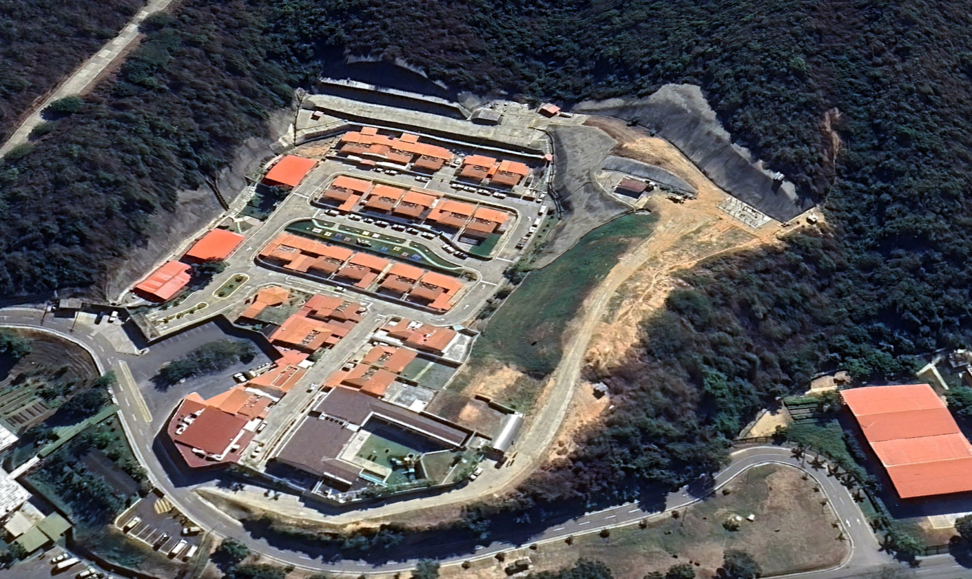
This next image, also from December 22, provides an even closer pre-strike view of the same area:
Next, we can see another close-up view, this time from after the raid, with the three long buildings clearly knocked out. The scale of the damage means that we cannot immediately identify what kind of equipment the buildings contained, although at least some military vehicles can be seen destroyed.
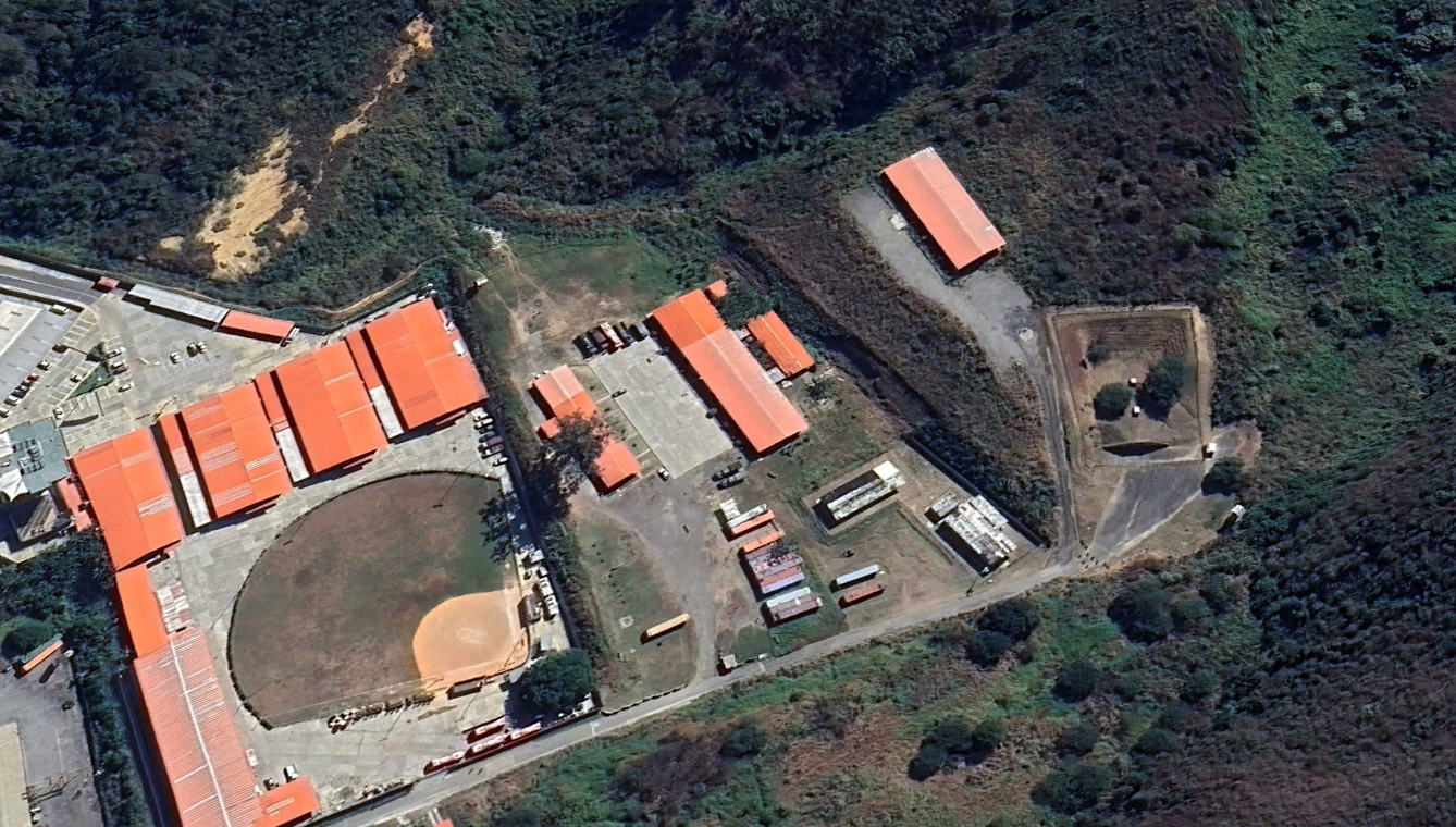
The same area is seen below in even greater detail, in an image dated December 22. At least six green-painted military trucks can be made out, as well as a handful of apparently civilian-looking semi-trailers, and around a dozen apparent cargo containers.
The next image provides a post-strike view of the same area, providing a better idea of the scale of destruction, consistent with an airstrike, presumably involving some kind of submunitions, since no obvious large craters are visible.
Now we move to another part of Fuerte Tiuna, namely the area that is partly surrounded by forest. The area is seen here as it appeared on December 22. The primary targets in this particular location are revealed as the two red-roofed storage buildings, one somewhat longer than the other. The shortened building reveals the presence of what look like relatively long trucks or possibly semi-trailers. These may well be associated with air defense systems, which we know were among the main targets of the U.S. airstrikes.
For comparison, this is the same partly wooded area as it appeared today, with extensive destruction evident. The two red buildings and their contents are entirely destroyed.
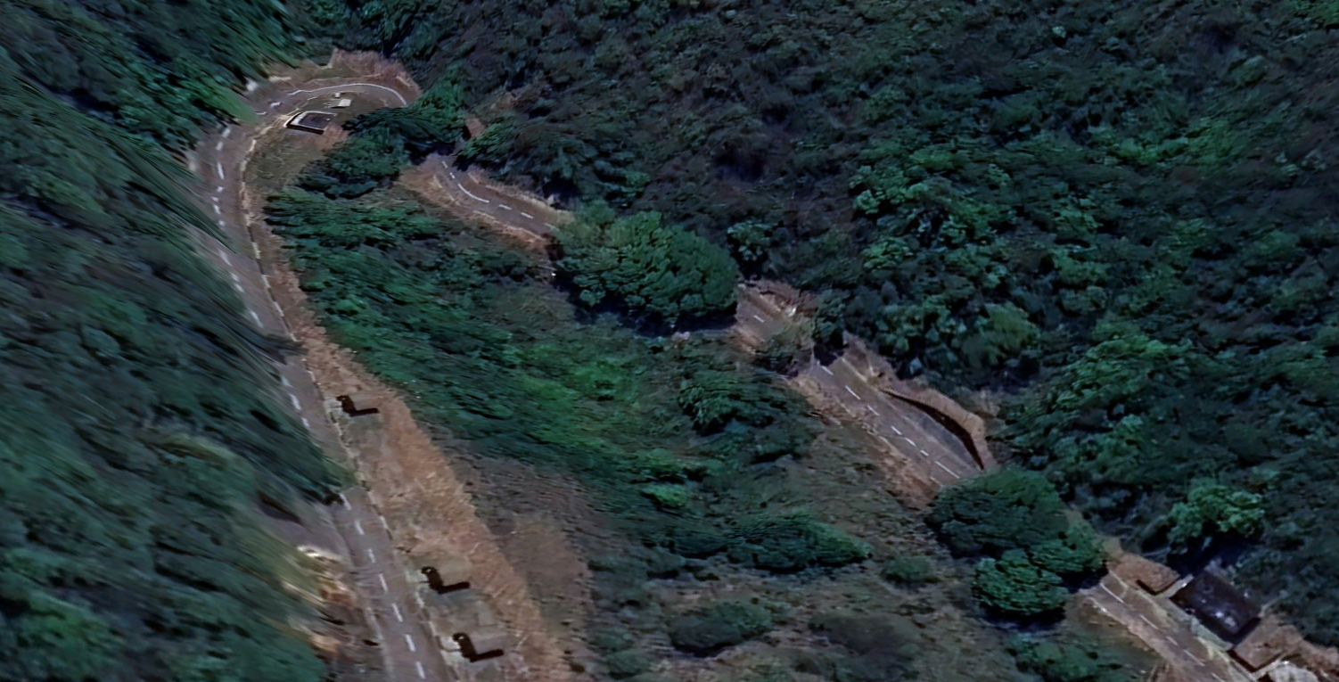
U.S. forces also targeted what are understood to be gate security buildings at the complex, which can be seen below in another image dated December 22. These buildings were located on a bend in the road, in a wooded area. They may also be another entrance into an underground area.
As of January 3, those same gate security buildings are entirely obliterated:
The final image we have received shows Palacio Miraflores, also in Caracas, as it appeared on January 1. This is the head office of the President of Venezuela. It is located on Urdaneta Avenue, in the Libertador Bolivarian Municipality, and is another, less likely option as to where the Venezuelan leader was seized.
The building was among the targets struck by U.S. forces, in line with early reporting of the operation. Soon after it had begun, videos emerged showing armored vehicles in position, protecting nearby roads. In the event, Maduro may well not have been home, but instead located in the presumed safer location at Fuerte Tiuna.
For now, we still await much more information to provide a better understanding of how Maduro was captured, and from where, exactly.
What is already clear is that this was a meticulously planned and extremely complicated operation involving multiple assets and agencies, fought across various domains, with many more facets of it still to be revealed.
Contact the author: thomas@thewarzone.com