Great Plains lighting bolt spanning three states sets shocking record
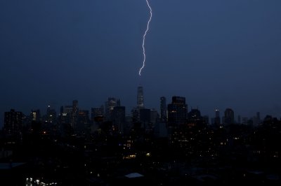
1 of 2 | An image from NOAA’s advanced GOES-16 satellite of the thunderstorm helped verify the record size of a megaflash lightning bolt on October 22, 2017. Photo by NOAA
Aug. 5 (UPI) — A massive lightning bolt that stretched from eastern Texas to just outside of Kansas City, Mo., has been officially recognized as the largest recorded flash by the World Meteorological Organization.
The lightning bolt was generated by a major cluster of thunderstorms that swept over the Great Plains on Oct. 22, 2017, the National Oceanic and Atmospheric Administration announced Monday. Researchers used advanced satellite technology to capture the flash’s enormous span, and they hope it will help them better understand how lightning affects people.
Despite the bolt having a horizontal distance of 515 miles, it was not identified in the original analysis of the thunderstorm and researchers took note of it during a recent re-examination, according to NOAA.
The World Meteorological Organization’s Committee on Weather and Climate Extremes used NOAA’s Geostationary Operational Environmental Satellite, the most advanced satellite technology available, to verify the length of the flash and recognize it as a new record, according to a press release from the organization.
Researchers had previously used data collected by ground-based technology to measure lightning flashes, according to the press release. The use of satellite technology allowed researchers to observe a larger area.
“Over time as the data record continues to expand, we will be able to observe even the rarest types of extreme lightning on Earth and investigate the broad impacts of lightning on society,” Michael J. Peterson, a researcher at the Georgia Institute of Technology’s Severe Storms Research Center and member of the committee, said in the press release.
The lightning bolt’s length is about the same distance between Paris, France, and Venice, Italy, according to the World Meteorological Organization. It would take about eight to nine hours to cover the same distance by car and about 90 minutes for a commercial plane.
The previous record was for a lightning bolt that spanned 477 miles across parts of the southern U.S. on April 29, 2020.
The Great Plains region is known for its large thunderstorms that also give rise to lightning “megaflashes” that extend over expansive distances or have longer durations. WMO Secretary-General Celeste Saulo said in a statement that while “lightning is a source of wonder,” it is also a deadly hazard.
“These new findings highlight important public safety concerns about electrified clouds which can produce flashes which travel extremely large distances and have a major impact on the aviation sector and can spark wildfires,” Saulo said.