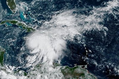
Weakened Hurricane Melissa passing north of Bermuda
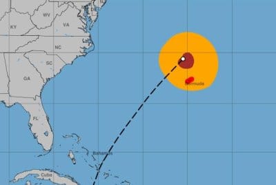
Hurricane Melissa was passing norther of Bermuda early Friday. Image courtesy NOAA
Oct. 31 (UPI) — Hurricane Melissa, now a weakened Category 1 storm, was passing north of Bermuda early Friday after battering the Caribbean over the past few days, forecasters said.
Forecasters said Melissa was at its nearest approach to Bermuda, where a hurricane warning was in effect and hurricane-force winds were being felt.
The eye of Melissa was about 150 miles north-northwest of Bermuda, the National Hurricane Center said in its 2 a.m. EDT update.
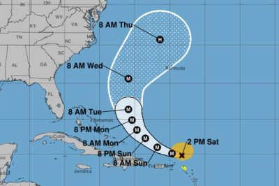
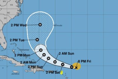
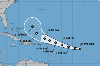
It had maximum sustained winds of 90 mph, a drop of 15 mph from 8 p.m. Thursday. The storm was moving northeast at 40 mph. Earlier in its life cycle, the storm was largely stationary, moving at about 2 mph as it made its way toward a Jamaican landfall Tuesday.
Forecasts had indicated that the storm would pick up speed as it moved away from the Bahamas. It was forecast to become a strong extratropical cyclone near the southeastern tip of Newfoundland on Friday.
Hurricane-force wind gusts were being reported early Friday on Bermuda, as the storm made its closest approach. The outer bands of Melissa could pour an additional 1 to 2 inches of rain over Bermuda through early Friday, while a brief period of heavy rain was considered possible for the southern Avalon Peninsula of Newfoundland on Friday night.
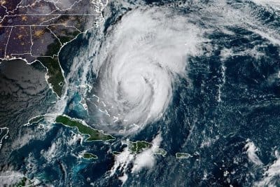
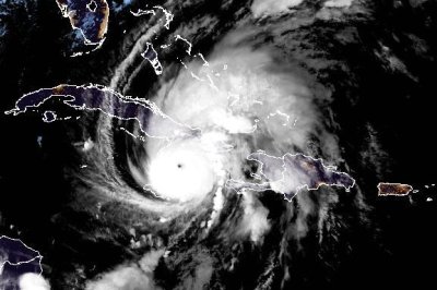
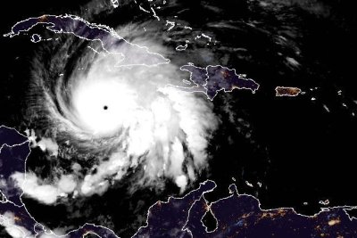
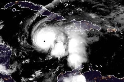
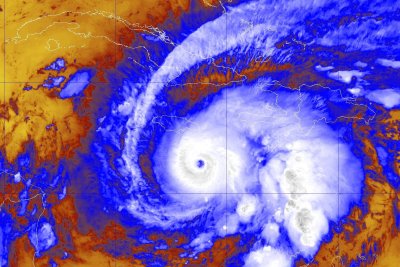
Melissa made landfall in Jamaica on Tuesday at about 1 p.m. as a powerful Category 5 storm, with estimated maximum sustained winds of 185 mph. It was the strongest direct hit on Jamaica since records have been kept in the Atlantic basin. It was also the first storm to make landfall in the Caribbean this season.
The storm lost some strength as it traveled over Jamaica’s western mountains, but maintained major hurricane status as it headed for Cuba. It remained a hurricane when it reached the Bahamas.
Melissa is the 13th named storm and fifth hurricane of the season. The other Category 5 storms in the Atlantic this season have been Erin and Humberto.
In September 2019, Hurricane Dorian had maximum sustained winds of 185 mph and devastated the Bahamian islands, including the Abaco Islands and Grand Bahama, as a Category 5 storm.
The all-time highest sustained wind speed recorded in the Atlantic was Hurricane Allen at 190 mph in August 1980 over the Yucatan Peninsula before weakening to a Category 3 when it struck South Texas.
The most destructive Category 5 storm in the United States was Hurricane Andrew in August 1992, causing $27.3 billion in damage. Hurricane Michael, also a Category 5 storm, struck the less-populated Florida Panhandle in October 2018.
Hurricane Gilbert struck Jamaica in 1988 as a Category 3 storm.