

The tourist boats that typically navigate Kenya’s renowned Lake Naivasha have recently taken on a new role: rescuing hundreds from inundated homes.
Though the lake’s water level has been increasing for more than a decade with repeated flooding, residents of the modest Kihoto district are stunned by this year’s unprecedented scale.
“It hasn’t happened like this before,” said resident Rose Alero.
According to local officials, the Rift Valley lake has advanced an unprecedented 1.5km (about 1 mile) inland.
“People are suffering,” said Alero, a 51-year-old grandmother, noting that many neighbours have fallen ill.
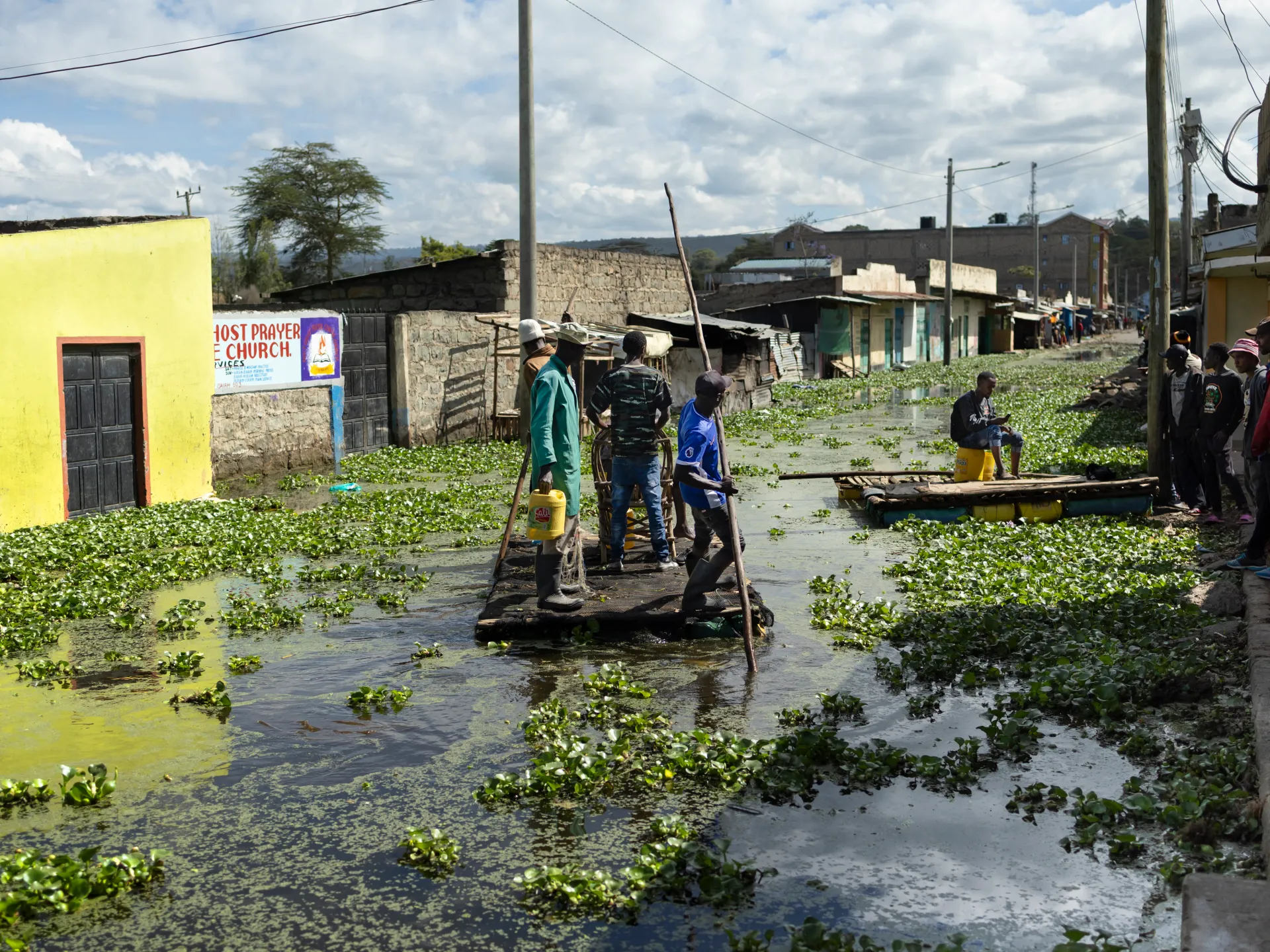
In her home, water reaches waist height, while throughout the district, toilets are overflowing.
“People are stuck … they have nowhere to go.”
The devastation is widespread: hundreds of homes are completely underwater, churches are destroyed, and police stations are submerged, surrounded by floating vegetation.
During one sudden water surge, children evacuated a school on improvised rafts.
Joyce Cheche, Nakuru County’s disaster risk management head, estimates 7,000 people have been displaced by the rising waters, which also impact wildlife and threaten tourism and commerce.
The county has provided transport assistance and implemented health measures, Cheche said, though financial compensation has not been offered yet.
Workers in the crucial flower export sector are avoiding work, fearing cholera and landslides.
She also highlighted the danger of encounters with the lake’s numerous hippos.
“We didn’t see it coming,” Cheche admitted.
At the lake’s edge, bare acacia trunks that were once lush now stand submerged in waters advancing about 1 metre (3.3 feet) daily.
This phenomenon affects other Rift Valley lakes and has displaced hundreds of thousands.
Numerous studies primarily attribute this to increased rainfall driven by climate change.
However, Kenyan geologist John Lagat, regional manager at the state-owned Geothermal Development Corporation, points to tectonics as the main cause, noting the lakes’ position along a major geological fault.
When English settlers arrived in the late 19th century, the lake was even larger before shifting tectonic plates reduced it to just 1km (0.6 miles) in diameter by 1921.
Subsequent tectonic movements increasingly sealed underground outflows, trapping water, Lagat explained, though he acknowledged that increased rainfall and land degradation from population growth also play a “substantial” role in flooding.
“We are very worried,” said Alero from her flooded home, dreading the upcoming rainy season.
“We can’t tell what will happen.”