Hidden Devon town tourists often skip but locals love with coastline of secret coves and historic funicular
DEVON is one of the most popular counties in the UK to visit for a staycation – so when looking at where to explore it can be hard to find somewhere that only locals know about.
Nestled within the coastline, between Dawlish and Torquay, you’ll find Babbacombe.
While it is often skipped for its larger neighbours on the English Riviera, Babbacombe deserves a spotlight of its own.
What used to be just a humble fishing village in the 16th century, has turned into a much-loved local gem.
In records, the area was previously known as ‘Babbecumbe’ meaning ‘Babba’s Valley’ and by 1775 there were only a few cottages littered across the area.
In the late 19th century, John ‘Babbacombe’ Lee survived three attempts to hang him at Exeter Prison for a murder he had committed in Babbacombe.
Read more on travel inspo


He became known as ‘the man they could not hang’ and has become a story told by locals.
In the Victorian era, the region grew in popularity for tourists as it was recognised for its dramatic cliff scenery.
The small town is home to Babbacombe Beach, which is made up of shingle and sits below the towering red cliffs that form Babbacombe Downs.
One recent visitor said: “Babbacombe Beach is a very peaceful, attractive place; the views from the top of the cliff are stunning.”
At Babbacombe Downs, you’ll find a promenade which is thought to be the highest in England, boasting amazing views across the bay.
And from there you can head to Oddicombe Beach, by walking down a picturesque lane – but be warned it is rather steep.
Alternatively, you can catch the funicular down to the beach.
One recent visitor said: “Oddicombe beach is a wonderful suntrap with a micro climate of its own.”
If with little kids, I would recommend taking the Babbacombe Cliff Railway, which has been operating for 100 years, this year.
The funicular runs from Babbacombe Downs to Oddicombe Beach, which neighbours Babbacombe Beach.
The Babbacombe Cliff Railway was built in 1926 and over that time has shuttled hundreds of holidaymakers to and from Oddicombe Beach.
The funicular did have to close for some time though between 1941 and 1951 due to wartime restrictions.
The carriages were later replaced in the early 2000s and painted in the original maroon and cream colours, with Torbay’s coat of arms on either side.
I remember as a child using the 200-metre cliff railway, with it feeling like stepping back in time, as if I was entering a part of history that I had been learning in school.
Nothing quite compares to the views either, the steepness of the track nestled between red sandstone and grey Devonian limestone 73metre-high cliffs means you can see the beach below with nothing disturbing the picture.
Because the railway and beaches below are hidden in the cliffside, not many tourists know about it.
It’s also away from the main hubbub of the main towns on the coastline.
If you’re wanting somewhere special to eat, head to Babbacombe Bay Cafe.
They serve freshly made toasties with salad and warming cups of tea that are ideal after being buffeted by the coastal winds.
You can also take a walk to the high street, which is about three minutes from the Downs.
One place to visit here is Bygones, a museum with a full-scale replica Victorian street.
The museum has over 2,000 artefacts to discover and your four-legged friend can even join you on a visit.
Tickets cost from £13.95 per adult and £9.75 per child.
Another nearby attraction is Babbacombe Model Village, which is over 60 years old.
Spread across four acres, visitors can feel like a giant as they explore hundreds of scenes depicting British life, including iconic landmarks.
I used to visit once or twice a year growing up and particularly remember going at Christmas when all of the park’s models become covered in ‘snow‘.
The attraction has a sense of humour too, great for keeping parents entertained.
For example, there’s an ‘unaffordable housing development’ and a celebrity mansion with the Mutant Ninja Turtles and The Incredibles family playing in the garden.
Included in your admission ticket, you also get the chance to watch a film in the attraction’s 4D cinema.
It was always a laugh being jolted around in your seat as puffs of air and water were sprayed at you.
Every Friday evening from April to October, the whole park is illuminated with multi-coloured lights as well.
Tickets cost £21.95 per adult and £17.95 per child.
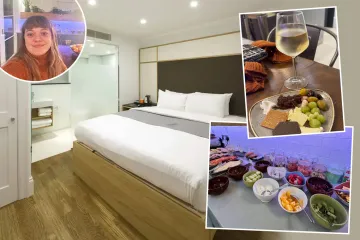
If you are looking for somewhere to stay, there are several options.
For example, you could stay at the Babbacombe Palms Guest House from £65 per night.
Fancy something a little more luxury? Then opt for the Cary Arms Hotel and Spa costing from £195 per night.
For more places to explore in Devon, here are the top 15 boozers in the county.
Plus, there’s a ‘wonderfully unspoilt’ seaside town in Devon and it is one of the UK’s best hidden spots.