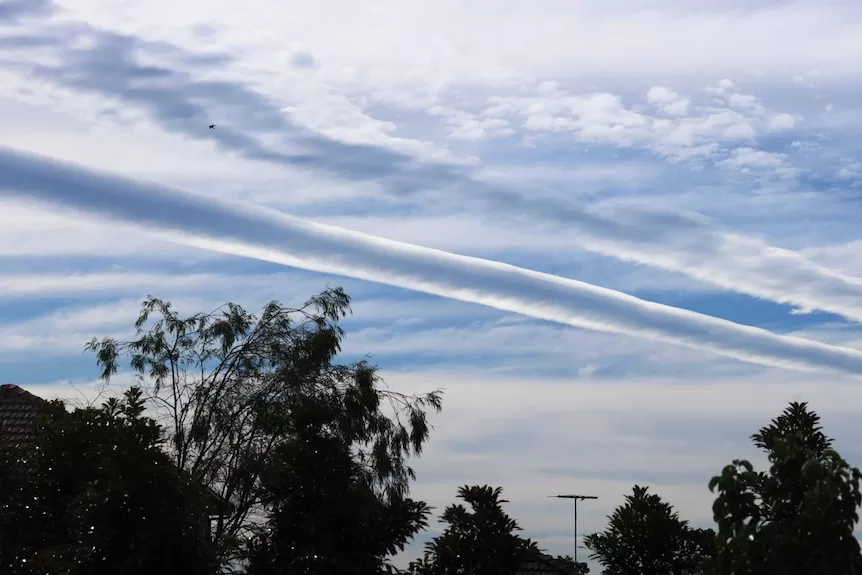
An unusual and rarely seen cloud formation has highlighted the skies across eastern NSW.
A series of roll clouds materialised roughly around 11:30am before moving east and dissipating around 3pm on Tuesday.
The formation stretched more than 300km and was seen on satellite extending from the Southern Highlands all the way to Nelsons Bay in the north, and even further.
Residents across locations in Greater Sydney, the north coast and south coast shared photos of the phenomenon on social media.
“This cloud has been slowly rolling its way across Sydney for the last couple of hours. Must be at least 100km long. Amazing,” wrote one person on X, formerly known as Twitter.
“Sydney clouds currently going wild out here,” said another.
Many questioned what the clouds actually were.
Roll clouds are long tube-like clouds which are rare across most of the world.
What separates them from other horizontal clouds, for example a shelf cloud on the leading edge of a thunderstorm, is roll clouds are detached from other cloud features.
Roll clouds form when wind shear across a horizontal boundary leads to uplift and cloud formation – but confined to a shallow vertical slab of air.
This very specific prerequisite for development is why roll clouds are rarely seen in most regions.
On exception though is the famous and regular roll cloud, named the Morning Glory, found over Cape York Peninsula.
It forms when sea breezes collide from the Gulf of Carpentaria and northern Coral Sea
Posted
