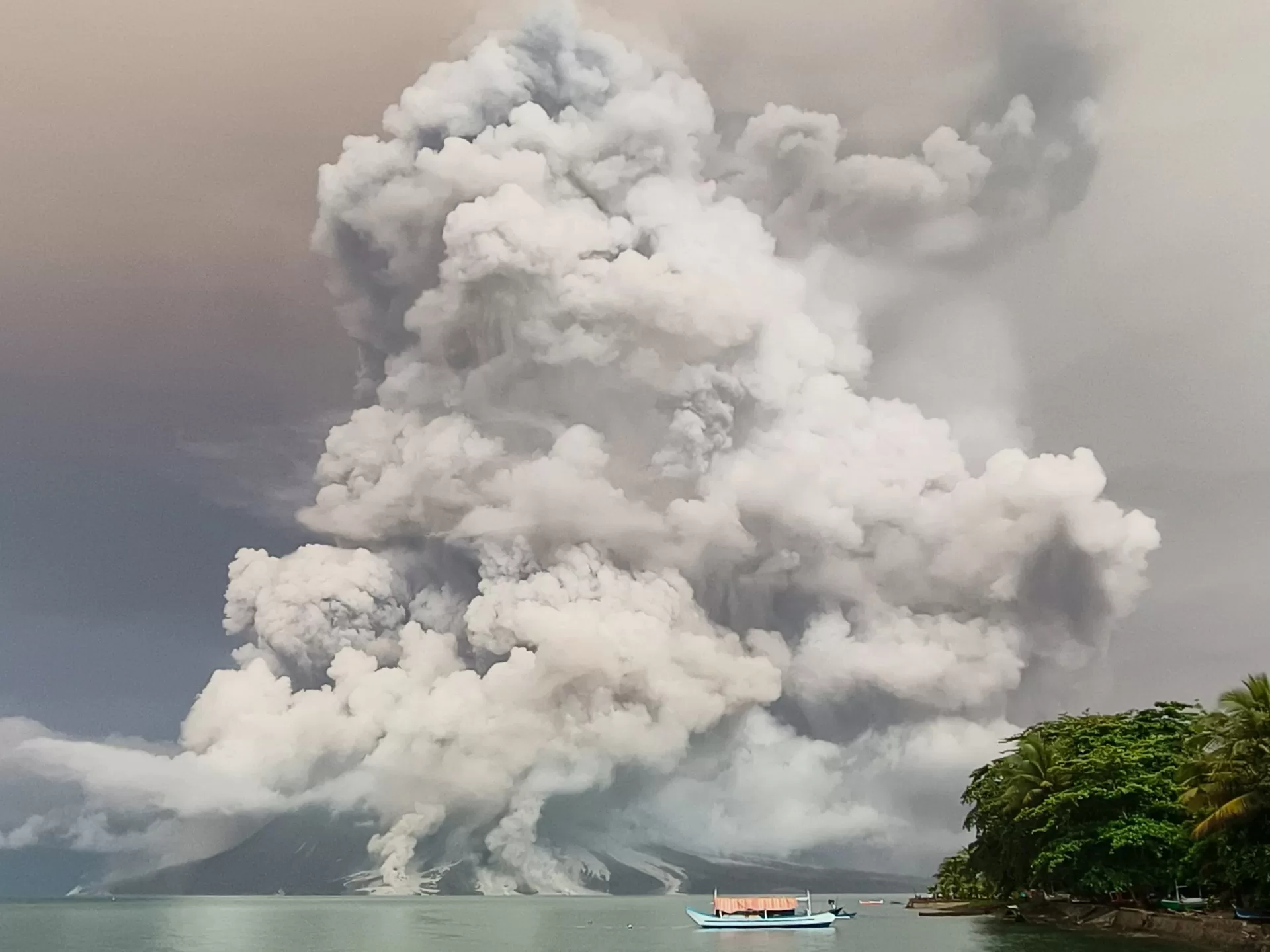
Mount Ruang in the central province of North Sulawesi sent thick clouds of ash more than 5km (3 miles) into the sky.
Officials said the volcano in the archipelago’s North Sulawesi province erupted at least three times on Tuesday, prompting fears debris might fall into the sea and cause a tsunami.
Footage shared by Indonesia’s disaster mitigation agency (BNPB) showed strikes of lightning flashing above Ruang’s crater as fiery red clouds of lava and rocks were thrown into the air.
The agency said that all 843 residents living on Ruang Island, where the volcano is located, had been moved to Manado, the provincial capital about 100km (62 miles) away. Some 12,000 people from the neighbouring Tagulandang Island are being evacuated to Siau Island further north with two ships deployed to help with the process.
Rosalin Salindeho, a 95-year-old Tagulandang resident, spoke of her fears when Ruang erupted after arriving in Siau.
“The mountain exploded. Wow, it was horrible. There were rains of rocks. Twice. The second one was really heavy, even the houses far away were also hit,” she said.
Indonesia’s meteorological agency (BMKG) shared a map on Wednesday morning that showed volcanic ash had reached as far as Borneo, the island Indonesia shares with Brunei and Malaysia.
Indonesian air traffic control agency AirNav Indonesia said seven airports had been forced to close including in Manado and the city of Gorontalo.
Malaysia Airlines said the ash led to the cancellation of some flights to and from airports in the Borneo states of Sabah and Sarawak, with travel dependent on the weather conditions. North Sulawesi is in the central part of the Indonesian archipelago.
Julius Ramopolii, the head of the Mount Ruang monitoring post, said the volcano was still billowing ash and smoke above the crater on Wednesday morning.
“The volcano is visibly seen, the plume of smoke is visible, grey and thick, and reached 500-700 metres (2,300 feet) above the crater,” he said in a statement.
He said the alert level remained at its highest of a four-tiered system and called on residents to remain outside a seven-kilometre exclusion zone declared by the authorities.
Indonesia sees regular earthquakes and volcanic eruptions as a result of its position on the Pacific “Ring of Fire” where multiple tectonic plates meet.
Mount Ruang recorded a series of eruptions earlier in April that also led to evacuations and disruption to aviation amid fears of a tsunami.
In 2018, the crater of Mount Anak Krakatoa, between Java and Sumatra islands, partly collapsed during a major eruption that sent huge chunks of the volcano sliding into the ocean, leading to a tsunami that killed more than 400 people and injured thousands more.
