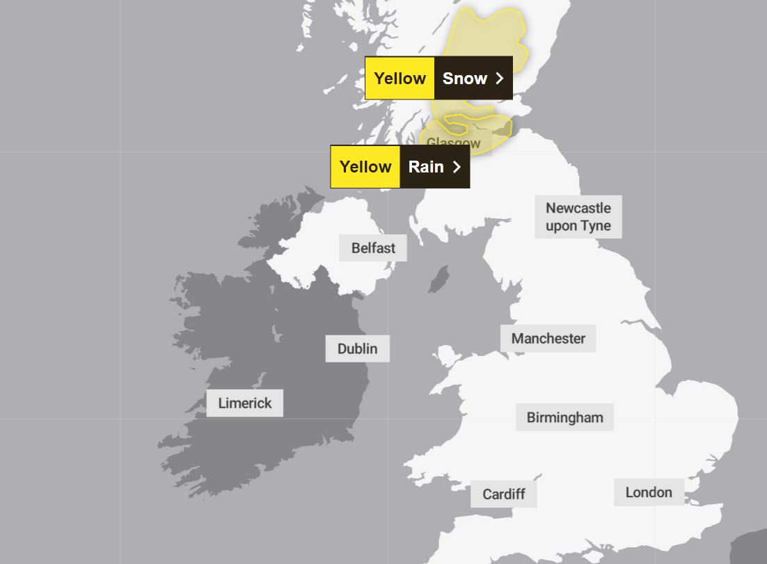
The Met Office has issued four yellow weather warnings across Friday and Saturday covering large parts of the UK.
It comes as an area of low pressure, named as Storm Kathleen by the Met Office yesterday, arrives.
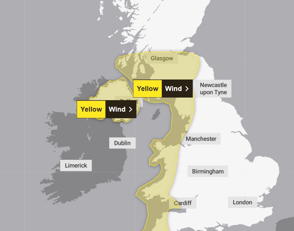
Forecasters say Kathleen will bring strong winds to Ireland and western areas of England, Wales and Scotland, as well as all of Northern Ireland, from 8am until 10pm on Saturday.
It will arrive from the South West with “unseasonably windy” weather and heavy rain.
The weather system is likely to cause gusts of up to 60mph to 70mph in exposed areas along the west coast of England and Scotland on Saturday, and 50mph more widely.
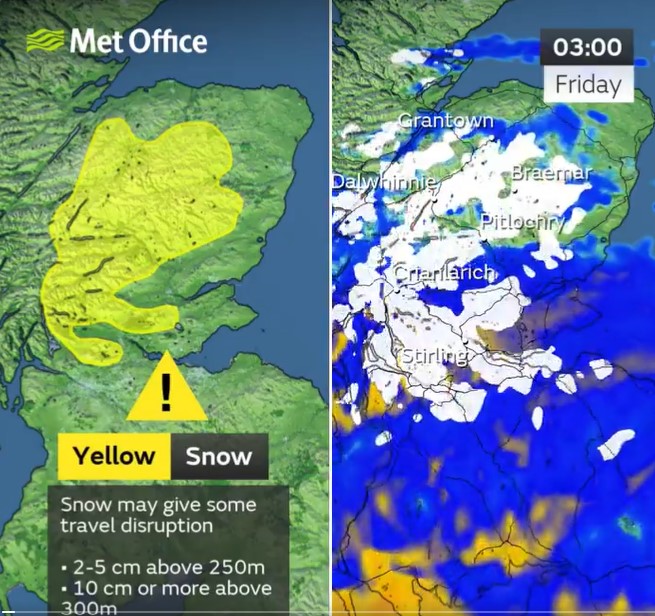
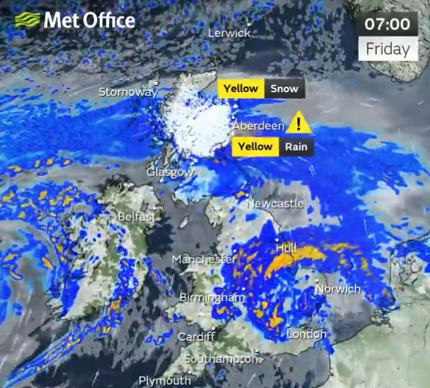
A notice for snow has been issued across northern Scotland which reaches down to Stirling on Friday from 3am until 9am.
Met Office meteorologists predict: “Snow is likely to cause some travel disruption on Friday morning, particularly on higher routes.
“Some roads and railways likely to be affected with longer journey times by road, bus and train services.”
There could be up to 10cm of snow in places above 300 metres but “2-5 cm of snow is expected fairly widely above 250 metres, with a chance that a few places within the warning area at lower levels could see a few centimetres settle,” said Met Office meteorologist Greg Dewhurst.
Meanwhile, a yellow weather warning for heavy rain is covering Glasgow, Edinburgh and surrounding areas from 2am until 9am.
“Heavy rain on Friday morning may cause some travel disruption,” said forecasters.
There is also a “chance of flooding” to a few homes and businesses.
FLOODING
Mr Dewhurst added: “We have got heavy rain pushing north and east across the country through Thursday night and into Friday morning.
“It will start to clear Friday morning but leaves a legacy of showers, and then perhaps some longer spells of rain as we go through the day across the north of the UK.”
Meanwhile, there will be some sunny spells in south-eastern parts of England, with figures reaching up to 18C.
Moving into Saturday, an alert for wind stretches from Glasgow all the way down the west coast of Britain, down to Wales and to the tip England’s south west coast.
It also extends to the whole of Northern Ireland.
“Winds pick up further through Friday evening, overnight into Saturday, where as we start Saturday morning we’ll see widely across the country gusts of 30-40mph,” added Mr Dewhurst.
“In western parts of the UK, inland, we could see gusts of 40 to 50mph and then around the western coast of the UK we could see gusts of sort of 60-70mph.”
The Met Office website stated: “A deep area of low pressure will bring a spell of very windy weather to western areas this weekend.”
It’s likely the weather will spark some travel chaos with cancelled and delayed services.
Roads, railways and ferry services may be affected, while bridges could be closed.
Those affected may also experience some power cuts and service shortages.
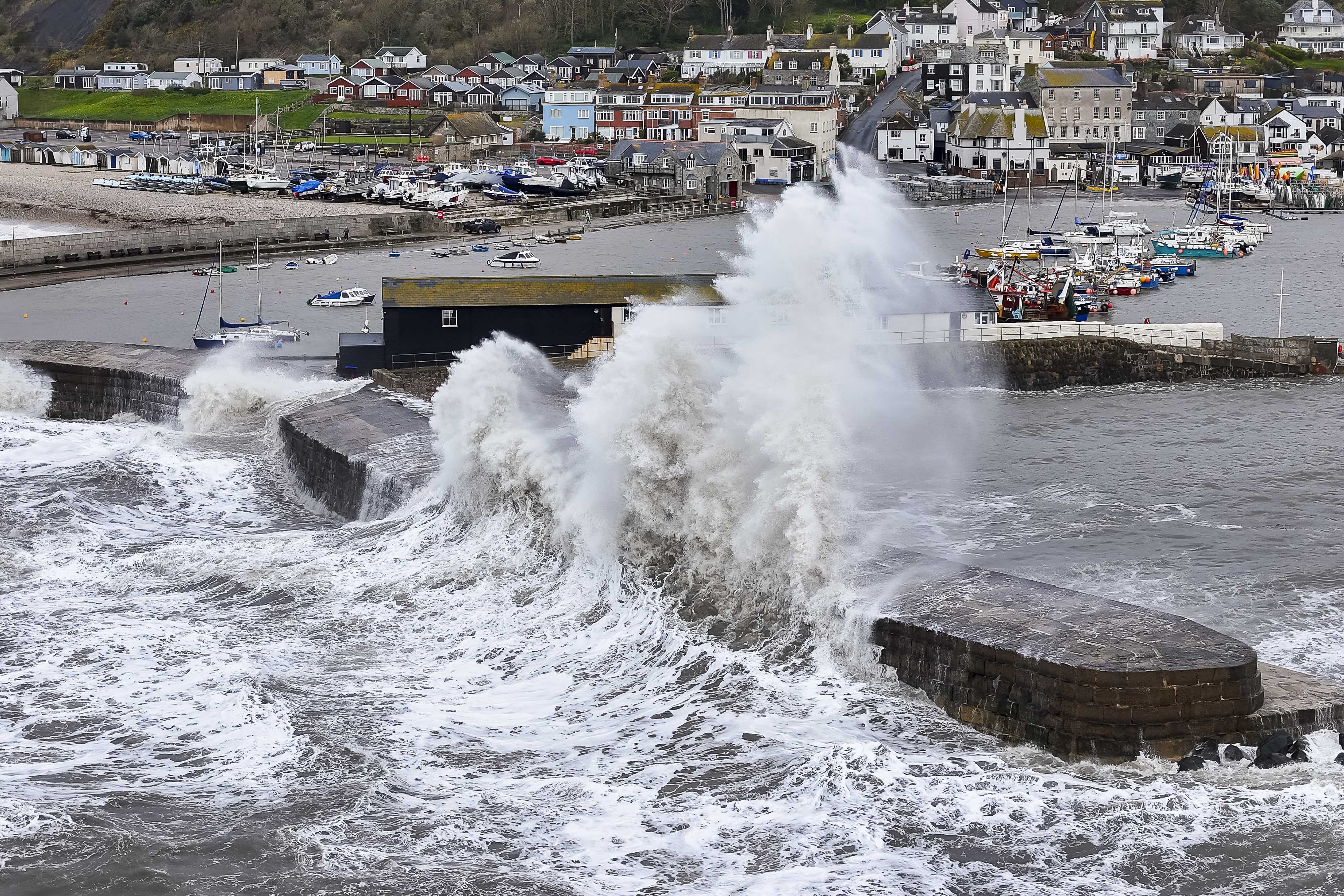
“There is a small chance that injuries and danger to life could occur from large waves and beach material being thrown onto sea fronts, coastal roads and properties,” Met Office meteorologists added.
Kathleen is the first storm named by the Met Office or Irish weather service Met Eireann since Jocelyn on January 22.
It comes as the Portuguese meteorological service raised the alarm over Storm Olivia, which is expected to arrive first.
Britain will be hit by the tail end of Storm Olivia tomorrow before the second storm strikes on Saturday, said forecasters.
Met Office forecast
This Evening and Tonight
- Rain, heavy at times,will move northwards tonight, turning to snow over hills in central and northern Scotland.
- Drier with clear spells and a few showers following in the southwest later Rather windy for most with gales in the west.
Friday
- Rain clearing eastwards, though lingering across parts of the north, with further hill snow here.
- Warm sunshine developing across England and Wales, though with showers for a time. Generally windy.
Outlook for Saturday to Monday
- A windy day on Saturday, especially in the west, with rain clearing to showers.
- Sunny spells and blustery showers on Sunday, with perhaps a longer spell of rain on Monday.
