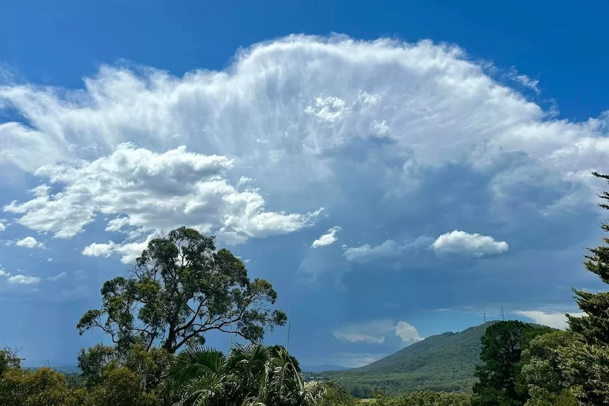
This week’s weather across Australia almost perfectly encapsulates the summer so far — skies are rumbling with thunder across the eastern states, a tropical low (possibly a cyclone) will bring heavy rain and flooding to the tropics, while WA suffers through a seemingly endless heatwave.
For southern states, the prevailing weather will result from predominantly easterly winds, a moist direction for Queensland and NSW off the warm Coral and Tasman seas, while for WA, easterlies bring hot and dry weather off the western deserts.
The stagnant pattern for the remainder of the week follows a tumultuous Tuesday across Victoria that saw catastrophic fire dangers, wild thunderstorms generating wind gust to 122kph and a gusty cool change that dropped Geelong’s temperature 12 degrees in 25 minutes.
Humidity and wet weather returning to NSW and Queensland
The trough responsible for Victoria’s wild weather on Tuesday will sweep through NSW today, reaching Sydney around lunchtime.
A few pockets of severe storms are likely along the coast and eastern ranges from the Illawarra to the Hunter, with the risk of hail, gusty winds and flash flooding – most likely for inland regions, including western suburbs of Sydney.
The most intense storms will then shift to northern NSW and western Queensland on Thursday, where pockets of heavy rain are again possible as humid air off the Coral Sea and Tasman seas feed well inland.
Showers and thunderstorms will then continue Friday across much of eastern Australia, with moderate falls possible around Sydney and Brisbane, ahead of a general easing of activity through the weekend.
Most of eastern NSW, along with central and southern Queensland can expect at least 20mm of rain for the remainder of the week, however, heavy summer downpours from thunderstorms will bring localised heavier falls in excess of 50mm.
Loading…
Monsoon return increases cyclone risk
Communities surrounding the Gulf of Carpentaria will be closely watching a developing tropical low this week, which has the potential to become the third tropical cyclone to make landfall this wet season.
The low formed on Sunday over the western Top End and has already dumped more than 300mm on Darwin since the start of the weekend.
Weather models predict the system will drift east into the very warm Gulf of Carpentaria later today, opening up the opportunity for further development through coming days.
The Bureau currently estimates the chance of intensification into a cyclone at 30 per cent — a prediction matched by one the world’s leading forecasting models whose “cyclone strike probability” below also shows a probability at about 30 per cent.
The general consensus, irrespective of the system’s strength, is a turn to the right during the next 48 hours on a trajectory towards the southern Gulf coast where landfall is likely late Friday or Saturday.
The system is particularly concerning for north-west Queensland where rivers are still in flood following ex-Tropical Cyclone Kirrily earlier this month.
A track deep into the Gulf towards Cape York Peninsula before curving southwards could bring widespread falls of 200-500mm from around Weipa to the NT border, leading to renewed flooding and isolation of communities as roads become submerged.
The low could then bring flooding to the central NT from Saturday as it continues a right-hand turn back towards the west.
Loading…
WA heatwave to bring prolonged 40 degree heat
This summer has been one of the hottest on record for WA, and yet another heatwave is forecast to spread down the west coast this week.
The prolonged spell of above average temperatures is due to a dome of hot sinking air, called an upper high, which already brought maximums in the mid-40s on Tuesday in the Pilbara and Gascoyne.
The scorching air mass will drift south during the coming days, culminating in Perth reaching 42 degrees Celsius on Thursday, more than 10 degrees above their February average and the seventh day this summer over 40C.
The high temperatures will combine with low humidity to cause “high” to “severe” fire dangers this week, a threat enhanced further by dry lightning on Thursday and Friday over many western regions, which could spark up new blazes.
The west coast of WA will welcome a milder westerly change on Friday, but relief will be temporary as sweltering hot easterly winds return to Perth during the weekend — potentially the eighth 40C day of summer on Sunday.
Perth’s average maximum so far this summer is sitting at 32C, around two above the long-term average and in the top three hottest summers on record.
