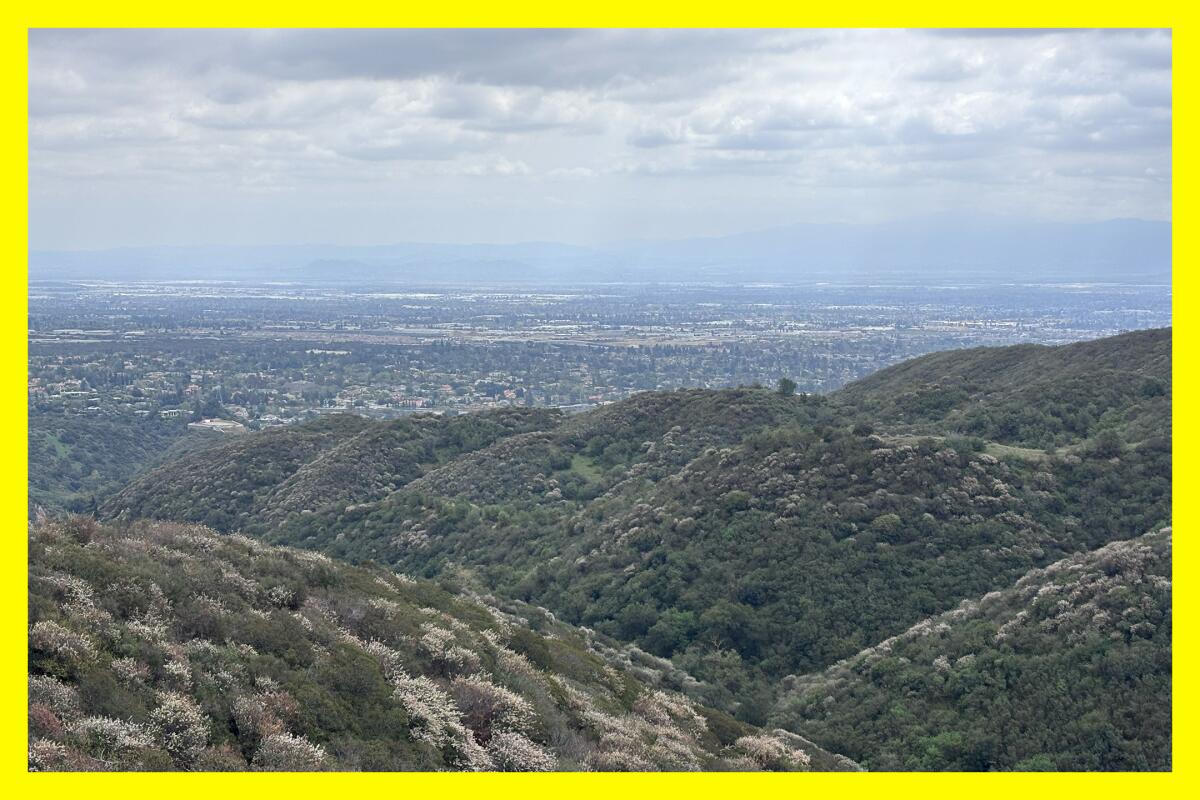
My friends promised me that our hike through Claremont Hills Wilderness Park would feature something I didn’t expect — a superbloom.
How could this be? Wildflower experts had said not to expect anything major this spring. As we headed up, Machiko and Max, carrying their 1-year-old in a hiking backpack, pointed to the white blooms of the hoaryleaf ceanothus that blanketed the hillsides. “How is this not a superbloom?” they both asked me.
Newsletter
You are reading The Wild newsletter
Sign up to get expert tips on the best of Southern California’s beaches, trails, parks, deserts, forests and mountains in your inbox every Thursday
You may occasionally receive promotional content from the Los Angeles Times.
Well, there’s no one definition of what a superbloom is, although it’s a term often used to describe thousands of wildflowers concentrated in one area. That said, why not include such vivid expressions from our native shrubs and trees?
I was so heartened to see dozens, if not hundreds, of ceanothus shrubs bursting with white flowers throughout the park, along with other healthy native plants and trees. I’d love you to experience that same joy. Spring is here, dear Wilder, and there are so many beautiful places where that’s apparent. Here are three hikes to enjoy the blessings of the season.
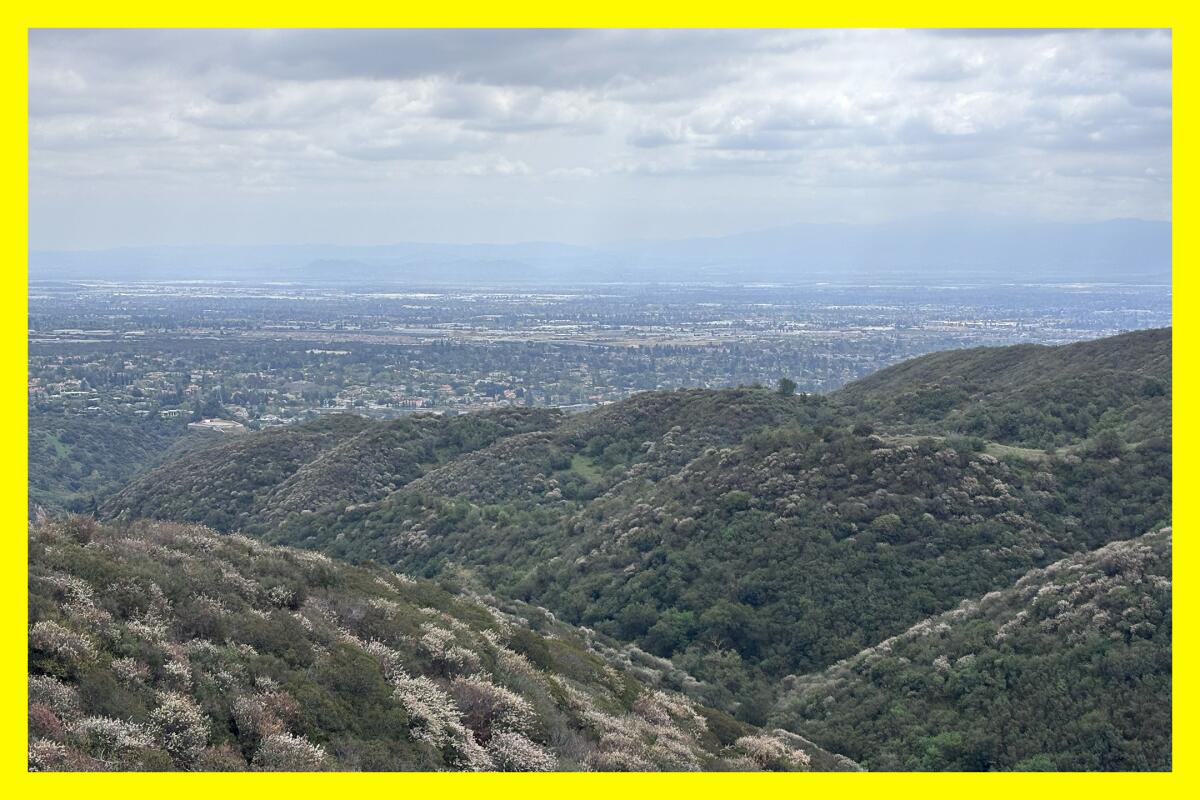
The view of Claremont and surrounding cities from the Cobal Canyon Fire Trail.
(Jaclyn Cosgrove / Los Angeles Times)
1. Cobal Canyon Trail to West Fork Palmer Trail
Distance: 6 miles (though can vary)
Elevation gained: 1,350 feet
Difficulty: Moderate
Dogs allowed? Yes
Accessible alternative: Thompson Creek Trail
As someone who loves the Mt. Baldy area, I’ve driven through Claremont several times. Until Saturday, I’d spent very little time hiking there. My aforementioned pals introduced me to an absolute treat!
The Claremont Hills Wilderness Park is about 2,500 acres of public land with several trails featuring a varied landscape. To see the most blooming ceanothus, I’d recommend taking the Cobal Canyon Trail north and then east. Then, head south on the West Fork Palmer Trail, which (unfortunately) ends at a short private road. Taking this route does mean you’ll go up, down, up, down, but I found it spectacular thanks to the views and plant life.
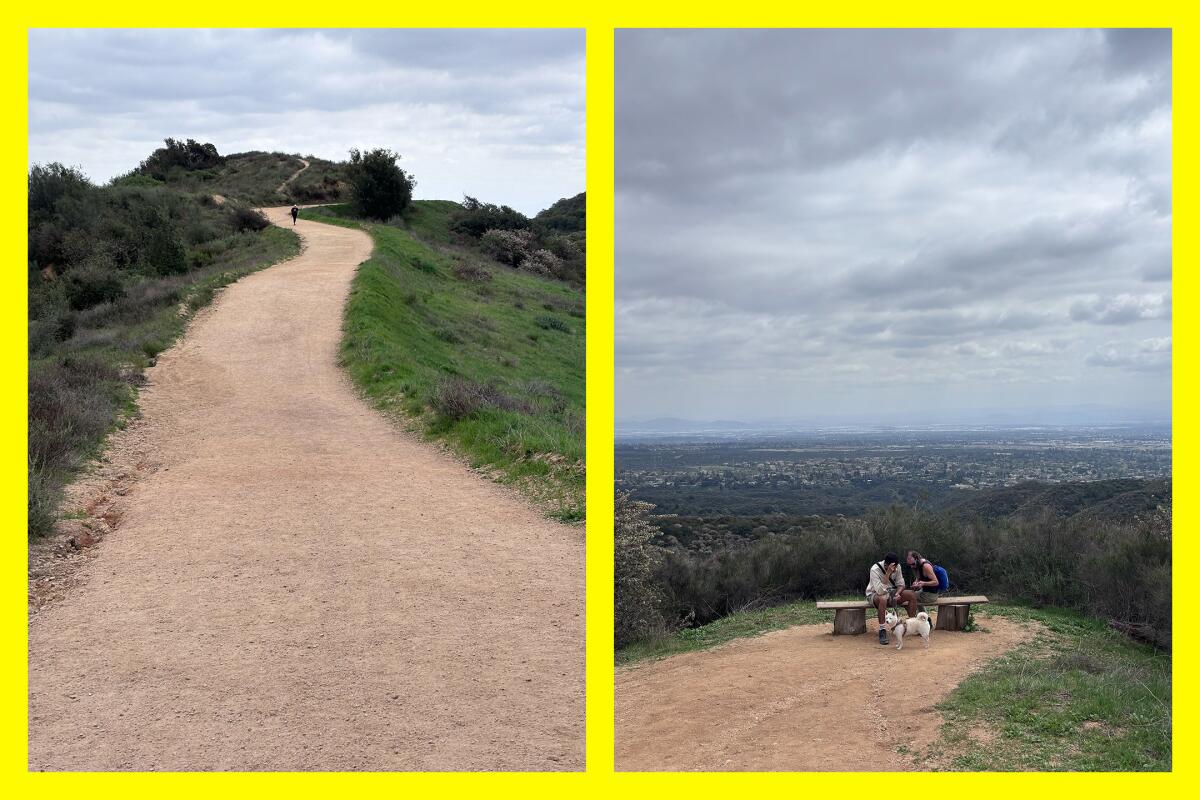
(L) A bit of an incline on the Cobal Canyon Fire Trail. (R) Hikers rest with their pooch near the shade structure on the Cobal Canyon Fire Trail.
(Jaclyn Cosgrove / Los Angeles Times)
Another option is to take the less intense loop up Cobal Canyon Trail and then west toward the Johnson’s Pasture Trail south to the Burbank Trail, which will take you back to where you started. There will still be some ceanothus blooms on this path, but not as dramatic as the other route. There’s a nice shade structure and lookout point here. We ate snacks there and watched the baby roll around in the grass.
The accessible alternative is the Thompson Creek Trail, which features several entry points and is bursting with birds and tall shade trees. Per the city of Claremont, this “2.8-mile trail is accessible from many points along its route including Base Line Road, Higginbotham Park, North Indian Hill Boulevard, several cul-de-sacs and Pomello Drive.”
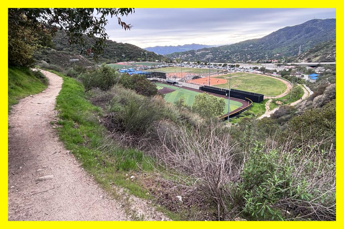
The Glendale Sports Complex and Verdugo Mountains from the Catalina Verdugo Trail.
(Jaclyn Cosgrove / Los Angeles Times)
2. Catalina Verdugo Trail
Distance: 2-mile loop
Elevation gained: 550 feet
Difficulty: On the easier end of moderate
Dogs allowed? Yes
Accessible alternative: Mountain Do Trail
The Catalina Verdugo Trail is a great option for either a quick solo hike or fun jaunt with a friend to catch up without huffing and puffing between sentences. The trail meanders around the Glendale Sports Complex in the San Rafael Hills above Glendale. It’s not an escape from urban life, but it is well-maintained and has much to appreciate.
I hiked the trail on a Sunday afternoon and first parked near where athletes were playing softball. I soon moved my car out of fear of fly balls.
The hike starts near the complex’s entrance and heads east, featuring benches at just under half a mile and at three-quarters of a mile. It has multiple shady spots covered by a lush green tree canopy. Local fauna includes laurel sumac, lemonade berry, oak trees, toyon and more blooming ceanothus. I ran my fingers through some sagebrush, taking in its zesty citrus scent. And, at one point, I spotted fuchsia flowered gooseberry, which look like tiny red lanterns hanging on the vine.
At 1.25 miles, you have the choice to continue up to the Ridge Motorway, or you can go down .7 of a mile back via the Catalina Verdugo Trail. I was curious about the Ridge Motorway, so I headed up, where I was soon greeted with a view of the ocean. The Ridge Motorway continues on and connects with the Descanso Motorway and several other trails.
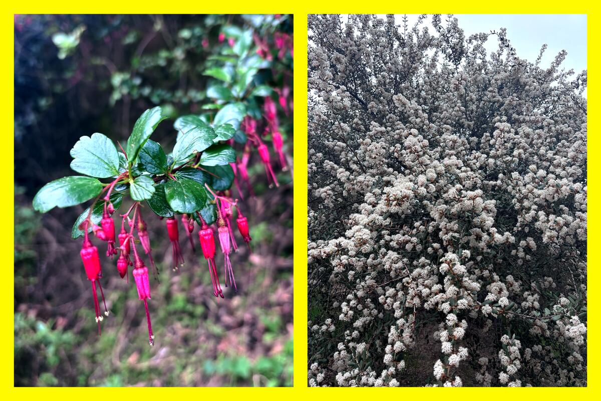
(L) A fuchsia flowered gooseberry on the Catalina Verdugo Trail. (R) A hoaryleaf ceanothus blooming along the Catalina Verdugo Trail.
(Jaclyn Cosgrove / Los Angeles Times)
This trail won’t win a “quiet trail” award, but it’s still a great spot to appreciate native plants and get a little hike in. I didn’t mind the cheering of sports teams, but I did find the noise pollution from the 2 Freeway quite loud. I don’t generally endorse headphones on the trail for safety reasons, but I wouldn’t fault someone for wearing one AirPod. Do leave one ear unhindered, though, to ensure you can hear other hikers, bikers and, hey, the gentle tweeting of a wrentit or house wren, which brought me joy as their song reached me through the roar of nearby engines.
The accessible alternative is the Mountain Do Trail that runs around the border of the sports fields. You can extend your journey beyond the Mountain Do Trail, which I drew out via CalTopo here. It’s overall a wide path with a gentle slope and a few picnic tables where it’d be nice to take a break and journal, eat snacks and enjoy the scenery.
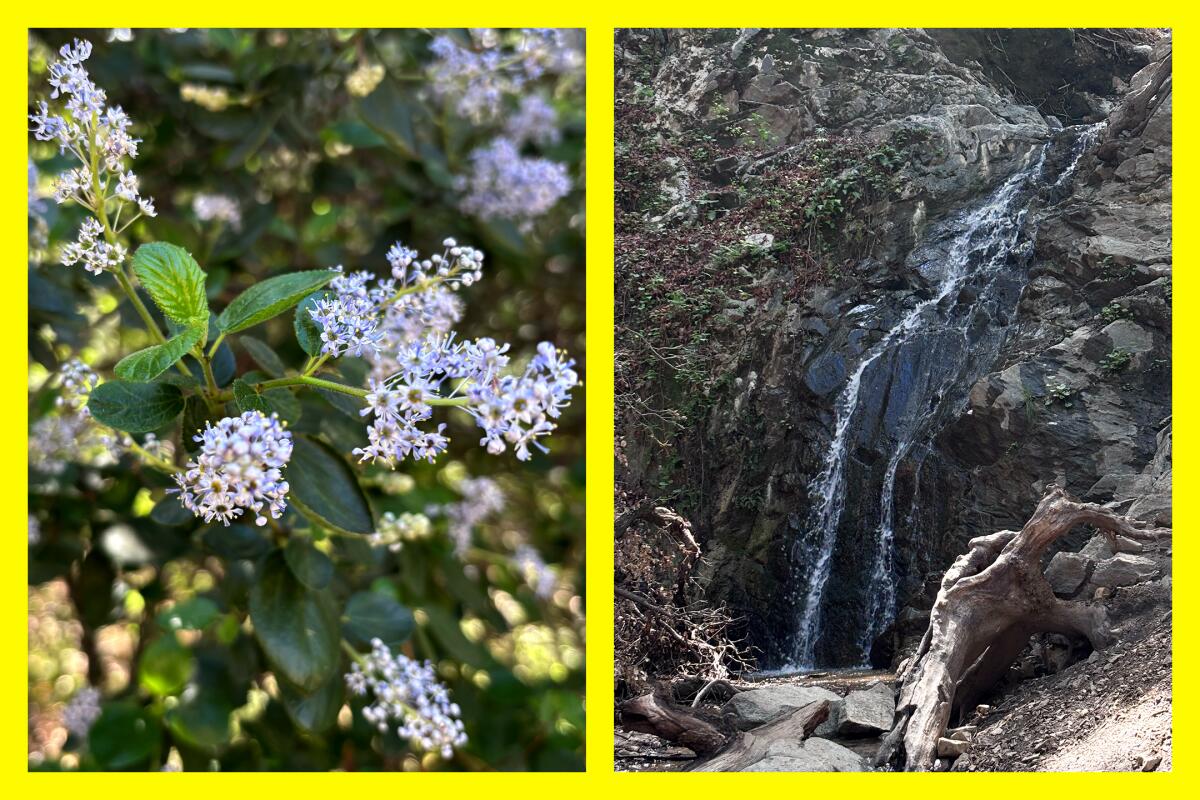
(L) A light purple ceanothus bloom. (R) The short waterfall at Placerita Canyon State Park.
(Jaclyn Cosgrove / Los Angeles Times)
3. Canyon and Waterfall Trails
Distance: 4.7 miles out and back
Elevation gained: 650 feet
Difficulty: Moderate
Dogs allowed? Yes
Accessible alternative: Placerita Nature Center Loop
This journey merges two trails, the Canyon and the Waterfall Trails at Placerita Canyon State Park. One of the least visited public recreation areas managed by L.A. County, the park features eight paths spanning more than 12 miles.
The Canyon Trail, a 3.6-mile out-and-back, runs alongside the gently streaming Placerita Creek, which you will cross several times. You’ll walk along the path, which at times averages 8 feet wide, shaded by large oak and sycamore trees. I spotted several ceanothus bursting with tiny light purple blooms, along with buckwheat and sagebrush. Keep an eye out, though, for poison oak, as it’s found throughout the canyon.
Just before the 1.5-mile marker, I was broken from the trance I get into while hiking, admiring this flower or that tree, by the sharp putrid stench of gas. I quickly spotted an information board that asked, “Do you smell that?” Yes, tell me more.
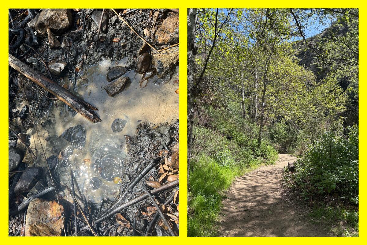
(L) The white oil that bubbles (and stinks) near the Canyon Trail. (R) Tall trees provide much shade along the Canyon Trail.
(Jaclyn Cosgrove / Los Angeles Times)
Next to the trail, there are two small pools of bubbling goop. “This very rare geologic feature of translucent petroleum has been filtered by nature,” the sign reads. Scientists think this white oil originated deep within the earth, traveled along the San Gabriel fault zone, and was filtered through several layers of sediment. Years ago, residents would pour it into their Ford Model Ts for fuel, according to the sign.
Less than a mile after stink city, you’ll arrive at the end of the Canyon Trail. You’ll find several picnic tables, and close by two portable toilets that, as of Tuesday, were quite clean.
To reach the start of the Waterfall Trail, you’ll pass the Los Pinetos trail head, which I’ve previously written about. There’s a water fountain here that your trusty Wild writer tried to use, only to be blasted in the face. It works!
If you have small kids, I’d advise sticking to the Canyon Trail. The Waterfall Trail is more technical. It features stairs and a bit of scrambling. Shortly before you reach the waterfall, you’ll navigate a sketchy spot where you hike up a rocky, root-covered segment. The closer you get to the waterfall, the easier it is to lose the trail.
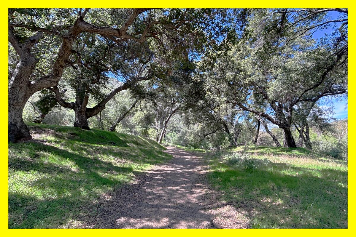
Large old oak trees line the Canyon Trail.
(Jaclyn Cosgrove / Los Angeles Times)
That aside, the trail takes you through a gorgeous area that reminded me of Millard Canyon, especially the Dawn Mine area. That’s one of my favorite hikes, and it is closed because of its proximity to the Eaton fire burn scar. It was nice to be reminded of its beauty.
After finishing the Waterfall Trail, I had a snack at a picnic table near its trailhead and opened Merlin, a birding app, to discern all the chittering I heard. It identified seven birds, including acorn woodpeckers, dark-eyed Juncos (so cute) and California quail. That’s the kind of tweeting I’m into.
The accessible alternative, the Placerita Nature Center Loop, is a 1.4-mile path that traverses around the nature center. A portion of it, called the Heritage Trail, is paved and includes a 700-foot segment with Braille-equipped signs and things that visitors can touch, hear or smell.

3 things to do

Bikers at a CicLAvia event.
(Kirk Tsonos / CicLAvia)
1. Have a wheely good time in Koreatown and Hollywood
CicLAvia will host its 59th car-free open streets event from 9 a.m. to 4 p.m. Sunday with a 4.75.-mile route from Koreatown to Hollywood. The course includes multiple Metro train stops, including the Hollywood/Vine Station at one end and the Wilshire/Vermont Station at the other. More than 100 local businesses, points of interest and restaurants will be open along the path. This car-free excursion will be open to walkers, joggers, skaters, bikers and anyone else using a people-powered device. Learn more at ciclavia.org.
2. Mingle with other hikers in Frogtown
Just Trek, an L.A.-based podcast and hiking community, will celebrate its fifth anniversary (and founder’s birthday) from 2 to 6 p.m. Saturday at Happier Cafe by @TADAA.Coffee. This free event will feature a live recording of the podcast with panelists including myself (come say hi!), Joshua Walker, Victor Martinez and Nicole Snell. Register at eventbrite.com.
3. Gather around the campfire in Chino Hills
Join a Chino Hills State Park interpreter from 4 to 5 p.m. Saturday at the amphitheater at the Rolling M Ranch campground for a campfire, songs and treats. Guests will hear stories about the park’s history, its flora and fauna, and volunteers who are helping conserve the park by yanking up invasive plants like mustard. Blankets are encouraged. Guests should enter through the Chino Hills gate (4721 Sapphire Road in Chino Hills). It can be a 20-minute drive from that entrance to the campground, so please plan accordingly. Register at eventbrite.com.

The must-read

(Ryan Johnson / For The Times)
What would you do if you spotted a bear on the trail? That’s the question that trail runner Bethany Pinedo had to grapple with as a very large bruin charged toward her. Pinedo shares her experience in the latest edition of Between A Rock, our monthly outdoors survival series. “I fully thought it was going to kill me. I still see it in my mind like it was yesterday. I was 100% convinced I was going to die,” Pinedo told me. What saved her? Click through to find out.
This is our fourth edition of Between A Rock. You can read the previous three here.
Happy adventuring,

P.S.
In mid-March, the outdoors community mourned the death of one of the three chicks of Big Bear eagles Jackie and Shadow. Several local children learned about the eaglets in their classrooms, so kiddos might come home with questions about what happened. LAist has a helpful guide about how to talk to children about the loss. “Kids are extremely resilient if you provide them the support that they need in order to navigate those feelings,” fourth-grade teacher Marcy Billdt said.
For more insider tips on Southern California’s beaches, trails and parks, check out past editions of The Wild. And to view this newsletter in your browser, click here.
