Some people stay up late binging a TV show. I recently found myself awake long past midnight zooming in and out of maps, tagging every single hike on my outdoors app that I haven’t done in our local mountains.
It was an attempt to address the gnawing anxiety I can’t shake that, at any moment, a wildfire will break out and burn more beautiful places. Since the Eaton and Palisades fires, I’ve been full of regret over the trails that burned that I never completed. Although I had been up to Inspiration Point, which I hope gets rebuilt, I’d never completed the Echo Mountain hike. And I have never hiked to Skull Rock or been on the Los Leones Trail.
I told myself that evening, rather than going to sleep as I had intended to do, that I was going to make a list and tackle it accordingly.
Newsletter
You are reading The Wild newsletter
Sign up to get expert tips on the best of Southern California’s beaches, trails, parks, deserts, forests and mountains in your inbox every Thursday
You may occasionally receive promotional content from the Los Angeles Times.
I ended up with 73 trails, far more than I will get done this year. It was definitely part of my continued post-fires mourning process but also a good reminder of all the beauty that remains. And a good to-do list for me, personally.
In the coming weeks, I will roll out some of the 73 hikes I flagged and am eager to explore. In the meantime, I thought I’d recommend three hikes that can serve as new favorites while we wait for the land to recover. Say hello to your new besties.

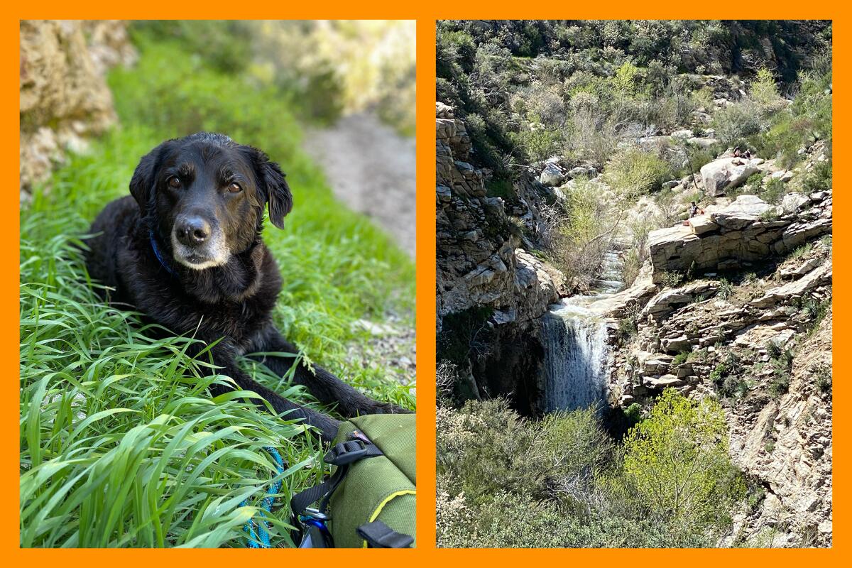
(L) Maggie May rests near Trail Canyon Falls. (R) Trail Canyon Falls as seen last April. Thanks to recent rainfall, there’s a healthy amount of water in the canyon.
(Jaclyn Cosgrove / Los Angeles Times)
1. Trail Canyon Falls
Distance: 4.4 miles out-and-back
Elevation gained: 1,010 feet
Difficulty: Moderate
Accessible alternative: West Fork National Scenic Bikeway
Several beloved waterfall hikes are closed because of fire and storm damage, including Switzer Falls and Eaton and Millard canyons. Luckily, you can still check out Trail Canyon Falls, which descends at least 30 feet over large boulders.
To reach the falls, you’ll hike alongside the creek for most of your journey, crossing it several times. Even though this isn’t a challenging hike in terms of vertical gain, I recommend bringing poles to help navigate the creek crossings.
If you’re hiking with a dog, take care to discern the best place to cross, as the creek can be deep in the springtime. I once tried carrying my 50-pound dog Maggie May through a deep crossing on this trail, fell and found myself stuck against a boulder. Not my best moment, but bless the stranger who helped get Maggie and me to safety.
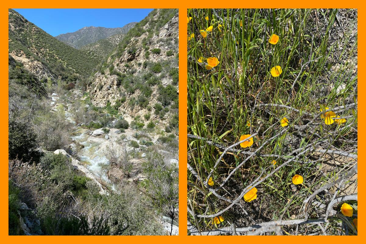
(L) Water rushes through Trail Canyon in Angeles National Forest last April. (R) Poppies spotted near Trail Canyon Falls last April. Please practice Leave No Trace and don’t pick wildflowers.
(Jaclyn Cosgrove / Los Angeles Times)
Shortly after you pass a picnic table (about 1.5 miles in), you’ll ascend to the exposed portion of this hike, where it can get hot in the afternoon. Thankfully nice views of the canyon below serve as a distraction. Sweet relief comes when you turn a corner about two miles in and can see the wide gorgeous falls.
I do not follow other hikers who trek down a harrowing path to get closer to the falls. Instead, I appreciate the falls from the actual trail and then walk past to a rocky outcropping near the creek, where I rest and have lunch. Regardless of what you do, remember that rocks near waterfalls and rivers are really, really slick. You have the option to continue hiking toward Condor Peak, but keep in mind that the route is challenging.
This hike can get busy on weekends, so plan accordingly in terms of parking.
If you plan to visit the accessible alternative, please note that it can also get crowded at peak times. The West Fork Trail, a paved path that runs alongside the West Fork of the San Gabriel River, is one of my favorites in all of Angeles National Forest. After a good rain, small waterfalls run down the hillsides next to the trail. Regardless of how far you hike in, you’ll be greeted with a natural soundscape of the river rushing by and local birds chirping in the canopy of trees above.
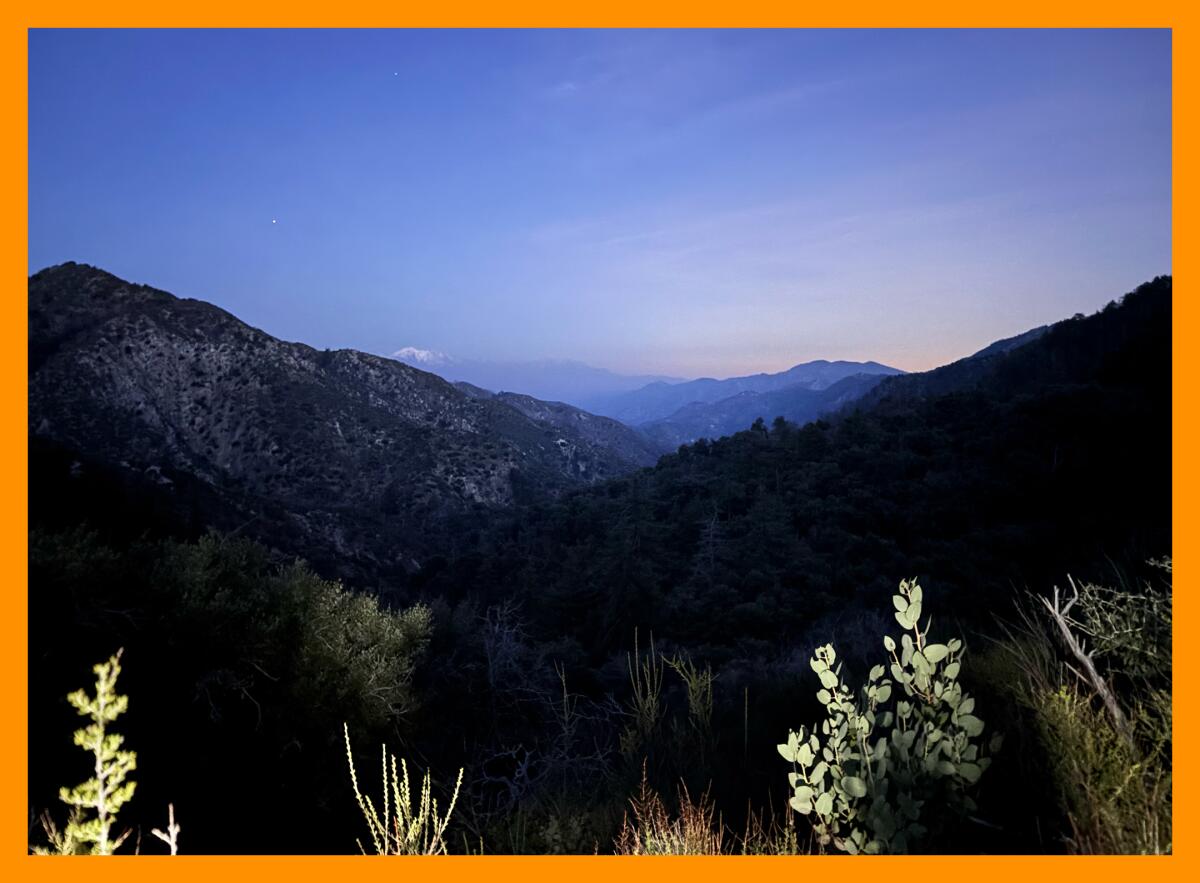
The view of the sunset from the trail to Valley Forge campground in Angeles National Forest. A snow-covered Mt. Baldy can be seen in the distance.
(Jaclyn Cosgrove / Los Angeles Times)
2. Valley Forge Trail Camp via Gabrielino National Recreation Trail
Distance: Up to 5.7 miles out-and-back, depending on your route
Elevation gained: Up to about 1,200 feet, depending on your route
Difficulty: Moderate
Accessible alternative: Lower Arroyo Seco Trail
One of my goals this summer was to hike the entire 28.8 miles of the Gabrielino trail. Unfortunately, several sections remain closed because of fire and storm damage.
My heart was happy, though, as I descended the well-maintained rock steps from the Red Box parking lot into the canyon. Thanks to hundreds of volunteer hours by the Mount Wilson Bicycling Assn., this trail is in good shape.
Less than half a mile in, I had crossed over three trickling streams. I continued on past moss-covered hillsides, the rushing river and several California bay laurels, pausing to smell their deliciously spicy leaves.
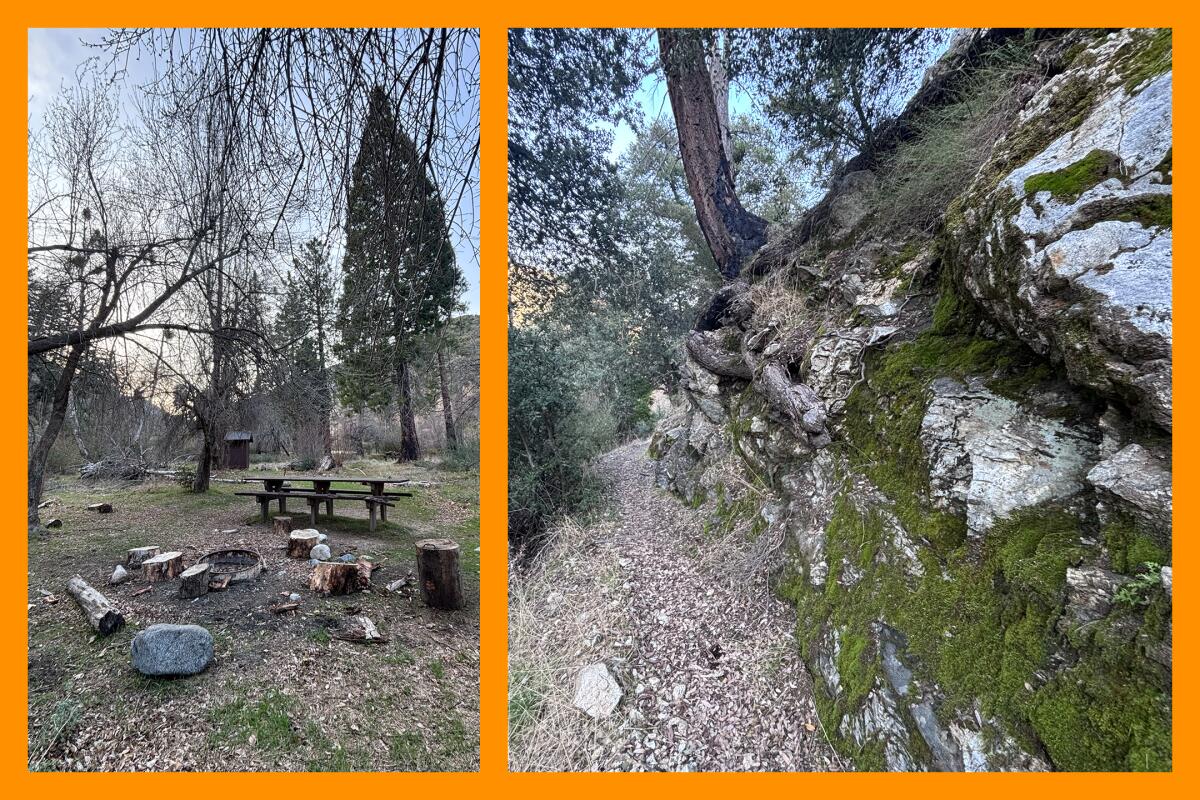
(L) As of March, the campsites at Valley Forge Trail Camp were well-maintained and the perfect spots to rest before heading back. (R) Mossy rocks are one of many joys to observe along the Gabrielino trail to Valley Forge Trail Camp.
At 0.7 miles in, you’ll arrive at a crossroads. You can continue on the Gabrielino Trail or take that fire road (the Rincon Red Box Truck Trail), either way arriving at the Valley Forge Trail Camp. I continued on the Gabrielino Trail but did take the fire road back, as it’s easier to navigate and provides beautiful views of nearby local peaks.
Just over two miles in, you’ll near the trail camp. Take good care to ensure you’re on the right trail. Instead of following the Gabrielino Trail, keep your eyes peeled for the trail that descends toward the riverbed. Walk a flat path over the river and into the trail camp. If you find yourself up on a hillside looking down at the camp, you’ve gone the wrong way and should turn around.
When I visited last week, the trail camp was well maintained. There was even tissue paper in the vault toilets! I sat at one of the picnic tables admiring the large pine and other trees, towering several feet in the air.
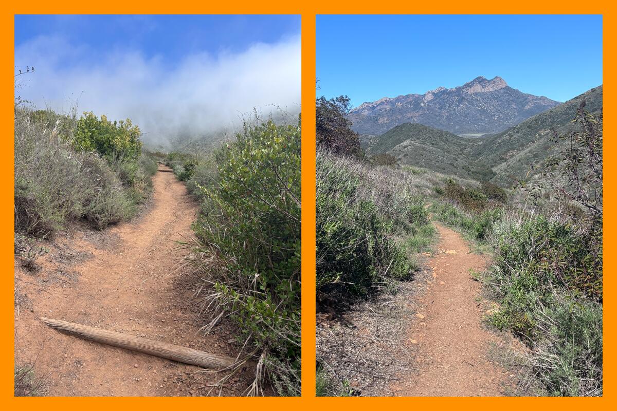
(L) Climb this hill up to the Scenic Trail’s lookout in Sycamore Canyon. (R) The rocky Tri-Peaks boulders are visible from Sycamore Canyon.
(Jaclyn Cosgrove / Los Angeles Times)
3. Big Sycamore Canyon Trail in Point Mugu State Park
Distance: 4.6 miles
Elevation gained: 810 feet
Difficulty: Moderate
Accessible alternative: Sycamore Canyon Fire Road
Often while hiking through the Santa Monica Mountains, you are doubly rewarded with both striking views of nearby peaks and incredible vantage points to gaze upon the Pacific Ocean. Big Sycamore Canyon Trail delivers in an epic way on both fronts.
Several miles of trails cut through Sycamore Canyon in Point Mugu State Park. Upon my arrival, a park worker recommended I take the aptly named Scenic Trail 0.7 miles to what they said was the best lookout in the park. How can you argue with that? After parking in the day-use area, you’ll walk through the campground to site No. 10, where you’ll find a yellow gate. Walk through it and take a gander at (and a photo of) the map before continuing.
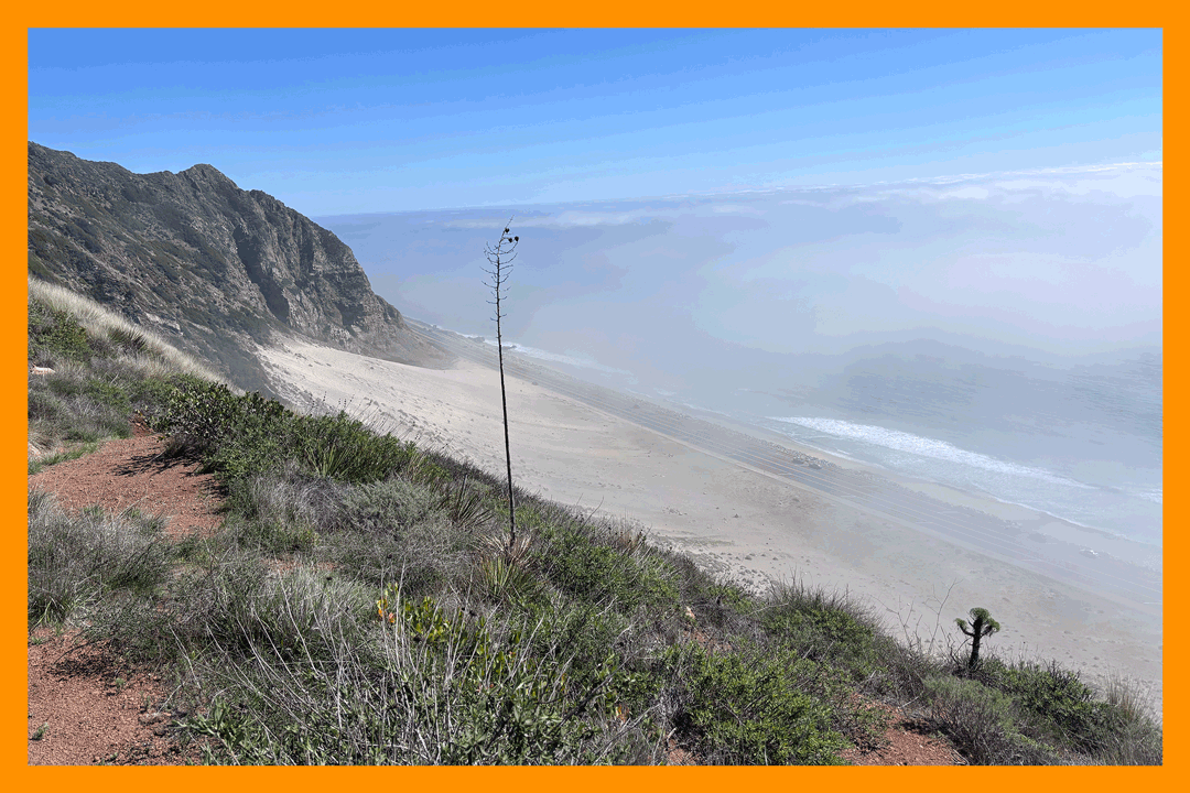
A foggy view from the Scenic Trail in Sycamore Canyon.
(Jaclyn Cosgrove / Los Angeles Times)
On the Scenic Trail, I quickly spotted nanday parakeets squawking below a crow perched high on a tree. The trail is narrow in places and lush with plant life, including purple sage and flowers that appeared to be false bindweed (my pal Jeanette Marantos is the plant expert, not me!). I traveled up several rock and wood steps, gaining about 300 feet in elevation to reach the lookout point.
I hiked this trail on a foggy day, and even still, the lookout made me feel like a happy little bird perched high above the crashing ocean and the Pacific Coast Highway. (Note: I noticed multiple blunt butts on the ground and want to remind folks that smoking isn’t allowed on trails, in part because it poses a tremendous fire hazard. Also, please don’t litter!)
Next, I took the Scenic Trail north to the Overlook Fire Road. I hiked it a mile north, and saw more lizards than people on the trail. I also spotted several small blue butterflies. Loads of prickly pears grow up the hillsides. I enjoyed the view of Tri Peaks, Boney Mountain and Exchange Peak, a rocky trio of peaks who become more visible and striking as you trek through the canyon.
At the picnic table, I turned east onto Fireline Trail about 1.3 miles down. I heard several wrentits tweeting in the coastal sage scrub and stands of laurel sumac. There are a few acres of dense orange, yellow and green sumac just below the trail that I’d recommend pausing to appreciate.
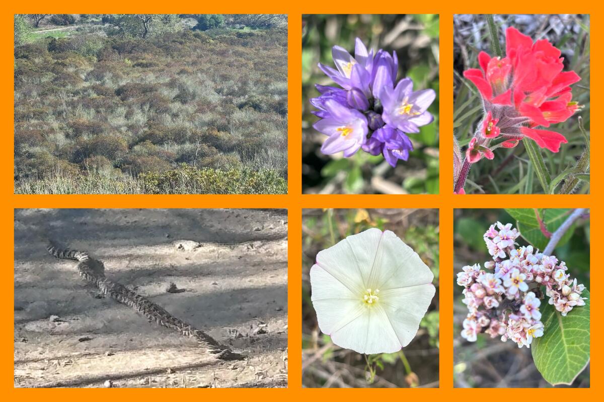
Clockwise from top left: A few acres of dense laurel sumac provides a feast of colors; blooms in Sycamore Canyon at Point Mugu State Park, including Dipterostemon capitatus, or blue dicks, a Paintbrush flower whose latin name is Castilleja affinis, Lemonade berry shrub trees and a type of false bindweed; A rattlesnake on the trail.
(Jaclyn Cosgrove / Los Angeles Times)
To finish my hike, I took the Sycamore Canyon Fire Road, a picturesque path shaded by several old trees, including the canyon’s namesake. It is popular among mountain bikers and, on the day I hiked it, baby rattlesnakes. I spotted the first one stretched out in the sun on the road and gave it wide berth as I passed. The next little guy was sleeping in the middle of the trail, less than a third of a mile from the entrance. I cautioned passing mountain bikers of their presence and went on my way. (And the reason I was able to remain mostly calm was because I learned so much reporting this guide on rattlesnakes.)
If you choose to take the accessible alternative, which is the Sycamore Canyon Fire Road, please note it isn’t paved, but when I visited it was well graded. There was one rockier patch, but mountain bikers had carved out smooth lines that made avoiding the rocks easier. The trail is a gentle incline that I plan to take my mom along next time she visits. Always good to have a few solid hikes for visitors in your back pocket.

3 things to do
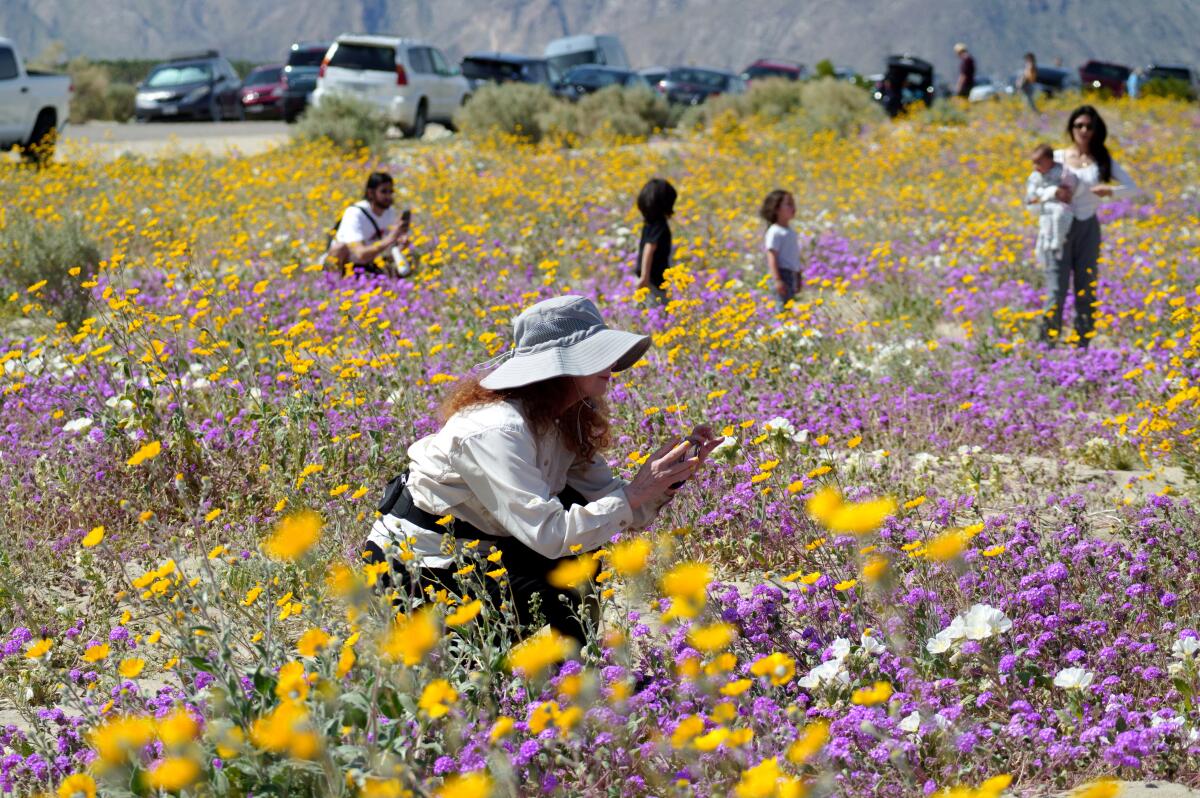
Nature enthusiasts observing wildflowers, including Desert Sunflower, purple Sand Verbena and white Dune Evening Primrose in Borrego Springs during March of last year.
(Raul Roa/Los Angeles Times)
1. Serve as a citizen scientist in Anza-Borrego
The Anza-Borrego Desert State Park BioBlitz, a free family-friendly community science gathering, will take place over three days this weekend in the park. Scientists will lead guided hikes and field surveys where participants of all ages can use the iNaturalist app to catalog the park’s species. The effort contributes to the understanding of plant and animal life in the park. Learn more and register at theabf.org.
2. Howl at the moon in Beverly Hills
TreePeople will host a moonlight hike at 7 p.m. Friday in Coldwater Canyon Park with a special performance by musicians with Living Earth, an outdoor art series. Music starts at 7 p.m. and the hike at 8 p.m. Tickets are $20 for adults and $10 for children under 15. Buy tickets at treepeople.org.
3. Bike to art galleries in Highland Park
Bike Oven, a community-run repair shop, will host an art and culture bike tour at 6:30 p.m. Saturday in Highland Park. Several galleries, studios and local businesses from Avenues 52 to 58 will open their doors to visitors throughout the day. The bike tour will start at Bike Oven’s shop. Learn more at its Instagram page.

The must-read
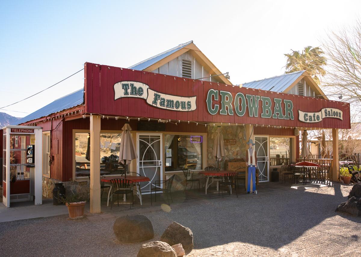
The Crowbar Cafe and Saloon in Shoshane.
(Elisabeth Brentano)
Although the headline mentions it’s for “non-hikers,” our guide on what to do in the charming towns near Death Valley is a great read for outdoorsy folks of all persuasions. Times contributor Jessie Schiewe writes about how visitors headed to and from Death Valley National Park should consider stopping for more than gas when passing through Shoshone and Tecopa, two small communities along Highway 127. Grabbing a date shake and hiking through the desert oasis at China Ranch Date Farm and Bakery sounds like a blissful way to spend half a day, followed by a stop to the Shoshone Museum & Visitor Center, where you can view 600,000-year-old mammoth bones. My friend and I recently passed through Shoshone on my way home from the park and found great food and service (and even a vegan option!) at the Crowbar Café and Saloon. The gift shop across the street was also great. Thanks to this guide, I will definitely spend even more time during my next trip to Death Valley!
Happy adventuring,

P.S.
Were you or someone you know recently fired from either the National Park Service or U.S. Forest Service? I am continuing to write about the impact of the workers fired from our local national parks and forests, and I would love to hear from you. I have tried to get answers from the U.S. Forest Service about the number of workers terminated but have been met with vague responses to my very specific questions. To reach me, you can simply respond to this newsletter if it arrived in your inbox, or email me. If you’re worried about securely contacting me, you can address a message to me via our encrypted tip line. Thank you for your consideration!
For more insider tips on Southern California’s beaches, trails and parks, check out past editions of The Wild. And to view this newsletter in your browser, click here.