
Last week, I stared out the window at the mountains like a little kid, watching the rain come down. I knew at higher elevations the storm was dumping buckets of snow onto L.A.’s backyard. And I really wanted to go play in it.
But the adult in me knew the key to enjoying snow in Angeles National Forest and other nearby public lands is to wait until the weather is right, the roads are clear and you have the right gear to have a safe day in wintry nature with friends and family. Here’s how and where to do exactly that.
Newsletter
You are reading The Wild newsletter
Sign up to get expert tips on the best of Southern California’s beaches, trails, parks, deserts, forests and mountains in your inbox every Thursday
You may occasionally receive promotional content from the Los Angeles Times.
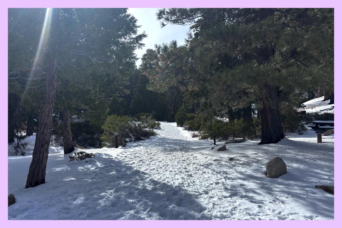
This past Sunday, my friends Bob and Mish joined me for a little adventure to the Buckhorn Campground to rejoice in the snow. We started our trek at the entrance of the campground and walked down the paved road covered in several inches of white powder. (At one point, I measured 9 inches of it on our path.) It was a sunny, brisk day, and the snow on the mountains around us was strikingly beautiful.
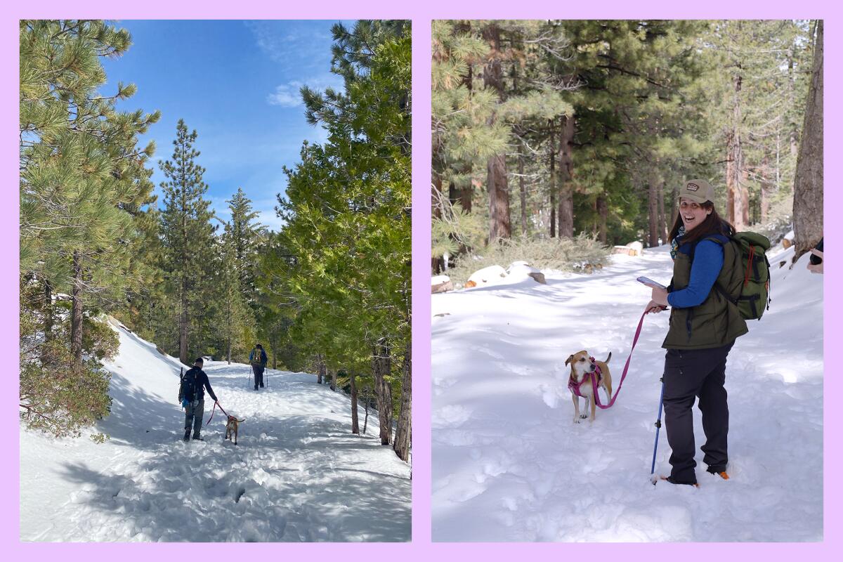
The author and pal Mish and dog Bonnie, at left, hike along the snowy road headed to Buckhorn Campground. A pause after a quick run through the snow.
(Photos by Barbara Allen; Mish Bruton)
But, amid my excitement, I also had my breaking-news reporter hat on, which meant I was considering what terrible things could happen at any moment of the day. Was it a good idea to suggest to my dear Wilders that they drive up Highway 2 and tromp around in the elements? To ease my fears (and yours), I talked to Mike Leum, whose job it is to respond to worst-case scenarios in Angeles National Forest.
Leum is the assistant director of the Los Angeles Sheriff’s Department’s Reserve Forces Detail, which oversees the search-and-rescue program. He regularly responds to emergencies in the mountains with Montrose Search and Rescue (which, as an aside, is always in need of more volunteers).
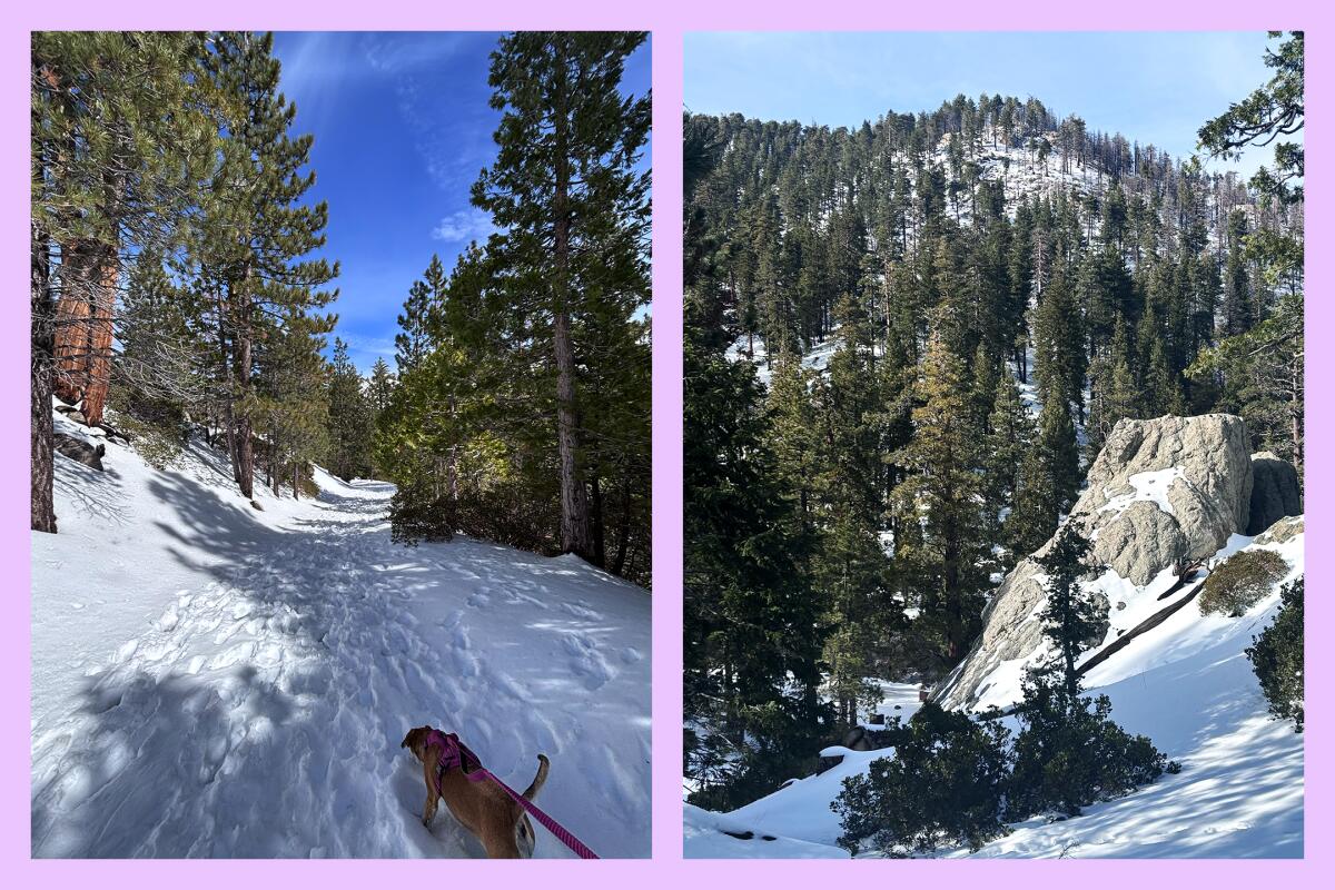
Bonnie the dog leads the author through the snow, left. Several inches of snow fell at the Buckhorn Campground in Angeles National Forest, leaving its boulders and trees dusted with white powder.
(Jaclyn Cosgrove / Los Angeles Times)
Coincidentally, Leum was also at Buckhorn Campground on Sunday, thankfully just to have fun with his wife and dog. Although we did not run into each other, it put us on the same page about the conditions we were discussing and what kind of gear would be needed for each of the three hikes recommended below.
Leum, who has 30 years of search-and-rescue experience, gave me a clear rundown of how hikers should prepare for a day in the snow:
- Check the weather. Leum and his team regularly rescue people who went out even “when the entire world knows there’s a storm coming.”
- Check the road conditions and closures. On Sunday, I felt grateful for the snow plow drivers who cleared Highway 2 so we could enjoy the 50-degree day in the mountains. Our plan was to be out from about 2 p.m. to 6 p.m. to ensure we weren’t in high elevation if the water from the melting snow refroze on the roadway.
- Consider snow chains. To determine whether snow chains are required, visit this map, click “Options” on the first QuickMap tab, then “Road Conditions,” and under the menu “Chain controls.”
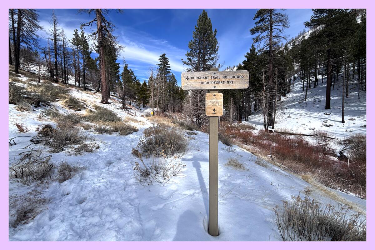
The trailhead of the Burkhart Trail near Buckhorn Campground in Angeles National Forest.
(Jaclyn Cosgrove / Los Angeles Times)
- Share your location. Once you’ve determined it is safe to travel, share your plans with a loved one. Leum recommends giving a filled-out version of this form to a friend or family member and also printing one to leave on your vehicle’s window. It has everything rescuers need to know to find you.
- Get the right shoes. That means waterproof hiking footwear. On Sunday, both Leum and I spotted folks hiking in the snow in sneakers. Not only will sneakers make you miserable with wet feet but they may also cause you to get frostbite if you’re out long enough. “Lots of bad things happen when you don’t have the appropriate footwear,” Leum said.
- Add extra traction. On Sunday, my friends and I were slipping and sliding through the snow when I decided it was time to test the microspikes. Microspikes are small, usually metal spikes that you slip onto your boots. Bob and Mish followed shortly after, and we all agreed it helped, even though we continued to slip a bit. But microspikes, Leum said, are generally only good for flat roads, like the Buckhorn Campground road and frozen parking lots and sidewalks. Once you start traveling uphill or downhill, microspikes will start to slip on your boot. “I cannot count the number of bodies I have recovered of people wearing one microspike, meaning they were hiking in a technical area, a microspike came off, and they unfortunately fell to their death,” Leum said. “Unfortunately, it happens a lot.”
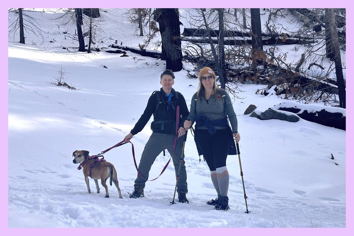
Mish and Bob, friends of the Wild, and dog Bonnie on a snow day through Buckhorn Campground.
(Jaclyn Cosgrove / Los Angeles Times)
- Embrace the crampon. Leum cautioned that, if you choose a hike with incline and decline, you need to have crampons in your pack in case you come across ice. (This applies to hikes No. 2 and 3 on the list below.) There are multiple types of crampons, but generally, they are large sharp metal spikes that you strap onto your boots. Since they are annoying to transport and wear, people often wait too long to put them on, Leum said. It’s also important to carry an ice ax and helmet that you know how to use.
- Layer up. So, you’ve got your waterproof boots, your wool or synthetic socks, your additional traction, your poles and additional equipment. It’s also vital that you layer your clothing properly. “Cotton kills” is a frequent refrain among outdoors folks in reference to how the material will retain moisture, which will make you get cold quickly. It’s best to wear synthetics and wool on winter hikes. And “you should have a very large warm puffy jacket because — as scary as it sounds — you need to be able to spend the night if you have to,” Leum said.
- Bring a map. You should always have a map, either paper or one downloaded on your phone. But it is especially important when hiking in the snow.
- Bring plenty of food and water. Hiking in snow feels like you’re hiking through sand. It will tire you out much more quickly, so even if you’re on a hike you have completed before, consider the extra energy it’ll take and thus the additional calories you’ll need to complete your adventure. And, as always, drink water. A common misconception is that eating snow will keep you hydrated, Leum said. “If you take a soup pot full of snow and melt it, there is very little actual water in there. The idea of taking a few bites of a snowball — that is not hydration,” he said.
- Bring a friend with technical experience. If you’ve never hiked in the snow, it’s best to go with someone who has — several times.
As I have previously covered, outdoors enthusiasts get into trouble way more often on day hikes than backpacking trips. The snow and ice add an additional layer to how you should plan your day, but that shouldn’t discourage you from trying. On Sunday, I saw families and friends out hiking, sledding down hillsides and just overall enjoying the day.
I’d love for you to make similar memories in our local public lands. And to do that, here are three hikes I ran past Leum to determine the type of gear you’ll need to stay as safe as possible. If you choose to do hikes No. 2 and 3, you should do so only if you’re willing to turn around if things get dicey.
The snow-covered road to the Buckhorn Campground in Angeles National Forest. The campground is closed to overnight stays until the summer.
(Jaclyn Cosgrove / Los Angeles Times)
1. Buckhorn Campground
Distance: Varies
Elevation gained: 300 to 500 feet
Difficulty: Easy to lower-level moderate
Accessible alternative: Large turnouts along Highway 2 east of Camp Valcrest
Starting from the Buckhorn Campground entrance, it is about a mile hike to the Burkhart Trail starting point, where there’s a restroom and picnic table. My friends and I rested here before heading back up. You have the option to take the Burkhart Trail, including to Cooper Canyon Falls. Keep in mind: To reach Cooper Canyon Falls, you must use a short rope (unofficial, not maintained by the forest service) to belay down to the falls. (The day after we spoke, Leum was sent to rescue two hikers at the falls, both of whom had to be airlifted; please use necessary precautions if you choose this hike!)
For an accessible alternative, take Highway 2 to any of the large turnouts past Camp Valcrest, where the snow is deeper and more substantial on the hillsides. You’ll have the opportunity to walk around the parking lots and take nice photos of the snow and trees. The road is open to Islip Saddle and has several turnouts along the way.
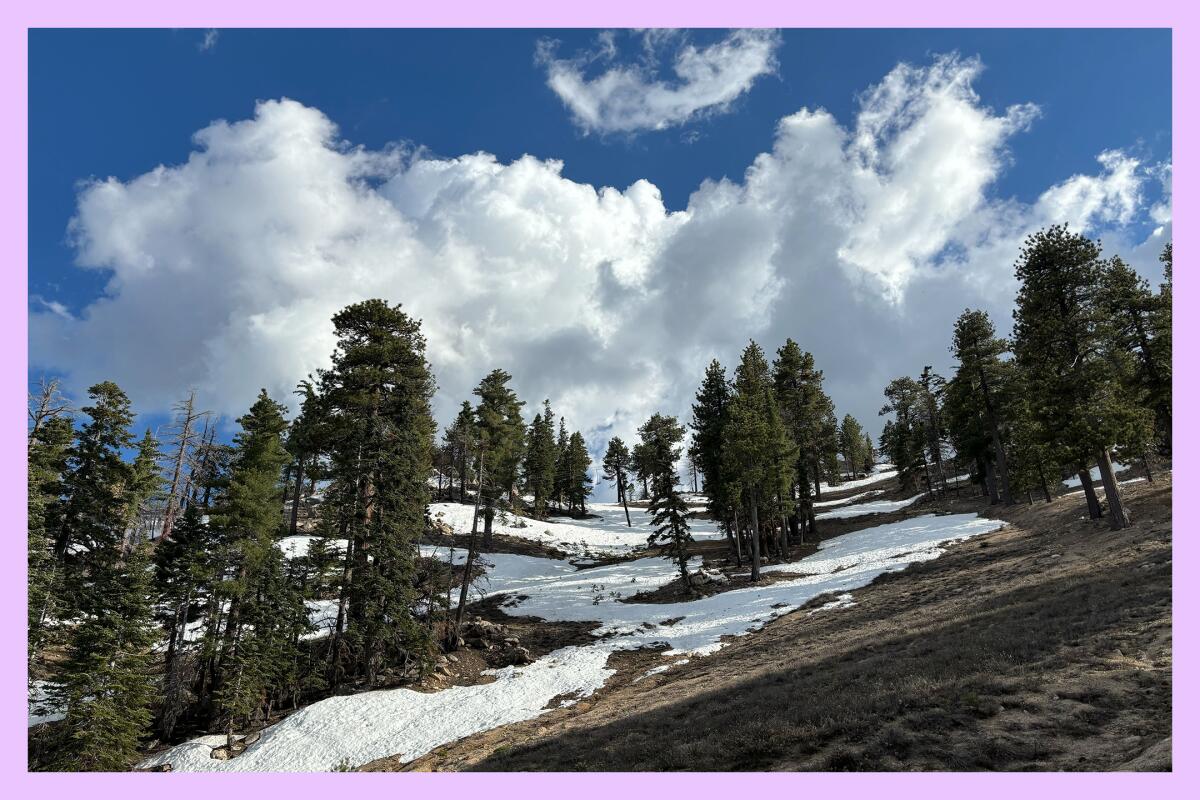
Snow can linger for months at Mt. Waterman. Last May, snow remained near the top of the trail on the path and along the hillsides.
(Jaclyn Cosgrove / Los Angeles Times)
2. Mt. Waterman Loop
Distance: About 6 miles
Elevation gained: About 1,400 feet
Difficulty: Moderately challenging, especially in snow; crampons needed
Accessible alternative: Mt. Wilson walking path
I’ve hiked in the Mt. Waterman area in every season, including last May when there was still snow on the ground, and I made a snow angel while my dog Maggie May zoomed around me. I take it counterclockwise, which allows me to hike through the forest and then down a fire road. The trail is covered in pine and other evergreen trees and provides incredible views of the San Gabriel and Antelope valleys. The forested portion of this hike does have a steep drop-off on one side, so please remember to bring your crampons and ice ax if you want to take that route.
For those considering the accessible alternative, the paved Mt. Wilson path is 1.2 miles round trip from the parking lot and will provide you with great views and gorgeous pines. Echo Rock is reachable via a few stairs and is a stunning lookout point. (Note: The road to Mt. Wilson is closed, as of today, but is expected to reopen soon; check this map for updates.)
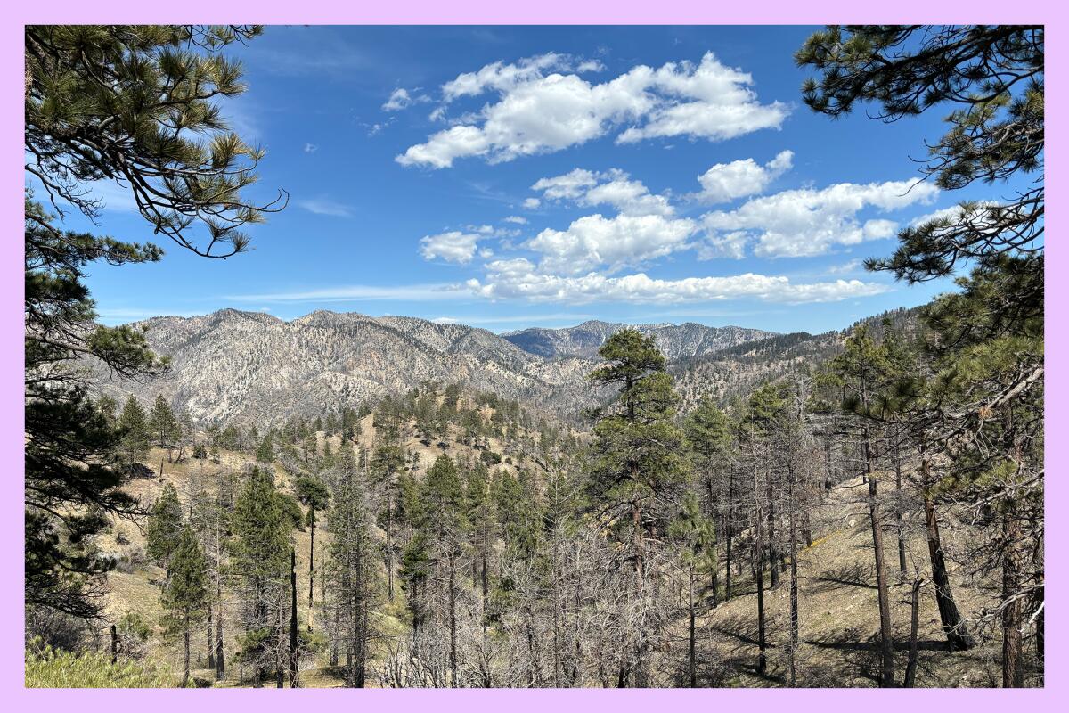
The path to the Cooper Canyon Trail Camp includes stunning views, including this one from a hike last summer.
(Jaclyn Cosgrove / Los Angeles Times)
3. Cooper Canyon Trail Camp via Cloudburst Summit
Distance: 3 to 5.2 miles, depending on your route
Elevation gained: About 750 to 1,000 feet, depending on your route
Difficulty: Moderate, made more challenging in snow; crampons needed
Accessible alternative: Chilao Visitor Center and campground
As you’ll see on this map I made, you can take two different routes downhill to the Cooper Canyon Trail Camp: Either a wider fire road (1.5 miles, one way) or the Pacific Crest Trail (2.6 miles, one way), which will be narrow in places. I hiked to the trail camp in the summer, taking the PCT route there and the fire road back. I found both to be enjoyable and scenic, so if the PCT is sketchy (read: icy), I don’t think you’ll miss out by taking the wider fire road down and back. Regardless, remember to pack your crampons!
The accessible alternative is Chilao Visitor Center, open weekends from 9 to 3 p.m., and its surrounding campground. You’ll find a similar visual experience to the hike down to Cooper Canyon, albeit with less snow. At Chilao, you’ll see the massive Coulter pine cones, and if you hike or drive through the campground’s Little Pines and Manzanita loops, you’ll spot large boulders and great views of the mountains around you.

3 things to do

Organizer Cris Graves speaks to the crowd during the “Protect the Parks” rally that attracted over 100 to the Anthony C. Beilenson Interagency Visitor Center at King Gillette Ranch in Calabasas on Saturday, March 1.
(Myung J. Chun / Los Angeles Times)
1. Show your support for public lands in Calabasas and Ventura
A “Protect The Parks” rally will be hosted from 10 a.m. to noon Saturday outside the Anthony C. Beilenson visitor center (26876 Mulholland Highway) in Calabasas to show support for the National Park Service, which recently lost about 1,000 permanent workers. Attendees will learn about local efforts to protect the Santa Monica Mountains and write thank-you letters to local rangers. Organizers ask those who can to print predesigned stationery and bring two envelopes to write the letters. Kids and signs welcome. There is also a rally for Channel Islands National Park from 11:30 to 1:30 p.m. Saturday at the park’s visitor center (1901 Spinnaker Drive) in Ventura. Learn more about the Calabasas rally at organizer Cris Graves’ Instagram page and the Channel Islands rally here.
2. Learn about baby raptors in San Dimas
As part of its “Nature Knowledge Series,” the San Dimas Canyon Nature Center will host free talks 6 p.m. Wednesday and Friday on how its staff and volunteers navigate baby raptor season. The nature center is home to L.A. County’s raptor rescue center and takes in dozens of owlets each spring along with other birds of prey. The staff and volunteers spent five months teaching the wee birds how to survive in the wild before releasing them. No registration is required. Learn more at the nature center’s Instagram page.
3. Hike with outdoors advocates in Griffith Park
The National Parks Conservation Assn. and Latino Outdoors L.A. will host “Postcards and Parks” from 8 a.m. to noon Saturday in Griffith Park. Attendees will write postcards to national park staff, thanking them for continuing to work in challenging times, and then take a 4-mile jaunt around the park (800 feet elevation gained). Register at eventbrite.com.

The must-read
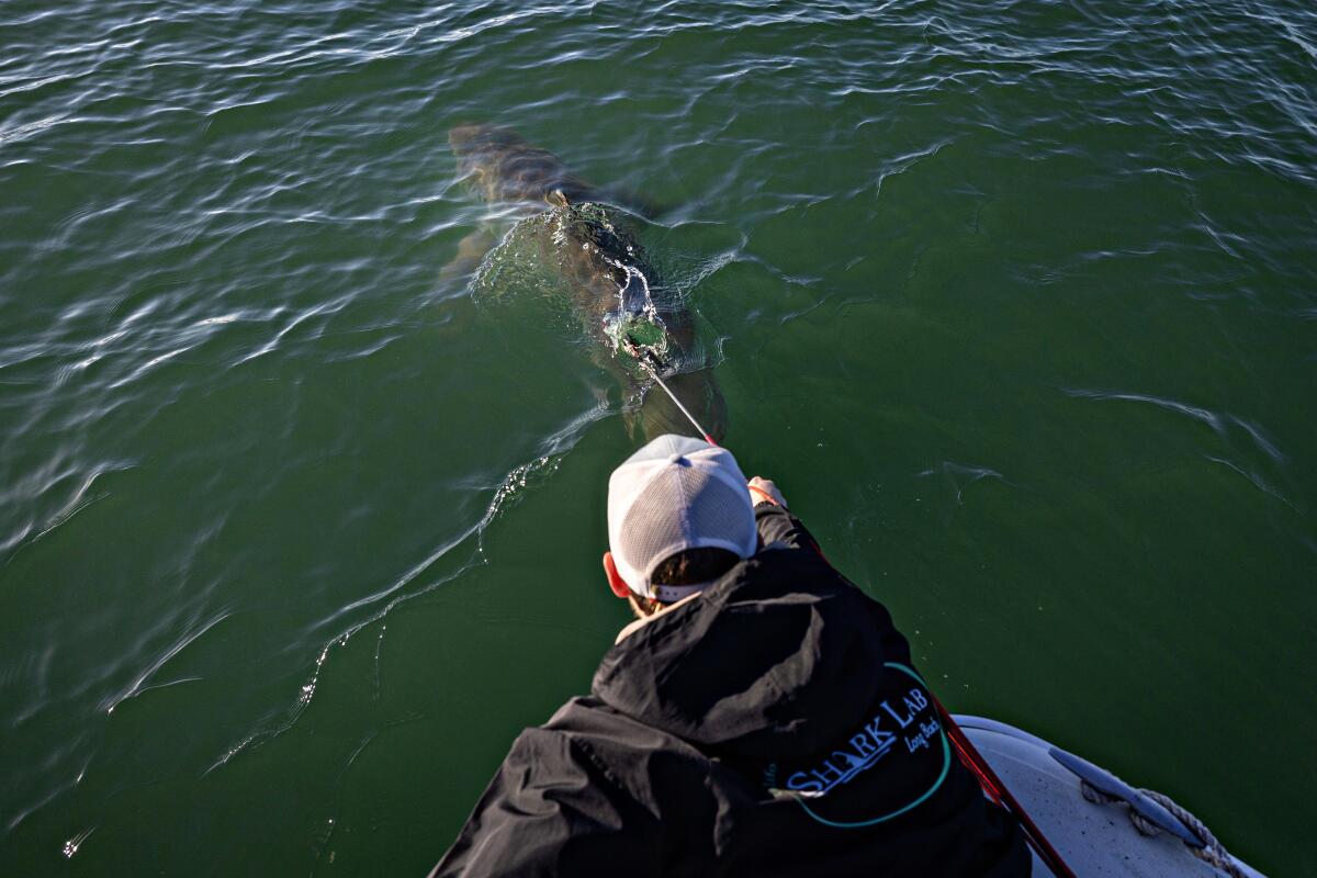
CSULB Shark Lab researcher Dr. Ryan Logan spear tags a great white shark off Huntington Beach.
(Jason Armond / Los Angeles Times)
I’m trying to get over my fear of sharks, which stems in part from my wife’s annual viewing of Shark Week. As such, I was eager to dive into Times staff writer Jack Dolan’s recent story on the research being conducted on young great white sharks hanging out near the Southern California coastline. These baby sharks — not the kind from the song — are thought to use the beaches of Southern California and northern Baja California as nurseries, looking for cozy warm waters where they can learn to shark while hiding from killer whales and other critters who would eat them. Researchers from the Cal State Long Beach Shark Lab regularly tag these sharks, a process that’s allowed scientists to glean loads of data about shark behavior, including that they really don’t want to eat us. That, friends, might be enough to get me to try surfing again! Maybe.
Happy adventuring,

P.S.
I had the pleasure of being a recent guest on Just Trek, an outdoors podcast hosted by Justin Rimon. Rimon has also created an L.A.-based hiking group with the same name. It’s an amazing community, and I enjoyed spending an evening in Debs Park, where we taped. We discussed a range of topics, including the impact of the L.A. wildfires on our mountains, the firings of National Park Service workers and, on a lighter note, where I most enjoy hiking. I hope you enjoy listening to the conversation, available as a podcast or video. Thank you!
For more insider tips on Southern California’s beaches, trails and parks, check out past editions of The Wild. And to view this newsletter in your browser, click here.